


Antonio Antoine
@aasmith.bsky.social
I love a custom north arrow.


February 9, 2026 at 2:54 AM
I love a custom north arrow.
Reposted by Antonio Antoine

Our paper “Inferring fine-grained migration patterns across the United States” is now out in @natcomms.nature.com! We released a new, highly granular migration dataset. 1/9
February 5, 2026 at 5:30 PM
Our paper “Inferring fine-grained migration patterns across the United States” is now out in @natcomms.nature.com! We released a new, highly granular migration dataset. 1/9
Reposted by Antonio Antoine

The Utah Historical Society just produced a new, excellent map of "The Peoples of North America in 1776." Great resource for anyone teaching, writing, presenting about Native peoples as part of their 250th work. america250.utah.gov/power-of-pla...

February 3, 2026 at 1:49 PM
The Utah Historical Society just produced a new, excellent map of "The Peoples of North America in 1776." Great resource for anyone teaching, writing, presenting about Native peoples as part of their 250th work. america250.utah.gov/power-of-pla...
Five classes I took in college.
- Intro to Art (I still think about this class)
- United States History in the 1970s
- Climatology
- German Fairly Tales
- Microeconomics (yuck)
Honorable mention for statistics. Also, taking an econ class dropped my opinion of econ into the toilet. Lol
- Intro to Art (I still think about this class)
- United States History in the 1970s
- Climatology
- German Fairly Tales
- Microeconomics (yuck)
Honorable mention for statistics. Also, taking an econ class dropped my opinion of econ into the toilet. Lol

Here's to great little state schools! 5 classes I took in college
-Revolution
-American Landscapes
-Fascism and WWII
-Calligraphy
-Roots of 20th Century Science
& so many others with boring names but impactful content.
-Revolution
-American Landscapes
-Fascism and WWII
-Calligraphy
-Roots of 20th Century Science
& so many others with boring names but impactful content.

Five classes I took in college?
* Dinosaurs and Disasters
* Appalachian Music
* The American City
* Google Maps and the Geography of Information
* Civil Rights Movement in the US since 1930
I'd put my little state school education up against just about anybody's.
* Dinosaurs and Disasters
* Appalachian Music
* The American City
* Google Maps and the Geography of Information
* Civil Rights Movement in the US since 1930
I'd put my little state school education up against just about anybody's.
January 31, 2026 at 11:03 PM
Five classes I took in college.
- Intro to Art (I still think about this class)
- United States History in the 1970s
- Climatology
- German Fairly Tales
- Microeconomics (yuck)
Honorable mention for statistics. Also, taking an econ class dropped my opinion of econ into the toilet. Lol
- Intro to Art (I still think about this class)
- United States History in the 1970s
- Climatology
- German Fairly Tales
- Microeconomics (yuck)
Honorable mention for statistics. Also, taking an econ class dropped my opinion of econ into the toilet. Lol
I made a Median Generations map of the US for a contest, but I missed the deadline. 😅 The generations are based on the median age of census tracts in 2023. The urban areas are tract centroids, and the rural areas were dasymetrically binned to a 10km grid.
#gis #cartography #gischat
#gis #cartography #gischat

January 31, 2026 at 6:55 PM
I made a Median Generations map of the US for a contest, but I missed the deadline. 😅 The generations are based on the median age of census tracts in 2023. The urban areas are tract centroids, and the rural areas were dasymetrically binned to a 10km grid.
#gis #cartography #gischat
#gis #cartography #gischat
Reposted by Antonio Antoine

Just an incredible and unusual landslide at Niscemi, Sicily, Italy, as captured by @planet.com SuperDove satellites 🧪⚒️🛰️
January 29, 2026 at 11:24 PM
Just an incredible and unusual landslide at Niscemi, Sicily, Italy, as captured by @planet.com SuperDove satellites 🧪⚒️🛰️
Reposted by Antonio Antoine

Animation showing the plunge of cold Arctic air which is causing disruption to flights and has left almost a million people without power
Read
Martha Muir and Ilya Gridneff's report
www.ft.com/content/8757...
Read
Martha Muir and Ilya Gridneff's report
www.ft.com/content/8757...
January 26, 2026 at 4:53 PM
Animation showing the plunge of cold Arctic air which is causing disruption to flights and has left almost a million people without power
Read
Martha Muir and Ilya Gridneff's report
www.ft.com/content/8757...
Read
Martha Muir and Ilya Gridneff's report
www.ft.com/content/8757...
Reposted by Antonio Antoine

For context, before 1980, #Nashville temperatures hit 0°F an average of once per winter. Because of #GlobalWarming, what used to be an annual event has only happened 4 times in the last 30 years.
Similarly, before 1980 we got 12" of snow in an average winter. Since 2000, it's around 4".
Similarly, before 1980 we got 12" of snow in an average winter. Since 2000, it's around 4".

Ultra rare weather event could happen in Middle Tennessee next week

Ultra rare weather event could happen in Middle Tennessee next week
Major winter storm hits this weekend
www.wsmv.com
January 24, 2026 at 4:27 PM
For context, before 1980, #Nashville temperatures hit 0°F an average of once per winter. Because of #GlobalWarming, what used to be an annual event has only happened 4 times in the last 30 years.
Similarly, before 1980 we got 12" of snow in an average winter. Since 2000, it's around 4".
Similarly, before 1980 we got 12" of snow in an average winter. Since 2000, it's around 4".
Reposted by Antonio Antoine
Increasing hazard situational awareness is always worthwhile, and disaster maps are never excessive. I made this US #WinterStorm map with a dark background (save battery during outages), a vertical layout (mobile viewing/sharing), colorblind friendliness, and county/city references. Source: #NOAA

January 24, 2026 at 12:46 PM
Increasing hazard situational awareness is always worthwhile, and disaster maps are never excessive. I made this US #WinterStorm map with a dark background (save battery during outages), a vertical layout (mobile viewing/sharing), colorblind friendliness, and county/city references. Source: #NOAA
Reposted by Antonio Antoine

Do you appreciate @nws.noaa.gov's posts on Bluesky?
Did you know that this account is a pilot program that may or may not be continued and even expanded to NWS field offices?
NWS is soliciting comments here! www.surveymonkey.com/r/PrototypeN...
Press release:
www.weather.gov/media/notifi...
Did you know that this account is a pilot program that may or may not be continued and even expanded to NWS field offices?
NWS is soliciting comments here! www.surveymonkey.com/r/PrototypeN...
Press release:
www.weather.gov/media/notifi...

⚠️~132 million: Number of people under alerts for snow, sleet, & freezing rain.
A large, long-duration winter storm is expected to bring widespread heavy snow, sleet, & freezing rain from the Southern Rockies & Plains beginning Friday (Jan. 23), spreading eastward toward New England this weekend.
🧵
A large, long-duration winter storm is expected to bring widespread heavy snow, sleet, & freezing rain from the Southern Rockies & Plains beginning Friday (Jan. 23), spreading eastward toward New England this weekend.
🧵

January 22, 2026 at 7:53 PM
Do you appreciate @nws.noaa.gov's posts on Bluesky?
Did you know that this account is a pilot program that may or may not be continued and even expanded to NWS field offices?
NWS is soliciting comments here! www.surveymonkey.com/r/PrototypeN...
Press release:
www.weather.gov/media/notifi...
Did you know that this account is a pilot program that may or may not be continued and even expanded to NWS field offices?
NWS is soliciting comments here! www.surveymonkey.com/r/PrototypeN...
Press release:
www.weather.gov/media/notifi...
I created a quick workflow on how to find the highest value from multiple attribute columns in #QGIS. This is helpful if you have temporal or similar data in a single feature class. In my example, I had over 100 columns to compare.
#gis #gischat
#gis #gischat
QGIS: How to Calculate the Max Value across Multiple Columns – Antonio Antoine Cartography
If you work with temporal or raster data, you may find yourself in a position where you have multiple columns of data for a single feature. I came across this issue recently for a map I am working on,...
antonioantoine.com
January 22, 2026 at 8:06 PM


January 21, 2026 at 3:02 PM
The first JHU GIS After Dark in 2026 is on February 5th from 7-8pm featuring Lauren Teirney from ESRI. The event is free and open to the public, however, you need register to attend.
#gis #gischat
www.eventbrite.com/e/gis-after-...
#gis #gischat
www.eventbrite.com/e/gis-after-...
GIS After Dark presents "Mapping and Cartography at Esri"
GIS After Dark presents "Mapping and Cartography at Esri"
www.eventbrite.com
January 16, 2026 at 8:55 PM
The first JHU GIS After Dark in 2026 is on February 5th from 7-8pm featuring Lauren Teirney from ESRI. The event is free and open to the public, however, you need register to attend.
#gis #gischat
www.eventbrite.com/e/gis-after-...
#gis #gischat
www.eventbrite.com/e/gis-after-...
This simple label took me over day to make. I am still learning expression builder in #QGIS. I needed the highest value for each feature from over one hundred attribute columns AND the name of the field name. The worst part is I don't know if I will use this info. lol

![Screenshot of QGIS showing the expression to find the highest value from a range of fields. The code reads as:
concat( "PARKNAME", '/',map_akeys(attributes())[array_find(map_avals(attributes()), array_max(array_slice(map_avals(attributes()), 10, 148)))], '/' , array_max(array_slice(map_avals(attributes()), 10, 148)))](https://cdn.bsky.app/img/feed_thumbnail/plain/did:plc:vxgrriczkvh2dojfuogcju2n/bafkreibba47gbphqr5oufxcsf7mw23rpzgdgnx2oowf3g5pvyeh5ue2ueu@jpeg)
January 15, 2026 at 8:54 PM
This simple label took me over day to make. I am still learning expression builder in #QGIS. I needed the highest value for each feature from over one hundred attribute columns AND the name of the field name. The worst part is I don't know if I will use this info. lol
Reposted by Antonio Antoine

couple interesting maps of climate change vulnerability across Canada by Isabeaux Graham on our team
check out more here: schoolofcities.utoronto.ca/layers-of-cl...
#maps #gis #canada #climateChange
check out more here: schoolofcities.utoronto.ca/layers-of-cl...
#maps #gis #canada #climateChange


January 14, 2026 at 9:23 PM
couple interesting maps of climate change vulnerability across Canada by Isabeaux Graham on our team
check out more here: schoolofcities.utoronto.ca/layers-of-cl...
#maps #gis #canada #climateChange
check out more here: schoolofcities.utoronto.ca/layers-of-cl...
#maps #gis #canada #climateChange
This is a very cool idea.


January 15, 2026 at 4:42 AM
This is a very cool idea.
Reposted by Antonio Antoine

Labeling maps is a peaceful practice, and often is half the job of a cartographer. I'm sure seas will be drained and skies will be blackened so that AI can do it in our stead in a year or two, but for now, I always enjoy looking at a "map minus map" version of completed work.

January 10, 2026 at 2:36 AM
Labeling maps is a peaceful practice, and often is half the job of a cartographer. I'm sure seas will be drained and skies will be blackened so that AI can do it in our stead in a year or two, but for now, I always enjoy looking at a "map minus map" version of completed work.
A work-in-progress map of the Forests in the lower US. I haven't decided if I am going to display and label the National Parks and/or Forests yet. Things get pretty busy on the West Coast.
The legend is going to be a nightmare and I am not looking forward to it. 😂
#gis #gischat #cartography #map
The legend is going to be a nightmare and I am not looking forward to it. 😂
#gis #gischat #cartography #map

January 9, 2026 at 6:32 PM
A work-in-progress map of the Forests in the lower US. I haven't decided if I am going to display and label the National Parks and/or Forests yet. Things get pretty busy on the West Coast.
The legend is going to be a nightmare and I am not looking forward to it. 😂
#gis #gischat #cartography #map
The legend is going to be a nightmare and I am not looking forward to it. 😂
#gis #gischat #cartography #map
Reposted by Antonio Antoine

#Caracas 1936
Scale 1:5,000
Ministerio De Obras Publicas
Direccion de Cartografia Nacional
archive.org/details/WCWd...
A #cartographic gem from 90 years ago - worth the zoom in.
Scale 1:5,000
Ministerio De Obras Publicas
Direccion de Cartografia Nacional
archive.org/details/WCWd...
A #cartographic gem from 90 years ago - worth the zoom in.


January 8, 2026 at 12:06 AM
#Caracas 1936
Scale 1:5,000
Ministerio De Obras Publicas
Direccion de Cartografia Nacional
archive.org/details/WCWd...
A #cartographic gem from 90 years ago - worth the zoom in.
Scale 1:5,000
Ministerio De Obras Publicas
Direccion de Cartografia Nacional
archive.org/details/WCWd...
A #cartographic gem from 90 years ago - worth the zoom in.
Arizona Joy Plot Map
Testing out another method. Instead of applying the gradient across the entire feature layer, I applied a gradient to each individual plot line. This gives the plot lines a more 3D like effect. This is still a work in progress.
#gis #qgis #cartography #maps
Testing out another method. Instead of applying the gradient across the entire feature layer, I applied a gradient to each individual plot line. This gives the plot lines a more 3D like effect. This is still a work in progress.
#gis #qgis #cartography #maps

January 2, 2026 at 4:22 PM
Arizona Joy Plot Map
Testing out another method. Instead of applying the gradient across the entire feature layer, I applied a gradient to each individual plot line. This gives the plot lines a more 3D like effect. This is still a work in progress.
#gis #qgis #cartography #maps
Testing out another method. Instead of applying the gradient across the entire feature layer, I applied a gradient to each individual plot line. This gives the plot lines a more 3D like effect. This is still a work in progress.
#gis #qgis #cartography #maps
Reposted by Antonio Antoine

Happy Solstice and first official day of winter. More daylight each day now and spring is not far away.
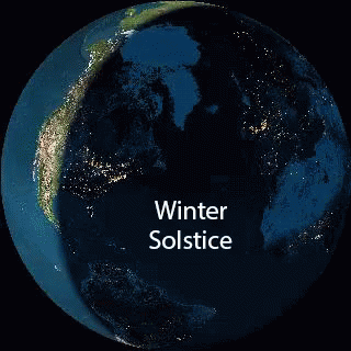
a picture of the earth with the words winter solstice below it
ALT: a picture of the earth with the words winter solstice below it
media.tenor.com
December 21, 2025 at 2:32 PM
Happy Solstice and first official day of winter. More daylight each day now and spring is not far away.
Reposted by Antonio Antoine

Solstice on a Spinning Earth apod.nasa.gov/apod/ap25122...
Can you tell that today is a solstice by the tilt of the Earth? Yes. At a solstice, the Earth's terminator -- the dividing line between night and day -- is tilted the most.
Can you tell that today is a solstice by the tilt of the Earth? Yes. At a solstice, the Earth's terminator -- the dividing line between night and day -- is tilted the most.
December 21, 2025 at 8:20 AM
Solstice on a Spinning Earth apod.nasa.gov/apod/ap25122...
Can you tell that today is a solstice by the tilt of the Earth? Yes. At a solstice, the Earth's terminator -- the dividing line between night and day -- is tilted the most.
Can you tell that today is a solstice by the tilt of the Earth? Yes. At a solstice, the Earth's terminator -- the dividing line between night and day -- is tilted the most.
Reposted by Antonio Antoine

Man, I'm done with the days getting shorter! I am talking to MANAGEMENT. I will GET RESULTS. If the days get longer here on out, you'll know who to thank.
December 21, 2025 at 5:58 PM
Man, I'm done with the days getting shorter! I am talking to MANAGEMENT. I will GET RESULTS. If the days get longer here on out, you'll know who to thank.
Reposted by Antonio Antoine

Happy winter solstice. 📊

December 21, 2025 at 3:15 PM
Happy winter solstice. 📊