


Jeff Allen
@jamaps.bsky.social
maps, graphics, cities, etc.
website: https://jamaps.github.io/
github: https://github.com/jamaps
~9-5 M-F: https://schoolofcities.utoronto.ca/research-type/data-visualization/
website: https://jamaps.github.io/
github: https://github.com/jamaps
~9-5 M-F: https://schoolofcities.utoronto.ca/research-type/data-visualization/
Reposted by Jeff Allen

Really enjoy working on @uoftcities.bsky.social projects like this.
Heavy lifting by @jamaps.bsky.social with data analysis & visualization. Also Mia Wang who’s led data collection and GIS data processing.
Who are streets for?
h/t @daniel-romm.bsky.social @ohtheurbanity.bsky.social #IdeasAtWork
Heavy lifting by @jamaps.bsky.social with data analysis & visualization. Also Mia Wang who’s led data collection and GIS data processing.
Who are streets for?
h/t @daniel-romm.bsky.social @ohtheurbanity.bsky.social #IdeasAtWork

The distribution of public land in cities has serious implications for how we move, how safe we feel, and who can access opportunities. @lanrickbennett.bsky.social + our data viz team find that 80% of T.O. street space is dedicated to motor vehicles:

Who are streets for?
More than 80% of street space in Toronto is inequitably dedicated to motor vehicles. How can this be fairly re-designed?
schoolofcities.github.io
October 1, 2025 at 1:33 PM
Really enjoy working on @uoftcities.bsky.social projects like this.
Heavy lifting by @jamaps.bsky.social with data analysis & visualization. Also Mia Wang who’s led data collection and GIS data processing.
Who are streets for?
h/t @daniel-romm.bsky.social @ohtheurbanity.bsky.social #IdeasAtWork
Heavy lifting by @jamaps.bsky.social with data analysis & visualization. Also Mia Wang who’s led data collection and GIS data processing.
Who are streets for?
h/t @daniel-romm.bsky.social @ohtheurbanity.bsky.social #IdeasAtWork
Graphics from our recent case study "From Tracks to Trail: Planning for equitable (re)development" (Albuquerque, New Mexico)
Read it here: schoolofcities.github.io/eddit/albuqu...
#maps #dataviz
Read it here: schoolofcities.github.io/eddit/albuqu...
#maps #dataviz


September 26, 2025 at 2:08 PM
Graphics from our recent case study "From Tracks to Trail: Planning for equitable (re)development" (Albuquerque, New Mexico)
Read it here: schoolofcities.github.io/eddit/albuqu...
#maps #dataviz
Read it here: schoolofcities.github.io/eddit/albuqu...
#maps #dataviz

check out our recent project mapping street space allocation in Toronto
we find that more than 80% of transportation infrastructure in Toronto is designed for cars, far more than how people actually travel
w/ @lanrickbennett.bsky.social & Mia Wang
schoolofcities.github.io/who-are-stre...
we find that more than 80% of transportation infrastructure in Toronto is designed for cars, far more than how people actually travel
w/ @lanrickbennett.bsky.social & Mia Wang
schoolofcities.github.io/who-are-stre...

Who are streets for?
81% of street space in Toronto is inequitably dedicated to motor vehicles. How can this be fairly re-designed?
schoolofcities.github.io
September 10, 2025 at 12:39 PM
check out our recent project mapping street space allocation in Toronto
we find that more than 80% of transportation infrastructure in Toronto is designed for cars, far more than how people actually travel
w/ @lanrickbennett.bsky.social & Mia Wang
schoolofcities.github.io/who-are-stre...
we find that more than 80% of transportation infrastructure in Toronto is designed for cars, far more than how people actually travel
w/ @lanrickbennett.bsky.social & Mia Wang
schoolofcities.github.io/who-are-stre...
quickly mapped out estimates of what % of children are driven to school in the greater toronto/hamilton area
check out more related maps from this data here: schoolofcities.github.io/transportati...
check out more related maps from this data here: schoolofcities.github.io/transportati...

September 2, 2025 at 8:50 PM
quickly mapped out estimates of what % of children are driven to school in the greater toronto/hamilton area
check out more related maps from this data here: schoolofcities.github.io/transportati...
check out more related maps from this data here: schoolofcities.github.io/transportati...
recent maps/scrollytelling piece on under-valued surface parking lots in Toronto (via an analysis of property tax data)
view the project here: schoolofcities.github.io/underutilize...
#toronto #maps #dataviz #parking
view the project here: schoolofcities.github.io/underutilize...
#toronto #maps #dataviz #parking
August 21, 2025 at 5:20 PM
recent maps/scrollytelling piece on under-valued surface parking lots in Toronto (via an analysis of property tax data)
view the project here: schoolofcities.github.io/underutilize...
#toronto #maps #dataviz #parking
view the project here: schoolofcities.github.io/underutilize...
#toronto #maps #dataviz #parking
I like this new raised pedestrian crossing at Draper and Wellington
#toronto #urbandesign #walkability
#toronto #urbandesign #walkability

August 20, 2025 at 12:22 AM
I like this new raised pedestrian crossing at Draper and Wellington
#toronto #urbandesign #walkability
#toronto #urbandesign #walkability
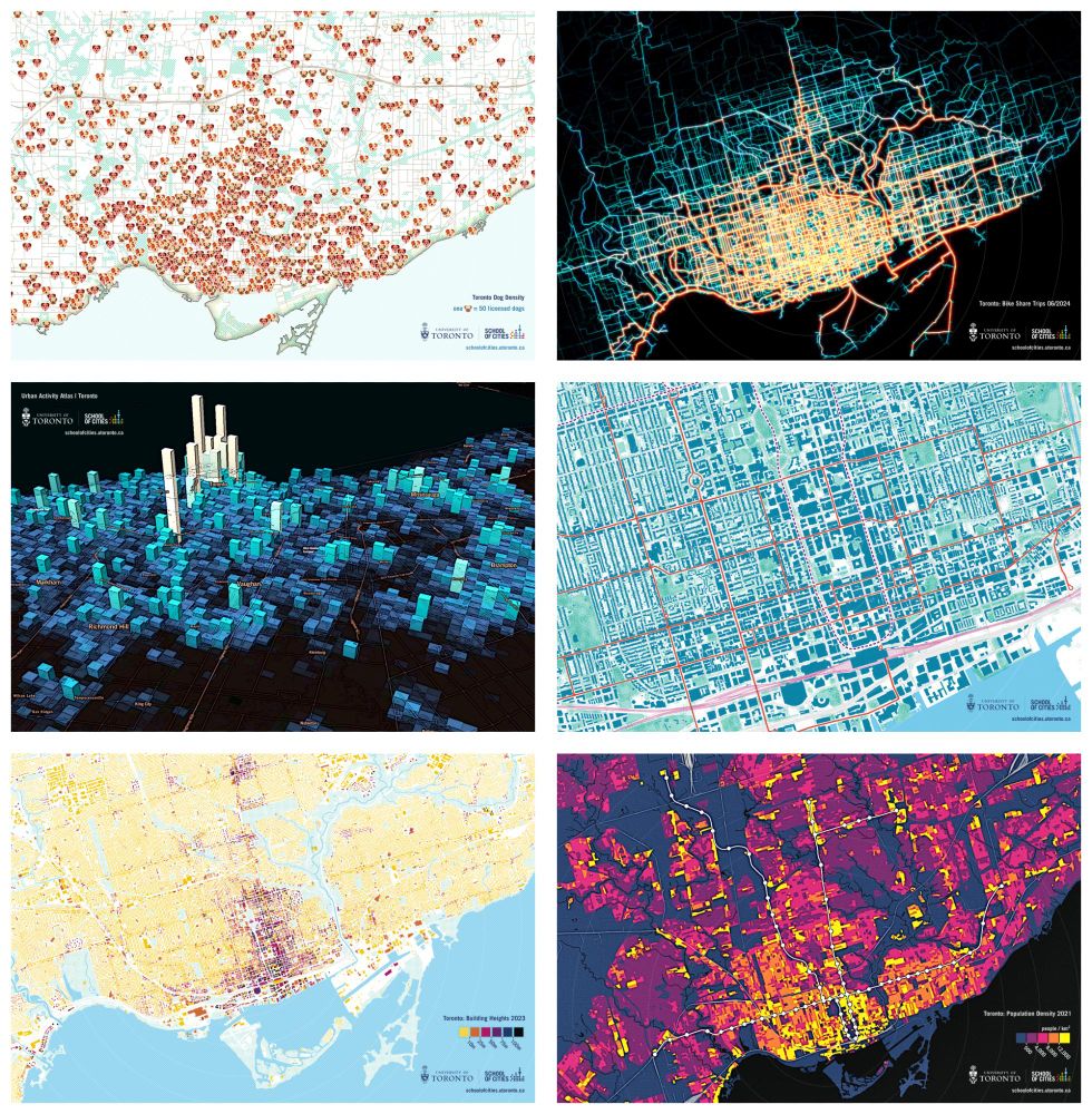
recently updated and printed more @uoftcities.bsky.social Toronto-map-viz postcards
planning to give out a bunch at Civic Spark tomorrow
#maps #dataviz #toronto
planning to give out a bunch at Civic Spark tomorrow
#maps #dataviz #toronto
August 15, 2025 at 6:58 PM
recently updated and printed more @uoftcities.bsky.social Toronto-map-viz postcards
planning to give out a bunch at Civic Spark tomorrow
#maps #dataviz #toronto
planning to give out a bunch at Civic Spark tomorrow
#maps #dataviz #toronto
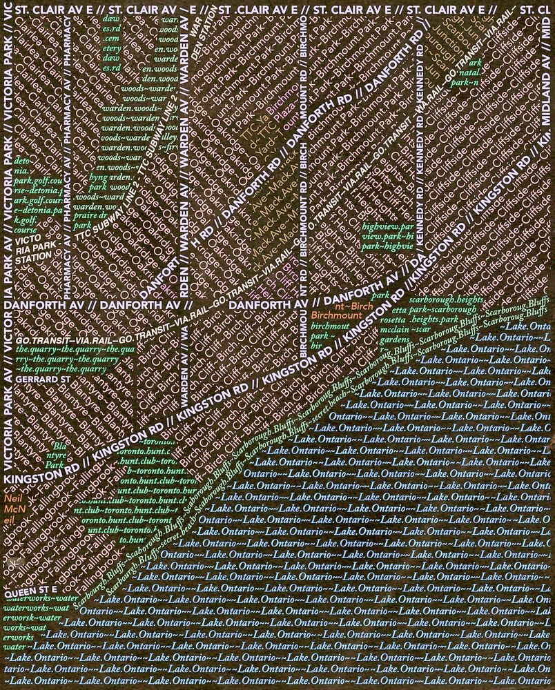
typographic map experiment of southwest Scarborough
(an older project, recent tinkering)
#scarborough #maps #typography
(an older project, recent tinkering)
#scarborough #maps #typography
June 30, 2025 at 5:29 PM
typographic map experiment of southwest Scarborough
(an older project, recent tinkering)
#scarborough #maps #typography
(an older project, recent tinkering)
#scarborough #maps #typography
helped create a few maps of heat vulnerability in Toronto around this time last year
thought today's a good time to re-share
check out more here! - schoolofcities.github.io/heat-vulnera...
#toronto #heat #maps
thought today's a good time to re-share
check out more here! - schoolofcities.github.io/heat-vulnera...
#toronto #heat #maps

June 23, 2025 at 1:01 PM
helped create a few maps of heat vulnerability in Toronto around this time last year
thought today's a good time to re-share
check out more here! - schoolofcities.github.io/heat-vulnera...
#toronto #heat #maps
thought today's a good time to re-share
check out more here! - schoolofcities.github.io/heat-vulnera...
#toronto #heat #maps
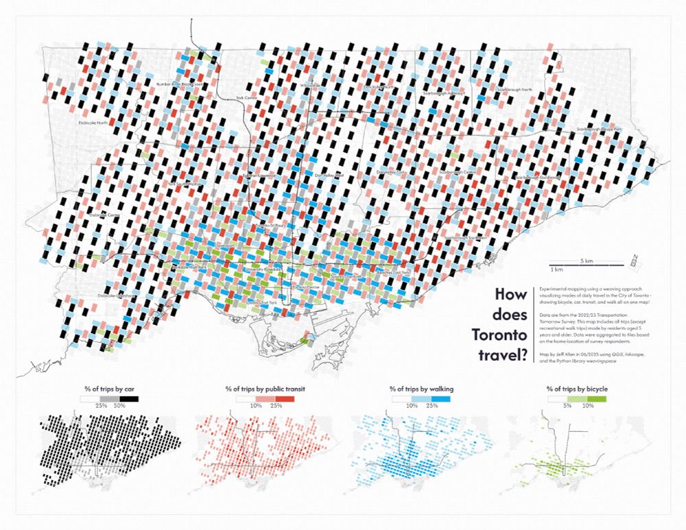
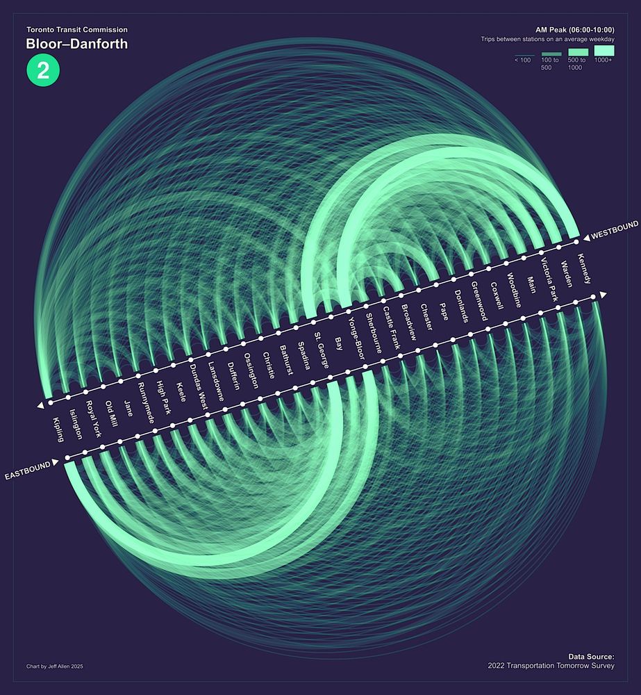
recent experiment mapping daily travel mode share in Toronto via weaving space
more info about this little project here: schoolofcities.github.io/transportati...
#toronto #maps #gis #dataviz
more info about this little project here: schoolofcities.github.io/transportati...
#toronto #maps #gis #dataviz
June 13, 2025 at 12:02 PM
recent experiment mapping daily travel mode share in Toronto via weaving space
more info about this little project here: schoolofcities.github.io/transportati...
#toronto #maps #gis #dataviz
more info about this little project here: schoolofcities.github.io/transportati...
#toronto #maps #gis #dataviz
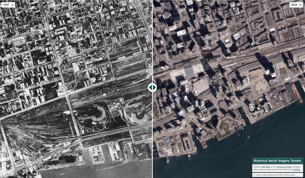
interested in Toronto history? - recently updated our site for viewing and comparing historical aerial imagery / air photos
now includes 1939, 1947, 1954, 1965, 1978, 1985, 2005, 2009, 2012, 2018, 2022, and 2024
schoolofcities.github.io/historical-a...
#toronto #torontohistory #aerial #gis
now includes 1939, 1947, 1954, 1965, 1978, 1985, 2005, 2009, 2012, 2018, 2022, and 2024
schoolofcities.github.io/historical-a...
#toronto #torontohistory #aerial #gis
June 4, 2025 at 11:40 AM
interested in Toronto history? - recently updated our site for viewing and comparing historical aerial imagery / air photos
now includes 1939, 1947, 1954, 1965, 1978, 1985, 2005, 2009, 2012, 2018, 2022, and 2024
schoolofcities.github.io/historical-a...
#toronto #torontohistory #aerial #gis
now includes 1939, 1947, 1954, 1965, 1978, 1985, 2005, 2009, 2012, 2018, 2022, and 2024
schoolofcities.github.io/historical-a...
#toronto #torontohistory #aerial #gis
June 1, 2025 at 5:33 PM
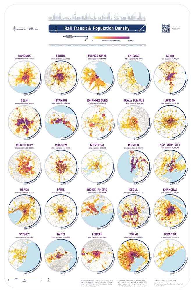
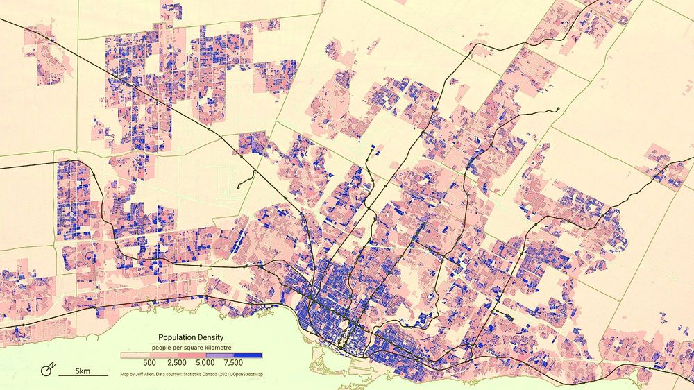
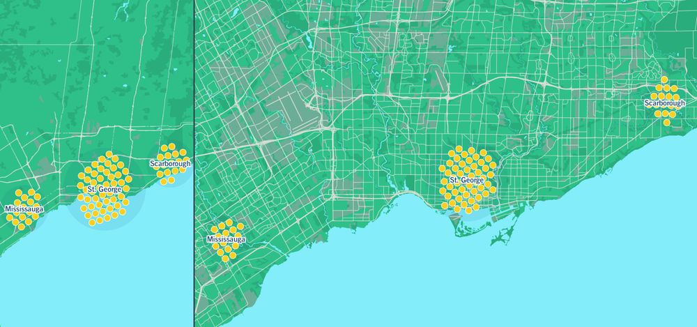
fun map poster of rail transit and population density by Aniket Kali and myself - just showed this at the Canadian Cartographic Association 2025 conference this week!
check out more maps here:) schoolofcities.github.io/rail-transit...
#maps #transit #gis #geopandas #inkscape #openstreetmap
check out more maps here:) schoolofcities.github.io/rail-transit...
#maps #transit #gis #geopandas #inkscape #openstreetmap
May 23, 2025 at 5:42 PM
fun map poster of rail transit and population density by Aniket Kali and myself - just showed this at the Canadian Cartographic Association 2025 conference this week!
check out more maps here:) schoolofcities.github.io/rail-transit...
#maps #transit #gis #geopandas #inkscape #openstreetmap
check out more maps here:) schoolofcities.github.io/rail-transit...
#maps #transit #gis #geopandas #inkscape #openstreetmap
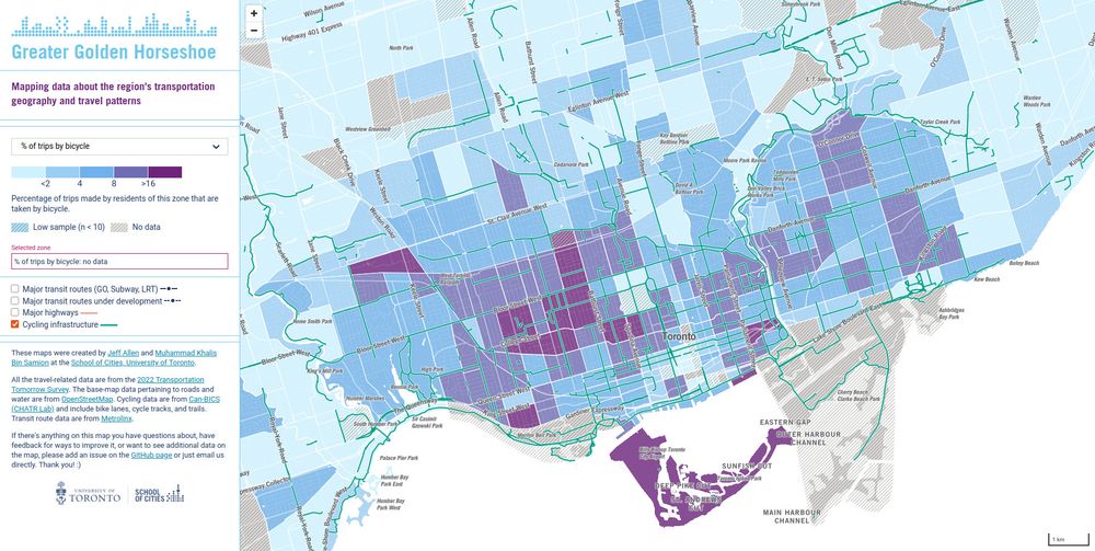
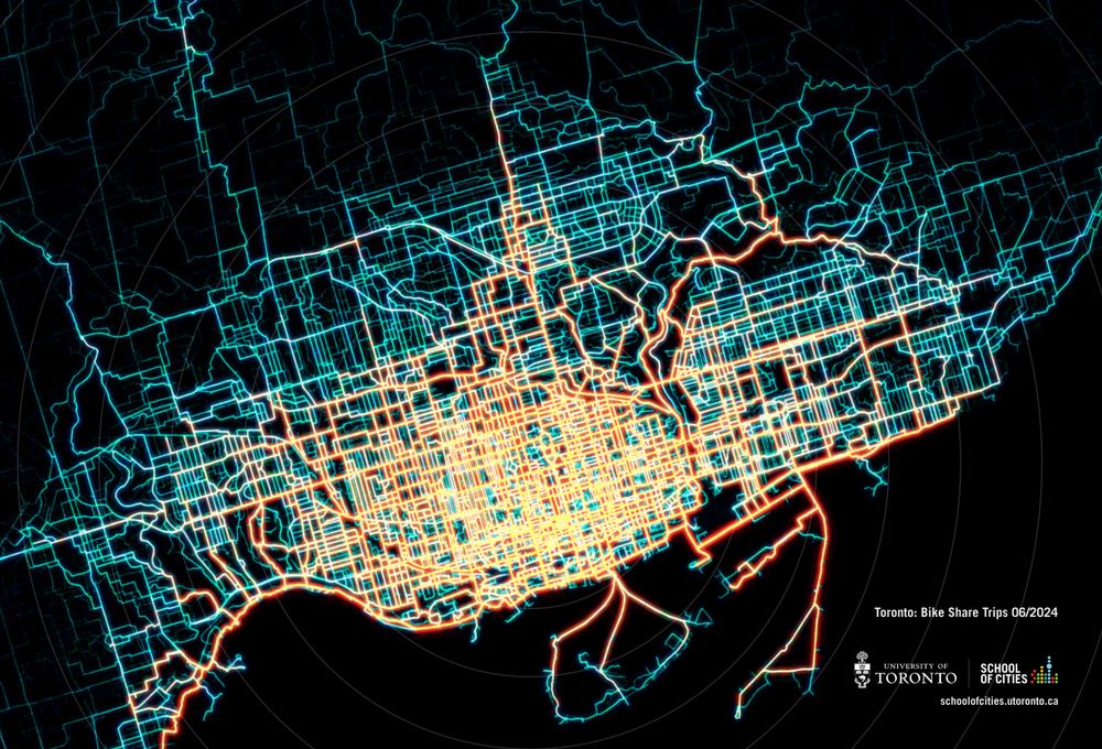
% of trips by bicycle in Toronto
more maps here! schoolofcities.github.io/ggh-transpor...
#maps #dataviz #toronto #biketo
more maps here! schoolofcities.github.io/ggh-transpor...
#maps #dataviz #toronto #biketo
April 12, 2025 at 1:28 PM
% of trips by bicycle in Toronto
more maps here! schoolofcities.github.io/ggh-transpor...
#maps #dataviz #toronto #biketo
more maps here! schoolofcities.github.io/ggh-transpor...
#maps #dataviz #toronto #biketo
April 8, 2025 at 12:06 PM
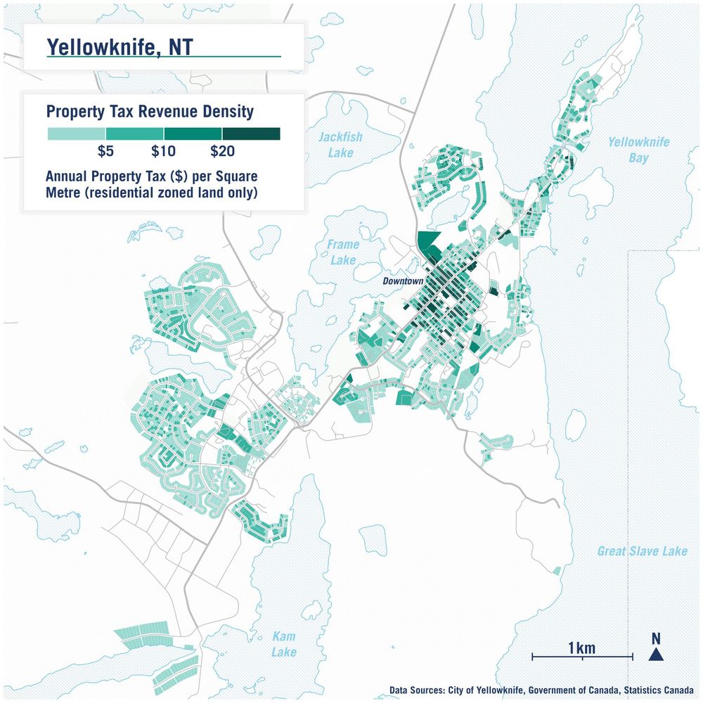
quick map I made about a year ago of Yellowknife showing property tax revenue density
keep on going back to this one as a way to show benefits of denser/central neighbourhoods
wish we had more openly available property tax data like this across Canada
#maps #gis #qgis #yellowknife #urbanism
keep on going back to this one as a way to show benefits of denser/central neighbourhoods
wish we had more openly available property tax data like this across Canada
#maps #gis #qgis #yellowknife #urbanism
April 7, 2025 at 10:14 PM
quick map I made about a year ago of Yellowknife showing property tax revenue density
keep on going back to this one as a way to show benefits of denser/central neighbourhoods
wish we had more openly available property tax data like this across Canada
#maps #gis #qgis #yellowknife #urbanism
keep on going back to this one as a way to show benefits of denser/central neighbourhoods
wish we had more openly available property tax data like this across Canada
#maps #gis #qgis #yellowknife #urbanism

March 24, 2025 at 9:05 PM
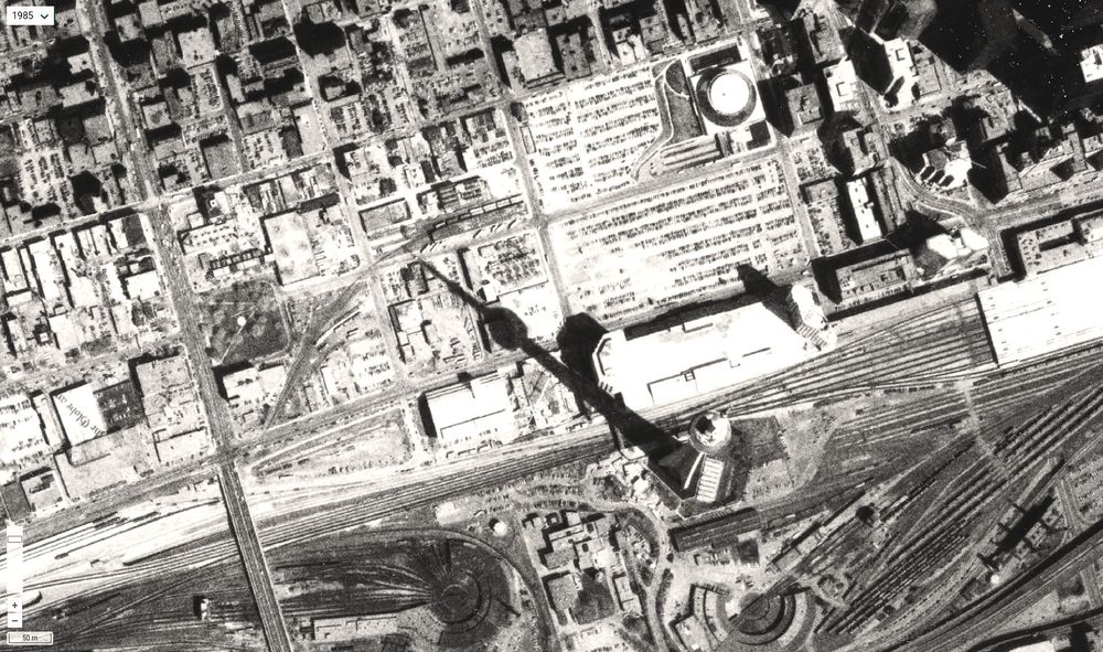
CN Tower casting a morning shadow 1985
Check out more aerial imagery of #toronto on our comparative viewer - schoolofcities.github.io/historical-a...
Check out more aerial imagery of #toronto on our comparative viewer - schoolofcities.github.io/historical-a...
March 9, 2025 at 12:35 PM
CN Tower casting a morning shadow 1985
Check out more aerial imagery of #toronto on our comparative viewer - schoolofcities.github.io/historical-a...
Check out more aerial imagery of #toronto on our comparative viewer - schoolofcities.github.io/historical-a...
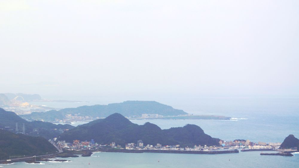
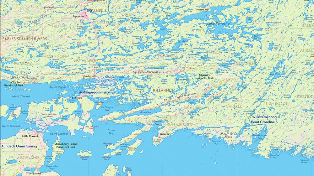
Part of a map I'm creating encompassing the northwestern part Georgian Bay and nearby area (work in progress)
March 8, 2025 at 8:58 PM
Part of a map I'm creating encompassing the northwestern part Georgian Bay and nearby area (work in progress)
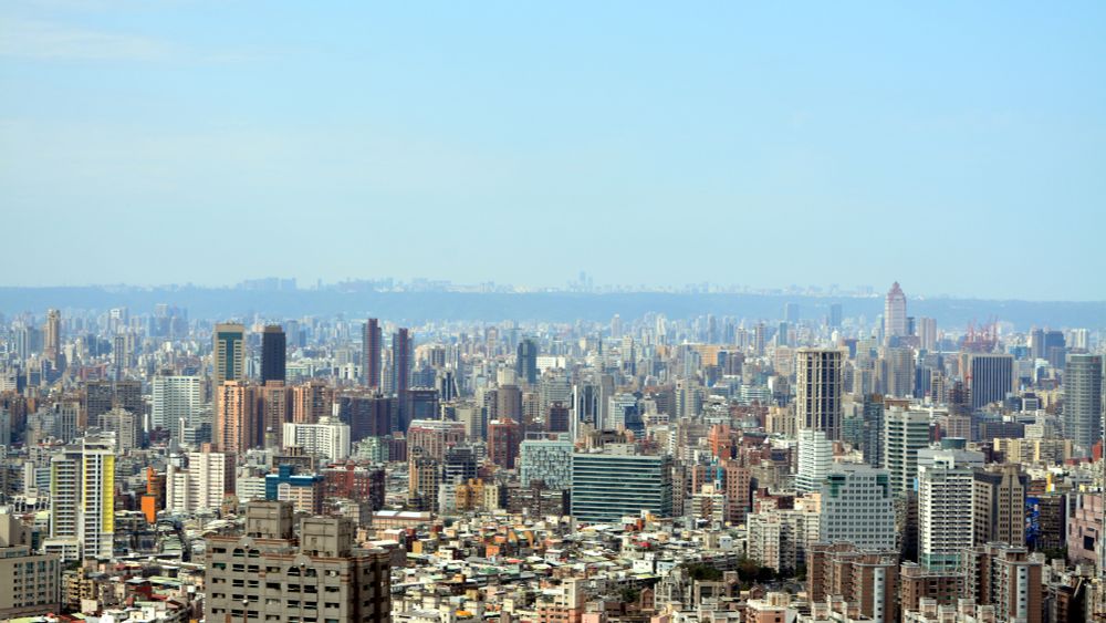
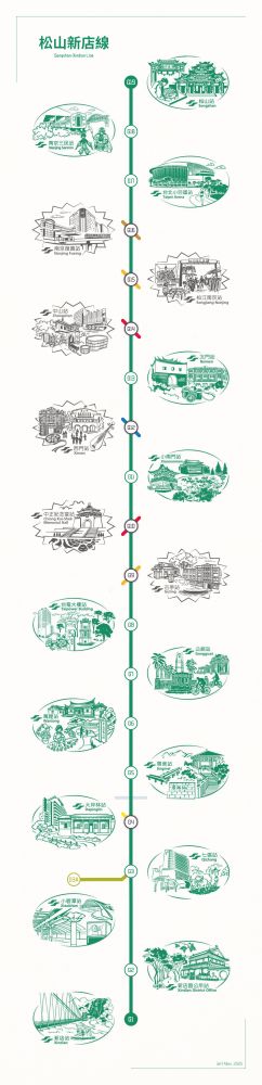
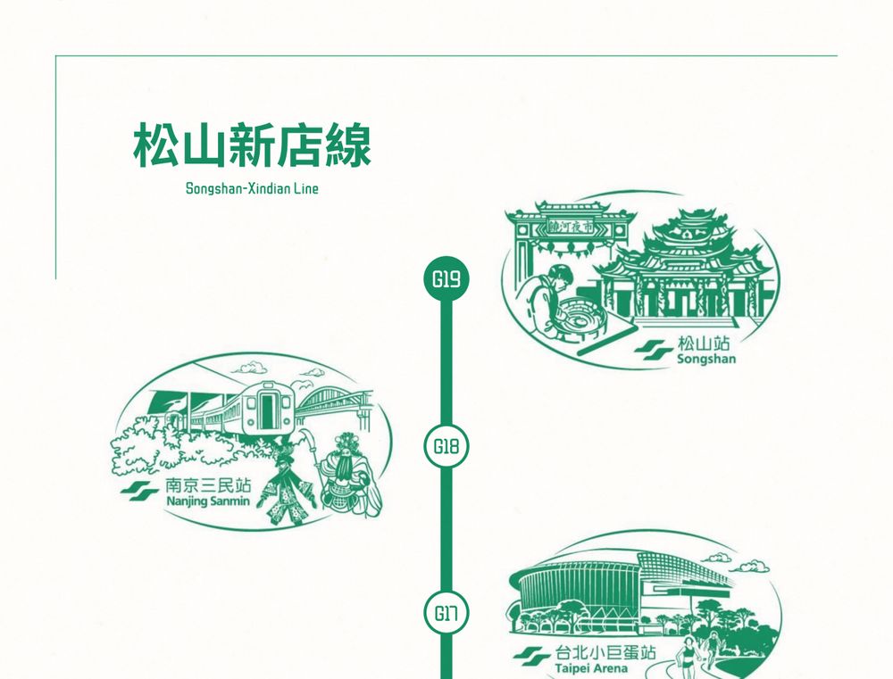
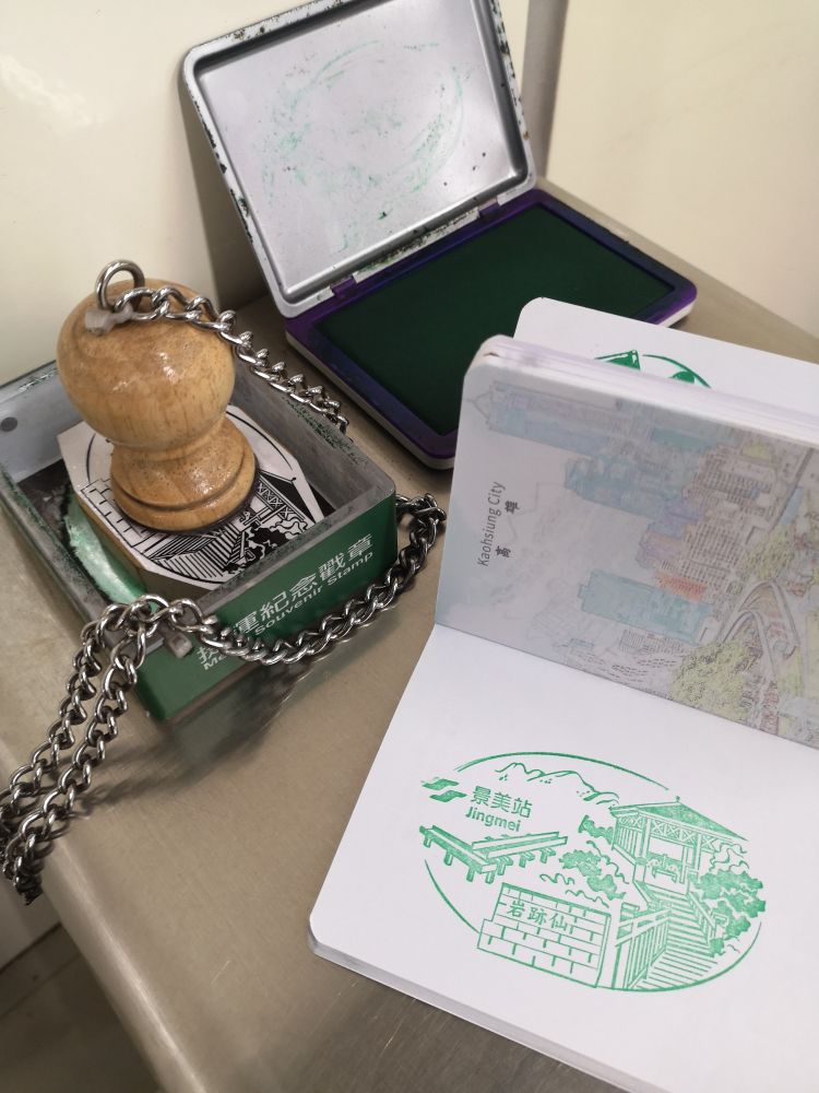
each metro station in taipei has a unique stamp - was super fun to try to collect as many as i could during my visit a few weeks ago
recently made this metro stamp map for the songshan–xindian line commemorating my trip
jamaps.github.io/maps/songsha...
#taipei #taiwan #transit #maps #inkscape
recently made this metro stamp map for the songshan–xindian line commemorating my trip
jamaps.github.io/maps/songsha...
#taipei #taiwan #transit #maps #inkscape
March 7, 2025 at 7:27 PM