Tim Collins
banner
timcdc.bsky.social
Tim Collins
@timcdc.bsky.social
NWS/OPC Marine Meteorologist, always sleepy.
Reposted by Tim Collins
Multi-panel view of the last few days of Hurricane Melissa:

↖️ GOES-19 infrared brightness temp
↗️ GOES-19 visible satellite
↙️ Hurricane hunter planes & flight paths
↘️ Recon-derived flight level wind swath
⬇️ Estimated minimum pressure from recon dropsondes
October 29, 2025 at 10:14 PM
Reposted by Tim Collins
#Melissa's landfall intensity of 185 mph/892 mb ties it with the Florida Key's Labor Day Hurricane of 1935 as the record minimum pressure of any TC making landfall *anywhere* the NATL basin. I feel for the residents of #Jamaica 😞

Zoomed in G19 visible meso loop courtesy of @cyclonicwx.bsky.social
October 28, 2025 at 5:14 PM
Reposted by Tim Collins
But they captured some historic data including the 893mb center drop, cementing #Melissa as the 3rd most intense hurricane on record in the Atlantic. Mission for the ages.
October 28, 2025 at 4:26 PM
Reposted by Tim Collins
I was worried for my crew mates when I saw them circling in the eye for over 20 mins. Looks like the very rough ride was confirmed. Plane had to leave early. They reported svr turb and a "sawtooth" eye. Looks like they moved 600-700ft up & down during this stretch in ~1 min.
October 28, 2025 at 4:23 PM
Reposted by Tim Collins
#Melissa (#13L) has officially made landfall near New Hope, Jamaica at Category 5 status, with winds of 160 knots (185 mph) and a central pressure of 892 mb.

Melissa is tied with the Labor Day Hurricane of 1935 as the most intense landfalling Atlantic #hurricane on record.
October 28, 2025 at 5:07 PM
Reposted by Tim Collins
Simply incredible imagery of Hurricane Melissa this morning as it approaches Jamaica.
October 28, 2025 at 1:41 PM
Reposted by Tim Collins
Here is a 54h WV loop of #Melissa as it underwent rapid intensification from a 60 kt TS ➡️ 150 kt cat 5 #Hurricane.

Pay attention to how "warm" eye becomes at the end of the loop which ends at 18 UTC 27 Oct.

Color scale ends at -5C & eye temp on the last few frames was warmer than that 🤯
October 27, 2025 at 11:42 PM
Reposted by Tim Collins
[at my second rodeo] listen up you ignorant sack of shit
September 26, 2025 at 12:40 PM
Reposted by Tim Collins
A spectacular view of Hurricane Erin swirling north as lightning flashes throughout the system.
August 21, 2025 at 8:19 AM
Reposted by Tim Collins
Erin's deepening rate is now a staggering 7.8 hPa/hour:
August 16, 2025 at 2:25 PM
Reposted by Tim Collins
📸August 16: Images from the NOAA Hurricane Hunter and our NOAA Satellites Ocean Winds team show an intense eyewall in Hurricane #Erin This photo shows the ocean surface calm in the eye and roaring in the eyewall. For the latest forecast visit hurricanes.gov
August 16, 2025 at 2:35 PM
Reposted by Tim Collins
This is one of the most beautiful things I have witnessed, the craft here is impeccable.
August 13, 2025 at 6:06 AM
Reposted by Tim Collins
Fortunately well out to sea, but check out #Dexter & its resurrection as a powerful #extratropical cyclone over the North Atlantic.

Perfect case for a meteorological deep dive: Favorable trough interaction led to "sting jet" formation & #hurricane force winds as cyclone phases w/ shortwave. 🌀 🦂
August 9, 2025 at 5:37 AM
my fellow excessive sweaters, rejoice!! the first comfortable air mass on the horizon since july 4, and maybe the second time we've seen dew points below 60 in about a month. 😍
July 20, 2025 at 3:16 AM
T-minus 10 hours to the Avett Brothers and @joekwon80.bsky.social at Wolf Trap woooo hoooo! 🎻🤘🏻
May 31, 2025 at 2:28 PM
Reposted by Tim Collins
Undefeated
May 12, 2025 at 6:39 PM
Reposted by Tim Collins
my endorsement for any democratic presidential candidate who promises to send the entire DOGE team to prison
This is insane and everyone involved needs to be sued into oblivion and then go directly to jail
April 24, 2025 at 7:37 PM
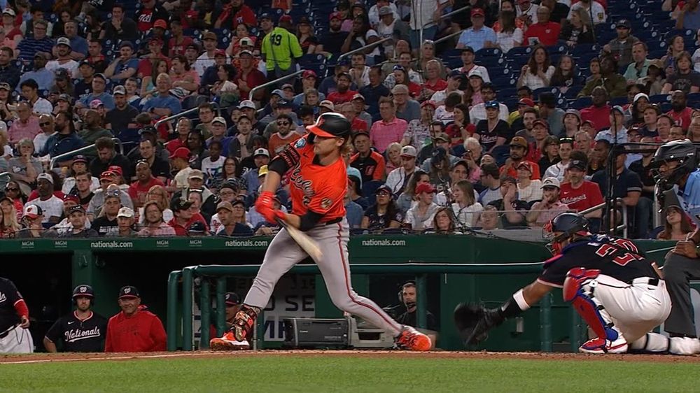
lol CB Bucknor behind the plate, not even asking for help down the line. good freakin grief, man.
April 24, 2025 at 12:03 AM
Reposted by Tim Collins
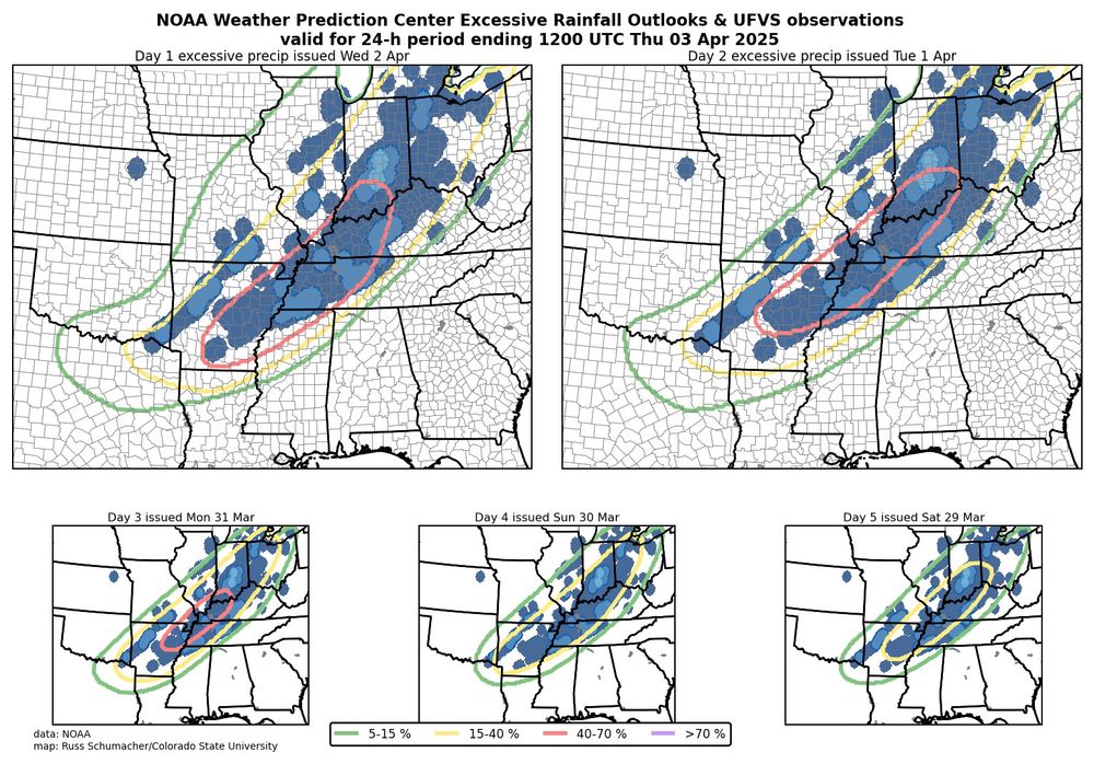
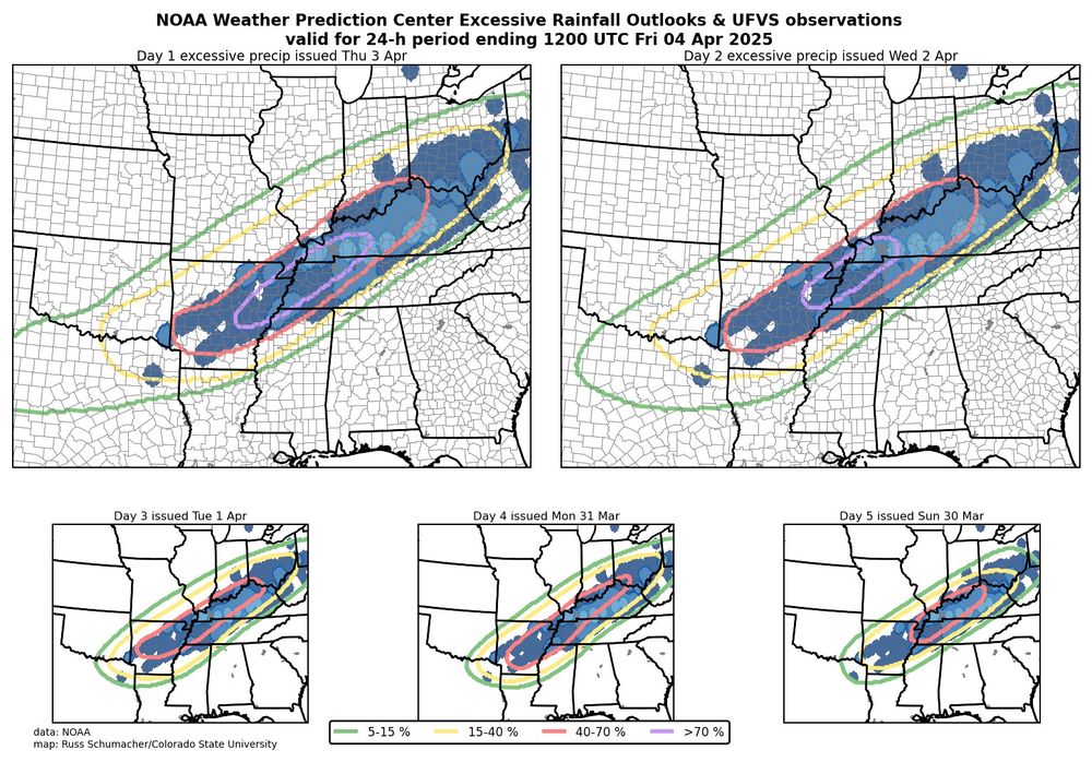
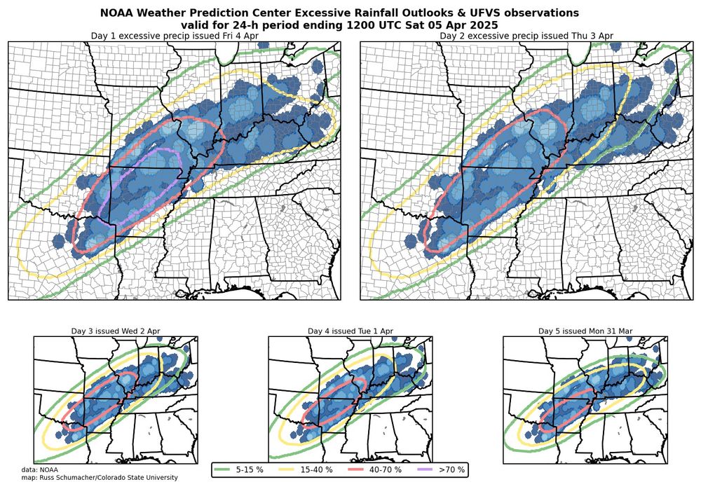
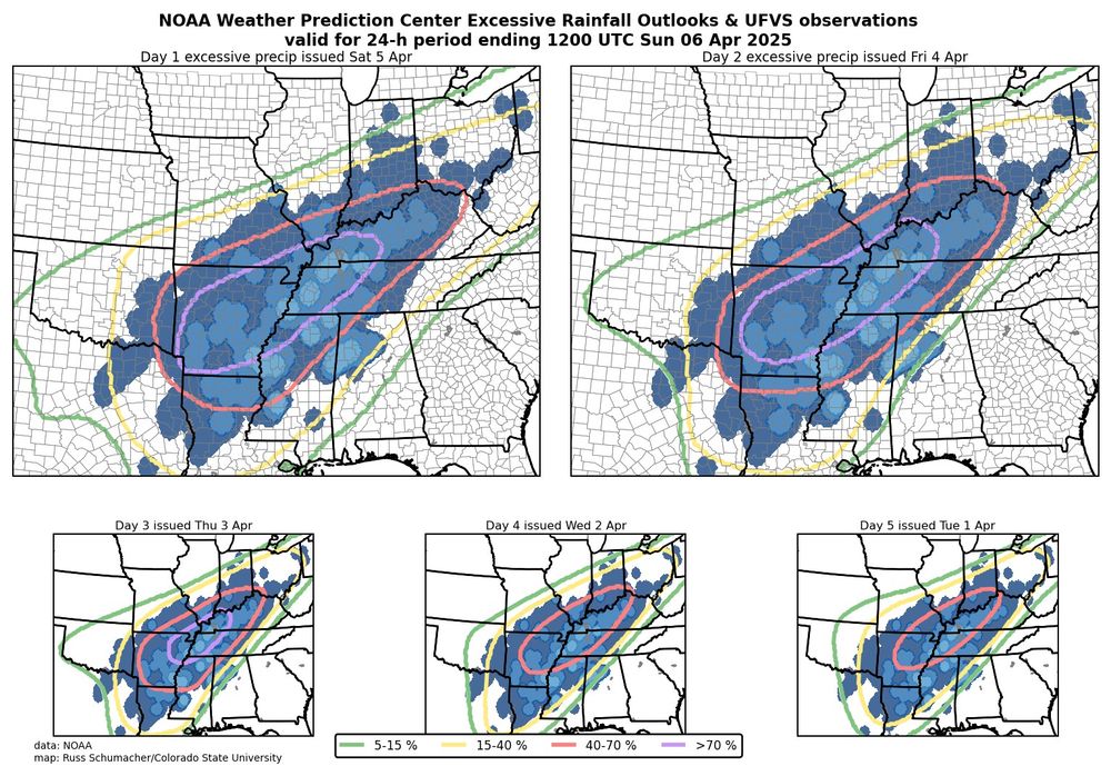
We often (rightly) see maps like these showing how good SPC convective outlooks are; let's also give some kudos to WPC for some outstanding excessive rainfall outlooks for this event. Especially impressive are the day 5 outlooks, giving advance notice of prolonged excessive rainfall and flood risk.
April 6, 2025 at 10:00 PM
Reposted by Tim Collins
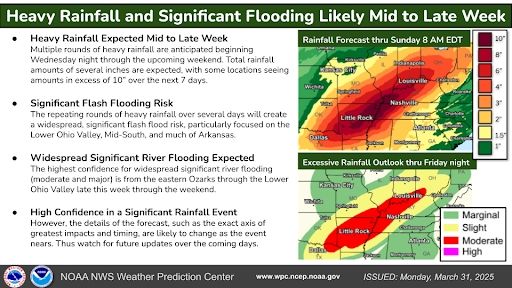
Sharing a WPC graphic regarding the incredibly concerning flood threat later this week.
April 1, 2025 at 12:44 AM
Reposted by Tim Collins
It's the most wonderful day of the year 😍
March 27, 2025 at 10:05 AM
Reposted by Tim Collins
As someone who went to college in western North Carolina... seeing this map really hit me pretty good :\ #NCwx
March 19, 2025 at 8:15 PM
Reposted by Tim Collins
NHC released Tropical Cyclone Report on Hurricane Helene and it's a HUGE report at over 100 pages. Some really staggering facts and maps in there. #NCwx
March 19, 2025 at 8:00 PM
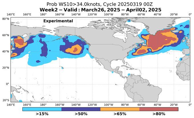
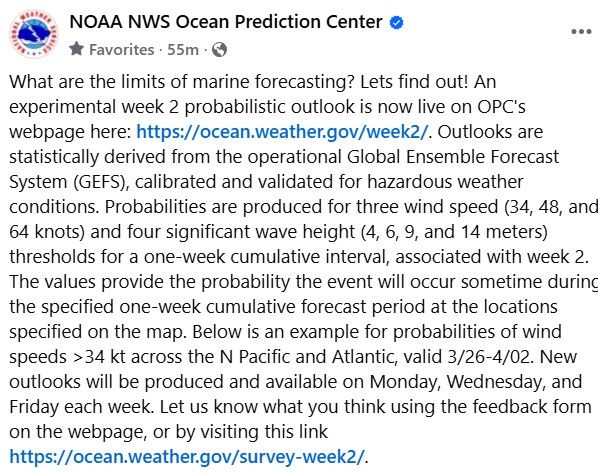
📣 Useful new marine forecasting tool from OPC released today! ocean.weather.gov/week2/
March 19, 2025 at 11:41 PM