
Notice the thermocline is quickly deepening and the subsurface anomalies are beginning to advance eastward over the West-Central Equatorial Pacific.
Notice the thermocline is quickly deepening and the subsurface anomalies are beginning to advance eastward over the West-Central Equatorial Pacific.

A large build-up of westerly momentum (+U) in the tropics is being supplanted by a West Pac MJO orbit & repeated bouts of positive E Asia Mtn Torque (+EAMT) fluxing/squeezing +U equatorward


A large build-up of westerly momentum (+U) in the tropics is being supplanted by a West Pac MJO orbit & repeated bouts of positive E Asia Mtn Torque (+EAMT) fluxing/squeezing +U equatorward
EC analysis showing W winds 10hpa 60N increasing from around 35mph to around 70mph
Models have also been forecasting a weakening going forward now..one to watch


EC analysis showing W winds 10hpa 60N increasing from around 35mph to around 70mph
Models have also been forecasting a weakening going forward now..one to watch


The extreme -IOD we're currently seeing (right) is about to collapse because the warm water in the Equatorial Indian Ocean will get flushed into the tropical West Pac at depth over the next month in this MJO event's westerly wind burst (left)


The extreme -IOD we're currently seeing (right) is about to collapse because the warm water in the Equatorial Indian Ocean will get flushed into the tropical West Pac at depth over the next month in this MJO event's westerly wind burst (left)
1. Weak La Nina
2. E QBO
3. -IOD
4. Active MJO heading into phase 6/7
5. Potential weaker stratospheric polar vortex


1. Weak La Nina
2. E QBO
3. -IOD
4. Active MJO heading into phase 6/7
5. Potential weaker stratospheric polar vortex
Thereafter, also worth watching for a consistently signalled weakening


Thereafter, also worth watching for a consistently signalled weakening

In records back to 1959 I'm aware of only 3 major SSWs within 1st half Dec & none in November.

In records back to 1959 I'm aware of only 3 major SSWs within 1st half Dec & none in November.
I replicated Gray et al (2004)'s analysis except used SLPa from 20CR & isolated -ENSO (left), which is close to the latest Euro weekly forecast (right) journals.ametsoc.org/view/journal...


I replicated Gray et al (2004)'s analysis except used SLPa from 20CR & isolated -ENSO (left), which is close to the latest Euro weekly forecast (right) journals.ametsoc.org/view/journal...
www.amazon.com/Sword-Defian...

www.amazon.com/Sword-Defian...
Here's what this -EPO/+TNH or "ABNA" pattern looks like in winter (annotated over their fig 1)

Here's what this -EPO/+TNH or "ABNA" pattern looks like in winter (annotated over their fig 1)
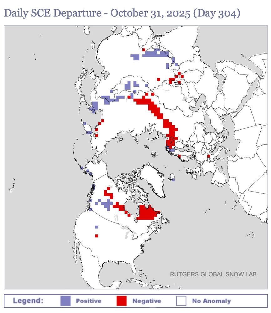
Namely, a warmer-than-normal Maritime Continent & West Pac as well as a Eurasian Snow Cover Dipole.
journals.ametsoc.org/view/journal...


Namely, a warmer-than-normal Maritime Continent & West Pac as well as a Eurasian Snow Cover Dipole.
journals.ametsoc.org/view/journal...


This explicitly supports Melissa being a 145-150 knot hurricane 😳

This explicitly supports Melissa being a 145-150 knot hurricane 😳
www.nature.com/articles/s43...

www.nature.com/articles/s43...
I also reorganized the dropdown menu to separate NWP ensembles vs AI ensembles:


I also reorganized the dropdown menu to separate NWP ensembles vs AI ensembles:
Community action works.
Source: www.instagram.com/reel/DPZL2AL...


