


Joe Mason
@moreorloess.bsky.social
UW Madison Geography, opinions are mine. Geomorphology, soils, dunes, loess, in the Midwest, Great Plains, northern China. He/him. Living on Ho-Chunk lands.
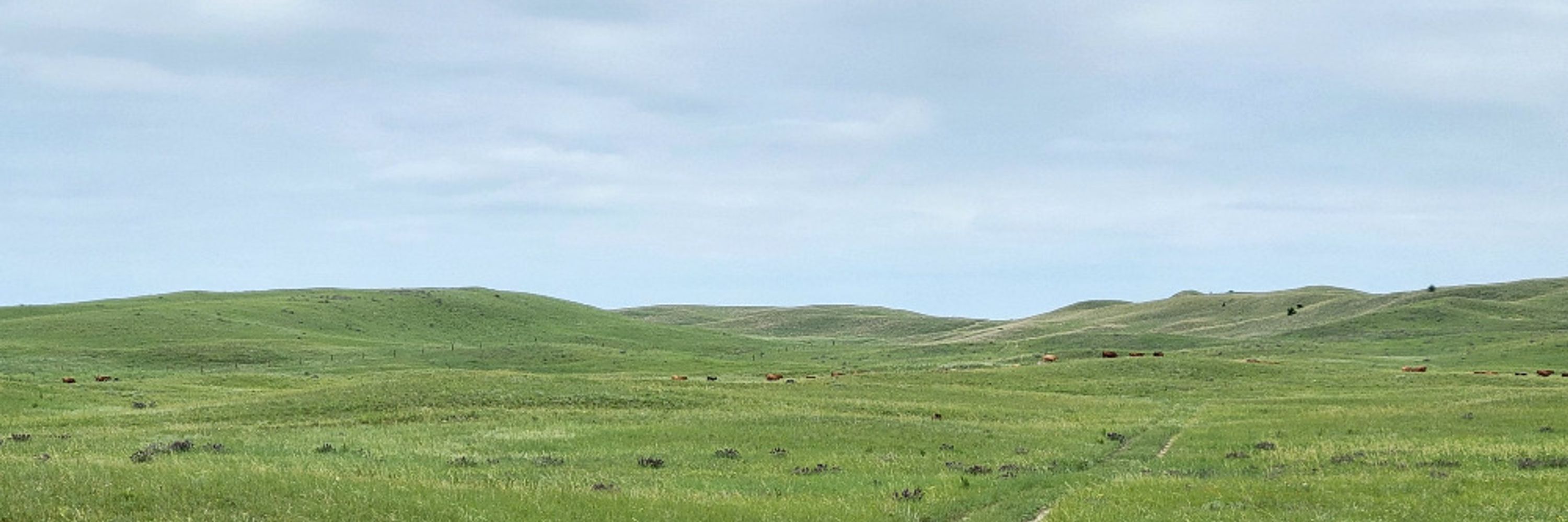
Interesting year to teach a course on Changing Landscapes of the American West. Although that's been true of every year I've taught it.

As a Colorado River deadline passes, reservoirs keep declining

As a Colorado River deadline passes, reservoirs keep declining
Seven states have missed a federal deadline to reach a water deal on the Colorado River. They remain divided how to cut water use.
www.latimes.com
February 14, 2026 at 1:17 AM
Interesting year to teach a course on Changing Landscapes of the American West. Although that's been true of every year I've taught it.
Pretty sure he didn't write "I have searched the depths of Legal Arguments not yet articulated or vetted on this subject, and I will be presenting an irrefutable one in the very near future" but it's really as dumb as the stuff he writes and says himself.
February 14, 2026 at 1:11 AM
Pretty sure he didn't write "I have searched the depths of Legal Arguments not yet articulated or vetted on this subject, and I will be presenting an irrefutable one in the very near future" but it's really as dumb as the stuff he writes and says himself.
Reposted by Joe Mason

this is repugnant and horrific on a human/moral level, obviously, but also seems to me colossal financial mismanagement.
immigrants boost economic activity, so we're spending vast sums ($38 billion is more than the total annual spending for 22 states) to injure the economy. cruelty is expensive
immigrants boost economic activity, so we're spending vast sums ($38 billion is more than the total annual spending for 22 states) to injure the economy. cruelty is expensive

Breaking news: ICE expects to spend $38.3 billion on its plan to acquire warehouses across the U.S. and retrofit them into immigrant detention centers that can hold tens of thousands of people, according to agency documents.

ICE plans to spend $38.3 billion turning warehouses into detention centers
ICE plans to spend $38.3 billion converting warehouses into detention centers, according to planning documents, more than the annual budgets of 22 states.
www.washingtonpost.com
February 13, 2026 at 5:56 PM
this is repugnant and horrific on a human/moral level, obviously, but also seems to me colossal financial mismanagement.
immigrants boost economic activity, so we're spending vast sums ($38 billion is more than the total annual spending for 22 states) to injure the economy. cruelty is expensive
immigrants boost economic activity, so we're spending vast sums ($38 billion is more than the total annual spending for 22 states) to injure the economy. cruelty is expensive
Thinking about senior faculty on committees. First, two who were well-known and admired for their work outside academia, listening carefully and sympathetically to nervous, hesitant students appealing suspensions for low grades, recognizing circumstances beyond the students' control.
February 13, 2026 at 3:33 PM
Thinking about senior faculty on committees. First, two who were well-known and admired for their work outside academia, listening carefully and sympathetically to nervous, hesitant students appealing suspensions for low grades, recognizing circumstances beyond the students' control.
Reposted by Joe Mason

My jaw dropped at this quote

Wow: Meta has been working on plans to add facial recognition technology to its AI smart glasses. nyti.ms/3Os1oxf
And this was the company’s cynical view on when, and how, to do it:
And this was the company’s cynical view on when, and how, to do it:

February 13, 2026 at 2:16 PM
My jaw dropped at this quote
Reposted by Joe Mason

NEW: A federal tool meant to find noncitizens on voter rolls is consistently marking citizens as noncitizens, especially if they were born outside the U.S., causing chaos as election clerks try not to disenfranchise voters, @zachdespart.bsky.social and I found. 🧵 www.propublica.org/article/save...

“Not Ready for Prime Time.” A Federal Tool to Check Voter Citizenship Keeps Making Mistakes.
The Department of Homeland Security pushed out the revamped tool while it was still adding data. That led to widespread misidentification, particularly for citizens born outside the U.S.
www.propublica.org
February 13, 2026 at 1:21 PM
NEW: A federal tool meant to find noncitizens on voter rolls is consistently marking citizens as noncitizens, especially if they were born outside the U.S., causing chaos as election clerks try not to disenfranchise voters, @zachdespart.bsky.social and I found. 🧵 www.propublica.org/article/save...
Reposted by Joe Mason

Check out the female inflorescences of Cliffortia conifera, a denizen of fire-prone ecosystems of South Africa. The “cones” are condensed clusters of flowers & bracts. This species is serotinous & also resprouts from lignotubers. 📷: Ismail Ebrahim CCBYNC4. #Rosaceae #serotiny #Botany 🌾🧪🌱

February 12, 2026 at 11:45 AM
Reposted by Joe Mason
These fruits of Hakea lehmanniana (📷: geoffbyrne CCBYNC4) are impossibly woody, but a bushfire will trigger the fruits to open and release the seeds. Native to Western Australia. (HT to devils.poison on IG for directing me to this sp.) #Proteaceae #serotiny #Botany 🌾🧪🌱


February 11, 2026 at 4:42 PM
These fruits of Hakea lehmanniana (📷: geoffbyrne CCBYNC4) are impossibly woody, but a bushfire will trigger the fruits to open and release the seeds. Native to Western Australia. (HT to devils.poison on IG for directing me to this sp.) #Proteaceae #serotiny #Botany 🌾🧪🌱
Reposted by Joe Mason
Australia’s Banksia has fruits that are serotinous, opening after fire. Wildfires clear competing vegetation + deposit nutrients in the soil = good conditions for seedling establishment. 📷: Banksia ornata by davidsando CCBYNC4. #Proteaceae #serotiny #Botany 🌾🧪🌱

February 11, 2026 at 11:30 AM
Australia’s Banksia has fruits that are serotinous, opening after fire. Wildfires clear competing vegetation + deposit nutrients in the soil = good conditions for seedling establishment. 📷: Banksia ornata by davidsando CCBYNC4. #Proteaceae #serotiny #Botany 🌾🧪🌱
Reposted by Joe Mason
Pinus banksiana cones are strongly serotinous in populations in the center of the species’ range, but less so at the edges of its range (where fires are less frequent). It's a bet-hedging strategy to ensure seedling establishment. 📷: Taylor Justason CCBYNC4. #Pinaceae #serotiny #Botany 🌾🧪🌱

February 10, 2026 at 4:44 PM
Reposted by Joe Mason
Pinus radiata releases seeds when the temperature goes above 45°C (113°F). Sometimes that threshold temperature can be reached by passive solar heating of the cones if they are exposed to sunlight on the tree or on the ground. They can open even without fire. #Pinaceae #serotiny #Botany 🌾🧪🌱

February 10, 2026 at 11:00 AM
Reposted by Joe Mason

I'm super excited to share that this article was published today in Science! www.science.org/doi/10.1126/...
All made possible by the fantastic group of donors, volunteers and scientists at The American Chestnut Foundation (tacf.org), HudsonAlpha Institute for Biotechnology, and our collaborators.
All made possible by the fantastic group of donors, volunteers and scientists at The American Chestnut Foundation (tacf.org), HudsonAlpha Institute for Biotechnology, and our collaborators.
February 12, 2026 at 7:26 PM
I'm super excited to share that this article was published today in Science! www.science.org/doi/10.1126/...
All made possible by the fantastic group of donors, volunteers and scientists at The American Chestnut Foundation (tacf.org), HudsonAlpha Institute for Biotechnology, and our collaborators.
All made possible by the fantastic group of donors, volunteers and scientists at The American Chestnut Foundation (tacf.org), HudsonAlpha Institute for Biotechnology, and our collaborators.
Reposted by Joe Mason

Mural memorializing the No Exit Cafe, Rogers Park, Chicago

February 13, 2026 at 1:10 AM
Mural memorializing the No Exit Cafe, Rogers Park, Chicago
0 points. I have eaten everything on here and would again. I like this stuff. The licorice is pushing it, though.


February 13, 2026 at 1:57 AM
0 points. I have eaten everything on here and would again. I like this stuff. The licorice is pushing it, though.
For example, there is a vast amount of information about paleoenvironments and environmental change out there, buried in loess and sand dunes, or in lake beds, inside trees, etc., that can only be accessed by funding researchers to go take cores.

A lot of people really don’t realize that there is a vast amount of information out there that is not online and plausibly never will be, or can’t be.

I think that's a point that will surprise a lot of people. There's a lot of calling the internet capable of accessing "the sum of all human knowledge" and such that I think gives people the impression that any and all records exist online somewhere.
February 13, 2026 at 1:06 AM
For example, there is a vast amount of information about paleoenvironments and environmental change out there, buried in loess and sand dunes, or in lake beds, inside trees, etc., that can only be accessed by funding researchers to go take cores.
Reposted by Joe Mason

Here's Michelle Wu doing the introduction to a Know Your Rights video in Haitian Creole. This is the kind of stuff I think of when I say she truly represents the entire state. Great work by the Mayor and her team.

🇭🇹 Boston se lakay nou tout. Aprann konnen dwa ou, e ede proteje kominote w. Ou ka jwenn plis enfòmasyon nan miracoalition.org/KYR.
February 12, 2026 at 11:24 PM
Here's Michelle Wu doing the introduction to a Know Your Rights video in Haitian Creole. This is the kind of stuff I think of when I say she truly represents the entire state. Great work by the Mayor and her team.
The current regime is both unprecedented in how far it's gone, and completely precedented* in its ideology, its constant effort to push the limits of what's considered legal, and its willingness to tell obvious lies in serious, pained voices.
*awkward, I know, but I don't care
*awkward, I know, but I don't care
Maybe it's my age, but my first reaction to things like this is to say "I am not a crook!" in an exaggerated version of Nixon's voice.

Homan: "ICE is a legitimate federal law enforcement agency. We're not out scouring the streets to disappear people or deny people their civil rights or due process."
February 13, 2026 at 12:57 AM
The current regime is both unprecedented in how far it's gone, and completely precedented* in its ideology, its constant effort to push the limits of what's considered legal, and its willingness to tell obvious lies in serious, pained voices.
*awkward, I know, but I don't care
*awkward, I know, but I don't care
Reposted by Joe Mason

“The Constitution does not permit the government to arrest thousands of individuals and then disregard their constitutional rights because it would be too challenging to honor those rights.”

BREAKING: Judge Nancy Brasel, a Trump appointee, has issued a TRO in the Minnesota access-to-counsel case about treatment at Whipple.
"It appears that in planning for Operation Metro Surge, the government failed to plan for the constitutional rights of its civil detainees."
"It appears that in planning for Operation Metro Surge, the government failed to plan for the constitutional rights of its civil detainees."

February 13, 2026 at 12:24 AM
“The Constitution does not permit the government to arrest thousands of individuals and then disregard their constitutional rights because it would be too challenging to honor those rights.”
Snow water equivalent, 1980-2026 water years, at two pairs of SNOTEL stations. 1. Park Range, northern Colorado. Tower is on Continental Divide (Colorado-Mississippi), Dry Lake not far down valley to the west.

February 13, 2026 at 12:35 AM
Snow water equivalent, 1980-2026 water years, at two pairs of SNOTEL stations. 1. Park Range, northern Colorado. Tower is on Continental Divide (Colorado-Mississippi), Dry Lake not far down valley to the west.
Reposted by Joe Mason

On our commentary page today: Editor @rconniff.bsky.social talks to a Minneapolis mom for lessons in how parents prepared for ICE wisconsinexaminer.com/2026/02/12/w...

Wisconsin take note: Here’s how Minneapolis parents prepared for ICE • Wisconsin Examiner
Before Operation Metro Surge sent thousands of armed federal agents into Minneapolis, terrorizing families and spreading chaos and violence in formerly peaceful residential neighborhoods, local parent...
wisconsinexaminer.com
February 12, 2026 at 4:14 PM
On our commentary page today: Editor @rconniff.bsky.social talks to a Minneapolis mom for lessons in how parents prepared for ICE wisconsinexaminer.com/2026/02/12/w...
"They got you now, Big John!" This is something I remember clearly, and to be honest, think about more often these days.
A United States Attorney General who obstructs justice can be jailed.
Case in point: Inmate 24171-157.
Case in point: Inmate 24171-157.

February 12, 2026 at 7:55 PM
"They got you now, Big John!" This is something I remember clearly, and to be honest, think about more often these days.
The colors are backwards here, Tower site is in blue, Dry Lake in red. Apparently no one noticed that or maybe it's more that no one noticed the post at all! So in any case I have at least not caused much confusion.
Similar comparison for the Park Range, with much higher snow water equivalent at both elevations. The difference here (over a larger elevation range) is less, but still striking. Medano Pass and South Colony SNOTEL sites are in the Sangre de Cristo range, warmer and drier at a given elevation.
February 12, 2026 at 6:37 PM
The colors are backwards here, Tower site is in blue, Dry Lake in red. Apparently no one noticed that or maybe it's more that no one noticed the post at all! So in any case I have at least not caused much confusion.
Reposted by Joe Mason


Maybe it's my age, but my first reaction to things like this is to say "I am not a crook!" in an exaggerated version of Nixon's voice.
Homan: "ICE is a legitimate federal law enforcement agency. We're not out scouring the streets to disappear people or deny people their civil rights or due process."
February 12, 2026 at 4:21 PM
Maybe it's my age, but my first reaction to things like this is to say "I am not a crook!" in an exaggerated version of Nixon's voice.
Reposted by Joe Mason

I am really not in the camp of "this person supports MAHA so they deserve to struggle" and if that's a value you live your life by, congrats! but we are not the same. My politics isn't organized around sorting through who deserves to be taken care of. I believe in universal healthcare.
February 12, 2026 at 3:26 PM
I am really not in the camp of "this person supports MAHA so they deserve to struggle" and if that's a value you live your life by, congrats! but we are not the same. My politics isn't organized around sorting through who deserves to be taken care of. I believe in universal healthcare.