


Joe Mason
@moreorloess.bsky.social
UW Madison Geography, opinions are mine. Geomorphology, soils, dunes, loess, in the Midwest, Great Plains, northern China. He/him. Living on Ho-Chunk lands.
My generation.
(Library Mall, UW Madison, ca. 1970)
(Library Mall, UW Madison, ca. 1970)

November 14, 2025 at 2:46 AM
My generation.
(Library Mall, UW Madison, ca. 1970)
(Library Mall, UW Madison, ca. 1970)
Speaking of this part of Colorado, Killing for Coal by Thomas Andrews is well worth reading, on organizing and strikes in the Colorado coal fields leading up to the Ludlow Massacre and the "Ten-Day War" that followed. The most interesting part of the story for me was how often the conditions of work

November 13, 2025 at 2:07 PM
Speaking of this part of Colorado, Killing for Coal by Thomas Andrews is well worth reading, on organizing and strikes in the Colorado coal fields leading up to the Ludlow Massacre and the "Ten-Day War" that followed. The most interesting part of the story for me was how often the conditions of work
Teaching that class, Changing Landscapes of the American West, for what is probably the last time this spring. Bear Lake and south of Tooele, Utah, photos from a late fall field trip for students from the Earth and Atmospheric Science department that UNL is shutting down.


November 13, 2025 at 2:48 AM
Teaching that class, Changing Landscapes of the American West, for what is probably the last time this spring. Bear Lake and south of Tooele, Utah, photos from a late fall field trip for students from the Earth and Atmospheric Science department that UNL is shutting down.
Spanish Peaks, Colorado, from the Plains to the east. September 1979. Showed this during a lecture and it turned out a senior auditor in the class was from Trinidad (the city in Colorado, not the island) and talked about what it was like growing up there.

November 13, 2025 at 2:39 AM
Spanish Peaks, Colorado, from the Plains to the east. September 1979. Showed this during a lecture and it turned out a senior auditor in the class was from Trinidad (the city in Colorado, not the island) and talked about what it was like growing up there.


I walked through this upland area on a later visit in 2017. It's a beautiful landscape (not sure this photo is in the area shown, but if not it's nearby).

November 12, 2025 at 12:41 AM
I walked through this upland area on a later visit in 2017. It's a beautiful landscape (not sure this photo is in the area shown, but if not it's nearby).
Some consolidation of fields on the uplands to the north since 1950, though other fields still have exactly the same boundaries. A few areas where forest replaced farmland, or vice versa. I think the soils here are often thin, over limestone bedrock.


November 12, 2025 at 12:35 AM
Some consolidation of fields on the uplands to the north since 1950, though other fields still have exactly the same boundaries. A few areas where forest replaced farmland, or vice versa. I think the soils here are often thin, over limestone bedrock.
Fields around two former meanders of the Dordogne River east of Sainte-Foy-la-Grande in southwestern France, in 1950 (left) and today. I walked that road along the river in 1975. I suspect the narrow fields perpendicular to the channels were gone by then, but of course I didn't know to check.


November 12, 2025 at 12:21 AM
Fields around two former meanders of the Dordogne River east of Sainte-Foy-la-Grande in southwestern France, in 1950 (left) and today. I walked that road along the river in 1975. I suspect the narrow fields perpendicular to the channels were gone by then, but of course I didn't know to check.
Our oaks look good this afternoon.


November 11, 2025 at 10:19 PM
Our oaks look good this afternoon.
Edmund Fitzgerald leaving the Duluth-Superior harbor through the ship canal, under the lift bridge (not on its last trip). UW Madison Libraries Digital Collections, photographer unknown, apparently.

November 10, 2025 at 11:54 PM
Edmund Fitzgerald leaving the Duluth-Superior harbor through the ship canal, under the lift bridge (not on its last trip). UW Madison Libraries Digital Collections, photographer unknown, apparently.
Daily weather maps for November 11 and 12, 1940, the Armistice Day blizzard. 49 people died in Minnesota, about half of them duck hunters on the Upper Mississippi; 66 sailors died in the sinking of 3 freighters and two smaller boats on the Great Lakes. NOAA archive: library.noaa.gov/weather-clim...


November 10, 2025 at 12:40 AM
Daily weather maps for November 11 and 12, 1940, the Armistice Day blizzard. 49 people died in Minnesota, about half of them duck hunters on the Upper Mississippi; 66 sailors died in the sinking of 3 freighters and two smaller boats on the Great Lakes. NOAA archive: library.noaa.gov/weather-clim...
Daily weather maps for November 9 and November 10, 1975 (from NOAA archive, library.noaa.gov/weather-clim...)


November 10, 2025 at 12:29 AM
Daily weather maps for November 9 and November 10, 1975 (from NOAA archive, library.noaa.gov/weather-clim...)
It's a lot easier to interpret the geomorphology if you don't exaggerate elevation quite so much and leave out the elevation shading. I don't have the whole area you show handy but here's part of it. I interpret the bumpy areas toward the east as dunes buried by Late Pleistocene loess (based on

November 8, 2025 at 2:24 PM
It's a lot easier to interpret the geomorphology if you don't exaggerate elevation quite so much and leave out the elevation shading. I don't have the whole area you show handy but here's part of it. I interpret the bumpy areas toward the east as dunes buried by Late Pleistocene loess (based on
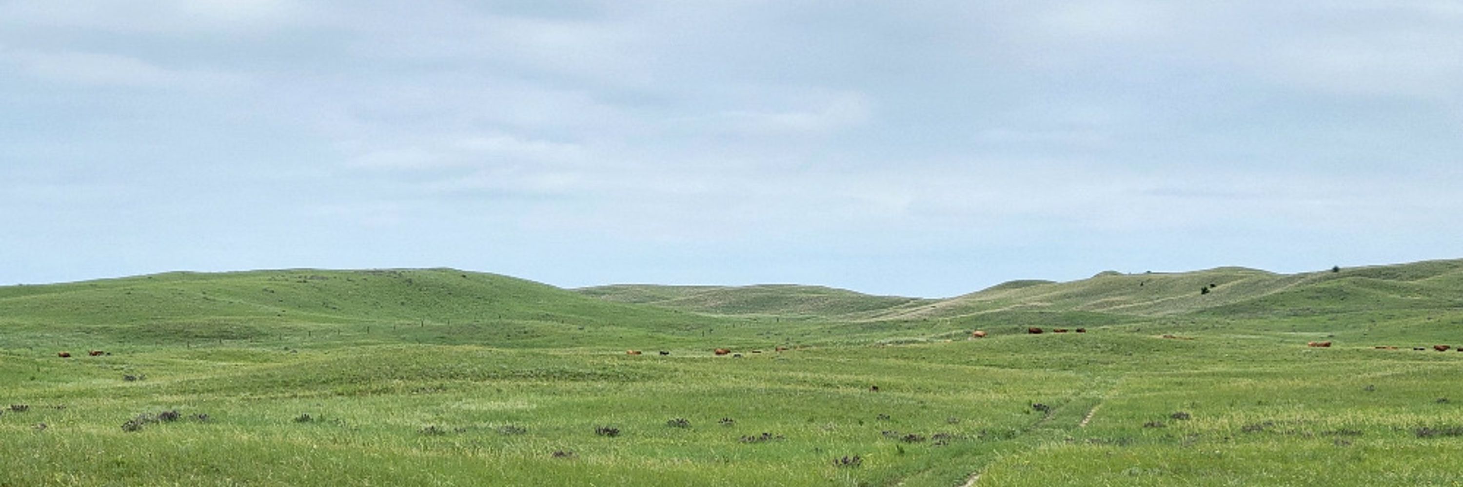
Map of sites sampled for that project. Lots of section-line roads.

November 8, 2025 at 2:36 AM
Map of sites sampled for that project. Lots of section-line roads.
to help him acquire lands with valuable timber. Here are the first of three pages of patents in the General Land Office database by which Cornell acquired parcels in a single township (a small part of which is in the first post). Quite a bit of this land is now part of the Chequamegon-Nicolet NF,

November 8, 2025 at 12:02 AM
to help him acquire lands with valuable timber. Here are the first of three pages of patents in the General Land Office database by which Cornell acquired parcels in a single township (a small part of which is in the first post). Quite a bit of this land is now part of the Chequamegon-Nicolet NF,
Since Cornell is in the news: This 1897 plat map of Sawyer County, Wisconsin, shows a few of the parcels that still belonged to Cornell University. They are a small remnant of the vast areas of pine lands in Wisconsin bought with Morrill Act (Agricultural College) scrip by Ezra Cornell himself. 🧵

November 8, 2025 at 12:02 AM
Since Cornell is in the news: This 1897 plat map of Sawyer County, Wisconsin, shows a few of the parcels that still belonged to Cornell University. They are a small remnant of the vast areas of pine lands in Wisconsin bought with Morrill Act (Agricultural College) scrip by Ezra Cornell himself. 🧵
Beautiful fall light all week. A good morning to take the long way to the bus stop.


November 7, 2025 at 3:09 PM
Beautiful fall light all week. A good morning to take the long way to the bus stop.
The bathymetry of eastern Lake Superior, the part that would be crossed by an ore carrier coming from the NW, trying to make Whitefish Bay in a storm, is fascinating. I have heard those N-S troughs explained as subglacially eroded tunnel channels, but there are probably other ideas out there.

November 7, 2025 at 1:14 PM
The bathymetry of eastern Lake Superior, the part that would be crossed by an ore carrier coming from the NW, trying to make Whitefish Bay in a storm, is fascinating. I have heard those N-S troughs explained as subglacially eroded tunnel channels, but there are probably other ideas out there.
Zoomed out some, shaded by classification instead of elevation (trees, buildings, bare ground, etc.)

November 6, 2025 at 12:00 AM
Zoomed out some, shaded by classification instead of elevation (trees, buildings, bare ground, etc.)
Something to work on when I have more time: Lidar point cloud from the Dordogne River valley in southern France, just upstream from Les Eyzies, close to many of the famous archaeological sites in this region. LidarHD from IGN.

November 5, 2025 at 11:57 PM
Something to work on when I have more time: Lidar point cloud from the Dordogne River valley in southern France, just upstream from Les Eyzies, close to many of the famous archaeological sites in this region. LidarHD from IGN.
Southernmost part of the relief model of California in the main stairwell of Science Hall. Geology, including faults, from a 1932 USGS map. The model dates to 1939 and was restored within the last 10-15 years.

November 5, 2025 at 8:54 PM
Southernmost part of the relief model of California in the main stairwell of Science Hall. Geology, including faults, from a 1932 USGS map. The model dates to 1939 and was restored within the last 10-15 years.
Okay, fine with the first snow this weekend (it'll melt). Ready for some winter hiking when the semester winds down. Past snowy Ice Age Trail hikes: Brooklyn Wildlife Area, on showshoes (left) and all those steps going up Lapham Peak in the Kettle Moraine at the end of 14.5 miles.


November 5, 2025 at 2:47 PM
Okay, fine with the first snow this weekend (it'll melt). Ready for some winter hiking when the semester winds down. Past snowy Ice Age Trail hikes: Brooklyn Wildlife Area, on showshoes (left) and all those steps going up Lapham Peak in the Kettle Moraine at the end of 14.5 miles.
And I'm pretty sure the id is correct this time because here is the next photo I took! ☺️

November 5, 2025 at 1:47 AM
And I'm pretty sure the id is correct this time because here is the next photo I took! ☺️
Oops, this was the wrong photo. Here is the right one of the foliage on a young L. chinense.

November 5, 2025 at 1:47 AM
Oops, this was the wrong photo. Here is the right one of the foliage on a young L. chinense.
I believe this is Liriodendron chinense, the only other species in that genus, in a park in Nanjing ("I believe" because I can't be certain it's not the American species, though there were a lot that looked like this in the park and on a nearby mountain).

November 5, 2025 at 1:09 AM
I believe this is Liriodendron chinense, the only other species in that genus, in a park in Nanjing ("I believe" because I can't be certain it's not the American species, though there were a lot that looked like this in the park and on a nearby mountain).