


Bram van 't Veen
@bramvantveen.bsky.social
Severe storms and radar | Creator of radar viewer NLradar | MSc Climate Physics | Working with radar data for @essl-ecss.bsky.social.
Reposted by Bram van 't Veen

Experts waarschuwen: ‘Nederland lijkt deze week van bovenaf gevaarlijk veel op Groenland’

Experts waarschuwen: ‘Nederland lijkt deze week van bovenaf gevaarlijk veel op Groenland’
Militair analisten luiden de noodklok nu grote delen van Nederland bedolven zijn onder een flinke laag sneeuw.
speld.nl
January 7, 2026 at 10:33 AM
Experts waarschuwen: ‘Nederland lijkt deze week van bovenaf gevaarlijk veel op Groenland’
Reposted by Bram van 't Veen

Are you interested in tornadoes in Germany (temporal+spatial distribution) you should read our recently published paper. It is the first detailed statistical analysis since the paper of Dotzek (2003). Would be happy to learn about statistics in other European countries!
doi.org/10.1127/metz...
doi.org/10.1127/metz...

January 6, 2026 at 9:53 AM
Are you interested in tornadoes in Germany (temporal+spatial distribution) you should read our recently published paper. It is the first detailed statistical analysis since the paper of Dotzek (2003). Would be happy to learn about statistics in other European countries!
doi.org/10.1127/metz...
doi.org/10.1127/metz...
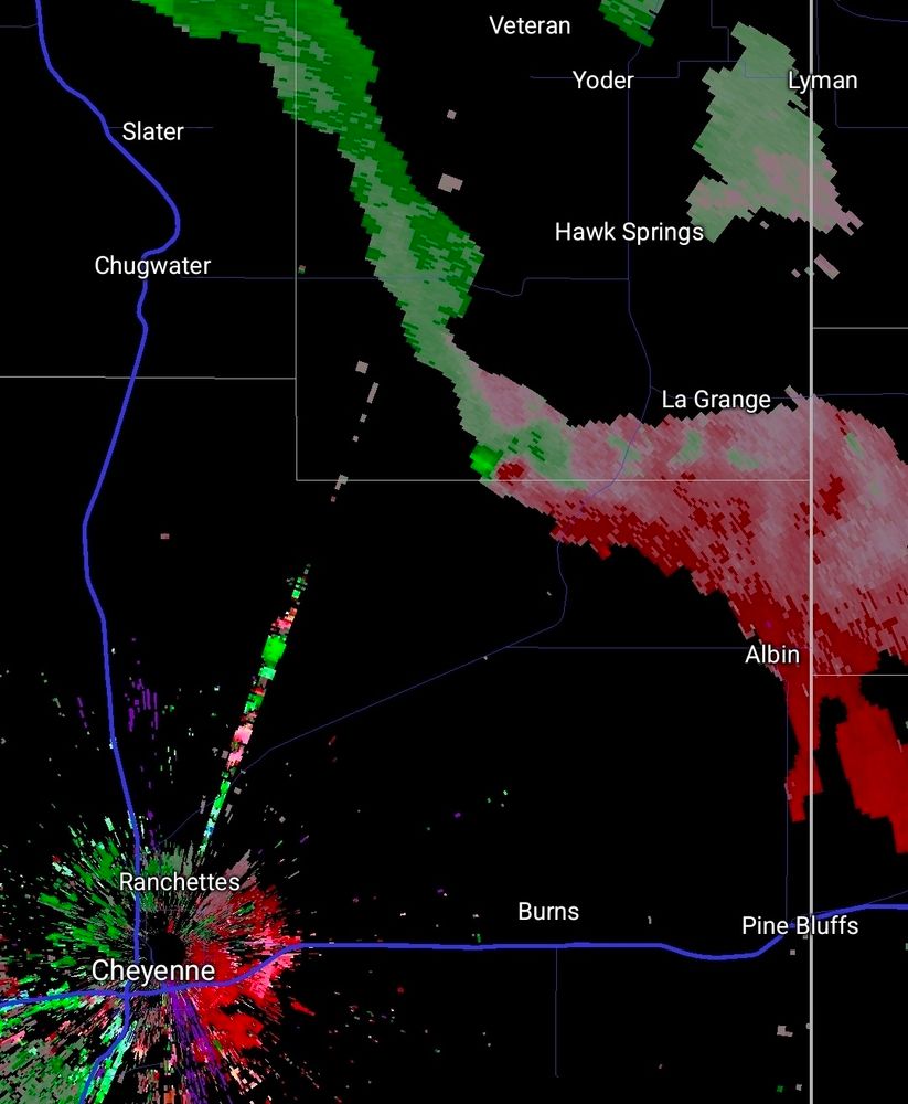
The Atlantic west of Norway also remains interesting. Look at these southwestward moving snowpercells of last night:
January 6, 2026 at 11:22 AM
The Atlantic west of Norway also remains interesting. Look at these southwestward moving snowpercells of last night:
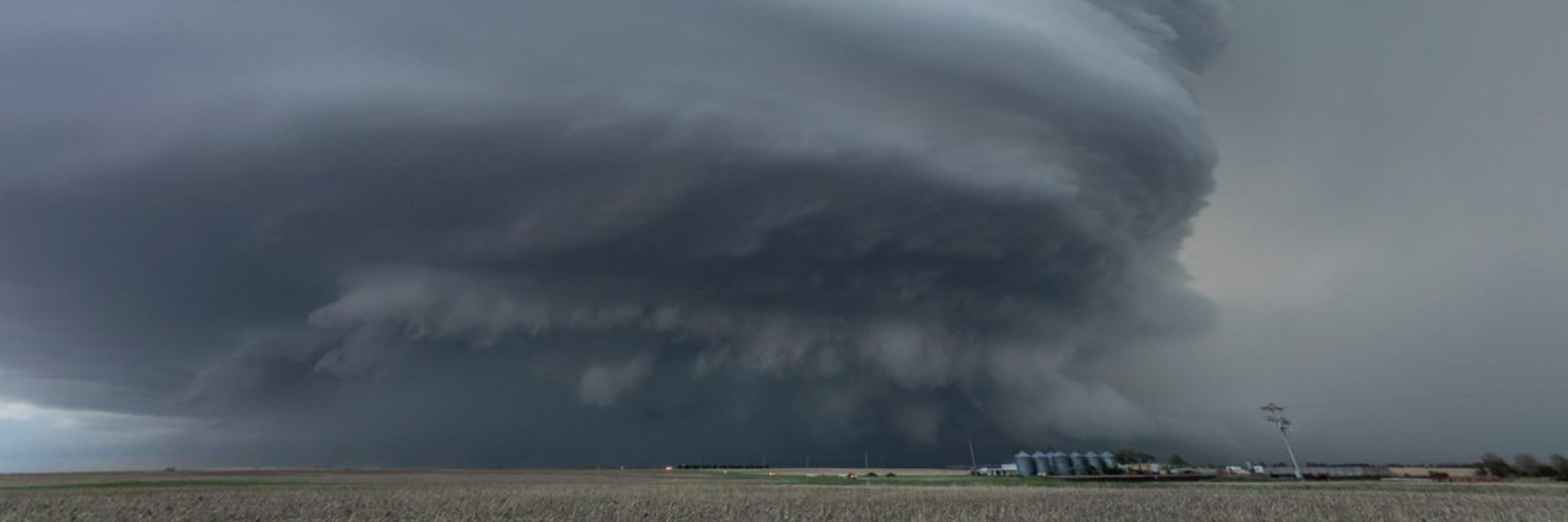
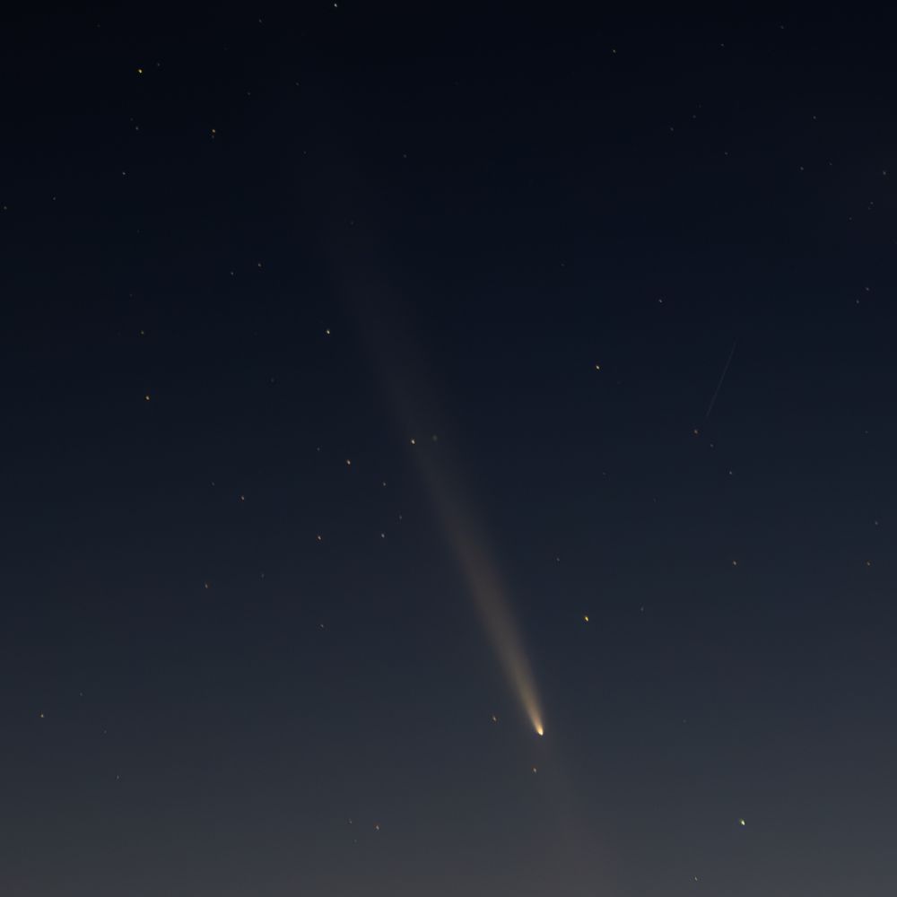
It's looking pretty nice outside here


January 6, 2026 at 11:06 AM
It's looking pretty nice outside here


Reposted by Bram van 't Veen

The far southeastern suburbs of Rome (Ciampino area) observed the first Italian tornado of 2026. Video via Meteo Lazio
January 4, 2026 at 12:02 PM
The far southeastern suburbs of Rome (Ciampino area) observed the first Italian tornado of 2026. Video via Meteo Lazio
Beautiful swirls visible in radar imagery from the Norwegian coast over the past 2 days:
January 3, 2026 at 9:01 PM
Beautiful swirls visible in radar imagery from the Norwegian coast over the past 2 days:
Decent rotation in this storm over the North Sea:

January 3, 2026 at 10:37 AM
Decent rotation in this storm over the North Sea:

Elevated storms with severe winds associated with gravity waves remain one of the most interesting weather phenomena to me. And vertical cross-sections of radial velocity nicely show their wave structures. Here is an example from the US, from a storm that produced serious wind damage:
December 23, 2025 at 6:34 PM
Elevated storms with severe winds associated with gravity waves remain one of the most interesting weather phenomena to me. And vertical cross-sections of radial velocity nicely show their wave structures. Here is an example from the US, from a storm that produced serious wind damage:
Reposted by Bram van 't Veen

Hurricane MELISSA's winds were the fiercest I've witnessed. & this is one of the highest gusts I filmed before 100% whiteout. The palm is bending so far, the crown is below the railing. This megagust happens at 43:26 in my video. Soon after, you can't see anything—just a screaming wall of whiteness.

December 20, 2025 at 2:35 AM
Hurricane MELISSA's winds were the fiercest I've witnessed. & this is one of the highest gusts I filmed before 100% whiteout. The palm is bending so far, the crown is below the railing. This megagust happens at 43:26 in my video. Soon after, you can't see anything—just a screaming wall of whiteness.
Reposted by Bram van 't Veen
HISTORY HAS BEEN MADE!
Italy is, as of now, the European country (and really, correct me if I'm wrong, the only country IN THE WORLD outside the U.S.) with more than two confirmed F5/EF5/IF5 tornadoes. @essl-ecss.bsky.social did the hardest part of the job, but I'm happy to have been of help
Italy is, as of now, the European country (and really, correct me if I'm wrong, the only country IN THE WORLD outside the U.S.) with more than two confirmed F5/EF5/IF5 tornadoes. @essl-ecss.bsky.social did the hardest part of the job, but I'm happy to have been of help

December 19, 2025 at 3:08 PM
HISTORY HAS BEEN MADE!
Italy is, as of now, the European country (and really, correct me if I'm wrong, the only country IN THE WORLD outside the U.S.) with more than two confirmed F5/EF5/IF5 tornadoes. @essl-ecss.bsky.social did the hardest part of the job, but I'm happy to have been of help
Italy is, as of now, the European country (and really, correct me if I'm wrong, the only country IN THE WORLD outside the U.S.) with more than two confirmed F5/EF5/IF5 tornadoes. @essl-ecss.bsky.social did the hardest part of the job, but I'm happy to have been of help
Reposted by Bram van 't Veen
My video: Hurricane MELISSA at Ground Zero: youtu.be/siq-DdmBUIY
This is the whole story. Skip to Chapter 5 for the crazy stuff. The highest winds I’ve personally witnessed—or heard. (Screaming sound as storm peaked was harsh & painful. Folks with me held their ears.) These winds smashed concrete.
This is the whole story. Skip to Chapter 5 for the crazy stuff. The highest winds I’ve personally witnessed—or heard. (Screaming sound as storm peaked was harsh & painful. Folks with me held their ears.) These winds smashed concrete.

Hurricane MELISSA at Ground Zero (2025)
YouTube video by iCyclone
youtu.be
December 16, 2025 at 3:54 PM
My video: Hurricane MELISSA at Ground Zero: youtu.be/siq-DdmBUIY
This is the whole story. Skip to Chapter 5 for the crazy stuff. The highest winds I’ve personally witnessed—or heard. (Screaming sound as storm peaked was harsh & painful. Folks with me held their ears.) These winds smashed concrete.
This is the whole story. Skip to Chapter 5 for the crazy stuff. The highest winds I’ve personally witnessed—or heard. (Screaming sound as storm peaked was harsh & painful. Folks with me held their ears.) These winds smashed concrete.
Reposted by Bram van 't Veen

Gerade heute frisch bestätigt wurde ein Tornado am 24.11. nachmittags bei Illingen im Saarland. Die Rotation ist wunderbar in den Daten des Schaumberg-Radars zu sehen. Weiß jemand, wo diese öffentlich zugängliche Datenplattform ist, von der hier gesprochen wird?
www.wndn.de/neues-wetter...
www.wndn.de/neues-wetter...

December 16, 2025 at 3:05 PM
Gerade heute frisch bestätigt wurde ein Tornado am 24.11. nachmittags bei Illingen im Saarland. Die Rotation ist wunderbar in den Daten des Schaumberg-Radars zu sehen. Weiß jemand, wo diese öffentlich zugängliche Datenplattform ist, von der hier gesprochen wird?
www.wndn.de/neues-wetter...
www.wndn.de/neues-wetter...
Something exciting that I'm currently working on is adding vertical cross-sections to the ESSL Radar Displayer. And one of the more interesting phenomena that I've seen in them is debris fallout from the tops of storms with violent tornadoes. Here is an example of precisely 4 years ago today:
December 10, 2025 at 7:06 PM
Something exciting that I'm currently working on is adding vertical cross-sections to the ESSL Radar Displayer. And one of the more interesting phenomena that I've seen in them is debris fallout from the tops of storms with violent tornadoes. Here is an example of precisely 4 years ago today:
Reposted by Bram van 't Veen
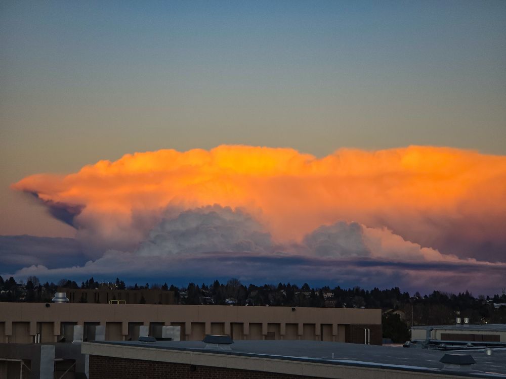
That's certainly a surprise for December 6th


December 6, 2025 at 11:42 PM
That's certainly a surprise for December 6th
Reposted by Bram van 't Veen

In normal Jersey things, 3 waterspouts were spotted off the coast earlier today.
www.facebook.com/groups/jerse...
www.facebook.com/groups/jerse...

December 4, 2025 at 8:58 PM
In normal Jersey things, 3 waterspouts were spotted off the coast earlier today.
www.facebook.com/groups/jerse...
www.facebook.com/groups/jerse...
Reposted by Bram van 't Veen
New video of the tornado in Apulia from yesterday. So far we managed to find a 1.5 km long path in the populated area, but NOBODY documented the countryside north of there. A 5-7+ km path is very plausible
December 3, 2025 at 5:21 PM
New video of the tornado in Apulia from yesterday. So far we managed to find a 1.5 km long path in the populated area, but NOBODY documented the countryside north of there. A 5-7+ km path is very plausible
Reposted by Bram van 't Veen
Today Apulia has never been this Great Plains-esque. Insane supercell and tornado in the Manduria area (we're working on the damage... frustrating is quite reductive). Videos by Fausto Perretti and Giuseppe Mauro (below)
December 2, 2025 at 7:35 PM
Today Apulia has never been this Great Plains-esque. Insane supercell and tornado in the Manduria area (we're working on the damage... frustrating is quite reductive). Videos by Fausto Perretti and Giuseppe Mauro (below)
Reposted by Bram van 't Veen

Perfect demonstration of the fact that you don't need straight hodographs to get left-moving supercells
(In this case, storms are rooted at ~2km)
(In this case, storms are rooted at ~2km)


November 29, 2025 at 2:50 AM
Perfect demonstration of the fact that you don't need straight hodographs to get left-moving supercells
(In this case, storms are rooted at ~2km)
(In this case, storms are rooted at ~2km)
Looking back at a great #ECSS conference last week, where I also gave my first conference talk. It was great to meet people that I so far had only met online, and to reconnect with many others! Also first time I saw in person a number of big names in svr storms from the US @essl-ecss.bsky.social


November 24, 2025 at 9:33 AM
Looking back at a great #ECSS conference last week, where I also gave my first conference talk. It was great to meet people that I so far had only met online, and to reconnect with many others! Also first time I saw in person a number of big names in svr storms from the US @essl-ecss.bsky.social
Reposted by Bram van 't Veen
From 4/27/2011, a short multi-tilt storm-following loop from ARMOR of the Hackleburg tornado. Some pretty incredible temporal resolution is possible like this when you interleave the different tilts! You get some shakiness but overall this turned out quite incredible. Love the merger stream!
November 22, 2025 at 1:36 AM
From 4/27/2011, a short multi-tilt storm-following loop from ARMOR of the Hackleburg tornado. Some pretty incredible temporal resolution is possible like this when you interleave the different tilts! You get some shakiness but overall this turned out quite incredible. Love the merger stream!
Reposted by Bram van 't Veen
In the end, today we confirmed five tornadoes (landfalling waterspouts), three of which can be rated (IF0.5, IF1 and IF1.5). Two more additional possible tornadoes occurred, but those will have to wait

November 15, 2025 at 6:11 PM
In the end, today we confirmed five tornadoes (landfalling waterspouts), three of which can be rated (IF0.5, IF1 and IF1.5). Two more additional possible tornadoes occurred, but those will have to wait
Reposted by Bram van 't Veen

A tornado🌪️ wreaks havoc at a campsite in #Albufeira, Portugal. One person has died and several are injured.
November 15, 2025 at 2:38 PM
A tornado🌪️ wreaks havoc at a campsite in #Albufeira, Portugal. One person has died and several are injured.
Reposted by Bram van 't Veen

November 15, 2025 at 12:14 PM