


Wisconet
@wisconet.bsky.social
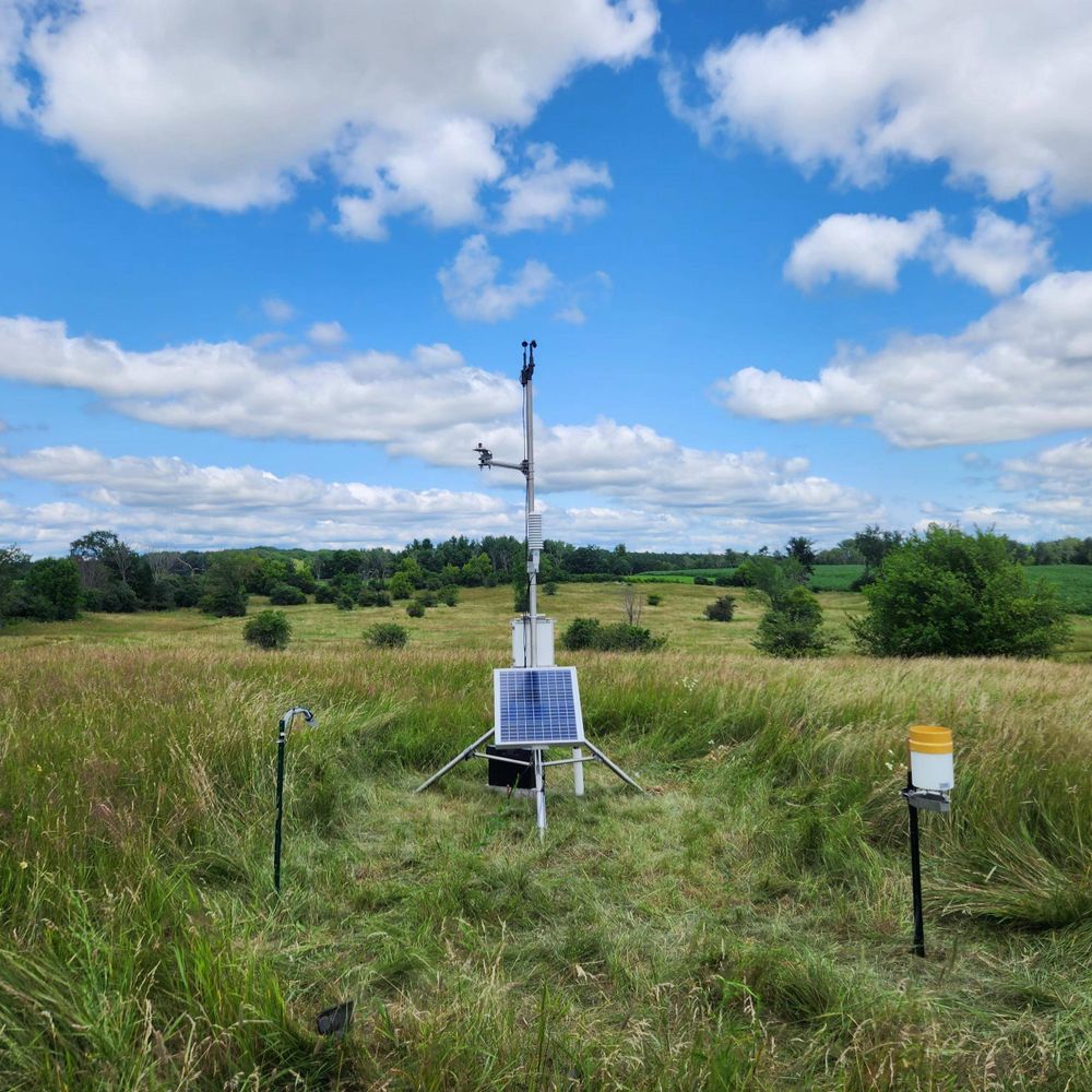
A network of 78 weather and soil monitoring stations in Wisconsin. We're growing with the support of the USDA Rural Partnerships Institute and Wisconsin Alumni Research Foundation.

Very mild this morning, but high temperatures tomorrow won’t even come close to approaching what we’re currently seeing.
We promise we won’t make the cliched joke about temperatures dropping from 60 to 45 like they saw a state trooper.
We promise we won’t make the cliched joke about temperatures dropping from 60 to 45 like they saw a state trooper.


November 15, 2025 at 1:44 PM
Very mild this morning, but high temperatures tomorrow won’t even come close to approaching what we’re currently seeing.
We promise we won’t make the cliched joke about temperatures dropping from 60 to 45 like they saw a state trooper.
We promise we won’t make the cliched joke about temperatures dropping from 60 to 45 like they saw a state trooper.
Did you know that Wisconsin produces 60% of the U.S. cranberry harvest?
Did you further know that Wisconet supports the Wisconsin cranberry growers, with 5 weather stations installed at cranberry sites?
Now you know.
Did you further know that Wisconet supports the Wisconsin cranberry growers, with 5 weather stations installed at cranberry sites?
Now you know.


November 14, 2025 at 11:17 PM
Did you know that Wisconsin produces 60% of the U.S. cranberry harvest?
Did you further know that Wisconet supports the Wisconsin cranberry growers, with 5 weather stations installed at cranberry sites?
Now you know.
Did you further know that Wisconet supports the Wisconsin cranberry growers, with 5 weather stations installed at cranberry sites?
Now you know.
Have you ever seen such a perfect solar radiation curve?

November 14, 2025 at 9:55 PM
Have you ever seen such a perfect solar radiation curve?
It's feeling nice across the state this afternoon - with highs in the 50s and 60s, but a cold front comes through this weekend and brings us back to more seasonable conditions.


November 14, 2025 at 8:01 PM
It's feeling nice across the state this afternoon - with highs in the 50s and 60s, but a cold front comes through this weekend and brings us back to more seasonable conditions.
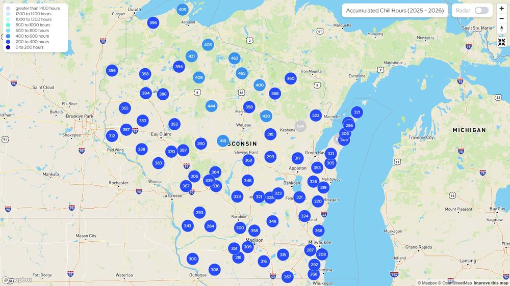
It's been chilly for several hundred hours across Wisconsin since October 1.
But what is chilly?
When we count the number of chill hours for fruit producers, that's any hour that averages between 32° and 45° Fahrenheit between October and February.
Your Friday science lesson.
But what is chilly?
When we count the number of chill hours for fruit producers, that's any hour that averages between 32° and 45° Fahrenheit between October and February.
Your Friday science lesson.
November 14, 2025 at 2:10 PM
It's been chilly for several hundred hours across Wisconsin since October 1.
But what is chilly?
When we count the number of chill hours for fruit producers, that's any hour that averages between 32° and 45° Fahrenheit between October and February.
Your Friday science lesson.
But what is chilly?
When we count the number of chill hours for fruit producers, that's any hour that averages between 32° and 45° Fahrenheit between October and February.
Your Friday science lesson.
Our station in Nasewaupee is currently unable to report data because of a Verizon outage. The data are still being collected and will be reported to us once the outage is resolved.

November 13, 2025 at 9:54 PM
Our station in Nasewaupee is currently unable to report data because of a Verizon outage. The data are still being collected and will be reported to us once the outage is resolved.
Abnormally dry and drought conditions continue to spread across Wisconsin, with more than 75% of the state now highlighted on the Drought Monitor.

November 13, 2025 at 7:17 PM
Abnormally dry and drought conditions continue to spread across Wisconsin, with more than 75% of the state now highlighted on the Drought Monitor.
😍


November 13, 2025 at 3:01 AM
😍
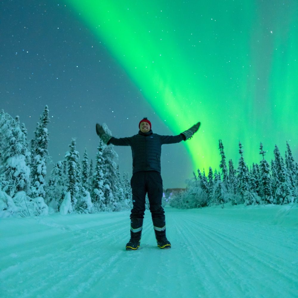
It’s heeeeere

November 13, 2025 at 12:49 AM
It’s heeeeere
Keep your fingers crossed 🤞
Main takeaways from SWPC's video update, posted one hour ago on X:
- Third CME has arrived.
- G4 watch has been extended into Nov 13 in case Bz goes south.
- Third CME is fast, over 800 km/s.
- Not sure if we are in the heart of the third CME, yet.
- Third CME has arrived.
- G4 watch has been extended into Nov 13 in case Bz goes south.
- Third CME is fast, over 800 km/s.
- Not sure if we are in the heart of the third CME, yet.
November 13, 2025 at 12:13 AM
Keep your fingers crossed 🤞
The cloud forecast for Wisconsin is looking better for tonight, so if the aurora is out - we need to see your pictures and time lapses!

We have upgraded our geomagnetic forecast today (12 November 2025) to the highest intensity level amid an ongoing solar storm.
Current predictions suggest that the activity will result in potentially the largest solar storm to hit our planet in over two decades.
Current predictions suggest that the activity will result in potentially the largest solar storm to hit our planet in over two decades.
November 12, 2025 at 9:02 PM
The cloud forecast for Wisconsin is looking better for tonight, so if the aurora is out - we need to see your pictures and time lapses!
Reposted by Wisconet
Brief aurora display here on the east side of Madison, WI. Visible to naked eye in color but not as vivid as these photos


November 12, 2025 at 4:02 AM
Brief aurora display here on the east side of Madison, WI. Visible to naked eye in color but not as vivid as these photos
Aurora visible in Madison from the @uwmad-aos.bsky.social roof camera!

November 12, 2025 at 1:46 AM
Aurora visible in Madison from the @uwmad-aos.bsky.social roof camera!
If you’re in southwestern Wisconsin, go out and look at the aurora.
If you’re anywhere else in Wisconsin, don’t look at social media unless you really want to be jealous.
If you’re anywhere else in Wisconsin, don’t look at social media unless you really want to be jealous.

November 12, 2025 at 1:31 AM
If you’re in southwestern Wisconsin, go out and look at the aurora.
If you’re anywhere else in Wisconsin, don’t look at social media unless you really want to be jealous.
If you’re anywhere else in Wisconsin, don’t look at social media unless you really want to be jealous.
For you winter weather fans, the Winter Storm Severity Index is now available on the Wisconet Outdoor Activities Dashboard!
wisconet.wisc.edu/tools/outdoo...
wisconet.wisc.edu/tools/outdoo...

November 11, 2025 at 10:21 PM
For you winter weather fans, the Winter Storm Severity Index is now available on the Wisconet Outdoor Activities Dashboard!
wisconet.wisc.edu/tools/outdoo...
wisconet.wisc.edu/tools/outdoo...
Chilly start to Veterans Day across Wisconsin, but it's actually a bit warmer than this time yesterday.
We've seen some pockets of snowfall this morning across the state and there are some slick spots out there - so take it easy on the drive in to work.
We've seen some pockets of snowfall this morning across the state and there are some slick spots out there - so take it easy on the drive in to work.


November 11, 2025 at 2:28 PM
Chilly start to Veterans Day across Wisconsin, but it's actually a bit warmer than this time yesterday.
We've seen some pockets of snowfall this morning across the state and there are some slick spots out there - so take it easy on the drive in to work.
We've seen some pockets of snowfall this morning across the state and there are some slick spots out there - so take it easy on the drive in to work.
This map of storm reports shows just how localized lake effect snow can be.
It's all highly dependent on where the band comes in, and you can see a significant gradient of snow accumulations over just a couple miles.
It's all highly dependent on where the band comes in, and you can see a significant gradient of snow accumulations over just a couple miles.


November 10, 2025 at 3:24 PM
This map of storm reports shows just how localized lake effect snow can be.
It's all highly dependent on where the band comes in, and you can see a significant gradient of snow accumulations over just a couple miles.
It's all highly dependent on where the band comes in, and you can see a significant gradient of snow accumulations over just a couple miles.
50 years ago, the Edmund Fitzgerald sank in Lake Superior during a major fall storm.
www.youtube.com/watch?v=9vST...
www.youtube.com/watch?v=9vST...
November 10, 2025 at 2:57 PM
50 years ago, the Edmund Fitzgerald sank in Lake Superior during a major fall storm.
www.youtube.com/watch?v=9vST...
www.youtube.com/watch?v=9vST...
Kenosha and Racine have been under the firehose of lake effect snow for hours now, and we’ve seen some impressive snow totals so far, with 8-10 inch reports.
November 10, 2025 at 12:37 PM
Kenosha and Racine have been under the firehose of lake effect snow for hours now, and we’ve seen some impressive snow totals so far, with 8-10 inch reports.
The winter alerts keep multiplying for the lake effect snow we’re seeing this weekend.
Winter Weather Advisories: Ashland, Iron, Vilas, Oneida, Milwaukee, Racine, Kenosha Counties
Winter Storm Warning: Door County
Avoid driving through lake effect snow bands!
Winter Weather Advisories: Ashland, Iron, Vilas, Oneida, Milwaukee, Racine, Kenosha Counties
Winter Storm Warning: Door County
Avoid driving through lake effect snow bands!

November 9, 2025 at 7:58 PM
The winter alerts keep multiplying for the lake effect snow we’re seeing this weekend.
Winter Weather Advisories: Ashland, Iron, Vilas, Oneida, Milwaukee, Racine, Kenosha Counties
Winter Storm Warning: Door County
Avoid driving through lake effect snow bands!
Winter Weather Advisories: Ashland, Iron, Vilas, Oneida, Milwaukee, Racine, Kenosha Counties
Winter Storm Warning: Door County
Avoid driving through lake effect snow bands!
Reposted by Wisconet

November 9, 2025 at 2:34 PM
Some parts of the state are waking up to snow on the ground on this cold November 9.
While not a big snowmaker, it’s the first measurable snowfall across southern Wisconsin, and wind chills have dipped into the single digits and teens across the state.
Stay warm this weekend!
While not a big snowmaker, it’s the first measurable snowfall across southern Wisconsin, and wind chills have dipped into the single digits and teens across the state.
Stay warm this weekend!


November 9, 2025 at 1:57 PM
Some parts of the state are waking up to snow on the ground on this cold November 9.
While not a big snowmaker, it’s the first measurable snowfall across southern Wisconsin, and wind chills have dipped into the single digits and teens across the state.
Stay warm this weekend!
While not a big snowmaker, it’s the first measurable snowfall across southern Wisconsin, and wind chills have dipped into the single digits and teens across the state.
Stay warm this weekend!
A Winter Weather Advisory is in place for Ashland, Iron, and Vilas Counties from this evening until Monday morning, where lake effect snow is expected to accumulate to several inches.


November 8, 2025 at 1:52 PM
A Winter Weather Advisory is in place for Ashland, Iron, and Vilas Counties from this evening until Monday morning, where lake effect snow is expected to accumulate to several inches.
First snow of the season is expected tonight! It won’t be much, but you might still be able to measure it. Do you know how?
Here are the details: media.cocorahs.org/docs/WinterP...
Happy snowfall season!
Here are the details: media.cocorahs.org/docs/WinterP...
Happy snowfall season!

November 8, 2025 at 1:28 PM
First snow of the season is expected tonight! It won’t be much, but you might still be able to measure it. Do you know how?
Here are the details: media.cocorahs.org/docs/WinterP...
Happy snowfall season!
Here are the details: media.cocorahs.org/docs/WinterP...
Happy snowfall season!