


Allie Mazurek
@amaz.bsky.social
Atmospheric Scientist (via CSUx2 & UGA). Enjoyer of ⛈️❄️🐱🏔️🏃♀️
(personal account)
(personal account)
Pinned

Reposted by Allie Mazurek

Any teachers out there? Ramping this back up again and figured I would advertise.
I am on the National Weather Service National School Outreach Team. We are composed of various NWS meteorologists across the country that give school talks about the weather. We can use just about any online platform.
I am on the National Weather Service National School Outreach Team. We are composed of various NWS meteorologists across the country that give school talks about the weather. We can use just about any online platform.
November 18, 2025 at 1:46 AM
Any teachers out there? Ramping this back up again and figured I would advertise.
I am on the National Weather Service National School Outreach Team. We are composed of various NWS meteorologists across the country that give school talks about the weather. We can use just about any online platform.
I am on the National Weather Service National School Outreach Team. We are composed of various NWS meteorologists across the country that give school talks about the weather. We can use just about any online platform.
Reposted by Allie Mazurek

If all this warm and dry November weather has you thinking back to October when there was quite a bit more happening, our monthly summary is for you. Including the big southwest rainstorm and flood, a lack of mountain snow, and more warmth on the Plains:
climate.colostate.edu/monthly_summ... #cowx
climate.colostate.edu/monthly_summ... #cowx

November 13, 2025 at 11:03 PM
If all this warm and dry November weather has you thinking back to October when there was quite a bit more happening, our monthly summary is for you. Including the big southwest rainstorm and flood, a lack of mountain snow, and more warmth on the Plains:
climate.colostate.edu/monthly_summ... #cowx
climate.colostate.edu/monthly_summ... #cowx
Reposted by Allie Mazurek
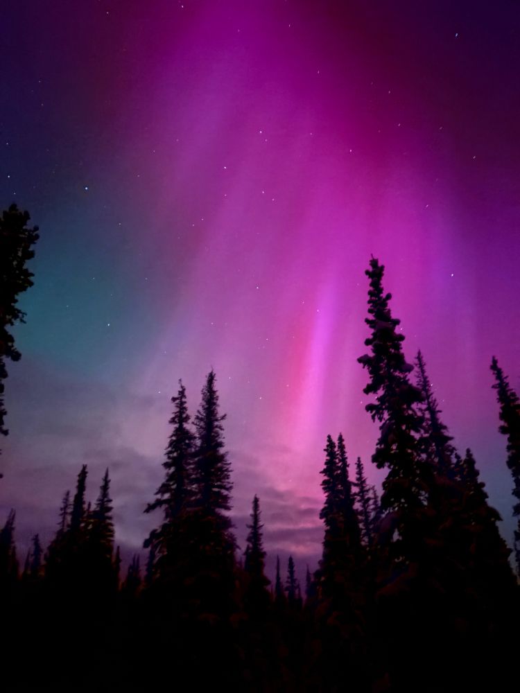
#alaskasky from Denali, 64°N, never seen so much pink and red


November 12, 2025 at 4:08 AM
#alaskasky from Denali, 64°N, never seen so much pink and red
Reposted by Allie Mazurek
The world would be a better place if we all spent more time looking at cool stuff in the sky.


November 12, 2025 at 4:12 AM
The world would be a better place if we all spent more time looking at cool stuff in the sky.
Reposted by Allie Mazurek
Despite being sick with COVID (again) I couldn't miss this magical evening with my old friend, Lady Aurora
November 12, 2025 at 3:53 AM
Despite being sick with COVID (again) I couldn't miss this magical evening with my old friend, Lady Aurora
Reposted by Allie Mazurek
Water Year 2025 was the 10th warmest on record for Colorado and featured drought, fires, floods, and even a record-setting snowstorm. We recap all that and more in our Colorado Water Year 2025 Summary! ⬇️
Home
co-water-year-2025.my.canva.site
November 10, 2025 at 6:06 PM
Water Year 2025 was the 10th warmest on record for Colorado and featured drought, fires, floods, and even a record-setting snowstorm. We recap all that and more in our Colorado Water Year 2025 Summary! ⬇️
Reposted by Allie Mazurek
I was going to wait until the shutdown was over but the cat is out if the bag. My first journal article is now live!
Convective Mode Classification and Distribution of Contiguous United States Tornado Events from 2003–2023 in: Weather and Forecasting - Ahead of print share.google/M3ty4pVs5Tld...
Convective Mode Classification and Distribution of Contiguous United States Tornado Events from 2003–2023 in: Weather and Forecasting - Ahead of print share.google/M3ty4pVs5Tld...

Convective Mode Classification and Distribution of Contiguous United States Tornado Events from 2003–2023
Abstract Tornadoes and severe thunderstorms represent a significant threat to life and property in the United States annually. Approximately one thousand tornadoes, two-hundred being significant (F/EF-2+), are documented on average every year. Using archived radar and Storm Data storm report information, 21 912 tornado grid hours were manually analyzed for convective mode from the years 2003–2023. This dataset builds upon prior work by Smith et al. (2012) (hereafter S12) by more than doubling the sample size to produce a robust, multidecadal climatology of tornadoes by convective mode. Comparisons were made between tornado samples spanning 2003–2011 and 2012–2023 to assess changes in the frequency and spatial occurrence of tornadoes. Convective mode characterization consisted of a subjective analysis of WSR-88D imagery into three categories: 1) supercell, 2) quasi–linear convective system (QLCS), and 3) disorganized. Spatial climatologies of the different modes were performed and Kernel Density Estimate plots of events per decade were generated as in S12. The highest climatological frequency for tornadic supercells is reaffirmed to extend from KS and OK east-southeastward to MS and AL, while QLCS tornadoes are more frequent from the northern Gulf Coast states into the lower Ohio River Valley. Comparing the new sample to the original, QLCS tornado relative frequency increased by over 100%. Substantial variation in QLCS tornado occurrence may be due to non-meteorological factors such as dual polarization radar and different observing/reporting practices.
share.google
November 5, 2025 at 3:18 PM
I was going to wait until the shutdown was over but the cat is out if the bag. My first journal article is now live!
Convective Mode Classification and Distribution of Contiguous United States Tornado Events from 2003–2023 in: Weather and Forecasting - Ahead of print share.google/M3ty4pVs5Tld...
Convective Mode Classification and Distribution of Contiguous United States Tornado Events from 2003–2023 in: Weather and Forecasting - Ahead of print share.google/M3ty4pVs5Tld...
Reposted by Allie Mazurek

Alrighty, ready to see something really cool? (and maybe a little nauseating)
The evolution of Hurricane Melissa's mesovortices at peak strength.
The evolution of Hurricane Melissa's mesovortices at peak strength.
October 29, 2025 at 8:10 PM
Alrighty, ready to see something really cool? (and maybe a little nauseating)
The evolution of Hurricane Melissa's mesovortices at peak strength.
The evolution of Hurricane Melissa's mesovortices at peak strength.
Reposted by Allie Mazurek

A lightning-packed eye spins ferociously at the center of Hurricane Melissa.
October 27, 2025 at 8:18 PM
A lightning-packed eye spins ferociously at the center of Hurricane Melissa.
Reposted by Allie Mazurek

[Melissa forecast analysis, Friday 10/24]
The forecast is looking increasingly dire for Jamaica. Model guidance has increasingly clustered on a direct hit - Jamaica has only had close calls from five category 4 hurricanes on record - with catastrophic flooding a major concern.
The forecast is looking increasingly dire for Jamaica. Model guidance has increasingly clustered on a direct hit - Jamaica has only had close calls from five category 4 hurricanes on record - with catastrophic flooding a major concern.

October 24, 2025 at 10:55 PM
[Melissa forecast analysis, Friday 10/24]
The forecast is looking increasingly dire for Jamaica. Model guidance has increasingly clustered on a direct hit - Jamaica has only had close calls from five category 4 hurricanes on record - with catastrophic flooding a major concern.
The forecast is looking increasingly dire for Jamaica. Model guidance has increasingly clustered on a direct hit - Jamaica has only had close calls from five category 4 hurricanes on record - with catastrophic flooding a major concern.
Reposted by Allie Mazurek
There were major improvements to this week's drought monitor following the significant precipitation and flooding that impacted western CO over the past week. Changes include two-category improvements over portions of southwest CO, many of which are now drought-free. #cowx

October 16, 2025 at 11:14 PM
There were major improvements to this week's drought monitor following the significant precipitation and flooding that impacted western CO over the past week. Changes include two-category improvements over portions of southwest CO, many of which are now drought-free. #cowx
Reposted by Allie Mazurek
Some early analysis of the major rainfall and flooding in southwest Colorado this weekend in this blog post. It was one of the largest fall rainstorms ever to hit the region, and resulted in major flooding on the San Juan River in Pagosa Springs and on Vallecito Creek, among other locations. #cowx

Major rainfall and flooding in southwest Colorado - Colorado Climate Blog
On Friday and Saturday, southwestern Colorado experienced one of the largest fall rainstorms ever to hit the region. Rainfall totals from 2 to over 4 inches were reported at both lower and higher elev...
climate.colostate.edu
October 12, 2025 at 6:29 PM
Some early analysis of the major rainfall and flooding in southwest Colorado this weekend in this blog post. It was one of the largest fall rainstorms ever to hit the region, and resulted in major flooding on the San Juan River in Pagosa Springs and on Vallecito Creek, among other locations. #cowx
Reposted by Allie Mazurek

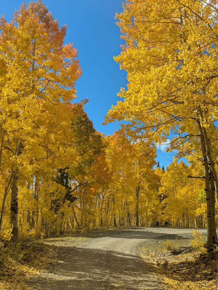
It is raining gold on the San Juans. Probably peak color for the season as rain moves in this weekend.


October 8, 2025 at 11:09 PM
It is raining gold on the San Juans. Probably peak color for the season as rain moves in this weekend.
Reposted by Allie Mazurek

Highly unusual situation approaching western Colorado with the moisture from Hurricane Priscilla. Grand Junction has never had precipitable water over an inch (25mm) so late in the year, but looks like it will be near that level on both Fri & Sat. Six standard deviations above average! #cowx 1/2


October 8, 2025 at 2:23 PM
Highly unusual situation approaching western Colorado with the moisture from Hurricane Priscilla. Grand Junction has never had precipitable water over an inch (25mm) so late in the year, but looks like it will be near that level on both Fri & Sat. Six standard deviations above average! #cowx 1/2
Reposted by Allie Mazurek
Most of Colorado's lower elevations haven't yet had a freeze this fall, but it'll get cold sooner or later. Here's our blog post from last year on when first freezes tend to happen across the state. #cowx

First fall freezes - Colorado Climate Blog
Climatological fall has arrived, and although September thus far has been much warmer than normal across most of Colorado, it’s still time to be thinking about when the first freeze could happen. Now,...
climate.colostate.edu
October 7, 2025 at 1:03 PM
Most of Colorado's lower elevations haven't yet had a freeze this fall, but it'll get cold sooner or later. Here's our blog post from last year on when first freezes tend to happen across the state. #cowx
Reposted by Allie Mazurek

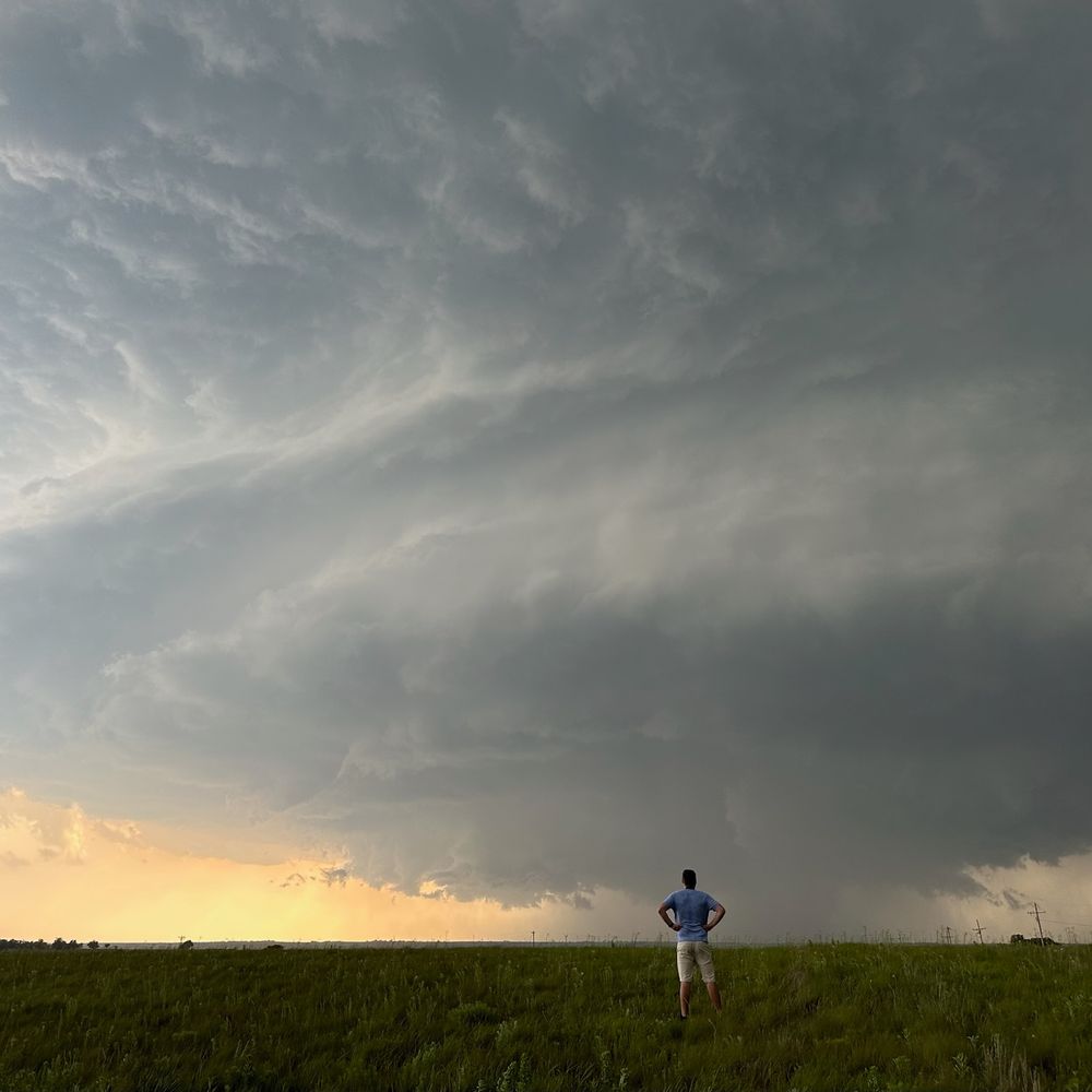
there’s always one person in the family who looks at the Doppler radar

October 6, 2025 at 7:58 PM
there’s always one person in the family who looks at the Doppler radar
Reposted by Allie Mazurek
Happy New (Water) Year! 🥳 Today marks the first day of Water Year 2026. But what is a "water year" and why does it begin in October? Here's a short explainer! [1/7]
October 1, 2025 at 11:05 PM
Happy New (Water) Year! 🥳 Today marks the first day of Water Year 2026. But what is a "water year" and why does it begin in October? Here's a short explainer! [1/7]
Reposted by Allie Mazurek

It's that time of year for green and gold 💚💛


September 23, 2025 at 4:16 PM
It's that time of year for green and gold 💚💛


What a game!! GO DAWGS! 🐶
September 13, 2025 at 11:42 PM
What a game!! GO DAWGS! 🐶
Reposted by Allie Mazurek

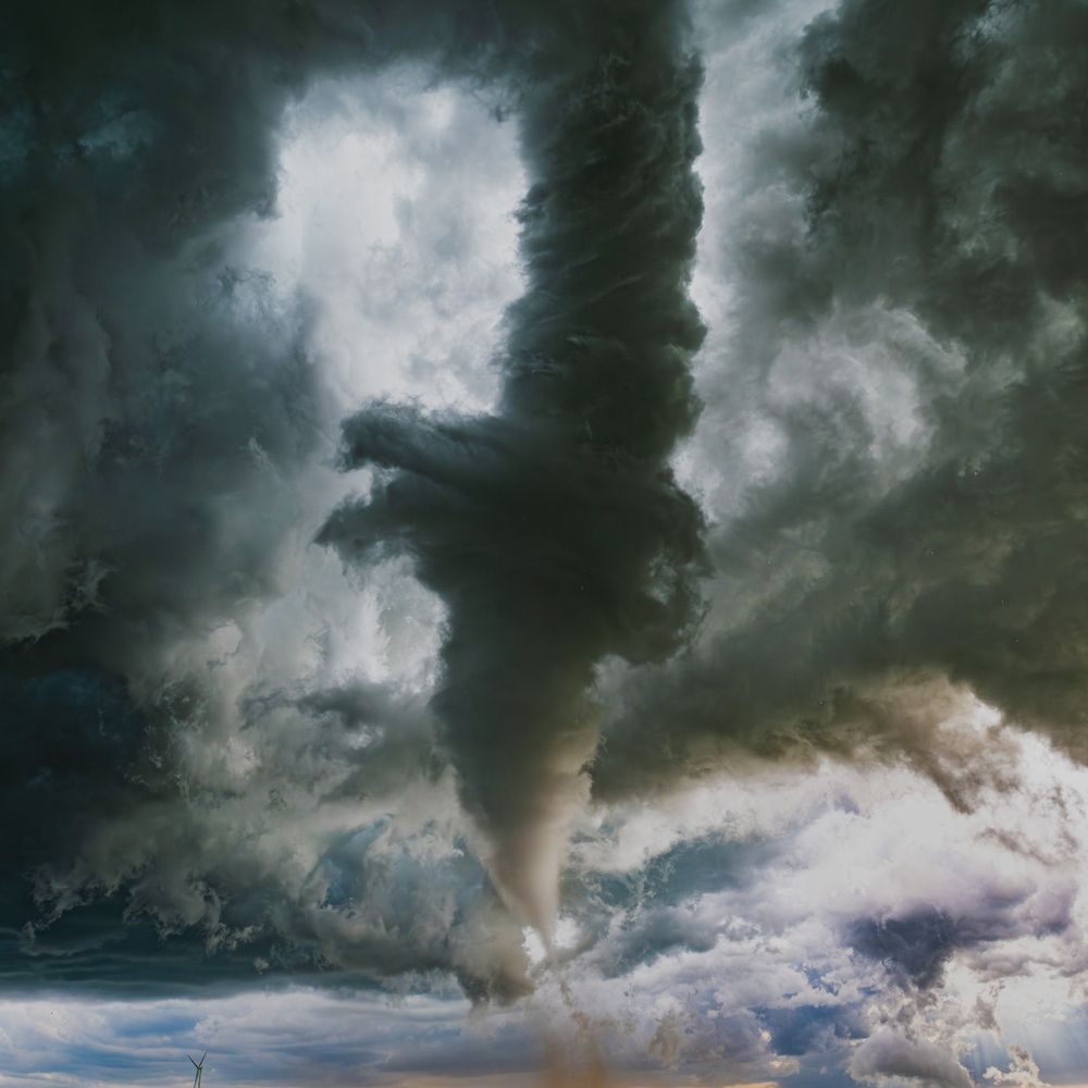
Tornado near Pleaant View, Colorado this afternoon…near the Utah/Colorado line in southwestern Colorado!
📸: Landan Wilson
📸: Landan Wilson
September 13, 2025 at 8:34 PM
Tornado near Pleaant View, Colorado this afternoon…near the Utah/Colorado line in southwestern Colorado!
📸: Landan Wilson
📸: Landan Wilson
Reposted by Allie Mazurek


September 13, 2025 at 7:23 PM
Reposted by Allie Mazurek
August Recap ⏪: Hot, dry conditions intensified drought and fanned wildfires across western Colorado, but monsoon moisture finally delivered some much-needed precipitation at the end of the month. Just how significant was that rainfall? All that and more in our monthly climate summary! col.st/STpEm

September 10, 2025 at 5:34 PM
August Recap ⏪: Hot, dry conditions intensified drought and fanned wildfires across western Colorado, but monsoon moisture finally delivered some much-needed precipitation at the end of the month. Just how significant was that rainfall? All that and more in our monthly climate summary! col.st/STpEm
Reposted by Allie Mazurek
Impressive weekly rain totals around the Denver area and across Colorado!
Gonna thread some exact totals, but general idea:
Denver metro: 0.5-3” (most 1-2”)
Mountains: Most 1-2”
Southern CO (Colorado Springs on south): 2-6”+
#COwx
Gonna thread some exact totals, but general idea:
Denver metro: 0.5-3” (most 1-2”)
Mountains: Most 1-2”
Southern CO (Colorado Springs on south): 2-6”+
#COwx


August 31, 2025 at 3:19 PM
Impressive weekly rain totals around the Denver area and across Colorado!
Gonna thread some exact totals, but general idea:
Denver metro: 0.5-3” (most 1-2”)
Mountains: Most 1-2”
Southern CO (Colorado Springs on south): 2-6”+
#COwx
Gonna thread some exact totals, but general idea:
Denver metro: 0.5-3” (most 1-2”)
Mountains: Most 1-2”
Southern CO (Colorado Springs on south): 2-6”+
#COwx