


StormArtz
@stormartz.bsky.social
I draw weather art, and take cool pictures sometimes
Pinned
StormArtz
@stormartz.bsky.social
· Oct 19


Guess ill start w a new pinned!
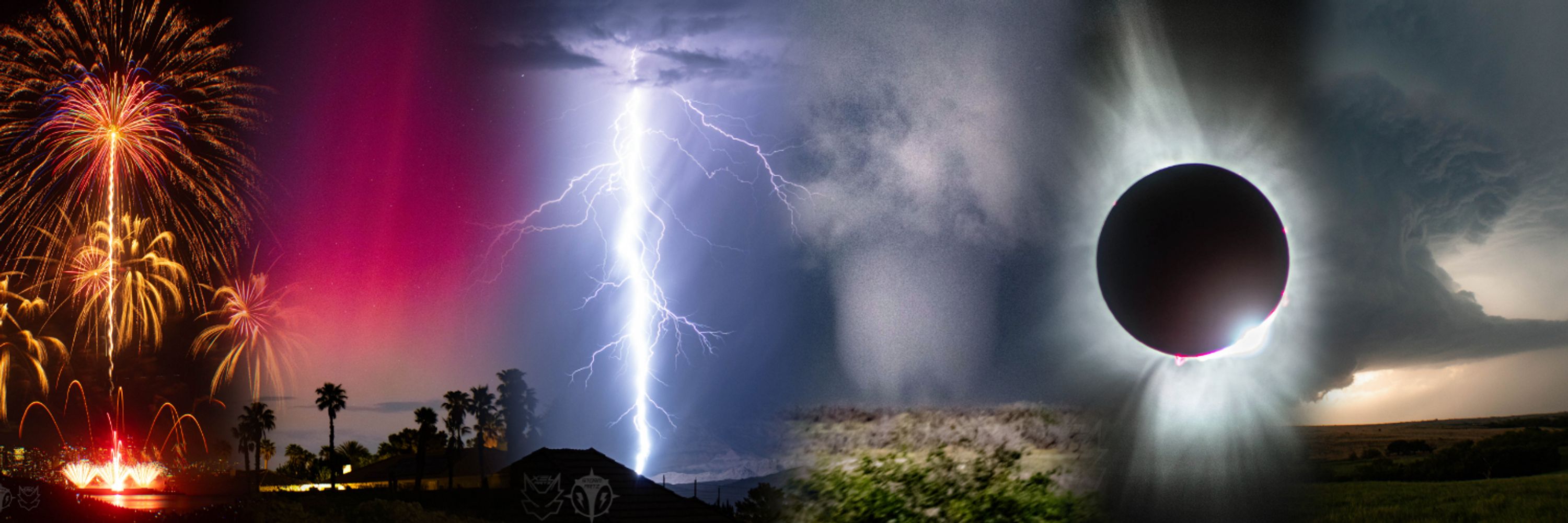
Hello! I'm StormArtz! I am a photographer, digital artist, and storm chaser!
I like to draw "weatherscapes" alongside my photography.
Hello! I'm StormArtz! I am a photographer, digital artist, and storm chaser!
I like to draw "weatherscapes" alongside my photography.
Reposted by StormArtz

The days are getting longer, which means skies like this over the plains are almost on the horizon. 🙌 #Photography

January 13, 2026 at 7:02 PM
The days are getting longer, which means skies like this over the plains are almost on the horizon. 🙌 #Photography
forgot to share this here earlier!
I drew the Enderlin ND EF5 tornado
I drew the Enderlin ND EF5 tornado

January 8, 2026 at 5:07 AM
forgot to share this here earlier!
I drew the Enderlin ND EF5 tornado
I drew the Enderlin ND EF5 tornado
Reposted by StormArtz

Never before seen footage‼️
Tornado genesis of the Clear Lake, South Dakota tornado earlier this year.
@myradar.bsky.social
#tornado #weather
Tornado genesis of the Clear Lake, South Dakota tornado earlier this year.
@myradar.bsky.social
#tornado #weather
January 2, 2026 at 9:29 AM
Never before seen footage‼️
Tornado genesis of the Clear Lake, South Dakota tornado earlier this year.
@myradar.bsky.social
#tornado #weather
Tornado genesis of the Clear Lake, South Dakota tornado earlier this year.
@myradar.bsky.social
#tornado #weather
I do see the potential for algorithmic-ehnaced weather forecasting but for maps? Nah that aint it chief lmao

Amid a big agency push to use AI models in weather prediction, the National Weather Service shared a forecast map riddled with spelling mistakes, non-existent locations and other geographical errors.

‘Whata Bod’: An AI-generated NWS map invented fake towns in Idaho
Amid a big agency push to use AI models in weather prediction, an AI-generated forecast graphic with errors was pulled from NWS sites.
www.washingtonpost.com
January 7, 2026 at 4:55 AM
I do see the potential for algorithmic-ehnaced weather forecasting but for maps? Nah that aint it chief lmao
Reposted by StormArtz

I always thought the first time I had a chance to see and photograph the Aurora it would be somewhere like Iceland, or Alaska. I was wrong. It was in New Mexico! 😂
And if you look closely, you can see a bit of the Milky Way up above as well.
#on1pics #photography #astrophotography
And if you look closely, you can see a bit of the Milky Way up above as well.
#on1pics #photography #astrophotography

December 23, 2025 at 3:50 PM
I always thought the first time I had a chance to see and photograph the Aurora it would be somewhere like Iceland, or Alaska. I was wrong. It was in New Mexico! 😂
And if you look closely, you can see a bit of the Milky Way up above as well.
#on1pics #photography #astrophotography
And if you look closely, you can see a bit of the Milky Way up above as well.
#on1pics #photography #astrophotography
multicolored lightning madness from September 5

December 25, 2025 at 12:16 AM
multicolored lightning madness from September 5
Lady Aurora paid Las Vegas a visit again on the night of the 11th

November 19, 2025 at 1:36 AM
Lady Aurora paid Las Vegas a visit again on the night of the 11th
The wind damage from Melissa is by far the worst ive ever seen documented from any hurricane.
Looks more like violent tornado damage than a TC. Mass-debarking of sections of forests, large buildings like churches demolished, concrete structures w upper floors blown away...its unreal.
Looks more like violent tornado damage than a TC. Mass-debarking of sections of forests, large buildings like churches demolished, concrete structures w upper floors blown away...its unreal.
November 1, 2025 at 5:43 AM
The wind damage from Melissa is by far the worst ive ever seen documented from any hurricane.
Looks more like violent tornado damage than a TC. Mass-debarking of sections of forests, large buildings like churches demolished, concrete structures w upper floors blown away...its unreal.
Looks more like violent tornado damage than a TC. Mass-debarking of sections of forests, large buildings like churches demolished, concrete structures w upper floors blown away...its unreal.
Reposted by StormArtz

The Advanced Dvorak Technique (ADT) satellite-derived intensity estimate peaked at 185 knots for #Melissa -- which, according to the developer at CIMSS, is the highest value to date for any tropical cyclone.

October 28, 2025 at 10:41 PM
The Advanced Dvorak Technique (ADT) satellite-derived intensity estimate peaked at 185 knots for #Melissa -- which, according to the developer at CIMSS, is the highest value to date for any tropical cyclone.
Reposted by StormArtz

2X increase in the most extreme hurrucanes!
Looking at every Cat 4 & 5 in the Atlantic since 1980 (reliable records/ data gathering) I broke the record into 2 equal parts.
1980-2002 and 2003-2025
The most recent period has more than double the number of most intense hurricanes in the Atlantic!…
1/
Looking at every Cat 4 & 5 in the Atlantic since 1980 (reliable records/ data gathering) I broke the record into 2 equal parts.
1980-2002 and 2003-2025
The most recent period has more than double the number of most intense hurricanes in the Atlantic!…
1/

October 30, 2025 at 2:04 PM
2X increase in the most extreme hurrucanes!
Looking at every Cat 4 & 5 in the Atlantic since 1980 (reliable records/ data gathering) I broke the record into 2 equal parts.
1980-2002 and 2003-2025
The most recent period has more than double the number of most intense hurricanes in the Atlantic!…
1/
Looking at every Cat 4 & 5 in the Atlantic since 1980 (reliable records/ data gathering) I broke the record into 2 equal parts.
1980-2002 and 2003-2025
The most recent period has more than double the number of most intense hurricanes in the Atlantic!…
1/
Reposted by StormArtz

Nighttime polar orbiter satellite photos of Jamaica before and after #Melissa show how the power grid was affected. Melissa knocked out power to about 77% of Jamaica’s customers, said Minister of Local Government Desmond McKenzie. Photos from worldview.earthdata.nasa.gov

October 30, 2025 at 2:16 PM
Nighttime polar orbiter satellite photos of Jamaica before and after #Melissa show how the power grid was affected. Melissa knocked out power to about 77% of Jamaica’s customers, said Minister of Local Government Desmond McKenzie. Photos from worldview.earthdata.nasa.gov
This Sentinel-2 satellite pass of Hurricane Melissa's eye is downright incredible.

October 30, 2025 at 6:52 AM
This Sentinel-2 satellite pass of Hurricane Melissa's eye is downright incredible.
Reposted by StormArtz

Hurricane Melissa’s historic journey to becoming one of the most intense tropical cyclones ever recorded on Earth.
A storm we won't forget anytime soon.
A storm we won't forget anytime soon.
October 29, 2025 at 1:49 PM
Hurricane Melissa’s historic journey to becoming one of the most intense tropical cyclones ever recorded on Earth.
A storm we won't forget anytime soon.
A storm we won't forget anytime soon.
Reposted by StormArtz
Incredible Sentinal-2 satellite imagery of #Melissa at peak intensity before landfall. In the cloud-free areas of the eye you can see the physical effect of the surface wind gradient (2nd image): chaotic whitecapped waves near center transition to extreme sea spray/linear streaking near the eyewall!


October 29, 2025 at 12:26 AM
Incredible Sentinal-2 satellite imagery of #Melissa at peak intensity before landfall. In the cloud-free areas of the eye you can see the physical effect of the surface wind gradient (2nd image): chaotic whitecapped waves near center transition to extreme sea spray/linear streaking near the eyewall!
Reposted by StormArtz

Hurricane Melissa's extreme Category 5 eyewall, rapid core disintegration over Jamaica, and subsequent rapid reintensification on approach to southeastern Cuba. Landfall is ongoing 20 mi/32 km west of Santiago de Cuba.
October 29, 2025 at 7:14 AM
Hurricane Melissa's extreme Category 5 eyewall, rapid core disintegration over Jamaica, and subsequent rapid reintensification on approach to southeastern Cuba. Landfall is ongoing 20 mi/32 km west of Santiago de Cuba.
Reposted by StormArtz

Alrighty, ready to see something really cool? (and maybe a little nauseating)
The evolution of Hurricane Melissa's mesovortices at peak strength.
The evolution of Hurricane Melissa's mesovortices at peak strength.
October 29, 2025 at 8:10 PM
Alrighty, ready to see something really cool? (and maybe a little nauseating)
The evolution of Hurricane Melissa's mesovortices at peak strength.
The evolution of Hurricane Melissa's mesovortices at peak strength.
Reposted by StormArtz

Multi-panel view of the last few days of Hurricane Melissa:
↖️ GOES-19 infrared brightness temp
↗️ GOES-19 visible satellite
↙️ Hurricane hunter planes & flight paths
↘️ Recon-derived flight level wind swath
⬇️ Estimated minimum pressure from recon dropsondes
↖️ GOES-19 infrared brightness temp
↗️ GOES-19 visible satellite
↙️ Hurricane hunter planes & flight paths
↘️ Recon-derived flight level wind swath
⬇️ Estimated minimum pressure from recon dropsondes
October 29, 2025 at 10:14 PM
Multi-panel view of the last few days of Hurricane Melissa:
↖️ GOES-19 infrared brightness temp
↗️ GOES-19 visible satellite
↙️ Hurricane hunter planes & flight paths
↘️ Recon-derived flight level wind swath
⬇️ Estimated minimum pressure from recon dropsondes
↖️ GOES-19 infrared brightness temp
↗️ GOES-19 visible satellite
↙️ Hurricane hunter planes & flight paths
↘️ Recon-derived flight level wind swath
⬇️ Estimated minimum pressure from recon dropsondes
Reposted by StormArtz
@JustonStrmRider and I were mesmerized by this incredible supercell structure as the Enderlin, North Dakota EF5 tornado was occurring! This was the first official NWS-assigned EF5 tornado rating since the infamous Moore, Oklahoma Tornado on May 20, 2013. #ndwx


October 6, 2025 at 4:33 PM
@JustonStrmRider and I were mesmerized by this incredible supercell structure as the Enderlin, North Dakota EF5 tornado was occurring! This was the first official NWS-assigned EF5 tornado rating since the infamous Moore, Oklahoma Tornado on May 20, 2013. #ndwx
Reposted by StormArtz
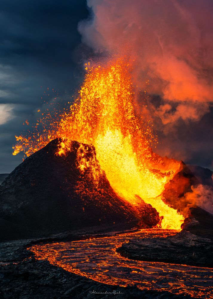
Just found this image of the 2021 Fagradalsfjall eruption in Iceland that I've never shared before. Being in the presence of this volcano and feeling the intense heat of the Earth on my skin was genuinely the best experience of my life and its not even close. #photography
October 7, 2025 at 4:25 AM
Just found this image of the 2021 Fagradalsfjall eruption in Iceland that I've never shared before. Being in the presence of this volcano and feeling the intense heat of the Earth on my skin was genuinely the best experience of my life and its not even close. #photography
"Wait what"
-the entire wx verse after the Enderlin news
-the entire wx verse after the Enderlin news
October 7, 2025 at 3:13 AM
"Wait what"
-the entire wx verse after the Enderlin news
-the entire wx verse after the Enderlin news
Reposted by StormArtz

Excited to announce that my method for estimating wind speeds based on lofted debris in tornadoes was used as contextual evidence for upgrading the Enderlin, ND tornado to an EF5!
doi.org/10.1175/MWR-...
#NDwx #Enderlin #EF5 #Tornado
doi.org/10.1175/MWR-...
#NDwx #Enderlin #EF5 #Tornado

October 6, 2025 at 3:38 PM
Excited to announce that my method for estimating wind speeds based on lofted debris in tornadoes was used as contextual evidence for upgrading the Enderlin, ND tornado to an EF5!
doi.org/10.1175/MWR-...
#NDwx #Enderlin #EF5 #Tornado
doi.org/10.1175/MWR-...
#NDwx #Enderlin #EF5 #Tornado
I am...about 70-80% sure I saw a tornado from my house in Las Vegas on Friday night.
Supercell north of town put on a spectacular lightning show, and a stovepipe-shaped cloud formed under it. Either the most convincing scud ever or I caught a truly rare desert twister.
Supercell north of town put on a spectacular lightning show, and a stovepipe-shaped cloud formed under it. Either the most convincing scud ever or I caught a truly rare desert twister.

September 8, 2025 at 9:19 AM
I am...about 70-80% sure I saw a tornado from my house in Las Vegas on Friday night.
Supercell north of town put on a spectacular lightning show, and a stovepipe-shaped cloud formed under it. Either the most convincing scud ever or I caught a truly rare desert twister.
Supercell north of town put on a spectacular lightning show, and a stovepipe-shaped cloud formed under it. Either the most convincing scud ever or I caught a truly rare desert twister.
Reposted by StormArtz
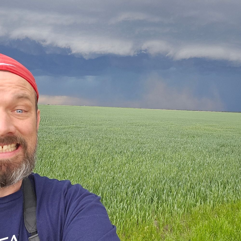
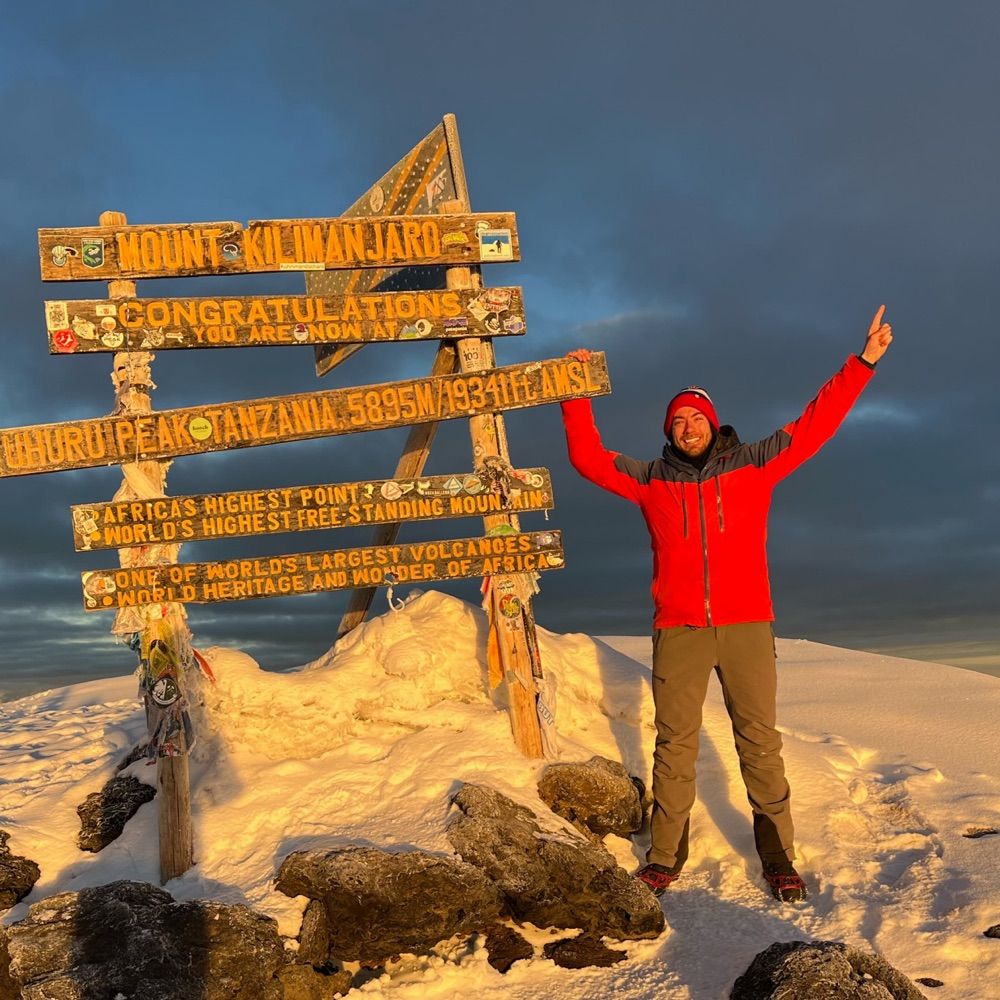
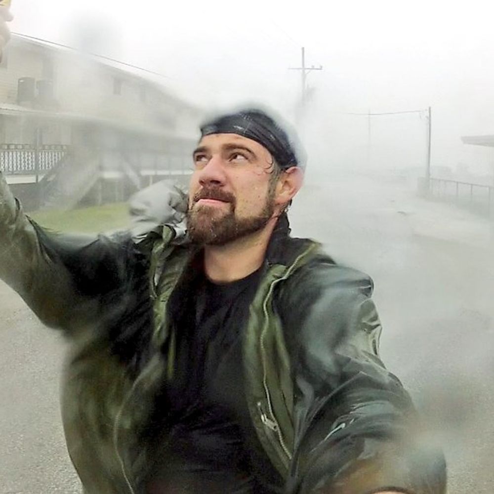
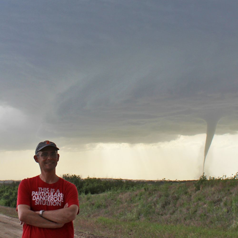
This could be you! Be like Alex and get yourself a selfie in front of a supercell!
Booking now for June 2026!
darksky-adventures.com
Booking now for June 2026!
darksky-adventures.com


August 28, 2025 at 1:31 AM
This could be you! Be like Alex and get yourself a selfie in front of a supercell!
Booking now for June 2026!
darksky-adventures.com
Booking now for June 2026!
darksky-adventures.com
I painted the eye of Hurricane Erin, based on video taken from Hurricane Hunter aircraft during it's Category 5 peak.

August 19, 2025 at 12:38 PM
I painted the eye of Hurricane Erin, based on video taken from Hurricane Hunter aircraft during it's Category 5 peak.
Reposted by StormArtz
Pictures from the 2025 field course are up vortexjeff.smugmug.com/Storms-of-2025
Storms of 2025 - Jeff Frame
I only lead one field course in 2025, in June. We observed the Wellfleet, Nebraska, tornado on June 16, which is a top 3 chase for me and the best tornado/structure combo of my career. We saw many oth...
vortexjeff.smugmug.com
August 1, 2025 at 8:40 PM
Pictures from the 2025 field course are up vortexjeff.smugmug.com/Storms-of-2025