


Marc-André Brideau
@mabrideau.bsky.social
Engineering geologist specializing in landslide hazard. Based in Victoria British Columbia.
Version 13 of the Preliminary Canadian Landslide Database is available. Highlights include 2,500 new entries and 449 slopes that were likely moving (2016-2024) based on interpretation of NRCan and NASA InSAR-based deformation maps.
zenodo.org/records/1821...
zenodo.org/records/1821...


January 12, 2026 at 2:22 PM
Version 13 of the Preliminary Canadian Landslide Database is available. Highlights include 2,500 new entries and 449 slopes that were likely moving (2016-2024) based on interpretation of NRCan and NASA InSAR-based deformation maps.
zenodo.org/records/1821...
zenodo.org/records/1821...
Reposted by Marc-André Brideau

Magnitude 6.8 earthquake ten minutes ago along Yukon/Alaska border on the Fairweather Fault. I am guessing this will result in some big landslides. 🧪⚒️
earthquake.usgs.gov/earthquakes/...
earthquake.usgs.gov/earthquakes/...
The Earthquake Event Page application supports most recent browsers, view supported browsers. Or, try our Real-time Notifications, Feeds, and Web Services.
earthquake.usgs.gov
December 6, 2025 at 8:52 PM
Magnitude 6.8 earthquake ten minutes ago along Yukon/Alaska border on the Fairweather Fault. I am guessing this will result in some big landslides. 🧪⚒️
earthquake.usgs.gov/earthquakes/...
earthquake.usgs.gov/earthquakes/...
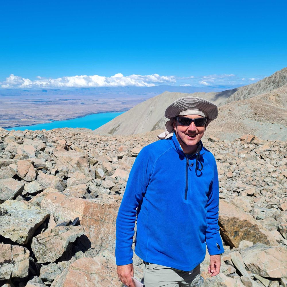
This week I get the chance to present at the Rock Slope and Gravity 2025 (RSG-2025) Conference: Forecasting and Modelling Large Rock Slope Failures in a Changing Mountain Environment. Lots of interesting talks: wp.unil.ch/rsg-2025/pro... It has an option to attend online.
Program - Rock slope and gravity 2025
Program: Rock slope and gravity 2025 (RSG-2025): Forecasting and Modelling Large Rock Slope Failures in a Changing Mountain Environment The program generally follows the original session plan, though ...
wp.unil.ch
November 23, 2025 at 8:56 PM
This week I get the chance to present at the Rock Slope and Gravity 2025 (RSG-2025) Conference: Forecasting and Modelling Large Rock Slope Failures in a Changing Mountain Environment. Lots of interesting talks: wp.unil.ch/rsg-2025/pro... It has an option to attend online.
Natural Resources Canada has released a national scale maps of active deformation processes based on 2017-2024 Sentinel-1 InSAR data. For best results download the images, load them up in your fav GIS software, and watch out many hours will be spent checking out features you always wondered about.

October 23, 2025 at 1:36 PM
Natural Resources Canada has released a national scale maps of active deformation processes based on 2017-2024 Sentinel-1 InSAR data. For best results download the images, load them up in your fav GIS software, and watch out many hours will be spent checking out features you always wondered about.
Only six days left to submit an abstract to Geohazards 9 which will take place in Edmonton, Alberta, Canada next June.
www.geohazards9.ca
www.geohazards9.ca

Geohazards 9
Welcome to the 9th installment of the Canadian Conference on Geotechnique and Natural Hazards. Since the inception for the series in 1992, applied earth science practitioners from across Canada have ...
www.geohazards9.ca
October 23, 2025 at 1:07 PM
Only six days left to submit an abstract to Geohazards 9 which will take place in Edmonton, Alberta, Canada next June.
www.geohazards9.ca
www.geohazards9.ca
Reposted by Marc-André Brideau

The 17 December 2024 Takhini River landslide and river-ice tsunami in Whitehorse, Yukon, Canada highlights the role of progressive failure in frozen materials.
eos.org/thelandslide...
eos.org/thelandslide...

October 8, 2025 at 7:24 AM
The 17 December 2024 Takhini River landslide and river-ice tsunami in Whitehorse, Yukon, Canada highlights the role of progressive failure in frozen materials.
eos.org/thelandslide...
eos.org/thelandslide...
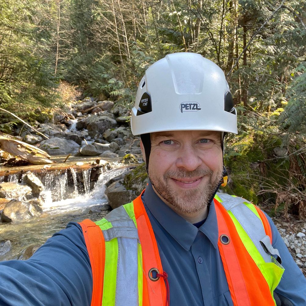
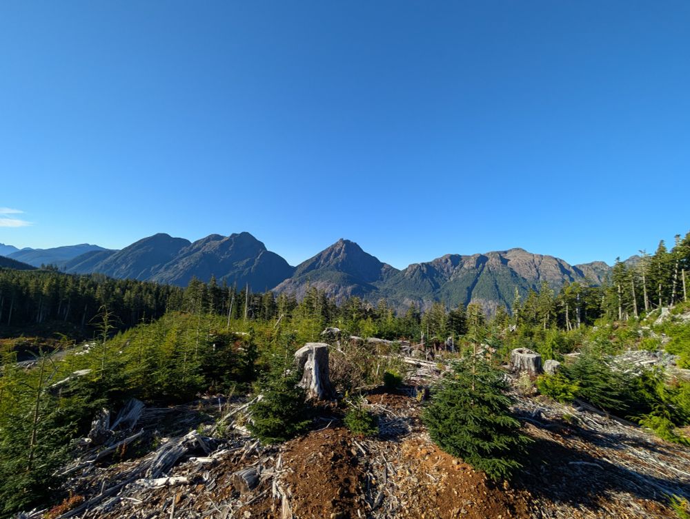
Had a great day in the field yesterday. Between Woss and Zeballos on Vancouver Island.


October 7, 2025 at 12:37 PM
Had a great day in the field yesterday. Between Woss and Zeballos on Vancouver Island.
Reposted by Marc-André Brideau
🚨FOUR tenure track positions in my dept @ucalgary.bsky.social @ucalgaryscience.bsky.social in applied & computational geophysics, subsurface geochemistry, sedimentary geology, and sustainable soil science. careers.ucalgary.ca/search/jobs?...
(please reskeet widely!) #academicsky 🧪⚒️🇨🇦
(please reskeet widely!) #academicsky 🧪⚒️🇨🇦

Opportunities
matching 'earth'
Search 4 Careers available at University of Calgary.
careers.ucalgary.ca
October 3, 2025 at 5:57 PM
🚨FOUR tenure track positions in my dept @ucalgary.bsky.social @ucalgaryscience.bsky.social in applied & computational geophysics, subsurface geochemistry, sedimentary geology, and sustainable soil science. careers.ucalgary.ca/search/jobs?...
(please reskeet widely!) #academicsky 🧪⚒️🇨🇦
(please reskeet widely!) #academicsky 🧪⚒️🇨🇦
Over the last three years, @drewbrayshaw.bsky.social, @geocron.bsky.social, me, and twelve colleagues have been compiling a Preliminary Canadian Landslide Database. Version 12 is now available and contains 25,500 entries.
zenodo.org/records/1721...
zenodo.org/records/1721...


September 29, 2025 at 1:16 PM
Over the last three years, @drewbrayshaw.bsky.social, @geocron.bsky.social, me, and twelve colleagues have been compiling a Preliminary Canadian Landslide Database. Version 12 is now available and contains 25,500 entries.
zenodo.org/records/1721...
zenodo.org/records/1721...
Reposted by Marc-André Brideau

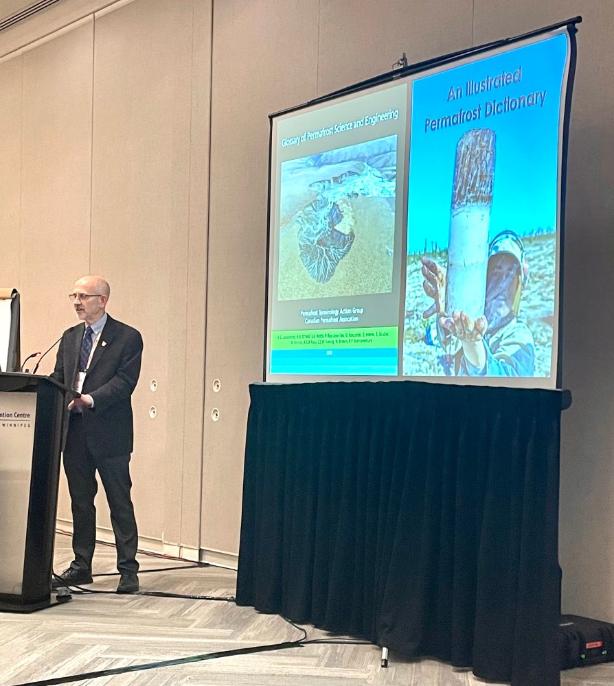
IT’S ALIVE! The Glossary of Permafrost Science and Engineering is released and available to all for free! Spread the news! You can download it here: canadianpermafrostassociation.ca/glossary-of-...
September 23, 2025 at 11:27 PM
IT’S ALIVE! The Glossary of Permafrost Science and Engineering is released and available to all for free! Spread the news! You can download it here: canadianpermafrostassociation.ca/glossary-of-...
You can now submit your abstract for the Geohazards 9 conference next June in Edmonton Alberta
www.geohazards9.ca/call-for-abs...
www.geohazards9.ca/call-for-abs...
Submit | Geohazards 9
www.geohazards9.ca
July 23, 2025 at 10:23 PM
You can now submit your abstract for the Geohazards 9 conference next June in Edmonton Alberta
www.geohazards9.ca/call-for-abs...
www.geohazards9.ca/call-for-abs...
Interesting landslide landscape visible in the newly available 2024 lidar along the Fraser River. Lidar from lidar.gov.bc.ca/pages/downlo...
Landslide outlines from www.frdr-dfdr.ca/repo/dataset...
Landslide points from zenodo.org/records/1529...
Landslide outlines from www.frdr-dfdr.ca/repo/dataset...
Landslide points from zenodo.org/records/1529...

July 20, 2025 at 3:53 AM
Interesting landslide landscape visible in the newly available 2024 lidar along the Fraser River. Lidar from lidar.gov.bc.ca/pages/downlo...
Landslide outlines from www.frdr-dfdr.ca/repo/dataset...
Landslide points from zenodo.org/records/1529...
Landslide outlines from www.frdr-dfdr.ca/repo/dataset...
Landslide points from zenodo.org/records/1529...
the new Landslide Mapping Guidelines from Engineers and Geoscientists British Columbia are now available. A useful document for geohazard practitioners in British Columbia (and beyond).
tools.egbc.ca/Registrants/...
tools.egbc.ca/Registrants/...
tools.egbc.ca
July 17, 2025 at 7:09 PM
the new Landslide Mapping Guidelines from Engineers and Geoscientists British Columbia are now available. A useful document for geohazard practitioners in British Columbia (and beyond).
tools.egbc.ca/Registrants/...
tools.egbc.ca/Registrants/...
Reposted by Marc-André Brideau
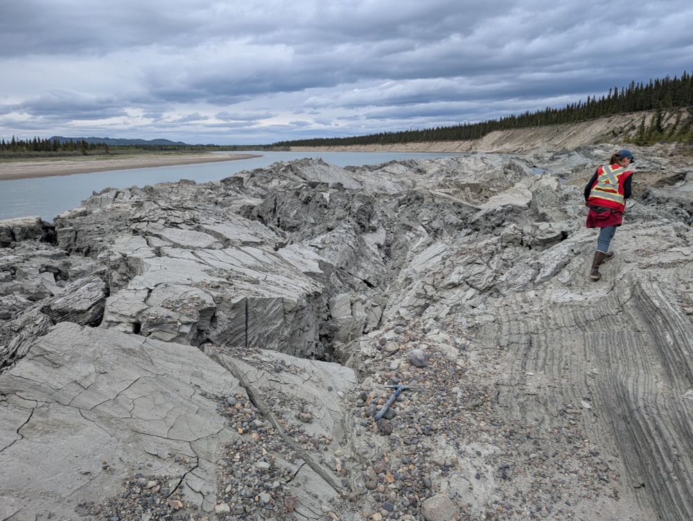
Derek Cronmiller of the Yukon Geological Survey has provided a stunning set of the images of the fascinating recent failure that partially blocked the Yukon River. This is a textbook example of a complex rotational landslide:-
eos.org/thelandslide...
eos.org/thelandslide...


June 18, 2025 at 6:37 AM
Derek Cronmiller of the Yukon Geological Survey has provided a stunning set of the images of the fascinating recent failure that partially blocked the Yukon River. This is a textbook example of a complex rotational landslide:-
eos.org/thelandslide...
eos.org/thelandslide...
A landslide in quick (sensitive) clay in central Québec this week as been featured in the news.
www.cbc.ca/news/canada/...
Lidar and previous landslide inventory support the statement in the news report that landslides have occurred in the area before.
www.cbc.ca/news/canada/...
Lidar and previous landslide inventory support the statement in the news report that landslides have occurred in the area before.


May 23, 2025 at 1:08 PM
A landslide in quick (sensitive) clay in central Québec this week as been featured in the news.
www.cbc.ca/news/canada/...
Lidar and previous landslide inventory support the statement in the news report that landslides have occurred in the area before.
www.cbc.ca/news/canada/...
Lidar and previous landslide inventory support the statement in the news report that landslides have occurred in the area before.
Reposted by Marc-André Brideau
I am pleased to report that we are now accepting abstracts for the 11th International Conference on #Geomorphology in Christchurch New Zealand in February 2026. #geoscience #hazards #rivers #tectonics #glaciers #coasts #landslides
Please repost.
www.confer.co.nz/icg2026/call...
Please repost.
www.confer.co.nz/icg2026/call...

Call For Abstracts - 2026 IAG International Conference on Geomorphology
Call for Abstracts Abstract Submissions Now Open! Click the button to the right to begin your abstract submission. SUBMIT YOUR ABSTRACT HERE Abstract
www.confer.co.nz
February 9, 2025 at 9:10 AM
I am pleased to report that we are now accepting abstracts for the 11th International Conference on #Geomorphology in Christchurch New Zealand in February 2026. #geoscience #hazards #rivers #tectonics #glaciers #coasts #landslides
Please repost.
www.confer.co.nz/icg2026/call...
Please repost.
www.confer.co.nz/icg2026/call...
Very interesting new paper by former colleagues Carie-Ann Hancock and Kyle Wlodarczyk on the role of wildfires and forest harvesting on geohazards and channel stability during the November 2021 atmospheric river in SW British Columbia, Canada. onlinelibrary.wiley.com/doi/full/10....

The role of wildfires and forest harvesting on geohazards and channel instability during the November 2021 atmospheric river in southwestern British Columbia, Canada
During the November 2021 atmospheric river in British Columbia, Canada, hundreds of landslides were triggered. We found that geohazards occurred more frequently in wildfire burned areas and along for...
onlinelibrary.wiley.com
January 30, 2025 at 1:50 PM
Very interesting new paper by former colleagues Carie-Ann Hancock and Kyle Wlodarczyk on the role of wildfires and forest harvesting on geohazards and channel stability during the November 2021 atmospheric river in SW British Columbia, Canada. onlinelibrary.wiley.com/doi/full/10....
The next Canadian Geohazards Conference will be June 1-3, 2026 in Edmonton Alberta. You can register for updates at geohazards9.ca

GeoHazards 9
June 1-3, 2026 Edmonton, Alberta
geohazards9.ca
January 22, 2025 at 11:38 PM
The next Canadian Geohazards Conference will be June 1-3, 2026 in Edmonton Alberta. You can register for updates at geohazards9.ca
Reposted by Marc-André Brideau

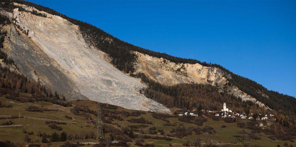
Brienz has just been evacuated for the second time. The decision is based, among other things, on thousands of simulations that ETH professor Jordan Aaron has produced using a computer model he developed. In an interview with ETH News, he explains why this model was used.
“We needed to know how far and how fast the event could travel”
Brienz has just been evacuated for the second time. The decision is based, among other things, on thousands of simulations that ETH professor Jordan Aaron has produced using a computer model he develo...
ethz.ch
December 13, 2024 at 10:21 AM
Brienz has just been evacuated for the second time. The decision is based, among other things, on thousands of simulations that ETH professor Jordan Aaron has produced using a computer model he developed. In an interview with ETH News, he explains why this model was used.
Really interesting article and radio interview about landslide early warning systems in British Columbia and Alaska. Featuring the work by @volcancanuck.bsky.social
www.cbc.ca/radio/whaton...
www.cbc.ca/radio/whaton...
Microphones and rain buckets are being used to help detect landslides before they happen | CBC Radio
Scientists say giving people hours, or even a few minutes, of early warning has grown in importance, as climate change makes natural disasters more common and dangerous than ever before.
www.cbc.ca
December 8, 2024 at 7:49 PM
Really interesting article and radio interview about landslide early warning systems in British Columbia and Alaska. Featuring the work by @volcancanuck.bsky.social
www.cbc.ca/radio/whaton...
www.cbc.ca/radio/whaton...
Pretty scenery this morning in Selbu, Trøndelag county, Norway


December 3, 2024 at 9:34 AM
Pretty scenery this morning in Selbu, Trøndelag county, Norway
If you are a professional geoscientist or engineering in British Columbia, Canada, there is a new Artificial Intelligence Practice Advisory from EGBC.
www.egbc.ca/News/Article...
www.egbc.ca/News/Article...
New Practice Advisory on AI
www.egbc.ca
December 2, 2024 at 9:49 AM
If you are a professional geoscientist or engineering in British Columbia, Canada, there is a new Artificial Intelligence Practice Advisory from EGBC.
www.egbc.ca/News/Article...
www.egbc.ca/News/Article...
Great new resources on slope stability published by the New Zealand Geotechnical Society
www.nzgs.org/libraries/sl...
www.nzgs.org/libraries/sl...
Slope Stability Guidance Units - New Zealand Geotechnical Society
Unit 1 – General Guidance New Zealand is highly vulnerable to natural hazard risks, as evidenced by earthquakes and storm events over recent decades. Landslides form a significant part of the natural...
www.nzgs.org
November 27, 2024 at 10:40 PM
Great new resources on slope stability published by the New Zealand Geotechnical Society
www.nzgs.org/libraries/sl...
www.nzgs.org/libraries/sl...


One of the most impressive landslide landscape in British Columbia Canada is near Pinaus Lake (9km south of small community of Falkland). The geology consists dominantly trachyandesite and breccia flows with some shale, sandstone, conglomerate units.


November 10, 2024 at 2:30 PM
One of the most impressive landslide landscape in British Columbia Canada is near Pinaus Lake (9km south of small community of Falkland). The geology consists dominantly trachyandesite and breccia flows with some shale, sandstone, conglomerate units.