


Marc-André Brideau
@mabrideau.bsky.social
Engineering geologist specializing in landslide hazard. Based in Victoria British Columbia.
Natural Resources Canada has released a national scale maps of active deformation processes based on 2017-2024 Sentinel-1 InSAR data. For best results download the images, load them up in your fav GIS software, and watch out many hours will be spent checking out features you always wondered about.

October 23, 2025 at 1:36 PM
Natural Resources Canada has released a national scale maps of active deformation processes based on 2017-2024 Sentinel-1 InSAR data. For best results download the images, load them up in your fav GIS software, and watch out many hours will be spent checking out features you always wondered about.
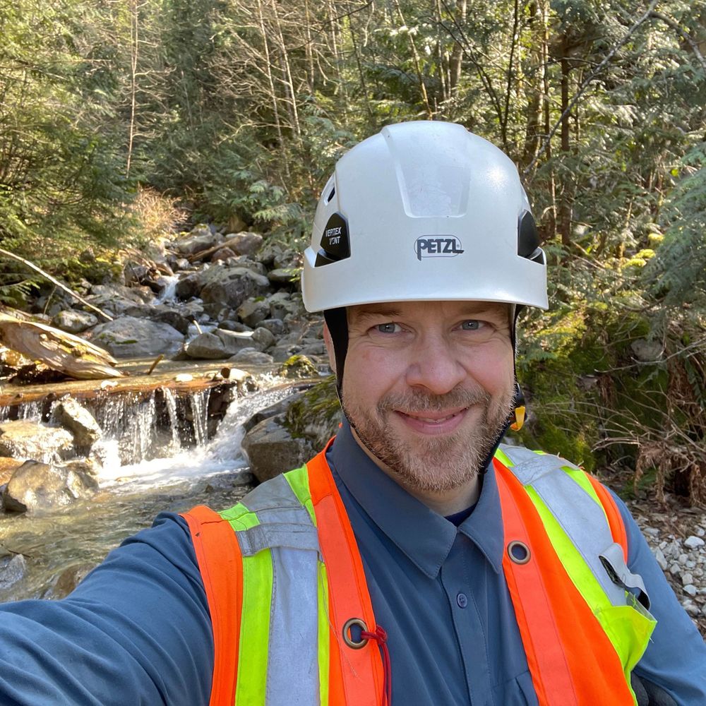
Had a great day in the field yesterday. Between Woss and Zeballos on Vancouver Island.

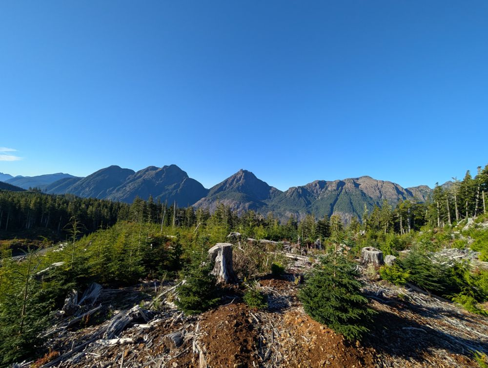

October 7, 2025 at 12:37 PM
Had a great day in the field yesterday. Between Woss and Zeballos on Vancouver Island.
Over the last three years, @drewbrayshaw.bsky.social, @geocron.bsky.social, me, and twelve colleagues have been compiling a Preliminary Canadian Landslide Database. Version 12 is now available and contains 25,500 entries.
zenodo.org/records/1721...
zenodo.org/records/1721...


September 29, 2025 at 1:16 PM
Over the last three years, @drewbrayshaw.bsky.social, @geocron.bsky.social, me, and twelve colleagues have been compiling a Preliminary Canadian Landslide Database. Version 12 is now available and contains 25,500 entries.
zenodo.org/records/1721...
zenodo.org/records/1721...
Interesting landslide landscape visible in the newly available 2024 lidar along the Fraser River. Lidar from lidar.gov.bc.ca/pages/downlo...
Landslide outlines from www.frdr-dfdr.ca/repo/dataset...
Landslide points from zenodo.org/records/1529...
Landslide outlines from www.frdr-dfdr.ca/repo/dataset...
Landslide points from zenodo.org/records/1529...

July 20, 2025 at 3:53 AM
Interesting landslide landscape visible in the newly available 2024 lidar along the Fraser River. Lidar from lidar.gov.bc.ca/pages/downlo...
Landslide outlines from www.frdr-dfdr.ca/repo/dataset...
Landslide points from zenodo.org/records/1529...
Landslide outlines from www.frdr-dfdr.ca/repo/dataset...
Landslide points from zenodo.org/records/1529...
Not sure, the pre-failure imagery from esri shows small scale instabilities and talus along the runout path. Could be runup, or entrainment, or secondary failures.

June 27, 2025 at 1:42 PM
Not sure, the pre-failure imagery from esri shows small scale instabilities and talus along the runout path. Could be runup, or entrainment, or secondary failures.
The July 26, 2022 imagery has a nice view of the source area

June 27, 2025 at 1:33 PM
The July 26, 2022 imagery has a nice view of the source area
Sentinel imagery suggest it happened between June 26, 2022 and June 29, 2022


June 27, 2025 at 1:31 PM
Sentinel imagery suggest it happened between June 26, 2022 and June 29, 2022
A landslide in quick (sensitive) clay in central Québec this week as been featured in the news.
www.cbc.ca/news/canada/...
Lidar and previous landslide inventory support the statement in the news report that landslides have occurred in the area before.
www.cbc.ca/news/canada/...
Lidar and previous landslide inventory support the statement in the news report that landslides have occurred in the area before.


May 23, 2025 at 1:08 PM
A landslide in quick (sensitive) clay in central Québec this week as been featured in the news.
www.cbc.ca/news/canada/...
Lidar and previous landslide inventory support the statement in the news report that landslides have occurred in the area before.
www.cbc.ca/news/canada/...
Lidar and previous landslide inventory support the statement in the news report that landslides have occurred in the area before.
There is 2021 lidar available from (lidar.gov.bc.ca/pages/downlo...) for that feature. It suggest that the local relief is only ~260m.


February 13, 2025 at 1:53 PM
There is 2021 lidar available from (lidar.gov.bc.ca/pages/downlo...) for that feature. It suggest that the local relief is only ~260m.
Watch out Calgary you might loose your tie for fifth place

December 24, 2024 at 2:27 PM
Watch out Calgary you might loose your tie for fifth place
Pretty scenery this morning in Selbu, Trøndelag county, Norway


December 3, 2024 at 9:34 AM
Pretty scenery this morning in Selbu, Trøndelag county, Norway
One of the most impressive landslide landscape in British Columbia Canada is near Pinaus Lake (9km south of small community of Falkland). The geology consists dominantly trachyandesite and breccia flows with some shale, sandstone, conglomerate units.


November 10, 2024 at 2:30 PM
One of the most impressive landslide landscape in British Columbia Canada is near Pinaus Lake (9km south of small community of Falkland). The geology consists dominantly trachyandesite and breccia flows with some shale, sandstone, conglomerate units.
I saw an interesting bank erosion protection structure yesterday where tree root mat stumps were lashed and bolted together in a creek bend just before road culverts. It was a new one for me.


July 27, 2024 at 4:04 PM
I saw an interesting bank erosion protection structure yesterday where tree root mat stumps were lashed and bolted together in a creek bend just before road culverts. It was a new one for me.
As part of the 14th International Symposium on Landslides field trip I visited the La Séchiliènne Landslide. Great to see this site after reading so many papers on it.


July 10, 2024 at 4:12 PM
As part of the 14th International Symposium on Landslides field trip I visited the La Séchiliènne Landslide. Great to see this site after reading so many papers on it.
I had the chance to do fieldwork in Labrador this month. Such a beautiful landscape 😍


June 15, 2024 at 5:05 PM
I had the chance to do fieldwork in Labrador this month. Such a beautiful landscape 😍
Leaning retaining wall of Victoria

March 23, 2024 at 9:48 PM
Leaning retaining wall of Victoria
Really interesting landslide research PhD opportunity in New Zealand!!!

March 22, 2024 at 1:42 PM
Really interesting landslide research PhD opportunity in New Zealand!!!
It is early even for Victoria. I would gladly trade the opportunity to tease Calgarians for a bit more green and blue in this map

February 9, 2024 at 9:13 PM
It is early even for Victoria. I would gladly trade the opportunity to tease Calgarians for a bit more green and blue in this map
Meanwhile in Victoria


February 9, 2024 at 4:22 PM
Meanwhile in Victoria
Multi-levels gabion mitigation at coastal landslide in Victoria, British Columbia

January 21, 2024 at 5:18 AM
Multi-levels gabion mitigation at coastal landslide in Victoria, British Columbia