


David Roth
@drmetwatch.bsky.social
Meteorologist. Into weather records. Soft spot for subtropical 🌀. 😻 and nature imagery, too.
Pinned

The guidance, starting with the GFS days ago, has been indicating a convective low southwest of Mexico.
Something is there now, so let’s see what happens.
🐻⌚️🍿
Something is there now, so let’s see what happens.
🐻⌚️🍿
Is this coming? 🐻⌚️

January 22, 2026 at 9:17 PM
Is this coming? 🐻⌚️
Reposted by David Roth

This is the most astonishing graph of what the Trump regime has done to US science. They have destroyed the federal science workforce across the board. The negative impacts on Americans will be felt for generations, and the US might never be the same again.
www.nature.com/immersive/d4...
www.nature.com/immersive/d4...

January 20, 2026 at 10:53 PM
This is the most astonishing graph of what the Trump regime has done to US science. They have destroyed the federal science workforce across the board. The negative impacts on Americans will be felt for generations, and the US might never be the same again.
www.nature.com/immersive/d4...
www.nature.com/immersive/d4...
Reposted by David Roth

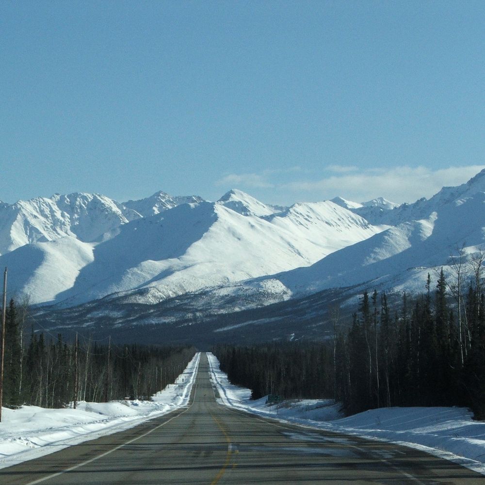
Views of the Aurora from mountain point (south of Ketchikan) at 5:30 am on Jan 20. It covered the entire sky and was flickering and pulsing. Incredible 😍
#AlaskaSky
#AlaskaSky


January 20, 2026 at 9:38 PM
Views of the Aurora from mountain point (south of Ketchikan) at 5:30 am on Jan 20. It covered the entire sky and was flickering and pulsing. Incredible 😍
#AlaskaSky
#AlaskaSky


Reposted by David Roth
Fairbanks airport low temperature Tuesday thru 7am has been -45F (-42.8C), making this the 21st day thus far this winter with a low temperature of -40F/C or lower. This is the most since the winter of 1970-71. #akwx #Climate #Winter2026 @leahwrenn.bsky.social @carrieinfbx.bsky.social
January 13, 2026 at 4:07 PM
Fairbanks airport low temperature Tuesday thru 7am has been -45F (-42.8C), making this the 21st day thus far this winter with a low temperature of -40F/C or lower. This is the most since the winter of 1970-71. #akwx #Climate #Winter2026 @leahwrenn.bsky.social @carrieinfbx.bsky.social
The guidance, starting with the GFS days ago, has been indicating a convective low southwest of Mexico.
Something is there now, so let’s see what happens.
🐻⌚️🍿
Something is there now, so let’s see what happens.
🐻⌚️🍿
January 13, 2026 at 6:18 PM
The guidance, starting with the GFS days ago, has been indicating a convective low southwest of Mexico.
Something is there now, so let’s see what happens.
🐻⌚️🍿
Something is there now, so let’s see what happens.
🐻⌚️🍿
Reposted by David Roth

The 5-day forecast for sea ice in the Bering Sea shows ice making it to St. Paul Island earlier than any date in the prior 27 years. It will then quickly retreat with a southerly flow. @alaskawx.bsky.social

January 13, 2026 at 5:47 AM
The 5-day forecast for sea ice in the Bering Sea shows ice making it to St. Paul Island earlier than any date in the prior 27 years. It will then quickly retreat with a southerly flow. @alaskawx.bsky.social
First 5pm sunset in a while. Spring, here we come…

January 5, 2026 at 12:48 PM
First 5pm sunset in a while. Spring, here we come…
A semi-convective low moving through the Strait of Gibraltar into the Mediterranean Sea. 🐻⌚️
January 4, 2026 at 6:41 PM
A semi-convective low moving through the Strait of Gibraltar into the Mediterranean Sea. 🐻⌚️
Kuujjuarapik & La Grande IV sites in Quebec set Dec low pressure records this morning when their MSLP fell into the low to mid 960s hPa.
Inukjuak’s MSLP fell to 955.7 hPa, an all-time record. POR starts in 1937.
The cyclone’s CP fell to 951 hPa at 15z, before moving west into Hudson Bay.
Inukjuak’s MSLP fell to 955.7 hPa, an all-time record. POR starts in 1937.
The cyclone’s CP fell to 951 hPa at 15z, before moving west into Hudson Bay.

December 31, 2025 at 10:09 PM
Kuujjuarapik & La Grande IV sites in Quebec set Dec low pressure records this morning when their MSLP fell into the low to mid 960s hPa.
Inukjuak’s MSLP fell to 955.7 hPa, an all-time record. POR starts in 1937.
The cyclone’s CP fell to 951 hPa at 15z, before moving west into Hudson Bay.
Inukjuak’s MSLP fell to 955.7 hPa, an all-time record. POR starts in 1937.
The cyclone’s CP fell to 951 hPa at 15z, before moving west into Hudson Bay.
Reposted by David Roth
The latest reported snow depth at the Juneau Airport is 37". This is higher than any of the 6-hour snow depths in the ASOS era (2001-present) and larger than any of the once daily values since March 11, 1972. @alaska.bsky.social @alaskawx.bsky.social

December 30, 2025 at 6:58 PM
The latest reported snow depth at the Juneau Airport is 37". This is higher than any of the 6-hour snow depths in the ASOS era (2001-present) and larger than any of the once daily values since March 11, 1972. @alaska.bsky.social @alaskawx.bsky.social
Reposted by David Roth
Here are a few back of the napkin stats for cold in Alaska this month. @alaskawx.bsky.social
Coldest since 2010:
Anchorage, Talkeetna, Homer, King Salmon, McGrath
Coldest since 1980:
Fairbanks, Bettles, Eagle, Delta Junction
Coldest since 1964:
Juneau
Coldest since 2010:
Anchorage, Talkeetna, Homer, King Salmon, McGrath
Coldest since 1980:
Fairbanks, Bettles, Eagle, Delta Junction
Coldest since 1964:
Juneau
December 30, 2025 at 4:07 PM
Here are a few back of the napkin stats for cold in Alaska this month. @alaskawx.bsky.social
Coldest since 2010:
Anchorage, Talkeetna, Homer, King Salmon, McGrath
Coldest since 1980:
Fairbanks, Bettles, Eagle, Delta Junction
Coldest since 1964:
Juneau
Coldest since 2010:
Anchorage, Talkeetna, Homer, King Salmon, McGrath
Coldest since 1980:
Fairbanks, Bettles, Eagle, Delta Junction
Coldest since 1964:
Juneau
Reposted by David Roth
With a powerful cold front coming through the country, we can see this on the hourly pressure changes from METAR stations. Very easy to see the rising pressure as the front passes! About to be very cold for a lot of people
December 30, 2025 at 2:50 AM
With a powerful cold front coming through the country, we can see this on the hourly pressure changes from METAR stations. Very easy to see the rising pressure as the front passes! About to be very cold for a lot of people
Reposted by David Roth

Look at this weird cloud


December 30, 2025 at 1:26 AM
Look at this weird cloud

Reposted by David Roth

Obligatory pic of glass gone bottom up.
For Gander #YQX, official minimum sea level pressure 949.7 mb this evening marks the lowest since Feb 9, 1964 (when the all-time low of 946.9 mb occurred). Data since 1959.
Rebound will be swift: 50 mb rise next 12 hrs. Thus, wind!
#nlwx
For Gander #YQX, official minimum sea level pressure 949.7 mb this evening marks the lowest since Feb 9, 1964 (when the all-time low of 946.9 mb occurred). Data since 1959.
Rebound will be swift: 50 mb rise next 12 hrs. Thus, wind!
#nlwx

December 16, 2025 at 12:41 AM
Dec and all-time low pressure records are expected Wed between southeast B.C. and southern Sask. The records were set <1970, so NCEP reanalysis percentiles/anomalies will be overblown.
Short period record sites, like Baudette & Park Rapids MN, could see new December low pressure records too.
Short period record sites, like Baudette & Park Rapids MN, could see new December low pressure records too.


December 16, 2025 at 12:00 AM
Dec and all-time low pressure records are expected Wed between southeast B.C. and southern Sask. The records were set <1970, so NCEP reanalysis percentiles/anomalies will be overblown.
Short period record sites, like Baudette & Park Rapids MN, could see new December low pressure records too.
Short period record sites, like Baudette & Park Rapids MN, could see new December low pressure records too.
The cyclone that broke the December low pressure record at Gander Newfoundland (and Labrador) by 7 hPa. The record is at least 950.1 hPa now.
The last time the site broke a monthly low pressure record was all the way back on November 4, 2025.
The last time the site broke a monthly low pressure record was all the way back on November 4, 2025.

December 15, 2025 at 11:38 PM
The cyclone that broke the December low pressure record at Gander Newfoundland (and Labrador) by 7 hPa. The record is at least 950.1 hPa now.
The last time the site broke a monthly low pressure record was all the way back on November 4, 2025.
The last time the site broke a monthly low pressure record was all the way back on November 4, 2025.
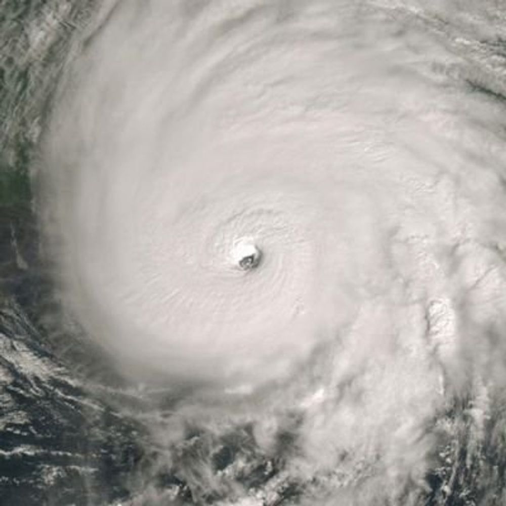
1001 cyclone near the Virginia Capes


December 2, 2025 at 7:12 PM
1001 cyclone near the Virginia Capes
Reposted by David Roth

Happy anniversary to the snow squall
December 2, 2025 at 6:45 PM
Happy anniversary to the snow squall
Reposted by David Roth

AIFS Ensemble plots are now available on PolarWx for a limited number of map projections: polarwx.com/models/?mode...


November 28, 2025 at 6:20 PM
AIFS Ensemble plots are now available on PolarWx for a limited number of map projections: polarwx.com/models/?mode...
Reposted by David Roth

We’re here for the inversions.

November 24, 2025 at 9:23 PM
We’re here for the inversions.
Reposted by David Roth

Rainfall reports and radar estimates (shaded map) are displayed below for the Southern Plains heavy rain event. Several locations saw 5-7 " rainfall accumulations, leading to several flash flood warnings and a flash flood emergency.

November 21, 2025 at 5:07 PM
Rainfall reports and radar estimates (shaded map) are displayed below for the Southern Plains heavy rain event. Several locations saw 5-7 " rainfall accumulations, leading to several flash flood warnings and a flash flood emergency.
Interesting convective feature north of the Leewards

November 18, 2025 at 9:18 PM
Interesting convective feature north of the Leewards
Reposted by David Roth

Officially a top-5 latest first snow in Denver as of today.
We are a lock to move into the top-3, though we may finally (and probably marginally) snap this skid later this week.
#COwx
We are a lock to move into the top-3, though we may finally (and probably marginally) snap this skid later this week.
#COwx

November 16, 2025 at 4:08 PM
Officially a top-5 latest first snow in Denver as of today.
We are a lock to move into the top-3, though we may finally (and probably marginally) snap this skid later this week.
#COwx
We are a lock to move into the top-3, though we may finally (and probably marginally) snap this skid later this week.
#COwx