Ben Bleiman
@benbleiman.bsky.social
Meteorologist, Denver
UIUC Atmospheric Sciences 2017
UIUC Atmospheric Sciences 2017
Can you find the climatological anomaly on this map 😂

The Storm Prediction Center issues Day 1 Convective Outlook (Max Risk: Marginal) at Nov 10, 0:45z Link

November 10, 2025 at 3:08 AM
Can you find the climatological anomaly on this map 😂
Reposted by Ben Bleiman

Albuquerque had consistent and overall above average dew points almost all monsoon season. Despite that, we ended up 1.41" below average with 3.07" of rain this year. The 32nd driest monsoon on record of 134 years. It was also the 5th warmest.

October 1, 2025 at 2:45 PM
Albuquerque had consistent and overall above average dew points almost all monsoon season. Despite that, we ended up 1.41" below average with 3.07" of rain this year. The 32nd driest monsoon on record of 134 years. It was also the 5th warmest.
Reposted by Ben Bleiman

Reposted by Ben Bleiman

Tornado near Pleaant View, Colorado this afternoon…near the Utah/Colorado line in southwestern Colorado!
📸: Landan Wilson
📸: Landan Wilson
September 13, 2025 at 8:34 PM
Tornado near Pleaant View, Colorado this afternoon…near the Utah/Colorado line in southwestern Colorado!
📸: Landan Wilson
📸: Landan Wilson
Reposted by Ben Bleiman


September 13, 2025 at 2:31 PM
Reposted by Ben Bleiman
Nine years ago, an EF-2 tornado struck mainly rural SE Champaign County, Illinois


September 9, 2025 at 5:37 PM
Nine years ago, an EF-2 tornado struck mainly rural SE Champaign County, Illinois
Reposted by Ben Bleiman

It was just an ordinary late-summer evening in #Boulder, until it wasn't...
How it started: ⛰️⛅️😎
How it ended: 🌫️😶🌫️😷
#COWX #Smoke #ThanksCanada
How it started: ⛰️⛅️😎
How it ended: 🌫️😶🌫️😷
#COWX #Smoke #ThanksCanada
September 5, 2025 at 3:48 AM
It was just an ordinary late-summer evening in #Boulder, until it wasn't...
How it started: ⛰️⛅️😎
How it ended: 🌫️😶🌫️😷
#COWX #Smoke #ThanksCanada
How it started: ⛰️⛅️😎
How it ended: 🌫️😶🌫️😷
#COWX #Smoke #ThanksCanada


Another fun chase on the CO High Plains today. This high precipitation beast was fairly fast-moving for most of the afternoon. Produced what appeared to be a brief gustnado around 4:37 pm (pic 1). Tried to wrap up around 5:10-5:20 pm with ground-scraping scud (pic 4) before cold pools merged. #cowx


August 11, 2025 at 4:15 AM
Another fun chase on the CO High Plains today. This high precipitation beast was fairly fast-moving for most of the afternoon. Produced what appeared to be a brief gustnado around 4:37 pm (pic 1). Tried to wrap up around 5:10-5:20 pm with ground-scraping scud (pic 4) before cold pools merged. #cowx


Great day for structure. Followed these storms for about 5 hours today from the Palmer Divide to Haswell, CO. Second storm gave it a good try at producing for about 10-15 minutes around 5:30 pm. #cowx


August 10, 2025 at 6:01 AM
Great day for structure. Followed these storms for about 5 hours today from the Palmer Divide to Haswell, CO. Second storm gave it a good try at producing for about 10-15 minutes around 5:30 pm. #cowx
Reposted by Ben Bleiman

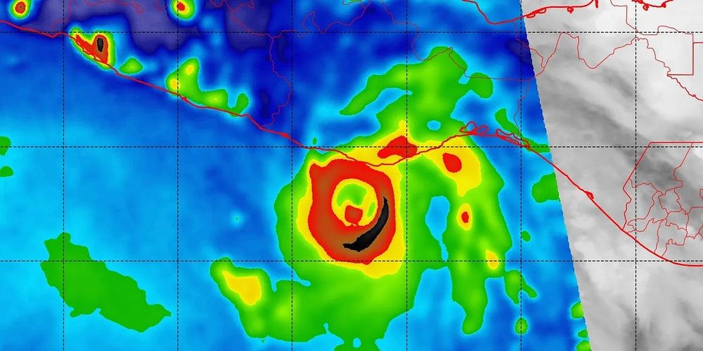
A huge blow was dealt to hurricane forecasters this week as a critical tool was abruptly terminated by the Department of Defense and NOAA. The immediate discontinuation of data from three weather satellites will severely impact hurricane forecasts this season and beyond. More ⬇️
Critical Hurricane Forecast Tool Abruptly Terminated
U.S. Department of Defense announced Tuesday it would no longer process and deliver data essential to most hurricane forecasts
michaelrlowry.substack.com
June 26, 2025 at 1:17 PM
A huge blow was dealt to hurricane forecasters this week as a critical tool was abruptly terminated by the Department of Defense and NOAA. The immediate discontinuation of data from three weather satellites will severely impact hurricane forecasts this season and beyond. More ⬇️
Reposted by Ben Bleiman
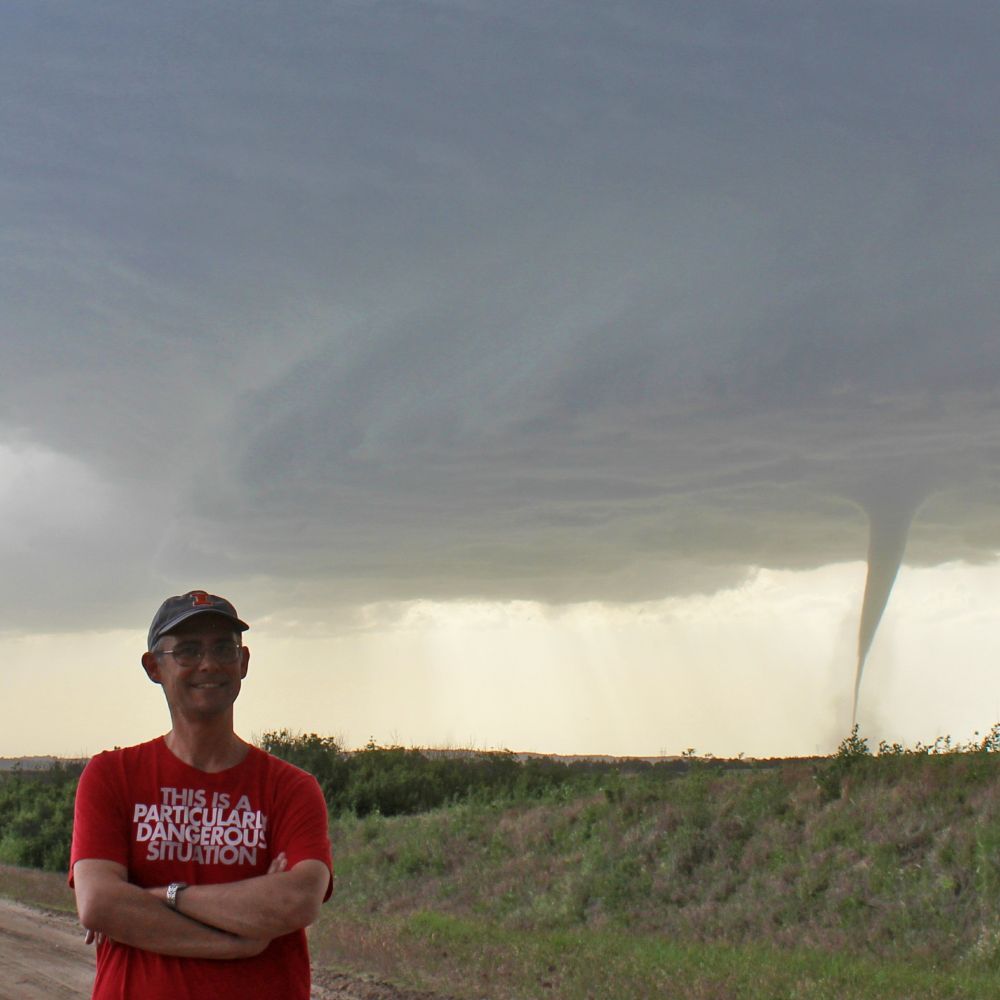
Day #5: The best structure/tornado combo of my career south of North Platte, Nebraska


June 17, 2025 at 5:25 AM
Day #5: The best structure/tornado combo of my career south of North Platte, Nebraska
Reposted by Ben Bleiman

An incredible look inside a tornado from our research drone of structures being destroyed in Crowder, Missouri
May 17, 2025 at 3:00 AM
An incredible look inside a tornado from our research drone of structures being destroyed in Crowder, Missouri