


Jonathan Erdman
@wxjerdman.bsky.social
Senior meteorologist @weatherchannel. M.S. Colorado State Univ.; B.S. UW-Madison; Insightful. Interesting. Impactful. Weather. Opinions are mine only, not of my employer.
57˚ may not sound all that cold to many of you.
But that was this morning's low in Key West, Florida, tying their "record coldest so early in fall" with four other dates in 1966, 1955, 1913.
But that was this morning's low in Key West, Florida, tying their "record coldest so early in fall" with four other dates in 1966, 1955, 1913.

November 11, 2025 at 3:28 PM
57˚ may not sound all that cold to many of you.
But that was this morning's low in Key West, Florida, tying their "record coldest so early in fall" with four other dates in 1966, 1955, 1913.
But that was this morning's low in Key West, Florida, tying their "record coldest so early in fall" with four other dates in 1966, 1955, 1913.
11/11/1911...arguably the nation's most extreme cold front.
But there's one juxtaposition in southern Wisconsin that makes this one of the most bizarre weather events in U.S. history.
But there's one juxtaposition in southern Wisconsin that makes this one of the most bizarre weather events in U.S. history.

On This Date: Most Extreme Cold Front In US History | Weather.com
You may think the cold front we just experienced was extreme. But that's nothing compared to what happened on 11-11-1911. Here are the incredible details.
weather.com
November 11, 2025 at 12:40 PM
11/11/1911...arguably the nation's most extreme cold front.
But there's one juxtaposition in southern Wisconsin that makes this one of the most bizarre weather events in U.S. history.
But there's one juxtaposition in southern Wisconsin that makes this one of the most bizarre weather events in U.S. history.
Soccer players in a whiteout.

Ottawa Soccer Final Blanketed By Intense Snowstorm | Weather.com
You've heard of a bicycle kick, but now, we've had the "icicle kick."
weather.com
November 10, 2025 at 3:33 PM
Soccer players in a whiteout.
Most jarring to me about the Edmund Fitzgerald was the evidence suggesting its sinking happened in just *seconds*, rather than the prolonged event you may be familiar with from the Titanic.
50 years ago this evening.
50 years ago this evening.

On This Date: The Edmund Fitzgerald Sank In Lake Superior | Weather.com
It's one of the most infamous ship sinkings in American history, and still shrouded in mystery decades after a chart-topping song was written about it. Here's what we know about the Edmund Fitzgerald.
weather.com
November 10, 2025 at 1:54 PM
Most jarring to me about the Edmund Fitzgerald was the evidence suggesting its sinking happened in just *seconds*, rather than the prolonged event you may be familiar with from the Titanic.
50 years ago this evening.
50 years ago this evening.
Among over 3 dozen daily record lows that may fall by the wayside Tuesday morning, this Veterans Day cold snap could be among the coldest so early on record in Florida and the Southeast. Fortunately, it won't last long.
Perspective 👇
Perspective 👇

Southeast's Record Cold Ahead, Including Florida | Weather.com
This cold blast isn't just a northern thing. Record lows are forecast as far south as the Florida Keys. Find out how cold it will get and how long it will last.
weather.com
November 10, 2025 at 1:22 PM
Among over 3 dozen daily record lows that may fall by the wayside Tuesday morning, this Veterans Day cold snap could be among the coldest so early on record in Florida and the Southeast. Fortunately, it won't last long.
Perspective 👇
Perspective 👇
2 most intriguing weather games this weekend:
- #9 Oregon @ #20 Iowa: Weather only a "duck" could love.
- NY Giants @ Chicago Bears: A passing, kicking challenge with cold wind howling from end zone to end zone. Flurry or snow shower, too?
- #9 Oregon @ #20 Iowa: Weather only a "duck" could love.
- NY Giants @ Chicago Bears: A passing, kicking challenge with cold wind howling from end zone to end zone. Flurry or snow shower, too?


November 7, 2025 at 11:46 AM
2 most intriguing weather games this weekend:
- #9 Oregon @ #20 Iowa: Weather only a "duck" could love.
- NY Giants @ Chicago Bears: A passing, kicking challenge with cold wind howling from end zone to end zone. Flurry or snow shower, too?
- #9 Oregon @ #20 Iowa: Weather only a "duck" could love.
- NY Giants @ Chicago Bears: A passing, kicking challenge with cold wind howling from end zone to end zone. Flurry or snow shower, too?
This may be the coldest early November outbreak in parts of Florida and the Southeast since 1993.
About 2 dozen daily record lows in jeopardy on Veterans Day.
More deets: weather.com/forecast/reg...
About 2 dozen daily record lows in jeopardy on Veterans Day.
More deets: weather.com/forecast/reg...

November 7, 2025 at 10:42 AM
This may be the coldest early November outbreak in parts of Florida and the Southeast since 1993.
About 2 dozen daily record lows in jeopardy on Veterans Day.
More deets: weather.com/forecast/reg...
About 2 dozen daily record lows in jeopardy on Veterans Day.
More deets: weather.com/forecast/reg...
There's a good chance you've seen this infamous video if you've taken any science, physics, or engineering class.
The Tacoma Narrows Bridge collapse happened 85 years ago today.
weather.com/science/weat...
The Tacoma Narrows Bridge collapse happened 85 years ago today.
weather.com/science/weat...

November 7, 2025 at 10:34 AM
There's a good chance you've seen this infamous video if you've taken any science, physics, or engineering class.
The Tacoma Narrows Bridge collapse happened 85 years ago today.
weather.com/science/weat...
The Tacoma Narrows Bridge collapse happened 85 years ago today.
weather.com/science/weat...
For some, it will be their first snow of the season ahead this weekend.
Then, the lake-effect snow machine kicks into gear for the first time this season.
Deets, perspective 👇
Then, the lake-effect snow machine kicks into gear for the first time this season.
Deets, perspective 👇

First Snow Of Season Ahead For Parts Of Midwest, Northeast | Weather.com
A few seasonal firsts are ahead for some in the Midwest and interior Northeast. That includes bands of lake-effect snow that could accumulate in some areas. Here's who could see these first flakes.
weather.com
November 6, 2025 at 2:01 PM
For some, it will be their first snow of the season ahead this weekend.
Then, the lake-effect snow machine kicks into gear for the first time this season.
Deets, perspective 👇
Then, the lake-effect snow machine kicks into gear for the first time this season.
Deets, perspective 👇
Last night: Nov. record setting Atlantic Canada "bomb cyclone", very nearly an all-time record low pressure for Newfoundland.
Now: Pacific storm moving ashore right now with high winds.
Late today-early Thu: Locally damaging winds possible in the Northeast.
#November 🌬️🍃
Now: Pacific storm moving ashore right now with high winds.
Late today-early Thu: Locally damaging winds possible in the Northeast.
#November 🌬️🍃


November 5, 2025 at 11:37 AM
Last night: Nov. record setting Atlantic Canada "bomb cyclone", very nearly an all-time record low pressure for Newfoundland.
Now: Pacific storm moving ashore right now with high winds.
Late today-early Thu: Locally damaging winds possible in the Northeast.
#November 🌬️🍃
Now: Pacific storm moving ashore right now with high winds.
Late today-early Thu: Locally damaging winds possible in the Northeast.
#November 🌬️🍃
Starting to see a few daily record lows and cold highs entering into play in the Southeast early next week.
How about daytime highs struggling to reach the low 50s along the coast of the Carolinas Tuesday?
Fortunately, this cold won't last long.
How about daytime highs struggling to reach the low 50s along the coast of the Carolinas Tuesday?
Fortunately, this cold won't last long.


November 5, 2025 at 11:19 AM
Starting to see a few daily record lows and cold highs entering into play in the Southeast early next week.
How about daytime highs struggling to reach the low 50s along the coast of the Carolinas Tuesday?
Fortunately, this cold won't last long.
How about daytime highs struggling to reach the low 50s along the coast of the Carolinas Tuesday?
Fortunately, this cold won't last long.
"November can be cold and gray. November can be surly, with bitter rain upon the world and winter coming early.” (John Facenda, NFL Films)
With that in mind, here's our cold blast forecast and perspective.
With that in mind, here's our cold blast forecast and perspective.

Coldest Air Of Season Ahead For Midwest, South, Northeast | Weather.com
So far, we've had it pretty good as far as fall warmth is concerned. That will come to a screeching halt with a cold blast beginning this weekend. Here's how cold it will get and who could even see so...
weather.com
November 4, 2025 at 3:09 PM
"November can be cold and gray. November can be surly, with bitter rain upon the world and winter coming early.” (John Facenda, NFL Films)
With that in mind, here's our cold blast forecast and perspective.
With that in mind, here's our cold blast forecast and perspective.
Reposted by Jonathan Erdman

Annotating a long 3+ day loop of #Hurricane #Melissa from Kingston, #Jamaica radar.
2️⃣ periods appear where an eyewall replacement cycle, #ERC, looked underway. In both cases, inner eyewall stayed intact & outer bands merged, resulting in a larger eye & strengthening after.
A remarkable evolution 🌀
2️⃣ periods appear where an eyewall replacement cycle, #ERC, looked underway. In both cases, inner eyewall stayed intact & outer bands merged, resulting in a larger eye & strengthening after.
A remarkable evolution 🌀
October 30, 2025 at 6:54 AM
Annotating a long 3+ day loop of #Hurricane #Melissa from Kingston, #Jamaica radar.
2️⃣ periods appear where an eyewall replacement cycle, #ERC, looked underway. In both cases, inner eyewall stayed intact & outer bands merged, resulting in a larger eye & strengthening after.
A remarkable evolution 🌀
2️⃣ periods appear where an eyewall replacement cycle, #ERC, looked underway. In both cases, inner eyewall stayed intact & outer bands merged, resulting in a larger eye & strengthening after.
A remarkable evolution 🌀
It's a virtual certainty there will not be another Atlantic Basin storm named "Melissa" going forward.
Here's why:👇
Here's why:👇

The 'Last Melissa': Why This Hurricane Name Will Be Retired | Weather.com
Did you know there's a "hall of infamy" of notorious hurricanes and tropical storms? Melissa is likely to join that club. Here's why its name won't be used for a future storm.
weather.com
October 29, 2025 at 4:46 PM
It's a virtual certainty there will not be another Atlantic Basin storm named "Melissa" going forward.
Here's why:👇
Here's why:👇
Here are all the Category 5 segments of the 45 known Cat 5 Atlantic Basin hurricanes since 1924, with Melissa's 36-hour segment highlighted.

October 29, 2025 at 10:13 AM
Here are all the Category 5 segments of the 45 known Cat 5 Atlantic Basin hurricanes since 1924, with Melissa's 36-hour segment highlighted.
While Melissa carves through eastern Cuba, bands of heavy rain are *still* soaking Haiti.
I believe a post from @drmetwatch.bsky.social Tuesday would imply that today is day 8 of at least locally heavy rain in Hispaniola.
E flank outer bands of TCs are frequently signif. flash flood generators.
I believe a post from @drmetwatch.bsky.social Tuesday would imply that today is day 8 of at least locally heavy rain in Hispaniola.
E flank outer bands of TCs are frequently signif. flash flood generators.

October 29, 2025 at 9:08 AM
While Melissa carves through eastern Cuba, bands of heavy rain are *still* soaking Haiti.
I believe a post from @drmetwatch.bsky.social Tuesday would imply that today is day 8 of at least locally heavy rain in Hispaniola.
E flank outer bands of TCs are frequently signif. flash flood generators.
I believe a post from @drmetwatch.bsky.social Tuesday would imply that today is day 8 of at least locally heavy rain in Hispaniola.
E flank outer bands of TCs are frequently signif. flash flood generators.
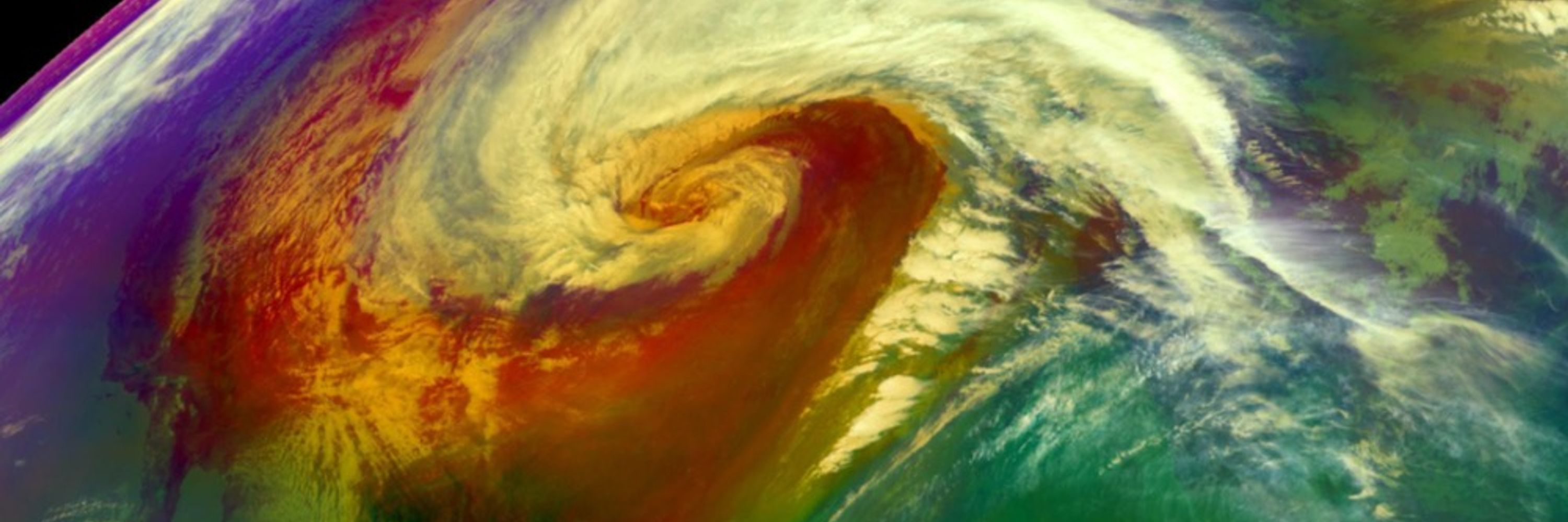
A graphic that will live in infamy. 😥
Record tying intense Atlantic Basin hurricane landfall.
Record tying intense Atlantic Basin hurricane landfall.

October 28, 2025 at 5:15 PM
A graphic that will live in infamy. 😥
Record tying intense Atlantic Basin hurricane landfall.
Record tying intense Atlantic Basin hurricane landfall.
Concerned for the area around Black River, Jamaica for surge flooding, apart from catastrophic wind, rainfall flood impacts.
SLOSH, wind wave model combination suggests over 6 feet of above ground inundation or higher possible in areas shaded in orange and red.
SLOSH, wind wave model combination suggests over 6 feet of above ground inundation or higher possible in areas shaded in orange and red.

October 28, 2025 at 3:33 PM
Concerned for the area around Black River, Jamaica for surge flooding, apart from catastrophic wind, rainfall flood impacts.
SLOSH, wind wave model combination suggests over 6 feet of above ground inundation or higher possible in areas shaded in orange and red.
SLOSH, wind wave model combination suggests over 6 feet of above ground inundation or higher possible in areas shaded in orange and red.
A bit "apples and oranges" as tornado winds are almost always estimated from damage and hurricane winds can last much longer...
...but these peak sustained winds in Melissa are in the EF4 range. Some gusts could be EF5 in the hills/mountains, etc.
...but these peak sustained winds in Melissa are in the EF4 range. Some gusts could be EF5 in the hills/mountains, etc.

October 28, 2025 at 2:28 PM
A bit "apples and oranges" as tornado winds are almost always estimated from damage and hurricane winds can last much longer...
...but these peak sustained winds in Melissa are in the EF4 range. Some gusts could be EF5 in the hills/mountains, etc.
...but these peak sustained winds in Melissa are in the EF4 range. Some gusts could be EF5 in the hills/mountains, etc.
Melissa is moving up the list of most extreme Atlantic hurricanes and could be a record intense Atlantic Basin landfall.
Our lists we're updating continuously through landfall 👇
Our lists we're updating continuously through landfall 👇

Hurricane Melissa Is One Of Strongest Atlantic Hurricanes | Weather.com
Here's where Category 5 Melissa ranks among the most intense Atlantic hurricanes of all time.
weather.com
October 28, 2025 at 2:26 PM
Melissa is moving up the list of most extreme Atlantic hurricanes and could be a record intense Atlantic Basin landfall.
Our lists we're updating continuously through landfall 👇
Our lists we're updating continuously through landfall 👇
While most attention is rightfully on Jamaica with Cat. 5 Melissa...note also the trailing bands of heavy rain pumping into southwestern Haiti's Tiburon Peninsula.
Likely rainfall rates of several inches per hour into an extremely flash flood, mudslide prone area.
Likely rainfall rates of several inches per hour into an extremely flash flood, mudslide prone area.

October 28, 2025 at 11:42 AM
While most attention is rightfully on Jamaica with Cat. 5 Melissa...note also the trailing bands of heavy rain pumping into southwestern Haiti's Tiburon Peninsula.
Likely rainfall rates of several inches per hour into an extremely flash flood, mudslide prone area.
Likely rainfall rates of several inches per hour into an extremely flash flood, mudslide prone area.
Melissa is forecast to be the Atlantic Basin's first Category 5 landfall today since Dorian on Sept. 1, 2019.
Quite an elite list of Cat. 5 Atlantic landfalls. Melissa will be among them by both pressure and winds.
Quite an elite list of Cat. 5 Atlantic landfalls. Melissa will be among them by both pressure and winds.

October 28, 2025 at 9:26 AM
Melissa is forecast to be the Atlantic Basin's first Category 5 landfall today since Dorian on Sept. 1, 2019.
Quite an elite list of Cat. 5 Atlantic landfalls. Melissa will be among them by both pressure and winds.
Quite an elite list of Cat. 5 Atlantic landfalls. Melissa will be among them by both pressure and winds.
Reposted by Jonathan Erdman

"The NOAA aircraft left the storm early after
experiencing severe turbulence in the southwestern eyewall."
These men and women are not being paid due to the US government shutdown. Not to mention that according to AOML's director emeritus Robert Atlas, they are down 40-50% staff. #Melissa
experiencing severe turbulence in the southwestern eyewall."
These men and women are not being paid due to the US government shutdown. Not to mention that according to AOML's director emeritus Robert Atlas, they are down 40-50% staff. #Melissa
October 27, 2025 at 3:49 PM
"The NOAA aircraft left the storm early after
experiencing severe turbulence in the southwestern eyewall."
These men and women are not being paid due to the US government shutdown. Not to mention that according to AOML's director emeritus Robert Atlas, they are down 40-50% staff. #Melissa
experiencing severe turbulence in the southwestern eyewall."
These men and women are not being paid due to the US government shutdown. Not to mention that according to AOML's director emeritus Robert Atlas, they are down 40-50% staff. #Melissa
Reposted by Jonathan Erdman

NOAA TDR showing evidence that a secondary eyewall is beginning to form, seen by the ring of larger vorticity and vertical velocities outside the inner eyewall. This signals Melissa has likely peaked in intensity, but the inner core wind field will begin to expand.

October 27, 2025 at 12:54 PM
NOAA TDR showing evidence that a secondary eyewall is beginning to form, seen by the ring of larger vorticity and vertical velocities outside the inner eyewall. This signals Melissa has likely peaked in intensity, but the inner core wind field will begin to expand.
Melissa's peak winds could "weaken slightly" before landfall. That could happen if it replaces its eyewall in an "eyewall replacement cycle".
But that would make Melissa's wind field *larger*, even while its peak winds tick down a tad.
That's what happened when Maria hit Puerto Rico in 2017.
But that would make Melissa's wind field *larger*, even while its peak winds tick down a tad.
That's what happened when Maria hit Puerto Rico in 2017.

October 27, 2025 at 12:50 PM
Melissa's peak winds could "weaken slightly" before landfall. That could happen if it replaces its eyewall in an "eyewall replacement cycle".
But that would make Melissa's wind field *larger*, even while its peak winds tick down a tad.
That's what happened when Maria hit Puerto Rico in 2017.
But that would make Melissa's wind field *larger*, even while its peak winds tick down a tad.
That's what happened when Maria hit Puerto Rico in 2017.