


Daniel Coe
@geo-coe.bsky.social
Maps—Rivers—Terrain
dancoecarto.com
dancoecarto.com
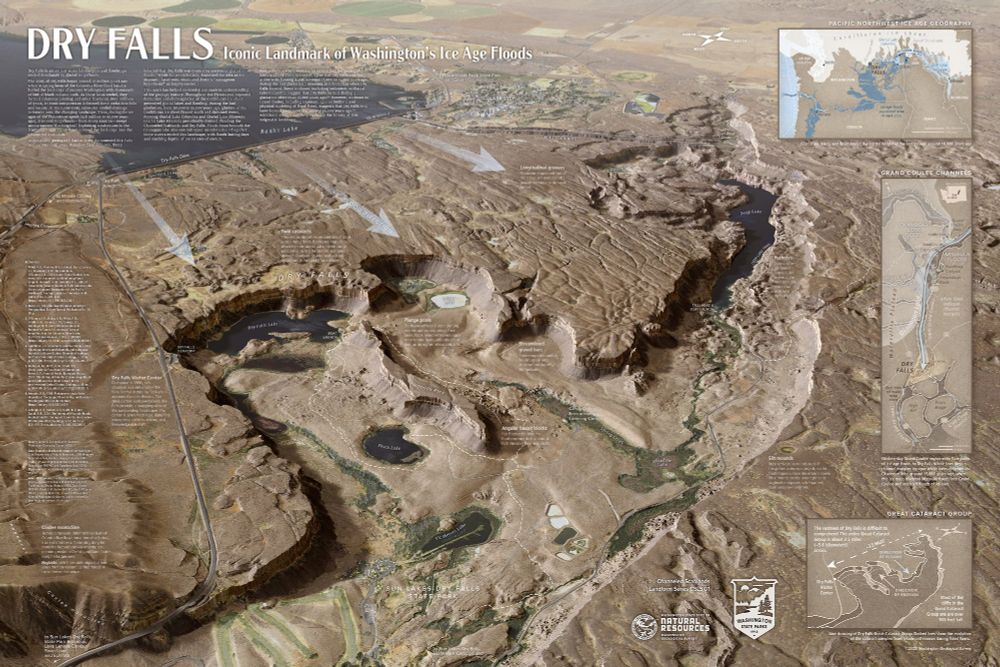
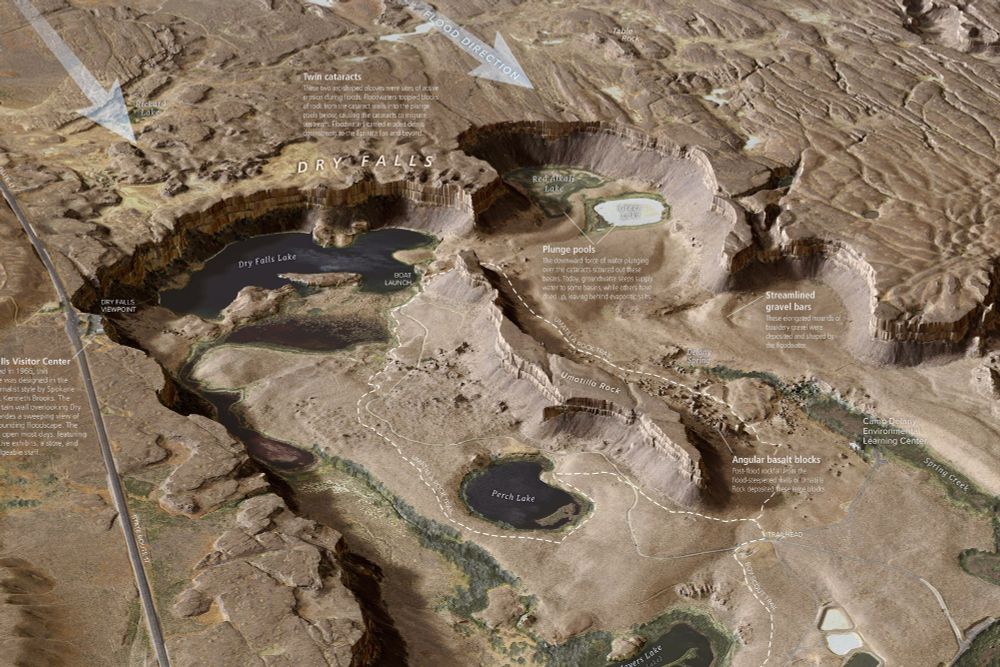
New, super-detailed Dry Falls interpretive map from the Washington Geological Survey. #iceagefloods #missoulafloods #channeledscablands #geomorphology washingtonstategeology.wordpress.com/2025/07/15/n...
July 23, 2025 at 4:26 AM
New, super-detailed Dry Falls interpretive map from the Washington Geological Survey. #iceagefloods #missoulafloods #channeledscablands #geomorphology washingtonstategeology.wordpress.com/2025/07/15/n...
@joelgombiner.bsky.social and I had a conversation with Nick Zentner yesterday about our upcoming WGS #DryFalls map. Looking for feedback before publishing. #iceagefloods #missoulafloods #geomorphology youtu.be/v01cycrCgno
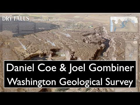
Daniel Coe & Joel Gombiner - Washington Geological Survey
YouTube video by Nick Zentner
youtu.be
May 29, 2025 at 4:15 PM
@joelgombiner.bsky.social and I had a conversation with Nick Zentner yesterday about our upcoming WGS #DryFalls map. Looking for feedback before publishing. #iceagefloods #missoulafloods #geomorphology youtu.be/v01cycrCgno
Reposted by Daniel Coe
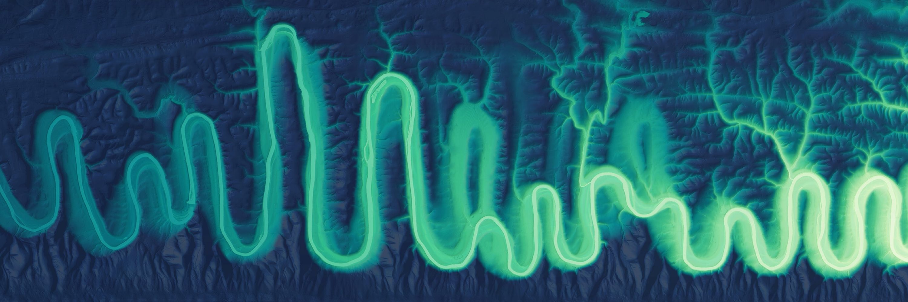
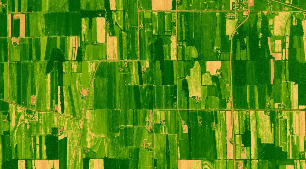
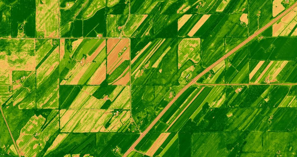
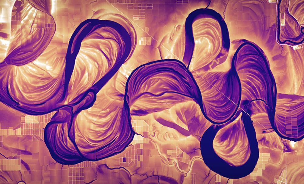
Drumlinized land use, shaded by NDVI. Fields with various degrees of vegetation greenness, oriented parallel to drumlin long axes reflecting two different ice flow directions across the Green Bay Lobe, southern Wisconsin.
April 3, 2025 at 1:07 AM
Drumlinized land use, shaded by NDVI. Fields with various degrees of vegetation greenness, oriented parallel to drumlin long axes reflecting two different ice flow directions across the Green Bay Lobe, southern Wisconsin.
Reposted by Daniel Coe

The Public Domain Image Archive is a newly launched “curated collection of more than 10,000 out-of-copyright historical images, free for all to explore and reuse”. Careful, you could lose some hours in here… [kottke.org]
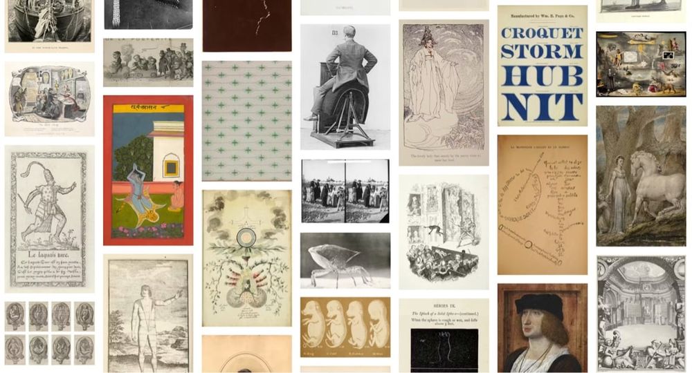
The Public Domain Image Archive
The Public Domain Review (a true gem of the web) has launched The Public Domain Image Archive, “a curated collection of more than 10,000 out-of-copyright historical images, free for all to explore and reuse”.
While Th
kottke.org
January 30, 2025 at 6:46 PM
The Public Domain Image Archive is a newly launched “curated collection of more than 10,000 out-of-copyright historical images, free for all to explore and reuse”. Careful, you could lose some hours in here… [kottke.org]
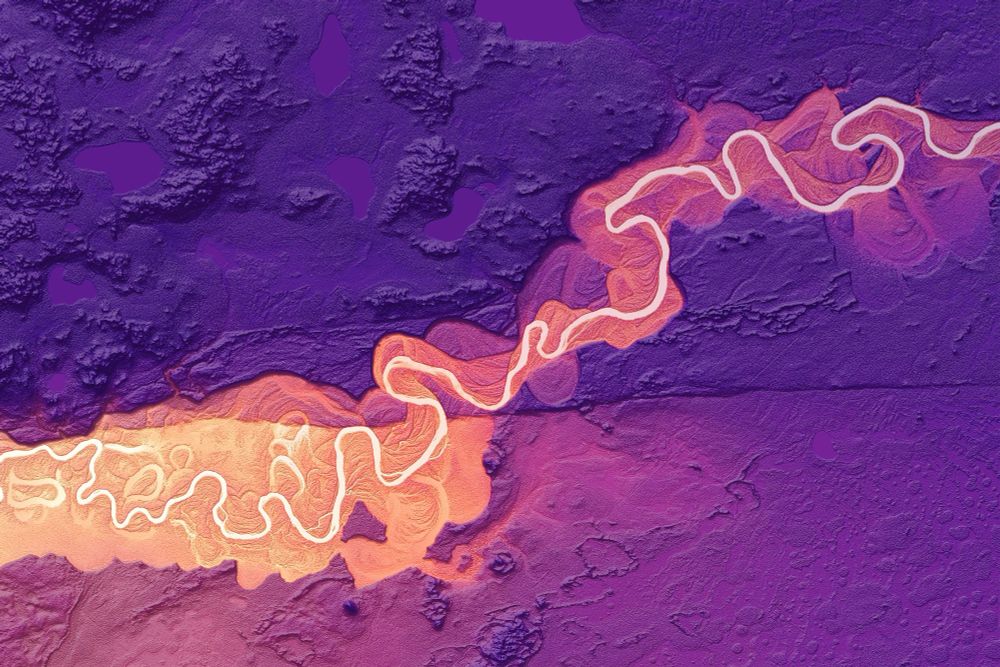
Castle Mountain Fault scarp cutting across the Little Susitna River about 50km north of Anchorage, #Alaska. #lidar #geomorphology #faultscarp
January 19, 2025 at 8:01 AM
Castle Mountain Fault scarp cutting across the Little Susitna River about 50km north of Anchorage, #Alaska. #lidar #geomorphology #faultscarp
Reposted by Daniel Coe

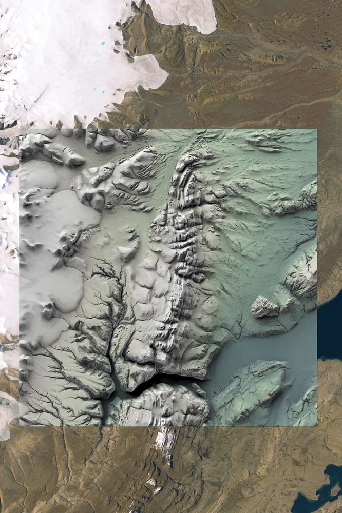
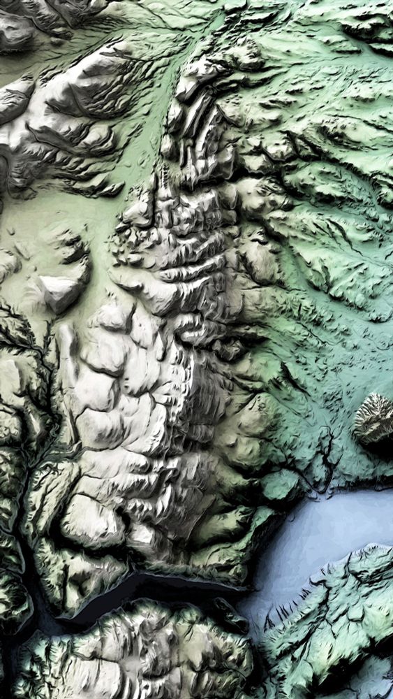
Just a regular reminder: the ArcticDEM is one of the most beautiful spatial datasets out there. I've been working on a large tile set for our #arctic abrupt thaw mapping activities recently and I can't help but stop and take a peek as the data rolls in.
December 30, 2024 at 4:55 PM
Just a regular reminder: the ArcticDEM is one of the most beautiful spatial datasets out there. I've been working on a large tile set for our #arctic abrupt thaw mapping activities recently and I can't help but stop and take a peek as the data rolls in.
Reposted by Daniel Coe

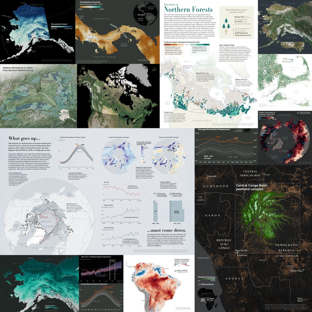
A few of the maps and graphics I made in 2024. What climate maps do you want to see next year?
December 31, 2024 at 6:45 PM
A few of the maps and graphics I made in 2024. What climate maps do you want to see next year?
Reposted by Daniel Coe

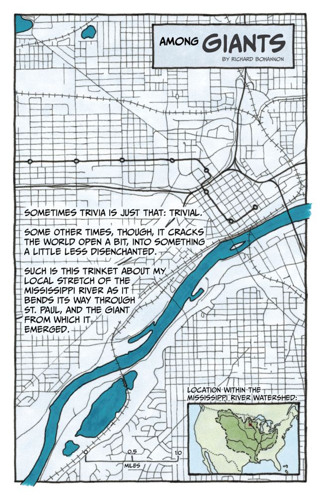
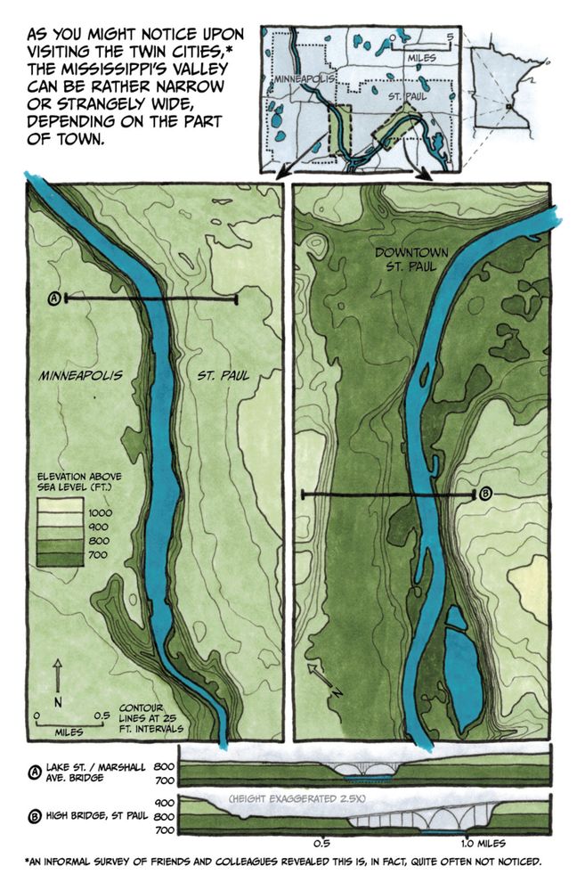
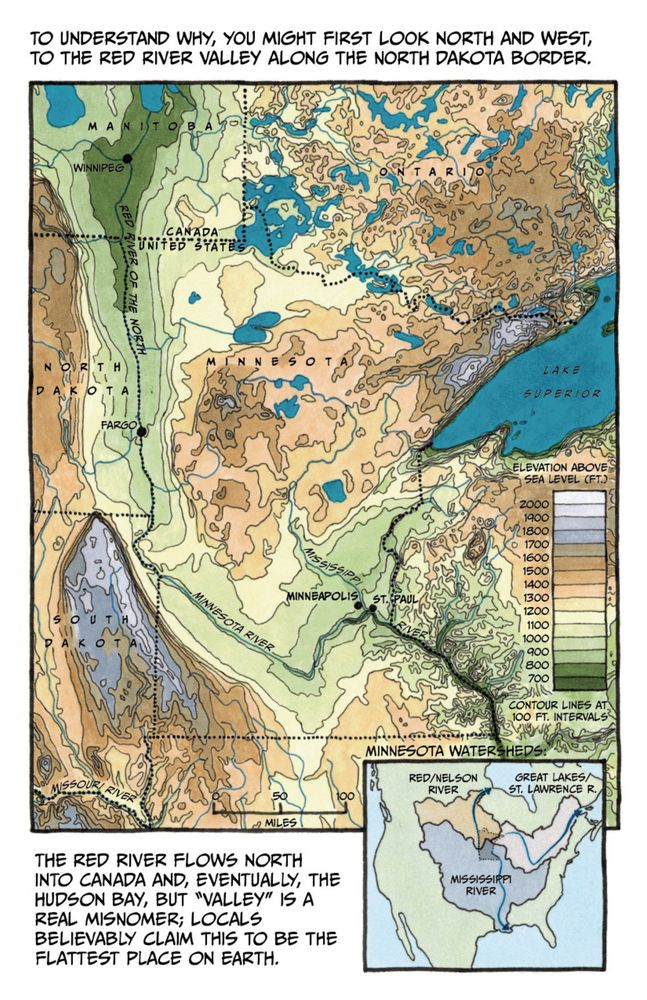
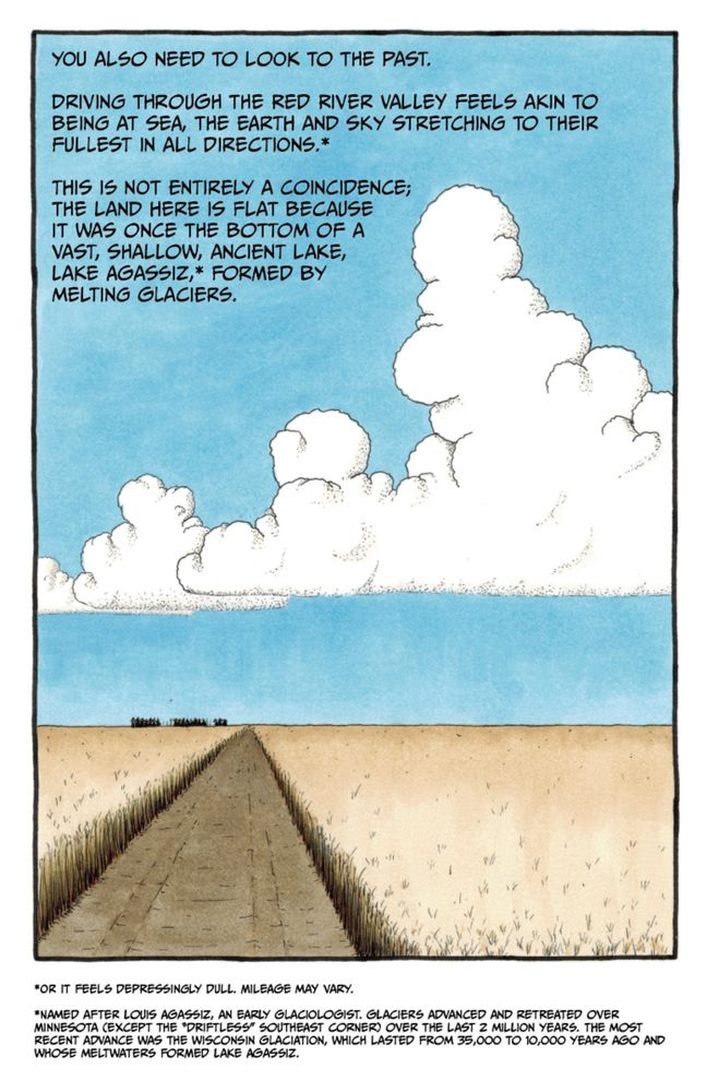
Among Giants: A Brief Hydrological History of the Upper Midwest: https://streets.mn/2024/12/20/among-giants-a-brief-hydrological-history-of-the-upper-midwest/
December 20, 2024 at 1:00 PM
Among Giants: A Brief Hydrological History of the Upper Midwest: https://streets.mn/2024/12/20/among-giants-a-brief-hydrological-history-of-the-upper-midwest/
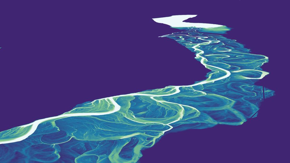
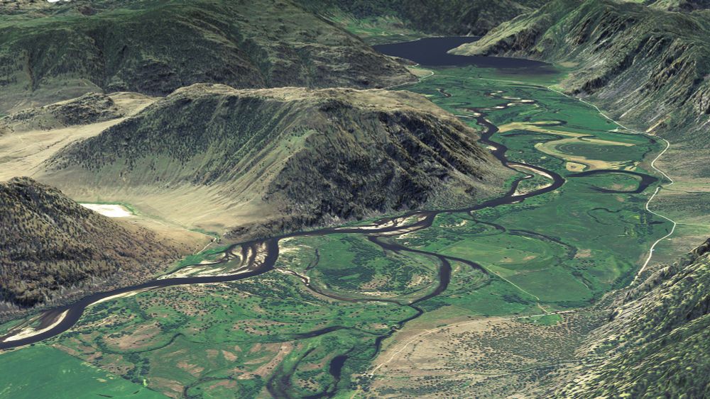
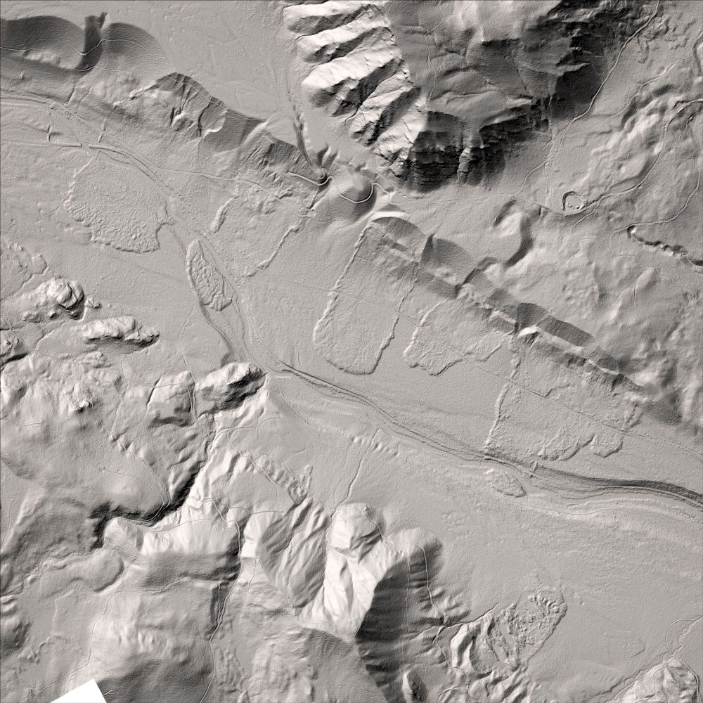
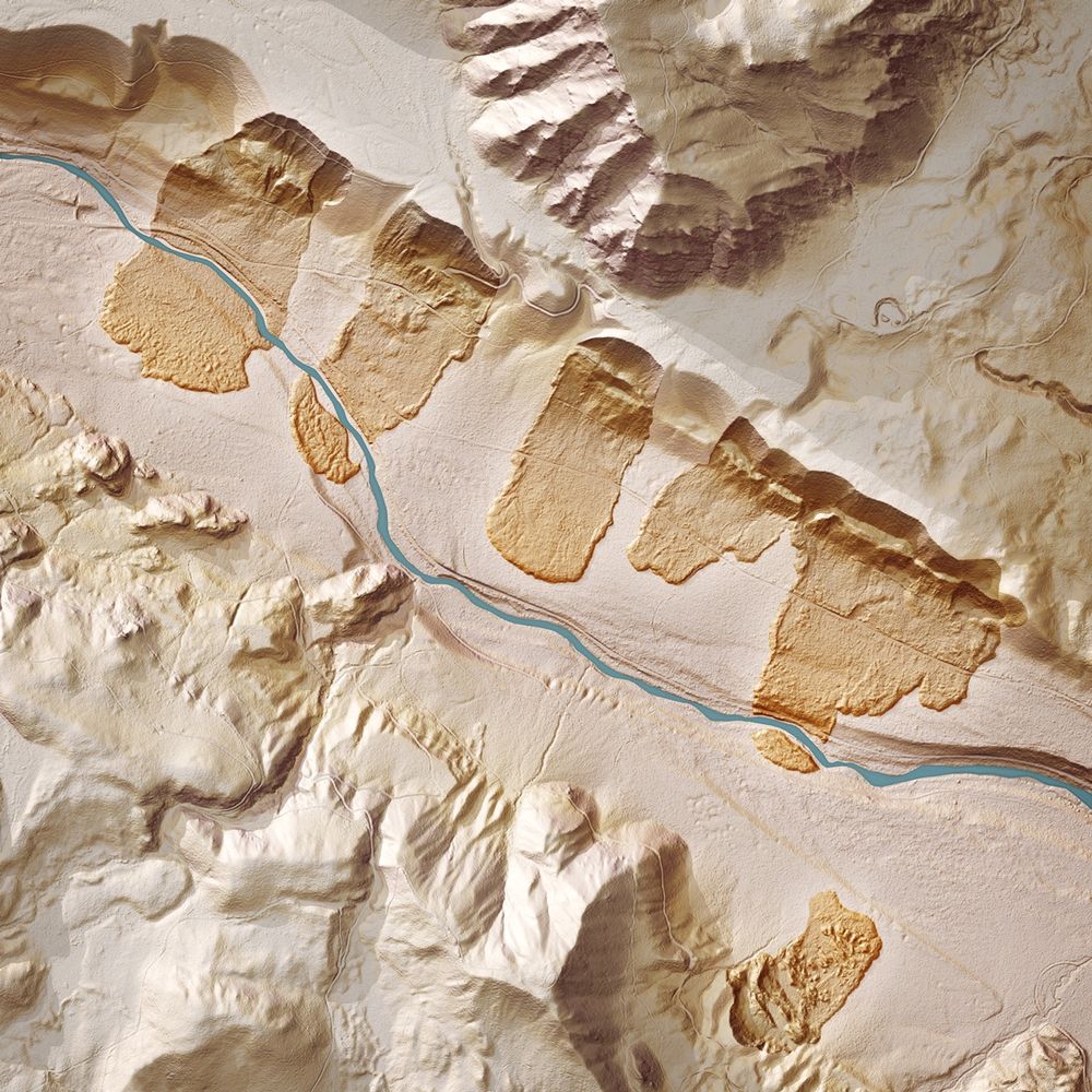
#Lidar relative elevation images and draped imagery of the Similkameen River #floodplain near the BC/WA border looking toward Little Chopaka Mtn and Palmer Lake. Made for the WA Geological Survey. #PNW #geography #geomorphology www.flickr.com/photos/wasta...
December 20, 2024 at 9:06 PM
#Lidar relative elevation images and draped imagery of the Similkameen River #floodplain near the BC/WA border looking toward Little Chopaka Mtn and Palmer Lake. Made for the WA Geological Survey. #PNW #geography #geomorphology www.flickr.com/photos/wasta...
Reposted by Daniel Coe

Here we go, a brief story of how I became the owner.of New England's oldest map store. youtu.be/wFI-lnikjJM?...
I Won a Map Store what happened next will shock you
YouTube video by Andrew Middleton
youtu.be
December 17, 2024 at 11:58 PM
Here we go, a brief story of how I became the owner.of New England's oldest map store. youtu.be/wFI-lnikjJM?...
Reposted by Daniel Coe

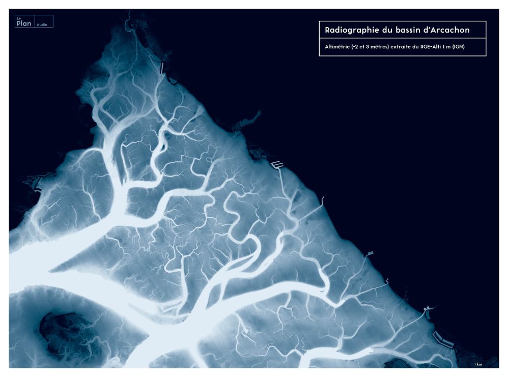
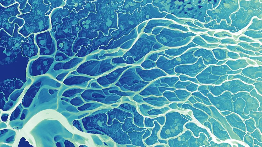
#30DayMapChallenge - Day 6 : Raster
"X-Ray of the Arcachon Bay" (France). DEM from IGN (RGE-Alti 1m)
"X-Ray of the Arcachon Bay" (France). DEM from IGN (RGE-Alti 1m)
November 6, 2024 at 7:03 AM
#30DayMapChallenge - Day 6 : Raster
"X-Ray of the Arcachon Bay" (France). DEM from IGN (RGE-Alti 1m)
"X-Ray of the Arcachon Bay" (France). DEM from IGN (RGE-Alti 1m)
Reposted by Daniel Coe

Hello! The Atlas of Design shows off some of the world’s most beautiful and intriguing cartographic design. Every two years, we publish a new volume of full-color maps, selected from worldwide competition and judged by an expert panel. Happy to be part of Bluesky!
#maps #cartography #books #design
#maps #cartography #books #design
December 9, 2024 at 7:13 PM
Hello! The Atlas of Design shows off some of the world’s most beautiful and intriguing cartographic design. Every two years, we publish a new volume of full-color maps, selected from worldwide competition and judged by an expert panel. Happy to be part of Bluesky!
#maps #cartography #books #design
#maps #cartography #books #design
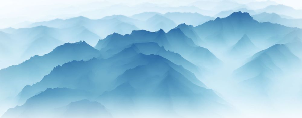
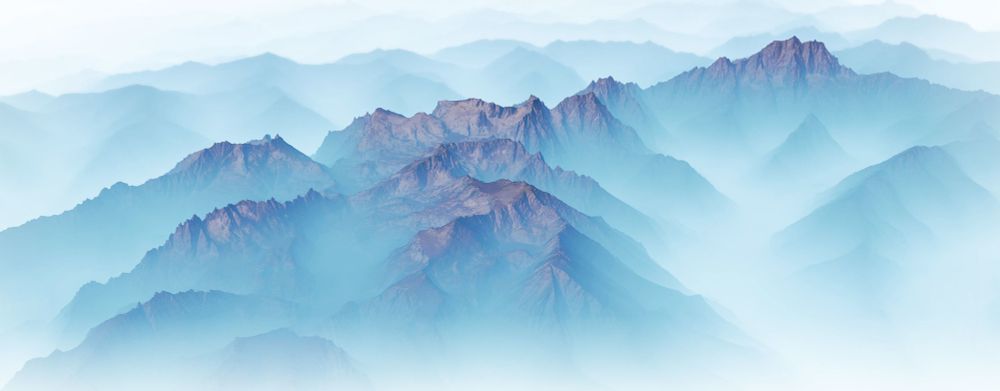
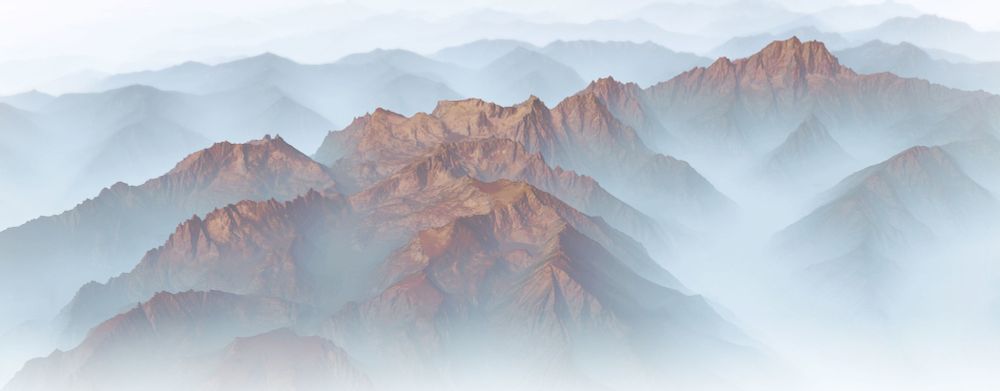
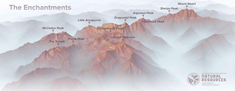
New #lidar images of the #Enchantments for the Washington Geological Survey. #PNW #Maps #CascadeRange
December 8, 2024 at 12:58 AM
New #lidar images of the #Enchantments for the Washington Geological Survey. #PNW #Maps #CascadeRange
Reposted by Daniel Coe

For @sciencenews.bsky.social: Trees and the fungi they depend on are being torn apart, a new study finds. As climates get warmer and drier, many trees should be migrating north—but some aren't.
That could be because their fungal friends can't make the journey.
www.sciencenews.org/article/clim...
That could be because their fungal friends can't make the journey.
www.sciencenews.org/article/clim...
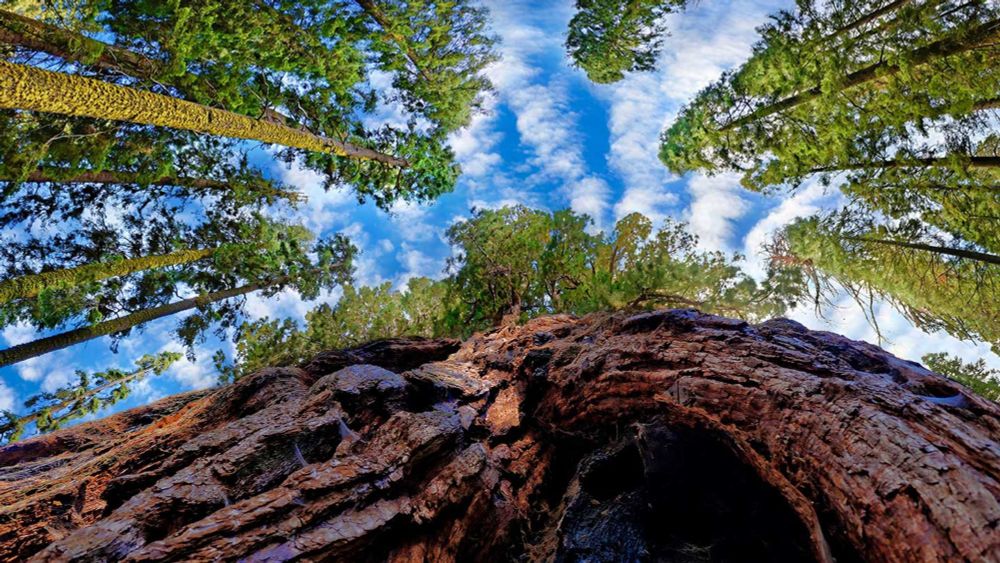
Why trees are failing to adapt to climate change
Certain fungi give trees nutrients and water, but heat and drought are putting both at risk.
www.sciencenews.org
December 6, 2024 at 5:28 PM
For @sciencenews.bsky.social: Trees and the fungi they depend on are being torn apart, a new study finds. As climates get warmer and drier, many trees should be migrating north—but some aren't.
That could be because their fungal friends can't make the journey.
www.sciencenews.org/article/clim...
That could be because their fungal friends can't make the journey.
www.sciencenews.org/article/clim...
Reposted by Daniel Coe

Also, my little online shop is but one of many cartography shops! @pinakographos.bsky.social and I recently launched mapartists.org with 30-something (and growing!) independent map sellers. Let your favorite cartographers cover all your gifting needs!

Independent Map Sellers
A shopping guide offered by the Independent Map Artists
mapartists.org
November 26, 2024 at 5:56 PM
Also, my little online shop is but one of many cartography shops! @pinakographos.bsky.social and I recently launched mapartists.org with 30-something (and growing!) independent map sellers. Let your favorite cartographers cover all your gifting needs!
Reposted by Daniel Coe

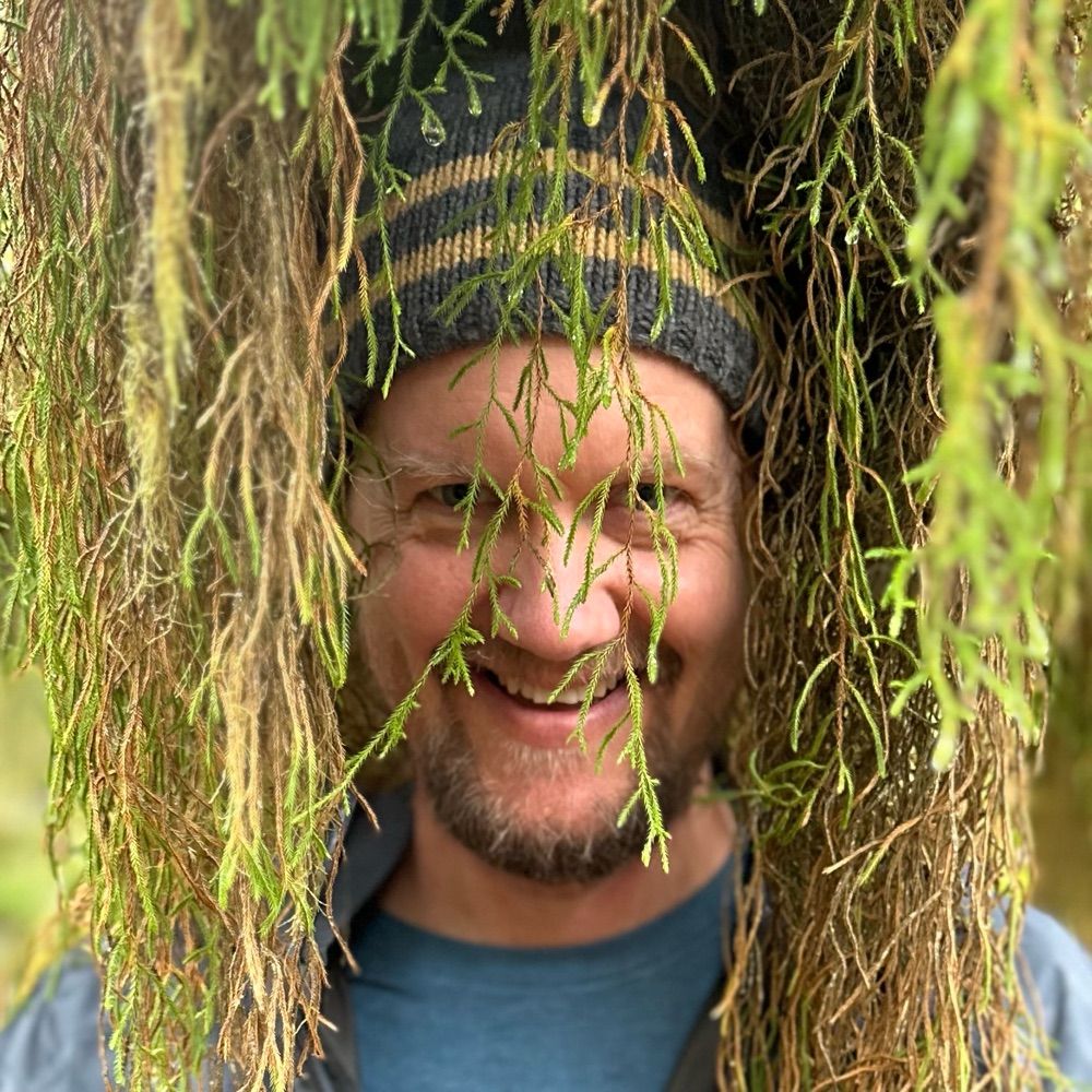
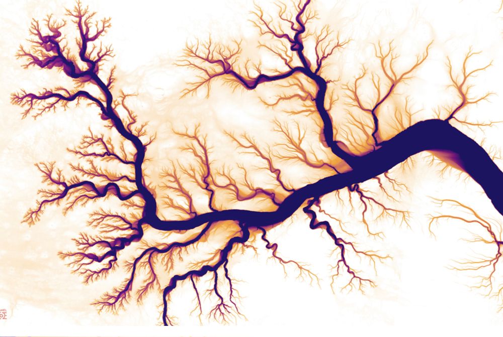
To say: my profile pic is a LiDAR image showing the river-ghosts—historical meanders—of the Lower Mississippi.
Water, wandering, wilfully.
It’s by Daniel Coe, who has deep-mapped the pasts of many rivers.
See more of his work at dancoecarto.com/work
& below.
What wild, wondrous beings rivers are.
Water, wandering, wilfully.
It’s by Daniel Coe, who has deep-mapped the pasts of many rivers.
See more of his work at dancoecarto.com/work
& below.
What wild, wondrous beings rivers are.

November 18, 2024 at 11:08 PM
To say: my profile pic is a LiDAR image showing the river-ghosts—historical meanders—of the Lower Mississippi.
Water, wandering, wilfully.
It’s by Daniel Coe, who has deep-mapped the pasts of many rivers.
See more of his work at dancoecarto.com/work
& below.
What wild, wondrous beings rivers are.
Water, wandering, wilfully.
It’s by Daniel Coe, who has deep-mapped the pasts of many rivers.
See more of his work at dancoecarto.com/work
& below.
What wild, wondrous beings rivers are.
Reposted by Daniel Coe
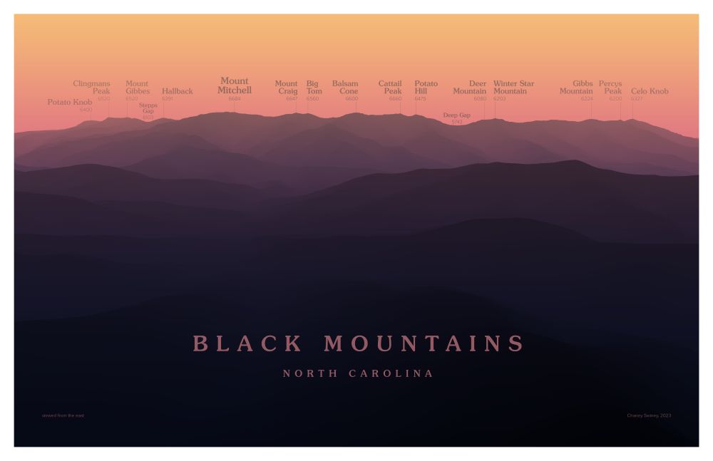
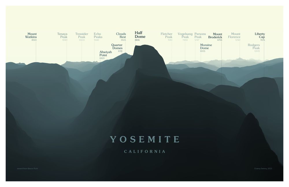
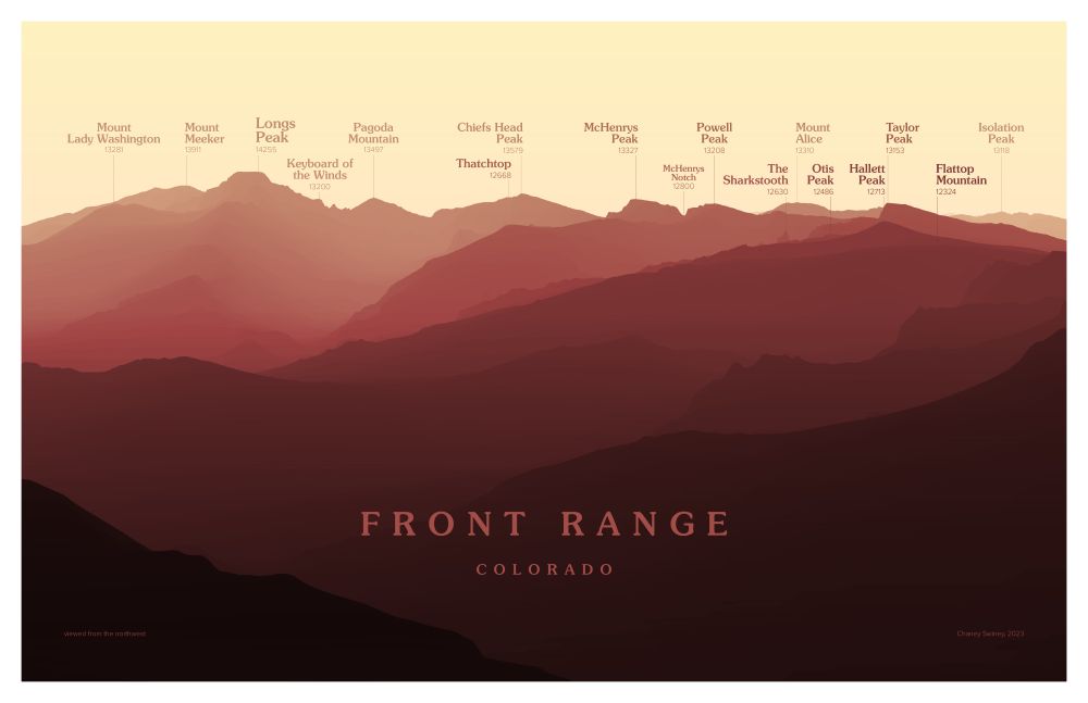
A favorite recent project: Peakscapes. I love the layered looks you get in the #mountains, and I always want to be able to name everything in view. These designs provide a cleaner, more idealized view of the landscape than a photo can.
Are they #maps? Or geographic art? I'm not sure.
Are they #maps? Or geographic art? I'm not sure.
December 5, 2024 at 3:48 PM
A favorite recent project: Peakscapes. I love the layered looks you get in the #mountains, and I always want to be able to name everything in view. These designs provide a cleaner, more idealized view of the landscape than a photo can.
Are they #maps? Or geographic art? I'm not sure.
Are they #maps? Or geographic art? I'm not sure.
Reposted by Daniel Coe

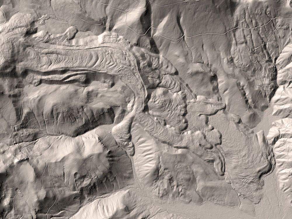
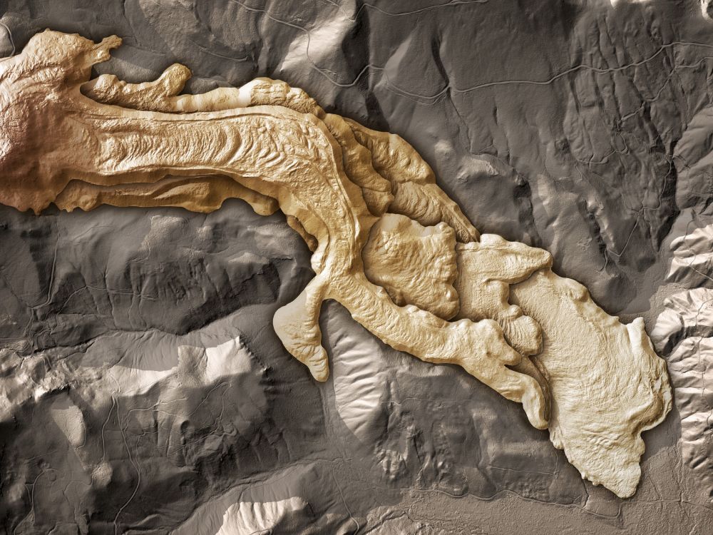
It’s amazing how one “simple” trick—color-coding landscape features in bare earth LIDAR data—can increase the readability of topography.
Image from the Washington Geological Survey (Washington State DNR)/Dan Coe
www.flickr.com/photos/wasta...
#dataviz 📊 #cartography🗺️
Image from the Washington Geological Survey (Washington State DNR)/Dan Coe
www.flickr.com/photos/wasta...
#dataviz 📊 #cartography🗺️
October 25, 2024 at 5:35 PM
It’s amazing how one “simple” trick—color-coding landscape features in bare earth LIDAR data—can increase the readability of topography.
Image from the Washington Geological Survey (Washington State DNR)/Dan Coe
www.flickr.com/photos/wasta...
#dataviz 📊 #cartography🗺️
Image from the Washington Geological Survey (Washington State DNR)/Dan Coe
www.flickr.com/photos/wasta...
#dataviz 📊 #cartography🗺️