

David Frantz
@dfrantz.bsky.social
Assistant Professor for Geoinformatics - Spatial Data Science at Trier University, Germany. Earth Observation. Remote Sensing. Geoinformatics. Data Science. Open Science.
Pinned
David Frantz
@dfrantz.bsky.social
· May 12

The application window for our English-taught MSc in Geoinformatics is now open! Join us in Trier to become an expert in 🌞 #remotesensing, 🛰️ #earthobservation and 🗺️ #GIS! www.uni-trier.de/en/studium/s...
Sascha Willmes from @unitrier.bsky.social just presented his work on sea ice lead detection using #sentinel3 SLSTR at #LPS25

June 27, 2025 at 10:04 AM
Sascha Willmes from @unitrier.bsky.social just presented his work on sea ice lead detection using #sentinel3 SLSTR at #LPS25

#FORCE_EO meets #LPS. Join us this afternoon for a gathering of developers, contributors and users. 17:45 - 19:00, 1st Floor, Foyer L3, Area 2. More info here: github.com/davidfrantz/...
June 25, 2025 at 7:59 AM
#FORCE_EO meets #LPS. Join us this afternoon for a gathering of developers, contributors and users. 17:45 - 19:00, 1st Floor, Foyer L3, Area 2. More info here: github.com/davidfrantz/...
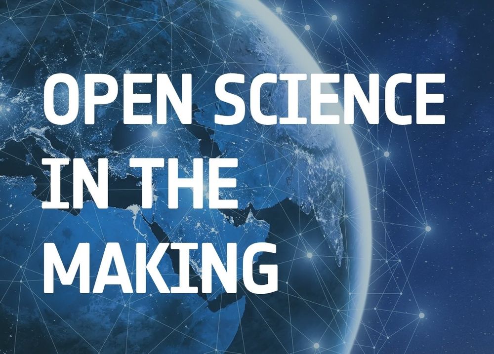
On my way to #LPS25 and looking forward to one week of condensed #earthobservation! Our team will present a broad portfolio of tree species unmixing, sea ice, land surface phenology, and human-made material mapping. Also come and chat with me during the open science in the making session - #FORCE_EO
June 22, 2025 at 3:06 PM
On my way to #LPS25 and looking forward to one week of condensed #earthobservation! Our team will present a broad portfolio of tree species unmixing, sea ice, land surface phenology, and human-made material mapping. Also come and chat with me during the open science in the making session - #FORCE_EO
The application window for our English-taught MSc in Geoinformatics is now open! Join us in Trier to become an expert in 🌞 #remotesensing, 🛰️ #earthobservation and 🗺️ #GIS! www.uni-trier.de/en/studium/s...
May 12, 2025 at 12:44 PM
The application window for our English-taught MSc in Geoinformatics is now open! Join us in Trier to become an expert in 🌞 #remotesensing, 🛰️ #earthobservation and 🗺️ #GIS! www.uni-trier.de/en/studium/s...
Reposted by David Frantz

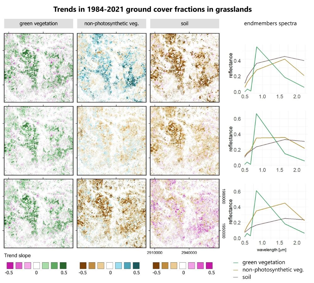
📣In our new paper we analyzed the impact of #Landsat and #Sentinel-2 🛰️ #satellite data density and SMA endmembers on trends in #grasslands ground cover:
- for monthly composites data density is irrelevant
- correct endmember definitions are critical‼️
Check out the full paper tinyurl.com/wha6pzax
- for monthly composites data density is irrelevant
- correct endmember definitions are critical‼️
Check out the full paper tinyurl.com/wha6pzax
April 4, 2025 at 1:05 PM
📣In our new paper we analyzed the impact of #Landsat and #Sentinel-2 🛰️ #satellite data density and SMA endmembers on trends in #grasslands ground cover:
- for monthly composites data density is irrelevant
- correct endmember definitions are critical‼️
Check out the full paper tinyurl.com/wha6pzax
- for monthly composites data density is irrelevant
- correct endmember definitions are critical‼️
Check out the full paper tinyurl.com/wha6pzax
🚨 Fresh off the press in #RSE: D. Klehr's first #PhD chapter 🎉 presents a new approach to surpass classification of tree species for large areas 🛰️🌳🌲. We pair #Sentinel2 #EarthObservation with #ANN #AI models to predict sub-pixel tree species! #OpenAccess: www.sciencedirect.com/science/arti...

April 7, 2025 at 1:38 PM
🚨 Fresh off the press in #RSE: D. Klehr's first #PhD chapter 🎉 presents a new approach to surpass classification of tree species for large areas 🛰️🌳🌲. We pair #Sentinel2 #EarthObservation with #ANN #AI models to predict sub-pixel tree species! #OpenAccess: www.sciencedirect.com/science/arti...
Reposted by David Frantz

👉 👉 👉 We're hiring! Seeking a NASA-funded postdoc/PhD candidate to use #RemoteSensing and #machinelearning, particularly #deeplearning to study disaster impacts on #AgriculturalLand. Please share! www.senslandlab.com/opportunitie...

Opportunities
Kent State Campus. Credit: KSU
www.senslandlab.com
February 20, 2025 at 4:07 PM
👉 👉 👉 We're hiring! Seeking a NASA-funded postdoc/PhD candidate to use #RemoteSensing and #machinelearning, particularly #deeplearning to study disaster impacts on #AgriculturalLand. Please share! www.senslandlab.com/opportunitie...
Reposted by David Frantz
📣PNAS piece led by @philrufin.bsky.social: commercial very-high-resolution EO data is needed for monitoring SDG 2 indicators in smallholder landscapes but costs are prohibitive. A call for open access for sustainability-centered research: doi.org/10.1073/pnas... @humboldtuni.bsky.social
February 13, 2025 at 9:28 AM
📣PNAS piece led by @philrufin.bsky.social: commercial very-high-resolution EO data is needed for monitoring SDG 2 indicators in smallholder landscapes but costs are prohibitive. A call for open access for sustainability-centered research: doi.org/10.1073/pnas... @humboldtuni.bsky.social
Reposted by David Frantz
📣 New in Remote Sensing of Environment!
PhD candidate @lasseharkort.bsky.social and team introduce a novel Phenological Feature Space (PFS) approach for mapping fractional vegetation cover in Sub-Saharan rangelands using Sentinel-2 time series. 🛰️
🔗 doi.org/10.1016/j.rs...
PhD candidate @lasseharkort.bsky.social and team introduce a novel Phenological Feature Space (PFS) approach for mapping fractional vegetation cover in Sub-Saharan rangelands using Sentinel-2 time series. 🛰️
🔗 doi.org/10.1016/j.rs...

February 13, 2025 at 3:47 PM
📣 New in Remote Sensing of Environment!
PhD candidate @lasseharkort.bsky.social and team introduce a novel Phenological Feature Space (PFS) approach for mapping fractional vegetation cover in Sub-Saharan rangelands using Sentinel-2 time series. 🛰️
🔗 doi.org/10.1016/j.rs...
PhD candidate @lasseharkort.bsky.social and team introduce a novel Phenological Feature Space (PFS) approach for mapping fractional vegetation cover in Sub-Saharan rangelands using Sentinel-2 time series. 🛰️
🔗 doi.org/10.1016/j.rs...
Excellent to have you here! I joined 2mo ago, and so far it has been great :)
Return of the good times: the Earth Observation Lab of @humboldtuni.bsky.social has joined Bluesky: Follow @humboldteolab.bsky.social for all things terrestrial remote sensing and geospatial at large!

February 12, 2025 at 7:04 PM
Excellent to have you here! I joined 2mo ago, and so far it has been great :)
One week left to apply!
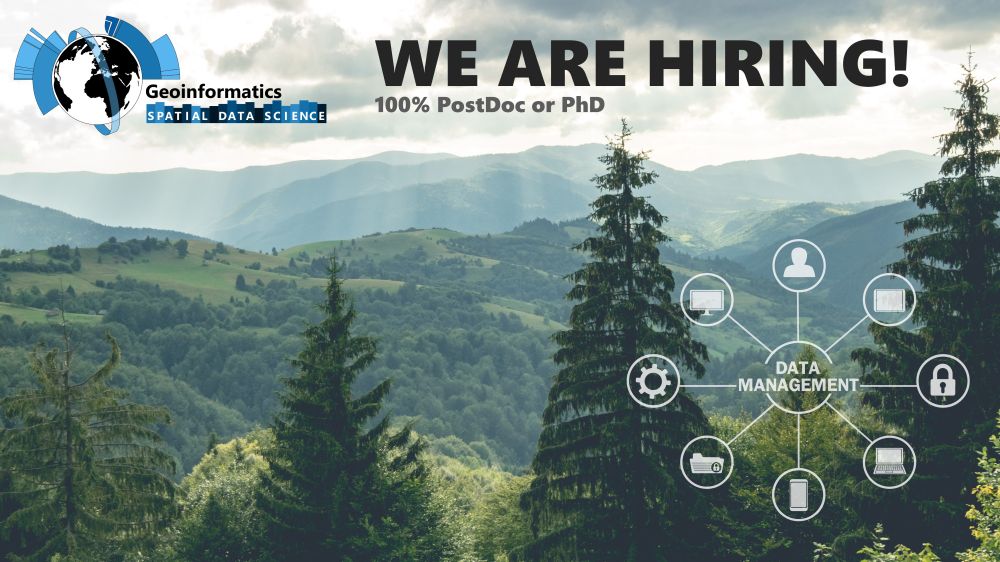
💼Job Alert: I am hiring a PostDoc/PhD (100%, 3yrs) to develop and orchestrate cloud-based workflows within a project that will create a forest information system 🌳 for Germany based on #sentinel2 🛰️ and #als ✈️. tinyurl.com/4hw426vw #RemoteSensing #EarthObservation @unitrier.bsky.social @thuenen.de
January 31, 2025 at 7:44 PM
One week left to apply!
Reposted by David Frantz
I'm so happy and proud of this decision 🙂. It is very important now to use the data, and compare the performances obtained with 2 and 3 satellites in your future communications. It will be the good way to thank @esa.int and #Copernicus.
Some more good news for the Sentinel-2 mission!
Sentinel-2A, which recently retired, has been given a temporary extension, where it will support S2B and S2C to provide additional data.
Lots of hard work behind the scenes to make this happen. Glad to see it!
sentinels.copernicus.eu/web/sentinel...
Sentinel-2A, which recently retired, has been given a temporary extension, where it will support S2B and S2C to provide additional data.
Lots of hard work behind the scenes to make this happen. Glad to see it!
sentinels.copernicus.eu/web/sentinel...

Sentinel-2A: Exceptional temporary extension campaign starting in March 2025 - Sentinel Online
sentinels.copernicus.eu
January 27, 2025 at 4:57 PM
I'm so happy and proud of this decision 🙂. It is very important now to use the data, and compare the performances obtained with 2 and 3 satellites in your future communications. It will be the good way to thank @esa.int and #Copernicus.
💼Job Alert: I am hiring a PostDoc/PhD (100%, 3yrs) to develop and orchestrate cloud-based workflows within a project that will create a forest information system 🌳 for Germany based on #sentinel2 🛰️ and #als ✈️. tinyurl.com/4hw426vw #RemoteSensing #EarthObservation @unitrier.bsky.social @thuenen.de
January 15, 2025 at 12:28 PM
💼Job Alert: I am hiring a PostDoc/PhD (100%, 3yrs) to develop and orchestrate cloud-based workflows within a project that will create a forest information system 🌳 for Germany based on #sentinel2 🛰️ and #als ✈️. tinyurl.com/4hw426vw #RemoteSensing #EarthObservation @unitrier.bsky.social @thuenen.de
Reposted by David Frantz
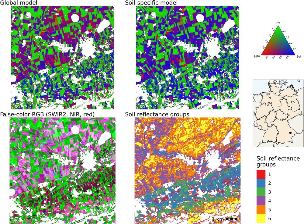
Happy to share our new paper on soil-specific unmixing of croplands in Germany led by Felix Lobert.
We adapted @katjakowalski.bsky.social’s approach using #Landsat and #Sentinel-2 🛰️ to account for soil variability using a soil reflectance composite developed at @thuenen.de EO:
tinyurl.com/5n92ae5z
We adapted @katjakowalski.bsky.social’s approach using #Landsat and #Sentinel-2 🛰️ to account for soil variability using a soil reflectance composite developed at @thuenen.de EO:
tinyurl.com/5n92ae5z
January 13, 2025 at 9:54 AM
Happy to share our new paper on soil-specific unmixing of croplands in Germany led by Felix Lobert.
We adapted @katjakowalski.bsky.social’s approach using #Landsat and #Sentinel-2 🛰️ to account for soil variability using a soil reflectance composite developed at @thuenen.de EO:
tinyurl.com/5n92ae5z
We adapted @katjakowalski.bsky.social’s approach using #Landsat and #Sentinel-2 🛰️ to account for soil variability using a soil reflectance composite developed at @thuenen.de EO:
tinyurl.com/5n92ae5z
Reposted by David Frantz

🎥 How do we study forests using satellite and laser data? Here's a overview by our Prof. Cornelius Senf (@corneliussenf.bsky.social) in a short video produced by @daadworldwide.bsky.social (with English subs):
www.youtube.com/watch?si=KPm...
www.youtube.com/watch?si=KPm...

Satelliten und Laser in der Waldforschung – Prof. Dr. Cornelius Senf zu seiner Forschung
YouTube video by DAAD Worldwide
www.youtube.com
January 8, 2025 at 5:20 PM
🎥 How do we study forests using satellite and laser data? Here's a overview by our Prof. Cornelius Senf (@corneliussenf.bsky.social) in a short video produced by @daadworldwide.bsky.social (with English subs):
www.youtube.com/watch?si=KPm...
www.youtube.com/watch?si=KPm...

December 20, 2024 at 11:01 AM
We just got word for being funded 🎅🎉 The next 3 years, we will work with @thuenen.de and other partners to develop a web-based forest information system 🌲🌳 for Germany 🇩🇪based on 🛰️ #sentinel2 and 🛩️ #als. We will put out a job offering soon! Keep your eyes open here on bluesky for updates (⬆️ follow)
December 19, 2024 at 5:07 PM
We just got word for being funded 🎅🎉 The next 3 years, we will work with @thuenen.de and other partners to develop a web-based forest information system 🌲🌳 for Germany 🇩🇪based on 🛰️ #sentinel2 and 🛩️ #als. We will put out a job offering soon! Keep your eyes open here on bluesky for updates (⬆️ follow)
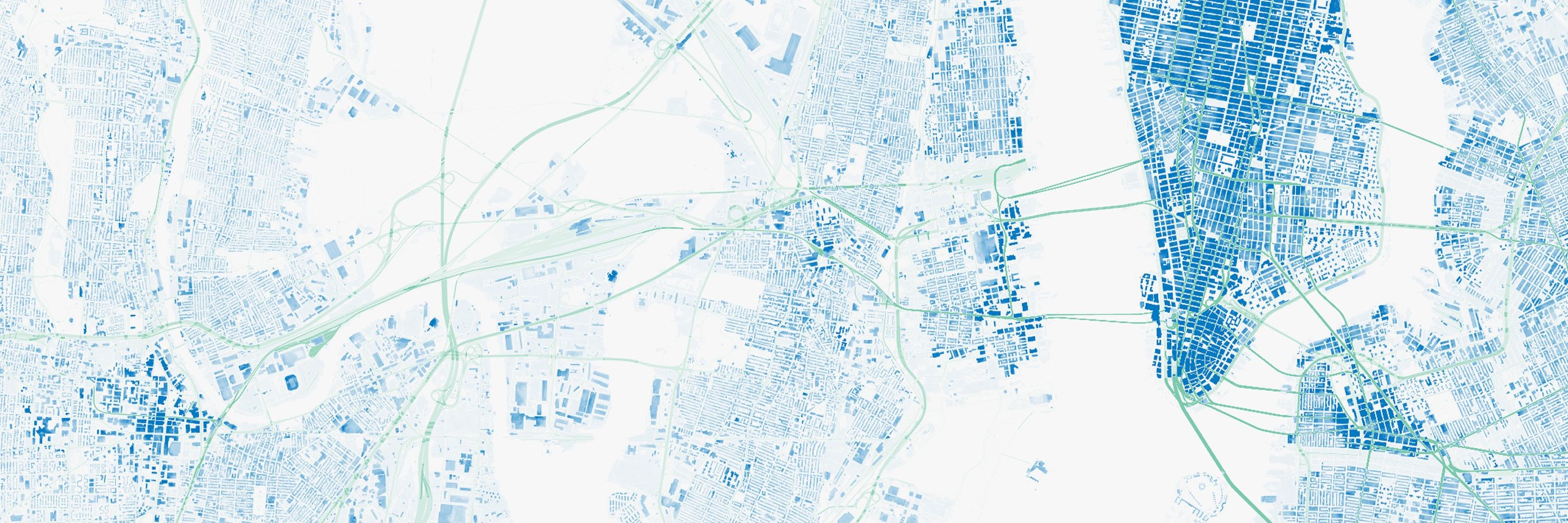
📢Our research on mapping societal material stocks 🏡🚗 is now featured on the #CDSE page as a use case! #sentinel1 #sentinel2 dataspace.copernicus.eu/cases/nation...

December 11, 2024 at 1:42 PM
📢Our research on mapping societal material stocks 🏡🚗 is now featured on the #CDSE page as a use case! #sentinel1 #sentinel2 dataspace.copernicus.eu/cases/nation...
Reposted by David Frantz

Fresh from the press: We map material stocks (concrete, steel, glass, bricks, etc.) in buildings world-wide. Maps are at 90m spatial resolution. Huge progress over previous results thanks to an excellent collaboration with German Aerospace.
onlinelibrary.wiley.com/doi/10.1111/...
onlinelibrary.wiley.com/doi/10.1111/...

Weighing the global built environment: High‐resolution mapping and quantification of material stocks in buildings
Buildings provide indispensable services for human well-being, but their construction and use are responsible for a substantial fraction of societies’ resource requirements and greenhouse gas emissio...
onlinelibrary.wiley.com
December 10, 2024 at 11:13 AM
Fresh from the press: We map material stocks (concrete, steel, glass, bricks, etc.) in buildings world-wide. Maps are at 90m spatial resolution. Huge progress over previous results thanks to an excellent collaboration with German Aerospace.
onlinelibrary.wiley.com/doi/10.1111/...
onlinelibrary.wiley.com/doi/10.1111/...
📢Our research on mapping societal material stocks 🏡🚗 is now featured on the #CDSE page as a use case! #sentinel1 #sentinel2 https://dataspace.copernicus.eu/cases/national-scale-mapping-societal-material-stocks-using-copernicus-data @BOKU_SEC

December 19, 2024 at 9:59 PM
📢Our research on mapping societal material stocks 🏡🚗 is now featured on the #CDSE page as a use case! #sentinel1 #sentinel2 https://dataspace.copernicus.eu/cases/national-scale-mapping-societal-material-stocks-using-copernicus-data @BOKU_SEC
🛰️🍷🌱🇩🇪 Are you interested in a fully-funded PhD position in #uav #remotesensing for health assessment of #vineyards for #precision #agriculture and #harvest #optimization? Apply here @TrierUni:
https://www.uni-trier.de/fileadmin/organisation/ABT3/Stellen_WissMitarbeiter/a55_24_WissMA_FB_VI_Umwelt...
https://www.uni-trier.de/fileadmin/organisation/ABT3/Stellen_WissMitarbeiter/a55_24_WissMA_FB_VI_Umwelt...

December 19, 2024 at 9:59 PM
🛰️🍷🌱🇩🇪 Are you interested in a fully-funded PhD position in #uav #remotesensing for health assessment of #vineyards for #precision #agriculture and #harvest #optimization? Apply here @TrierUni:
https://www.uni-trier.de/fileadmin/organisation/ABT3/Stellen_WissMitarbeiter/a55_24_WissMA_FB_VI_Umwelt...
https://www.uni-trier.de/fileadmin/organisation/ABT3/Stellen_WissMitarbeiter/a55_24_WissMA_FB_VI_Umwelt...
How can #Sentinel2 satellite data enhance large-scale forest fire risk maps for locally adaptive management? The #BrandSat project by @TrierUni and @HumboldtUni's @HumboldtEOLab explores this crucial issue. #ForestFireRisk #RemoteSensing #ClimateAction
https://tinyurl.com/2s48st85
https://tinyurl.com/2s48st85

December 19, 2024 at 9:59 PM
How can #Sentinel2 satellite data enhance large-scale forest fire risk maps for locally adaptive management? The #BrandSat project by @TrierUni and @HumboldtUni's @HumboldtEOLab explores this crucial issue. #ForestFireRisk #RemoteSensing #ClimateAction
https://tinyurl.com/2s48st85
https://tinyurl.com/2s48st85
What is the fastest way to get global #sentinel2 metadata from CDSE? I am currently struggling with pages and item limits. All, and @azlinszky, do you have some suggestions?
December 19, 2024 at 9:59 PM
What is the fastest way to get global #sentinel2 metadata from CDSE? I am currently struggling with pages and item limits. All, and @azlinszky, do you have some suggestions?