


Tyler Morgan-Wall
@tylermw.com
R, data science, dataviz, maps, experimental design, raytracing. Developer of rayshader, rayrender, and the rayverse | PhD in Physics from Johns Hopkins | Penn
Pinned
Tyler Morgan-Wall
@tylermw.com
· Nov 8
Hi all! A (re)-introduction: I'm Tyler, developer of #rayshader and the #rayverse, a collection of R packages for 3D #dataviz and #mapping.
Here's one of my greatest hits (now that Bluesky supports videos!): The Earth's submarine fiber optic cable network, visualized in #RStats with #rayrender.
Here's one of my greatest hits (now that Bluesky supports videos!): The Earth's submarine fiber optic cable network, visualized in #RStats with #rayrender.
I also found it interesting how much of content from the surrounding clusters has made it into my feed--treating this 2D projection as a distance metric to "regularly served content on algorithmic feeds" seems pretty accurate in my case!
February 9, 2026 at 2:02 PM
I also found it interesting how much of content from the surrounding clusters has made it into my feed--treating this 2D projection as a distance metric to "regularly served content on algorithmic feeds" seems pretty accurate in my case!
Obviously I'm in the #RStats cluster, but my favorite find is the small fungi enthusiast cluster (unlabeled but annotated here), which seems to have naturally formed a fairy ring (en.wikipedia.org/wiki/Fairy_r...) around its members. Beautiful.

February 9, 2026 at 2:02 PM
Obviously I'm in the #RStats cluster, but my favorite find is the small fungi enthusiast cluster (unlabeled but annotated here), which seems to have naturally formed a fairy ring (en.wikipedia.org/wiki/Fairy_r...) around its members. Beautiful.
Reposted by Tyler Morgan-Wall

February 8, 2026 at 10:31 PM
Reposted by Tyler Morgan-Wall

"Animated Bokeh" has been on my whiteboard for a long time, and this is the result.
I thought it would just be for cheesy novelty effects, but it also does lightfield manipulation that was cooler than I expected.
www.youtube.com/watch?v=Kg_2...
I thought it would just be for cheesy novelty effects, but it also does lightfield manipulation that was cooler than I expected.
www.youtube.com/watch?v=Kg_2...

Digital Iris
YouTube video by Ancient
www.youtube.com
February 7, 2026 at 5:35 PM
"Animated Bokeh" has been on my whiteboard for a long time, and this is the result.
I thought it would just be for cheesy novelty effects, but it also does lightfield manipulation that was cooler than I expected.
www.youtube.com/watch?v=Kg_2...
I thought it would just be for cheesy novelty effects, but it also does lightfield manipulation that was cooler than I expected.
www.youtube.com/watch?v=Kg_2...
Reposted by Tyler Morgan-Wall

February 7, 2026 at 9:12 PM
Reposted by Tyler Morgan-Wall
The Ganges–Brahmaputra basin. Have another version that includes even more rivers but that's taking forever.
#rayshader adventures, an #rstats tale
#rayshader adventures, an #rstats tale

February 6, 2026 at 6:06 PM
The Ganges–Brahmaputra basin. Have another version that includes even more rivers but that's taking forever.
#rayshader adventures, an #rstats tale
#rayshader adventures, an #rstats tale
Reposted by Tyler Morgan-Wall

Nice, figured out how to fetch some Arctic DEM data, fill in the gaps with Copernicus GLO-30, run it through rio-tiler, and connect a WebGPU viewer with some basic level of detail refinement.

February 6, 2026 at 5:28 PM
Nice, figured out how to fetch some Arctic DEM data, fill in the gaps with Copernicus GLO-30, run it through rio-tiler, and connect a WebGPU viewer with some basic level of detail refinement.
Reposted by Tyler Morgan-Wall
The Amazon basin. Been wanting to do this for a while and finally managed to fix the errors I was getting.
I rather like how it turned out.
#rayshader adventures, an #rstats tale
I rather like how it turned out.
#rayshader adventures, an #rstats tale

February 6, 2026 at 12:22 AM
The Amazon basin. Been wanting to do this for a while and finally managed to fix the errors I was getting.
I rather like how it turned out.
#rayshader adventures, an #rstats tale
I rather like how it turned out.
#rayshader adventures, an #rstats tale
Reposted by Tyler Morgan-Wall

February 4, 2026 at 8:46 PM
Question: Is there an option/configuration setting to run jarl on file save (like `air format`) and automatically fix selected rules specified in jarl.toml?
February 5, 2026 at 3:14 PM
Question: Is there an option/configuration setting to run jarl on file save (like `air format`) and automatically fix selected rules specified in jarl.toml?
#rstats I'm very happy to announce Jarl 0.4.0!
Jarl is a very fast R linter, written in Rust. This release brings lots of improvements and fixes.
See the blog post: www.etiennebacher.com/posts/2026-0...
And the full changelog: jarl.etiennebacher.com/changelog
🧵 to highlight some features below
Jarl is a very fast R linter, written in Rust. This release brings lots of improvements and fixes.
See the blog post: www.etiennebacher.com/posts/2026-0...
And the full changelog: jarl.etiennebacher.com/changelog
🧵 to highlight some features below
Etienne Bacher: Jarl 0.4.0
Find unreachable code, ignore diagnostics, show summary statistics of diagnostics,
and more.
www.etiennebacher.com
February 5, 2026 at 3:05 PM
That was fast! Nice work, @etiennebacher.bsky.social!

February 5, 2026 at 3:04 PM
That was fast! Nice work, @etiennebacher.bsky.social!
I can't tell you how many future borked overnight simulations this will un-ruin for me
February 4, 2026 at 8:18 PM
I can't tell you how many future borked overnight simulations this will un-ruin for me
Reposted by Tyler Morgan-Wall

It will make it in the update:

February 4, 2026 at 7:47 PM
It will make it in the update:
My emotional journey reading about `filter_out()`
😀
...
🤔
...
🤨
...
😰
> filter_in = dplyr::filter
😌
😀
...
🤔
...
🤨
...
😰
> filter_in = dplyr::filter
😌
February 4, 2026 at 6:59 PM
My emotional journey reading about `filter_out()`
😀
...
🤔
...
🤨
...
😰
> filter_in = dplyr::filter
😌
😀
...
🤔
...
🤨
...
😰
> filter_in = dplyr::filter
😌
Nice! I just installed jarl for the first time. Looking forward to the update
February 4, 2026 at 6:50 PM
Nice! I just installed jarl for the first time. Looking forward to the update
Oh, I figured it wasn't a voluntary choice.
I'm hopeful that macOS 26 is the last gasp of the Alan Dye era (daringfireball.net/2025/12/bad_...), and that Stephen Lemay (a career UI person) can right the course.
I'm hopeful that macOS 26 is the last gasp of the Alan Dye era (daringfireball.net/2025/12/bad_...), and that Stephen Lemay (a career UI person) can right the course.

Bad Dye Job
It might have made some sense to bring someone from the fashion/brand world to lead software design for Apple Watch, but it sure didn’t seem to make sense for the rest of Apple’s platforms. And the de...
daringfireball.net
February 4, 2026 at 6:41 PM
Oh, I figured it wasn't a voluntary choice.
I'm hopeful that macOS 26 is the last gasp of the Alan Dye era (daringfireball.net/2025/12/bad_...), and that Stephen Lemay (a career UI person) can right the course.
I'm hopeful that macOS 26 is the last gasp of the Alan Dye era (daringfireball.net/2025/12/bad_...), and that Stephen Lemay (a career UI person) can right the course.
After I read the blog post linked below I decided I wouldn't be updating to any variant of 26 or beyond until Apple got their s*** together.
bsky.app/profile/tyle...
bsky.app/profile/tyle...
This blog post on the proliferation of icons in macOS Tahoe makes the decision clear: I'm never updating to this cluttered mess. Where did your aesthetic taste go, Apple? Yuck. 🤮
Left: Macintosh Human Interface Guidelines
Right: macOS Tahoe
Read the post:
tonsky.me/blog/tahoe-i...
Left: Macintosh Human Interface Guidelines
Right: macOS Tahoe
Read the post:
tonsky.me/blog/tahoe-i...


February 4, 2026 at 6:33 PM
After I read the blog post linked below I decided I wouldn't be updating to any variant of 26 or beyond until Apple got their s*** together.
bsky.app/profile/tyle...
bsky.app/profile/tyle...
It could be added in a linter but I'd just rather have it short circuit immediately.
February 4, 2026 at 5:49 PM
It could be added in a linter but I'd just rather have it short circuit immediately.
Thought of the day: You should be able to turn re-assignment of a `for` loops control variable into an error. E.g.
for(i in seq_len(10)) {
for(i in seq_len(5)) {
...
}
...whoops! code here has i = 5...
}
"Error: reassignment of for loop iterator `i` detected"
#RStats
for(i in seq_len(10)) {
for(i in seq_len(5)) {
...
}
...whoops! code here has i = 5...
}
"Error: reassignment of for loop iterator `i` detected"
#RStats
February 4, 2026 at 5:49 PM
Thought of the day: You should be able to turn re-assignment of a `for` loops control variable into an error. E.g.
for(i in seq_len(10)) {
for(i in seq_len(5)) {
...
}
...whoops! code here has i = 5...
}
"Error: reassignment of for loop iterator `i` detected"
#RStats
for(i in seq_len(10)) {
for(i in seq_len(5)) {
...
}
...whoops! code here has i = 5...
}
"Error: reassignment of for loop iterator `i` detected"
#RStats
Reposted by Tyler Morgan-Wall

New post: the design behind secretbase, a 40KB streaming hash package I maintain.
The entire source package is smaller than most hex sticker PNGs.
Hash large objects with constant memory. Powers targets pipelines. Plus CBOR encoding comes to R.
shikokuchuo.net/posts/28-int...
#RStats #OpenSource
The entire source package is smaller than most hex sticker PNGs.
Hash large objects with constant memory. Powers targets pipelines. Plus CBOR encoding comes to R.
shikokuchuo.net/posts/28-int...
#RStats #OpenSource
shikokuchuo{net}: secretbase: The 40KB Hash Package
Streaming cryptographic hashes for R
shikokuchuo.net
February 4, 2026 at 4:02 PM
New post: the design behind secretbase, a 40KB streaming hash package I maintain.
The entire source package is smaller than most hex sticker PNGs.
Hash large objects with constant memory. Powers targets pipelines. Plus CBOR encoding comes to R.
shikokuchuo.net/posts/28-int...
#RStats #OpenSource
The entire source package is smaller than most hex sticker PNGs.
Hash large objects with constant memory. Powers targets pipelines. Plus CBOR encoding comes to R.
shikokuchuo.net/posts/28-int...
#RStats #OpenSource
Reposted by Tyler Morgan-Wall

February 3, 2026 at 3:16 PM
Happy Groundhog Day! In honor of the day, here's an infinitely repeating video of a realistic atmospheric simulation showing the shadows the sun casts on February 2nd. (over Monterey Bay, California, because no one would want to go to Punxsutawney, PA right now).
#RStats #rayshader #skymodelr
#RStats #rayshader #skymodelr
February 2, 2026 at 5:08 PM
Happy Groundhog Day! In honor of the day, here's an infinitely repeating video of a realistic atmospheric simulation showing the shadows the sun casts on February 2nd. (over Monterey Bay, California, because no one would want to go to Punxsutawney, PA right now).
#RStats #rayshader #skymodelr
#RStats #rayshader #skymodelr
Reposted by Tyler Morgan-Wall

January 29, 2026 at 11:41 PM
Reposted by Tyler Morgan-Wall

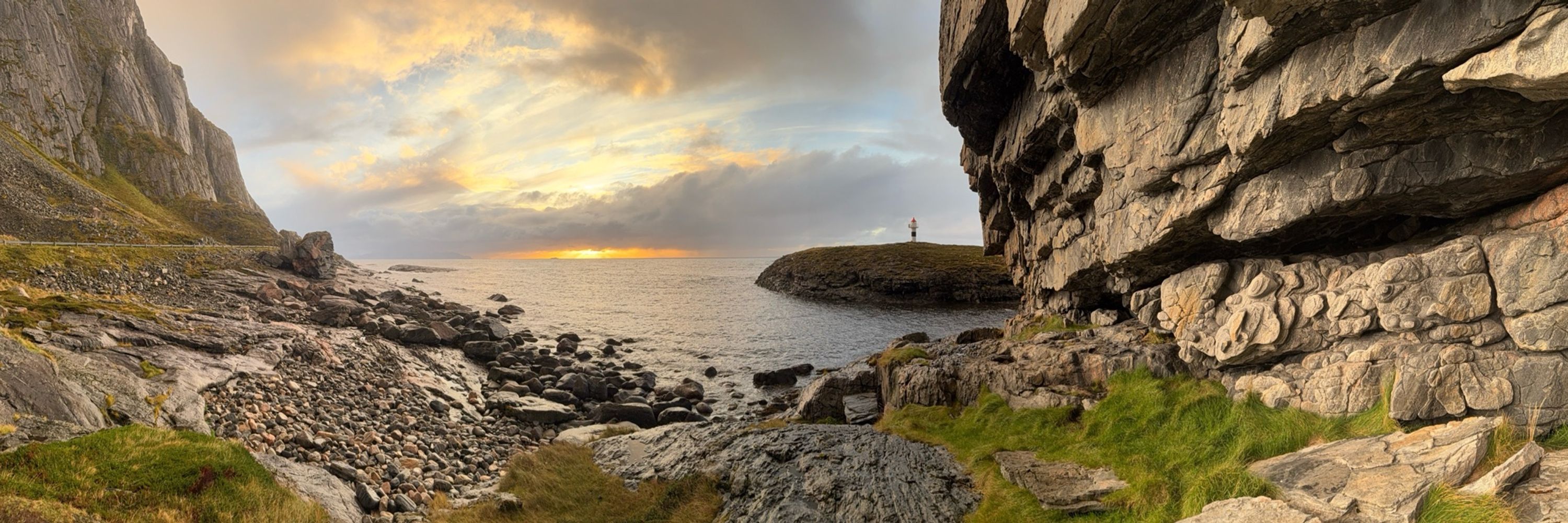
Cipriano Hills, Organ Pipe Cactus NM (NE of Quitobaquito Springs). I hope you like this but I really just made it for my own nostalgic enjoyment. Data from @opentopography.org, visualized with #rayshader.
January 23, 2026 at 3:18 AM
Cipriano Hills, Organ Pipe Cactus NM (NE of Quitobaquito Springs). I hope you like this but I really just made it for my own nostalgic enjoyment. Data from @opentopography.org, visualized with #rayshader.