
Protomaps
@protomaps.com
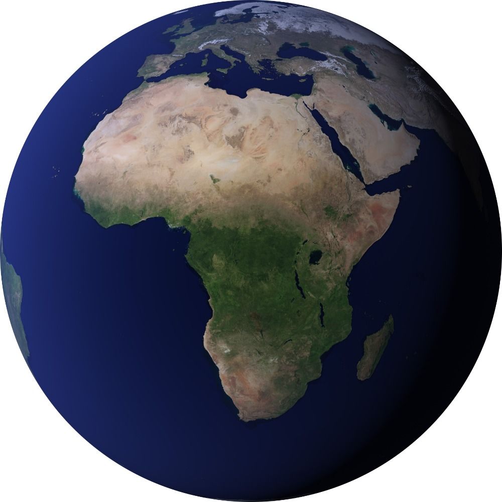
The world in a file. Open source!
more: https://protomaps.com
GitHub: https://github.com/protomaps
posts by @bdon.org
more: https://protomaps.com
GitHub: https://github.com/protomaps
posts by @bdon.org
Reposted by Protomaps
Cyprus, Greenland, Faroe, Iceland, Japan, New Zealand, Norway, Svalbard, Portugal, Madeira, Spain, England, Scotland, Wales, and the United States are now included in Mapterhorn v0.0.7.
Special thanks to Daniel Silk (NZ), Hidenori Fujimura (JP), and Christopher Varjas (US)!
Special thanks to Daniel Silk (NZ), Hidenori Fujimura (JP), and Christopher Varjas (US)!
Mapterhorn
mapterhorn.com
December 29, 2025 at 10:22 PM
Cyprus, Greenland, Faroe, Iceland, Japan, New Zealand, Norway, Svalbard, Portugal, Madeira, Spain, England, Scotland, Wales, and the United States are now included in Mapterhorn v0.0.7.
Special thanks to Daniel Silk (NZ), Hidenori Fujimura (JP), and Christopher Varjas (US)!
Special thanks to Daniel Silk (NZ), Hidenori Fujimura (JP), and Christopher Varjas (US)!
Reposted by Protomaps

If you work in geospatial, PMTiles is one of the technologies you need to know going into 2026.
This past year, I wrote an R package to help you get started.
Learn how here:
This past year, I wrote an R package to help you get started.
Learn how here:

Mapping 650,000+ Texas Census blocks with PMTiles – WALKER DATA
GIS, demographics, and data science consulting
walker-data.com
December 23, 2025 at 7:44 PM
If you work in geospatial, PMTiles is one of the technologies you need to know going into 2026.
This past year, I wrote an R package to help you get started.
Learn how here:
This past year, I wrote an R package to help you get started.
Learn how here:
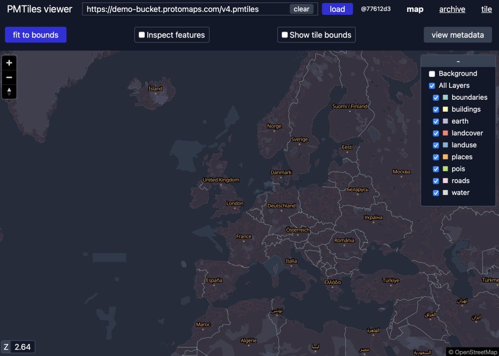
people kept asking for pmtiles merge, now there is pmtiles merge, inevitably they will ask why it refuses to work for overlapping inputs, here is why merging tilesets is hard (blog post):
protomaps.com/blog/pmtiles...
protomaps.com/blog/pmtiles...

New CLI feature: pmtiles merge
The pmtiles CLI now includes the highly requested merge command for combining multiple tilesets into a single archive.
As an example use case: the Mapterhorn project distributes several archives:
plan...
protomaps.com
December 16, 2025 at 5:16 PM
people kept asking for pmtiles merge, now there is pmtiles merge, inevitably they will ask why it refuses to work for overlapping inputs, here is why merging tilesets is hard (blog post):
protomaps.com/blog/pmtiles...
protomaps.com/blog/pmtiles...
Reposted by Protomaps
The @sfomuseum.bsky.social aviation collection has new aerial imagery / and we have published some experimental work about hosting and serving the entire planet OSM @protomaps.com pmtiles database, locally and offline, on a recycled ipad – millsfield.sfomuseum.org/blog/2025/12...

Map updates, December 2025 - Now with more PMTiles
In addition to 2025, we’ve also added new imagery from 1920, 1936 and 1961 all produced using the Allmaps Editor to georeference existing collections materials. I’ll talk more about some of the tools ...
millsfield.sfomuseum.org
December 16, 2025 at 4:42 PM
The @sfomuseum.bsky.social aviation collection has new aerial imagery / and we have published some experimental work about hosting and serving the entire planet OSM @protomaps.com pmtiles database, locally and offline, on a recycled ipad – millsfield.sfomuseum.org/blog/2025/12...
new pmtiles CLI feature (the most requested one)
pmtiles merge input input output
docs.protomaps.com/pmtiles/cli#...
download new version here:
github.com/protomaps/go...
pmtiles merge input input output
docs.protomaps.com/pmtiles/cli#...
download new version here:
github.com/protomaps/go...

pmtiles CLI | Protomaps Docs
Technical Documentation for Protomaps
docs.protomaps.com
December 16, 2025 at 4:33 AM
new pmtiles CLI feature (the most requested one)
pmtiles merge input input output
docs.protomaps.com/pmtiles/cli#...
download new version here:
github.com/protomaps/go...
pmtiles merge input input output
docs.protomaps.com/pmtiles/cli#...
download new version here:
github.com/protomaps/go...
SFO Airport Museum's map viewer is powered by a raster pmtiles archive + leaflet
millsfield.sfomuseum.org/map/#2025/fg/
millsfield.sfomuseum.org/map/#2025/fg/


December 3, 2025 at 10:40 AM
SFO Airport Museum's map viewer is powered by a raster pmtiles archive + leaflet
millsfield.sfomuseum.org/map/#2025/fg/
millsfield.sfomuseum.org/map/#2025/fg/
Reposted by Protomaps

Nice work and good to see @protomaps.com finding adoption in major news outlets!
What would happen if the Amazon rainforest collapsed?
Our look at deforestation and feedback loops.
Also, the perfect occasion to make use of our new MapLibre/Protomaps scroller component.
#maps #dataviz #ddj
www.spiegel.de/wissenschaft...
Our look at deforestation and feedback loops.
Also, the perfect occasion to make use of our new MapLibre/Protomaps scroller component.
#maps #dataviz #ddj
www.spiegel.de/wissenschaft...
November 12, 2025 at 10:31 AM
Nice work and good to see @protomaps.com finding adoption in major news outlets!
Reposted by Protomaps

What would happen if the Amazon rainforest collapsed?
Our look at deforestation and feedback loops.
Also, the perfect occasion to make use of our new MapLibre/Protomaps scroller component.
#maps #dataviz #ddj
www.spiegel.de/wissenschaft...
Our look at deforestation and feedback loops.
Also, the perfect occasion to make use of our new MapLibre/Protomaps scroller component.
#maps #dataviz #ddj
www.spiegel.de/wissenschaft...
November 12, 2025 at 10:22 AM
What would happen if the Amazon rainforest collapsed?
Our look at deforestation and feedback loops.
Also, the perfect occasion to make use of our new MapLibre/Protomaps scroller component.
#maps #dataviz #ddj
www.spiegel.de/wissenschaft...
Our look at deforestation and feedback loops.
Also, the perfect occasion to make use of our new MapLibre/Protomaps scroller component.
#maps #dataviz #ddj
www.spiegel.de/wissenschaft...
Reposted by Protomaps

Flix Bus in US powered by @protomaps.com and @openstreetmap.bsky.social
I love when apps clearly attribute their map source.
I love when apps clearly attribute their map source.

October 10, 2025 at 1:33 PM
Flix Bus in US powered by @protomaps.com and @openstreetmap.bsky.social
I love when apps clearly attribute their map source.
I love when apps clearly attribute their map source.
Reposted by Protomaps
I'll also share some latest developments using @protomaps.com and @maplibre.org to self-host vector maps with custom layers, beautiful rendering and seamless zoom, in case you are interested in that type of thing 🗺️
October 10, 2025 at 12:36 PM
I'll also share some latest developments using @protomaps.com and @maplibre.org to self-host vector maps with custom layers, beautiful rendering and seamless zoom, in case you are interested in that type of thing 🗺️
The #protomaps project recently reached its goal of 50+ GitHub Sponsors!
Becoming a sponsor allows commercial use of the hosted API: protomaps.com/api and supports the compute and storage for free daily planet builds: maps.protomaps.com/builds/
GitHub Sponsors: github.com/sponsors/pro...
Becoming a sponsor allows commercial use of the hosted API: protomaps.com/api and supports the compute and storage for free daily planet builds: maps.protomaps.com/builds/
GitHub Sponsors: github.com/sponsors/pro...

Sponsor @protomaps on GitHub Sponsors
A free and open source map of the world, deployable as a single static file.
github.com
September 26, 2025 at 8:19 AM
The #protomaps project recently reached its goal of 50+ GitHub Sponsors!
Becoming a sponsor allows commercial use of the hosted API: protomaps.com/api and supports the compute and storage for free daily planet builds: maps.protomaps.com/builds/
GitHub Sponsors: github.com/sponsors/pro...
Becoming a sponsor allows commercial use of the hosted API: protomaps.com/api and supports the compute and storage for free daily planet builds: maps.protomaps.com/builds/
GitHub Sponsors: github.com/sponsors/pro...
September 3, 2025 at 6:00 AM
Reposted by Protomaps
mapgl for #rstats supports @protomaps.com PMTiles as a data source in both @maplibre.org and @mapbox.com maps.
If you need to visualize large datasets but struggle with hosting / infrastructure requirements, PMTiles may be exactly what you need.
If you need to visualize large datasets but struggle with hosting / infrastructure requirements, PMTiles may be exactly what you need.
September 2, 2025 at 6:24 PM
mapgl for #rstats supports @protomaps.com PMTiles as a data source in both @maplibre.org and @mapbox.com maps.
If you need to visualize large datasets but struggle with hosting / infrastructure requirements, PMTiles may be exactly what you need.
If you need to visualize large datasets but struggle with hosting / infrastructure requirements, PMTiles may be exactly what you need.
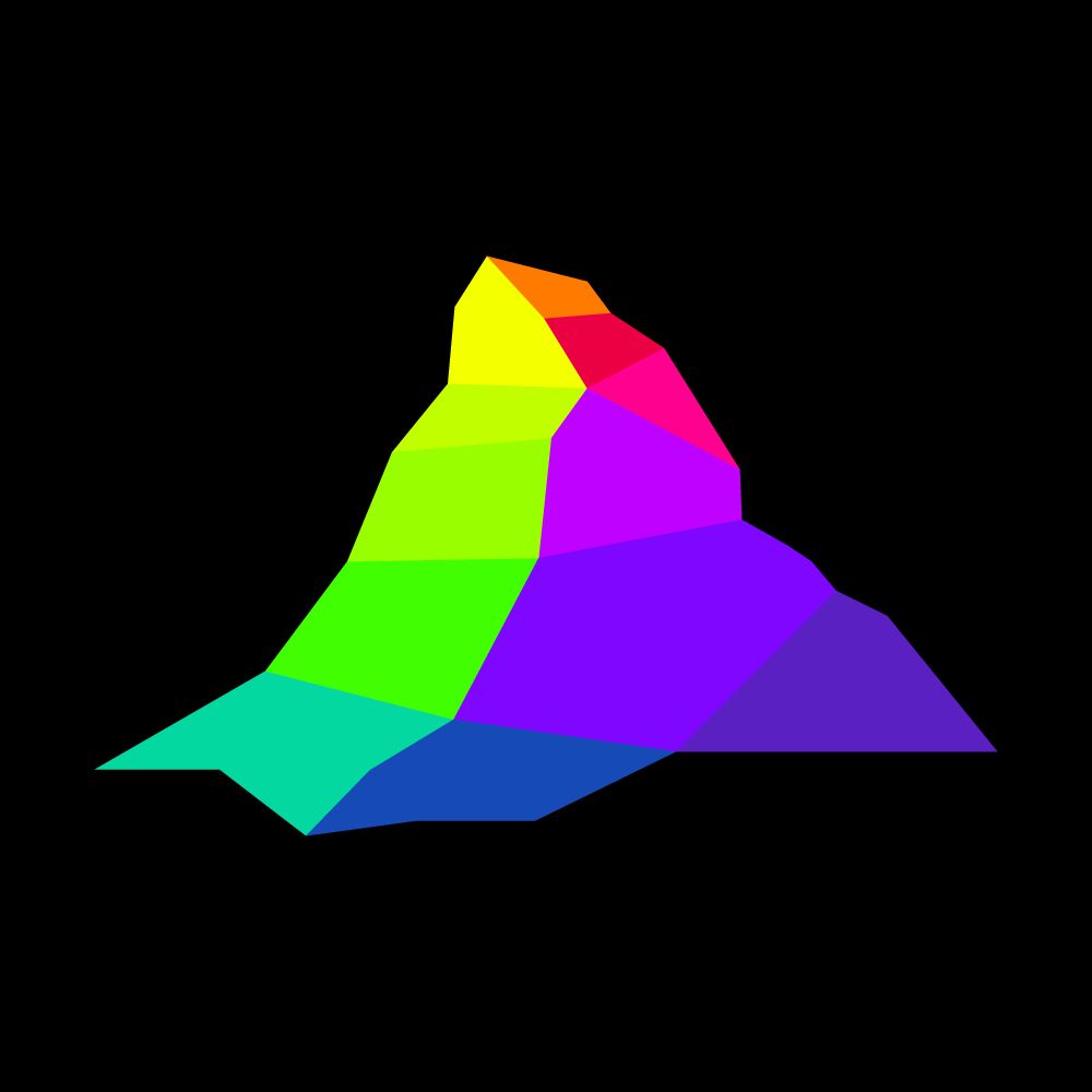
Have you been waiting for "Protomaps Terrain"?
It's arriving! @mapterhorn.com is an independent project created by @oliverwipfli.ch - a global elevation model built from multiple sources, distributed as a single PMTiles archive
It's arriving! @mapterhorn.com is an independent project created by @oliverwipfli.ch - a global elevation model built from multiple sources, distributed as a single PMTiles archive
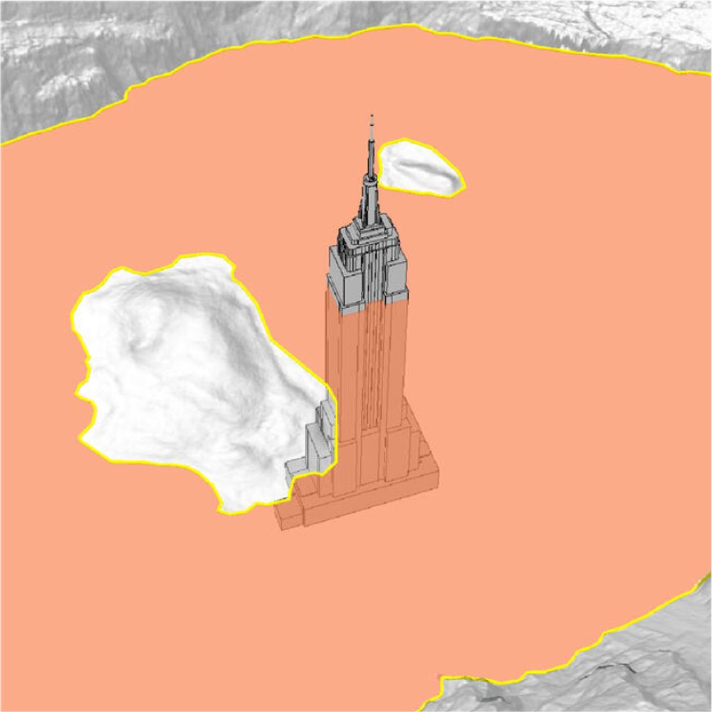
Mapterhorn v0.0.1 has been released. It is an aggregation of the global Copernicus GLO-30 low-resolution digital elevation model with the Swiss swissALTI3D high-resolution model. mapterhorn.com
mapterhorn
Open terrain tile sets and data catalog
mapterhorn.com
August 11, 2025 at 9:07 AM
Have you been waiting for "Protomaps Terrain"?
It's arriving! @mapterhorn.com is an independent project created by @oliverwipfli.ch - a global elevation model built from multiple sources, distributed as a single PMTiles archive
It's arriving! @mapterhorn.com is an independent project created by @oliverwipfli.ch - a global elevation model built from multiple sources, distributed as a single PMTiles archive
Reposted by Protomaps
Great to see protomaps go from strength to strength with handy open source viewer. www.youtube.com/watch?v=4Qn3...
August 8, 2025 at 12:55 PM
Great to see protomaps go from strength to strength with handy open source viewer. www.youtube.com/watch?v=4Qn3...
Reposted by Protomaps
A very manual @protomaps.com to print pipeline. Always excited to get something in print 🗞️ www.nytimes.com/interactive/...

July 19, 2025 at 9:05 PM
A very manual @protomaps.com to print pipeline. Always excited to get something in print 🗞️ www.nytimes.com/interactive/...
Added a section to the PMTiles docs on fast uploading to @source.coop using only the pmtiles single binary CLI:
docs.protomaps.com/pmtiles/clou...
Easier to install than awscli or rclone - just bring your repo credentials!
docs.protomaps.com/pmtiles/clou...
Easier to install than awscli or rclone - just bring your repo credentials!
July 10, 2025 at 1:34 AM
Added a section to the PMTiles docs on fast uploading to @source.coop using only the pmtiles single binary CLI:
docs.protomaps.com/pmtiles/clou...
Easier to install than awscli or rclone - just bring your repo credentials!
docs.protomaps.com/pmtiles/clou...
Easier to install than awscli or rclone - just bring your repo credentials!
Reposted by Protomaps

I'd like to give a big thanks to @protomaps.com for their fantastic work. Our open source Android port of Soundscape, the navigation and exploration app for visually impaired uses a protomaps server and it's reduced the cost to the supporting charities by a huge amount. github.com/Scottish-Tec...

GitHub - Scottish-Tech-Army/Soundscape-Android: This is the source for an Android version of the original iOS Soundscape app
This is the source for an Android version of the original iOS Soundscape app - Scottish-Tech-Army/Soundscape-Android
github.com
July 9, 2025 at 8:57 AM
I'd like to give a big thanks to @protomaps.com for their fantastic work. Our open source Android port of Soundscape, the navigation and exploration app for visually impaired uses a protomaps server and it's reduced the cost to the supporting charities by a huge amount. github.com/Scottish-Tec...
There's an ongoing issue preventing PMTiles hosted on GitHub Pages from being loaded correctly in Firefox
Issue:
github.com/protomaps/PM...
Minimal Reproduction using raw fetch and plain files:
github.com/bdon/ghpages...
Work at @github.com or know someone who does?
Issue:
github.com/protomaps/PM...
Minimal Reproduction using raw fetch and plain files:
github.com/bdon/ghpages...
Work at @github.com or know someone who does?
July 9, 2025 at 6:22 AM
There's an ongoing issue preventing PMTiles hosted on GitHub Pages from being loaded correctly in Firefox
Issue:
github.com/protomaps/PM...
Minimal Reproduction using raw fetch and plain files:
github.com/bdon/ghpages...
Work at @github.com or know someone who does?
Issue:
github.com/protomaps/PM...
Minimal Reproduction using raw fetch and plain files:
github.com/bdon/ghpages...
Work at @github.com or know someone who does?
Reposted by Protomaps

🗺️ La prévisualisation des fichiers PMTiles et GeoJSON est désormais disponible sur la plateforme ! #geo
Et bientôt d’autres formats (flux WMS et WFS, CSV contenant des données géographiques) grâce aux communs numériques de cartes.gouv.fr (IGN).
En savoir plus : www.data.gouv.fr/fr/posts/pre...
Et bientôt d’autres formats (flux WMS et WFS, CSV contenant des données géographiques) grâce aux communs numériques de cartes.gouv.fr (IGN).
En savoir plus : www.data.gouv.fr/fr/posts/pre...

June 23, 2025 at 1:59 PM
🗺️ La prévisualisation des fichiers PMTiles et GeoJSON est désormais disponible sur la plateforme ! #geo
Et bientôt d’autres formats (flux WMS et WFS, CSV contenant des données géographiques) grâce aux communs numériques de cartes.gouv.fr (IGN).
En savoir plus : www.data.gouv.fr/fr/posts/pre...
Et bientôt d’autres formats (flux WMS et WFS, CSV contenant des données géographiques) grâce aux communs numériques de cartes.gouv.fr (IGN).
En savoir plus : www.data.gouv.fr/fr/posts/pre...
Reposted by Protomaps

My first @protomaps.com
Faults, earthquakes, Alquist-Priolo fault zones, landslides, custom shaded relief, and a base layer. Just the East Bay for now. 🗺️
Faults, earthquakes, Alquist-Priolo fault zones, landslides, custom shaded relief, and a base layer. Just the East Bay for now. 🗺️

June 19, 2025 at 7:35 PM
My first @protomaps.com
Faults, earthquakes, Alquist-Priolo fault zones, landslides, custom shaded relief, and a base layer. Just the East Bay for now. 🗺️
Faults, earthquakes, Alquist-Priolo fault zones, landslides, custom shaded relief, and a base layer. Just the East Bay for now. 🗺️


Possibly the first PMTiles appearance on the NYT front page?!
Live-updating mini globe on the home page over the weekend w/ @jkeefe.bsky.social

May 20, 2025 at 5:07 PM
Possibly the first PMTiles appearance on the NYT front page?!