


Mike 🇨🇦
@ontariowedges.bsky.social
(🏳️🌈) SWON storms. Huron County ON. Northern Tornadoes Project Super Contributor https://uwo.ca/ntp/superC/
Reposted by Mike 🇨🇦

The NTP has confirmed 11 new ON tornadoes based on AI-assisted satellite review. All caused EF1-EF2 tree damage.
These are in addition to 5 tornadoes already confirmed in ON via AI-assisted satellite review. All sectors in Ontario have now been reviewed.
Details: uwo.ca/ntp/blog/202...
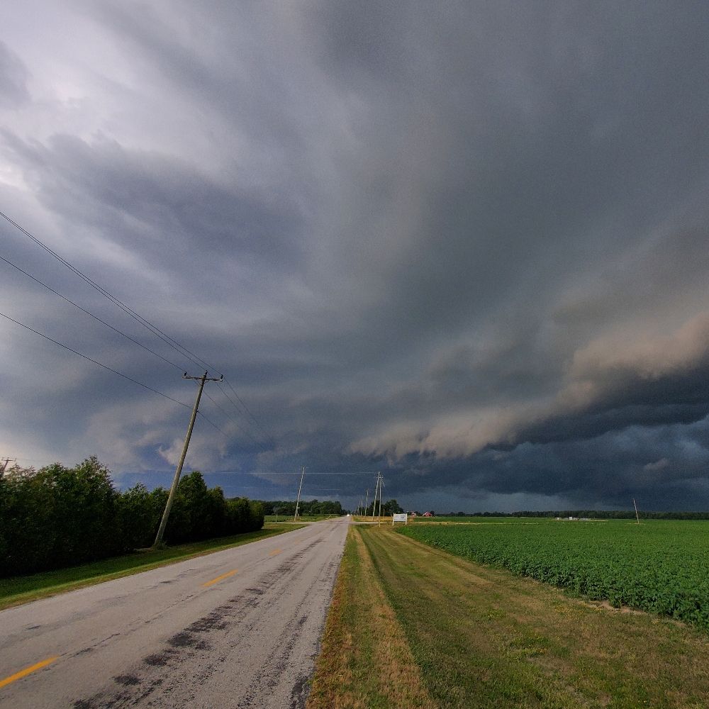
#ONstorm
These are in addition to 5 tornadoes already confirmed in ON via AI-assisted satellite review. All sectors in Ontario have now been reviewed.
Details: uwo.ca/ntp/blog/202...
#ONstorm

November 12, 2025 at 3:46 PM
The NTP has confirmed 11 new ON tornadoes based on AI-assisted satellite review. All caused EF1-EF2 tree damage.
These are in addition to 5 tornadoes already confirmed in ON via AI-assisted satellite review. All sectors in Ontario have now been reviewed.
Details: uwo.ca/ntp/blog/202...
#ONstorm
These are in addition to 5 tornadoes already confirmed in ON via AI-assisted satellite review. All sectors in Ontario have now been reviewed.
Details: uwo.ca/ntp/blog/202...
#ONstorm
Did radaromega add canadian weather alerts like less than 2 weeks before the weather alert system is supposed to change

November 10, 2025 at 3:34 AM
Did radaromega add canadian weather alerts like less than 2 weeks before the weather alert system is supposed to change
So much for that idea
November 2, 2025 at 4:18 AM
So much for that idea
Come on jaybirds. Win that trophy for ✨️King Charles✨️
November 2, 2025 at 12:54 AM
Come on jaybirds. Win that trophy for ✨️King Charles✨️
Alright jays let's do this for KING and COUNTRY
November 1, 2025 at 12:41 AM
Alright jays let's do this for KING and COUNTRY


Best news all day! Doctor Who is back at the end of 2026

October 29, 2025 at 1:04 AM
Best news all day! Doctor Who is back at the end of 2026
Reposted by Mike 🇨🇦


October 28, 2025 at 10:39 PM
Reposted by Mike 🇨🇦

Terrified Jays fan still trapped inside Game 3

Terrified Jays fan still trapped inside Game 3
TORONTO - Following a World Series game against the LA Dodgers that went into multiple extra innings, local Blue Jays fan Mike Cortner reports that he appears to be trapped inside a metaphysical priso...
www.thebeaverton.com
October 28, 2025 at 3:34 PM
Terrified Jays fan still trapped inside Game 3
Reposted by Mike 🇨🇦
The NTP has confirmed nine new Quebec tornadoes for 2025 based on our end-of-season satellite review, assisted by an AI detection algorithm. The damage in each case was only to trees, with one tornado rated EF2 and eight rated EF1.
Details: uwo.ca/ntp/blog/202...
#meteoQC
Details: uwo.ca/ntp/blog/202...
#meteoQC

October 27, 2025 at 3:33 PM
The NTP has confirmed nine new Quebec tornadoes for 2025 based on our end-of-season satellite review, assisted by an AI detection algorithm. The damage in each case was only to trees, with one tornado rated EF2 and eight rated EF1.
Details: uwo.ca/ntp/blog/202...
#meteoQC
Details: uwo.ca/ntp/blog/202...
#meteoQC
Amazing work by Ontario's own Dr. Connell Miller of NTP!

Excited to announce that my method for estimating wind speeds based on lofted debris in tornadoes was used as contextual evidence for upgrading the Enderlin, ND tornado to an EF5!
doi.org/10.1175/MWR-...
#NDwx #Enderlin #EF5 #Tornado
doi.org/10.1175/MWR-...
#NDwx #Enderlin #EF5 #Tornado

October 6, 2025 at 7:19 PM
Amazing work by Ontario's own Dr. Connell Miller of NTP!
Reposted by Mike 🇨🇦
The CSSL/NTP assisted the US National Weather Service (NWS) with their upgrading of the official rating of the June 2025 Enderlin, ND tornado from EF3 to EF5.
Announced by the NWS today, it’s the first EF5-rated tornado in the US since 2013.
Details here: uwo.ca/ntp/blog/202...
Image B. Emfinger
Announced by the NWS today, it’s the first EF5-rated tornado in the US since 2013.
Details here: uwo.ca/ntp/blog/202...
Image B. Emfinger

October 6, 2025 at 6:16 PM
The CSSL/NTP assisted the US National Weather Service (NWS) with their upgrading of the official rating of the June 2025 Enderlin, ND tornado from EF3 to EF5.
Announced by the NWS today, it’s the first EF5-rated tornado in the US since 2013.
Details here: uwo.ca/ntp/blog/202...
Image B. Emfinger
Announced by the NWS today, it’s the first EF5-rated tornado in the US since 2013.
Details here: uwo.ca/ntp/blog/202...
Image B. Emfinger
Reposted by Mike 🇨🇦
The EF-5 Drought is finally over. mesonet.agron.iastate.edu/wx/afos/p.ph...
October 6, 2025 at 2:43 PM
The EF-5 Drought is finally over. mesonet.agron.iastate.edu/wx/afos/p.ph...
Reposted by Mike 🇨🇦

I've created a Bluesky Starter Pack called 'Canadian Severe Storms Community'. Makes it easy to find and follow severe storm forecasters, researchers, chasers and enthusiasts in Canada!
go.bsky.app/9eQf9Zd
Please let me know if you'd like to be added or if you think someone else needs to be added.
go.bsky.app/9eQf9Zd
Please let me know if you'd like to be added or if you think someone else needs to be added.
October 4, 2025 at 2:24 PM
I've created a Bluesky Starter Pack called 'Canadian Severe Storms Community'. Makes it easy to find and follow severe storm forecasters, researchers, chasers and enthusiasts in Canada!
go.bsky.app/9eQf9Zd
Please let me know if you'd like to be added or if you think someone else needs to be added.
go.bsky.app/9eQf9Zd
Please let me know if you'd like to be added or if you think someone else needs to be added.
Reposted by Mike 🇨🇦
The first forested area to be searched with NTP's new AI tool - Northern Ontario east of Lake Superior - turned up five tornadoes, including one rated EF2. These were all manually verified and documented.
Details here:
uwo.ca/ntp/blog/202...
#ONstorm
Lots more to come...
Details here:
uwo.ca/ntp/blog/202...
#ONstorm
Lots more to come...

October 3, 2025 at 4:19 PM
The first forested area to be searched with NTP's new AI tool - Northern Ontario east of Lake Superior - turned up five tornadoes, including one rated EF2. These were all manually verified and documented.
Details here:
uwo.ca/ntp/blog/202...
#ONstorm
Lots more to come...
Details here:
uwo.ca/ntp/blog/202...
#ONstorm
Lots more to come...
Reposted by Mike 🇨🇦
The NTP has confirmed three new tornadoes and upgraded a downburst damage rating in Northern Ontario.
Details here:
uwo.ca/ntp/blog/202...
#ONstorm
Details here:
uwo.ca/ntp/blog/202...
#ONstorm

October 2, 2025 at 1:05 PM
The NTP has confirmed three new tornadoes and upgraded a downburst damage rating in Northern Ontario.
Details here:
uwo.ca/ntp/blog/202...
#ONstorm
Details here:
uwo.ca/ntp/blog/202...
#ONstorm
Reposted by Mike 🇨🇦
The NTP has confirmed four EF2 tornadoes in western Quebec during the late afternoon and evening hours of September 5. In each case there was considerable tree damage.
Full details can be found here:
uwo.ca/ntp/blog/202...
#meteoQC
Full details can be found here:
uwo.ca/ntp/blog/202...
#meteoQC

September 30, 2025 at 7:18 PM
The NTP has confirmed four EF2 tornadoes in western Quebec during the late afternoon and evening hours of September 5. In each case there was considerable tree damage.
Full details can be found here:
uwo.ca/ntp/blog/202...
#meteoQC
Full details can be found here:
uwo.ca/ntp/blog/202...
#meteoQC
Reposted by Mike 🇨🇦

Two new open access journal papers today from CSSL researchers!
Stochastic Modeling of Radar-derived Maximum Estimated Size of Hail for Scenario-based Hail Loss Estimation
doi.org/10.1016/j.ij...
Multi-Level In-Situ Measurements During a Direct Hit by a Significant Tornado
doi.org/10.1080/0705...
Stochastic Modeling of Radar-derived Maximum Estimated Size of Hail for Scenario-based Hail Loss Estimation
doi.org/10.1016/j.ij...
Multi-Level In-Situ Measurements During a Direct Hit by a Significant Tornado
doi.org/10.1080/0705...


September 16, 2025 at 2:46 PM
Two new open access journal papers today from CSSL researchers!
Stochastic Modeling of Radar-derived Maximum Estimated Size of Hail for Scenario-based Hail Loss Estimation
doi.org/10.1016/j.ij...
Multi-Level In-Situ Measurements During a Direct Hit by a Significant Tornado
doi.org/10.1080/0705...
Stochastic Modeling of Radar-derived Maximum Estimated Size of Hail for Scenario-based Hail Loss Estimation
doi.org/10.1016/j.ij...
Multi-Level In-Situ Measurements During a Direct Hit by a Significant Tornado
doi.org/10.1080/0705...
Reposted by Mike 🇨🇦
New paper alert!
"Multi-Level In-Situ Measurements During a Direct Hit by a Significant Tornado" in A-O.
Observations from a 2010 F2 tornado at a Harrow, ON-area wind farm show that peak winds do increase closer to the ground, supporting DOW radar measurements/analysis.
doi.org/10.1080/0705...
"Multi-Level In-Situ Measurements During a Direct Hit by a Significant Tornado" in A-O.
Observations from a 2010 F2 tornado at a Harrow, ON-area wind farm show that peak winds do increase closer to the ground, supporting DOW radar measurements/analysis.
doi.org/10.1080/0705...

Multi-Level In-Situ Measurements During a Direct Hit by a Significant Tornado
A rare direct hit by a significant tornado on a weather station is documented, with a peak 1-s wind gust of 53.1 m/s (191.2 km/h) and a surface pressure deficit of 16.0 hPa recorded. Even more unco...
doi.org
September 16, 2025 at 2:36 PM
New paper alert!
"Multi-Level In-Situ Measurements During a Direct Hit by a Significant Tornado" in A-O.
Observations from a 2010 F2 tornado at a Harrow, ON-area wind farm show that peak winds do increase closer to the ground, supporting DOW radar measurements/analysis.
doi.org/10.1080/0705...
"Multi-Level In-Situ Measurements During a Direct Hit by a Significant Tornado" in A-O.
Observations from a 2010 F2 tornado at a Harrow, ON-area wind farm show that peak winds do increase closer to the ground, supporting DOW radar measurements/analysis.
doi.org/10.1080/0705...