


Philipp Gärtner
@mixedpixels.bsky.social
interested in spatial • mapping • remote sensing • #eochat • eo-journalism 🛰️ topics but also kayaking & trekking | based in Berlin
Pinned
Philipp Gärtner
@mixedpixels.bsky.social
· Oct 19
Hello world 🌍
Always beautiful, the train journey from Prague 🇨🇿 to Dresden 🇩🇪 along the Elbe River / Saxon Switzerland.
June 27, 2025 at 6:46 PM
Always beautiful, the train journey from Prague 🇨🇿 to Dresden 🇩🇪 along the Elbe River / Saxon Switzerland.


June 24, 2025 at 10:14 AM
🔌💡 Power outage from April 28 in the Iberian Peninsula is in parts still visible from space. This VIIRS nighttime imagery shows a clear drop in light emissions across southeast Spain (Almería, Murcia, Albacete) on April 29, 2025. lnkd.in/gghZ__Kh
🌍 Data: NASA Worldview / Suomi NPP VIIRS
#PowerOutage
🌍 Data: NASA Worldview / Suomi NPP VIIRS
#PowerOutage
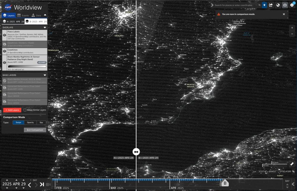
April 29, 2025 at 12:08 PM
🔌💡 Power outage from April 28 in the Iberian Peninsula is in parts still visible from space. This VIIRS nighttime imagery shows a clear drop in light emissions across southeast Spain (Almería, Murcia, Albacete) on April 29, 2025. lnkd.in/gghZ__Kh
🌍 Data: NASA Worldview / Suomi NPP VIIRS
#PowerOutage
🌍 Data: NASA Worldview / Suomi NPP VIIRS
#PowerOutage
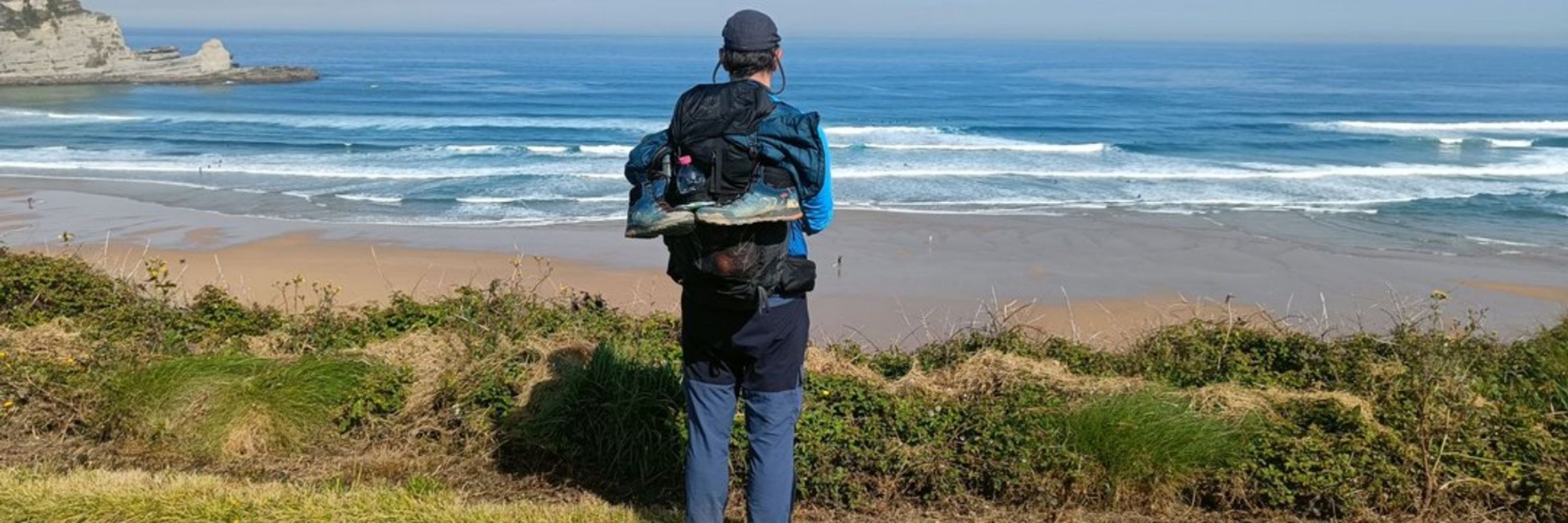
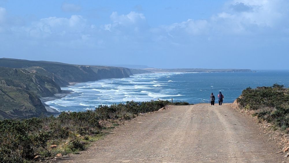
Just came back from the Fisherman's Trail (Rota Vicentina) in South-West Portugal. 10 days (240km) of ocean views • wind • waves • plenty of sun • but also rain. Loved it. 🇵🇹
April 24, 2025 at 4:48 PM
Just came back from the Fisherman's Trail (Rota Vicentina) in South-West Portugal. 10 days (240km) of ocean views • wind • waves • plenty of sun • but also rain. Loved it. 🇵🇹
Reposted by Philipp Gärtner

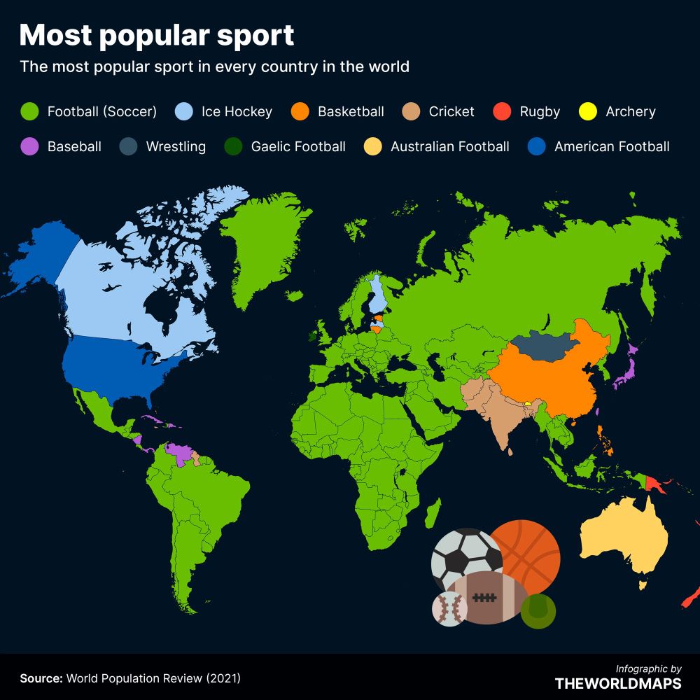
The most popular sport in every country in the world.
What’s your favourite sport?
What’s your favourite sport?
March 18, 2025 at 7:23 PM
The most popular sport in every country in the world.
What’s your favourite sport?
What’s your favourite sport?
Reposted by Philipp Gärtner
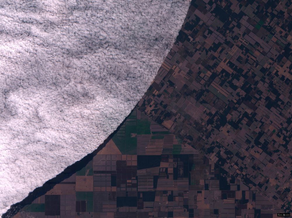
Some nice low-level cloud in Argentina.
Image taken by Sentinel-2.
Image taken by Sentinel-2.
February 7, 2025 at 9:52 AM
Some nice low-level cloud in Argentina.
Image taken by Sentinel-2.
Image taken by Sentinel-2.
Reposted by Philipp Gärtner

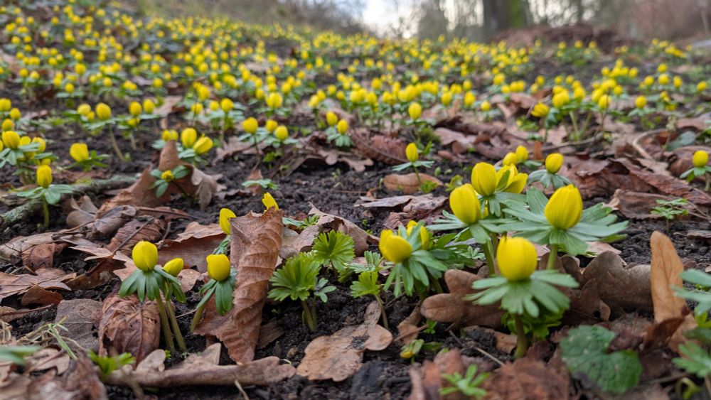
Early spring in Leipzig, Germany. 🌱🕐
January 30, 2025 at 8:08 AM
Early spring in Leipzig, Germany. 🌱🕐
@planet (not yet on bsky 🤔) will be hosting a virtual Planet AI Symposium on January 30th! #eochat 🛰️
Register here: planet-ai-symposium.nowvirtual.live/register?eid...
Register here: planet-ai-symposium.nowvirtual.live/register?eid...

January 25, 2025 at 7:29 AM
@planet (not yet on bsky 🤔) will be hosting a virtual Planet AI Symposium on January 30th! #eochat 🛰️
Register here: planet-ai-symposium.nowvirtual.live/register?eid...
Register here: planet-ai-symposium.nowvirtual.live/register?eid...
Reposted by Philipp Gärtner

January 22, 2025 at 8:45 PM
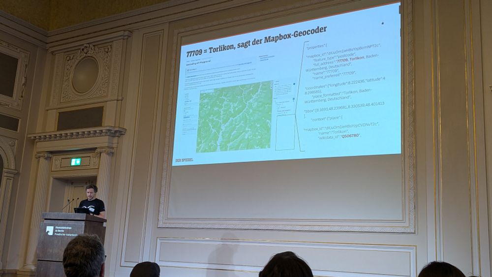
Sehr schöner Vortrag von @patrickstotz.bsky.social über Torlikon / #Mapbox-Geocoder / #Wikidata auf der #NIAM2025 pretalx.news-infographics-analytics-maps.media/2025/talk/LJ...
January 16, 2025 at 3:03 PM
Sehr schöner Vortrag von @patrickstotz.bsky.social über Torlikon / #Mapbox-Geocoder / #Wikidata auf der #NIAM2025 pretalx.news-infographics-analytics-maps.media/2025/talk/LJ...
Reposted by Philipp Gärtner

ClearSky shows the lists (including starter packs) you are part of (or any other account you enter): clearsky.app/infowetrust....
ClearSky
ClearSky
clearsky.app
December 8, 2024 at 5:17 PM
ClearSky shows the lists (including starter packs) you are part of (or any other account you enter): clearsky.app/infowetrust....
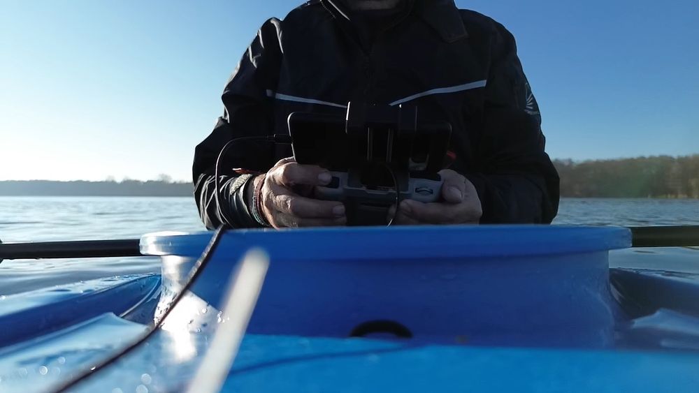
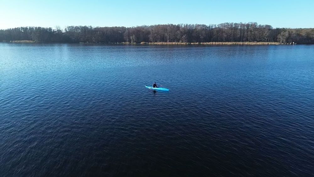
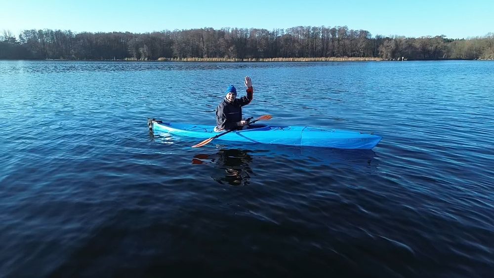
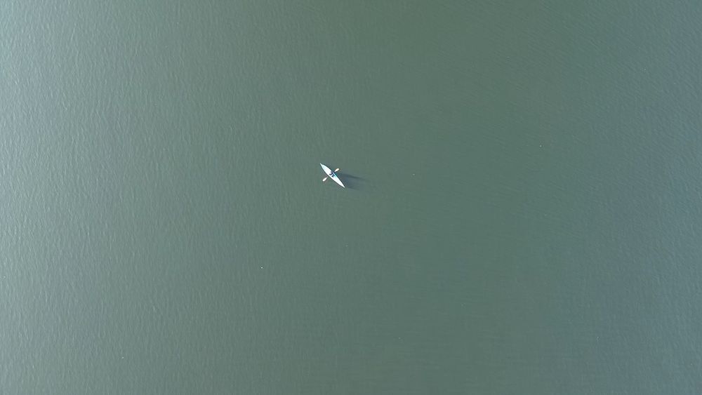
Winter kayak tour from #Berlin #Köpenick to #Müggelsee and back. At the end, my feet were really cold. Need to get better equipment. 🥶🛶 #dji
December 1, 2024 at 3:33 PM
Winter kayak tour from #Berlin #Köpenick to #Müggelsee and back. At the end, my feet were really cold. Need to get better equipment. 🥶🛶 #dji
November 29, 2024 at 10:11 AM
Reposted by Philipp Gärtner

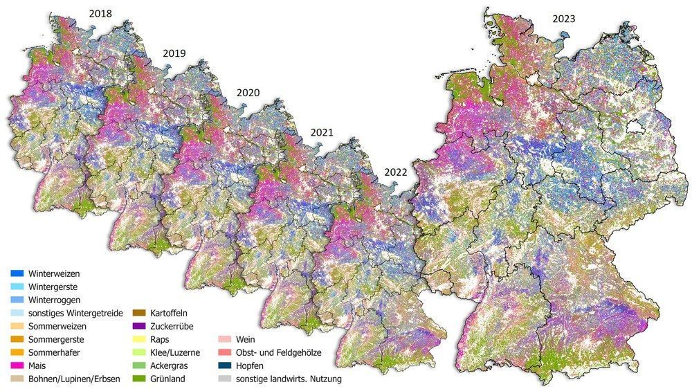
Six-years, 76,100 satellite images and 44 terabytes of data.
Analysis shows which crops grow in Germany-
https://buff.ly/4g7REB3
#earthobservation #sentinel1 #sentinel2
Analysis shows which crops grow in Germany-
https://buff.ly/4g7REB3
#earthobservation #sentinel1 #sentinel2
November 26, 2024 at 2:33 PM
Six-years, 76,100 satellite images and 44 terabytes of data.
Analysis shows which crops grow in Germany-
https://buff.ly/4g7REB3
#earthobservation #sentinel1 #sentinel2
Analysis shows which crops grow in Germany-
https://buff.ly/4g7REB3
#earthobservation #sentinel1 #sentinel2
Reposted by Philipp Gärtner

Is this Germany or the cover of an epic fantasy novel? 🗺️⚡
😎 Witness forests come alive in this jaw-dropping 3D masterpiece 🖤❤️🧡 == 🇩🇪
From the Black Forest to the Alps, this map is WILD! 🌳✨
#3DMap #RArt #Germanyforest #forestmapping #R #GIS #30DayMapChallenge #Dataviz
😎 Witness forests come alive in this jaw-dropping 3D masterpiece 🖤❤️🧡 == 🇩🇪
From the Black Forest to the Alps, this map is WILD! 🌳✨
#3DMap #RArt #Germanyforest #forestmapping #R #GIS #30DayMapChallenge #Dataviz

November 22, 2024 at 6:51 PM
Is this Germany or the cover of an epic fantasy novel? 🗺️⚡
😎 Witness forests come alive in this jaw-dropping 3D masterpiece 🖤❤️🧡 == 🇩🇪
From the Black Forest to the Alps, this map is WILD! 🌳✨
#3DMap #RArt #Germanyforest #forestmapping #R #GIS #30DayMapChallenge #Dataviz
😎 Witness forests come alive in this jaw-dropping 3D masterpiece 🖤❤️🧡 == 🇩🇪
From the Black Forest to the Alps, this map is WILD! 🌳✨
#3DMap #RArt #Germanyforest #forestmapping #R #GIS #30DayMapChallenge #Dataviz
Reposted by Philipp Gärtner
Proper release Friday when we merge docs, but if you can't wait:
1. Clay v1.5 Largest #AIforEarth model, works with any satellite. huggingface.co/made-with-cl...
2. Also embedded the ENTIRE naip archive. 10b embeddings
source.coop/repositories...
All open source, open data, open license. #satsummit
1. Clay v1.5 Largest #AIforEarth model, works with any satellite. huggingface.co/made-with-cl...
2. Also embedded the ENTIRE naip archive. 10b embeddings
source.coop/repositories...
All open source, open data, open license. #satsummit
Source Cooperative
Source Cooperative is a neutral, non-profit data-sharing utility that allows trusted organizations to share data without purchasing a data portal SaaS subscription or managing infrastructure. Source a...
source.coop
November 19, 2024 at 12:51 PM
Proper release Friday when we merge docs, but if you can't wait:
1. Clay v1.5 Largest #AIforEarth model, works with any satellite. huggingface.co/made-with-cl...
2. Also embedded the ENTIRE naip archive. 10b embeddings
source.coop/repositories...
All open source, open data, open license. #satsummit
1. Clay v1.5 Largest #AIforEarth model, works with any satellite. huggingface.co/made-with-cl...
2. Also embedded the ENTIRE naip archive. 10b embeddings
source.coop/repositories...
All open source, open data, open license. #satsummit
Reposted by Philipp Gärtner

All posts from the other website have been migrated! Thank you @marcomaroni.it for building this open source migration tool! github.com/marcomaroni-...
November 20, 2024 at 2:28 AM
All posts from the other website have been migrated! Thank you @marcomaroni.it for building this open source migration tool! github.com/marcomaroni-...


Reposted by Philipp Gärtner
If you're curious about implementation, I wrote a blog post about processing this with #EarthEngine and #BigQuery.
www.aazuspan.dev/blog/summari...
www.aazuspan.dev/blog/summari...
Summarizing 51 Years of Landsat Data
I analyzed 11 million Landsat scenes to test out the new Earth Engine - BigQuery interface.
www.aazuspan.dev
November 13, 2024 at 1:28 AM
If you're curious about implementation, I wrote a blog post about processing this with #EarthEngine and #BigQuery.
www.aazuspan.dev/blog/summari...
www.aazuspan.dev/blog/summari...
Reposted by Philipp Gärtner

Nice intro to foundational models in remote sensing by @developmentseed.org
developmentseed.org/blog/2024-11...
tl, dr:
Enable rapid identification of regions with matching characteristics across large datasets.
Accelerate the development of segmentation, object detection, & change analysis.
developmentseed.org/blog/2024-11...
tl, dr:
Enable rapid identification of regions with matching characteristics across large datasets.
Accelerate the development of segmentation, object detection, & change analysis.

Using Foundation Models for Earth Observation — Development Seed
Making sense of planetary data with next-generation AI.
developmentseed.org
November 12, 2024 at 10:40 PM
Nice intro to foundational models in remote sensing by @developmentseed.org
developmentseed.org/blog/2024-11...
tl, dr:
Enable rapid identification of regions with matching characteristics across large datasets.
Accelerate the development of segmentation, object detection, & change analysis.
developmentseed.org/blog/2024-11...
tl, dr:
Enable rapid identification of regions with matching characteristics across large datasets.
Accelerate the development of segmentation, object detection, & change analysis.
Connect with other #EarthEngine Enthusiasts here go.bsky.app/F7mQ2Cy
November 11, 2024 at 7:44 AM
Connect with other #EarthEngine Enthusiasts here go.bsky.app/F7mQ2Cy