


Harald Zandler
@hzandler.bsky.social
Remote Sensing, Geography, Natural Science, Environment. Scientist @ Department of Geography and Regional Science @Uni-Graz.at
Reposted by Harald Zandler
Eiríksjökull Glacier in Iceland.
Image taken by Sentinel-2 in 2024.
Image taken by Sentinel-2 in 2024.

October 24, 2025 at 5:46 PM
Eiríksjökull Glacier in Iceland.
Image taken by Sentinel-2 in 2024.
Image taken by Sentinel-2 in 2024.

I'm dismayed that many proposals for CO₂ removal involve digging a hole and burying organic matter. But I guess that's how we've always treated waste.

October 17, 2025 at 4:48 AM
Reposted by Harald Zandler
October 2, 2025 at 11:21 AM
Autumn Time - Mushroom Time 😀


September 27, 2025 at 2:19 PM
Autumn Time - Mushroom Time 😀
Reposted by Harald Zandler
GUESS WHAT WEEK IT IS

September 22, 2025 at 11:12 AM
GUESS WHAT WEEK IT IS
Short #orf feature on geography @uni-graz.at research at Pasterze glacier salzburg.orf.at/stories/3321... happening each year in September

Ewiges Eis auf Glockner schrumpft weiter
Die Pasterze auf dem Großglockner schmilzt immer mehr – das bestätigen Geografen der Universität Graz. Sie führten diese Woche dort die jährlichen Gletschermessungen durch. Die Gletscherzunge droht in naher Zukunft abzureißen.
salzburg.orf.at
September 15, 2025 at 12:33 PM
Short #orf feature on geography @uni-graz.at research at Pasterze glacier salzburg.orf.at/stories/3321... happening each year in September
Reposted by Harald Zandler
Juni-Rekordhitze in Kärnten: 38,1° in Feistritz ob Bleiburg - eine so hohe Temperatur wurde in Kärnten im Juni noch nie gemessen.
Auch in Klagenfurt 37,9°. 🔥
Auch in Klagenfurt 37,9°. 🔥

June 26, 2025 at 1:19 PM
Juni-Rekordhitze in Kärnten: 38,1° in Feistritz ob Bleiburg - eine so hohe Temperatur wurde in Kärnten im Juni noch nie gemessen.
Auch in Klagenfurt 37,9°. 🔥
Auch in Klagenfurt 37,9°. 🔥
Reposted by Harald Zandler

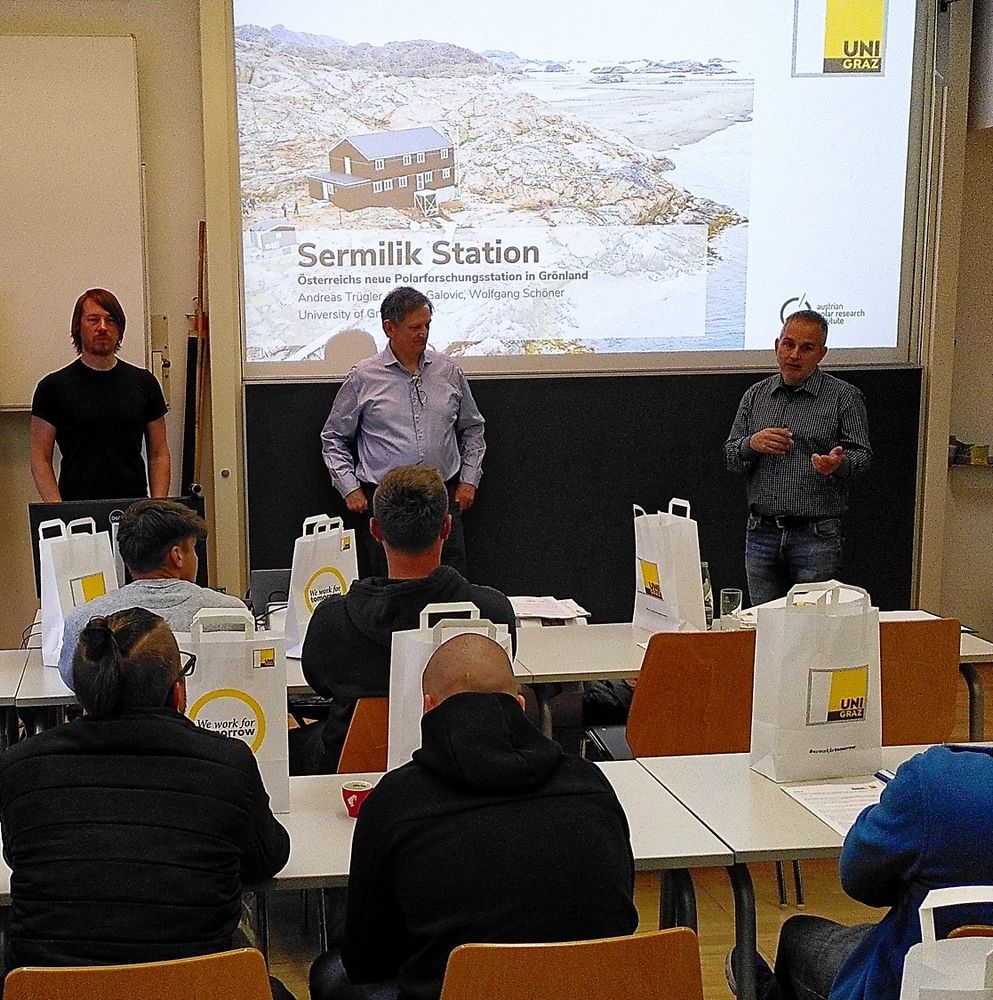
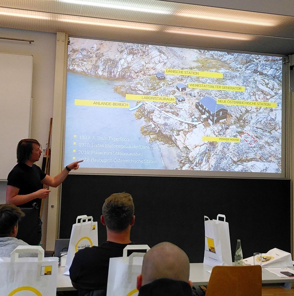
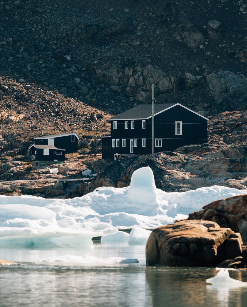
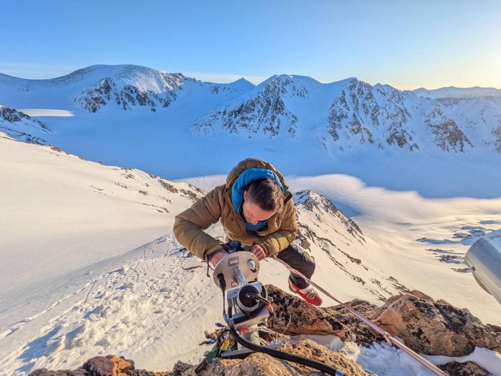
Preparations underway at Sermilik Station!🔧❄️
A UNI Graz team is heading north soon to finalize Austria’s first polar research station before scientists arrive in August. Big thanks to all involved!🏔️
📸 © Steinegger & Ruhsam
#SermilikStation #PolarResearch #APRI #Fieldwork #Arctic
A UNI Graz team is heading north soon to finalize Austria’s first polar research station before scientists arrive in August. Big thanks to all involved!🏔️
📸 © Steinegger & Ruhsam
#SermilikStation #PolarResearch #APRI #Fieldwork #Arctic
June 3, 2025 at 11:23 AM
Preparations underway at Sermilik Station!🔧❄️
A UNI Graz team is heading north soon to finalize Austria’s first polar research station before scientists arrive in August. Big thanks to all involved!🏔️
📸 © Steinegger & Ruhsam
#SermilikStation #PolarResearch #APRI #Fieldwork #Arctic
A UNI Graz team is heading north soon to finalize Austria’s first polar research station before scientists arrive in August. Big thanks to all involved!🏔️
📸 © Steinegger & Ruhsam
#SermilikStation #PolarResearch #APRI #Fieldwork #Arctic
Reposted by Harald Zandler
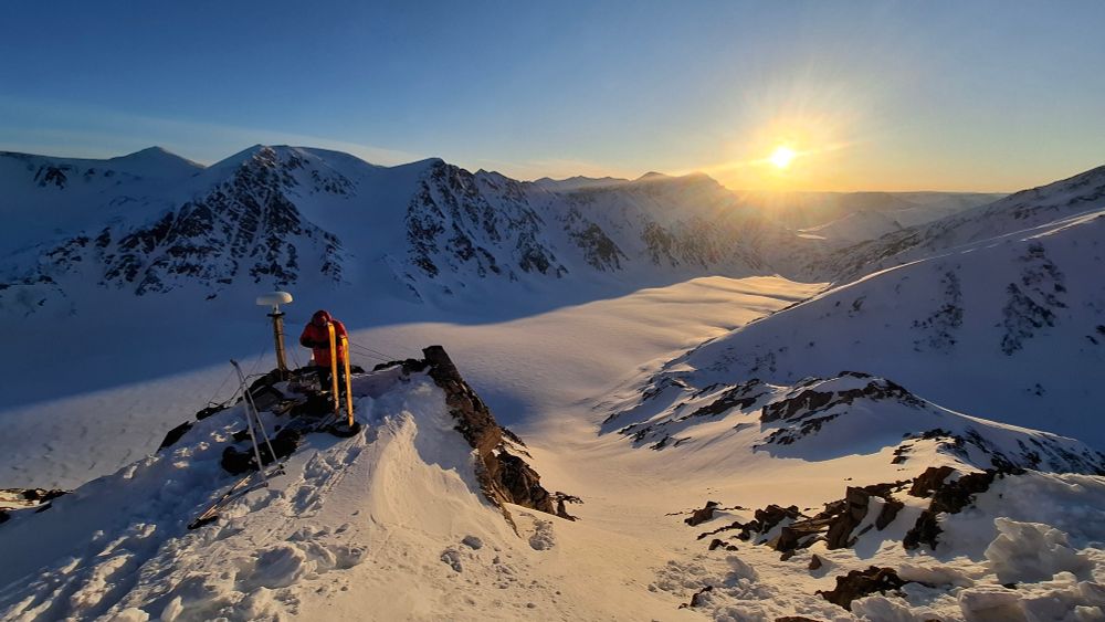
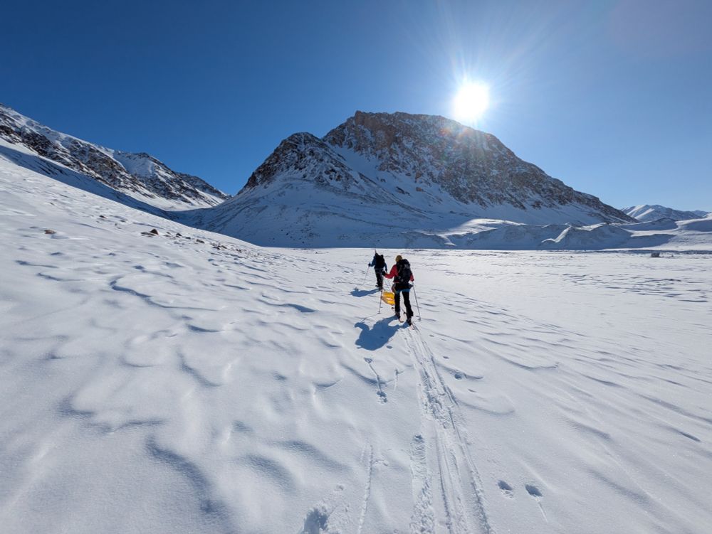
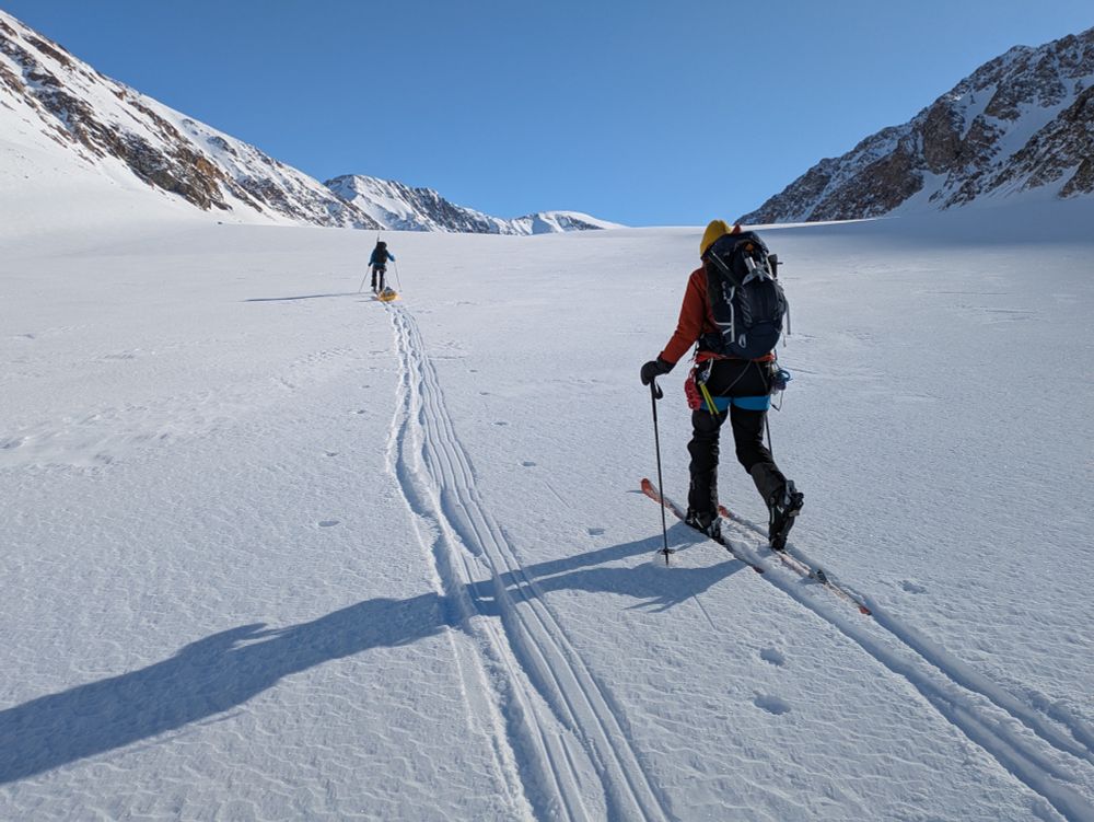
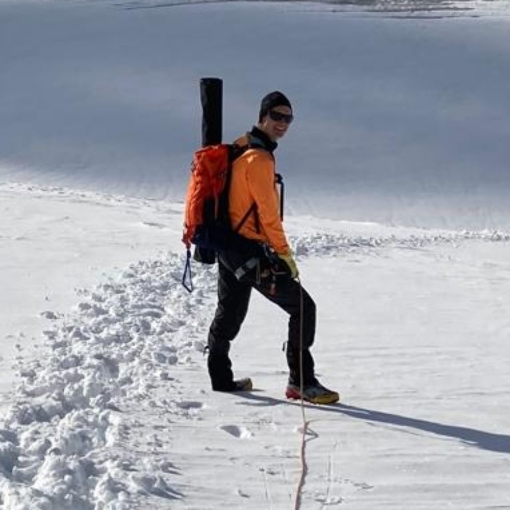
#FieldworkFriday from Freya Glacier, Greenland❄️🌎
A Team from Geosphere Austria conducted glaciological fieldwork at Freya Glacier in Northeast Greenland.
They also fixed the Webcams at the Glacier that you can find on our Website 👉 www.polarresearch.at/multimedia
📷 B. Hynek, A. Neureiter
A Team from Geosphere Austria conducted glaciological fieldwork at Freya Glacier in Northeast Greenland.
They also fixed the Webcams at the Glacier that you can find on our Website 👉 www.polarresearch.at/multimedia
📷 B. Hynek, A. Neureiter
May 23, 2025 at 6:59 PM
#FieldworkFriday from Freya Glacier, Greenland❄️🌎
A Team from Geosphere Austria conducted glaciological fieldwork at Freya Glacier in Northeast Greenland.
They also fixed the Webcams at the Glacier that you can find on our Website 👉 www.polarresearch.at/multimedia
📷 B. Hynek, A. Neureiter
A Team from Geosphere Austria conducted glaciological fieldwork at Freya Glacier in Northeast Greenland.
They also fixed the Webcams at the Glacier that you can find on our Website 👉 www.polarresearch.at/multimedia
📷 B. Hynek, A. Neureiter
Reposted by Harald Zandler
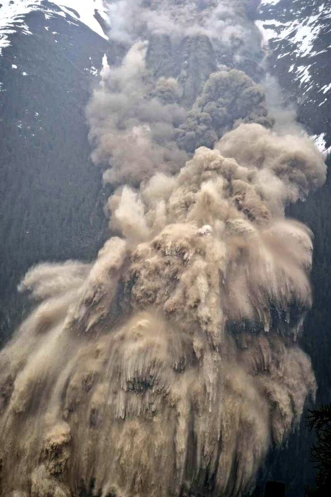
Stunning overview of the former bed of the now gone Birch Glacier shot yesterday from the right lateral moraine 😲😱
INCREDIBLE to think that there WAS a glacier here just a few days ago!
The area above the glacier still holds ~300,000m3 of debris
Source D. Farinotti - @vaw-glaciology.bsky.social
INCREDIBLE to think that there WAS a glacier here just a few days ago!
The area above the glacier still holds ~300,000m3 of debris
Source D. Farinotti - @vaw-glaciology.bsky.social
June 2, 2025 at 1:36 PM
Stunning overview of the former bed of the now gone Birch Glacier shot yesterday from the right lateral moraine 😲😱
INCREDIBLE to think that there WAS a glacier here just a few days ago!
The area above the glacier still holds ~300,000m3 of debris
Source D. Farinotti - @vaw-glaciology.bsky.social
INCREDIBLE to think that there WAS a glacier here just a few days ago!
The area above the glacier still holds ~300,000m3 of debris
Source D. Farinotti - @vaw-glaciology.bsky.social
Inspired by previous posts of @subfossilguy.bsky.social sky.social and nice visualizations of @stim3on.bsky.social, I created a before and after 3D visualization of the tragic events at Blatten & Birchgletscher. Made possible b#swisstopopo Rapid Mapping imagery and their open data policy
June 2, 2025 at 4:17 PM
Inspired by previous posts of @subfossilguy.bsky.social sky.social and nice visualizations of @stim3on.bsky.social, I created a before and after 3D visualization of the tragic events at Blatten & Birchgletscher. Made possible b#swisstopopo Rapid Mapping imagery and their open data policy
Reposted by Harald Zandler
Nice annotated 3D model of the Birch Glacier collapse! 🏔️🧊🌊
sketchfab.com/3d-models/bl...
Source: Simeon Schmauß - created from @swisstopo Rapid Mapping oblique imagery
sketchfab.com/3d-models/bl...
Source: Simeon Schmauß - created from @swisstopo Rapid Mapping oblique imagery

June 1, 2025 at 12:38 PM
Nice annotated 3D model of the Birch Glacier collapse! 🏔️🧊🌊
sketchfab.com/3d-models/bl...
Source: Simeon Schmauß - created from @swisstopo Rapid Mapping oblique imagery
sketchfab.com/3d-models/bl...
Source: Simeon Schmauß - created from @swisstopo Rapid Mapping oblique imagery
Reposted by Harald Zandler
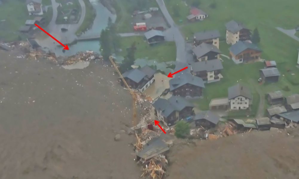
Yesterday's devastating #glacier collapse erasing the Swiss village of Blatten still leaves me speechless...
The high mountain areas are adapting to ever increasing temperatures. It's time to wake up! When, if not now?
This is not far away but right here...
pic: Pomona/A. Amherd
The high mountain areas are adapting to ever increasing temperatures. It's time to wake up! When, if not now?
This is not far away but right here...
pic: Pomona/A. Amherd
May 29, 2025 at 6:15 PM
Yesterday's devastating #glacier collapse erasing the Swiss village of Blatten still leaves me speechless...
The high mountain areas are adapting to ever increasing temperatures. It's time to wake up! When, if not now?
This is not far away but right here...
pic: Pomona/A. Amherd
The high mountain areas are adapting to ever increasing temperatures. It's time to wake up! When, if not now?
This is not far away but right here...
pic: Pomona/A. Amherd
Reposted by Harald Zandler

Es regnet, der Boden sieht wieder feucht aus... Dürre vorbei?
Zur Einordnung, hier ein paar Bodenfeuchte- sowie eine Niederschlagsmessung vom @bayceer.bsky.social an der @unibayreuth.bsky.social.
Kleiner 🧵
Zur Einordnung, hier ein paar Bodenfeuchte- sowie eine Niederschlagsmessung vom @bayceer.bsky.social an der @unibayreuth.bsky.social.
Kleiner 🧵

May 28, 2025 at 2:09 PM
Es regnet, der Boden sieht wieder feucht aus... Dürre vorbei?
Zur Einordnung, hier ein paar Bodenfeuchte- sowie eine Niederschlagsmessung vom @bayceer.bsky.social an der @unibayreuth.bsky.social.
Kleiner 🧵
Zur Einordnung, hier ein paar Bodenfeuchte- sowie eine Niederschlagsmessung vom @bayceer.bsky.social an der @unibayreuth.bsky.social.
Kleiner 🧵
Reposted by Harald Zandler
The river level has already started to rise behind the dam in Blatten! 🌊
A lake is underway... 😨
To 'mitigate' flooding hazard in the valley, the Ferden dam lake, located 6 km downstream has been emptied.
📷 SRF
A lake is underway... 😨
To 'mitigate' flooding hazard in the valley, the Ferden dam lake, located 6 km downstream has been emptied.
📷 SRF
May 28, 2025 at 4:36 PM
The river level has already started to rise behind the dam in Blatten! 🌊
A lake is underway... 😨
To 'mitigate' flooding hazard in the valley, the Ferden dam lake, located 6 km downstream has been emptied.
📷 SRF
A lake is underway... 😨
To 'mitigate' flooding hazard in the valley, the Ferden dam lake, located 6 km downstream has been emptied.
📷 SRF
Are you working on glacier monitoring using UAVs? Do you face challenges in computing glacier surface velocities due to strong glacial surface changes & decorrelation? Our new paper shows that deep learning methods may be a solution where other methods fail: www.frontiersin.org/journals/rem...

Frontiers | Deep learning outperforms existing algorithms in glacier surface velocity estimation with high-resolution data – the example of Austerdalsbreen, Norway
Remote sensing is a key tool to derive glacier surface velocities but existing mapping methods, such as cross-correlation techniques, can fail where surface ...
www.frontiersin.org
May 26, 2025 at 8:56 AM
Are you working on glacier monitoring using UAVs? Do you face challenges in computing glacier surface velocities due to strong glacial surface changes & decorrelation? Our new paper shows that deep learning methods may be a solution where other methods fail: www.frontiersin.org/journals/rem...
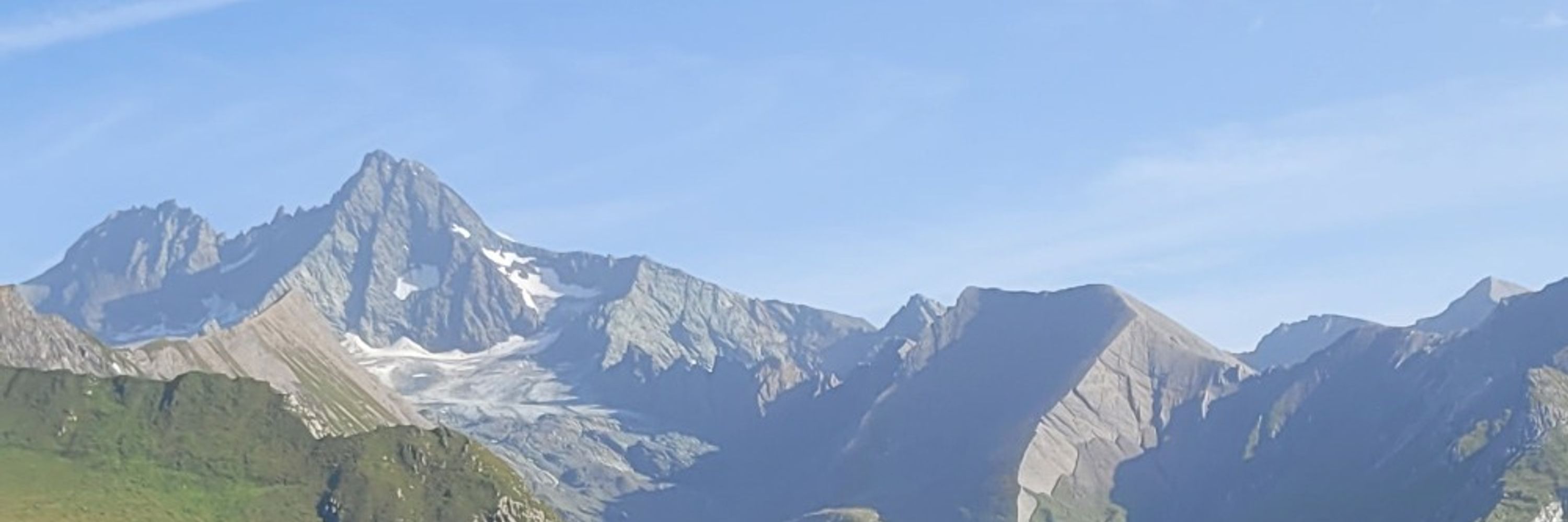
Spring is here at 2470 m.a.s.l.😳 Location: Border Rätikon-Silvretta, Vorarlberg


April 19, 2025 at 12:40 PM
Spring is here at 2470 m.a.s.l.😳 Location: Border Rätikon-Silvretta, Vorarlberg
Today is the first World Day for Glaciers. However, in Austria, glaciers are rapidly vanishing. Here is a 3D comparison of Pasterze 1969-2018. In 2018, the glacier tongue was still well connected to the accumulation area of higher areas. This will soon change:
www.derstandard.de/story/300000...
www.derstandard.de/story/300000...
March 21, 2025 at 7:51 AM
Today is the first World Day for Glaciers. However, in Austria, glaciers are rapidly vanishing. Here is a 3D comparison of Pasterze 1969-2018. In 2018, the glacier tongue was still well connected to the accumulation area of higher areas. This will soon change:
www.derstandard.de/story/300000...
www.derstandard.de/story/300000...
Geographers’ achievement unlocked 😉: had the chance to make a (tiny tiny) contribution to the new school’s atlas for Styria by compiling and coloring the Sentinel-2 mosaic for this nice remote sensing map www.schulatlas.at

November 22, 2024 at 8:16 AM
Geographers’ achievement unlocked 😉: had the chance to make a (tiny tiny) contribution to the new school’s atlas for Styria by compiling and coloring the Sentinel-2 mosaic for this nice remote sensing map www.schulatlas.at
Reposted by Harald Zandler

@hzandler.bsky.social Auge!

It's fat bear week, everyone!!!!!!
explore.org/fat-bear-week
explore.org/fat-bear-week

Fat Bear Week 2024
Fat Bear Week 2024
explore.org
October 2, 2024 at 6:23 PM
@hzandler.bsky.social Auge!
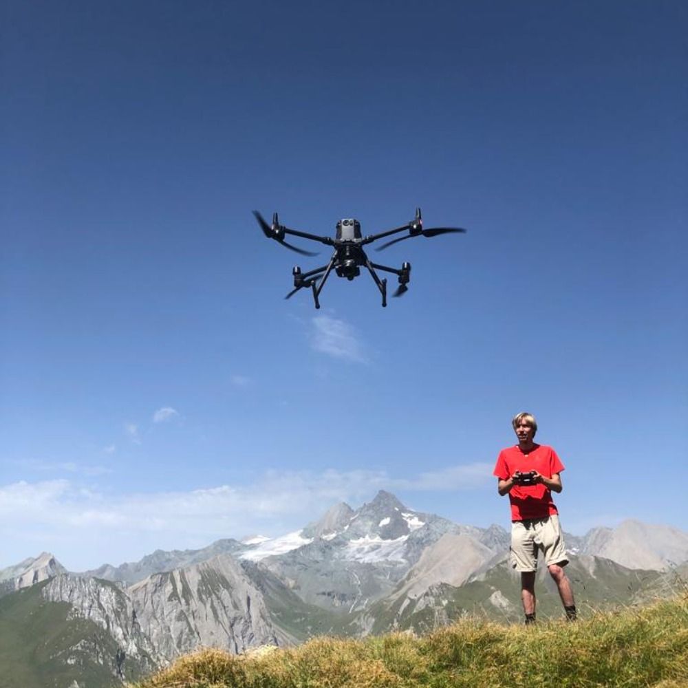
End of summer is field work season. This is our drone mapping #rockglaciers, which are important climate indicators, in Hohe Tauern National Park. The resulting orthophotos allow us to derive flow velocities and compare them with climate trends. #GeoGraz #Permafrost Monitoring

September 3, 2024 at 12:28 PM
End of summer is field work season. This is our drone mapping #rockglaciers, which are important climate indicators, in Hohe Tauern National Park. The resulting orthophotos allow us to derive flow velocities and compare them with climate trends. #GeoGraz #Permafrost Monitoring
Do trees still cool cities despite extreme heat and drought? Yes, but tree species cooling potential strongly varies. This and more in our new #thermal remote sensing publication - covering the current #heatrecord in Franconia in 2022 www.mdpi.com/2072-4292/16...

June 10, 2024 at 9:30 AM
Do trees still cool cities despite extreme heat and drought? Yes, but tree species cooling potential strongly varies. This and more in our new #thermal remote sensing publication - covering the current #heatrecord in Franconia in 2022 www.mdpi.com/2072-4292/16...
Reposted by Harald Zandler
Und jetzt alle gemeinsam: “Farbe ist keine sichere Radinfrastruktur.” 🖤 vorarlberg.orf.at/stories/3252...

Tödlicher Unfall: Radfahrer von Auto niedergefahren
In Bregenz hat sich Donnerstagvormittag ein tödlicher Verkehrsunfall ereignet. Ein 56-jähriger Radfahrer wurde von einem Auto erfasst, er starb noch an der Unfallstelle. Wie die Polizei mitteilte, wur...
vorarlberg.orf.at
April 12, 2024 at 6:16 AM
Und jetzt alle gemeinsam: “Farbe ist keine sichere Radinfrastruktur.” 🖤 vorarlberg.orf.at/stories/3252...
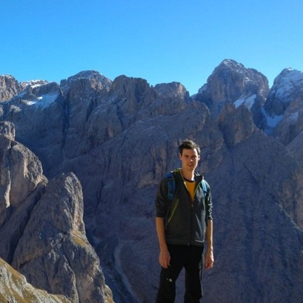
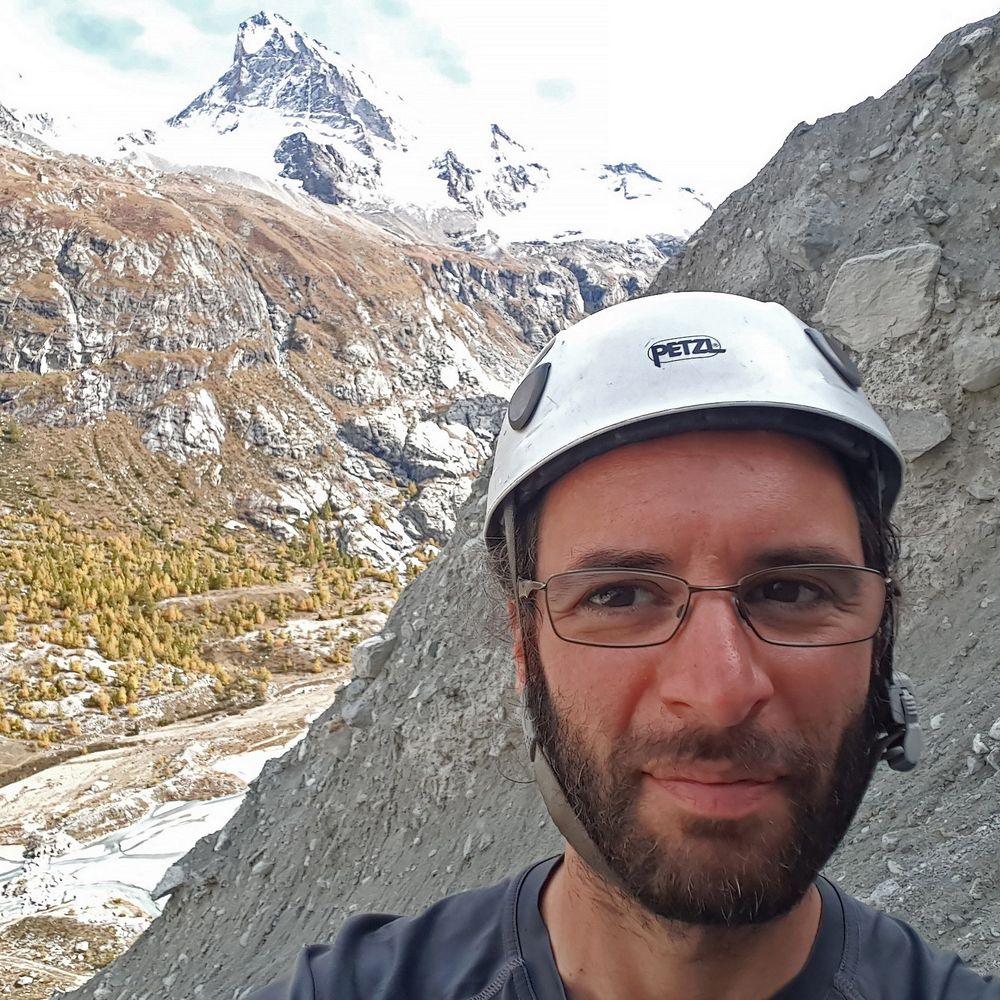
Etwas Eigenwerbung: diesen Donnerstag werde ich - im Rahmen des Kolloquiums des Instituts für Geographie und Raumforschung @UniGraz - über Geographische (Fern-)Erkundung im Hindukusch und Pamir sprechen (30.11., 18:00 Uhr, Heinrichstr. 36, Graz, HS 11.03, Foto: Sayeed©WCS 2016)

November 27, 2023 at 2:09 PM
Etwas Eigenwerbung: diesen Donnerstag werde ich - im Rahmen des Kolloquiums des Instituts für Geographie und Raumforschung @UniGraz - über Geographische (Fern-)Erkundung im Hindukusch und Pamir sprechen (30.11., 18:00 Uhr, Heinrichstr. 36, Graz, HS 11.03, Foto: Sayeed©WCS 2016)
Huge team effort including data of more than three expeditions - a short thread on our new paper with @TheWCS: we present a detailed approach to assess grazing intensity & sustainability in high mountain rangelands with remote sensing & field data (1/10): www.sciencedirect.com/science/arti...

High-resolution assessment of the carrying capacity and utilization intensity in mountain rangelands...
Dry rangelands provide resources for half of the world's livestock, but degradation due to overgrazing is a major threat to system sustainability. Exi…
www.sciencedirect.com
November 6, 2023 at 5:05 PM
Huge team effort including data of more than three expeditions - a short thread on our new paper with @TheWCS: we present a detailed approach to assess grazing intensity & sustainability in high mountain rangelands with remote sensing & field data (1/10): www.sciencedirect.com/science/arti...