


Luca Malatesta
@geoluca.bsky.social
Geologist at GFZ (gfz.bsky.social). Interested in all things tectonic and climatic geomorphology.
https://www.gfz-potsdam.de/en/staff/luca.malatesta/sec47
ORCID https://orcid.org/0000-0003-0983-715X
https://www.gfz-potsdam.de/en/staff/luca.malatesta/sec47
ORCID https://orcid.org/0000-0003-0983-715X
Pinned

We'd have loved to share this at #AGU25
With marine terraces (4767 platforms 🖱️💪Nina!) spanning the last Myr we show that the faults of the Noto Peninsula EQ started slipping around 300 ka. A landscape evol. model explains the transient topography of the peninsula. 1/3
doi.org/10.1029/2025...
With marine terraces (4767 platforms 🖱️💪Nina!) spanning the last Myr we show that the faults of the Noto Peninsula EQ started slipping around 300 ka. A landscape evol. model explains the transient topography of the peninsula. 1/3
doi.org/10.1029/2025...
These cumulative energy release plots are always great visuals
#EarthquakeReport for 2025 Annual Year in #Earthquakes and #Tsunami
See summaries and interpretive posters for 13 earthquakes from 2025
See cumulative energy release plots for M≥6.5 earthquakes from 2017-2025
earthjay.com?page_id=12459
See summaries and interpretive posters for 13 earthquakes from 2025
See cumulative energy release plots for M≥6.5 earthquakes from 2017-2025
earthjay.com?page_id=12459


January 5, 2026 at 4:25 PM
These cumulative energy release plots are always great visuals
Reposted by Luca Malatesta

#EarthquakeReport for 2025 Annual Year in #Earthquakes and #Tsunami
See summaries and interpretive posters for 13 earthquakes from 2025
See cumulative energy release plots for M≥6.5 earthquakes from 2017-2025
earthjay.com?page_id=12459
See summaries and interpretive posters for 13 earthquakes from 2025
See cumulative energy release plots for M≥6.5 earthquakes from 2017-2025
earthjay.com?page_id=12459
January 2, 2026 at 2:24 AM
#EarthquakeReport for 2025 Annual Year in #Earthquakes and #Tsunami
See summaries and interpretive posters for 13 earthquakes from 2025
See cumulative energy release plots for M≥6.5 earthquakes from 2017-2025
earthjay.com?page_id=12459
See summaries and interpretive posters for 13 earthquakes from 2025
See cumulative energy release plots for M≥6.5 earthquakes from 2017-2025
earthjay.com?page_id=12459
Reposted by Luca Malatesta
Fog streams.
Mont Blanc in the top left.
Mont Blanc in the top left.
December 27, 2025 at 5:06 PM
Fog streams.
Mont Blanc in the top left.
Mont Blanc in the top left.
Mt Blanc in late afternoon light from the Jura

December 27, 2025 at 8:26 PM
Mt Blanc in late afternoon light from the Jura
Fog streams.
Mont Blanc in the top left.
Mont Blanc in the top left.
December 27, 2025 at 5:06 PM
Fog streams.
Mont Blanc in the top left.
Mont Blanc in the top left.
Beautiful. Missing it. everything remains so crisp in the distance.
December 25, 2025 at 11:08 PM
Beautiful. Missing it. everything remains so crisp in the distance.
Ho ho ho, Daisuke Ishimura @daisukeishimura.bsky.social has joined bluesky! 🎄
(pssst @earthjay.bsky.social )
(pssst @earthjay.bsky.social )
December 25, 2025 at 9:50 PM
Ho ho ho, Daisuke Ishimura @daisukeishimura.bsky.social has joined bluesky! 🎄
(pssst @earthjay.bsky.social )
(pssst @earthjay.bsky.social )
There might be some use in finding answers to a set question. But less in realising that there was a better question. That latter exercise is the hard part.
December 22, 2025 at 8:44 AM
There might be some use in finding answers to a set question. But less in realising that there was a better question. That latter exercise is the hard part.
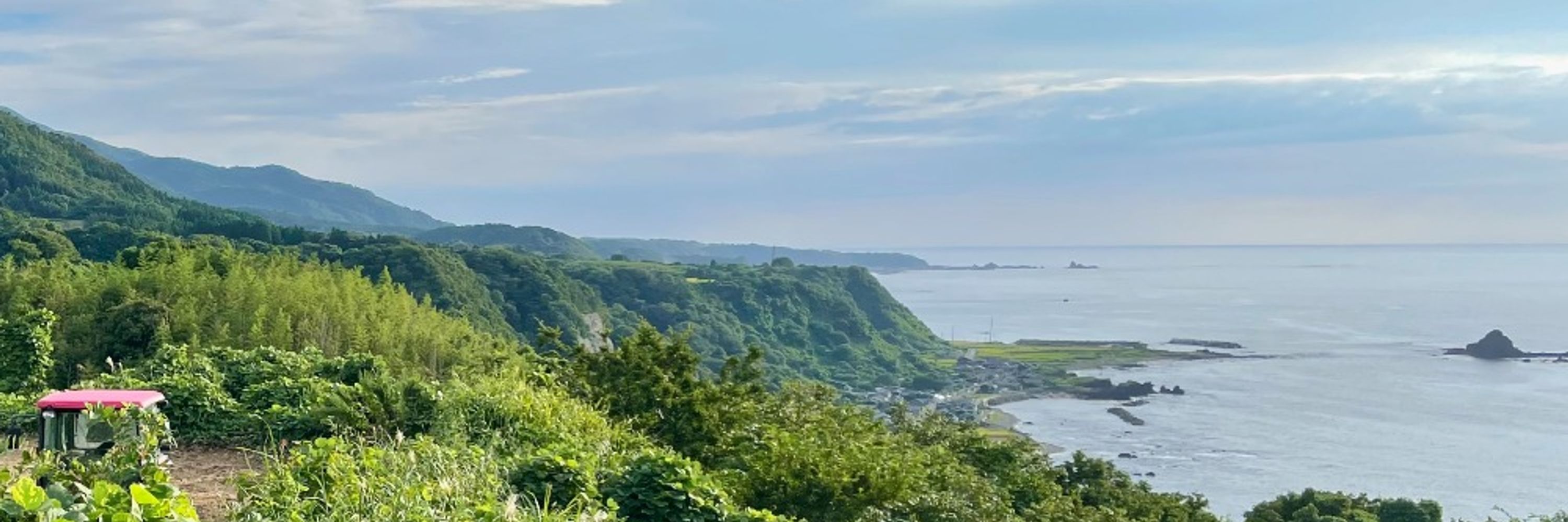
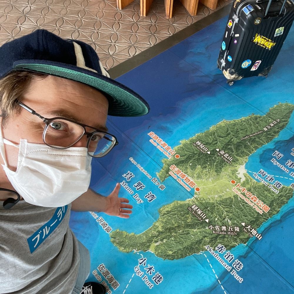
I should actually check with Alessio if the terraces on Noto Peninsula are relevant for WALIS (we will soon have radiometric ages for 5e). also working on digitizing all 7k+ 🗾MIS5e terraces from Koike and Machida (2001) Atlas. But only few have radiometric control.
bsky.app/profile/geol...
bsky.app/profile/geol...
The digitized marine terrace dataset can be downloaded as a shapefile on Zenodo (🔗 below). 4767 individual platforms distributed across 16 generations from the Atlas of Koike and Machida (2001). Maybe the most extensive erosive terrace record at a single site? 3/3
doi.org/10.5281/zeno...
doi.org/10.5281/zeno...

December 22, 2025 at 8:40 AM
I should actually check with Alessio if the terraces on Noto Peninsula are relevant for WALIS (we will soon have radiometric ages for 5e). also working on digitizing all 7k+ 🗾MIS5e terraces from Koike and Machida (2001) Atlas. But only few have radiometric control.
bsky.app/profile/geol...
bsky.app/profile/geol...
Realizing now that by traveling southwest from Berlin to Switzerland, I bought myself an extra 55 minutes of daylight on solstice day!
December 21, 2025 at 2:14 PM
Realizing now that by traveling southwest from Berlin to Switzerland, I bought myself an extra 55 minutes of daylight on solstice day!
Reposted by Luca Malatesta
We'd have loved to share this at #AGU25
With marine terraces (4767 platforms 🖱️💪Nina!) spanning the last Myr we show that the faults of the Noto Peninsula EQ started slipping around 300 ka. A landscape evol. model explains the transient topography of the peninsula. 1/3
doi.org/10.1029/2025...
With marine terraces (4767 platforms 🖱️💪Nina!) spanning the last Myr we show that the faults of the Noto Peninsula EQ started slipping around 300 ka. A landscape evol. model explains the transient topography of the peninsula. 1/3
doi.org/10.1029/2025...
December 19, 2025 at 4:12 PM
We'd have loved to share this at #AGU25
With marine terraces (4767 platforms 🖱️💪Nina!) spanning the last Myr we show that the faults of the Noto Peninsula EQ started slipping around 300 ka. A landscape evol. model explains the transient topography of the peninsula. 1/3
doi.org/10.1029/2025...
With marine terraces (4767 platforms 🖱️💪Nina!) spanning the last Myr we show that the faults of the Noto Peninsula EQ started slipping around 300 ka. A landscape evol. model explains the transient topography of the peninsula. 1/3
doi.org/10.1029/2025...
The digitized marine terrace dataset can be downloaded as a shapefile on Zenodo (🔗 below). 4767 individual platforms distributed across 16 generations from the Atlas of Koike and Machida (2001). Maybe the most extensive erosive terrace record at a single site? 3/3
doi.org/10.5281/zeno...
doi.org/10.5281/zeno...
December 19, 2025 at 4:12 PM
The digitized marine terrace dataset can be downloaded as a shapefile on Zenodo (🔗 below). 4767 individual platforms distributed across 16 generations from the Atlas of Koike and Machida (2001). Maybe the most extensive erosive terrace record at a single site? 3/3
doi.org/10.5281/zeno...
doi.org/10.5281/zeno...
The EQ faults (& scarp) are drowned by the current high stand. Nearby Sado Island shares similar deformation record and is flanked by a similar nearshore scarp. It is the potential location of a large fault system initially suggested by Ota Yoko in 1992 (she was 🎯). 2/3

December 19, 2025 at 4:12 PM
The EQ faults (& scarp) are drowned by the current high stand. Nearby Sado Island shares similar deformation record and is flanked by a similar nearshore scarp. It is the potential location of a large fault system initially suggested by Ota Yoko in 1992 (she was 🎯). 2/3
We'd have loved to share this at #AGU25
With marine terraces (4767 platforms 🖱️💪Nina!) spanning the last Myr we show that the faults of the Noto Peninsula EQ started slipping around 300 ka. A landscape evol. model explains the transient topography of the peninsula. 1/3
doi.org/10.1029/2025...
With marine terraces (4767 platforms 🖱️💪Nina!) spanning the last Myr we show that the faults of the Noto Peninsula EQ started slipping around 300 ka. A landscape evol. model explains the transient topography of the peninsula. 1/3
doi.org/10.1029/2025...
December 19, 2025 at 4:12 PM
We'd have loved to share this at #AGU25
With marine terraces (4767 platforms 🖱️💪Nina!) spanning the last Myr we show that the faults of the Noto Peninsula EQ started slipping around 300 ka. A landscape evol. model explains the transient topography of the peninsula. 1/3
doi.org/10.1029/2025...
With marine terraces (4767 platforms 🖱️💪Nina!) spanning the last Myr we show that the faults of the Noto Peninsula EQ started slipping around 300 ka. A landscape evol. model explains the transient topography of the peninsula. 1/3
doi.org/10.1029/2025...
Reposted by Luca Malatesta

December 9, 2025 at 11:18 AM
Shaking was strong, up to shindo 6+. I imagine that liquefaction is a bigger concern. We will know more in the morning.
NHK reports 6 injured in Aomori prefecture (falling objects and falls). 2/2
NHK reports 6 injured in Aomori prefecture (falling objects and falls). 2/2


December 8, 2025 at 5:43 PM
Shaking was strong, up to shindo 6+. I imagine that liquefaction is a bigger concern. We will know more in the morning.
NHK reports 6 injured in Aomori prefecture (falling objects and falls). 2/2
NHK reports 6 injured in Aomori prefecture (falling objects and falls). 2/2
Fortunately, the M7.6 earthquake struck at low tide, reducing the impact of the tsunami (itself smaller than feared, max 70cm observed). 1/2


December 8, 2025 at 5:43 PM
Fortunately, the M7.6 earthquake struck at low tide, reducing the impact of the tsunami (itself smaller than feared, max 70cm observed). 1/2
Reposted by Luca Malatesta
Also, you should really check out Kilauea right now! ⚒️🌋
www.youtube.com/live/tk0tfYD...
www.youtube.com/live/tk0tfYD...

December 6, 2025 at 9:32 PM
Also, you should really check out Kilauea right now! ⚒️🌋
www.youtube.com/live/tk0tfYD...
www.youtube.com/live/tk0tfYD...
North of the Bering Strait earlier today.
First Northern Lights for me!
First Northern Lights for me!


November 25, 2025 at 9:16 PM
North of the Bering Strait earlier today.
First Northern Lights for me!
First Northern Lights for me!
It makes a whole lot of sense yes, the coastal slope hosting the initial road is very landslide prone. (Actually the initial road has been wiped down). Google map has been updated, but the satellite images are still pre-EQ. Free flat land!


November 14, 2025 at 10:10 PM
It makes a whole lot of sense yes, the coastal slope hosting the initial road is very landslide prone. (Actually the initial road has been wiped down). Google map has been updated, but the satellite images are still pre-EQ. Free flat land!
On Noto Peninsula where coseismic uplift was ~2m.
Sequence pre-earthquake, EQ +3 months, EQ +23 months. I thought we would be able to monitor this nice flat surface for weathering efficiency over the years…
Sequence pre-earthquake, EQ +3 months, EQ +23 months. I thought we would be able to monitor this nice flat surface for weathering efficiency over the years…


November 14, 2025 at 9:43 PM
On Noto Peninsula where coseismic uplift was ~2m.
Sequence pre-earthquake, EQ +3 months, EQ +23 months. I thought we would be able to monitor this nice flat surface for weathering efficiency over the years…
Sequence pre-earthquake, EQ +3 months, EQ +23 months. I thought we would be able to monitor this nice flat surface for weathering efficiency over the years…


Noto Earthquake and submarine landscape. After a loooong time looking for reviewers, we received good critical comments which led to notable revisions. Now back in review at GRL hoping that the 2nd round will be shorter than the 6 months of the first: doi.org/10.31223/X53...
October 30, 2025 at 6:59 AM
Noto Earthquake and submarine landscape. After a loooong time looking for reviewers, we received good critical comments which led to notable revisions. Now back in review at GRL hoping that the 2nd round will be shorter than the 6 months of the first: doi.org/10.31223/X53...
He is still on the other place. But I’ll pass the message. I just saw him on Tuesday. It would be nice to read his posts again!
October 30, 2025 at 6:54 AM
He is still on the other place. But I’ll pass the message. I just saw him on Tuesday. It would be nice to read his posts again!
Larches in the fall ☺️
Magnificent trees
Magnificent trees
October 17, 2025 at 9:05 PM
Larches in the fall ☺️
Magnificent trees
Magnificent trees