


Malcolm
@ecmalcolm.bsky.social
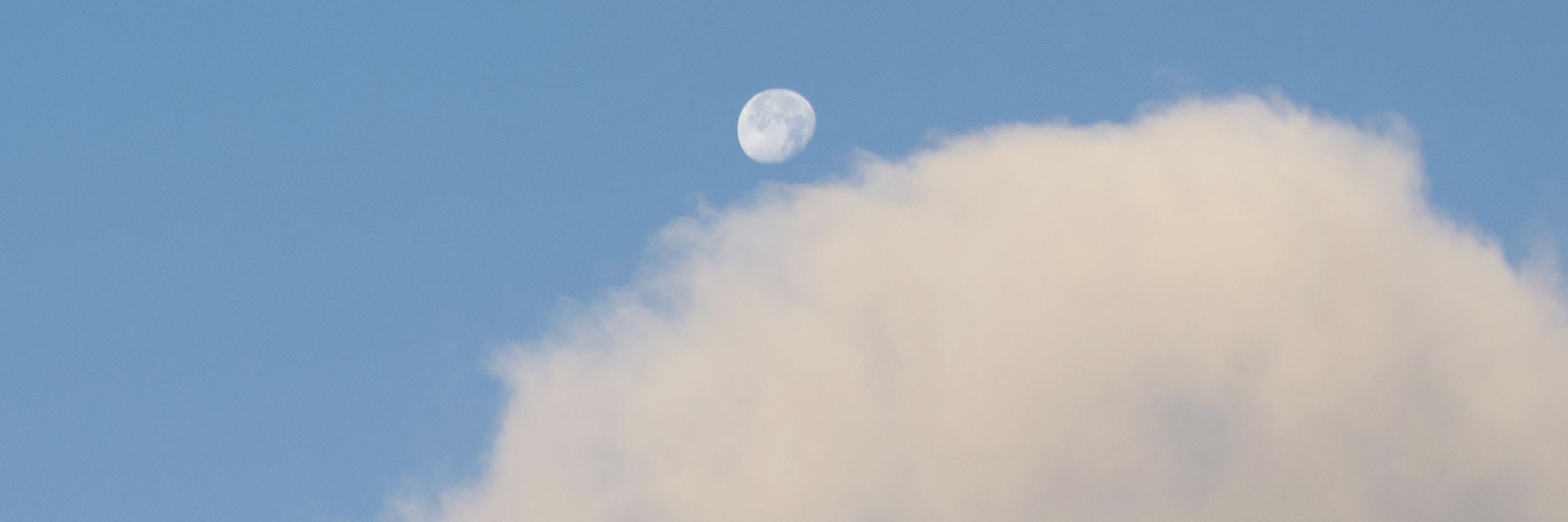
Enjoyer of clouds - Someone once asked if I was a photographer - #BillsMafia - Resident of the Finger Lakes region - 🐦
Pinned


Reposted by Malcolm

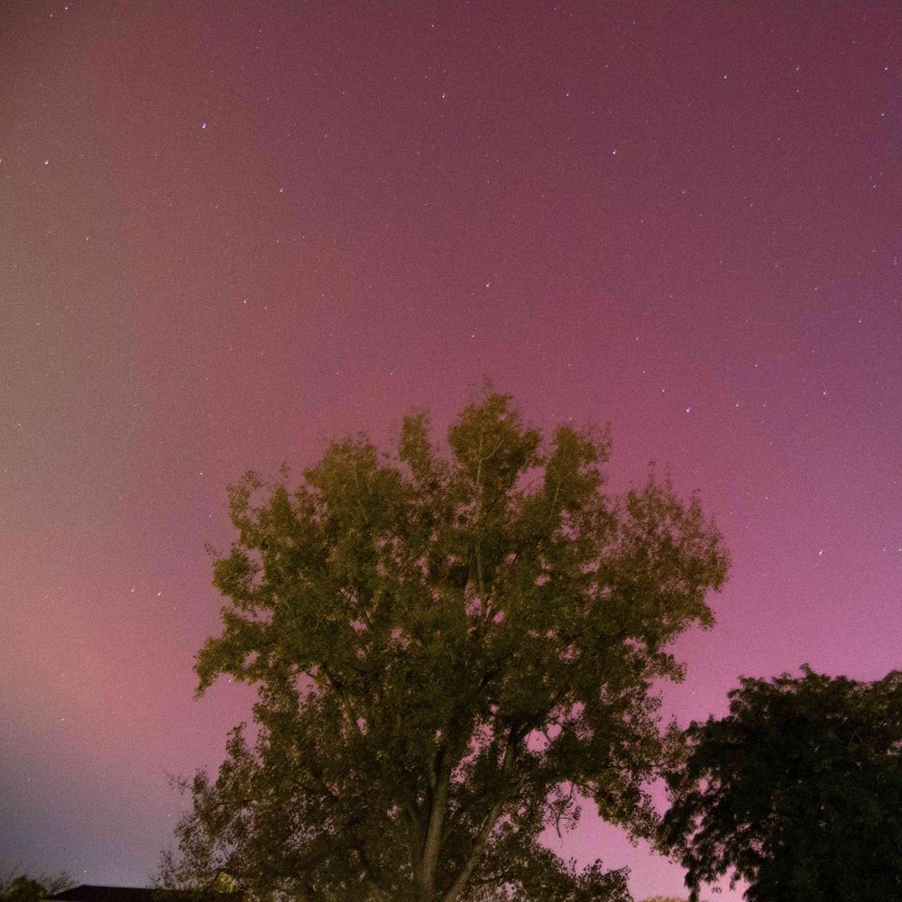
Auroras from a few weeks ago in Wyoming! By far the most vibrant reds I’ve ever seen. It almost felt wrong how saturated this image rendered out as. What a moment. ✨
#photography #landscapephotography #auroras #northernlights #wyoming #sonyalpha
#photography #landscapephotography #auroras #northernlights #wyoming #sonyalpha

November 26, 2025 at 9:50 PM
Auroras from a few weeks ago in Wyoming! By far the most vibrant reds I’ve ever seen. It almost felt wrong how saturated this image rendered out as. What a moment. ✨
#photography #landscapephotography #auroras #northernlights #wyoming #sonyalpha
#photography #landscapephotography #auroras #northernlights #wyoming #sonyalpha
Reposted by Malcolm

I'm happy to share two @cssl.ca open-access remote sensing papers that are both related to alternative methods of classifying tornado damage! 🧵:

November 26, 2025 at 6:46 PM
I'm happy to share two @cssl.ca open-access remote sensing papers that are both related to alternative methods of classifying tornado damage! 🧵:
Reposted by Malcolm

Here's a link to the premiere of my annual year-end storm chasing flick 'SKYDRAMA 2025'.
It's a long watch! Avoid the cold wind and watch it all at once, or enjoy it with leftovers through the holiday weekend. Cheers!
www.youtube.com/watch?v=dGLH...
It's a long watch! Avoid the cold wind and watch it all at once, or enjoy it with leftovers through the holiday weekend. Cheers!
www.youtube.com/watch?v=dGLH...

SKYDRAMA 2025 | The 2025 Storm Observation Season
YouTube video by Meteorologist Andrew Pritchard
www.youtube.com
November 26, 2025 at 7:01 PM
Here's a link to the premiere of my annual year-end storm chasing flick 'SKYDRAMA 2025'.
It's a long watch! Avoid the cold wind and watch it all at once, or enjoy it with leftovers through the holiday weekend. Cheers!
www.youtube.com/watch?v=dGLH...
It's a long watch! Avoid the cold wind and watch it all at once, or enjoy it with leftovers through the holiday weekend. Cheers!
www.youtube.com/watch?v=dGLH...
Reposted by Malcolm

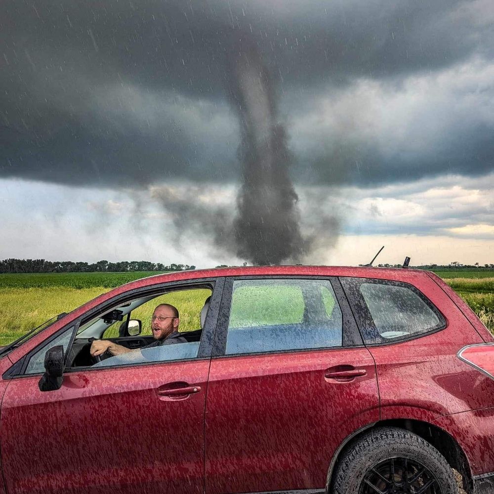
caught a nice dust devil on the stream
November 26, 2025 at 2:20 AM
caught a nice dust devil on the stream


Reposted by Malcolm

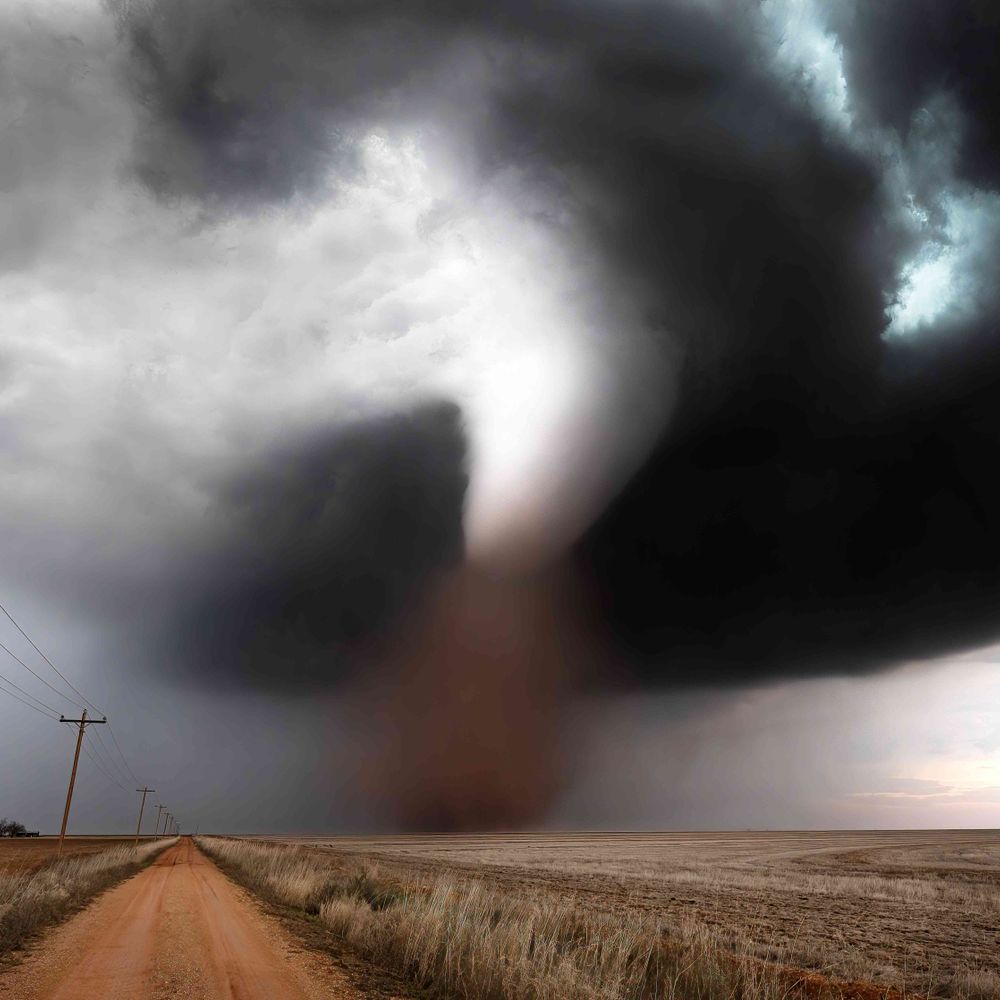
Probably one of my tor favorite photos (that I captured) from this last storm season. It was in the earlier stages of the Arnett, OK tornado of May 18. Of course, it's hard to compete with Dickens, NE or Gary, SD, but I wasn't on either of those two events. With @francescodemartin.bsky.social

November 25, 2025 at 10:04 PM
Probably one of my tor favorite photos (that I captured) from this last storm season. It was in the earlier stages of the Arnett, OK tornado of May 18. Of course, it's hard to compete with Dickens, NE or Gary, SD, but I wasn't on either of those two events. With @francescodemartin.bsky.social
Reposted by Malcolm

I've seen remarkable things in my years of chasing, but this scene from my first year remains a favorite. Here, the flanking line of a supercell is painted by the setting Sun, while the very clouds you're looking at cast shadows for miles (seen as anticrepuscular rays near the horizon). #photography

November 25, 2025 at 9:56 PM
I've seen remarkable things in my years of chasing, but this scene from my first year remains a favorite. Here, the flanking line of a supercell is painted by the setting Sun, while the very clouds you're looking at cast shadows for miles (seen as anticrepuscular rays near the horizon). #photography
Reposted by Malcolm
ITS PRINT SZN! I have a 10% discount running through Dec 26th using code: LandAndSky10
Link below!
marcusreynolds.darkroom.com/collections/...
Link below!
marcusreynolds.darkroom.com/collections/...


November 25, 2025 at 9:45 PM
ITS PRINT SZN! I have a 10% discount running through Dec 26th using code: LandAndSky10
Link below!
marcusreynolds.darkroom.com/collections/...
Link below!
marcusreynolds.darkroom.com/collections/...
Reposted by Malcolm

23 NOV 2025 - Waterspout near Bozburun (Muğla region), Türkiye. Medit.Sea.
@bramvantveen.bsky.social @federicopavan.bsky.social @aaron-stormchase.bsky.social @weatherhistory.bsky.social #weather #severewx #wx #turkey #türkiye @sarahhants.bsky.social @dnsrop.bsky.social
source: İHA, 24 NOV 2025
@bramvantveen.bsky.social @federicopavan.bsky.social @aaron-stormchase.bsky.social @weatherhistory.bsky.social #weather #severewx #wx #turkey #türkiye @sarahhants.bsky.social @dnsrop.bsky.social
source: İHA, 24 NOV 2025

November 25, 2025 at 10:12 AM
23 NOV 2025 - Waterspout near Bozburun (Muğla region), Türkiye. Medit.Sea.
@bramvantveen.bsky.social @federicopavan.bsky.social @aaron-stormchase.bsky.social @weatherhistory.bsky.social #weather #severewx #wx #turkey #türkiye @sarahhants.bsky.social @dnsrop.bsky.social
source: İHA, 24 NOV 2025
@bramvantveen.bsky.social @federicopavan.bsky.social @aaron-stormchase.bsky.social @weatherhistory.bsky.social #weather #severewx #wx #turkey #türkiye @sarahhants.bsky.social @dnsrop.bsky.social
source: İHA, 24 NOV 2025
Reposted by Malcolm
March 31st of 2023 near Hedrick, Iowa
an extremely fast moving and powerful tornado during a high risk tornado outbreak across eastern Iowa
an extremely fast moving and powerful tornado during a high risk tornado outbreak across eastern Iowa
November 24, 2025 at 3:19 AM
March 31st of 2023 near Hedrick, Iowa
an extremely fast moving and powerful tornado during a high risk tornado outbreak across eastern Iowa
an extremely fast moving and powerful tornado during a high risk tornado outbreak across eastern Iowa
Reposted by Malcolm
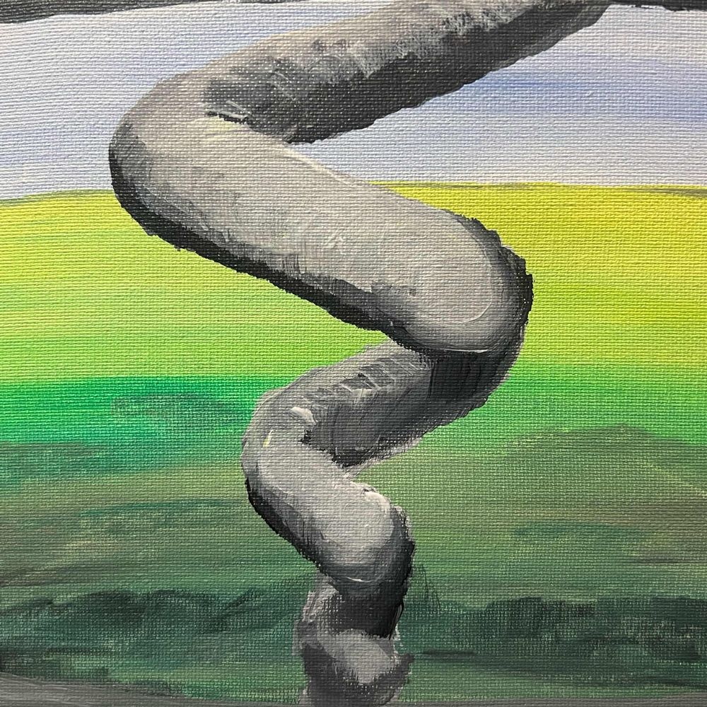
#MegawedgeMonday
May 31, 2013 El Reno, Oklahoma
Megawedge (noun) - defined as a visually wedge-shaped tornado with respect to the observer from a wall cloud or updraft base to Earth's surface with a diameter equal to or greater than 1.5 miles in diameter.
#okwx
May 31, 2013 El Reno, Oklahoma
Megawedge (noun) - defined as a visually wedge-shaped tornado with respect to the observer from a wall cloud or updraft base to Earth's surface with a diameter equal to or greater than 1.5 miles in diameter.
#okwx

November 24, 2025 at 3:59 PM
#MegawedgeMonday
May 31, 2013 El Reno, Oklahoma
Megawedge (noun) - defined as a visually wedge-shaped tornado with respect to the observer from a wall cloud or updraft base to Earth's surface with a diameter equal to or greater than 1.5 miles in diameter.
#okwx
May 31, 2013 El Reno, Oklahoma
Megawedge (noun) - defined as a visually wedge-shaped tornado with respect to the observer from a wall cloud or updraft base to Earth's surface with a diameter equal to or greater than 1.5 miles in diameter.
#okwx
Reposted by Malcolm
Aurora Structure Reference Guide
Special thanks to Jeremy, Chris and Landon for their expertise/ knowledge.
With the help of some friends photos, I made quick guide to the structures most often seen during mid latitude aurora events to communicate to general audiences what they’re seeing!
Special thanks to Jeremy, Chris and Landon for their expertise/ knowledge.
With the help of some friends photos, I made quick guide to the structures most often seen during mid latitude aurora events to communicate to general audiences what they’re seeing!

November 23, 2025 at 10:17 PM
Aurora Structure Reference Guide
Special thanks to Jeremy, Chris and Landon for their expertise/ knowledge.
With the help of some friends photos, I made quick guide to the structures most often seen during mid latitude aurora events to communicate to general audiences what they’re seeing!
Special thanks to Jeremy, Chris and Landon for their expertise/ knowledge.
With the help of some friends photos, I made quick guide to the structures most often seen during mid latitude aurora events to communicate to general audiences what they’re seeing!
Reposted by Malcolm

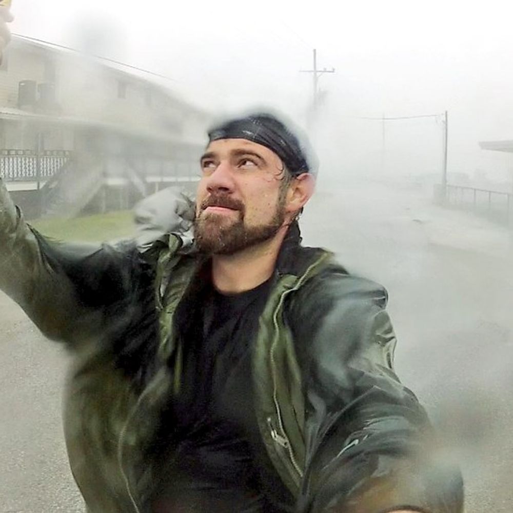
OH NO! DISASTER! WHAT A BAD IDEA!
November 23, 2025 at 5:04 AM
OH NO! DISASTER! WHAT A BAD IDEA!
Reposted by Malcolm
From 4/27/2011, a short multi-tilt storm-following loop from ARMOR of the Hackleburg tornado. Some pretty incredible temporal resolution is possible like this when you interleave the different tilts! You get some shakiness but overall this turned out quite incredible. Love the merger stream!
November 22, 2025 at 1:36 AM
From 4/27/2011, a short multi-tilt storm-following loop from ARMOR of the Hackleburg tornado. Some pretty incredible temporal resolution is possible like this when you interleave the different tilts! You get some shakiness but overall this turned out quite incredible. Love the merger stream!
Reposted by Malcolm

Reposted by Malcolm
What a year 2025 has been so far!
Still 5+ weeks to go...
with @JustonStrmRider
Still 5+ weeks to go...
with @JustonStrmRider


November 21, 2025 at 8:16 PM
What a year 2025 has been so far!
Still 5+ weeks to go...
with @JustonStrmRider
Still 5+ weeks to go...
with @JustonStrmRider
Reposted by Malcolm
Also a short time lapse video of the proton aurora being extraordinarily bright and dynamic!
November 21, 2025 at 12:00 AM
Also a short time lapse video of the proton aurora being extraordinarily bright and dynamic!
Reposted by Malcolm
Anyone else get absolutely dazzled by the ridiculous amount of proton aurora on 11/11? All night it was showing up in very quick bursts!


November 20, 2025 at 11:59 PM
Anyone else get absolutely dazzled by the ridiculous amount of proton aurora on 11/11? All night it was showing up in very quick bursts!
Could've sworn this stretch of the thruway was a lot greener 🤔
Must be that changing climate people keep talking about.
Must be that changing climate people keep talking about.

November 20, 2025 at 4:58 PM
Could've sworn this stretch of the thruway was a lot greener 🤔
Must be that changing climate people keep talking about.
Must be that changing climate people keep talking about.
Reposted by Malcolm


November 19, 2025 at 10:21 PM
Reposted by Malcolm
A “lost” tornado from 2011 was surveyed and confirmed 14+ years later by NWS Birmingham. They wrote, “It is important to correct the record for both accuracy and credibility.”
More details here: www.facebook.com/share/p/17KG...
More details here: www.facebook.com/share/p/17KG...

November 19, 2025 at 11:57 PM
A “lost” tornado from 2011 was surveyed and confirmed 14+ years later by NWS Birmingham. They wrote, “It is important to correct the record for both accuracy and credibility.”
More details here: www.facebook.com/share/p/17KG...
More details here: www.facebook.com/share/p/17KG...
Reposted by Malcolm

Hurricane Melissa produced the fastest hurricane winds to be recorded by a dropsonde, verified by reviewing data at NSF NCAR! Hurricane Melissa’s 252 mph wind gust surpassed the previous record from Typhoon Megi over the Western Pacific in 2010, where a dropsonde measured wind gusts of 248 mph.

November 19, 2025 at 5:37 PM
Hurricane Melissa produced the fastest hurricane winds to be recorded by a dropsonde, verified by reviewing data at NSF NCAR! Hurricane Melissa’s 252 mph wind gust surpassed the previous record from Typhoon Megi over the Western Pacific in 2010, where a dropsonde measured wind gusts of 248 mph.
Reposted by Malcolm
a tornadic supercell just west of the Missouri River on the border of North Dakota and South Dakota between Selfridge, ND and McLaughlin, SD - this storm produced multiple tornadoes west of the river before the real show began a few hours later near Mound City, SD - 8/28/2024
November 19, 2025 at 4:06 AM
a tornadic supercell just west of the Missouri River on the border of North Dakota and South Dakota between Selfridge, ND and McLaughlin, SD - this storm produced multiple tornadoes west of the river before the real show began a few hours later near Mound City, SD - 8/28/2024
Reposted by Malcolm
a large and extremely dangerous tornado
- 6/17/2014 near Coleridge, Nebraska
- 6/17/2014 near Coleridge, Nebraska
November 19, 2025 at 3:18 AM
a large and extremely dangerous tornado
- 6/17/2014 near Coleridge, Nebraska
- 6/17/2014 near Coleridge, Nebraska
Reposted by Malcolm

Possible goofballs in northwest Tennessee

November 19, 2025 at 2:54 AM
Possible goofballs in northwest Tennessee