


Brad Storm Chaser
@bradstorm19.bsky.social
I love weather and storms.
Reposted by Brad Storm Chaser

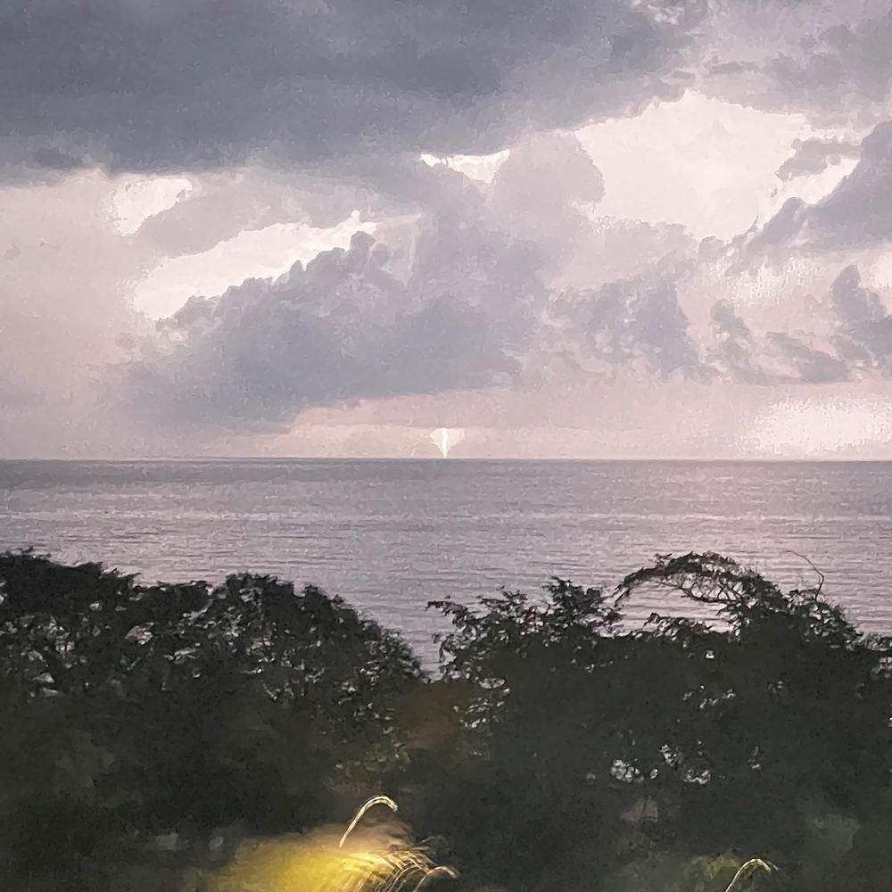
Ice flowers are as 'cool' as they sound!❄️🌼 The rare natural spectacle only appears in specific freezing conditions.
Watch more video: https://ow.ly/IEtE50YbYpe
Watch more video: https://ow.ly/IEtE50YbYpe
February 10, 2026 at 12:16 AM
Ice flowers are as 'cool' as they sound!❄️🌼 The rare natural spectacle only appears in specific freezing conditions.
Watch more video: https://ow.ly/IEtE50YbYpe
Watch more video: https://ow.ly/IEtE50YbYpe
Reposted by Brad Storm Chaser


Reposted by Brad Storm Chaser

More snow on the way!
An Alberta Clipper brings shovelable snow mid-week.
Snow spreads in west to east Wednesday with a slow/snowy afternoon-evening commute. Snow tapers overnight for most, lingers into Thursday in the east.
10–20 cm for Nova Scotia with 5–10 cm, southern NB.
Stay tuned.
#halisky
An Alberta Clipper brings shovelable snow mid-week.
Snow spreads in west to east Wednesday with a slow/snowy afternoon-evening commute. Snow tapers overnight for most, lingers into Thursday in the east.
10–20 cm for Nova Scotia with 5–10 cm, southern NB.
Stay tuned.
#halisky


February 9, 2026 at 10:14 PM
More snow on the way!
An Alberta Clipper brings shovelable snow mid-week.
Snow spreads in west to east Wednesday with a slow/snowy afternoon-evening commute. Snow tapers overnight for most, lingers into Thursday in the east.
10–20 cm for Nova Scotia with 5–10 cm, southern NB.
Stay tuned.
#halisky
An Alberta Clipper brings shovelable snow mid-week.
Snow spreads in west to east Wednesday with a slow/snowy afternoon-evening commute. Snow tapers overnight for most, lingers into Thursday in the east.
10–20 cm for Nova Scotia with 5–10 cm, southern NB.
Stay tuned.
#halisky
Reposted by Brad Storm Chaser

Light snow gradually developing over eastern NS & PEI today & tonight (2-5cm) xcp 15+cm N Inverness County. Snow eases off Tuesday morning.
An area of light snow (5cm or less) moves into western half of Maritimes Wednesday then persists over the eastern half on Thursday.
Looks like fine weekend.
An area of light snow (5cm or less) moves into western half of Maritimes Wednesday then persists over the eastern half on Thursday.
Looks like fine weekend.

February 9, 2026 at 12:03 PM
Light snow gradually developing over eastern NS & PEI today & tonight (2-5cm) xcp 15+cm N Inverness County. Snow eases off Tuesday morning.
An area of light snow (5cm or less) moves into western half of Maritimes Wednesday then persists over the eastern half on Thursday.
Looks like fine weekend.
An area of light snow (5cm or less) moves into western half of Maritimes Wednesday then persists over the eastern half on Thursday.
Looks like fine weekend.
Reposted by Brad Storm Chaser
Just patchy light snow or flurries today and Monday. A brisk and chilly north wind. Sunny periods more likely New Brunswick. Snow a bit heavier eastern areas Monday night... then just brief passing precipitation for the rest of the week with milder temperatures.

February 8, 2026 at 11:03 AM
Just patchy light snow or flurries today and Monday. A brisk and chilly north wind. Sunny periods more likely New Brunswick. Snow a bit heavier eastern areas Monday night... then just brief passing precipitation for the rest of the week with milder temperatures.
Reposted by Brad Storm Chaser
Not much sun, but not much snow next 3 days. Patchy light snow on a northerly flow today that becomes breezier Sunday. A band of snow becomes more likely off the Gulf late Monday into Tuesday.
Milder latter half of next week.
Milder latter half of next week.

February 7, 2026 at 11:18 AM
Not much sun, but not much snow next 3 days. Patchy light snow on a northerly flow today that becomes breezier Sunday. A band of snow becomes more likely off the Gulf late Monday into Tuesday.
Milder latter half of next week.
Milder latter half of next week.
Reposted by Brad Storm Chaser
The latest animation of weather systems keeps the storms passing well south until at least next Thursday. So fine overall but on the cold side. North winds trigger occasional snow off Fundy & Gulf. Then could be some snow next Thursday... but OK for the following weekend?
February 6, 2026 at 12:21 PM
The latest animation of weather systems keeps the storms passing well south until at least next Thursday. So fine overall but on the cold side. North winds trigger occasional snow off Fundy & Gulf. Then could be some snow next Thursday... but OK for the following weekend?
Reposted by Brad Storm Chaser

Happy National Weatherperson's Day!
February 5, 2026 at 5:07 PM
Happy National Weatherperson's Day!
Reposted by Brad Storm Chaser
Measured 5cm new snow that arrived when I did last night. There remains some patchy snow today... more likely in the east, and likely 5cm or less. Sunny breaks more likely in the west.
Pretty quiet weatherwise for the next 7 days.
Pretty quiet weatherwise for the next 7 days.

February 5, 2026 at 12:19 PM
Measured 5cm new snow that arrived when I did last night. There remains some patchy snow today... more likely in the east, and likely 5cm or less. Sunny breaks more likely in the west.
Pretty quiet weatherwise for the next 7 days.
Pretty quiet weatherwise for the next 7 days.
Reposted by Brad Storm Chaser

A weak trough moves east of Nova Scotia tonight. A chance of flurries on Thursday, especially northern/eastern Nova Scotia, PEI, northern New Brunswick and Newfoundland. Temperatures trend cooler to end the week. It looks like we will break the Sunday-Monday storm pattern! #NSwx #NBwx #PEwx #NLwx


February 4, 2026 at 10:03 PM
Reposted by Brad Storm Chaser
I'm OK with the multi-model outlook into mid-month: other than a drop in temperatures early next week, temperatures more comfortable and no suggestion yet of any big storms.
Still slippery at times with passing periods of light snow or sometimes mixed precip.
Still slippery at times with passing periods of light snow or sometimes mixed precip.

February 4, 2026 at 11:42 AM
I'm OK with the multi-model outlook into mid-month: other than a drop in temperatures early next week, temperatures more comfortable and no suggestion yet of any big storms.
Still slippery at times with passing periods of light snow or sometimes mixed precip.
Still slippery at times with passing periods of light snow or sometimes mixed precip.
Reposted by Brad Storm Chaser
Onshore light snow with freezing drizzle mix off the Gulf this morning dissipates as winds drop this aftn.
Patchy light snow, mostly over the southern Maritimes Wednesday. Less than 5cm, but slippery nevertheless.
Next system passes south of region on weekend. No consensus yet on snow hit or miss.
Patchy light snow, mostly over the southern Maritimes Wednesday. Less than 5cm, but slippery nevertheless.
Next system passes south of region on weekend. No consensus yet on snow hit or miss.

February 3, 2026 at 11:18 AM
Onshore light snow with freezing drizzle mix off the Gulf this morning dissipates as winds drop this aftn.
Patchy light snow, mostly over the southern Maritimes Wednesday. Less than 5cm, but slippery nevertheless.
Next system passes south of region on weekend. No consensus yet on snow hit or miss.
Patchy light snow, mostly over the southern Maritimes Wednesday. Less than 5cm, but slippery nevertheless.
Next system passes south of region on weekend. No consensus yet on snow hit or miss.


Reposted by Brad Storm Chaser
Just measured about 10cm... average with drifting from the strong north winds. Snow persisting in eastern NS & E PEI today where north winds continue to be strongest. Western NB will be first to clear.
Just lingering onshore flurries Tuesday. Just brief passing snow Wednesday-Friday.
Just lingering onshore flurries Tuesday. Just brief passing snow Wednesday-Friday.

February 2, 2026 at 11:24 AM
Just measured about 10cm... average with drifting from the strong north winds. Snow persisting in eastern NS & E PEI today where north winds continue to be strongest. Western NB will be first to clear.
Just lingering onshore flurries Tuesday. Just brief passing snow Wednesday-Friday.
Just lingering onshore flurries Tuesday. Just brief passing snow Wednesday-Friday.
Reposted by Brad Storm Chaser
After a shift in the track at the beginning of the weekend, the worst of the nor'easter will be over parts of eastern Nova Scotia and much of Newfoundland. Snow with high winds/poor visibility. Coastal flood risk. Full update: www.facebook.com/share/p/1AdK... #NSwx #PEwx #NLwx


February 1, 2026 at 6:16 PM
After a shift in the track at the beginning of the weekend, the worst of the nor'easter will be over parts of eastern Nova Scotia and much of Newfoundland. Snow with high winds/poor visibility. Coastal flood risk. Full update: www.facebook.com/share/p/1AdK... #NSwx #PEwx #NLwx

Reposted by Brad Storm Chaser
Sunday Nor’easter Update:
Cape Breton & the Northumberland Shore face heavy snow (20–30+ cm), whiteouts, and gusts 70–80+ km/h.
Tough forecast for Halifax and up the 102 to Truro, in the sharp gradient zone (10–20 cm). Snow tapers in northwest
Details: www.cbc.ca/news/canada/...
#halisky #nsstorm
Cape Breton & the Northumberland Shore face heavy snow (20–30+ cm), whiteouts, and gusts 70–80+ km/h.
Tough forecast for Halifax and up the 102 to Truro, in the sharp gradient zone (10–20 cm). Snow tapers in northwest
Details: www.cbc.ca/news/canada/...
#halisky #nsstorm


February 1, 2026 at 2:10 PM
Sunday Nor’easter Update:
Cape Breton & the Northumberland Shore face heavy snow (20–30+ cm), whiteouts, and gusts 70–80+ km/h.
Tough forecast for Halifax and up the 102 to Truro, in the sharp gradient zone (10–20 cm). Snow tapers in northwest
Details: www.cbc.ca/news/canada/...
#halisky #nsstorm
Cape Breton & the Northumberland Shore face heavy snow (20–30+ cm), whiteouts, and gusts 70–80+ km/h.
Tough forecast for Halifax and up the 102 to Truro, in the sharp gradient zone (10–20 cm). Snow tapers in northwest
Details: www.cbc.ca/news/canada/...
#halisky #nsstorm
Reposted by Brad Storm Chaser
An intense storm is bringing snow to the Carolinas coast. This storm passes just south of Sable Is overnight then south of NL Monday. Heavy snow & strong winds (outages?) over mostly the Ern half of NS tonight & early Monday. Halifax on the edge (pics); prepare for the worst but hope for the best.

February 1, 2026 at 11:39 AM
An intense storm is bringing snow to the Carolinas coast. This storm passes just south of Sable Is overnight then south of NL Monday. Heavy snow & strong winds (outages?) over mostly the Ern half of NS tonight & early Monday. Halifax on the edge (pics); prepare for the worst but hope for the best.
Reposted by Brad Storm Chaser
Updated Forecast for Nova Scotia Nor'easter.
Guidance is shifting east with the track of the storm, bringing heaviest snowfall to eastern areas & Cape Breton.
Despite the shift, still expecting very gusty winds with blowing and drifting snow.
Details:
www.cbc.ca/news/canada/...
#halisky #nsstorm
Guidance is shifting east with the track of the storm, bringing heaviest snowfall to eastern areas & Cape Breton.
Despite the shift, still expecting very gusty winds with blowing and drifting snow.
Details:
www.cbc.ca/news/canada/...
#halisky #nsstorm

January 31, 2026 at 10:57 PM
Updated Forecast for Nova Scotia Nor'easter.
Guidance is shifting east with the track of the storm, bringing heaviest snowfall to eastern areas & Cape Breton.
Despite the shift, still expecting very gusty winds with blowing and drifting snow.
Details:
www.cbc.ca/news/canada/...
#halisky #nsstorm
Guidance is shifting east with the track of the storm, bringing heaviest snowfall to eastern areas & Cape Breton.
Despite the shift, still expecting very gusty winds with blowing and drifting snow.
Details:
www.cbc.ca/news/canada/...
#halisky #nsstorm
Reposted by Brad Storm Chaser

Latest HRRR48 model afternoon run goes to town on that bomb. Impressive. And it just keeps deepening, as seen by the isobars "rings"(near the center of the Low) that just keep forming=deepening.
January 31, 2026 at 10:23 PM
Latest HRRR48 model afternoon run goes to town on that bomb. Impressive. And it just keeps deepening, as seen by the isobars "rings"(near the center of the Low) that just keep forming=deepening.
Reposted by Brad Storm Chaser
Snow from a Nor'easter moves onshore Atlantic coast NS late aftn-early evening Sunday. The slight shift in model track continues this am.. adding to the snowfall uncertainty. Pretty typical.
Nevertheless much of NS & PEI wake up Monday am to snow & blowing snow, strong NE winds and cancellations.
Nevertheless much of NS & PEI wake up Monday am to snow & blowing snow, strong NE winds and cancellations.

January 31, 2026 at 11:25 AM
Snow from a Nor'easter moves onshore Atlantic coast NS late aftn-early evening Sunday. The slight shift in model track continues this am.. adding to the snowfall uncertainty. Pretty typical.
Nevertheless much of NS & PEI wake up Monday am to snow & blowing snow, strong NE winds and cancellations.
Nevertheless much of NS & PEI wake up Monday am to snow & blowing snow, strong NE winds and cancellations.
Reposted by Brad Storm Chaser
A nor’easter develops this weekend and approaches our region Sunday night - Monday. Widespread impacts for Nova Scotia and Newfoundland, less so but for parts of P.E.I. and southern New Brunswick too. Timeline and amounts here: facebook.com/story.php?st... #NSwx #NBwx #PEwx #NLwx


January 30, 2026 at 10:07 PM
A nor’easter develops this weekend and approaches our region Sunday night - Monday. Widespread impacts for Nova Scotia and Newfoundland, less so but for parts of P.E.I. and southern New Brunswick too. Timeline and amounts here: facebook.com/story.php?st... #NSwx #NBwx #PEwx #NLwx
Reposted by Brad Storm Chaser
Very cold westerly wind generating some onshore snow off Fundy and Gulf today. Otherwise fine.
Snowstorm Sunday night with strong NE winds. Still too early for snowfall details, but heaviest snow likely Atlantic coast of Mainland NS and over Cape Breton.
Snowstorm Sunday night with strong NE winds. Still too early for snowfall details, but heaviest snow likely Atlantic coast of Mainland NS and over Cape Breton.

January 30, 2026 at 11:51 AM
Very cold westerly wind generating some onshore snow off Fundy and Gulf today. Otherwise fine.
Snowstorm Sunday night with strong NE winds. Still too early for snowfall details, but heaviest snow likely Atlantic coast of Mainland NS and over Cape Breton.
Snowstorm Sunday night with strong NE winds. Still too early for snowfall details, but heaviest snow likely Atlantic coast of Mainland NS and over Cape Breton.
Reposted by Brad Storm Chaser
A trough in the region on Friday will bring a chance of scattered flurries and light snow. Otherwise quiet until later Sunday- Monday when a developing nor’easter moving into the region. The track and thus amounts are still uncertain. Full update: facebook.com/story.php?st... #NSwx #NBwx #PEwx #NLwx


January 29, 2026 at 10:14 PM
A trough in the region on Friday will bring a chance of scattered flurries and light snow. Otherwise quiet until later Sunday- Monday when a developing nor’easter moving into the region. The track and thus amounts are still uncertain. Full update: facebook.com/story.php?st... #NSwx #NBwx #PEwx #NLwx