


Jim Abraham
@yhzweatherguy.bsky.social
Meteorologist. Started Canada’s hurricane research and forecast program. Past-President CMOS: https://www.cmos.ca/site/about/cmos?nav=sidebar
Born 314ppm CO2; we're now 425ppm!
Born 314ppm CO2; we're now 425ppm!
Pinned


Proud to meet some of our Canadian soldiers celebrating Remembrance Day and Lacplesa diena here in Latvia
The multi-model outlook into start of December does not suggest any remarkable storms. For Halifax, some remnant rain or snow showeers today in cool west wind. The next two events (late Fri-Sat and mid next week) are the 10-20mm rain variety.
Cools down as December starts... maybe a setup for snow?
Cools down as December starts... maybe a setup for snow?

November 18, 2025 at 7:42 AM
The multi-model outlook into start of December does not suggest any remarkable storms. For Halifax, some remnant rain or snow showeers today in cool west wind. The next two events (late Fri-Sat and mid next week) are the 10-20mm rain variety.
Cools down as December starts... maybe a setup for snow?
Cools down as December starts... maybe a setup for snow?
As the low moves through the N Gulf winds shift from SW to W to a chilly NW. Might be slippery in a few cm of snow over western areas this morning. Clouds start breaking up this aftn. Showers become mixed with snow; persisting in onshore westerlies.
Fine Wednesday-Friday. Showery Saturday.
Fine Wednesday-Friday. Showery Saturday.

November 17, 2025 at 8:27 AM
As the low moves through the N Gulf winds shift from SW to W to a chilly NW. Might be slippery in a few cm of snow over western areas this morning. Clouds start breaking up this aftn. Showers become mixed with snow; persisting in onshore westerlies.
Fine Wednesday-Friday. Showery Saturday.
Fine Wednesday-Friday. Showery Saturday.
Nasty travel weather: risk black ice early this am. Then a band of rain and strong SE winds crosses the region today. Stays as snow in NW NB.
A colder gusty west wind Monday with rain or wet snow; again making travel tricky.
The chilly west winds persist into Wednesday.
Stormy rain (snow N) Saturday
A colder gusty west wind Monday with rain or wet snow; again making travel tricky.
The chilly west winds persist into Wednesday.
Stormy rain (snow N) Saturday

November 16, 2025 at 8:28 AM
Nasty travel weather: risk black ice early this am. Then a band of rain and strong SE winds crosses the region today. Stays as snow in NW NB.
A colder gusty west wind Monday with rain or wet snow; again making travel tricky.
The chilly west winds persist into Wednesday.
Stormy rain (snow N) Saturday
A colder gusty west wind Monday with rain or wet snow; again making travel tricky.
The chilly west winds persist into Wednesday.
Stormy rain (snow N) Saturday
Fine today but clouds & flurries slow to clear where west winds blow off Fundy & Gulf (esply CB Highlands).
Rain and strong SE winds Sunday. Could be icy start in morning; in fact stays as snow (5-10cm) in NW NB.
Gusty NW winds and cooler Monday; showers or flurries more likely in onshore flow.
Rain and strong SE winds Sunday. Could be icy start in morning; in fact stays as snow (5-10cm) in NW NB.
Gusty NW winds and cooler Monday; showers or flurries more likely in onshore flow.

November 15, 2025 at 9:18 AM
Fine today but clouds & flurries slow to clear where west winds blow off Fundy & Gulf (esply CB Highlands).
Rain and strong SE winds Sunday. Could be icy start in morning; in fact stays as snow (5-10cm) in NW NB.
Gusty NW winds and cooler Monday; showers or flurries more likely in onshore flow.
Rain and strong SE winds Sunday. Could be icy start in morning; in fact stays as snow (5-10cm) in NW NB.
Gusty NW winds and cooler Monday; showers or flurries more likely in onshore flow.
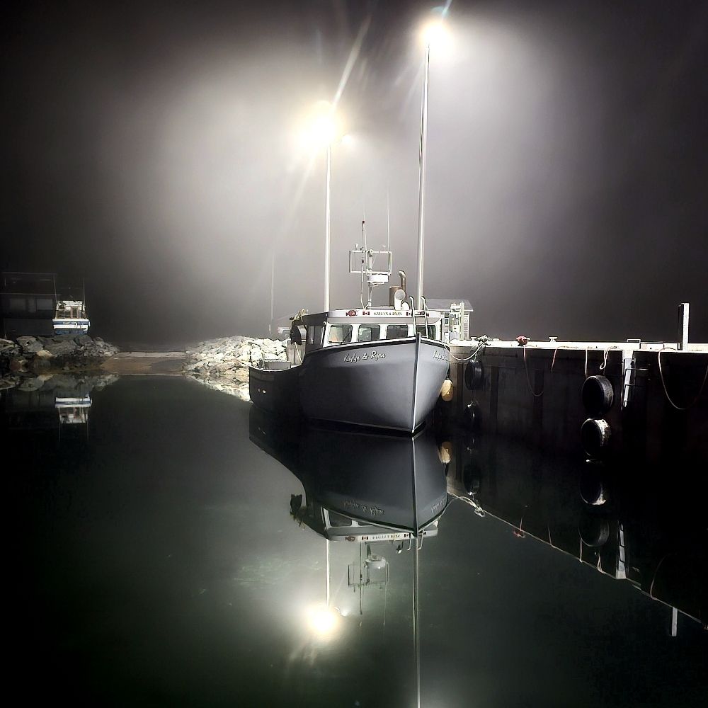
Last day in the beautiful Baltics... Vilnius a surprisingly vibrant and charming EU city with a very interesting history and culture. A few pics from last evening.
Been 6-9C... not bad for 55N.
Been 6-9C... not bad for 55N.


November 14, 2025 at 7:32 AM
Last day in the beautiful Baltics... Vilnius a surprisingly vibrant and charming EU city with a very interesting history and culture. A few pics from last evening.
Been 6-9C... not bad for 55N.
Been 6-9C... not bad for 55N.
An area of rain-drizzle with snow on its W edge is moving eastward today & tonight. Skies partially clear in NB today, then much of NS-PEI Saturday. Clouds & patchy snow will persist in the light onshore NW flow.
Wind & rain (wintry mix NB) develops Sunday, tapering to showers/flurries late Monday.
Wind & rain (wintry mix NB) develops Sunday, tapering to showers/flurries late Monday.

November 14, 2025 at 7:26 AM
An area of rain-drizzle with snow on its W edge is moving eastward today & tonight. Skies partially clear in NB today, then much of NS-PEI Saturday. Clouds & patchy snow will persist in the light onshore NW flow.
Wind & rain (wintry mix NB) develops Sunday, tapering to showers/flurries late Monday.
Wind & rain (wintry mix NB) develops Sunday, tapering to showers/flurries late Monday.
Patchy light precipitation. mostly over the south & east today & Friday. Snow mix on the western edge and over higher terrain may cover roads.
Fine Saturday.
Windy with mostly rain over NS-PEI and a wintry mix in NB Sunday and Monday.
Fine Saturday.
Windy with mostly rain over NS-PEI and a wintry mix in NB Sunday and Monday.

November 13, 2025 at 6:25 AM
Patchy light precipitation. mostly over the south & east today & Friday. Snow mix on the western edge and over higher terrain may cover roads.
Fine Saturday.
Windy with mostly rain over NS-PEI and a wintry mix in NB Sunday and Monday.
Fine Saturday.
Windy with mostly rain over NS-PEI and a wintry mix in NB Sunday and Monday.
A wet start to November... for the period 01-12th, thinking 50mm would be close to normal. The locations in red (mostly NS having 100+mm) have already reached or exceeded their monthly average. A number of areas are over 200mm, with Middle River in Cape Breton coming out on top with 268mm.

November 12, 2025 at 4:16 PM
A wet start to November... for the period 01-12th, thinking 50mm would be close to normal. The locations in red (mostly NS having 100+mm) have already reached or exceeded their monthly average. A number of areas are over 200mm, with Middle River in Cape Breton coming out on top with 268mm.
The Atlantic coast of NS into Cape Breton had 100-200+mm rain in the first 12 days of November (I'll share maps later).
A cold west flow triggered patchy snow overnight. Will now have to consider roads, as snow accompanies our systems; including the weak one Thurs am & a stronger one late Sunday.
A cold west flow triggered patchy snow overnight. Will now have to consider roads, as snow accompanies our systems; including the weak one Thurs am & a stronger one late Sunday.

November 12, 2025 at 6:44 AM
The Atlantic coast of NS into Cape Breton had 100-200+mm rain in the first 12 days of November (I'll share maps later).
A cold west flow triggered patchy snow overnight. Will now have to consider roads, as snow accompanies our systems; including the weak one Thurs am & a stronger one late Sunday.
A cold west flow triggered patchy snow overnight. Will now have to consider roads, as snow accompanies our systems; including the weak one Thurs am & a stronger one late Sunday.
Reposted by Jim Abraham
Reminder: there are Canadian soldiers on active duty in NATO counties bordering Russia.
Proud to meet some of our Canadian soldiers celebrating Remembrance Day and Lacplesa diena here in Latvia
November 11, 2025 at 5:45 PM
Reminder: there are Canadian soldiers on active duty in NATO counties bordering Russia.
Reposted by Jim Abraham

It stopped here, but the total was 90 mm since it started yesterday
November 11, 2025 at 1:00 PM
It stopped here, but the total was 90 mm since it started yesterday
Proud to meet some of our Canadian soldiers celebrating Remembrance Day and Lacplesa diena here in Latvia
November 11, 2025 at 11:11 AM
Proud to meet some of our Canadian soldiers celebrating Remembrance Day and Lacplesa diena here in Latvia
The heavy rain should ease off in eastern NS and end in most other areas for the 11am Remembrance Day ceremonies.
Rain will return to the eastern half of the Maritimes by evening & end overnight.
Flurries will develop in chilly west winds before dawn; a coating on elevated roads? Clearing follows.
Rain will return to the eastern half of the Maritimes by evening & end overnight.
Flurries will develop in chilly west winds before dawn; a coating on elevated roads? Clearing follows.

November 11, 2025 at 6:33 AM
The heavy rain should ease off in eastern NS and end in most other areas for the 11am Remembrance Day ceremonies.
Rain will return to the eastern half of the Maritimes by evening & end overnight.
Flurries will develop in chilly west winds before dawn; a coating on elevated roads? Clearing follows.
Rain will return to the eastern half of the Maritimes by evening & end overnight.
Flurries will develop in chilly west winds before dawn; a coating on elevated roads? Clearing follows.
4pm update: just over 30mm today in Halifax as the heaviest rain is passing just to the east. Along the Eastern Shore, Spanish Ship Bay, who have had a very damp November, has almost reached 50mm so far today
November 10, 2025 at 7:51 PM
4pm update: just over 30mm today in Halifax as the heaviest rain is passing just to the east. Along the Eastern Shore, Spanish Ship Bay, who have had a very damp November, has almost reached 50mm so far today
2am: heavy rain already into HFX & parts SW NS. A wintry mix over central & N NB & parts PEI.
There is a line of heavy rain & thunderstorms lined up toward the Atlantic coast of NS (flash flood risk).
The high resolution CDN model has HFX area under the torrential rain area (100+mm)!
Stay safe...
There is a line of heavy rain & thunderstorms lined up toward the Atlantic coast of NS (flash flood risk).
The high resolution CDN model has HFX area under the torrential rain area (100+mm)!
Stay safe...

November 10, 2025 at 6:23 AM
2am: heavy rain already into HFX & parts SW NS. A wintry mix over central & N NB & parts PEI.
There is a line of heavy rain & thunderstorms lined up toward the Atlantic coast of NS (flash flood risk).
The high resolution CDN model has HFX area under the torrential rain area (100+mm)!
Stay safe...
There is a line of heavy rain & thunderstorms lined up toward the Atlantic coast of NS (flash flood risk).
The high resolution CDN model has HFX area under the torrential rain area (100+mm)!
Stay safe...
Fine today. Teens in much of the south & west.
Rain (snow at first parts NB) develops tonight. Rain at times heavy Mon night-Tues & strong SE winds Fundy & Atl coasts. Models are indicating chances over 100mm (flooding) along Atl coast. (EU has risk over S Shore. CDN has risk E shore-CB).
Stay tuned
Rain (snow at first parts NB) develops tonight. Rain at times heavy Mon night-Tues & strong SE winds Fundy & Atl coasts. Models are indicating chances over 100mm (flooding) along Atl coast. (EU has risk over S Shore. CDN has risk E shore-CB).
Stay tuned

November 9, 2025 at 6:46 AM
Fine today. Teens in much of the south & west.
Rain (snow at first parts NB) develops tonight. Rain at times heavy Mon night-Tues & strong SE winds Fundy & Atl coasts. Models are indicating chances over 100mm (flooding) along Atl coast. (EU has risk over S Shore. CDN has risk E shore-CB).
Stay tuned
Rain (snow at first parts NB) develops tonight. Rain at times heavy Mon night-Tues & strong SE winds Fundy & Atl coasts. Models are indicating chances over 100mm (flooding) along Atl coast. (EU has risk over S Shore. CDN has risk E shore-CB).
Stay tuned
A wintry mix overnight is changing ro rain early this am and sliding south, mostly over NS this aftn & eve. Once again the Strait area into Cape Breton County will have the heaviest amounts (best chance of 25+mm). Fine on Sunday.
Rain moves in Monday (mix N NB); persists NS Tuesday; heaviest east.
Rain moves in Monday (mix N NB); persists NS Tuesday; heaviest east.

November 8, 2025 at 7:48 AM
A wintry mix overnight is changing ro rain early this am and sliding south, mostly over NS this aftn & eve. Once again the Strait area into Cape Breton County will have the heaviest amounts (best chance of 25+mm). Fine on Sunday.
Rain moves in Monday (mix N NB); persists NS Tuesday; heaviest east.
Rain moves in Monday (mix N NB); persists NS Tuesday; heaviest east.
Reposted by Jim Abraham
Reposted by Jim Abraham

I've had almost 100mm of rain in 12 days! #happydance
November 7, 2025 at 11:56 AM
I've had almost 100mm of rain in 12 days! #happydance
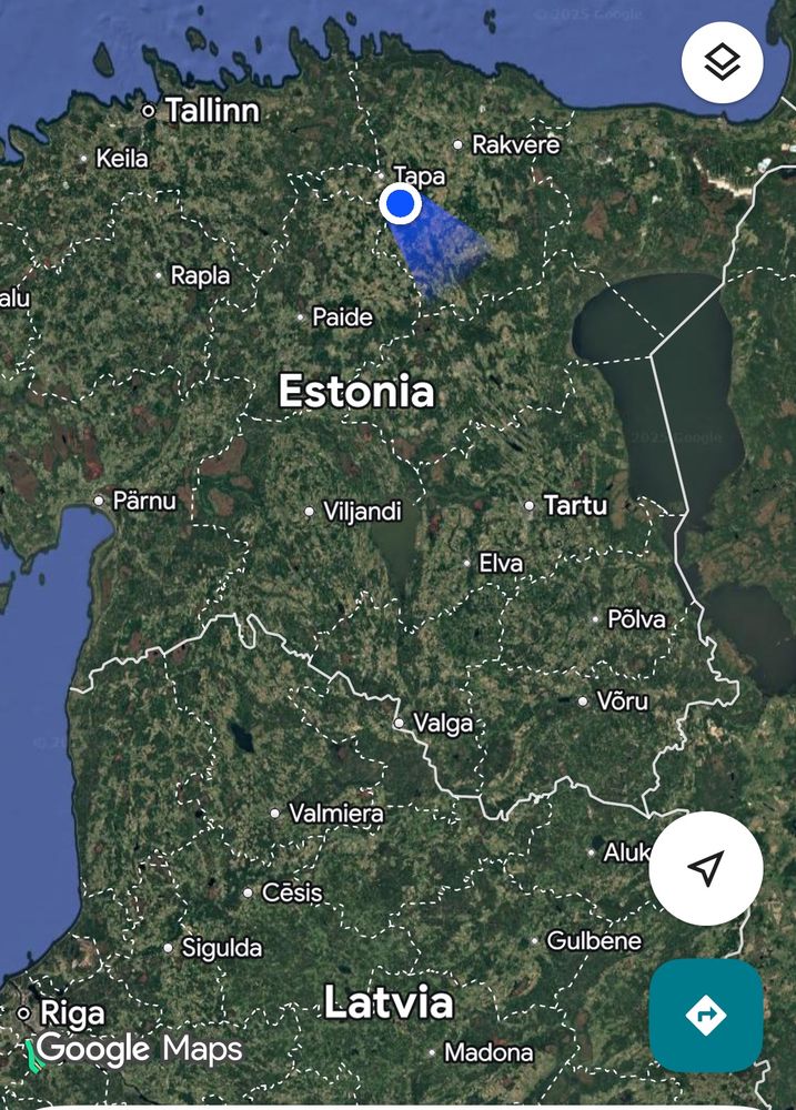
Lots of moose pasture on the train between Tallinn and Riga 😀
November 7, 2025 at 9:32 AM
Lots of moose pasture on the train between Tallinn and Riga 😀
Thursday's rain hardest in Strait area to CB county at 25-45mm. 10-20 elsewhere in NS; 10mm PEI; less that that in most of NB. Rain/snow showers ease off CB today in brisk & chilly NW onshore flow.
Rain develops overnight/early Saturday (10-20mm NS & 5-10mm NB-PEI).
Heavier rain returns Mon-Tues.
Rain develops overnight/early Saturday (10-20mm NS & 5-10mm NB-PEI).
Heavier rain returns Mon-Tues.

November 7, 2025 at 9:17 AM
Thursday's rain hardest in Strait area to CB county at 25-45mm. 10-20 elsewhere in NS; 10mm PEI; less that that in most of NB. Rain/snow showers ease off CB today in brisk & chilly NW onshore flow.
Rain develops overnight/early Saturday (10-20mm NS & 5-10mm NB-PEI).
Heavier rain returns Mon-Tues.
Rain develops overnight/early Saturday (10-20mm NS & 5-10mm NB-PEI).
Heavier rain returns Mon-Tues.

Weird weather. I am at almost 60N and comfortably strolling the streets of the Old Town.
Glad we are getting rain at home, but glad I on vacation up here.
Glad we are getting rain at home, but glad I on vacation up here.


November 6, 2025 at 1:54 PM
Weird weather. I am at almost 60N and comfortably strolling the streets of the Old Town.
Glad we are getting rain at home, but glad I on vacation up here.
Glad we are getting rain at home, but glad I on vacation up here.
Rain moved into the southern Maritimes overnight; heavy at times in NS, and mixed with snow over high terrain.
The rain finally tapers to showers or drizzle this aftn or eve. NS will total 20-40mm (50mm possible along the Atlantic coast).
Gusty & chilly NW winds Friday. Another rain event Saturday.
The rain finally tapers to showers or drizzle this aftn or eve. NS will total 20-40mm (50mm possible along the Atlantic coast).
Gusty & chilly NW winds Friday. Another rain event Saturday.

November 6, 2025 at 7:08 AM
Rain moved into the southern Maritimes overnight; heavy at times in NS, and mixed with snow over high terrain.
The rain finally tapers to showers or drizzle this aftn or eve. NS will total 20-40mm (50mm possible along the Atlantic coast).
Gusty & chilly NW winds Friday. Another rain event Saturday.
The rain finally tapers to showers or drizzle this aftn or eve. NS will total 20-40mm (50mm possible along the Atlantic coast).
Gusty & chilly NW winds Friday. Another rain event Saturday.
Yeserday's rain: 5-10mm NB; 10mm PEI; 10-15mm Mainland NS; and 30-60mm Cape Breton. More rain on Thursday; mostly in NS and heaviest again in CB (see pics). Gusty & chilly NE winds with snow mixed over high terrain.
More rain Saturday & again Mon-Tuesday.
My posts will be at odd times...
More rain Saturday & again Mon-Tuesday.
My posts will be at odd times...

November 5, 2025 at 7:27 AM
Yeserday's rain: 5-10mm NB; 10mm PEI; 10-15mm Mainland NS; and 30-60mm Cape Breton. More rain on Thursday; mostly in NS and heaviest again in CB (see pics). Gusty & chilly NE winds with snow mixed over high terrain.
More rain Saturday & again Mon-Tuesday.
My posts will be at odd times...
More rain Saturday & again Mon-Tuesday.
My posts will be at odd times...