🌉 bridged from ⁂ https://fosstodon.org/@underdarkGIS, follow @ap.brid.gy to interact
I'll be talking about #trajectools for #qgis and a similarly awesome @carto collaboration
I'll be talking about #trajectools for #qgis and a similarly awesome @carto collaboration
We’re looking for speakers. If you’d like to share your #qgis work or ideas, sign up
👉 https://github.com/qgis/QGIS/wiki/QOD-November-2025
#qod #gischat #osgeo

We’re looking for speakers. If you’d like to share your #qgis work or ideas, sign up
👉 https://github.com/qgis/QGIS/wiki/QOD-November-2025
#qod #gischat #osgeo
🍂 It was a beautiful autumn day here in the Netherlands, and I decided to bring a bit of that seasonal magic into my mapmaking. I collected autumn leaves and used them as the background for today’s map.
On top of this natural […]
[Original post on fosstodon.org]

🍂 It was a beautiful autumn day here in the Netherlands, and I decided to bring a bit of that seasonal magic into my mapmaking. I collected autumn leaves and used them as the background for today’s map.
On top of this natural […]
[Original post on fosstodon.org]
The GPL is a copyleft license, which may be very important in the coming years to fight the grab an run. We have to protect ourselves from malicious coders.
The AGPL adds clauses that do this for server code, where the code generated website content and the code […]
The GPL is a copyleft license, which may be very important in the coming years to fight the grab an run. We have to protect ourselves from malicious coders.
The AGPL adds clauses that do this for server code, where the code generated website content and the code […]
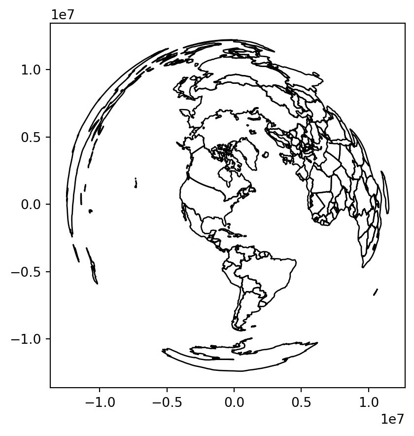
Chapter 6 of Geocomputation with Python dives into:
- Geographic vs projected CRSs (lon/lat vs meters)
- Getting, setting & reprojecting CRSs
- Why ignoring CRSs can break your analysis 🚨
👉 […]
[Original post on fosstodon.org]

Chapter 6 of Geocomputation with Python dives into:
- Geographic vs projected CRSs (lon/lat vs meters)
- Getting, setting & reprojecting CRSs
- Why ignoring CRSs can break your analysis 🚨
👉 […]
[Original post on fosstodon.org]
Das Ergebnis dient dem Programm-Komitee als Meinungsbild aus der Community & wird in die Bewertung einbezogen.
Vorgehen:
1. Link zur Abstimmung klicken, um sich anzumelden […]
[Original post on mastodon.online]

Das Ergebnis dient dem Programm-Komitee als Meinungsbild aus der Community & wird in die Bewertung einbezogen.
Vorgehen:
1. Link zur Abstimmung klicken, um sich anzumelden […]
[Original post on mastodon.online]


In the heart of London, archaeologists working on Southwark Street uncovered the largest Roman mosaic found in the city in half a century. Discovered in 2022 by the Museum of London Archaeology (MOLA), this […]
[Original post on mastodon.online]

In the heart of London, archaeologists working on Southwark Street uncovered the largest Roman mosaic found in the city in half a century. Discovered in 2022 by the Museum of London Archaeology (MOLA), this […]
[Original post on mastodon.online]
Over 250 #geospatial #gischat counts to follow: https://gist.github.com/anitagraser/a37118d74b839602e0f474375f548dfd
I've updated my Geospatial and #SpatialDataScience lists. Now with more than 200 accounts you shouldn't miss.
Details: https://anitagraser.com/2024/02/03/finding-geospatial-accounts-on-mastodon/
#osgeo #gis […]
> https://cran.r-project.org/view=Spatial
#rstats #rspatial #opensource #gischat


> https://cran.r-project.org/view=Spatial
#rstats #rspatial #opensource #gischat
The conversation around Looking for better ways to convert between QGIS VectorLayer and (Geo)DataFrame is continuing over at What I've learned so far: QgsVectorLayer.as_geopandas() has landed in QGIS master on 13 Oct 2025. There's also QgsVectorLayer […]
The conversation around Looking for better ways to convert between QGIS VectorLayer and (Geo)DataFrame is continuing over at What I've learned so far: QgsVectorLayer.as_geopandas() has landed in QGIS master on 13 Oct 2025. There's also QgsVectorLayer […]
Chapter 5 of geocompx talks about:
- Cropping & masking rasters with vectors
- Extracting raster values via vector data
- Raster ↔️ vector conversion (polygonize & rasterize)
👉 https://py.geocompx.org/05-raster-vector
#geopython #python […]
Chapter 5 of geocompx talks about:
- Cropping & masking rasters with vectors
- Extracting raster values via vector data
- Raster ↔️ vector conversion (polygonize & rasterize)
👉 https://py.geocompx.org/05-raster-vector
#geopython #python […]
Short paper submission deadline: March 1, 2026
https://agit.at/en/submissions/
#gischat #giscience #cfp #agit #salzburg

Short paper submission deadline: March 1, 2026
https://agit.at/en/submissions/
#gischat #giscience #cfp #agit #salzburg
The conversation around Looking for better ways to convert between QGIS VectorLayer and (Geo)DataFrame is continuing over at What I've learned so far: QgsVectorLayer.as_geopandas() has landed in QGIS master on 13 Oct 2025. There's also QgsVectorLayer […]
The conversation around Looking for better ways to convert between QGIS VectorLayer and (Geo)DataFrame is continuing over at What I've learned so far: QgsVectorLayer.as_geopandas() has landed in QGIS master on 13 Oct 2025. There's also QgsVectorLayer […]
Austria's Ministry of Economy had taken a decisive step toward digital sovereignty.
The Ministry is migrating 1,200 employees to a Nextcloud-based cloud and collaboration platform hosted on Austrian-based infrastructure
It's the latest […]
Austria's Ministry of Economy had taken a decisive step toward digital sovereignty.
The Ministry is migrating 1,200 employees to a Nextcloud-based cloud and collaboration platform hosted on Austrian-based infrastructure
It's the latest […]
I wonder what @ente think […]
I wonder what @ente think […]
The Geospatial Data Carpentry for Urbanism (TU Delft / thecarpentries) seeks beta pilot workshops.
Details 👉 https://carpentries.org/blog/2025/10/geospatial-data-carpentry-for-urbanism/
#rstats #gis #carpentries #rspatial

The Geospatial Data Carpentry for Urbanism (TU Delft / thecarpentries) seeks beta pilot workshops.
Details 👉 https://carpentries.org/blog/2025/10/geospatial-data-carpentry-for-urbanism/
#rstats #gis #carpentries #rspatial
> Diversity, equity, and inclusion are core to the PSF’s values
https://pyfound.blogspot.com/2025/10/NSF-funding-statement.html
> Diversity, equity, and inclusion are core to the PSF’s values
https://pyfound.blogspot.com/2025/10/NSF-funding-statement.html
Das Video von @_elena ist übrigens genial.

Das Video von @_elena ist übrigens genial.
Chapter 4 of geocompy covers:
- Vector: simplify, buffer, centroid, clip, unions, affine transforms
- Raster: crop, resample, aggregate, align datasets
👉 https://py.geocompx.org/04-geometry-operations
#geopython #python #gischat […]
Chapter 4 of geocompy covers:
- Vector: simplify, buffer, centroid, clip, unions, affine transforms
- Raster: crop, resample, aggregate, align datasets
👉 https://py.geocompx.org/04-geometry-operations
#geopython #python #gischat […]

https://geoaiconference.org/
#gischat #giscience #GeoAI
https://geoaiconference.org/
#gischat #giscience #GeoAI

