


Transitland
@transit.land
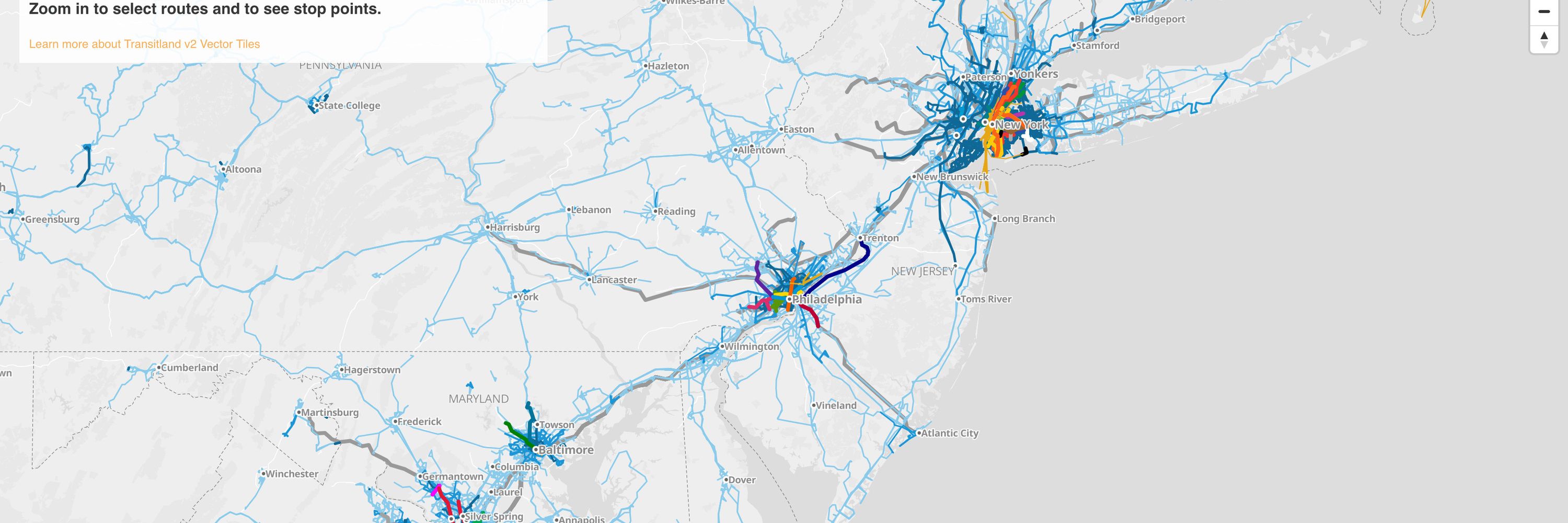
Buses, trains, subways, ferries, and more transit open to the public around the world. Aggregated from open-data feeds into a single API.
Explore at https://www.transit.land/map
For support post to https://github.com/transitland/transitland/discussions
Explore at https://www.transit.land/map
For support post to https://github.com/transitland/transitland/discussions
Explore GTFS-Pathways station data using Transitland's global transit map:
1) Click the gear icon to access advanced settings
2) Enable all stop types
3) Move your cursor over stop points
4) Notice the icons for station entrances and other station pathway nodes
(This example shows @mbta.com)
1) Click the gear icon to access advanced settings
2) Enable all stop types
3) Move your cursor over stop points
4) Notice the icons for station entrances and other station pathway nodes
(This example shows @mbta.com)
November 7, 2025 at 1:30 AM
Explore GTFS-Pathways station data using Transitland's global transit map:
1) Click the gear icon to access advanced settings
2) Enable all stop types
3) Move your cursor over stop points
4) Notice the icons for station entrances and other station pathway nodes
(This example shows @mbta.com)
1) Click the gear icon to access advanced settings
2) Enable all stop types
3) Move your cursor over stop points
4) Notice the icons for station entrances and other station pathway nodes
(This example shows @mbta.com)
Transitland's global transit map now provides info on bus, subway, train, and ferry stops around the world:
1) Zoom in
2) Click on a stop point
3) Drill down into Transitland's full depth of information, including real-time departures
Try Transitland global transit map at www.transit.land/map
1) Zoom in
2) Click on a stop point
3) Drill down into Transitland's full depth of information, including real-time departures
Try Transitland global transit map at www.transit.land/map
November 4, 2025 at 10:58 PM
Transitland's global transit map now provides info on bus, subway, train, and ferry stops around the world:
1) Zoom in
2) Click on a stop point
3) Drill down into Transitland's full depth of information, including real-time departures
Try Transitland global transit map at www.transit.land/map
1) Zoom in
2) Click on a stop point
3) Drill down into Transitland's full depth of information, including real-time departures
Try Transitland global transit map at www.transit.land/map
Together with a number of small refinements and large refactoring for future functionality, we've added a "dark" mode to the Transitland website. Try it out at https://www.transit.land
February 25, 2025 at 9:45 PM
Together with a number of small refinements and large refactoring for future functionality, we've added a "dark" mode to the Transitland website. Try it out at https://www.transit.land
January 6, 2025 at 8:07 PM