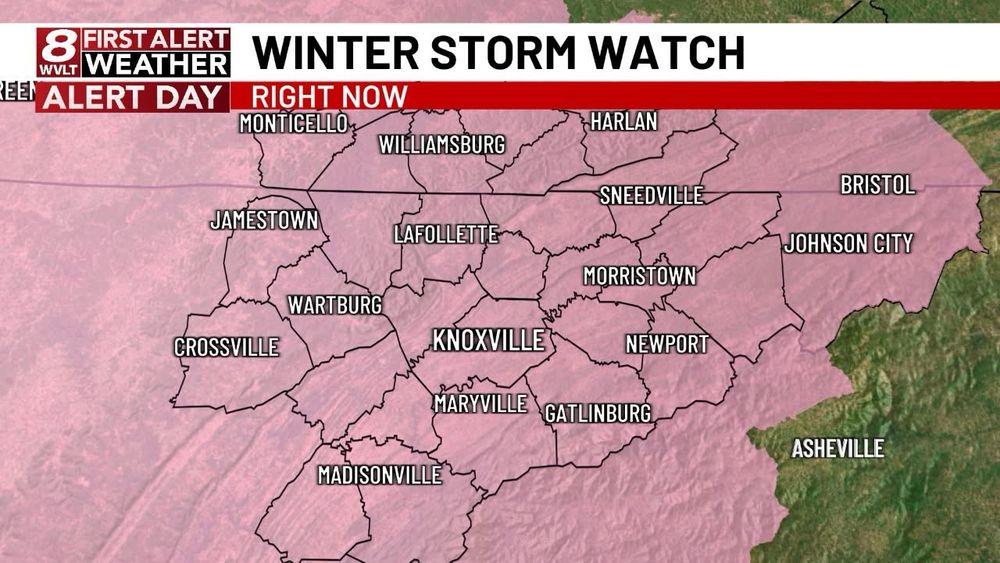

A low-end tornado risk is possible back toward middle TN. I’ll post a video update with more info later today.


A low-end tornado risk is possible back toward middle TN. I’ll post a video update with more info later today.

Get all the info at wvlt.tv/weather and in the WVLT First Alert Weather app!

Get all the info at wvlt.tv/weather and in the WVLT First Alert Weather app!
A brief period of sleet or freezing rain is most likely Sunday because of a warm layer aloft (above 32°) which we call the melting layer.
It will likely change over to snow showers Monday because the air will be below 32° all the way up through the atmosphere. 

A brief period of sleet or freezing rain is most likely Sunday because of a warm layer aloft (above 32°) which we call the melting layer.
It will likely change over to snow showers Monday because the air will be below 32° all the way up through the atmosphere. 
I mentioned this possibility yesterday. Plan for slick roads, especially bridges and over passes Sunday in these areas. This does not include Knox County at this time.

I mentioned this possibility yesterday. Plan for slick roads, especially bridges and over passes Sunday in these areas. This does not include Knox County at this time.


Anyone else see it?
Anyone else see it?
📸 - Betty Richardson

📸 - Betty Richardson


📸 - Stephanie Hambleton


📸 - Stephanie Hambleton
I’ll have more info here and WVLT this week at 5, 6, 10 and 11 PM.

I’ll have more info here and WVLT this week at 5, 6, 10 and 11 PM.


