


Seabed 2030
@seabed2030.bsky.social
A global initiative by the Nippon Foundation-GEBCO in relentless pursuit of achieving a complete map of the ocean floor by 2030 Endorsed by the UN Ocean Decade
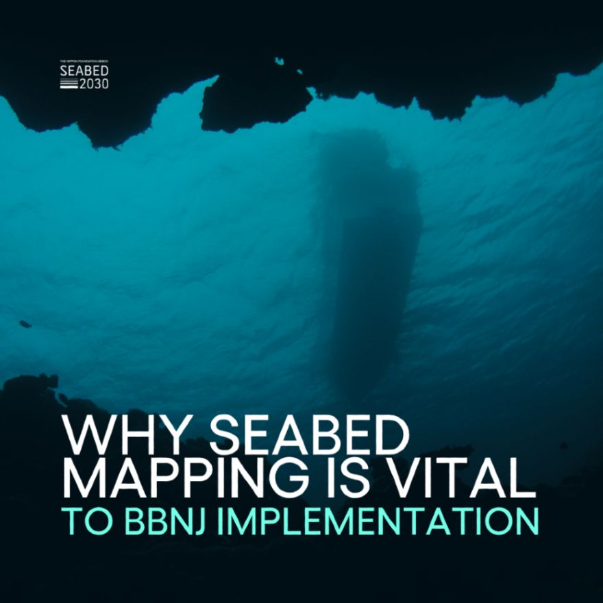
🇺🇳 The recent ratification of the #Biodiversity Beyond National Jurisdiction (BBNJ) Treaty marks a historic step for ocean protection. But it also highlights the urgency of seabed mapping.
After all, how can we protect what we don’t fully know?
After all, how can we protect what we don’t fully know?
November 3, 2025 at 10:33 AM
🇺🇳 The recent ratification of the #Biodiversity Beyond National Jurisdiction (BBNJ) Treaty marks a historic step for ocean protection. But it also highlights the urgency of seabed mapping.
After all, how can we protect what we don’t fully know?
After all, how can we protect what we don’t fully know?
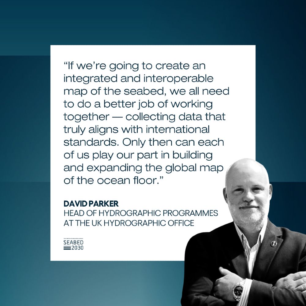
⛵ David Parker of #UKHO spent much of his early life at sea. A love of sailing sparked a lifelong interest in the ocean - and ultimately led him to a career in hydrography.
October 24, 2025 at 3:15 PM
⛵ David Parker of #UKHO spent much of his early life at sea. A love of sailing sparked a lifelong interest in the ocean - and ultimately led him to a career in hydrography.
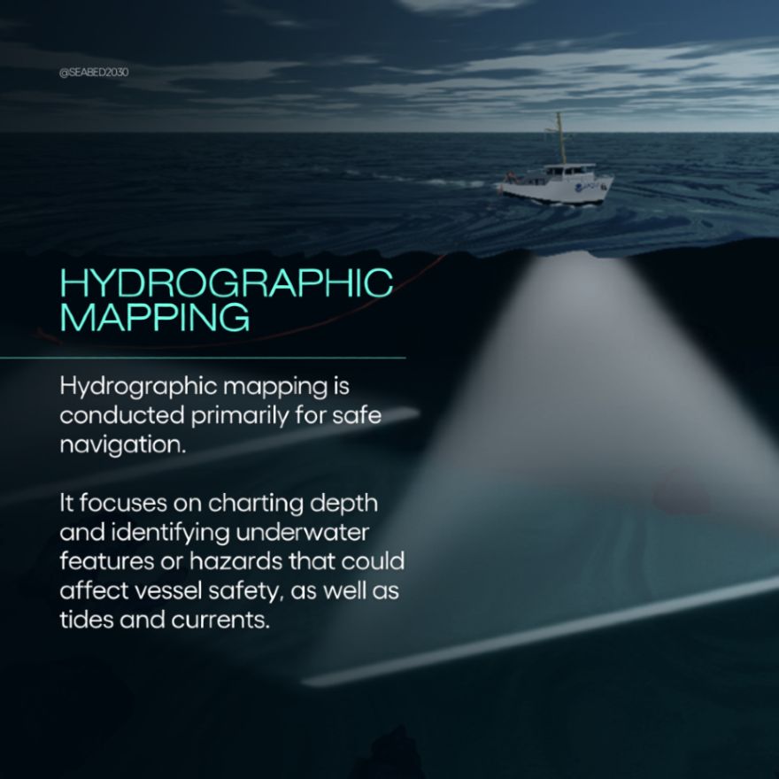
🗺️ Do you know the difference between bathymetric and hydrographic mapping?
While both datasets can be used for similar purposes, they each give us distinct insights into the #oceanfloor.
👉 Swipe to learn more.
While both datasets can be used for similar purposes, they each give us distinct insights into the #oceanfloor.
👉 Swipe to learn more.


October 21, 2025 at 2:23 PM
🗺️ Do you know the difference between bathymetric and hydrographic mapping?
While both datasets can be used for similar purposes, they each give us distinct insights into the #oceanfloor.
👉 Swipe to learn more.
While both datasets can be used for similar purposes, they each give us distinct insights into the #oceanfloor.
👉 Swipe to learn more.
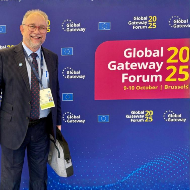
🇧🇪 Last week, our Head of Partnerships, Stephen Hall, attended the Global Gateway Forum in Brussels, participating courtesy of the #ParisPeaceForum, as part of its current Scale-up (SCUP) cohort.


October 15, 2025 at 8:56 AM
🇧🇪 Last week, our Head of Partnerships, Stephen Hall, attended the Global Gateway Forum in Brussels, participating courtesy of the #ParisPeaceForum, as part of its current Scale-up (SCUP) cohort.
🌎 We’re pleased to be taking part in this year’s Blue Earth Summit - a gathering of changemakers and #innovators working to drive action for a sustainable planet.

October 14, 2025 at 1:14 PM
🌎 We’re pleased to be taking part in this year’s Blue Earth Summit - a gathering of changemakers and #innovators working to drive action for a sustainable planet.
🗓 What a difference a decade makes!
Want to see it for yourself?
👉 Visit our website and use the interactive slider to explore how much progress has been made in mapping the ocean floor since since 2014.
Want to see it for yourself?
👉 Visit our website and use the interactive slider to explore how much progress has been made in mapping the ocean floor since since 2014.


October 9, 2025 at 10:38 AM
🗓 What a difference a decade makes!
Want to see it for yourself?
👉 Visit our website and use the interactive slider to explore how much progress has been made in mapping the ocean floor since since 2014.
Want to see it for yourself?
👉 Visit our website and use the interactive slider to explore how much progress has been made in mapping the ocean floor since since 2014.
🌊 Since we joined forces with NORBIT Oceans, they have helped to strengthen the capabilities of #Seabed2030 and our network - providing innovative solutions for seafloor mapping through bathymetric survey data sets, research voyages, and survey activities.

October 3, 2025 at 12:38 PM
🌊 Since we joined forces with NORBIT Oceans, they have helped to strengthen the capabilities of #Seabed2030 and our network - providing innovative solutions for seafloor mapping through bathymetric survey data sets, research voyages, and survey activities.
We are only just scratching the surface of our knowledge of the ocean floor.
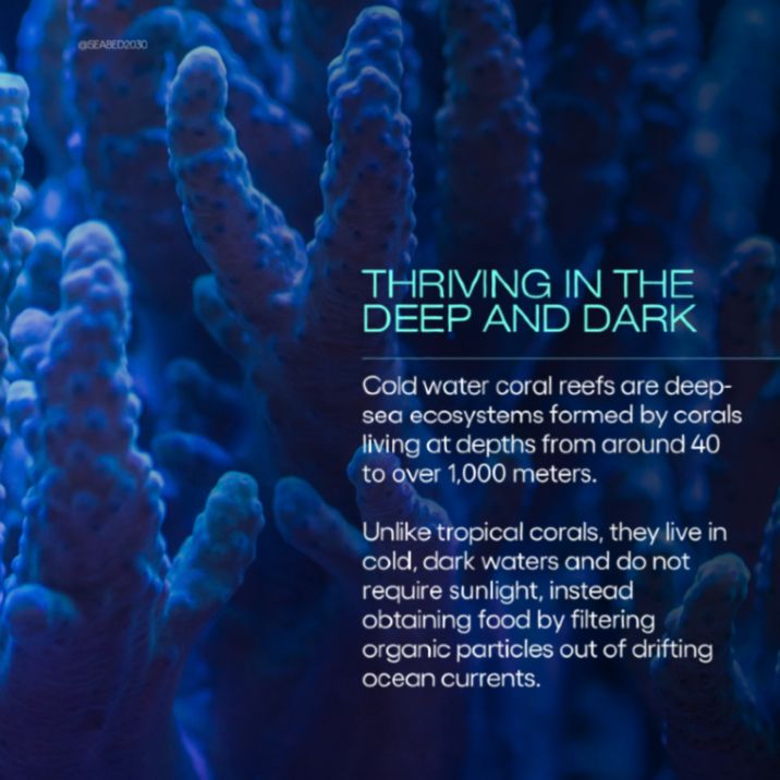
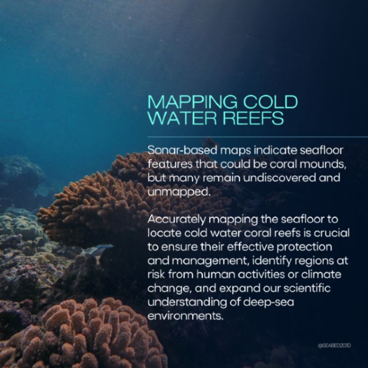
🪸 Deep-sea ecosystems such as cold-water coral reefs remind us how far we’ve come - and how vital it is to continue expanding research if we’re to conserve these fragile habitats for the future.
Swipe to learn more.
🪸 Deep-sea ecosystems such as cold-water coral reefs remind us how far we’ve come - and how vital it is to continue expanding research if we’re to conserve these fragile habitats for the future.
Swipe to learn more.


October 1, 2025 at 12:04 PM
We are only just scratching the surface of our knowledge of the ocean floor.
🪸 Deep-sea ecosystems such as cold-water coral reefs remind us how far we’ve come - and how vital it is to continue expanding research if we’re to conserve these fragile habitats for the future.
Swipe to learn more.
🪸 Deep-sea ecosystems such as cold-water coral reefs remind us how far we’ve come - and how vital it is to continue expanding research if we’re to conserve these fragile habitats for the future.
Swipe to learn more.
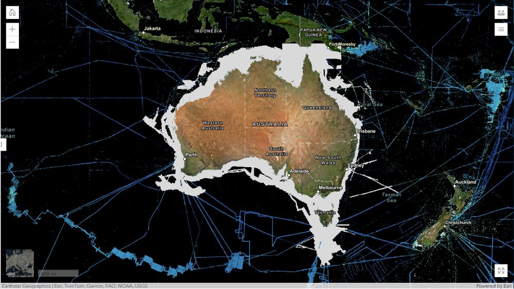
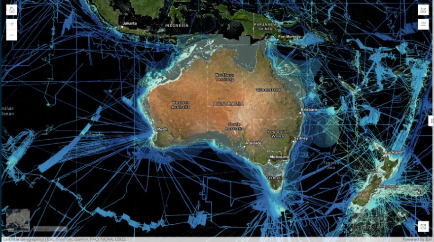
🇦🇺 Meet our partner Geoscience Australia.
Through the AusSeabed initiative - a national collaboration that coordinates and publishes seabed mapping data across the Australian region - Geoscience Australia actively supports our mission by providing high-quality, accessible data.
Through the AusSeabed initiative - a national collaboration that coordinates and publishes seabed mapping data across the Australian region - Geoscience Australia actively supports our mission by providing high-quality, accessible data.

September 30, 2025 at 8:03 AM
🇦🇺 Meet our partner Geoscience Australia.
Through the AusSeabed initiative - a national collaboration that coordinates and publishes seabed mapping data across the Australian region - Geoscience Australia actively supports our mission by providing high-quality, accessible data.
Through the AusSeabed initiative - a national collaboration that coordinates and publishes seabed mapping data across the Australian region - Geoscience Australia actively supports our mission by providing high-quality, accessible data.
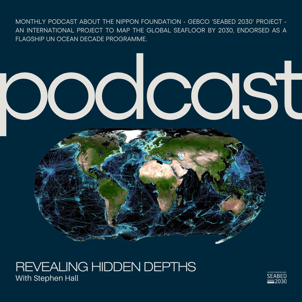
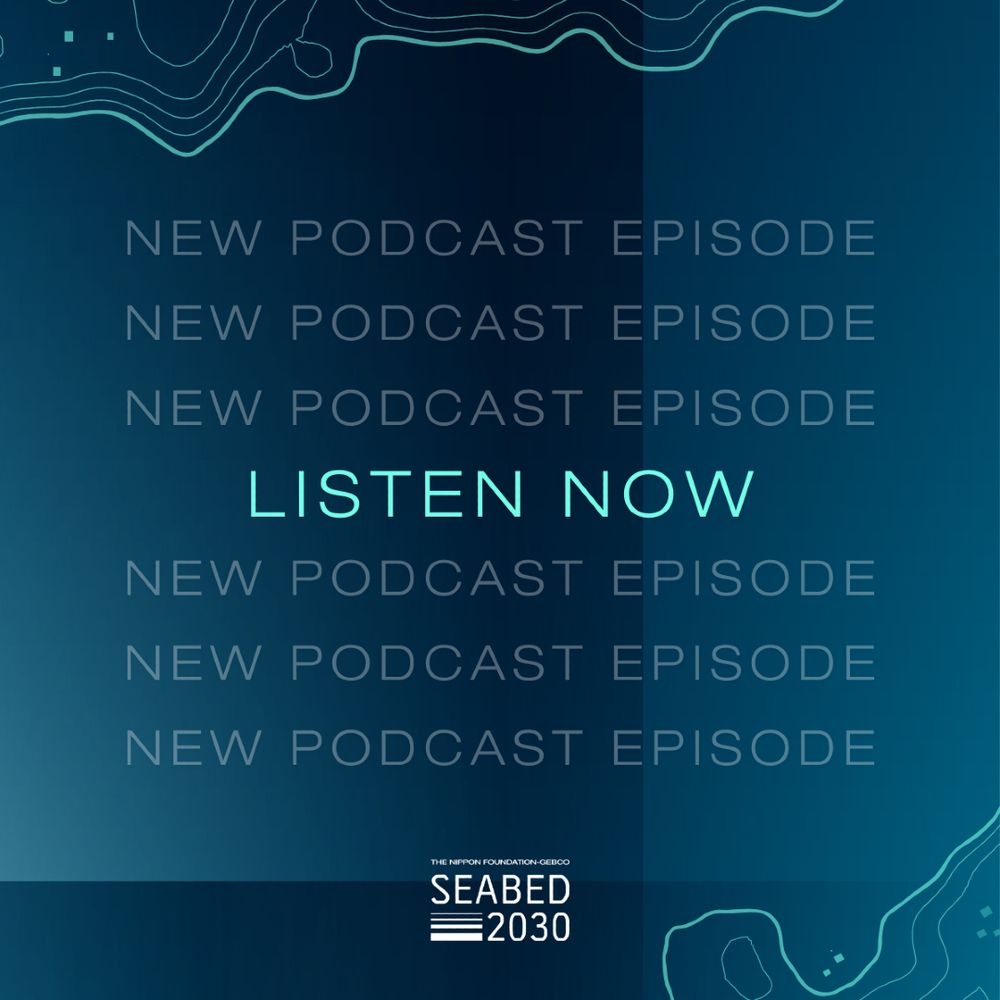
💭 How can you stay up to date with all things #ocean mapping?
The Seabed 2030 Podcast!
Expect:
🗞️ News from Seabed 2030
🎙️ Interviews with the international #hydrospatial community
📡 Updates on mapping technology and methods
Listen now 👉 https://seabed2030.buzzsprout.com
The Seabed 2030 Podcast!
Expect:
🗞️ News from Seabed 2030
🎙️ Interviews with the international #hydrospatial community
📡 Updates on mapping technology and methods
Listen now 👉 https://seabed2030.buzzsprout.com
September 16, 2025 at 2:37 PM
💭 How can you stay up to date with all things #ocean mapping?
The Seabed 2030 Podcast!
Expect:
🗞️ News from Seabed 2030
🎙️ Interviews with the international #hydrospatial community
📡 Updates on mapping technology and methods
Listen now 👉 https://seabed2030.buzzsprout.com
The Seabed 2030 Podcast!
Expect:
🗞️ News from Seabed 2030
🎙️ Interviews with the international #hydrospatial community
📡 Updates on mapping technology and methods
Listen now 👉 https://seabed2030.buzzsprout.com
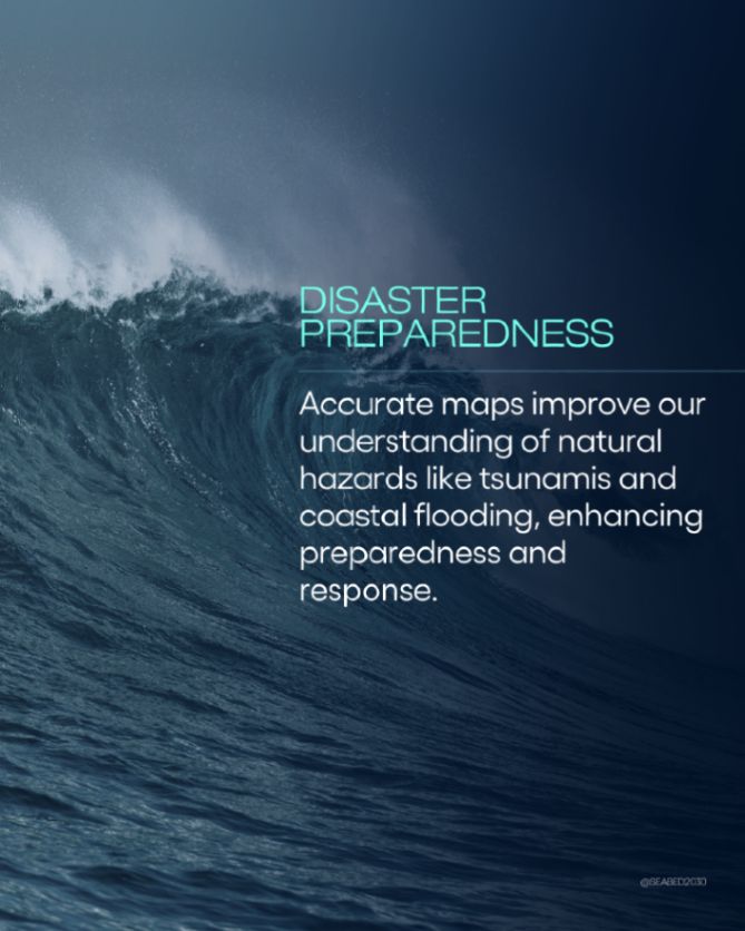
Because a complete map of the ocean underpins global progress. It gives us the knowledge we need to plan safe shipping routes, protect marine ecosystems, respond to natural disasters and manage resources sustainably.


September 12, 2025 at 12:07 PM
Because a complete map of the ocean underpins global progress. It gives us the knowledge we need to plan safe shipping routes, protect marine ecosystems, respond to natural disasters and manage resources sustainably.
🌍 To date, Seabed 2030 partners have helped map over 27% of the world’s seafloor - and we’re building on that progress every day.
September 12, 2025 at 12:07 PM
🌍 To date, Seabed 2030 partners have helped map over 27% of the world’s seafloor - and we’re building on that progress every day.
💬 "When we realize the possibilities of deep sea life still unknown to us, every haul of the dredge should be welcomed by an expectant enthusiasm equaled in other fields only by the possible hope of communication with our sister planets." 👇

September 10, 2025 at 8:02 AM
💬 "When we realize the possibilities of deep sea life still unknown to us, every haul of the dredge should be welcomed by an expectant enthusiasm equaled in other fields only by the possible hope of communication with our sister planets." 👇
Did you know that right now, as you read this post, your data is likely traveling through massive cables lying on the #oceanfloor - not bouncing off satellites, as many assume?
September 8, 2025 at 11:22 AM
Did you know that right now, as you read this post, your data is likely traveling through massive cables lying on the #oceanfloor - not bouncing off satellites, as many assume?
📢 We’re excited to sponsor Ocean Floor Explore - an event bringing together ocean explorers, technologists, and more to build new pathways for seafloor mapping and ocean discovery.
🇨🇦 Join us in Victoria, Canada from 26-29 October.
Find out more 👉 www.oceanfloorexplore.org
🇨🇦 Join us in Victoria, Canada from 26-29 October.
Find out more 👉 www.oceanfloorexplore.org

September 5, 2025 at 3:37 PM
📢 We’re excited to sponsor Ocean Floor Explore - an event bringing together ocean explorers, technologists, and more to build new pathways for seafloor mapping and ocean discovery.
🇨🇦 Join us in Victoria, Canada from 26-29 October.
Find out more 👉 www.oceanfloorexplore.org
🇨🇦 Join us in Victoria, Canada from 26-29 October.
Find out more 👉 www.oceanfloorexplore.org
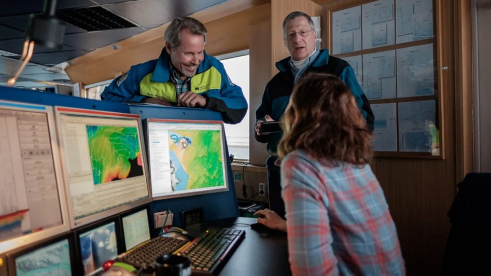
🖥️ Meet QPS - a valued Seabed 2030 partner supporting our mission through advanced hydrographic and maritime software.
QPS provides innovative tools that help process bathymetric data and generate visualisations - supporting the development of the GEBCO global grid.
Learn more 👉 https://qps.nl
QPS provides innovative tools that help process bathymetric data and generate visualisations - supporting the development of the GEBCO global grid.
Learn more 👉 https://qps.nl
September 4, 2025 at 8:50 AM
🖥️ Meet QPS - a valued Seabed 2030 partner supporting our mission through advanced hydrographic and maritime software.
QPS provides innovative tools that help process bathymetric data and generate visualisations - supporting the development of the GEBCO global grid.
Learn more 👉 https://qps.nl
QPS provides innovative tools that help process bathymetric data and generate visualisations - supporting the development of the GEBCO global grid.
Learn more 👉 https://qps.nl
📍 Most maps offer but a glimpse of our planet, only hinting at the vast detail beneath the waves.
For those navigating shipping routes, planning subsea infrastructure, developing climate adaptation policies, or designating marine conservation areas - standard surface maps don't go deep enough.
For those navigating shipping routes, planning subsea infrastructure, developing climate adaptation policies, or designating marine conservation areas - standard surface maps don't go deep enough.
September 3, 2025 at 2:46 PM
📍 Most maps offer but a glimpse of our planet, only hinting at the vast detail beneath the waves.
For those navigating shipping routes, planning subsea infrastructure, developing climate adaptation policies, or designating marine conservation areas - standard surface maps don't go deep enough.
For those navigating shipping routes, planning subsea infrastructure, developing climate adaptation policies, or designating marine conservation areas - standard surface maps don't go deep enough.
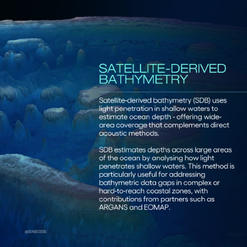
🏝️ Shallow waters are some of the most complex zones to map.
Today, as we mark four years of partnership with EOMAP, we’re celebrating their efforts to fill data gaps in coastal regions. 👇
Today, as we mark four years of partnership with EOMAP, we’re celebrating their efforts to fill data gaps in coastal regions. 👇
August 29, 2025 at 9:02 AM
🏝️ Shallow waters are some of the most complex zones to map.
Today, as we mark four years of partnership with EOMAP, we’re celebrating their efforts to fill data gaps in coastal regions. 👇
Today, as we mark four years of partnership with EOMAP, we’re celebrating their efforts to fill data gaps in coastal regions. 👇
🗺️ From 6% mapped in 2017 to 27.3% mapped in 2023.
Accelerating seabed mapping is no small feat - but thanks to global collaboration and technological innovation, we’re making progress.
Accelerating seabed mapping is no small feat - but thanks to global collaboration and technological innovation, we’re making progress.

August 27, 2025 at 9:02 AM
🗺️ From 6% mapped in 2017 to 27.3% mapped in 2023.
Accelerating seabed mapping is no small feat - but thanks to global collaboration and technological innovation, we’re making progress.
Accelerating seabed mapping is no small feat - but thanks to global collaboration and technological innovation, we’re making progress.
⭕ Can you guess what the circles on this bathymetric chart represent?
This illustration by John Pons depicts South Africa's coastline using underlying bathymetric data from NOAA's 90m resolution digital elevation model.
Take a guess below. 👇
This illustration by John Pons depicts South Africa's coastline using underlying bathymetric data from NOAA's 90m resolution digital elevation model.
Take a guess below. 👇
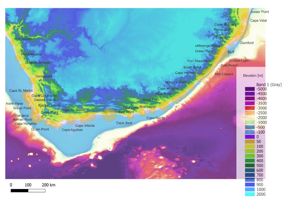
August 26, 2025 at 9:02 AM
⭕ Can you guess what the circles on this bathymetric chart represent?
This illustration by John Pons depicts South Africa's coastline using underlying bathymetric data from NOAA's 90m resolution digital elevation model.
Take a guess below. 👇
This illustration by John Pons depicts South Africa's coastline using underlying bathymetric data from NOAA's 90m resolution digital elevation model.
Take a guess below. 👇
🪸 A 10-year project has mapped the world’s largest deep-sea coral reef habitat.
The multi-partner study demonstrates the power of automated mapping and analysis methods and long-term partnerships for expanding our knowledge of the seabed.
Read more 👉 https://shorturl.at/1NUU6
The multi-partner study demonstrates the power of automated mapping and analysis methods and long-term partnerships for expanding our knowledge of the seabed.
Read more 👉 https://shorturl.at/1NUU6
August 23, 2025 at 9:01 AM
🪸 A 10-year project has mapped the world’s largest deep-sea coral reef habitat.
The multi-partner study demonstrates the power of automated mapping and analysis methods and long-term partnerships for expanding our knowledge of the seabed.
Read more 👉 https://shorturl.at/1NUU6
The multi-partner study demonstrates the power of automated mapping and analysis methods and long-term partnerships for expanding our knowledge of the seabed.
Read more 👉 https://shorturl.at/1NUU6
The event also offered an opportunity to reconnect with Marzia Rovere, former GEBCO Vice Chair & Research Scientist at the Marine Sciences Research Institute of the Italian National Research Council.
Grateful to all involved for advancing the conversation on maritime sustainability. 🤝
Grateful to all involved for advancing the conversation on maritime sustainability. 🤝


August 20, 2025 at 11:33 AM
The event also offered an opportunity to reconnect with Marzia Rovere, former GEBCO Vice Chair & Research Scientist at the Marine Sciences Research Institute of the Italian National Research Council.
Grateful to all involved for advancing the conversation on maritime sustainability. 🤝
Grateful to all involved for advancing the conversation on maritime sustainability. 🤝
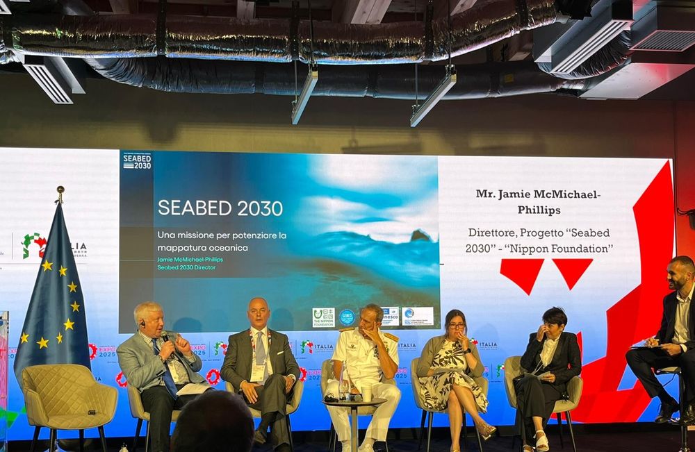
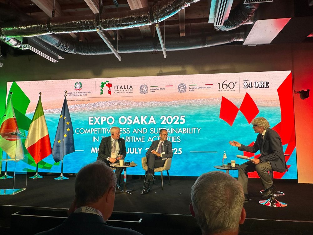
🇯🇵 Honoured to represent #Seabed2030 at Expo 2025 Osaka, where Director Jamie McMichael-Phillips joined experts at the Italian Pavilion for a two-day programme on Competitiveness & Sustainability in Maritime Activities.
He spoke on the role of seabed mapping in maritime resilience & data gaps. 🗺️
He spoke on the role of seabed mapping in maritime resilience & data gaps. 🗺️

August 20, 2025 at 11:31 AM
🇯🇵 Honoured to represent #Seabed2030 at Expo 2025 Osaka, where Director Jamie McMichael-Phillips joined experts at the Italian Pavilion for a two-day programme on Competitiveness & Sustainability in Maritime Activities.
He spoke on the role of seabed mapping in maritime resilience & data gaps. 🗺️
He spoke on the role of seabed mapping in maritime resilience & data gaps. 🗺️
💡 Innovation. Curiosity. Impact.
These values drive Seabed 2030 - and are shared by our partner REV Ocean.
This month marks 5 years since we welcomed them onboard. We remain committed to finding sustainable #solutions for a healthy #ocean.
Find out more: https://www.revocean.org/
These values drive Seabed 2030 - and are shared by our partner REV Ocean.
This month marks 5 years since we welcomed them onboard. We remain committed to finding sustainable #solutions for a healthy #ocean.
Find out more: https://www.revocean.org/

August 18, 2025 at 9:02 AM
💡 Innovation. Curiosity. Impact.
These values drive Seabed 2030 - and are shared by our partner REV Ocean.
This month marks 5 years since we welcomed them onboard. We remain committed to finding sustainable #solutions for a healthy #ocean.
Find out more: https://www.revocean.org/
These values drive Seabed 2030 - and are shared by our partner REV Ocean.
This month marks 5 years since we welcomed them onboard. We remain committed to finding sustainable #solutions for a healthy #ocean.
Find out more: https://www.revocean.org/
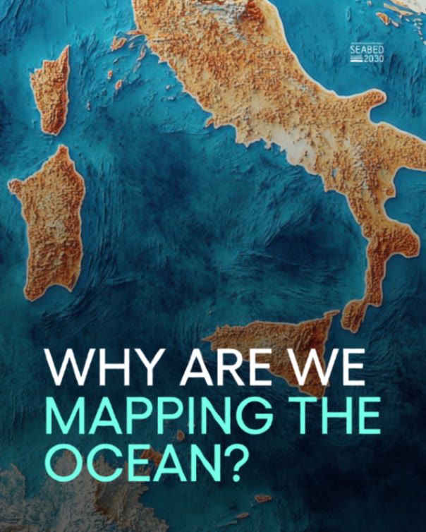
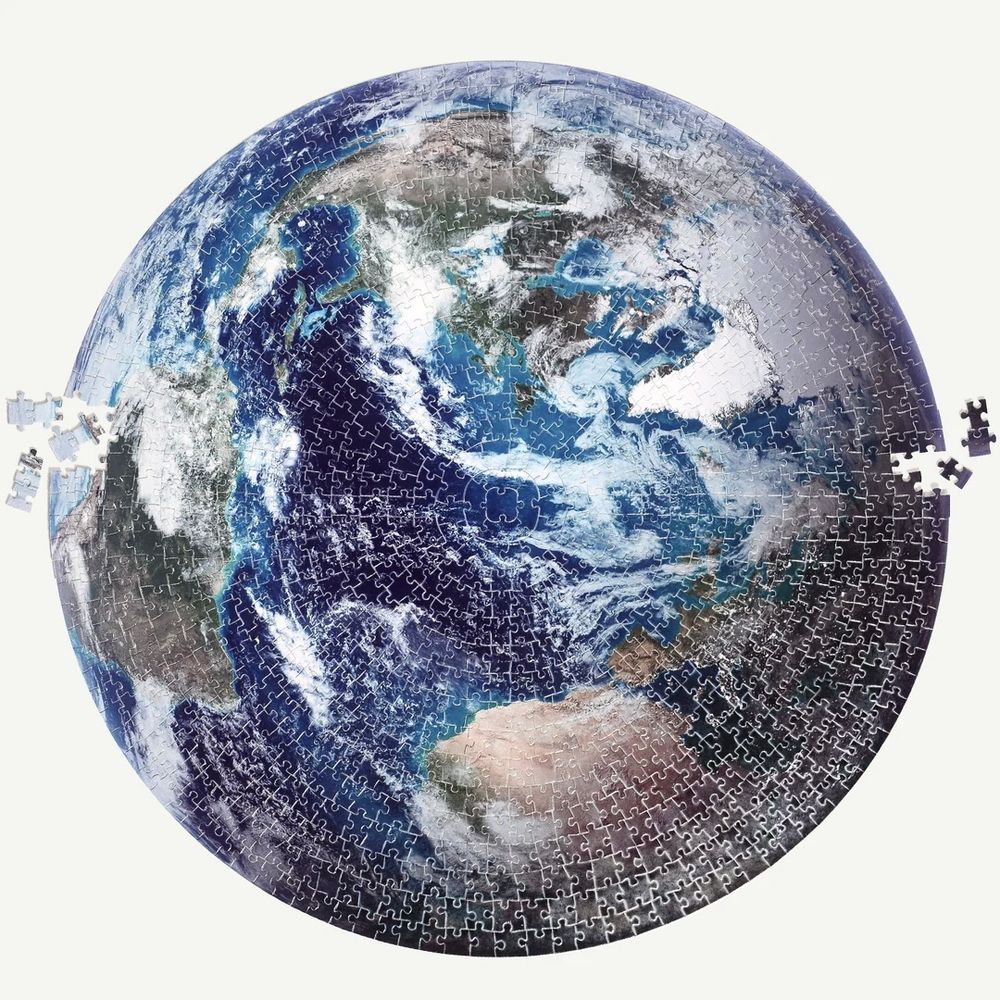
🧩 Mapping the entire ocean floor is like solving the world’s most complex jigsaw puzzle.
And we can’t complete it without the missing pieces.
And we can’t complete it without the missing pieces.
August 15, 2025 at 9:02 AM
🧩 Mapping the entire ocean floor is like solving the world’s most complex jigsaw puzzle.
And we can’t complete it without the missing pieces.
And we can’t complete it without the missing pieces.