


Neil Lareau
@neillareau.bsky.social
Prof. of Atmos Sci. @unevadareno. Mountain WX, Wildfire Plumes, Backcountry Skiing, Frontcountry Dadding. Formerly: @SJSUmeteorology @UUtah
@Livermore_Lab @MWObs https://scholar.google.com/citations?user=UGaGnAgAAAAJ&hl=en
@Livermore_Lab @MWObs https://scholar.google.com/citations?user=UGaGnAgAAAAJ&hl=en
New paper out! We document tornado-strength (98 mph) counter-rotating vortices that developed within California’s 2021 #DixieFire. These fire-generated vortices reshaped the fire front and spread, posing immediate risks to firefighters and civilians. doi.org/10.1175/MWR-...

November 15, 2025 at 1:48 AM
New paper out! We document tornado-strength (98 mph) counter-rotating vortices that developed within California’s 2021 #DixieFire. These fire-generated vortices reshaped the fire front and spread, posing immediate risks to firefighters and civilians. doi.org/10.1175/MWR-...


Here is the high resolution pressure data, showing a 3 mb increase in pressure consistent with the dropping temperature (e.g., hydrostatic pressure change due to the cold frontal passage).

June 25, 2025 at 8:56 AM
Here is the high resolution pressure data, showing a 3 mb increase in pressure consistent with the dropping temperature (e.g., hydrostatic pressure change due to the cold frontal passage).
4/n: Next up are wave data. This plot from TERC, shows that the wave heights follow a pattern similar to the wind ramp on 6/21, suddenly reaching above 1 m. The abrupt increase in way height is really an alarming signal.

June 25, 2025 at 12:39 AM
4/n: Next up are wave data. This plot from TERC, shows that the wave heights follow a pattern similar to the wind ramp on 6/21, suddenly reaching above 1 m. The abrupt increase in way height is really an alarming signal.
3/n: The corresponding temperature data show a sharp drop in temperature consistent with the frontal passage enhanced by diabatic cooling (evaporation) beneath the thunderstorms and stratiform rain/snow.

June 25, 2025 at 12:39 AM
3/n: The corresponding temperature data show a sharp drop in temperature consistent with the frontal passage enhanced by diabatic cooling (evaporation) beneath the thunderstorms and stratiform rain/snow.
2/n: Now lets look at the buoy weather station data over the center of the lake, first the wind speed, which shows relatively calm winds during the morning, then a sudden wind ramp followed by ~1.5 hrs of strong winds as high as 20 m/s (~44 mph). [the time stamps on these plots are wrong...]

June 25, 2025 at 12:39 AM
2/n: Now lets look at the buoy weather station data over the center of the lake, first the wind speed, which shows relatively calm winds during the morning, then a sudden wind ramp followed by ~1.5 hrs of strong winds as high as 20 m/s (~44 mph). [the time stamps on these plots are wrong...]
1/n: Still trying to understand the Lake Tahoe boating disaster from this past weekend. I like letting the data lead. Lets start with the radar, where I've added a red line annotating the clear, coherent wind shift associated with the front sagging south across the region.
June 25, 2025 at 12:39 AM
1/n: Still trying to understand the Lake Tahoe boating disaster from this past weekend. I like letting the data lead. Lets start with the radar, where I've added a red line annotating the clear, coherent wind shift associated with the front sagging south across the region.
More from today’s Rx burn:
June 4, 2025 at 12:57 AM
More from today’s Rx burn:


Did you know that in 2021 the Dixie Fire yielded spot fires 10 miles from the fire front? Want to know how? My new paper examines the plume dynamics driving these extreme spotting events: agupubs.onlinelibrary.wiley.com/doi/10.1029/...

May 19, 2025 at 5:48 PM
Did you know that in 2021 the Dixie Fire yielded spot fires 10 miles from the fire front? Want to know how? My new paper examines the plume dynamics driving these extreme spotting events: agupubs.onlinelibrary.wiley.com/doi/10.1029/...
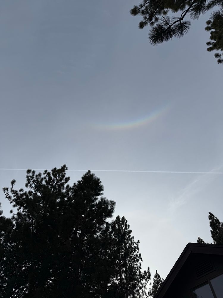
Circumzenithal arc.
April 25, 2025 at 1:16 AM
Circumzenithal arc.
Impressive fire activity today in New Jersey. Here is a 3D radar view of the plume structure from the #JonesFire during its peak fire intensity.
April 23, 2025 at 12:20 AM
Impressive fire activity today in New Jersey. Here is a 3D radar view of the plume structure from the #JonesFire during its peak fire intensity.
Cool example of preferential convection initiation on the snowy-to-snow-free boundary on the west slopes of the Sierra. Note the deeper cloud formation over the heated land as opposed to the snowpack (green).
April 2, 2025 at 11:15 PM
Cool example of preferential convection initiation on the snowy-to-snow-free boundary on the west slopes of the Sierra. Note the deeper cloud formation over the heated land as opposed to the snowpack (green).
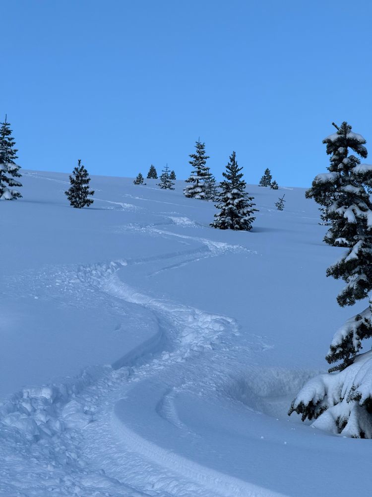
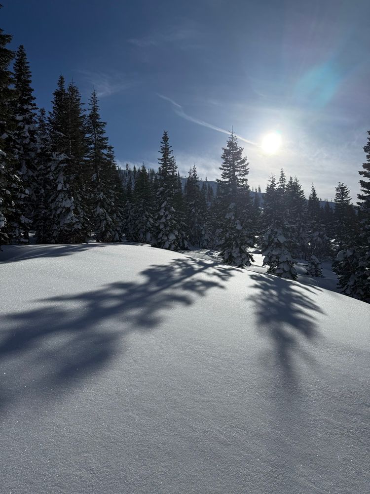
2+ ft of beautiful snow yesterday densified overnight, yielding excellent skiing this morning. Just wish I had more time!!
April 2, 2025 at 2:42 PM
2+ ft of beautiful snow yesterday densified overnight, yielding excellent skiing this morning. Just wish I had more time!!
With appreciable storm total accumulations:
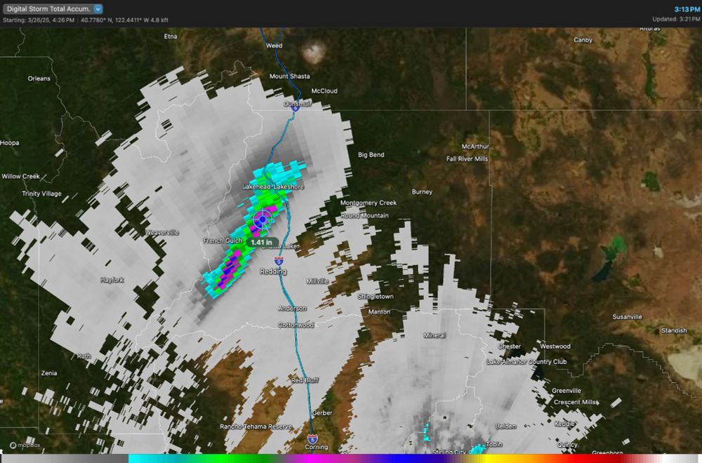
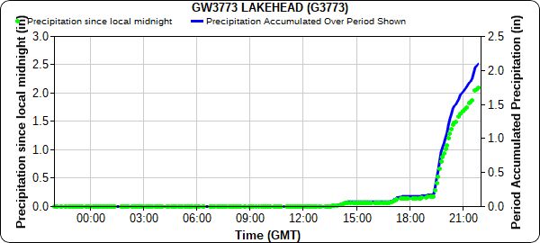
March 27, 2025 at 10:25 PM
With appreciable storm total accumulations:
Been an amazing day of #ShastaCountyConvergenceZone (SCCZ) activity.
March 27, 2025 at 10:25 PM
Been an amazing day of #ShastaCountyConvergenceZone (SCCZ) activity.
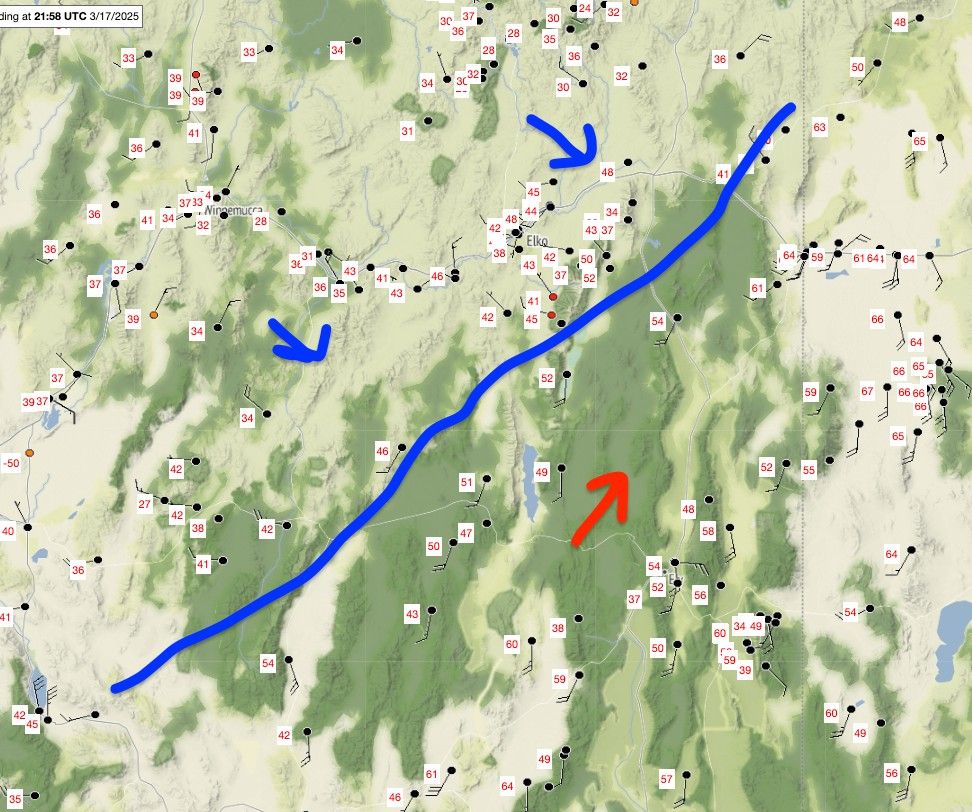
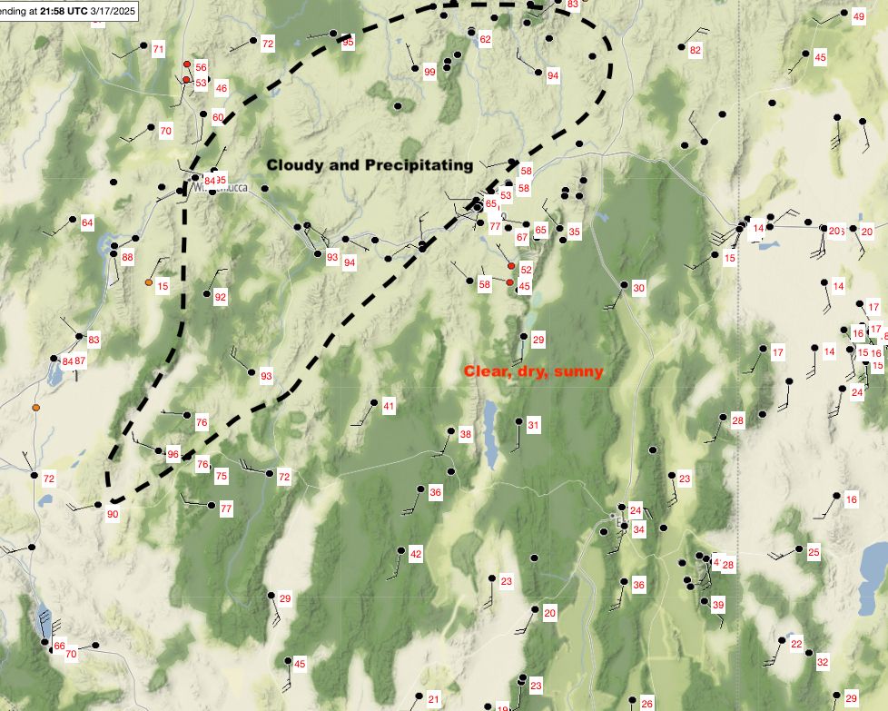
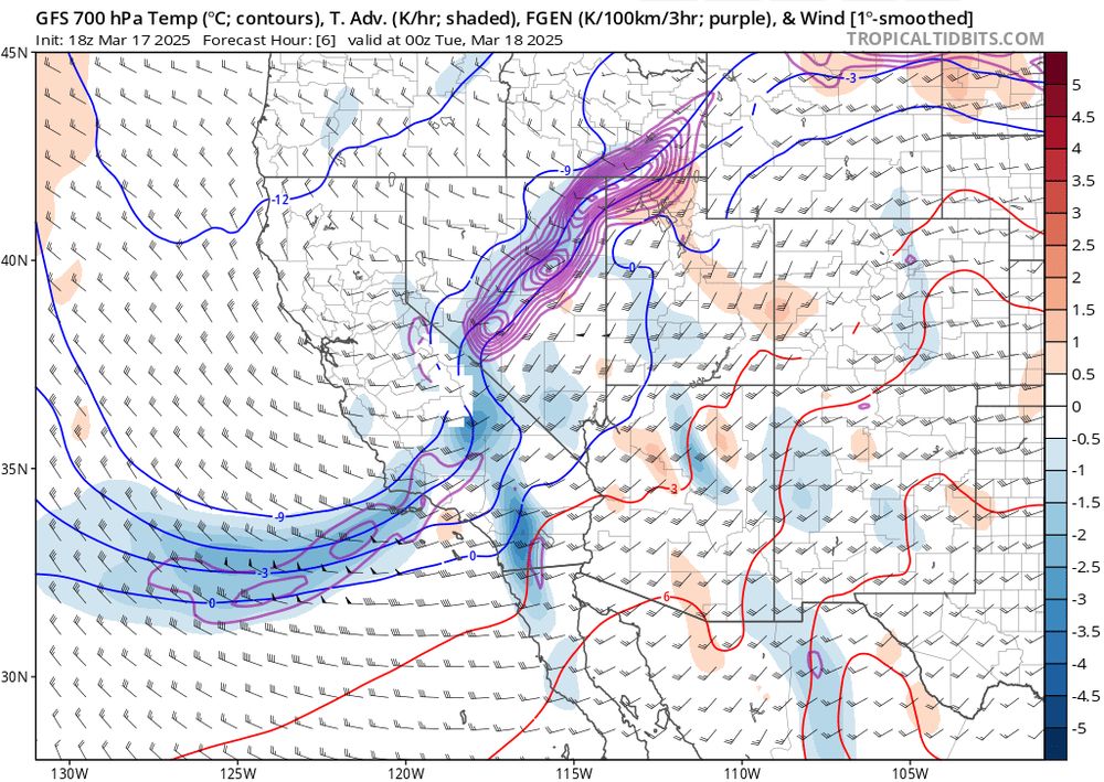
Classic early spring inter-mountain frontogenesis today: (1) Satellite image, (2) surface temperatures and rough diagram of the confluent region, (3) cross front diabatic heating differences helping to sharpen the front, (4) frontogenesis function (purple contours) from GFS.
March 17, 2025 at 10:09 PM
Classic early spring inter-mountain frontogenesis today: (1) Satellite image, (2) surface temperatures and rough diagram of the confluent region, (3) cross front diabatic heating differences helping to sharpen the front, (4) frontogenesis function (purple contours) from GFS.
Double barreled Shasta County Convergence Zone
March 17, 2025 at 1:54 AM
Double barreled Shasta County Convergence Zone
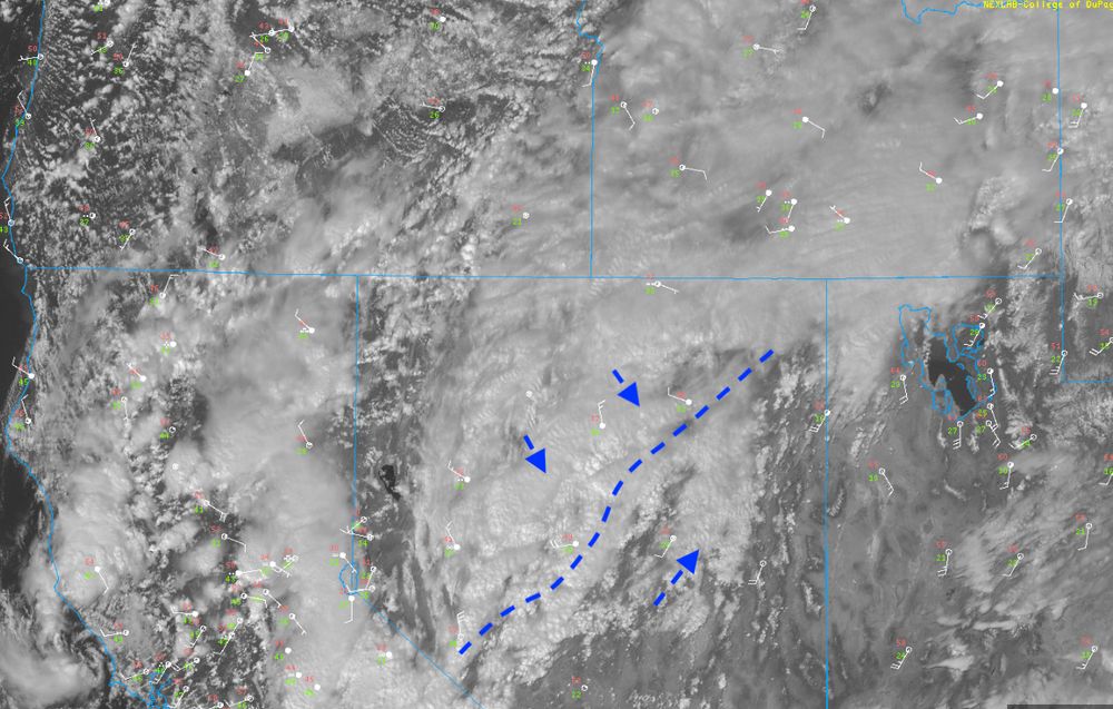
Fires (black dots) and plume (radar/green/blue) popping up amidst the blowing dust in Texas and Oklahoma. Could be ugly when the wind shift hits...
March 14, 2025 at 5:48 PM
Fires (black dots) and plume (radar/green/blue) popping up amidst the blowing dust in Texas and Oklahoma. Could be ugly when the wind shift hits...
Sierra crest looking mighty fine today. (Frog Lake cliffs and Castle Peak)
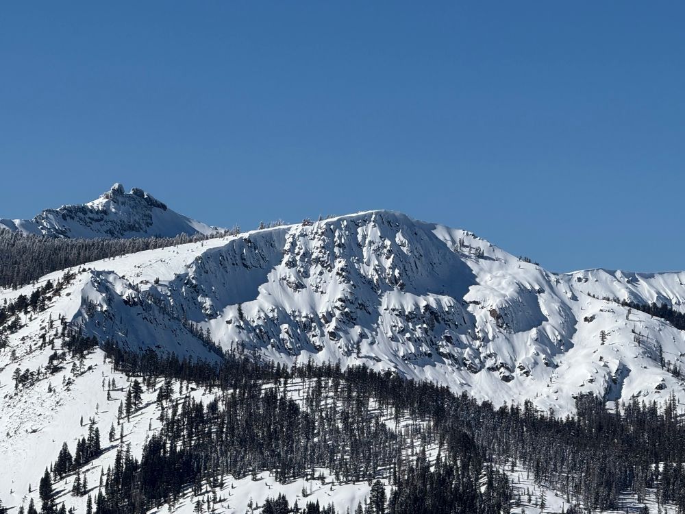
February 9, 2025 at 10:03 PM
Sierra crest looking mighty fine today. (Frog Lake cliffs and Castle Peak)
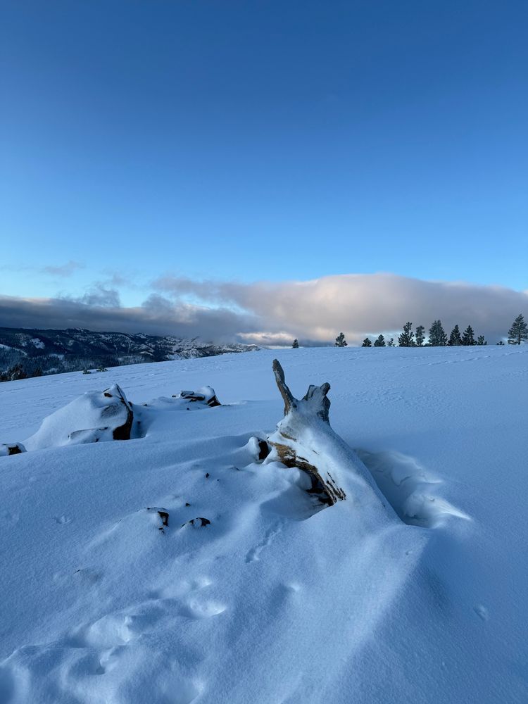
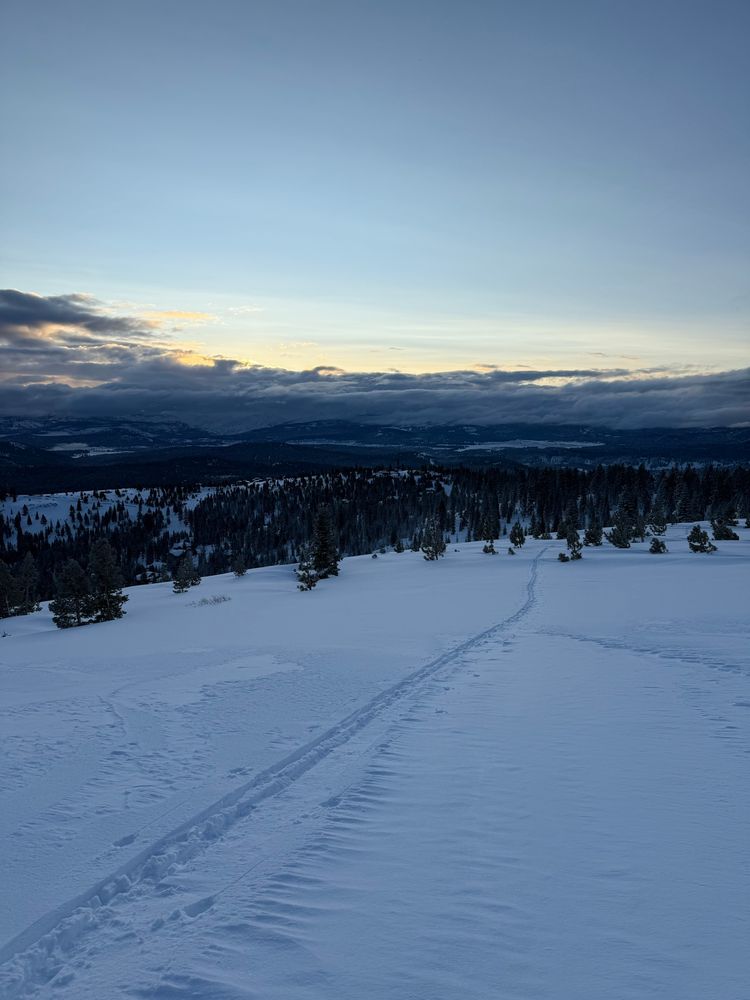
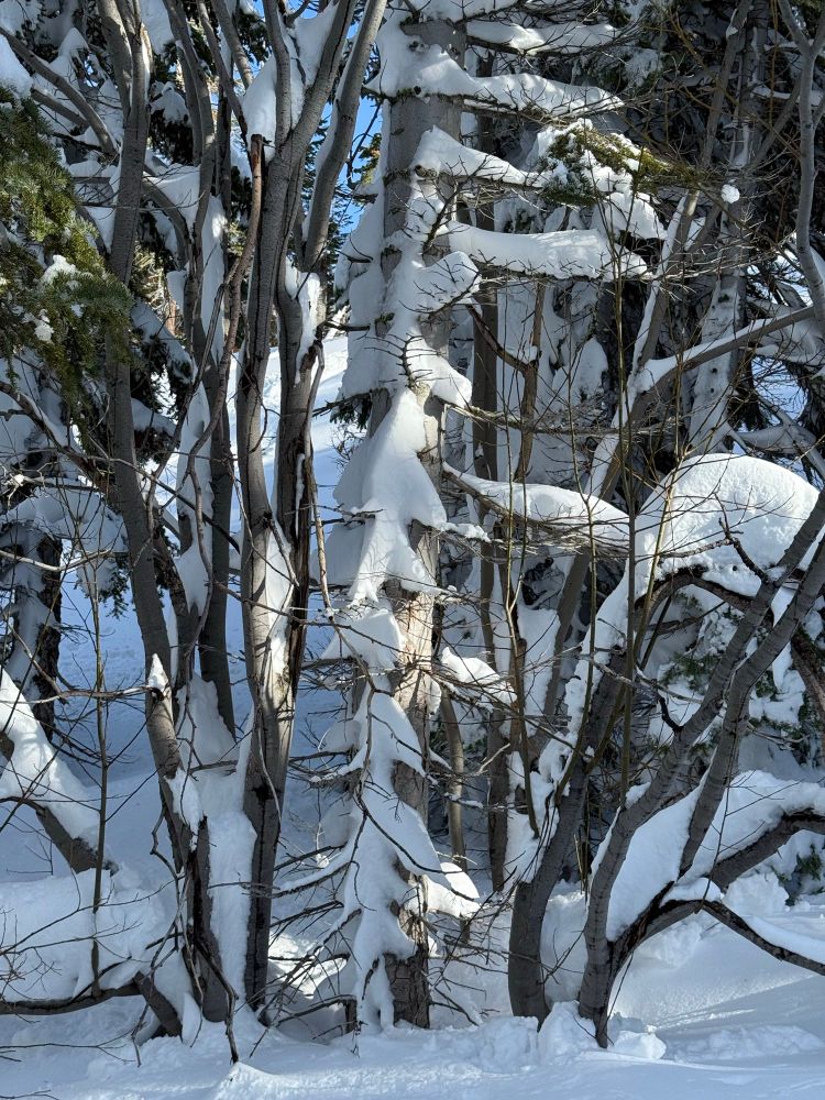
Resetting the brain chemistry.
February 6, 2025 at 6:50 PM
Resetting the brain chemistry.