


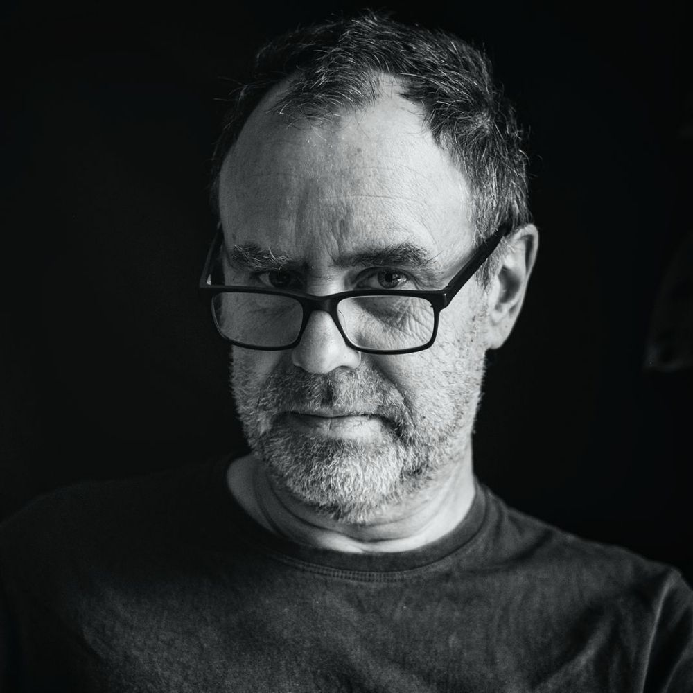
John Fielding Aerial Images
@john-fielding.bsky.social
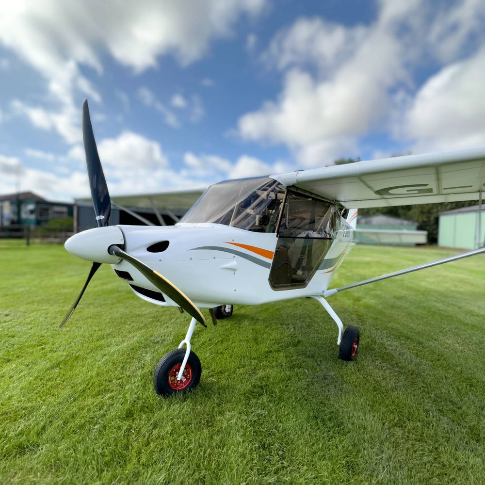
Photographed from a plane in full-frame detail using a Nikon D850. Occasionally from a DJI drone. Images: All Rights Reserved
E-mail: johnfielding001@gmail.com
High resolution images here: https://www.flickr.com/photos/john_fielding/
E-mail: johnfielding001@gmail.com
High resolution images here: https://www.flickr.com/photos/john_fielding/
A clear day over York – the River Ouse winding through centuries of streets and rooftops, with the great Minster dominating the city centre. Medieval street patterns still visible from above alongside modern developments #York #aerial #image #Yorkshire

November 22, 2025 at 6:08 PM
A clear day over York – the River Ouse winding through centuries of streets and rooftops, with the great Minster dominating the city centre. Medieval street patterns still visible from above alongside modern developments #York #aerial #image #Yorkshire
Aerial view - Brancaster Staithe harbour on the North Norfolk coast. The tidal creeks still holding water as the tide falls. Boats riding gently in the channels, Scolt Head Island guarding the shoreline and the North Sea beyond
#Norfolk #Coast #Aerial #image #BrancasterStaithe
#Norfolk #Coast #Aerial #image #BrancasterStaithe

November 22, 2025 at 8:58 AM
Aerial view - Brancaster Staithe harbour on the North Norfolk coast. The tidal creeks still holding water as the tide falls. Boats riding gently in the channels, Scolt Head Island guarding the shoreline and the North Sea beyond
#Norfolk #Coast #Aerial #image #BrancasterStaithe
#Norfolk #Coast #Aerial #image #BrancasterStaithe
Nottingham’s Eastcroft Waste Facility & depot from above, home to the rail maintenance sidings & the city’s Energy-from-Waste incinerator (opened in the 1970s) A key part of Nottingham’s district heating network. #Nottingham #aerial #image #EastMidlandsRailway

November 21, 2025 at 8:45 PM
Nottingham’s Eastcroft Waste Facility & depot from above, home to the rail maintenance sidings & the city’s Energy-from-Waste incinerator (opened in the 1970s) A key part of Nottingham’s district heating network. #Nottingham #aerial #image #EastMidlandsRailway
Night over the Thames: the circular Thames Barrier Navigation Control Centre glows like a beacon. Built after the Barrier (1984) to oversee river traffic & flood safety. Across the water – Royal Docks regeneration & a plane on final approach to City Airport #London #aerial #image

November 21, 2025 at 8:09 AM
Reposted by John Fielding Aerial Images
Waterland Books | a small, independent press specialising in books about East Anglia share.google/iflFcQL3VOng...
We'll be here at the Dragon Hall Book Fair on Satdy buh. Need some Xmas pressies? From Zen to Ron and back. All our books will be reduced. You know it makes sense. 👇👇
We'll be here at the Dragon Hall Book Fair on Satdy buh. Need some Xmas pressies? From Zen to Ron and back. All our books will be reduced. You know it makes sense. 👇👇

November 20, 2025 at 7:49 AM
Waterland Books | a small, independent press specialising in books about East Anglia share.google/iflFcQL3VOng...
We'll be here at the Dragon Hall Book Fair on Satdy buh. Need some Xmas pressies? From Zen to Ron and back. All our books will be reduced. You know it makes sense. 👇👇
We'll be here at the Dragon Hall Book Fair on Satdy buh. Need some Xmas pressies? From Zen to Ron and back. All our books will be reduced. You know it makes sense. 👇👇
London aerial at night – the O2 Arena lit up beside the Thames with Canary Wharf glowing in the background. One of London’s most recognisable skylines, with cranes, new towers & reflections shimmering on the river. A modern city still growing. #London #O2Arena #aerial #image

November 20, 2025 at 7:59 AM
Nottingham aerial image – Old Market Square in the centre with the Council House dome clearly visible. You can see the main arteries radiating out: Carrington St, Upper Parliament St, Maid Marian Way & Theatre Square. #Nottingham #city #aerial #image

November 19, 2025 at 4:52 PM
Nottingham aerial image – Old Market Square in the centre with the Council House dome clearly visible. You can see the main arteries radiating out: Carrington St, Upper Parliament St, Maid Marian Way & Theatre Square. #Nottingham #city #aerial #image

Great Yarmouth aerial pic. Britannia Pier (opened 1858 & rebuilt several times) sits to the right, with the Winter Gardens beside it, currently undergoing restoration. The 50-metre observation wheel stands on the Golden Mile. #GreatYarmouth #Norfolk #Aerial #image #Coast

November 18, 2025 at 7:51 AM
Great Yarmouth aerial pic. Britannia Pier (opened 1858 & rebuilt several times) sits to the right, with the Winter Gardens beside it, currently undergoing restoration. The 50-metre observation wheel stands on the Golden Mile. #GreatYarmouth #Norfolk #Aerial #image #Coast
Aerial view: CEfas Endeavour passing through Lowestoft’s Bascule Bridge. Built in 2002 for £10.5m, the 74-metre research vessel supports UK fisheries surveys, seabed mapping & environmental monitoring across the North Sea and eastern Channel #Lowestoft #CEFAS #ships #aerial #view

November 17, 2025 at 10:39 PM
Aerial view: CEfas Endeavour passing through Lowestoft’s Bascule Bridge. Built in 2002 for £10.5m, the 74-metre research vessel supports UK fisheries surveys, seabed mapping & environmental monitoring across the North Sea and eastern Channel #Lowestoft #CEFAS #ships #aerial #view
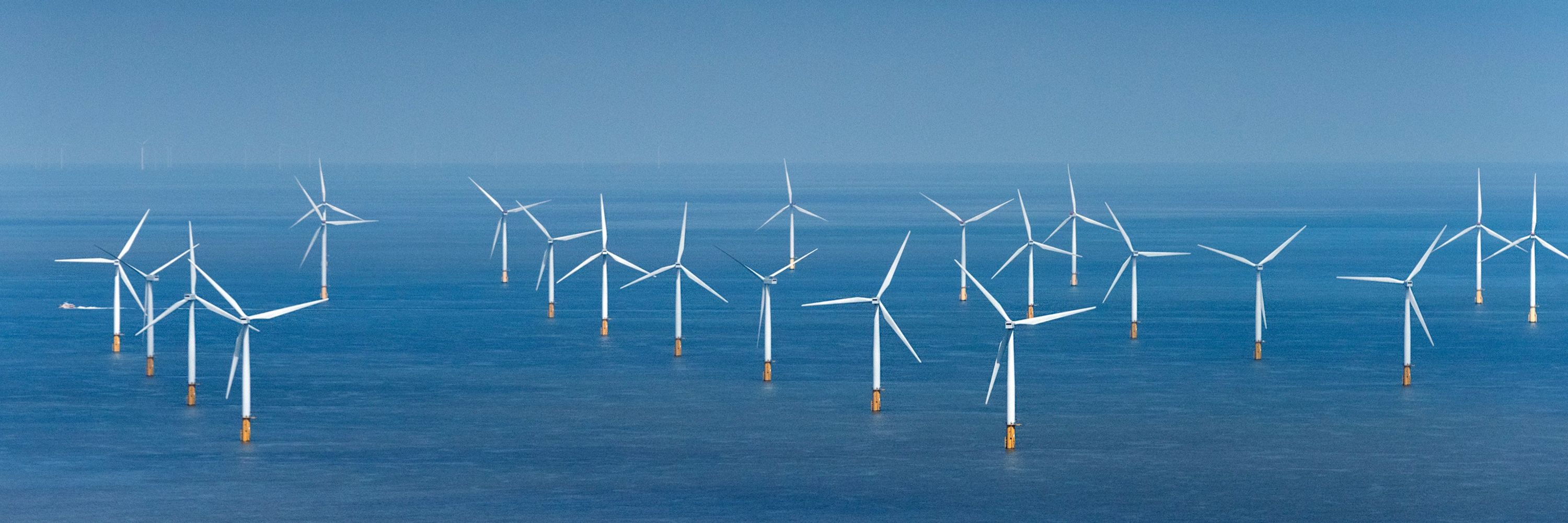
Scroby Sands aerial pic. The shifting sandbank laid bare at low tide. First commissioned in 2004, the site sits just off Great Yarmouth and is one of the UK’s early offshore wind farms #ScrobySands #WindFarm #Norfolk #Aerial #image

November 16, 2025 at 7:19 AM
Scroby Sands aerial pic. The shifting sandbank laid bare at low tide. First commissioned in 2004, the site sits just off Great Yarmouth and is one of the UK’s early offshore wind farms #ScrobySands #WindFarm #Norfolk #Aerial #image
Sotterley Hall aerial image: 18th-century Georgian country house remodelled around the 1740s–1750s, set within historic parkland that has evolved since the medieval estate first formed here. #SotterleyHall #aerial #image #Suffolk

November 15, 2025 at 7:32 PM
Sotterley Hall aerial image: 18th-century Georgian country house remodelled around the 1740s–1750s, set within historic parkland that has evolved since the medieval estate first formed here. #SotterleyHall #aerial #image #Suffolk
Thorpeness aerial view - with Sizewell in the distance. A striking stretch where fast-retreating cliffs show just how vulnerable this coast has become. Centuries of shifting shingle & today’s accelerating erosion tell the story in one frame. #Thorpeness #Sizewell #aerial #image #Suffolk #Coast

November 14, 2025 at 9:34 PM
Glenfield Hospital aerial image - one of the UK’s major centres for heart, lung and thoracic care. Built in the 1980s and part of the University Hospitals of Leicester #Leicester #Glenfield #hospital #aerial #image

November 14, 2025 at 8:07 PM
Glenfield Hospital aerial image - one of the UK’s major centres for heart, lung and thoracic care. Built in the 1980s and part of the University Hospitals of Leicester #Leicester #Glenfield #hospital #aerial #image
Salthouse aerial view: a ribbon of cottages between the salt marsh and the shingle ridge. The marshes - shaped by centuries of tidal change & are rich feeding grounds for migrating birds. St Nicholas Church stands at the heart of the village #Salthouse #aerial #image #Coast

November 14, 2025 at 7:18 AM
Salthouse aerial view: a ribbon of cottages between the salt marsh and the shingle ridge. The marshes - shaped by centuries of tidal change & are rich feeding grounds for migrating birds. St Nicholas Church stands at the heart of the village #Salthouse #aerial #image #Coast
Happisburgh Lighthouse aerial view. Built 1790. Norfolk’s oldest working lighthouse & the only one in Britain run by local volunteers. Once one of a pair of leading lights guiding ships past Haisborough Sands. Restored 1990 with help from Challenge Anneka. #Happisburgh #aerial

November 13, 2025 at 8:39 AM
Happisburgh Lighthouse aerial view. Built 1790. Norfolk’s oldest working lighthouse & the only one in Britain run by local volunteers. Once one of a pair of leading lights guiding ships past Haisborough Sands. Restored 1990 with help from Challenge Anneka. #Happisburgh #aerial
Cromer Lighthouse aerial view. Built 1833, replacing an earlier light lost to cliff erosion. 262ft above sea level. Automated in 1990, it continues service under Trinity House. The former keepers’ cottages are now private homes. #Cromer #lighthouse #aerial #image #TrinityHouse

November 12, 2025 at 5:20 PM
Cromer Lighthouse aerial view. Built 1833, replacing an earlier light lost to cliff erosion. 262ft above sea level. Automated in 1990, it continues service under Trinity House. The former keepers’ cottages are now private homes. #Cromer #lighthouse #aerial #image #TrinityHouse
North Norfolk coast in summer — taken off Sidestrand, looking east toward Mundesley. Fertile, green fields meet the deep blue of the North Sea, where erosion is steadily reshaping this striking stretch of coastline. #Norfolk #Aerial #image #NorthNorfolk #Coast

November 12, 2025 at 7:10 AM
North Norfolk coast in summer — taken off Sidestrand, looking east toward Mundesley. Fertile, green fields meet the deep blue of the North Sea, where erosion is steadily reshaping this striking stretch of coastline. #Norfolk #Aerial #image #NorthNorfolk #Coast
Nottingham Racecourse, Colwick Park aerial view. Dating back to 1773. The modern course reopened here in 1892 after the original Forest site closed. Home to flat racing only since 1996 #Nottingham #Racecourse #Aerial #image #HorseRacing #RiverTrent #ColwickPark

November 11, 2025 at 9:19 PM
Nottingham Racecourse, Colwick Park aerial view. Dating back to 1773. The modern course reopened here in 1892 after the original Forest site closed. Home to flat racing only since 1996 #Nottingham #Racecourse #Aerial #image #HorseRacing #RiverTrent #ColwickPark
Norwich aerial - a city of rivers, spires & stories.
Built on the River Wensum, it grew rich from weaving, shoes, mustard & engineering.
Today it’s famed for its skyline of medieval churches - more than any city north of the Alps.
#Norwich #Aerial #image #MedievalCity
Built on the River Wensum, it grew rich from weaving, shoes, mustard & engineering.
Today it’s famed for its skyline of medieval churches - more than any city north of the Alps.
#Norwich #Aerial #image #MedievalCity

November 11, 2025 at 8:39 AM
Norwich aerial - a city of rivers, spires & stories.
Built on the River Wensum, it grew rich from weaving, shoes, mustard & engineering.
Today it’s famed for its skyline of medieval churches - more than any city north of the Alps.
#Norwich #Aerial #image #MedievalCity
Built on the River Wensum, it grew rich from weaving, shoes, mustard & engineering.
Today it’s famed for its skyline of medieval churches - more than any city north of the Alps.
#Norwich #Aerial #image #MedievalCity
Downham Market aerial view. Once a Saxon settlement beside the Great Ouse, now one of West Norfolk’s fastest growing towns (pop 11,000). Known for its 16th-century clock tower, Victorian station 1846 & Friday markets dating back 800+ years. #DownhamMarket #aerial #image #Norfolk

November 10, 2025 at 8:53 PM
Downham Market aerial view. Once a Saxon settlement beside the Great Ouse, now one of West Norfolk’s fastest growing towns (pop 11,000). Known for its 16th-century clock tower, Victorian station 1846 & Friday markets dating back 800+ years. #DownhamMarket #aerial #image #Norfolk
Thorpeness aerial view. Created in the early 1900s by Glencairn Stuart Ogilvie as a private holiday resort. Its famous Meare was inspired by Peter Pan. The House in the Clouds & mock-Tudor homes make it wonderfully whimsical #Thorpeness #aerial #image #Suffolk #coast

November 10, 2025 at 7:04 AM
Thorpeness aerial view. Created in the early 1900s by Glencairn Stuart Ogilvie as a private holiday resort. Its famous Meare was inspired by Peter Pan. The House in the Clouds & mock-Tudor homes make it wonderfully whimsical #Thorpeness #aerial #image #Suffolk #coast
Grantham aerial view looking north along London Road & High Street towards St Wulfram’s Church. Once a key coaching route on the Great North Road. Birthplace of Isaac Newton & Margaret Thatcher #Grantham #Lincolnshire #Aerial #image

November 9, 2025 at 8:07 PM
Grantham aerial view looking north along London Road & High Street towards St Wulfram’s Church. Once a key coaching route on the Great North Road. Birthplace of Isaac Newton & Margaret Thatcher #Grantham #Lincolnshire #Aerial #image
Aerial view of Sheringham & Beeston Bump - the distinctive glacial hill rising 63 m above the Norfolk coast. Formed during the last Ice Age around 10,000 years ago, it marks the western end of the Cromer Ridge terminal moraine. #Sheringham #Norfolk #Coast #aerial #image

November 9, 2025 at 7:42 AM
Aerial view of Sheringham & Beeston Bump - the distinctive glacial hill rising 63 m above the Norfolk coast. Formed during the last Ice Age around 10,000 years ago, it marks the western end of the Cromer Ridge terminal moraine. #Sheringham #Norfolk #Coast #aerial #image
