


John Fielding Aerial Images
@john-fielding.bsky.social
Photographed from a plane in full-frame detail using a Nikon D850. Occasionally from a DJI drone. Images: All Rights Reserved
E-mail: johnfielding001@gmail.com
High resolution images here: https://www.flickr.com/photos/john_fielding/
E-mail: johnfielding001@gmail.com
High resolution images here: https://www.flickr.com/photos/john_fielding/
Crazy amount of change since the 1970s. It's fun getting old. 🙁
November 20, 2025 at 10:24 PM
Crazy amount of change since the 1970s. It's fun getting old. 🙁
Visiting London, coming from Norwich can feel like stepping into a science fiction film. It's changing so rapidly.
November 20, 2025 at 2:13 PM
Visiting London, coming from Norwich can feel like stepping into a science fiction film. It's changing so rapidly.
No need to apologise, Ian ... honestly, I'm grateful for corrections. They're extremely helpful and much appreciated.
November 18, 2025 at 9:33 PM
No need to apologise, Ian ... honestly, I'm grateful for corrections. They're extremely helpful and much appreciated.
Thanks Ian. I made a boo boo.
November 18, 2025 at 1:55 PM
Thanks Ian. I made a boo boo.
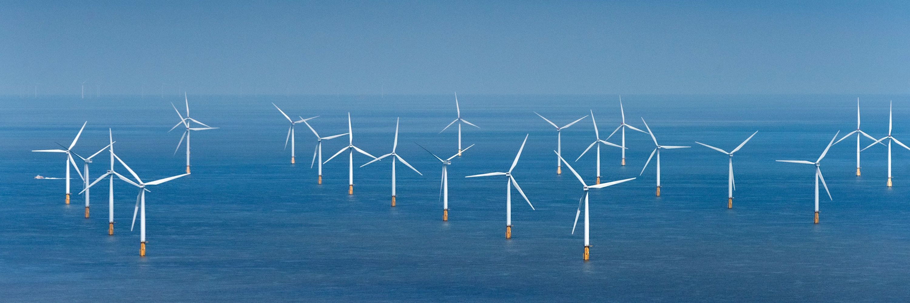
Yes. ‘Each turbine is supported by a monopile foundation, which are 4-meter diameter steel tubes, up to 50 meters long, hammered about 30 meters into the sea bed.’ windfarms.oedigital.com/windfarms/wi...
Scroby Sands - Windfarms Directory
windfarms.oedigital.com
November 17, 2025 at 10:44 PM
Yes. ‘Each turbine is supported by a monopile foundation, which are 4-meter diameter steel tubes, up to 50 meters long, hammered about 30 meters into the sea bed.’ windfarms.oedigital.com/windfarms/wi...
Fabulous link. Thanks Barbara. It put Norfolk on the world map ... again. 🙂
November 13, 2025 at 8:32 PM
Fabulous link. Thanks Barbara. It put Norfolk on the world map ... again. 🙂
Thank you Catman. It's the most popular image I've ever uploaded to Bluesky. Exciting.
November 13, 2025 at 8:31 PM
Thank you Catman. It's the most popular image I've ever uploaded to Bluesky. Exciting.
I had to double check it, myself ... and was surprised to find that it really is the Haisborough Sands.
www.norfolkwreckresearch.co.uk/the-tall-fiv...
www.norfolkwreckresearch.co.uk/the-tall-fiv...
The tall five and Haisborough Sands
www.norfolkwreckresearch.co.uk
November 13, 2025 at 8:29 PM
I had to double check it, myself ... and was surprised to find that it really is the Haisborough Sands.
www.norfolkwreckresearch.co.uk/the-tall-fiv...
www.norfolkwreckresearch.co.uk/the-tall-fiv...
Thank you, Mrs. JB. I imagine the lighthouse will be getting nervous in 30 years time.
November 13, 2025 at 8:26 PM
Thank you, Mrs. JB. I imagine the lighthouse will be getting nervous in 30 years time.