


@jenniebyron.bsky.social
Geo & geospatial geek at Esri, magpie for shiny rocks, especially when I can map them 🗺️🧭
Reposted

In 2 weeks, join #Esri's free #MOOC to explore modern approaches to visualize, process, and maximize insights from #imagery & #RemoteSensing #data tinyurl.com/28fzh7un
#images #sensors #GIS #arcgis #mapping #GISchat #geospatial #geography #EsriTraining #TheScienceOfWhere #geosky
#images #sensors #GIS #arcgis #mapping #GISchat #geospatial #geography #EsriTraining #TheScienceOfWhere #geosky

October 9, 2025 at 1:39 PM
In 2 weeks, join #Esri's free #MOOC to explore modern approaches to visualize, process, and maximize insights from #imagery & #RemoteSensing #data tinyurl.com/28fzh7un
#images #sensors #GIS #arcgis #mapping #GISchat #geospatial #geography #EsriTraining #TheScienceOfWhere #geosky
#images #sensors #GIS #arcgis #mapping #GISchat #geospatial #geography #EsriTraining #TheScienceOfWhere #geosky
Reposted

The amazingly astonishing Assiniboine River, Manitoba, Canada, again.

September 30, 2025 at 1:06 AM
The amazingly astonishing Assiniboine River, Manitoba, Canada, again.
Reposted

We are passionate about conservation at Esri ...and so are our users. So why not integrate all the great biodiversity and conservation information in the ArcGIS Living Atlas into a single dataset? ☑️
www.esri.com/arcgis-blog/...
#gischat #geogsky #geogchat 🌍 🌎 🌏 #30x30
www.esri.com/arcgis-blog/...
#gischat #geogsky #geogchat 🌍 🌎 🌏 #30x30

Introducing Global Biodiversity and Conservation Hexagons
New Living Atlas multiscale hexagon layers support quick insights and reporting for biodiversity and conservation.
www.esri.com
July 10, 2025 at 6:09 PM
We are passionate about conservation at Esri ...and so are our users. So why not integrate all the great biodiversity and conservation information in the ArcGIS Living Atlas into a single dataset? ☑️
www.esri.com/arcgis-blog/...
#gischat #geogsky #geogchat 🌍 🌎 🌏 #30x30
www.esri.com/arcgis-blog/...
#gischat #geogsky #geogchat 🌍 🌎 🌏 #30x30
Reposted


May 7, 2025 at 2:01 AM
Reposted
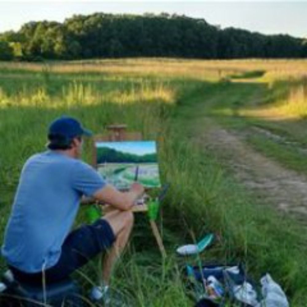
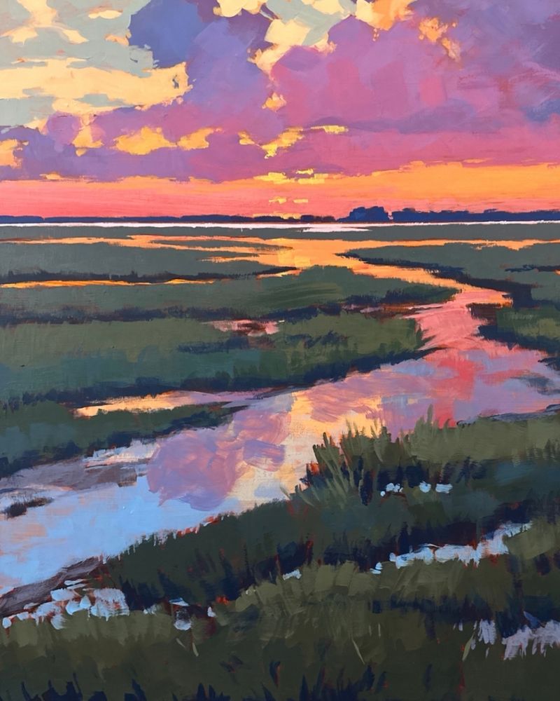
My painting TIDAL WETLANDS
April 24, 2025 at 1:36 PM
My painting TIDAL WETLANDS
Do you conduct regulatory reviews? Register for Thursday's webinar on "Streamlining Environmental Protection with GIS". Hear from #AEC and #Environmental consulting firm Stantec and the State of Tennessee on wetland delineation workflows. Register at www.esri.com/en-us/webina...

Streamlining Environmental Protection with GIS Webinar Series
Join us for a two-part webinar series on maximizing GIS for environmental permitting efficiency.
www.esri.com
April 23, 2025 at 10:03 PM
Do you conduct regulatory reviews? Register for Thursday's webinar on "Streamlining Environmental Protection with GIS". Hear from #AEC and #Environmental consulting firm Stantec and the State of Tennessee on wetland delineation workflows. Register at www.esri.com/en-us/webina...
Reposted
NASA's Surface Water and Ocean Topography (SWOT) mission enables us to map global surface freshwater components including rivers, lakes and wetlands with high-resolution measurements (~200 m).
Explore SWOT data and its potential applications in this training series: go.nasa.gov/4jcVk5J
Explore SWOT data and its potential applications in this training series: go.nasa.gov/4jcVk5J
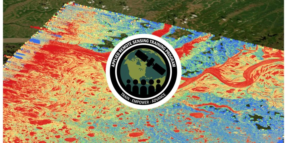
ARSET - Monitoring Global Terrestrial Surface Water Height using Remote Sensing | NASA Applied Sciences
go.nasa.gov
April 23, 2025 at 9:29 PM
NASA's Surface Water and Ocean Topography (SWOT) mission enables us to map global surface freshwater components including rivers, lakes and wetlands with high-resolution measurements (~200 m).
Explore SWOT data and its potential applications in this training series: go.nasa.gov/4jcVk5J
Explore SWOT data and its potential applications in this training series: go.nasa.gov/4jcVk5J