


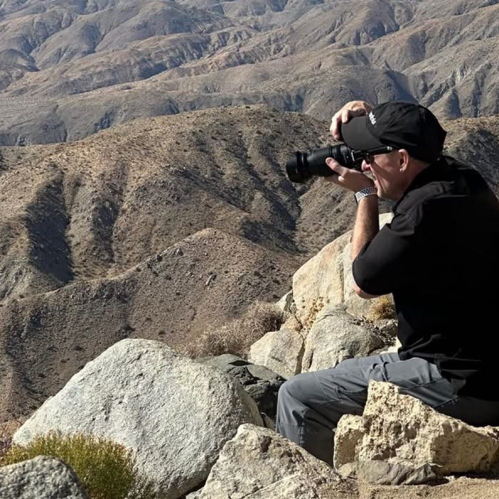
Pics from the weekend


September 15, 2025 at 7:51 PM
Pics from the weekend
Reposted
Portland Japanese Garden #PDX #portland #Portlandoregon #oregon #nature #naturephotography #landscape #landscapephotography #maple #japanesemaple #Fall #photo #photography #travel #travelphotography #leaves #Bluesky #asian #autumn #garden #leaf #PNW #moss #trees #rain #red

September 15, 2025 at 6:46 PM
Reposted
For #Stunday I'll drop this off from my very quick visit to #CraterLake National Park. I was in the area, so how could I not?
Compression will probably negate all the incredible detail I got out of this shot, which I need to print large format!
#PhotographersofBlueSky #Landscape #Scape #EastCoastKin
Compression will probably negate all the incredible detail I got out of this shot, which I need to print large format!
#PhotographersofBlueSky #Landscape #Scape #EastCoastKin

September 14, 2025 at 10:06 PM
For #Stunday I'll drop this off from my very quick visit to #CraterLake National Park. I was in the area, so how could I not?
Compression will probably negate all the incredible detail I got out of this shot, which I need to print large format!
#PhotographersofBlueSky #Landscape #Scape #EastCoastKin
Compression will probably negate all the incredible detail I got out of this shot, which I need to print large format!
#PhotographersofBlueSky #Landscape #Scape #EastCoastKin
Reposted
TOP TEN CAT BREEDS
1. Super Bingus
2. Tender Loaf
3. Crime Bean
4. Le Squishe
5. Load-bearing Tater
6. Royal Softling
7. Electric Spiceweasel
8. Pantaloosian
9. Tammy
10. Dinky Porch Pebble
1. Super Bingus
2. Tender Loaf
3. Crime Bean
4. Le Squishe
5. Load-bearing Tater
6. Royal Softling
7. Electric Spiceweasel
8. Pantaloosian
9. Tammy
10. Dinky Porch Pebble
September 15, 2025 at 7:28 PM
TOP TEN CAT BREEDS
1. Super Bingus
2. Tender Loaf
3. Crime Bean
4. Le Squishe
5. Load-bearing Tater
6. Royal Softling
7. Electric Spiceweasel
8. Pantaloosian
9. Tammy
10. Dinky Porch Pebble
1. Super Bingus
2. Tender Loaf
3. Crime Bean
4. Le Squishe
5. Load-bearing Tater
6. Royal Softling
7. Electric Spiceweasel
8. Pantaloosian
9. Tammy
10. Dinky Porch Pebble
Reposted
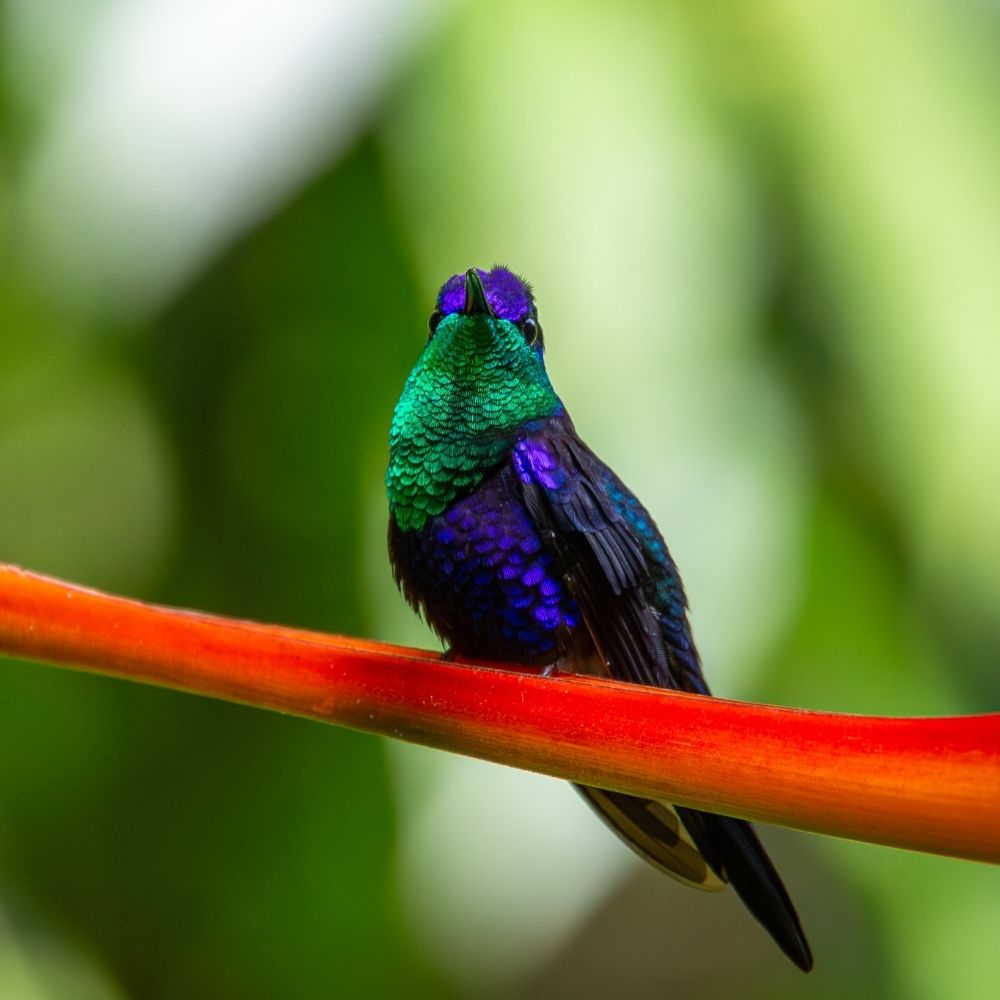
An Anna's hummingbird looks up towards the sky as other hummingbirds threaten to defend the feeder
📷 Canon R5
Canon RF100-500mm f/4.5-7.1L IS USM
M, f/7.1, 1/1600, ISO 1600, 500mm
12/22/23
Northern Oregon Coast
#birds #bird #photography #ornithology #birdphotos #nature #naturephotography
🦉 🪶
📷 Canon R5
Canon RF100-500mm f/4.5-7.1L IS USM
M, f/7.1, 1/1600, ISO 1600, 500mm
12/22/23
Northern Oregon Coast
#birds #bird #photography #ornithology #birdphotos #nature #naturephotography
🦉 🪶

September 7, 2025 at 1:50 PM
An Anna's hummingbird looks up towards the sky as other hummingbirds threaten to defend the feeder
📷 Canon R5
Canon RF100-500mm f/4.5-7.1L IS USM
M, f/7.1, 1/1600, ISO 1600, 500mm
12/22/23
Northern Oregon Coast
#birds #bird #photography #ornithology #birdphotos #nature #naturephotography
🦉 🪶
📷 Canon R5
Canon RF100-500mm f/4.5-7.1L IS USM
M, f/7.1, 1/1600, ISO 1600, 500mm
12/22/23
Northern Oregon Coast
#birds #bird #photography #ornithology #birdphotos #nature #naturephotography
🦉 🪶
Crying about it will make me feel better right?

September 6, 2025 at 5:41 PM
Crying about it will make me feel better right?
Reposted
Arguably another one of Oregon's most beautiful birds, the Lazuli bunting
📷 Canon 5D Mark III
Canon EF100-400mm f/4.5-5.6L IS II USM
Canon EF 1.4x III
M, f/8, 1/400, ISO 500, 560mm
7/3/21
Northern California
#birds #ornithology #birdphotos #nature #buntingbird #buntings #lazulibunting
🦉 🪶 🐤 🦜 📸
📷 Canon 5D Mark III
Canon EF100-400mm f/4.5-5.6L IS II USM
Canon EF 1.4x III
M, f/8, 1/400, ISO 500, 560mm
7/3/21
Northern California
#birds #ornithology #birdphotos #nature #buntingbird #buntings #lazulibunting
🦉 🪶 🐤 🦜 📸

September 4, 2025 at 6:45 PM
Arguably another one of Oregon's most beautiful birds, the Lazuli bunting
📷 Canon 5D Mark III
Canon EF100-400mm f/4.5-5.6L IS II USM
Canon EF 1.4x III
M, f/8, 1/400, ISO 500, 560mm
7/3/21
Northern California
#birds #ornithology #birdphotos #nature #buntingbird #buntings #lazulibunting
🦉 🪶 🐤 🦜 📸
📷 Canon 5D Mark III
Canon EF100-400mm f/4.5-5.6L IS II USM
Canon EF 1.4x III
M, f/8, 1/400, ISO 500, 560mm
7/3/21
Northern California
#birds #ornithology #birdphotos #nature #buntingbird #buntings #lazulibunting
🦉 🪶 🐤 🦜 📸
Reposted
A movie about a boy getting magic powers because he’s the seventh son of a seventh son and that’s how he realizes he’s got siblings he doesn’t know about lol
August 31, 2025 at 6:02 AM
A movie about a boy getting magic powers because he’s the seventh son of a seventh son and that’s how he realizes he’s got siblings he doesn’t know about lol
Reposted

🌊🧪On our Aleutians expedition, a 0300 onboard message got everyone out of their racks. We unintentionally mapped a MASSIVE landslide along a ridge line. Sent the initial data to USGS onshore SMEs- They were EXCITED.
So, we backtracked a few kms to collect a suite of data. Here’s the product:
So, we backtracked a few kms to collect a suite of data. Here’s the product:

3D perspective map of the seafloor on the southern Aleutian Shelf
Colored 3D perspective map of the seafloor on the southern Aleutian Shelf, approximately 18 miles south of Little Tanaga and Umak Islands, Alaska. Colors shows depth, ranging from the shallow shelf 16...
www.usgs.gov
August 28, 2025 at 9:30 PM
🌊🧪On our Aleutians expedition, a 0300 onboard message got everyone out of their racks. We unintentionally mapped a MASSIVE landslide along a ridge line. Sent the initial data to USGS onshore SMEs- They were EXCITED.
So, we backtracked a few kms to collect a suite of data. Here’s the product:
So, we backtracked a few kms to collect a suite of data. Here’s the product:
Reposted

You want to see this new geologic map of the contiguous US that the USGS just released.

Cooperative National Geologic Map | NGMDB
Explore the Cooperative National Geologic Map, a unified view of our Nation's geology, with interactive layers and geologic data.
ngmdb.usgs.gov
August 28, 2025 at 3:48 PM
You want to see this new geologic map of the contiguous US that the USGS just released.
Setting up my first raspberry pi :)
August 26, 2025 at 7:17 PM
Setting up my first raspberry pi :)
From our weekend adventures: Mount Adams

August 25, 2025 at 2:36 PM
From our weekend adventures: Mount Adams
Reposted

he really hit her with 'i studied the blade' 📽️

August 25, 2025 at 1:54 AM
he really hit her with 'i studied the blade' 📽️

August 22, 2025 at 6:24 PM