


Ramon Arrowsmith
@jrarrowsmith.bsky.social
Professor of Geology
SESE, ASU http://public.asu.edu/~arrows/
SESE, ASU http://public.asu.edu/~arrows/
Reposted by Ramon Arrowsmith

October 16, 2025 at 9:15 PM
Reposted by Ramon Arrowsmith
Ever wondered what #lidar point clouds reveal about forests? OpenForest4D’s new guide breaks down how elevation, return number, intensity, and classification describe forest structure.
openforest4d.org/lidar-point-...
#pointcloud #laserscanning #forestry #geospatial
openforest4d.org/lidar-point-...
#pointcloud #laserscanning #forestry #geospatial

October 27, 2025 at 4:33 PM
Ever wondered what #lidar point clouds reveal about forests? OpenForest4D’s new guide breaks down how elevation, return number, intensity, and classification describe forest structure.
openforest4d.org/lidar-point-...
#pointcloud #laserscanning #forestry #geospatial
openforest4d.org/lidar-point-...
#pointcloud #laserscanning #forestry #geospatial
Reposted by Ramon Arrowsmith
Discover how #lidar reveals the size & location of individual Ponderosa Pines at Sunset Crater, AZ! Using advanced algorithms in lidR, we map tree height and crowns in stunning detail, informing forest ecology and management.
openforest4d.org/tree-identif...
#Forestry
#RemoteSensing
#RStats
openforest4d.org/tree-identif...
#Forestry
#RemoteSensing
#RStats

October 30, 2025 at 3:41 PM
Discover how #lidar reveals the size & location of individual Ponderosa Pines at Sunset Crater, AZ! Using advanced algorithms in lidR, we map tree height and crowns in stunning detail, informing forest ecology and management.
openforest4d.org/tree-identif...
#Forestry
#RemoteSensing
#RStats
openforest4d.org/tree-identif...
#Forestry
#RemoteSensing
#RStats
Reposted by Ramon Arrowsmith
We created an #OpenSource automated workflow for multi-temporal #lidar processing to map forest change at scale. Generate canopy height, cover & change products critical for monitoring #wildfire impacts and ecosystem dynamics. Code and example from #Kaibab forest #AZ at github.com/OpenForest4D...

November 5, 2025 at 6:23 PM
We created an #OpenSource automated workflow for multi-temporal #lidar processing to map forest change at scale. Generate canopy height, cover & change products critical for monitoring #wildfire impacts and ecosystem dynamics. Code and example from #Kaibab forest #AZ at github.com/OpenForest4D...
Reposted by Ramon Arrowsmith
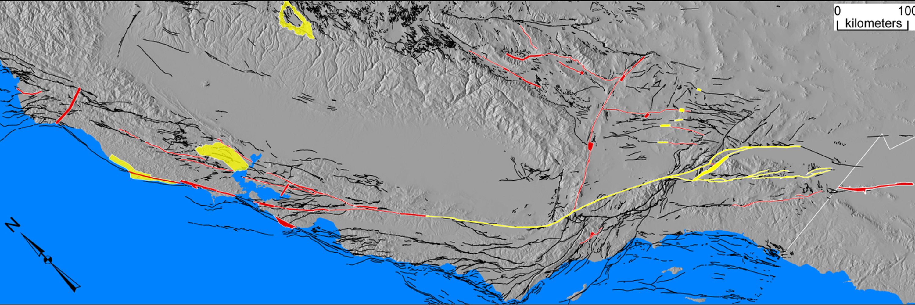
Very happy to share this documentary that documents some of the work of our team and our collaborators in learning more about the earthquakes of Central Asia. @jrarrowsmith.bsky.social

🎥 "It might never happen"...Remembering forgotten #earthquakes in Central Asia
What happens when natural disasters fade from living memory? How do societies perceive #risk? @richardthomasw.bsky.social & Dr Neill Marshall share their fascinating #research @ox.ac.uk
bit.ly/444sMFA
1/2
What happens when natural disasters fade from living memory? How do societies perceive #risk? @richardthomasw.bsky.social & Dr Neill Marshall share their fascinating #research @ox.ac.uk
bit.ly/444sMFA
1/2

"It might never happen..." Remembering forgotten earthquakes in Central Asia
Where in the world do earthquakes pose the greatest risk? Japan, perhaps...or California? When devastating earthquakes hit the news headlines, they implant themselves in our memory, and we create a long-lasting association between the location and the event. But what about the earthquakes that lie outside of living memory? Are the locations of these events perceived to hold the same degree of risk? In this film, Professor Richard Walker and Dr Neill Marshall from Oxford's Department of Earth Sciences share their work on the forgotten earthquakes of Central Asia, and explain the societal implications of natural disasters that have faded into the past.
bit.ly
June 18, 2025 at 2:35 PM
Very happy to share this documentary that documents some of the work of our team and our collaborators in learning more about the earthquakes of Central Asia. @jrarrowsmith.bsky.social
How many batteries does it take to do field work in the Jemez and the Hopi Buttes? 11+4+8+3+1. Funner than the rest of the doom and gloom

May 17, 2025 at 6:33 PM
How many batteries does it take to do field work in the Jemez and the Hopi Buttes? 11+4+8+3+1. Funner than the rest of the doom and gloom
Reposted by Ramon Arrowsmith
Check out the latest updates to RiverREM, a Python package that automatically generates river REM visualizations. Recent improvements include new colormap options (including custom and cmocean palettes), more efficient CPU and RAM usage, and expanded documentation.
buff.ly/bwtP8Vs
buff.ly/bwtP8Vs

April 9, 2025 at 4:30 PM
Check out the latest updates to RiverREM, a Python package that automatically generates river REM visualizations. Recent improvements include new colormap options (including custom and cmocean palettes), more efficient CPU and RAM usage, and expanded documentation.
buff.ly/bwtP8Vs
buff.ly/bwtP8Vs
Reposted by Ramon Arrowsmith
2024 OpenTopography Bibliography: Every year we review the literature for publications that used OT data or resources. Since 2009, OT has enabled 1,204 peer-reviewed publications, 139 theses, 34 book sections, and 57 reports. Read more in our full blog post: opentopography.org/blog/ot-bibl...

March 6, 2025 at 4:03 PM
2024 OpenTopography Bibliography: Every year we review the literature for publications that used OT data or resources. Since 2009, OT has enabled 1,204 peer-reviewed publications, 139 theses, 34 book sections, and 57 reports. Read more in our full blog post: opentopography.org/blog/ot-bibl...
Reposted by Ramon Arrowsmith
Sacramento River, CA Topo-Bathymetric #lidar dataset recently added to OpenTopography. 174 river miles of high resolution aerial imagery, topography, bathymetry, and water surface elevations were collected to support hydrodynamic modeling and habitat prediction: opentopography.org/news/sacrame...


February 27, 2025 at 3:59 PM
Sacramento River, CA Topo-Bathymetric #lidar dataset recently added to OpenTopography. 174 river miles of high resolution aerial imagery, topography, bathymetry, and water surface elevations were collected to support hydrodynamic modeling and habitat prediction: opentopography.org/news/sacrame...
Reposted by Ramon Arrowsmith
Explore in this interactive map of change: portal.opentopography.org/lafires
Change maps and processed #lidar DEMs used in the analysis are available here: doi.org/10.5069/G95B...
Original post-fire DEMs (courtesy of NV5 & UCSD):
Palisades: doi.org/10.5069/G9DR...
Eaton: doi.org/10.5069/G9JH...
Change maps and processed #lidar DEMs used in the analysis are available here: doi.org/10.5069/G95B...
Original post-fire DEMs (courtesy of NV5 & UCSD):
Palisades: doi.org/10.5069/G9DR...
Eaton: doi.org/10.5069/G9JH...
February 11, 2025 at 3:55 PM
Explore in this interactive map of change: portal.opentopography.org/lafires
Change maps and processed #lidar DEMs used in the analysis are available here: doi.org/10.5069/G95B...
Original post-fire DEMs (courtesy of NV5 & UCSD):
Palisades: doi.org/10.5069/G9DR...
Eaton: doi.org/10.5069/G9JH...
Change maps and processed #lidar DEMs used in the analysis are available here: doi.org/10.5069/G95B...
Original post-fire DEMs (courtesy of NV5 & UCSD):
Palisades: doi.org/10.5069/G9DR...
Eaton: doi.org/10.5069/G9JH...
Reposted by Ramon Arrowsmith
Using #lidar to understand the impacts of the 2025 Palisades and Eaton Fires, Los Angeles, CA: We processed pre- & post- fire lidar data to illustrate the changes to the natural and built environments caused by these devastating fires. Blog for more info & images: opentopography.org/blog/using-l...


February 11, 2025 at 3:55 PM
Using #lidar to understand the impacts of the 2025 Palisades and Eaton Fires, Los Angeles, CA: We processed pre- & post- fire lidar data to illustrate the changes to the natural and built environments caused by these devastating fires. Blog for more info & images: opentopography.org/blog/using-l...
New paper! Rachel Adam did a great job leading this work. Thanks to PGE and ASU for support.
Think about how we map potentially active faults.
pubs.geoscienceworld.org/gsa/geospher...
Think about how we map potentially active faults.
pubs.geoscienceworld.org/gsa/geospher...
A systematic approach to mapping tectonic faults and documenting supporting geomorphology | Geosphere | GeoScienceWorld
pubs.geoscienceworld.org
January 18, 2025 at 6:33 PM
New paper! Rachel Adam did a great job leading this work. Thanks to PGE and ASU for support.
Think about how we map potentially active faults.
pubs.geoscienceworld.org/gsa/geospher...
Think about how we map potentially active faults.
pubs.geoscienceworld.org/gsa/geospher...
Reposted by Ramon Arrowsmith
Very cool! Our USGS 3DEP #lidar notebook can be found on our Github here: github.com/OpenTopograp...
Sun and shade across the Madison isthmus today. View NW. Lidar from USGS using Jupyter notebook from @opentopography.bsky.social. Sun position using #suntools R package; perspective view and shadows modeled with #rayshader. Needs work but I like it. Will share the script when I get around to it.
January 5, 2025 at 2:51 AM
Very cool! Our USGS 3DEP #lidar notebook can be found on our Github here: github.com/OpenTopograp...
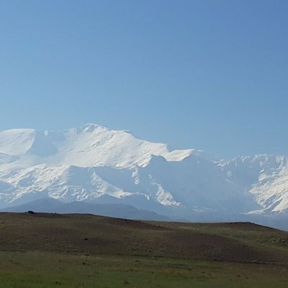
I am intrigued by these earthquakes in the northeastern Main Ethiopian Rift. I will be there next month...
activetectonics.blogspot.com/2024/12/m4-m...
activetectonics.blogspot.com/2024/12/m4-m...

M4-M5 earthquakes in the Awash area of Ethiopia (late 2024)
There have been numerous M4-M5 earthquakes in the Awash area of Ethiopia over the last few months. This is within the Main Ethiopia Rift at ...
activetectonics.blogspot.com
December 31, 2024 at 10:48 PM
I am intrigued by these earthquakes in the northeastern Main Ethiopian Rift. I will be there next month...
activetectonics.blogspot.com/2024/12/m4-m...
activetectonics.blogspot.com/2024/12/m4-m...
Reposted by Ramon Arrowsmith
Day three of #AGU24. If you’ve not yet said hi to the OpenTopography team please stop by booth 1108 in the exhibit hall: opentopography.org/news/opentop...


December 11, 2024 at 2:48 PM
Day three of #AGU24. If you’ve not yet said hi to the OpenTopography team please stop by booth 1108 in the exhibit hall: opentopography.org/news/opentop...
Dinner at Cosmos Club in DC. IUGG social. A pilgrimage thinking of Powell and Pewe also.


December 11, 2024 at 4:32 AM
Dinner at Cosmos Club in DC. IUGG social. A pilgrimage thinking of Powell and Pewe also.
Rose plant in honor of my mother


December 11, 2024 at 4:30 AM
Rose plant in honor of my mother