


Experimenting with my own Map Tooltips manager and Real World Symbol sizes at high zoom levels.
February 5, 2026 at 2:46 PM
Experimenting with my own Map Tooltips manager and Real World Symbol sizes at high zoom levels.
A first draft at sharing a universal layer management library that is mapping framework and UI library agnostic. We've utilised this approach to create our own layer management in Leaflet and ArcGIS applications without having to reimplement shared logic! antarctica.github.io/universal-la...
Universal Layer Manager
Documentation for Universal Layer Manager
antarctica.github.io
January 27, 2026 at 6:20 PM
A first draft at sharing a universal layer management library that is mapping framework and UI library agnostic. We've utilised this approach to create our own layer management in Leaflet and ArcGIS applications without having to reimplement shared logic! antarctica.github.io/universal-la...
I've created an open-sourced version of my logic for accessing a nmea feed on a usb gps device (or any nmea serial port!) Take a look here: github.com/antarctica/n...

GitHub - antarctica/nmea-web-serial: NMEA 0183 library for the Web Serial API. Generic adapter pattern, XState state management, and framework-agnostic client API. Perfect for marine navigation, GPS t...
NMEA 0183 library for the Web Serial API. Generic adapter pattern, XState state management, and framework-agnostic client API. Perfect for marine navigation, GPS tracking, and IoT applications. - a...
github.com
November 12, 2025 at 5:59 PM
I've created an open-sourced version of my logic for accessing a nmea feed on a usb gps device (or any nmea serial port!) Take a look here: github.com/antarctica/n...
Recently I stumbled upon the web serial api! Supported in Chromium browsers, it allows you to hook into a devices attached to serial ports on your machine through the browser! I've implemented logic to read in a gps nmea stream directly into our SIIS web app!
November 11, 2025 at 1:15 PM
Recently I stumbled upon the web serial api! Supported in Chromium browsers, it allows you to hook into a devices attached to serial ports on your machine through the browser! I've implemented logic to read in a gps nmea stream directly into our SIIS web app!
More timelines! Two way interaction between our custom Imagery Collection Layer and the timeline! #timelines #arcgisdev
October 31, 2025 at 4:02 PM
More timelines! Two way interaction between our custom Imagery Collection Layer and the timeline! #timelines #arcgisdev
Working on adding some timeline user interface components to simplify the process of choosing relevant data. In this case we a bring COGs directly into the app from a STAC api! #arcgisdev
October 29, 2025 at 4:25 PM
Working on adding some timeline user interface components to simplify the process of choosing relevant data. In this case we a bring COGs directly into the app from a STAC api! #arcgisdev
Building a timeline using d3.js. Sometimes its easier to roll your own then search for that golden goose library that someone else has built! Pretty much unstyled at the moment, but has the functionality I need for handling interactions.
October 1, 2025 at 4:31 PM
Building a timeline using d3.js. Sometimes its easier to roll your own then search for that golden goose library that someone else has built! Pretty much unstyled at the moment, but has the functionality I need for handling interactions.
Reposted by Jonny Dawe
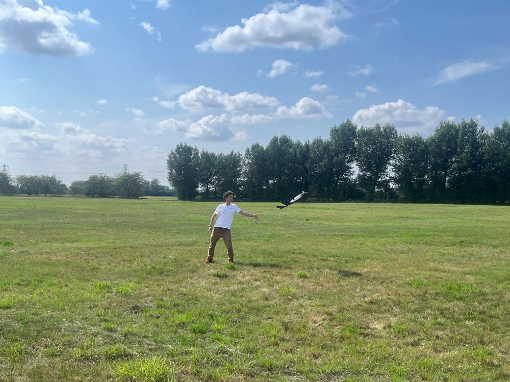
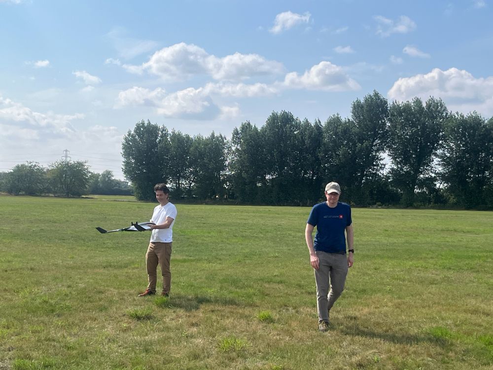
Made primarily of polystyrene they weigh just 1.6 kg on take-off, but despite this they are capable of operating in the stronger winds we experience down in the Antarctic with a maximum continuous wind limit of 17 m/s. In fact, yesterday we clocked a top ground speed of >63 mph!
2/2
2/2
August 1, 2025 at 3:59 PM
Made primarily of polystyrene they weigh just 1.6 kg on take-off, but despite this they are capable of operating in the stronger winds we experience down in the Antarctic with a maximum continuous wind limit of 17 m/s. In fact, yesterday we clocked a top ground speed of >63 mph!
2/2
2/2
Reposted by Jonny Dawe
MAGIC was out test flying our eBee VISION platforms in advance of the upcoming Antarctic field season this week. The eBee VISION UAVs can fly for 90 minutes and operate up to 20 km from the pilot. Here's a short clip of one of them in action! 🛩️
1/2
1/2
August 1, 2025 at 3:59 PM
MAGIC was out test flying our eBee VISION platforms in advance of the upcoming Antarctic field season this week. The eBee VISION UAVs can fly for 90 minutes and operate up to 20 km from the pilot. Here's a short clip of one of them in action! 🛩️
1/2
1/2
Reposted by Jonny Dawe
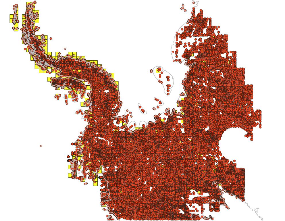
Lots of dots! These are spot heights generated for our Air Operations Planning Maps, using REMAv2 2m tiles. Next steps are to clean up the density, add existing GPS points & then add them to our maps, which are used for planning by pilots across the continent. The data will then be openly published!
July 30, 2025 at 9:09 AM
Lots of dots! These are spot heights generated for our Air Operations Planning Maps, using REMAv2 2m tiles. Next steps are to clean up the density, add existing GPS points & then add them to our maps, which are used for planning by pilots across the continent. The data will then be openly published!
Reposted by Jonny Dawe
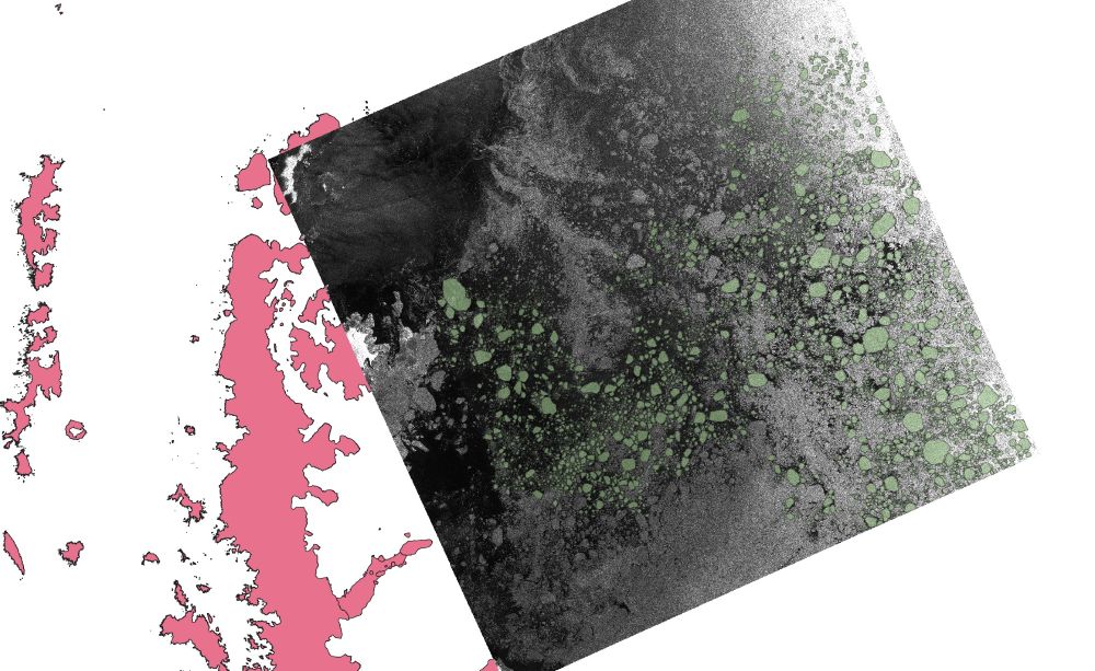
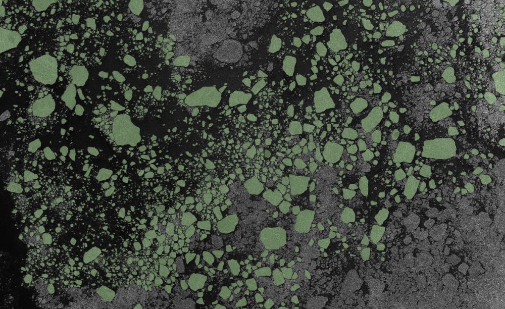
We are currently hosting an intern digitising ice floes from satellite radar (SAR) imagery in the Weddell Sea.
The resulting labelled data will be used in the NERC DEFIANT and QUASAR projects to assess the performance of machine learning methods and quantify errors in sea ice concentration data.
The resulting labelled data will be used in the NERC DEFIANT and QUASAR projects to assess the performance of machine learning methods and quantify errors in sea ice concentration data.
July 24, 2025 at 2:27 PM
We are currently hosting an intern digitising ice floes from satellite radar (SAR) imagery in the Weddell Sea.
The resulting labelled data will be used in the NERC DEFIANT and QUASAR projects to assess the performance of machine learning methods and quantify errors in sea ice concentration data.
The resulting labelled data will be used in the NERC DEFIANT and QUASAR projects to assess the performance of machine learning methods and quantify errors in sea ice concentration data.
Reposted by Jonny Dawe
We have been working along with engineers from Phase One and Rocky Mountain Aircraft over the past week to install and test our new Phase One PAS aerial camera into BAS's Twin Otter aircraft. 🛩️
1/3
1/3
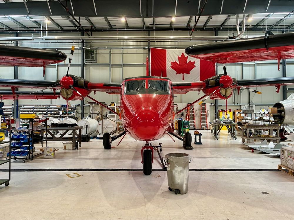
July 14, 2025 at 1:34 PM
We have been working along with engineers from Phase One and Rocky Mountain Aircraft over the past week to install and test our new Phase One PAS aerial camera into BAS's Twin Otter aircraft. 🛩️
1/3
1/3
Reposted by Jonny Dawe
Did you know that it's possible to follow the RRS Sir David Attenborough on @bas.ac.uk's website? We provide the maps and location tracking to underpin this. 🚢🗺️
See the latest position of the ship here, on its way north after a long season in Antarctica! www.bas.ac.uk/polar-operat...
See the latest position of the ship here, on its way north after a long season in Antarctica! www.bas.ac.uk/polar-operat...
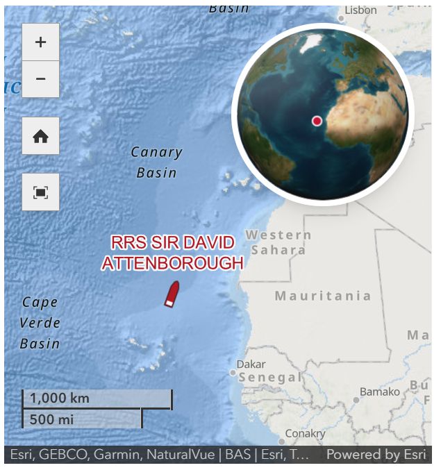
July 9, 2025 at 4:30 PM
Did you know that it's possible to follow the RRS Sir David Attenborough on @bas.ac.uk's website? We provide the maps and location tracking to underpin this. 🚢🗺️
See the latest position of the ship here, on its way north after a long season in Antarctica! www.bas.ac.uk/polar-operat...
See the latest position of the ship here, on its way north after a long season in Antarctica! www.bas.ac.uk/polar-operat...
Reposted by Jonny Dawe
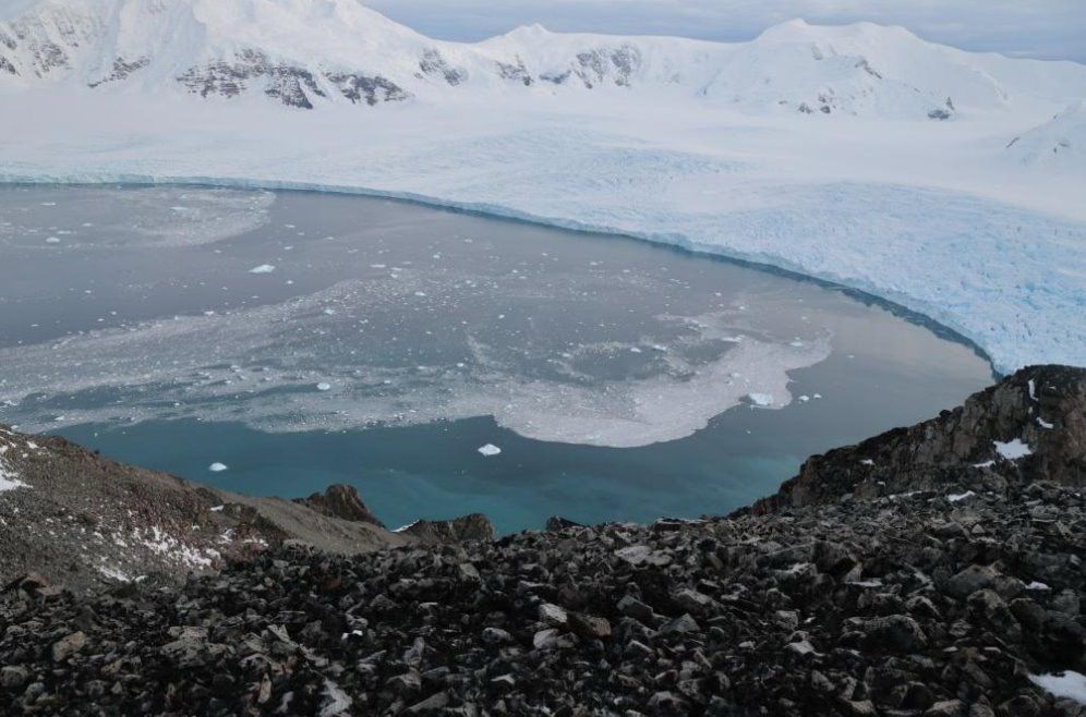
This week we have been at a @polomints.bsky.social project meeting, planning details of how to use fixed stereo cameras, RPAS and our new air camera to monitor calving of the Sheldon Glacier on Adelaide Island. For more information visit polomints.ac.uk.
July 4, 2025 at 1:50 PM
This week we have been at a @polomints.bsky.social project meeting, planning details of how to use fixed stereo cameras, RPAS and our new air camera to monitor calving of the Sheldon Glacier on Adelaide Island. For more information visit polomints.ac.uk.
Whilst updating an app to the latest version of the ArcGIS JS API (4.33) we picked up a minor regression in labelling for a super niche situation. I would call that one epic win for our automated testing setup! Check out our setup here: github.com/antarctica/e... #Arcgis #Dev #Playwright
July 3, 2025 at 5:11 PM
Whilst updating an app to the latest version of the ArcGIS JS API (4.33) we picked up a minor regression in labelling for a super niche situation. I would call that one epic win for our automated testing setup! Check out our setup here: github.com/antarctica/e... #Arcgis #Dev #Playwright
I always like to get in early with implementing a responsive UI - usually it means that the actual extra code is pretty minimal! #arcgis #responsive
June 25, 2025 at 3:02 PM
I always like to get in early with implementing a responsive UI - usually it means that the actual extra code is pretty minimal! #arcgis #responsive
Reposted by Jonny Dawe
We're hiring a GIS and Mapping Specialist to manage our Geospatial Helpdesk and to contribute to our Topographic Map Series.
This is a really exciting opportunity at the British Antarctic Survey to support colleagues across the organisation. Details here: shorturl.at/bA4fd #GISjobs
This is a really exciting opportunity at the British Antarctic Survey to support colleagues across the organisation. Details here: shorturl.at/bA4fd #GISjobs
June 25, 2025 at 8:31 AM
We're hiring a GIS and Mapping Specialist to manage our Geospatial Helpdesk and to contribute to our Topographic Map Series.
This is a really exciting opportunity at the British Antarctic Survey to support colleagues across the organisation. Details here: shorturl.at/bA4fd #GISjobs
This is a really exciting opportunity at the British Antarctic Survey to support colleagues across the organisation. Details here: shorturl.at/bA4fd #GISjobs
We've been developing a new application with ArcGIS Maps SDK to create a simple UX for exploring our imagery archive - We pull on lots of the existing widget view models but tweak them to create out own workflow and design system. Map and workflow logic is orchestrated by XState. #arcgis #arcgisdev
We’re developing a prototype web portal to explore British Antarctic Survey’s aerial photography archive 📸 ✈ Search by place or flight line, view results on the map, and access decades of contextual survey data. A step toward making this unique Antarctic record more discoverable & easier to explore!
June 24, 2025 at 10:20 AM
We've been developing a new application with ArcGIS Maps SDK to create a simple UX for exploring our imagery archive - We pull on lots of the existing widget view models but tweak them to create out own workflow and design system. Map and workflow logic is orchestrated by XState. #arcgis #arcgisdev
Reposted by Jonny Dawe
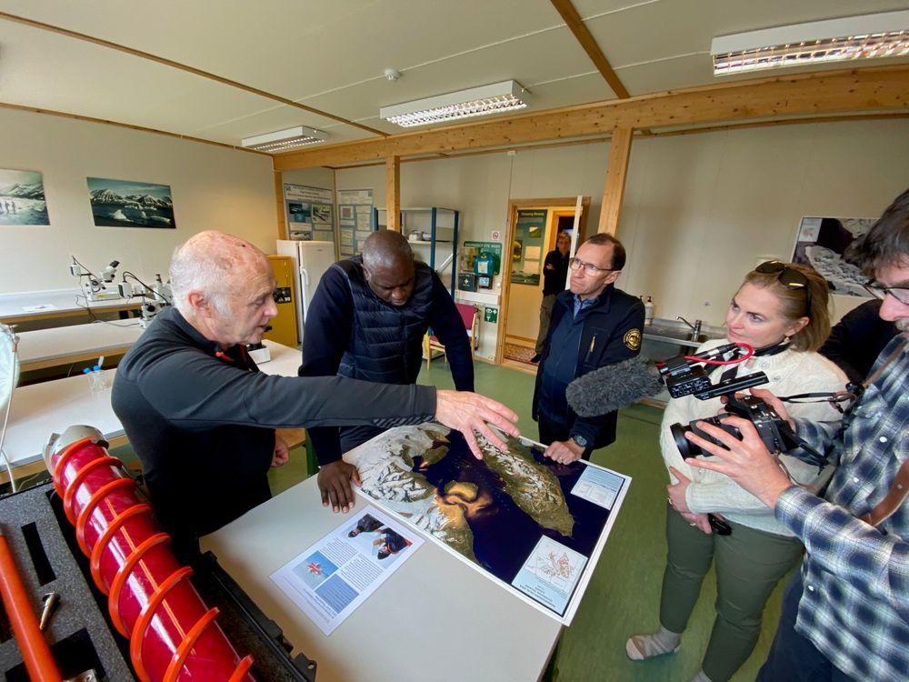
Great to see our map used by UK Foreign Secretary Rt Hon David Lammy and Espen Barth Eide during their visit to the @ukarcticoffice.bsky.social in Ny-Ålesund recently. With summer/winter versions, it shows how fast the region changes and why frequent, detailed mapping in the Arctic is so important.
June 12, 2025 at 4:05 PM
Great to see our map used by UK Foreign Secretary Rt Hon David Lammy and Espen Barth Eide during their visit to the @ukarcticoffice.bsky.social in Ny-Ålesund recently. With summer/winter versions, it shows how fast the region changes and why frequent, detailed mapping in the Arctic is so important.
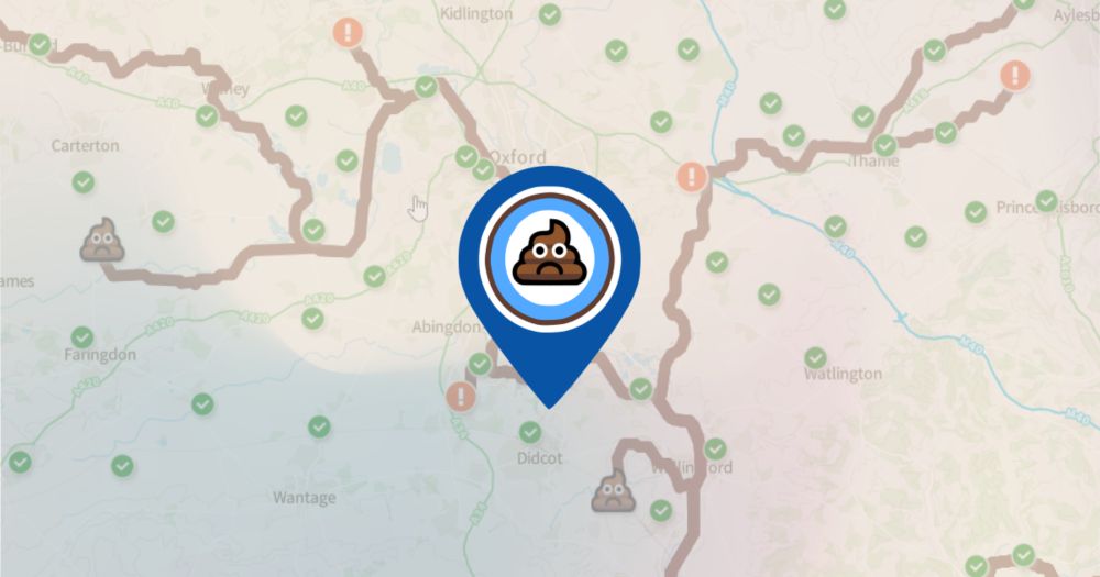
Just finished a little refresh of Sewagemap.co.uk. Added a fun loader, and additional layer filtering bits and bobs! It continues to show a bleak picture of sewage overflow in the uk... 💩😔 #sewage #uk #arcgis
Sewage Map
Real-Time Sewage Discharge Monitoring | Sewage Map - Stay Updated on Sewage Pollution
Sewagemap.co.uk
May 29, 2025 at 6:59 PM
Just finished a little refresh of Sewagemap.co.uk. Added a fun loader, and additional layer filtering bits and bobs! It continues to show a bleak picture of sewage overflow in the uk... 💩😔 #sewage #uk #arcgis
Reposted by Jonny Dawe
A few months ago, we surveyed Rothera Point using our fixed-wing eBee-X UAV. We've now processed the data and produced this beautiful, orthorectified mosaic, as well as a Digital Elevation Model.
We carry out these surveys every year, allowing all of BAS to work with current and accurate data!
We carry out these surveys every year, allowing all of BAS to work with current and accurate data!
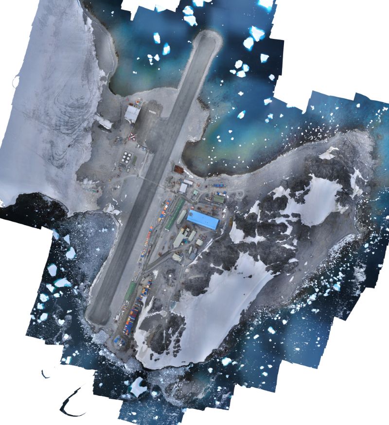
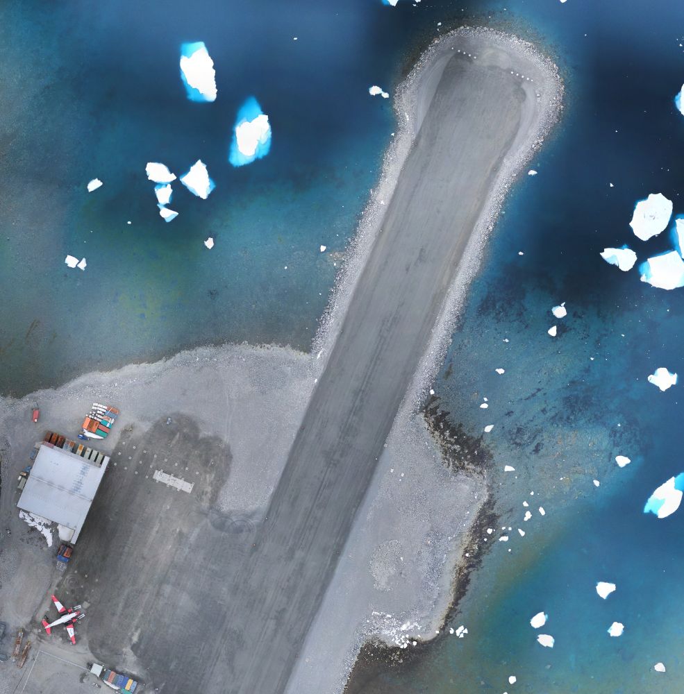
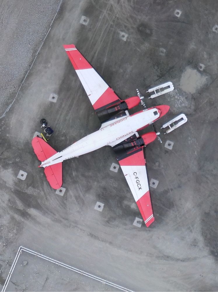
May 29, 2025 at 9:55 AM
A few months ago, we surveyed Rothera Point using our fixed-wing eBee-X UAV. We've now processed the data and produced this beautiful, orthorectified mosaic, as well as a Digital Elevation Model.
We carry out these surveys every year, allowing all of BAS to work with current and accurate data!
We carry out these surveys every year, allowing all of BAS to work with current and accurate data!
Reposted by Jonny Dawe


Reposted by Jonny Dawe
We're proud to share that our Bedmap3 map won "Best Map" at the International Map Industry Association (IMIA) forum in London last week! 🏆
This international award celebrates Outstanding Cartographic Design & we’re honoured to be recognised alongside leading names in the field from previous years. 🗺️
This international award celebrates Outstanding Cartographic Design & we’re honoured to be recognised alongside leading names in the field from previous years. 🗺️
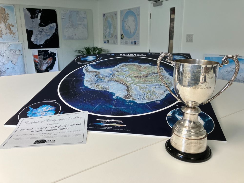
May 21, 2025 at 3:21 PM
We're proud to share that our Bedmap3 map won "Best Map" at the International Map Industry Association (IMIA) forum in London last week! 🏆
This international award celebrates Outstanding Cartographic Design & we’re honoured to be recognised alongside leading names in the field from previous years. 🗺️
This international award celebrates Outstanding Cartographic Design & we’re honoured to be recognised alongside leading names in the field from previous years. 🗺️