


Brian McNoldy
@bmcnoldy.bsky.social
Univ. of Miami hurricane researcher 🌀 living in New Mexico 🏜.
Husband and dog dad. 🏳️🌈
https://bmcnoldy.earth.miami.edu/
Husband and dog dad. 🏳️🌈
https://bmcnoldy.earth.miami.edu/
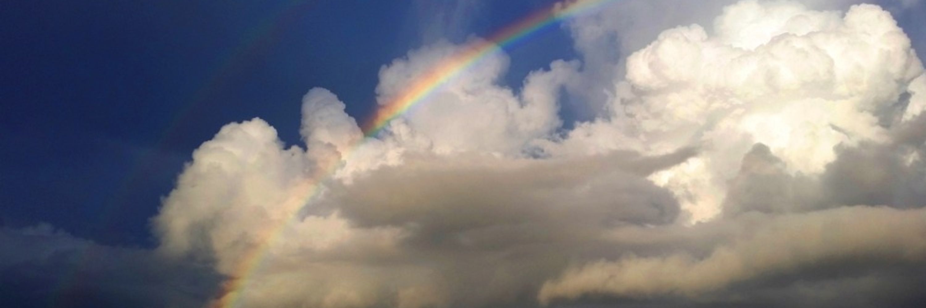
I'm giving a presentation today at @miamirosenstiel.bsky.social's informal seminar series "Lunch Bytes". It was really fun and nostalgic to put together. bmcnoldy.earth.miami.edu
[1/3]
[1/3]

February 13, 2026 at 12:55 PM
I'm giving a presentation today at @miamirosenstiel.bsky.social's informal seminar series "Lunch Bytes". It was really fun and nostalgic to put together. bmcnoldy.earth.miami.edu
[1/3]
[1/3]
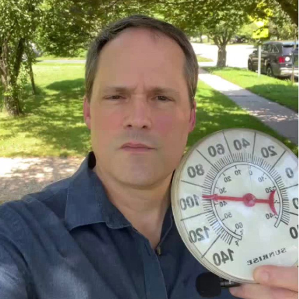
We made it up to 69.4°F at home in Bernalillo NM this afternoon, the new high of the year so far.
Couldn't quite sneak into the 70s, but close... and quite impressive for February 11 (about 16°F above average)! 🌷🪻⚘️🌸
Tomorrow will be similar.
Couldn't quite sneak into the 70s, but close... and quite impressive for February 11 (about 16°F above average)! 🌷🪻⚘️🌸
Tomorrow will be similar.
February 12, 2026 at 12:38 AM
We made it up to 69.4°F at home in Bernalillo NM this afternoon, the new high of the year so far.
Couldn't quite sneak into the 70s, but close... and quite impressive for February 11 (about 16°F above average)! 🌷🪻⚘️🌸
Tomorrow will be similar.
Couldn't quite sneak into the 70s, but close... and quite impressive for February 11 (about 16°F above average)! 🌷🪻⚘️🌸
Tomorrow will be similar.
Reposted by Brian McNoldy
At the Climate Resilience Institute, we're connecting resilience practitioners and innovators to drive impact year round.
Join us for this year's Resilience 365 Conference in March to see first hand how the magic happens.
Stay tuned for confirmed speakers & full agenda coming soon!
Join us for this year's Resilience 365 Conference in March to see first hand how the magic happens.
Stay tuned for confirmed speakers & full agenda coming soon!

January 21, 2026 at 4:18 PM
At the Climate Resilience Institute, we're connecting resilience practitioners and innovators to drive impact year round.
Join us for this year's Resilience 365 Conference in March to see first hand how the magic happens.
Stay tuned for confirmed speakers & full agenda coming soon!
Join us for this year's Resilience 365 Conference in March to see first hand how the magic happens.
Stay tuned for confirmed speakers & full agenda coming soon!
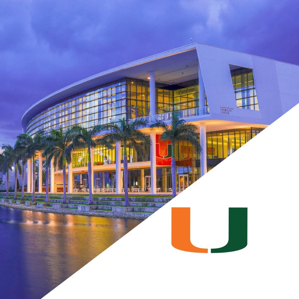
Five years ago today, I began working part-time for what is now the University of Miami Climate Resilience Institute (@miamiresilience.bsky.social).
[1/4]
[1/4]
February 11, 2026 at 1:17 PM
Five years ago today, I began working part-time for what is now the University of Miami Climate Resilience Institute (@miamiresilience.bsky.social).
[1/4]
[1/4]
Reposted by Brian McNoldy

"The response to Bad Bunny's inclusion shows just how racist our society is. Racists are angry about the halftime show? Good! Everything about our society SHOULD make racists feel alienated. How do we make racists feel even MORE alienated from even MORE of society??"

The reality is America is a huge multicultural multilingual country, not a white ethnostate, and venomous white supremacist MAGA crybabies lose it whenever that reality becomes unignorable. We should always seek to increase, not decrease, their discomfort. www.the-reframe.com/hating-the-g...

Hating the Game
The cooperation game, the murder game, and acting in good faith with people you know are acting in bad faith.
www.the-reframe.com
February 9, 2026 at 4:36 PM
"The response to Bad Bunny's inclusion shows just how racist our society is. Racists are angry about the halftime show? Good! Everything about our society SHOULD make racists feel alienated. How do we make racists feel even MORE alienated from even MORE of society??"
The high got up to 63° on Saturday and 66° on Sunday at home, with a warming trend on the way over the next few days. This was the winter that forgot to happen.
The roses and other perrenials are sprouting new growth.
The roses and other perrenials are sprouting new growth.


February 8, 2026 at 10:20 PM
The high got up to 63° on Saturday and 66° on Sunday at home, with a warming trend on the way over the next few days. This was the winter that forgot to happen.
The roses and other perrenials are sprouting new growth.
The roses and other perrenials are sprouting new growth.
Sea surface temperature data (ERSST version 6) from January 2026 are in, and here's the latest look at the newly-operational Relative Oceanic Niño Index, or #RONI.
ENSO has dug a little deeper into #LaNiña territory with a RONI value down to -1.03 °C.
bmcnoldy.earth.miami.edu/tropics/roni/
ENSO has dug a little deeper into #LaNiña territory with a RONI value down to -1.03 °C.
bmcnoldy.earth.miami.edu/tropics/roni/

February 4, 2026 at 7:34 PM
Sea surface temperature data (ERSST version 6) from January 2026 are in, and here's the latest look at the newly-operational Relative Oceanic Niño Index, or #RONI.
ENSO has dug a little deeper into #LaNiña territory with a RONI value down to -1.03 °C.
bmcnoldy.earth.miami.edu/tropics/roni/
ENSO has dug a little deeper into #LaNiña territory with a RONI value down to -1.03 °C.
bmcnoldy.earth.miami.edu/tropics/roni/
Using a linear trend through the data and the standard deviation of data around that trend, the odds of observing an outlier of this magnitude were about 1-in-3,000 (0.034% chance).
#Albuquerque #NMwx
#Albuquerque #NMwx
Wildly warm #Albuquerque temperatures lately:
October 2025 was the 4th warmest October.
November 2025 was the warmest November.
December 2025 was the warmest December.
January 2026 was the 5th warmest January.
Average temperature from October through January, going back to the winter of 1892-93: 📈
October 2025 was the 4th warmest October.
November 2025 was the warmest November.
December 2025 was the warmest December.
January 2026 was the 5th warmest January.
Average temperature from October through January, going back to the winter of 1892-93: 📈

February 3, 2026 at 3:32 PM
Using a linear trend through the data and the standard deviation of data around that trend, the odds of observing an outlier of this magnitude were about 1-in-3,000 (0.034% chance).
#Albuquerque #NMwx
#Albuquerque #NMwx
#Miami has just set two consecutive daily record low dewpoints: 22°F on Sunday and 16°F on Monday. Today will also be a new record low (third consecutive day)... the current record is 27° and as of 9am the lowest observed dewpoint today has been 22°.

February 3, 2026 at 2:13 PM
#Miami has just set two consecutive daily record low dewpoints: 22°F on Sunday and 16°F on Monday. Today will also be a new record low (third consecutive day)... the current record is 27° and as of 9am the lowest observed dewpoint today has been 22°.
Wildly warm #Albuquerque temperatures lately:
October 2025 was the 4th warmest October.
November 2025 was the warmest November.
December 2025 was the warmest December.
January 2026 was the 5th warmest January.
Average temperature from October through January, going back to the winter of 1892-93: 📈
October 2025 was the 4th warmest October.
November 2025 was the warmest November.
December 2025 was the warmest December.
January 2026 was the 5th warmest January.
Average temperature from October through January, going back to the winter of 1892-93: 📈
February 2, 2026 at 12:27 PM
Wildly warm #Albuquerque temperatures lately:
October 2025 was the 4th warmest October.
November 2025 was the warmest November.
December 2025 was the warmest December.
January 2026 was the 5th warmest January.
Average temperature from October through January, going back to the winter of 1892-93: 📈
October 2025 was the 4th warmest October.
November 2025 was the warmest November.
December 2025 was the warmest December.
January 2026 was the 5th warmest January.
Average temperature from October through January, going back to the winter of 1892-93: 📈
Reposted by Brian McNoldy

How cold has this winter been so far? The first 2/3 of winter 2025-26 is the 7th warmest on record for the Contiguous U.S.

February 2, 2026 at 3:22 AM
How cold has this winter been so far? The first 2/3 of winter 2025-26 is the 7th warmest on record for the Contiguous U.S.
Reposted by Brian McNoldy
Fun fact about new Fed chair Kevin Warsh: he’s married to the daughter of billionaire makeup baron Ronald Lauder, the guy who also convinced Trump he desperately needed to seize Greenland, which helped his own business interests. It’s grifting all the way down
www.theguardian.com/us-news/2026...
www.theguardian.com/us-news/2026...

How a billionaire with interests in Greenland encouraged Trump to acquire the territory
US president’s friend Ronald Lauder – who first proposed Arctic expansion – is now making deals in the island
www.theguardian.com
January 30, 2026 at 12:18 PM
Fun fact about new Fed chair Kevin Warsh: he’s married to the daughter of billionaire makeup baron Ronald Lauder, the guy who also convinced Trump he desperately needed to seize Greenland, which helped his own business interests. It’s grifting all the way down
www.theguardian.com/us-news/2026...
www.theguardian.com/us-news/2026...
High temperatures on Sunday will be notably cool in the east -- much of the west will be warmer than south Florida!

January 30, 2026 at 12:31 PM
High temperatures on Sunday will be notably cool in the east -- much of the west will be warmer than south Florida!
Watching the weather forecasts in #Albuquerque and #Miami, an unusual matchup during winter could happen on Sunday and perhaps Monday: Albuquerque WARMER than Miami!
[1/2]
[1/2]

January 29, 2026 at 2:15 PM
Watching the weather forecasts in #Albuquerque and #Miami, an unusual matchup during winter could happen on Sunday and perhaps Monday: Albuquerque WARMER than Miami!
[1/2]
[1/2]
Two big updates in the ocean temperature world:
1) The determination of the phase of ENSO ( #ElNiño, #LaNiña) will operationally transition to the RELATIVE Oceanic Niño Index ( #RONI) on February 1:
www.weather.gov/media/notifi...
[1/3]
1) The determination of the phase of ENSO ( #ElNiño, #LaNiña) will operationally transition to the RELATIVE Oceanic Niño Index ( #RONI) on February 1:
www.weather.gov/media/notifi...
[1/3]
www.weather.gov
January 29, 2026 at 12:03 AM
Two big updates in the ocean temperature world:
1) The determination of the phase of ENSO ( #ElNiño, #LaNiña) will operationally transition to the RELATIVE Oceanic Niño Index ( #RONI) on February 1:
www.weather.gov/media/notifi...
[1/3]
1) The determination of the phase of ENSO ( #ElNiño, #LaNiña) will operationally transition to the RELATIVE Oceanic Niño Index ( #RONI) on February 1:
www.weather.gov/media/notifi...
[1/3]
Sunrise from just outside my office at @miamirosenstiel.bsky.social six years ago today.
One of the best, and I saw A LOT of sunrises from there.
One of the best, and I saw A LOT of sunrises from there.

January 27, 2026 at 12:32 PM
Sunrise from just outside my office at @miamirosenstiel.bsky.social six years ago today.
One of the best, and I saw A LOT of sunrises from there.
One of the best, and I saw A LOT of sunrises from there.
Today is my daily observation # 4,949 for CoCoRaHS, but my first-ever snowfall report!
We got a whopping 0.8 inches of snow from this beast of a winter storm. 😒
It's pretty!
We got a whopping 0.8 inches of snow from this beast of a winter storm. 😒
It's pretty!


January 25, 2026 at 2:29 PM
Today is my daily observation # 4,949 for CoCoRaHS, but my first-ever snowfall report!
We got a whopping 0.8 inches of snow from this beast of a winter storm. 😒
It's pretty!
We got a whopping 0.8 inches of snow from this beast of a winter storm. 😒
It's pretty!
Happy #MartiniFriday to all who celebrate. 🍸🍸

January 24, 2026 at 12:27 AM
Happy #MartiniFriday to all who celebrate. 🍸🍸
Six years ago today, I gave a brief presentation at the Miami Climate Symposium: "A Quarter-century of Tide Measurements at Virginia Key". It covered the basics of tides, tide prediction, local influences on water levels, seasonal cycles and trends.
@miamirosenstiel.bsky.social
[1/3]
@miamirosenstiel.bsky.social
[1/3]

January 23, 2026 at 1:59 PM
Six years ago today, I gave a brief presentation at the Miami Climate Symposium: "A Quarter-century of Tide Measurements at Virginia Key". It covered the basics of tides, tide prediction, local influences on water levels, seasonal cycles and trends.
@miamirosenstiel.bsky.social
[1/3]
@miamirosenstiel.bsky.social
[1/3]
I think this is excellent, and I'd encourage people to complete the survey and let them know that we do find it useful!

Do you appreciate @nws.noaa.gov's posts on Bluesky?
Did you know that this account is a pilot program that may or may not be continued and even expanded to NWS field offices?
NWS is soliciting comments here! www.surveymonkey.com/r/PrototypeN...
Press release:
www.weather.gov/media/notifi...
Did you know that this account is a pilot program that may or may not be continued and even expanded to NWS field offices?
NWS is soliciting comments here! www.surveymonkey.com/r/PrototypeN...
Press release:
www.weather.gov/media/notifi...
⚠️~132 million: Number of people under alerts for snow, sleet, & freezing rain.
A large, long-duration winter storm is expected to bring widespread heavy snow, sleet, & freezing rain from the Southern Rockies & Plains beginning Friday (Jan. 23), spreading eastward toward New England this weekend.
🧵
A large, long-duration winter storm is expected to bring widespread heavy snow, sleet, & freezing rain from the Southern Rockies & Plains beginning Friday (Jan. 23), spreading eastward toward New England this weekend.
🧵
January 22, 2026 at 8:50 PM
I think this is excellent, and I'd encourage people to complete the survey and let them know that we do find it useful!
Reposted by Brian McNoldy

⚠️~132 million: Number of people under alerts for snow, sleet, & freezing rain.
A large, long-duration winter storm is expected to bring widespread heavy snow, sleet, & freezing rain from the Southern Rockies & Plains beginning Friday (Jan. 23), spreading eastward toward New England this weekend.
🧵
A large, long-duration winter storm is expected to bring widespread heavy snow, sleet, & freezing rain from the Southern Rockies & Plains beginning Friday (Jan. 23), spreading eastward toward New England this weekend.
🧵

January 22, 2026 at 4:17 PM
⚠️~132 million: Number of people under alerts for snow, sleet, & freezing rain.
A large, long-duration winter storm is expected to bring widespread heavy snow, sleet, & freezing rain from the Southern Rockies & Plains beginning Friday (Jan. 23), spreading eastward toward New England this weekend.
🧵
A large, long-duration winter storm is expected to bring widespread heavy snow, sleet, & freezing rain from the Southern Rockies & Plains beginning Friday (Jan. 23), spreading eastward toward New England this weekend.
🧵
Virginia Key (home of @miamirosenstiel.bsky.social) is just wrapping up the climatological coldest week of the year. Amazingly, there have already been *two* new daily records set!
- A record LOW on January 16 (46.4 °F)
- A record HIGH on January 18 (78.6 °F)
bmcnoldy.earth.miami.edu/vk/
- A record LOW on January 16 (46.4 °F)
- A record HIGH on January 18 (78.6 °F)
bmcnoldy.earth.miami.edu/vk/

January 21, 2026 at 12:41 PM
Virginia Key (home of @miamirosenstiel.bsky.social) is just wrapping up the climatological coldest week of the year. Amazingly, there have already been *two* new daily records set!
- A record LOW on January 16 (46.4 °F)
- A record HIGH on January 18 (78.6 °F)
bmcnoldy.earth.miami.edu/vk/
- A record LOW on January 16 (46.4 °F)
- A record HIGH on January 18 (78.6 °F)
bmcnoldy.earth.miami.edu/vk/
A couple cool things on this evening's dog walk: a pretty moonset/sunset and a Great Horned Owl.


January 21, 2026 at 1:01 AM
A couple cool things on this evening's dog walk: a pretty moonset/sunset and a Great Horned Owl.
Wow, the afternoon run of the American model (GFS) really cranked up the snow totals across New Mexico on Friday and Saturday... in the 4-6 inch ballpark here at home in Bernalillo.
So far this season, we've gotten 0.0 inches, so this would be the first of the season!
#NMwx #WinterStorm
So far this season, we've gotten 0.0 inches, so this would be the first of the season!
#NMwx #WinterStorm

January 21, 2026 at 12:13 AM
Wow, the afternoon run of the American model (GFS) really cranked up the snow totals across New Mexico on Friday and Saturday... in the 4-6 inch ballpark here at home in Bernalillo.
So far this season, we've gotten 0.0 inches, so this would be the first of the season!
#NMwx #WinterStorm
So far this season, we've gotten 0.0 inches, so this would be the first of the season!
#NMwx #WinterStorm
Two years ago today, I was honored to be a panelist at the @miamirosenstiel.bsky.social Climate Café Series... our topic was "The Future of Climate. A look back at 2023 and the best available science to plan for the future."
[1/2]
[1/2]


January 17, 2026 at 1:16 PM
Two years ago today, I was honored to be a panelist at the @miamirosenstiel.bsky.social Climate Café Series... our topic was "The Future of Climate. A look back at 2023 and the best available science to plan for the future."
[1/2]
[1/2]