Mike Wulder
banner
mikewulder.bsky.social
Mike Wulder
@mikewulder.bsky.social

Senior Research Scientist with the Canadian Forest Service. 🍁
#Landsat super-fan. #Lidar. #Forests. #Remotesensing. 🌲🛰
Member of the #OrderOfCanada. 🎖
📎https://www.researchgate.net/profile/Michael-Wulder

Environmental science 68%
Geography 18%
Pinned
We use satellite data to map Canada's forests. 🛰️🌲
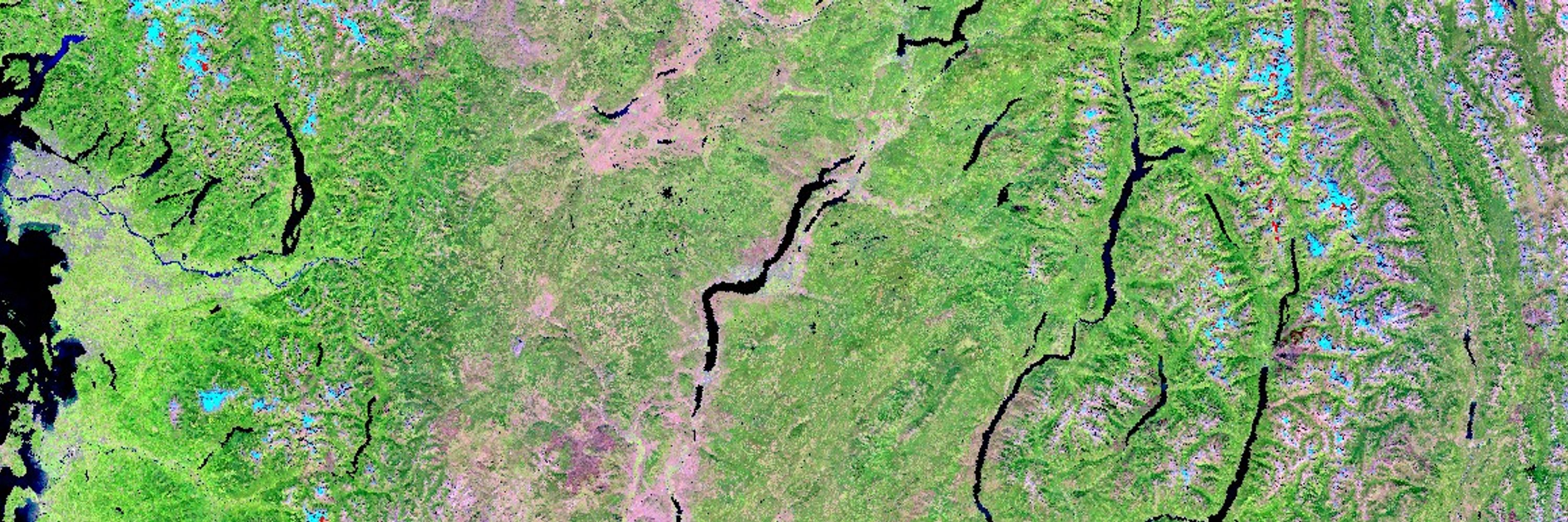
National maps represent forest status and trends. Peer reviewed methods & accuracy statements.
#landcover #biomass #wildfire #Landsat #Sentinel2
Access open data here:
opendata.nfis.org/mapserver/nf...
Info/pubs: www.researchgate.net/publication/...

White et al. Enhanced forest inventories in Canada: implementation, status, and research needs. #EFI
➡️ Airborne Laser Scanning (ALS) is operational for forest inventory in Canada enabling EFIs.
➡️ Coverage exceeds 66% of Canada’s managed forest area (~230 million ha). #lidar
🔗 doi.org/10.1139/cjfr...

Reposted by Michael A. Wulder

#Silvilaser2025 schedule & program are now online! 🥳

Check out the line up of workshops, speakers, field tour & social events! 👉 www.silvilaser2025.com/program

Which plenary session are you most looking forward to?!

Registration for extra activities closes Sep 10
📍 Quebec City Convention Centre
Program — SilviLaser 2025
www.silvilaser2025.com

Reposted by Michael A. Wulder

NEW PAPER 📣 Temporally Consistent Forest Stand Segmentation using Landsat Imagery

dx.doi.org/10.1109/LGRS...

📖: Geoscience and Remote Sensing Letters

✍️: Ye, Coops, Hermosilla @txominhermos.bsky.social, Wulder @mikewulder.bsky.social, Gergel

#Segmentation #ChangeDetection #Landsat #ubcforestry

Link to Ramon's science below. Prepare to be amazed!
Research themes:
-Vegetation Resilience in Boreal Ecosystems
-Satellite Data and Model Integration
-Climate Change Impacts
-Early Warning Indicators
➡️https://www.researchgate.net/profile/Ramon-Melser
Ramon MELSER | Postdoctoral Research Fellow | PhD in Forestry (Remote Sensing) | University of British Columbia, Vancouver | UBC | Research profile
Ramon MELSER, Postdoctoral Research Fellow | Cited by 13 | of University of British Columbia, Vancouver (UBC) | Read 4 publications | Contact Ramon MELSER
www.researchgate.net

Reposted by Michael A. Wulder

Congratulations again and again and again to Dr. Ramon Melser! (@ramonmelser.bsky.social)

He joins the wall after successfully defending his thesis: “Enhanced assessment of boreal vegetation productivity using integrated satellite-derived datasets and analysis approaches.”

#IRSSLab #UBCForestry

Reposted by Michael A. Wulder

Check out this innovative work in Forestry:
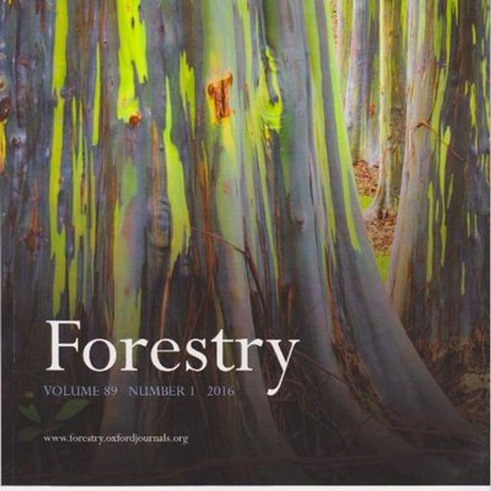
Yrttimaa et al. Quantifying architectural uniqueness of Scots pine trees using terrestrial laser scanning: toward individual tree fingerprinting. #lidar #tls
academic.oup.com/forestry/art...

Fantastic! Our paper made the list! Development and implementation of a stand-level satellite-based forest inventory for Canada. #SBFI
academic.oup.com/forestry/art...
Check out the link below for collection of High-Impact Research from Forestry 👇👇

Reposted by Michael A. Wulder

Work hard, play hard! 🌲✨ The #IRSSLab just wrapped up our annual summer retreat.

This week away gave lab members the chance to share research updates, pick up new skills from colleagues and guests, and, of course, enjoy some much-needed R&R!

#UBCForestry #remotesensing

Reposted by Michael A. Wulder

Happy to be part of the team led by Martin Schwartz (@lsce-ipsl.bsky.social) behind our new publication:

“Retrieving yearly forest growth from satellite data: A deep learning based approach.”

📖 Published in Remote Sensing of Environment:
www.sciencedirect.com/science/arti...

1/4
Retrieving yearly forest growth from satellite data: A deep learning based approach
High-resolution mapping of forest attributes is crucial for ecosystem monitoring and carbon budget assessments. Recent advancements have leveraged sat…
www.sciencedirect.com

Canada's Satellite-Based Forest Inventory uses image segmentation to create stand-level maps for forest science & monitoring, including tree species & biomass. #SBFI
Paper: doi.org/10.1093/fore...
Download data opendata.nfis.org/mapserver/nf...
Data on #GEE: gee-community-catalog.org/projects/ca_...

Reposted by Michael A. Wulder

The global bimonthly 30m GPP product (2000-2024) is now ready for use (landcarbonlab.org/insights/glo...); available on GEE, STAC... so proud of the @opengeohub.bsky.social and @worldresources.bsky.social & colleagues!
📝 doi.org/10.7717/peer...
🖥️ stac.openlandmap.org/gpw_ugpp.dai...
Tracking the Health of Earth’s Ecosystems with New Global Productivity Data
Gross primary productivity (GPP) is a key indicator of ecosystem health. New data from Land & Carbon Lab provides the first global, higher resolution GPP data.
landcarbonlab.org

Innovative, interesting, and successful!
Great work on this James. 👏👏
@jamesmcglade.bsky.social
A good story about current and historical fire activity in Canada (and the US) though I may be biased

thetradeoff.substack.com/p/north-amer...
North America’s forests used to burn a lot more than present…
So, is climate change really making wildfires worse today?
thetradeoff.substack.com

"AI is not replacing the geographer; it is super-charging the geographer. Geographers are poised to have the biggest impact on communities, businesses, and the planet in decades."
Insight from Prof Trisalyn Nelson, Jack & Laura Dangermond Chair of Geography, UCSB.
www.independent.com/2025/08/20/g...
Geographers Aren't Going Anywhere
Why Microsoft is wrong about my profession when it comes to AI.
www.independent.com

Reposted by Michael A. Wulder

treecbh: a new R package for crown base height (CBH) detection using aerial laser-scanned data in broad leaved forests 🌳

Diószegi et al. develop a workflow that automates and optimises CBH detection in already segmented individual trees.

🗞️ doi.org/10.1093/fore...
🔧 github.com/DijoG/treecbh

Reposted by Michael A. Wulder

Reposted by Michael A. Wulder

Reposted by Michael A. Wulder

Reposted by Michael A. Wulder

Excited to share that I successfully defended my PhD dissertation in Remote Sensing (Forestry) at @forestry.ubc.ca. Thank you to all of my fantastic labmates in the @irssubc.bsky.social, as well as my supervisor, Nicholas Coops, and my research committee for all their support.

Reposted by Michael A. Wulder

Reposted by Michael A. Wulder

Members from the IRSS attended the #WIRED2025 symposium to present their research on overhead power lines across forested landscapes, as well as engage with industry and project participants.

Wonderful work from James (@jamesmcglade.bsky.social), Eliceo and Celine!

#IRSSlab #ubcforestry

Reposted by Michael A. Wulder

Having a great time at the #IRSSlab retreat 2025 @ Cowichan Lake!🫶

Thanks to all who demo’d the Outdoors Tips & Tricks!🔨
@la-stack.bsky.social with the #Trimble, @jamesmcglade.bsky.social with the the #GeoSlam & Liam with PostEx👏

@irssubc.bsky.social @forestry.ubc.ca @metafor-ulaval.bsky.social