


James Hyde
@wxmeddler.bsky.social
Wx Nerd💨| Space🚀| Avgeek✈️. I play with weather instruments & data 🌩 Writer for USTornadoes 🌪 M.S. Emergency Management 💥 Tweets Mine. *Mostly* Harmless.
Reposted by James Hyde

One of the primary tools we use to predict flash floods is the NSSL's Multi-Radar/Multi-Sensor System. "I’ve zero doubt NWS forecasters were leveraging that tool that evening to issue flash flood warnings. NSSL and associated projects are slated for elimination in NOAA’s proposed 2026 budget."

It's been a terrible and tragic weekend from tropically-infused floods, including the heartbreaking events in Texas Hill Country. In today's newsletter, I revisit the weather causes and detail how National Weather Servive forecasters performed admirably despite political headwinds. ⬇️

Trying to Make Sense of the Unspeakable Texas Tragedy
Catastrophic flooding in the Texas Hill Country over the holiday weekend is one of the deadliest in modern memory. How did it happen?
michaelrlowry.substack.com
July 7, 2025 at 2:11 PM
One of the primary tools we use to predict flash floods is the NSSL's Multi-Radar/Multi-Sensor System. "I’ve zero doubt NWS forecasters were leveraging that tool that evening to issue flash flood warnings. NSSL and associated projects are slated for elimination in NOAA’s proposed 2026 budget."
Below is a series of posts explaining the difference between a wake low and a Mesoscale Convective Vortex (MCV) and a Rear Inflow Jet (RIJ) and how this exceptional storm system over North Dakota came to be last night. This radar loop is awesome by the way.

Discrete tornado-producing supercells, derecho with a textbook bookend vortex & rear inflow jet development, MCS-supercell mergers... this is one of the most meteorologically impressive radar loops I've put together.
June 21, 2025 at 8:24 PM
Below is a series of posts explaining the difference between a wake low and a Mesoscale Convective Vortex (MCV) and a Rear Inflow Jet (RIJ) and how this exceptional storm system over North Dakota came to be last night. This radar loop is awesome by the way.
Here is the launch via GOES-16. Didn't notice any clear signature down-range in southwest atlantic. Looked at Key West, Puerto Rico, and the few cuban radars as well and nothing.
January 16, 2025 at 11:33 PM
Here is the launch via GOES-16. Didn't notice any clear signature down-range in southwest atlantic. Looked at Key West, Puerto Rico, and the few cuban radars as well and nothing.
Do you use @radarscope.bsky.social and have a Tier 1 or 2 subscription? I made some custom color tables you can download and import.
github.com/wxmeddler/Ra...
github.com/wxmeddler/Ra...

RadarScope/colortables at main · wxmeddler/RadarScope
Custom Color Tables and Other Things for Radarscope - wxmeddler/RadarScope
github.com
November 28, 2024 at 4:19 AM
Do you use @radarscope.bsky.social and have a Tier 1 or 2 subscription? I made some custom color tables you can download and import.
github.com/wxmeddler/Ra...
github.com/wxmeddler/Ra...
Get off my lawn.

patrick star from spongebob squarepants is standing in front of a giant whale that says who are you people
Alt: Patrick star from spongebob squarepants is standing in front his coconut house saying "who are you people"?
media.tenor.com
October 17, 2024 at 8:33 PM
Get off my lawn.
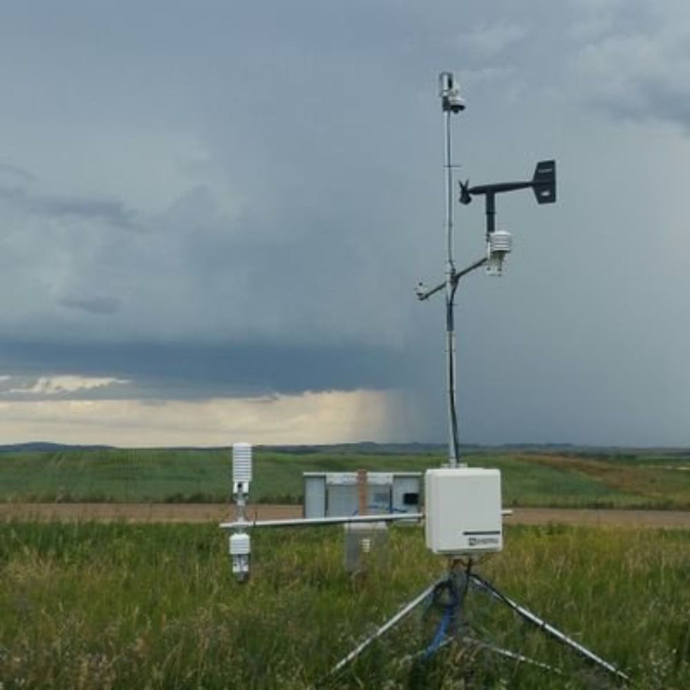
Reminder that Sonic anemometers are absolute CRAP during wind events with flying particles. Here is a outflow boundary full of dust in North Dakota tonight. Sonic's are recording gusts to "70+ mph" while the mesonet with all mechanical propeller anemometers are topping out in the 40s +50s.


May 18, 2024 at 2:09 AM
Reminder that Sonic anemometers are absolute CRAP during wind events with flying particles. Here is a outflow boundary full of dust in North Dakota tonight. Sonic's are recording gusts to "70+ mph" while the mesonet with all mechanical propeller anemometers are topping out in the 40s +50s.