


Thomas Larkin
@thomaslarkin.bsky.social
Assistant Professor at the University of Prince Edward Island. Historian of China and the U.S., specializing in global historical and digital methods.
Legally speaking, if the US signs a treaty with another country, and then, during a conflict in which they aren’t belligerents, steals said treaty from said country. Is said country still required to honour the terms of it?

November 6, 2025 at 5:51 PM
Legally speaking, if the US signs a treaty with another country, and then, during a conflict in which they aren’t belligerents, steals said treaty from said country. Is said country still required to honour the terms of it?
🧵3/3
I've then combined the datasets so that all GPS points fall within the attributes table for the lots with which they align. The effect is that we can light up the lots that contain Carl Smith data and embed links to the archive, providing an alt. spatial/temporal means to search the index!
I've then combined the datasets so that all GPS points fall within the attributes table for the lots with which they align. The effect is that we can light up the lots that contain Carl Smith data and embed links to the archive, providing an alt. spatial/temporal means to search the index!

August 29, 2025 at 5:34 PM
🧵3/3
I've then combined the datasets so that all GPS points fall within the attributes table for the lots with which they align. The effect is that we can light up the lots that contain Carl Smith data and embed links to the archive, providing an alt. spatial/temporal means to search the index!
I've then combined the datasets so that all GPS points fall within the attributes table for the lots with which they align. The effect is that we can light up the lots that contain Carl Smith data and embed links to the archive, providing an alt. spatial/temporal means to search the index!
🧵2/3
Eric has also converted the dates into integer values so that we can isolate cards by date range, as many cover a few decades of history. I have then overlaid this data on the MHHK maps that fall within that date range (here's 1866).
Eric has also converted the dates into integer values so that we can isolate cards by date range, as many cover a few decades of history. I have then overlaid this data on the MHHK maps that fall within that date range (here's 1866).

August 29, 2025 at 5:34 PM
🧵2/3
Eric has also converted the dates into integer values so that we can isolate cards by date range, as many cover a few decades of history. I have then overlaid this data on the MHHK maps that fall within that date range (here's 1866).
Eric has also converted the dates into integer values so that we can isolate cards by date range, as many cover a few decades of history. I have then overlaid this data on the MHHK maps that fall within that date range (here's 1866).
🧵1/3
Exciting (for me) progress for this Friday's MHHK update. We've begun to experiment with integrating the Carl Smith Index Card collection for HK history. My colleague Eric Chow has been tokenizing the cards and appending GPS coordinates to recorded locations using the Google Maps API.
Exciting (for me) progress for this Friday's MHHK update. We've begun to experiment with integrating the Carl Smith Index Card collection for HK history. My colleague Eric Chow has been tokenizing the cards and appending GPS coordinates to recorded locations using the Google Maps API.

August 29, 2025 at 5:34 PM
🧵1/3
Exciting (for me) progress for this Friday's MHHK update. We've begun to experiment with integrating the Carl Smith Index Card collection for HK history. My colleague Eric Chow has been tokenizing the cards and appending GPS coordinates to recorded locations using the Google Maps API.
Exciting (for me) progress for this Friday's MHHK update. We've begun to experiment with integrating the Carl Smith Index Card collection for HK history. My colleague Eric Chow has been tokenizing the cards and appending GPS coordinates to recorded locations using the Google Maps API.
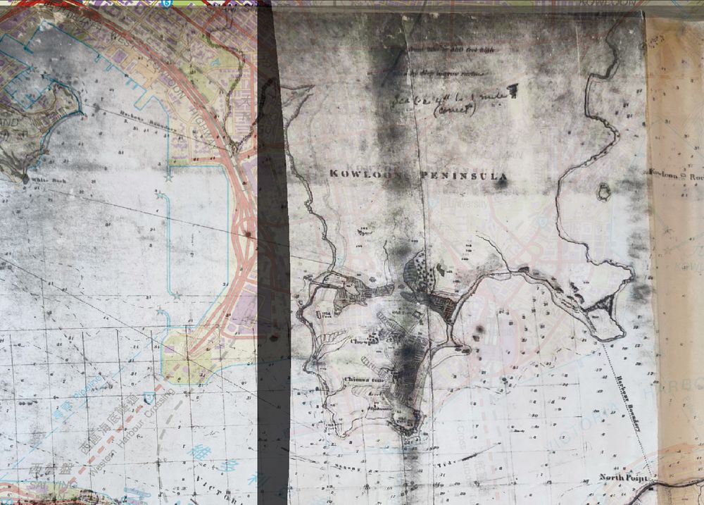
Wasn't totally satisfied with last week's map transformations, so I've been playing around with Thin Plate Spline transformations on the larger maps this week using the same reference points. Instantly better look, with much more accurate coastlines for Hong Kong and Kowloon.


August 22, 2025 at 4:18 PM
Wasn't totally satisfied with last week's map transformations, so I've been playing around with Thin Plate Spline transformations on the larger maps this week using the same reference points. Instantly better look, with much more accurate coastlines for Hong Kong and Kowloon.
Kowloon also appears to have been a rush job or afterthought in many of these earlier maps. Its shoreline is highly approximate, requires a lot of manipulation, and no two maps that I've found from the era are quite the same in where they place things.
August 10, 2025 at 11:43 PM
Kowloon also appears to have been a rush job or afterthought in many of these earlier maps. Its shoreline is highly approximate, requires a lot of manipulation, and no two maps that I've found from the era are quite the same in where they place things.
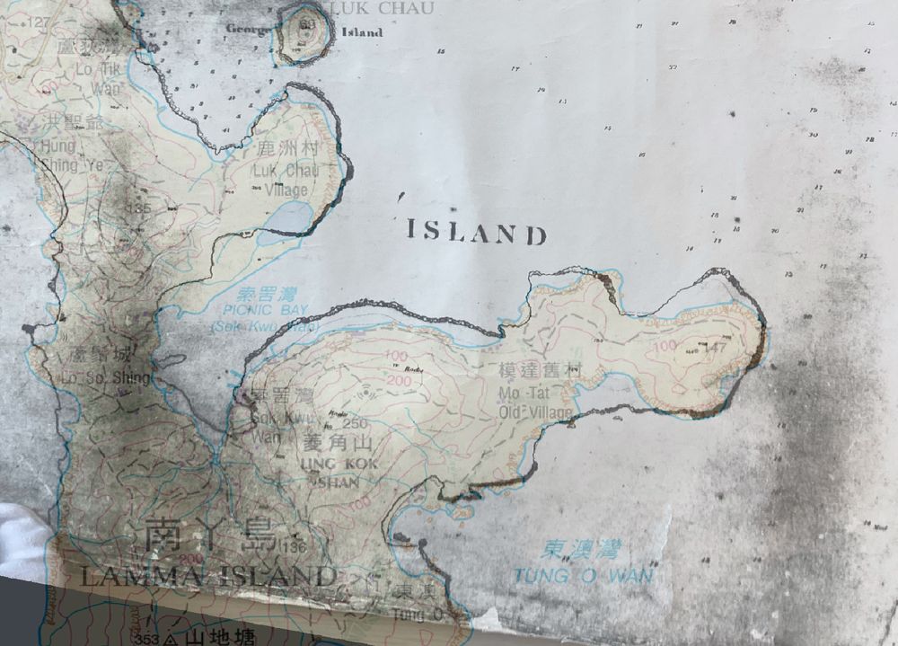
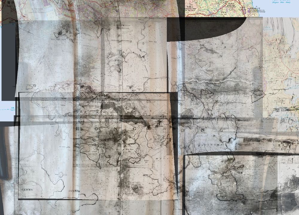
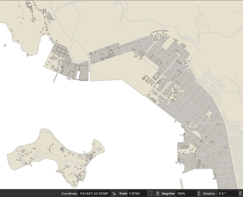
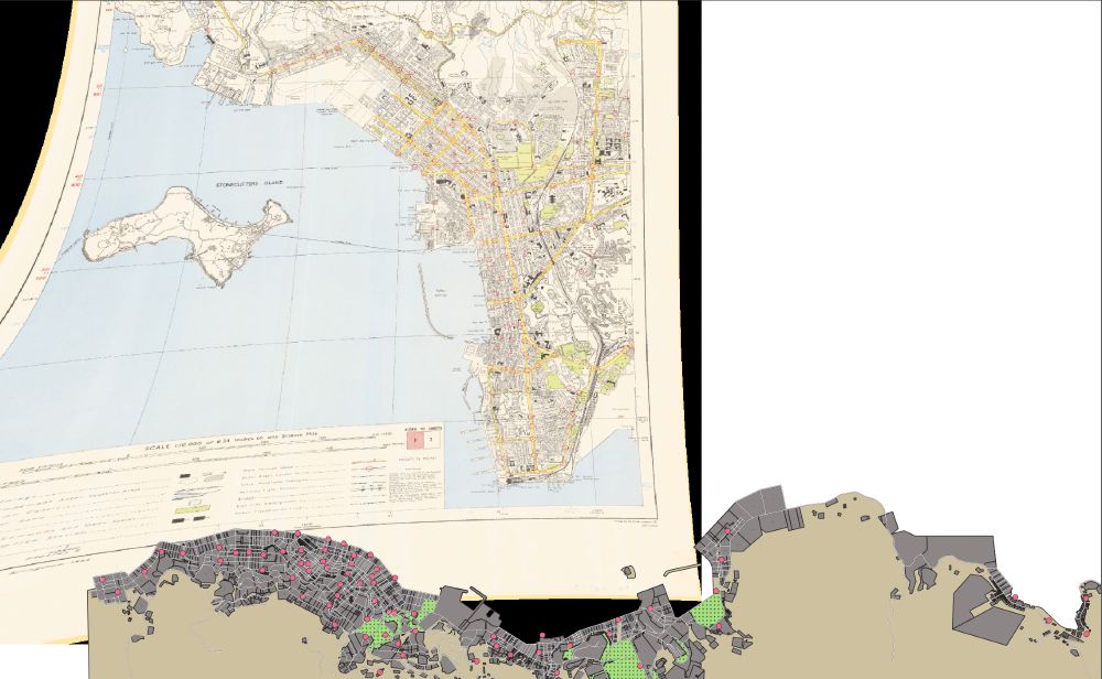
These maps have given me MHHK's first territory map. Ordnance Mapping of mid-nineteenth century HK proved really accurate to a point, but precision fell away once coastlines get involved. The result is that the maps have been easy to centre, but very difficult to precisely align along the shore.
August 10, 2025 at 11:43 PM
These maps have given me MHHK's first territory map. Ordnance Mapping of mid-nineteenth century HK proved really accurate to a point, but precision fell away once coastlines get involved. The result is that the maps have been easy to centre, but very difficult to precisely align along the shore.
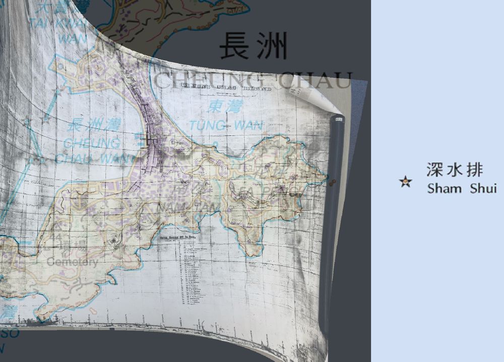
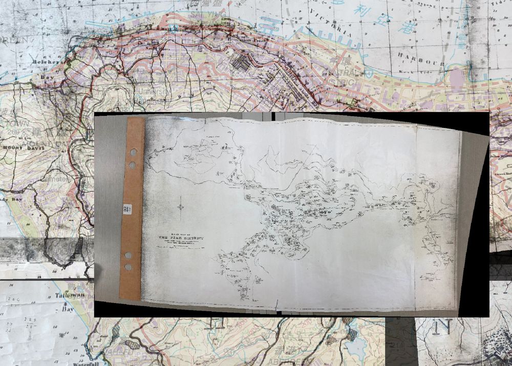
Spent bits of the last week correcting new maps pulled from the HKPRO. Some truly interesting ones of the development of The Peak and Cheung Chau. I've pulled a series that I'm excited about as well that surveys Kowloon, NT, and Sai Wan village lots (still to be processed).
August 10, 2025 at 11:43 PM
Spent bits of the last week correcting new maps pulled from the HKPRO. Some truly interesting ones of the development of The Peak and Cheung Chau. I've pulled a series that I'm excited about as well that surveys Kowloon, NT, and Sai Wan village lots (still to be processed).
Academic hack: if I split my time between PEI in the winter and HK in the summer, I can gain almost another month of forced vacation on account of weather.
August 5, 2025 at 2:03 AM
Academic hack: if I split my time between PEI in the winter and HK in the summer, I can gain almost another month of forced vacation on account of weather.
Coastline change, for comparison.
July 4, 2025 at 2:38 PM
Coastline change, for comparison.
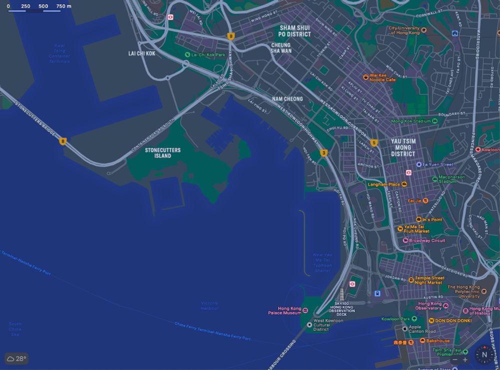
This week's MHHK update. Stonecutter's Island, reclamation projects, and the villages to the west of Kowloon (1964). Not sure how accurate the source map was on rural lots and buildings, so will have to check these against the far more detailed large-scale surveys from the following decades.
July 4, 2025 at 2:36 PM
This week's MHHK update. Stonecutter's Island, reclamation projects, and the villages to the west of Kowloon (1964). Not sure how accurate the source map was on rural lots and buildings, so will have to check these against the far more detailed large-scale surveys from the following decades.
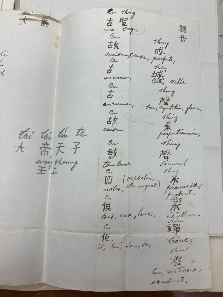
Today’s best archival find is Caleb Cushing trying to figure out a suitable Chinese name. He eventually settled on 顧聖, but I think 鼓聲 (drumbeat) should have stuck. Would have looked better on the Treaty of Wangxia and the dozens of red calling cards he had written up.
June 27, 2025 at 8:18 PM
Today’s best archival find is Caleb Cushing trying to figure out a suitable Chinese name. He eventually settled on 顧聖, but I think 鼓聲 (drumbeat) should have stuck. Would have looked better on the Treaty of Wangxia and the dozens of red calling cards he had written up.
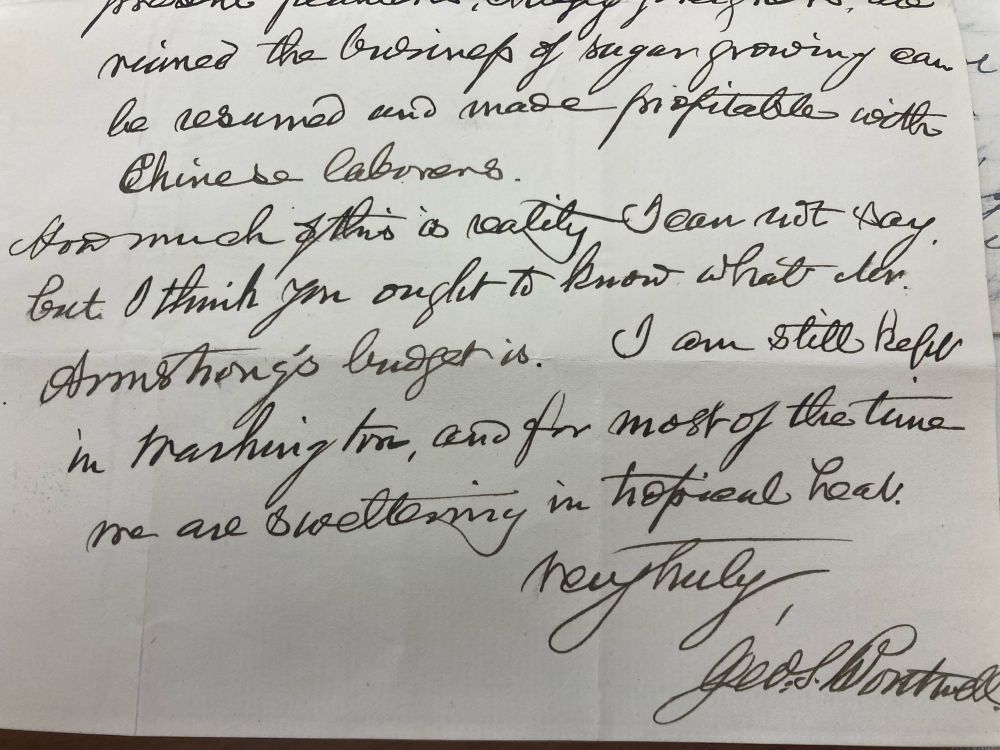
Archives imitate life.
“I am still in Washington and for most of the time we are sweltering in tropical heat”
“I am still in Washington and for most of the time we are sweltering in tropical heat”
June 24, 2025 at 8:29 PM
Archives imitate life.
“I am still in Washington and for most of the time we are sweltering in tropical heat”
“I am still in Washington and for most of the time we are sweltering in tropical heat”
This week's MHHK. So many lots to fill. Is the task hypnotic? Yes. Is it therapeutic? No. Have I watched two HBO miniseries while doing it? Absolutely.
June 20, 2025 at 1:52 PM
This week's MHHK. So many lots to fill. Is the task hypnotic? Yes. Is it therapeutic? No. Have I watched two HBO miniseries while doing it? Absolutely.
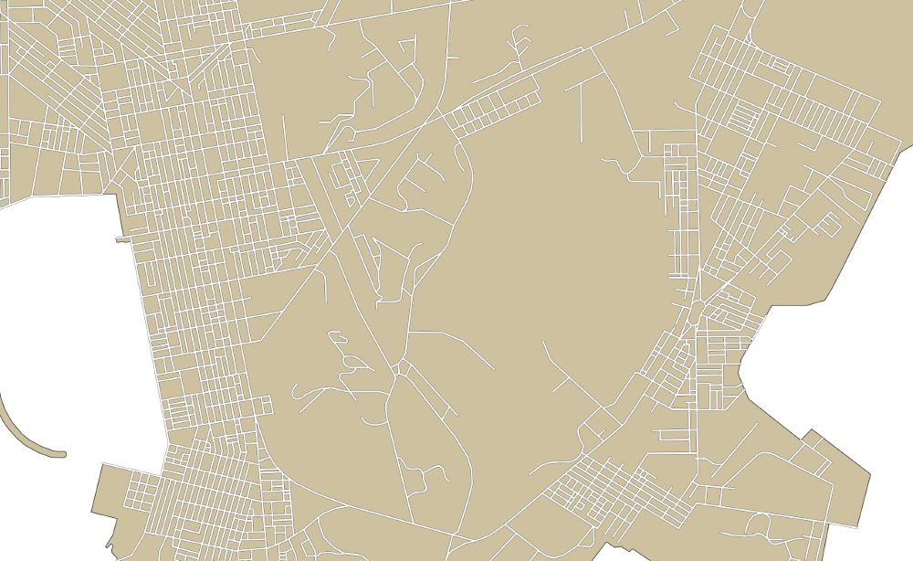
Today's MHHK work has really been more this week's MHHK work - to the detriment of the article I was supposed to be writing. Got sucked into building a road layer on this 1964 map of Kowloon. While it took forever, working backwards from this map should just be a process of subtraction.
June 13, 2025 at 12:36 PM
Today's MHHK work has really been more this week's MHHK work - to the detriment of the article I was supposed to be writing. Got sucked into building a road layer on this 1964 map of Kowloon. While it took forever, working backwards from this map should just be a process of subtraction.
Added MHHK's first georeferenced base map for Kowloon today. Likely going to have to redo it though because I forgot to correct Stonecutters Island.
Eventually the project will include the entire territory, but I can't say I'm looking forward to how long some of those maps are going to take.
Eventually the project will include the entire territory, but I can't say I'm looking forward to how long some of those maps are going to take.
June 6, 2025 at 6:10 PM
Added MHHK's first georeferenced base map for Kowloon today. Likely going to have to redo it though because I forgot to correct Stonecutters Island.
Eventually the project will include the entire territory, but I can't say I'm looking forward to how long some of those maps are going to take.
Eventually the project will include the entire territory, but I can't say I'm looking forward to how long some of those maps are going to take.
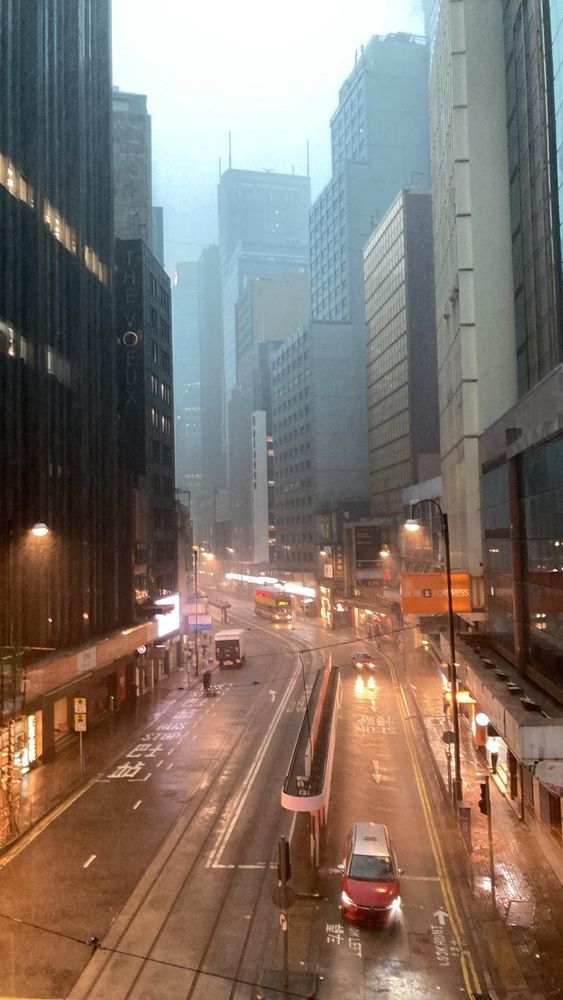
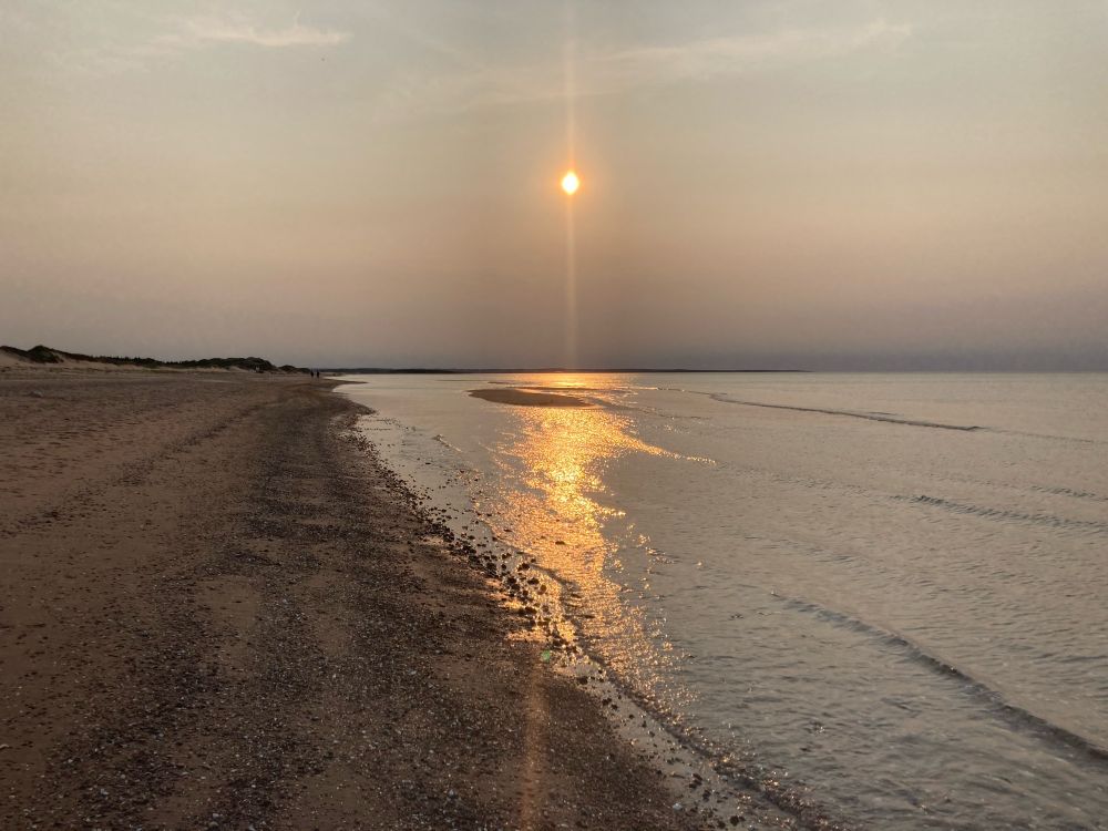
The attached photo taken at about 8 pm is of the smoke haze we’re experiencing in one of Canada’s easternmost provinces.
June 5, 2025 at 1:41 AM
The attached photo taken at about 8 pm is of the smoke haze we’re experiencing in one of Canada’s easternmost provinces.
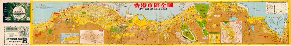
Spent the last month wrapping up term and moving so I haven't found time to update about MHHK progress, but I've spent this afternoon tracking down source maps and wanted to share this 1958 one from the Hai Kwang Press. By far one of my favourites.
May 23, 2025 at 6:55 PM
Spent the last month wrapping up term and moving so I haven't found time to update about MHHK progress, but I've spent this afternoon tracking down source maps and wanted to share this 1958 one from the Hai Kwang Press. By far one of my favourites.
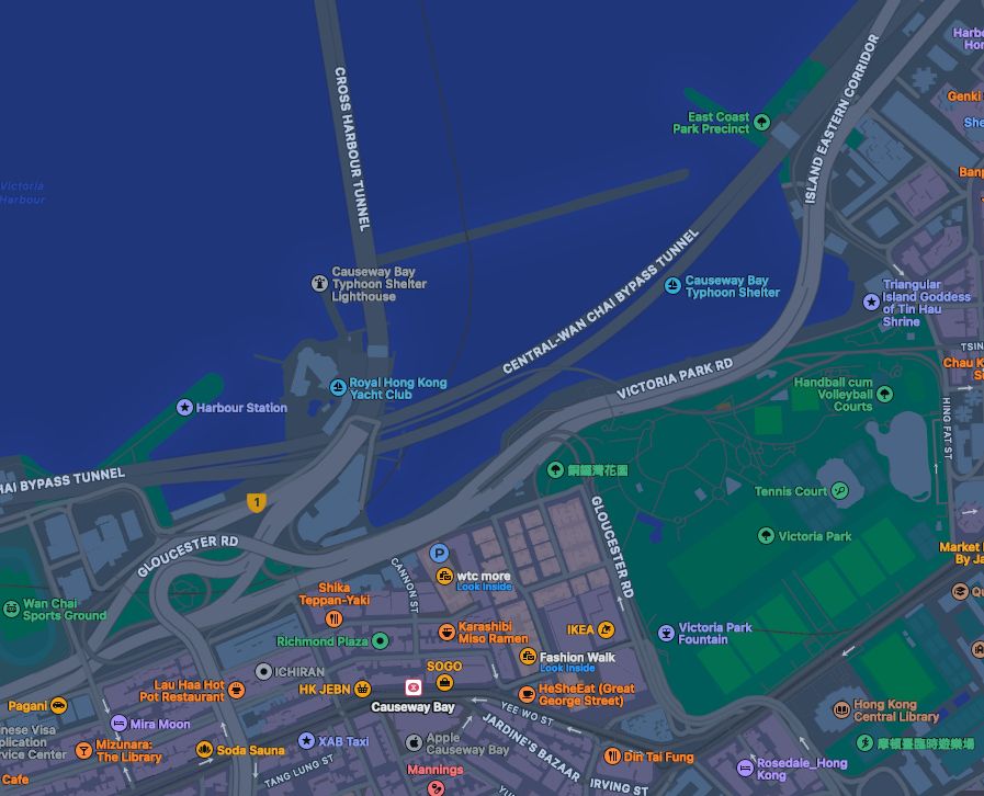
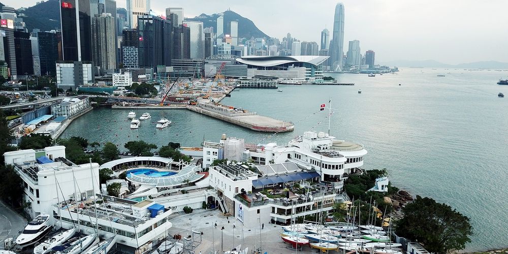
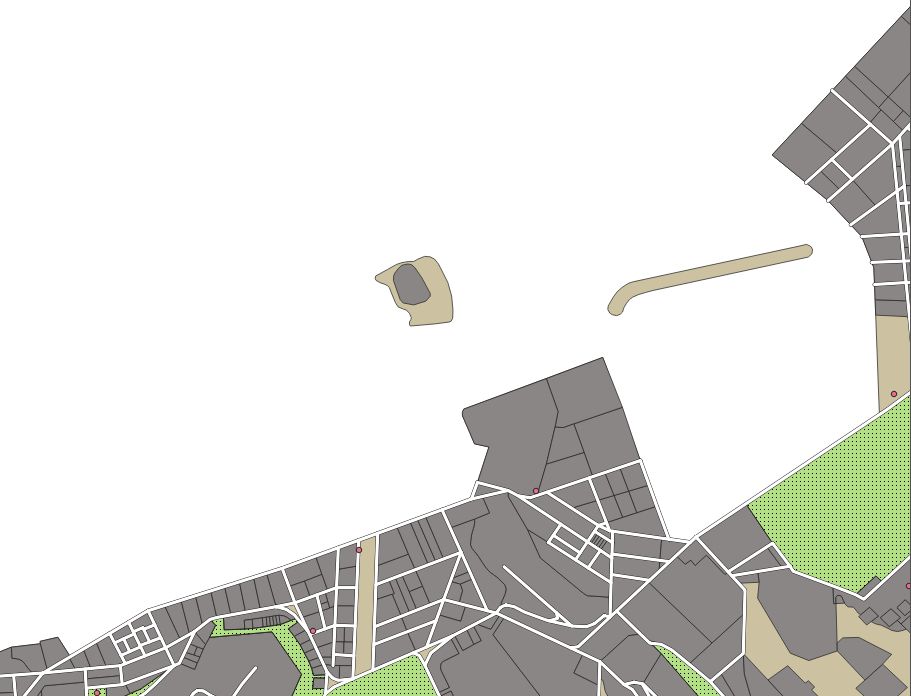
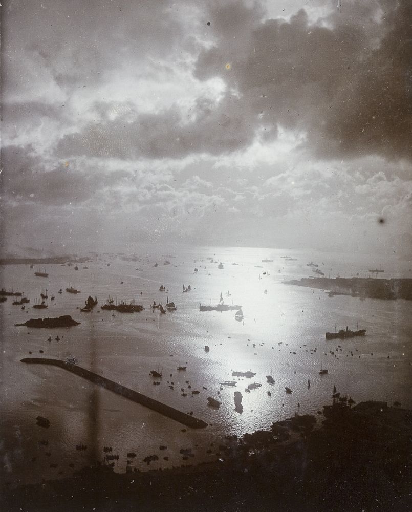
Kellett Island (where the RHK Yacht Club pin sits on the map) was connected to the mainland through land reclamation projects in 1969. Comparing the contemporary map with the 1924 map shows the extent of Wan Chai/Victoria Park development which extended to the breakwater visible in the HPC photo.
April 25, 2025 at 6:59 PM
Kellett Island (where the RHK Yacht Club pin sits on the map) was connected to the mainland through land reclamation projects in 1969. Comparing the contemporary map with the 1924 map shows the extent of Wan Chai/Victoria Park development which extended to the breakwater visible in the HPC photo.
Still working on 1842 this week for the MHHK project. So instead I wanted to showcase one of my current favourite markers of shoreline change in Hong Kong: Kellett Island (photo courtesy of the @uobrishistory.bsky.social Historical Photographs of China project).
April 25, 2025 at 6:59 PM
Still working on 1842 this week for the MHHK project. So instead I wanted to showcase one of my current favourite markers of shoreline change in Hong Kong: Kellett Island (photo courtesy of the @uobrishistory.bsky.social Historical Photographs of China project).
As a bonus, we also started tests integrating and displaying partner data on MHHK's base maps. This meant working with some cleaned sample data from Spatial History team at HKBU.
The sample data (little red nodes) in question? Public Toilets... ☹️
The sample data (little red nodes) in question? Public Toilets... ☹️

April 11, 2025 at 8:34 PM
As a bonus, we also started tests integrating and displaying partner data on MHHK's base maps. This meant working with some cleaned sample data from Spatial History team at HKBU.
The sample data (little red nodes) in question? Public Toilets... ☹️
The sample data (little red nodes) in question? Public Toilets... ☹️
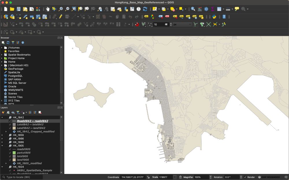
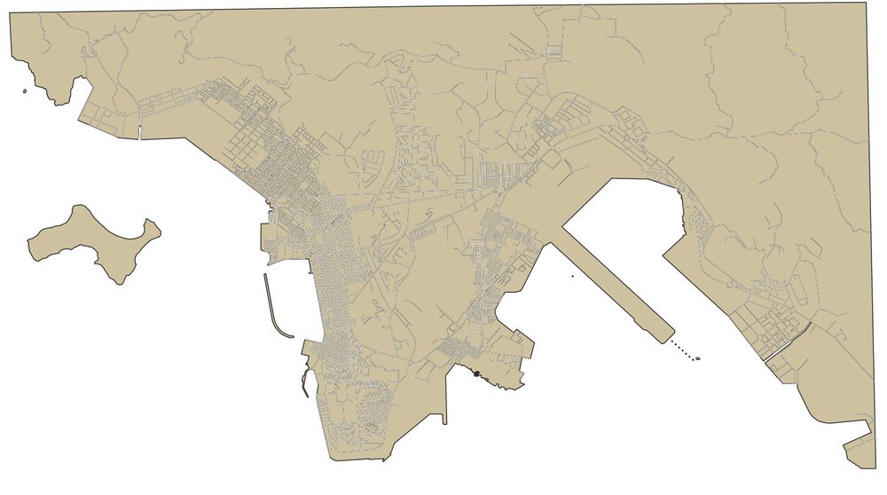
This week's work with MHHK included finishing up the map of the 1920s and starting a new one on the 1840s as I continue to build out the starter kit. This has meant working with Adolphe Dubois de Jancigny's fantastic 1842 survey, which provides a very different profile of Hong Kong's shoreline.

April 11, 2025 at 8:34 PM
This week's work with MHHK included finishing up the map of the 1920s and starting a new one on the 1840s as I continue to build out the starter kit. This has meant working with Adolphe Dubois de Jancigny's fantastic 1842 survey, which provides a very different profile of Hong Kong's shoreline.
What a difference 20 years makes.
Much of today's work with MHHK has been spent splitting lots in Hong Kong. The examples are from 1866 (first image) and 1886 (second). If the Land Registry website is anything to go by, this is going to quickly become tedious.
Much of today's work with MHHK has been spent splitting lots in Hong Kong. The examples are from 1866 (first image) and 1886 (second). If the Land Registry website is anything to go by, this is going to quickly become tedious.


April 4, 2025 at 6:54 PM
What a difference 20 years makes.
Much of today's work with MHHK has been spent splitting lots in Hong Kong. The examples are from 1866 (first image) and 1886 (second). If the Land Registry website is anything to go by, this is going to quickly become tedious.
Much of today's work with MHHK has been spent splitting lots in Hong Kong. The examples are from 1866 (first image) and 1886 (second). If the Land Registry website is anything to go by, this is going to quickly become tedious.
In the midst of marking, so not much done with MHHK this week. So I thought I'd share one of my favourite parts of working on this series - the visualization of Hong Kong's land reclamation.


March 28, 2025 at 7:44 PM
In the midst of marking, so not much done with MHHK this week. So I thought I'd share one of my favourite parts of working on this series - the visualization of Hong Kong's land reclamation.
In an effort to remind myself that there's more to life than panic-refreshing the news, I'm going to start posting weekly Friday updates on the Mapping Historical Hong Kong Project as we work to create c.156 interactive maps of Hong Kong throughout history.

March 21, 2025 at 3:53 PM
In an effort to remind myself that there's more to life than panic-refreshing the news, I'm going to start posting weekly Friday updates on the Mapping Historical Hong Kong Project as we work to create c.156 interactive maps of Hong Kong throughout history.