


@solomonseal.bsky.social
I’m a software developer with an interests in gardening, 3D printing, mapping / cartography, and various other things :)
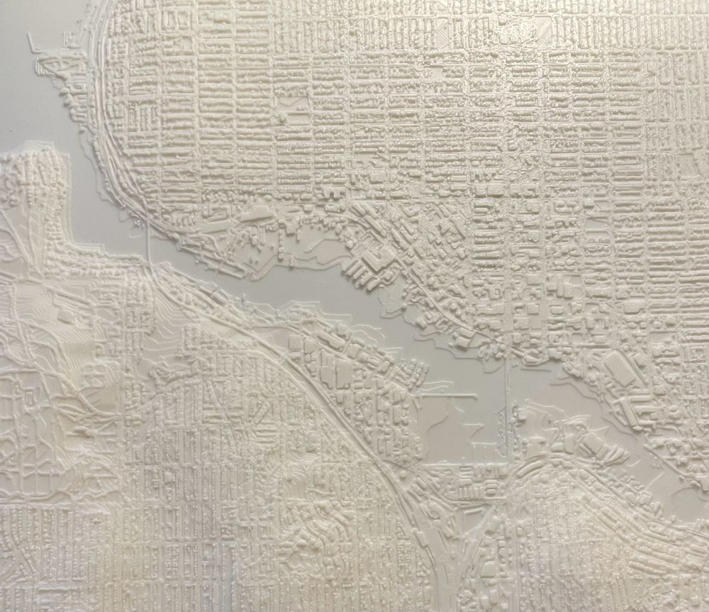
I converted a LiDAR .las file into a printable .stl using python! This is Ballard WA
#LiDAR #python #cartography #3dprinting
#LiDAR #python #cartography #3dprinting
January 3, 2025 at 1:48 AM
I converted a LiDAR .las file into a printable .stl using python! This is Ballard WA
#LiDAR #python #cartography #3dprinting
#LiDAR #python #cartography #3dprinting
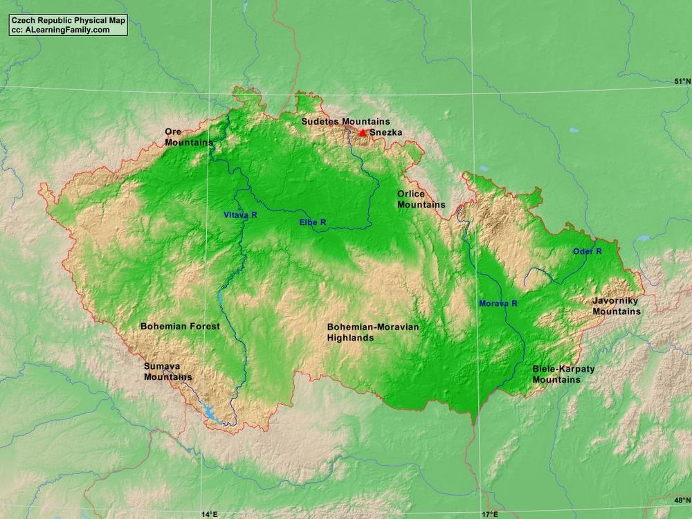
Topography of Czechia is interesting too. The Sudetes mountain range form a ring around the core of Czechia. The rough terrain is likely the reason for the high forest coverage, and why you also see high forest coverage in Alps, Carpathians, and Pyrenees.
December 16, 2024 at 10:22 PM
Topography of Czechia is interesting too. The Sudetes mountain range form a ring around the core of Czechia. The rough terrain is likely the reason for the high forest coverage, and why you also see high forest coverage in Alps, Carpathians, and Pyrenees.
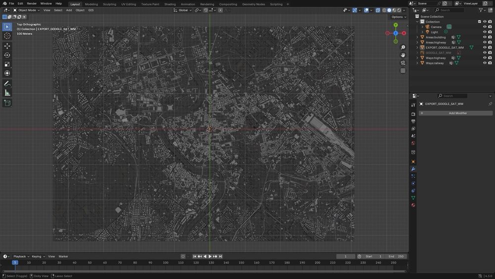
I have not been able to find any LiDAR data of Rome, but I think that is ok because .las files are super difficult to work with anyways.
The OSM data looks very interesting though. More contributions to building outlines would improve it a lot
#rome #osm #blender #opentopography
The OSM data looks very interesting though. More contributions to building outlines would improve it a lot
#rome #osm #blender #opentopography
December 14, 2024 at 8:46 AM
I have not been able to find any LiDAR data of Rome, but I think that is ok because .las files are super difficult to work with anyways.
The OSM data looks very interesting though. More contributions to building outlines would improve it a lot
#rome #osm #blender #opentopography
The OSM data looks very interesting though. More contributions to building outlines would improve it a lot
#rome #osm #blender #opentopography
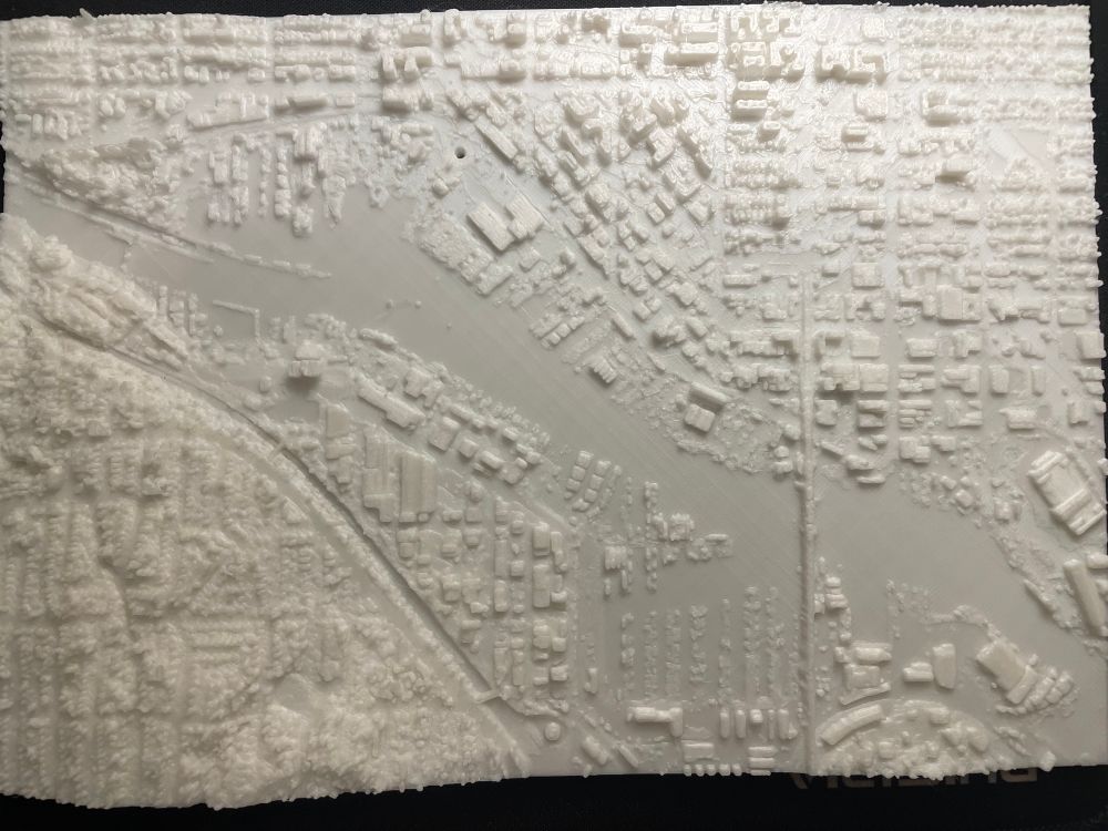
3D printed map of Ballard WA! buildings, streets, and railway lines included
#blender #openstreetmaps #osm #3dprinting #opentopogrpahy
#blender #openstreetmaps #osm #3dprinting #opentopogrpahy
December 13, 2024 at 5:23 AM
3D printed map of Ballard WA! buildings, streets, and railway lines included
#blender #openstreetmaps #osm #3dprinting #opentopogrpahy
#blender #openstreetmaps #osm #3dprinting #opentopogrpahy