

Prof. Simon Carn
@simoncarn.bsky.social
Volcanologist @michigantech.bsky.social. Satellite-powered analysis of global #volcanic activity. #GreatLakes silent sports 🏃🏻♂️🚵🏻♂️⛷. Often buried in snow. 🇬🇧/🇺🇸
Dispersion of #volcanic SO₂ from the latest #eruption on #Iceland's #Reykjanes peninsula (July 16), measured by the Sentinel-5P TROPOMI satellite instrument. SO₂ emissions have spread into north and west Iceland, impacting air quality (Icelandic Met Office). @esa.int
July 18, 2025 at 7:15 PM
Dispersion of #volcanic SO₂ from the latest #eruption on #Iceland's #Reykjanes peninsula (July 16), measured by the Sentinel-5P TROPOMI satellite instrument. SO₂ emissions have spread into north and west Iceland, impacting air quality (Icelandic Met Office). @esa.int
Reposted by Prof. Simon Carn

Today, we're launching a dedicated action hub for the crisis threatening NASA science. Find actions, latest news and up-to-date resources at: www.planetary.org/save-nasa-sc... #ProtectNASAScience
May 1, 2025 at 4:17 PM
Today, we're launching a dedicated action hub for the crisis threatening NASA science. Find actions, latest news and up-to-date resources at: www.planetary.org/save-nasa-sc... #ProtectNASAScience
Satellite imagery of nighttime lights using the NOAA-20/VIIRS Day/Night Band ('visible image at night') shows areas of Spain and Portugal still affected by power outages overnight on April 28-29. Images from NASA Worldview. @thenasaearth.bsky.social @noaa.gov
April 29, 2025 at 3:54 PM
Satellite imagery of nighttime lights using the NOAA-20/VIIRS Day/Night Band ('visible image at night') shows areas of Spain and Portugal still affected by power outages overnight on April 28-29. Images from NASA Worldview. @thenasaearth.bsky.social @noaa.gov
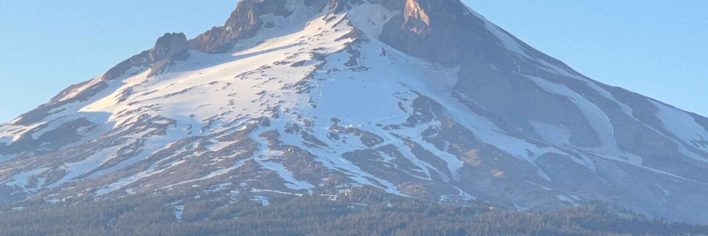
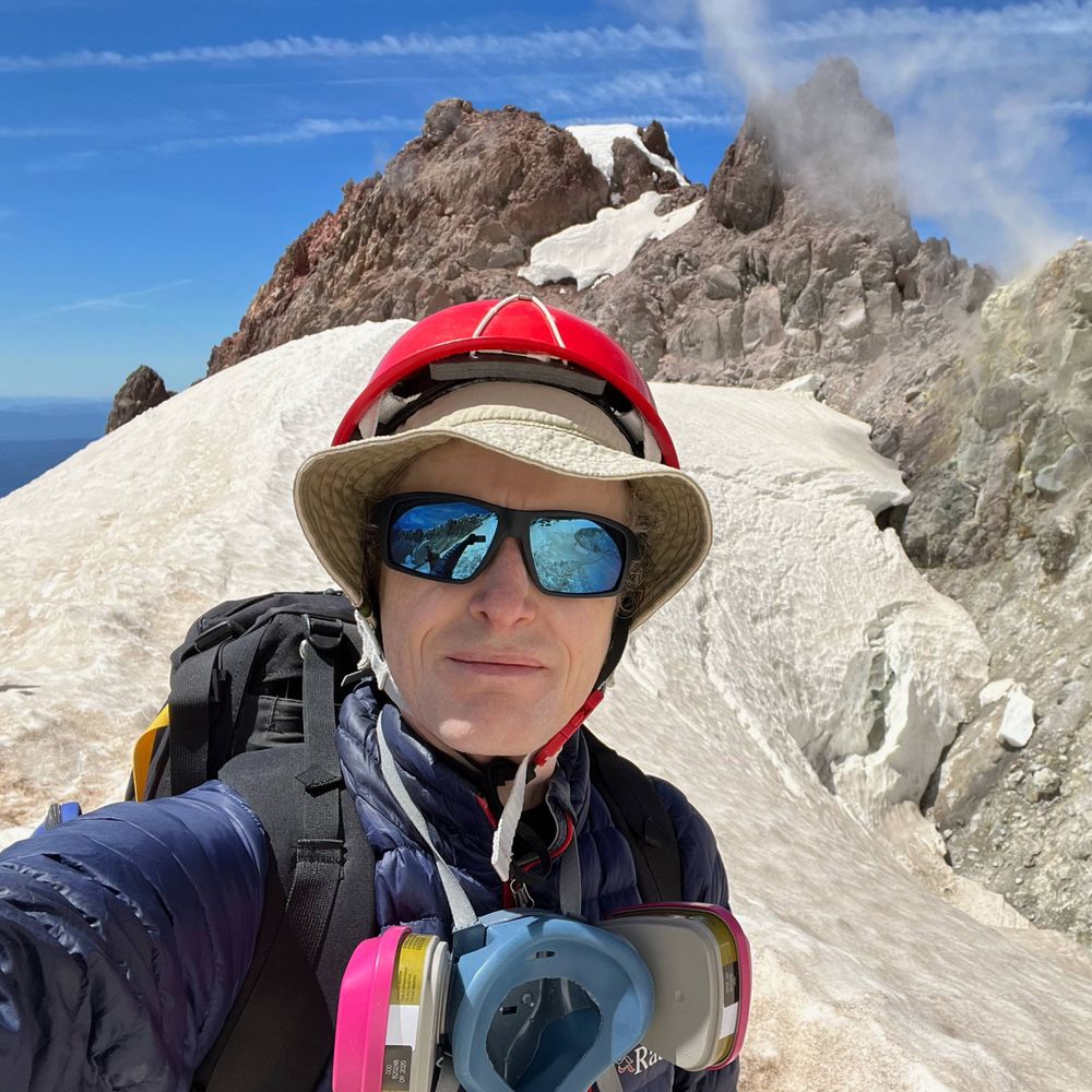
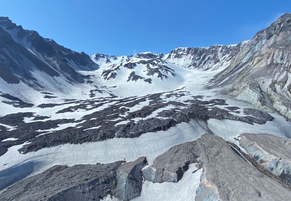
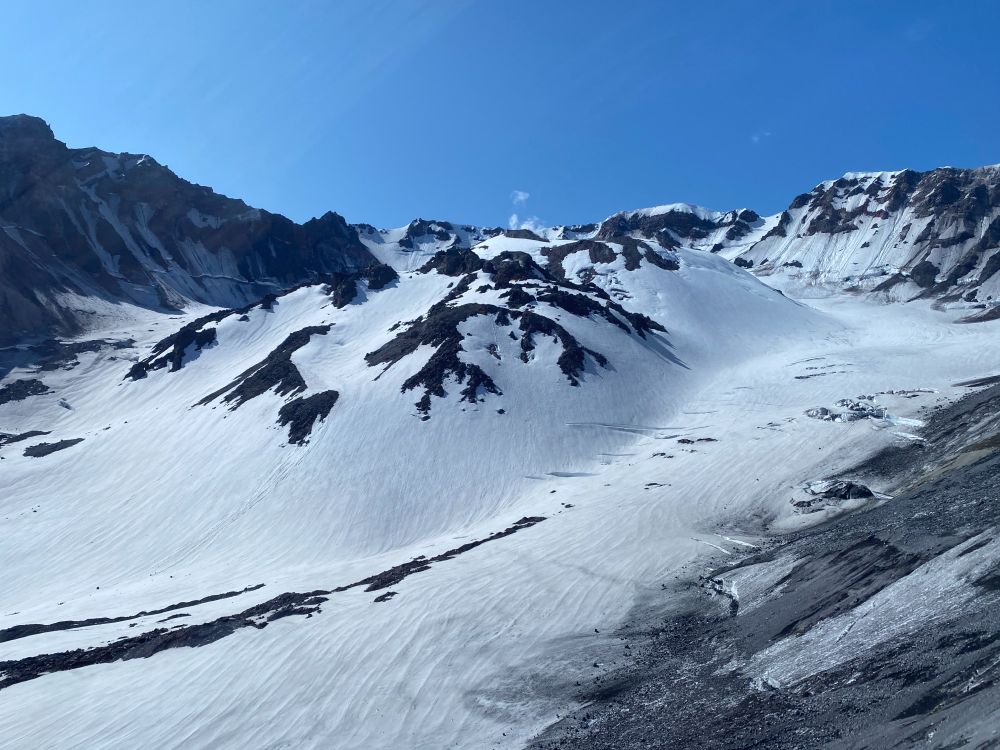
The world's youngest mountain glacier - Crater Glacier at Mount St. Helens #volcano (WA, USA) - formed in 1996 in the amphitheater produced by the May 1980 eruption. The glacier flows around lava domes erupted in 1980-86 and 2004-08. Photos taken in 2023. #WorldGlacierDay 🧪🌋
March 21, 2025 at 4:54 PM
The world's youngest mountain glacier - Crater Glacier at Mount St. Helens #volcano (WA, USA) - formed in 1996 in the amphitheater produced by the May 1980 eruption. The glacier flows around lava domes erupted in 1980-86 and 2004-08. Photos taken in 2023. #WorldGlacierDay 🧪🌋
Reposted by Prof. Simon Carn
🧪🛰️
My colleague @simoncarn.bsky.social and I were consulted for this note by @avoiland.bsky.social to comment on volcanoes and clouds in the South Atlantic.
A nice place to study aerosol-cloud interactions! (and other things of course)
earthobservatory.nasa.gov/images/15404...
My colleague @simoncarn.bsky.social and I were consulted for this note by @avoiland.bsky.social to comment on volcanoes and clouds in the South Atlantic.
A nice place to study aerosol-cloud interactions! (and other things of course)
earthobservatory.nasa.gov/images/15404...
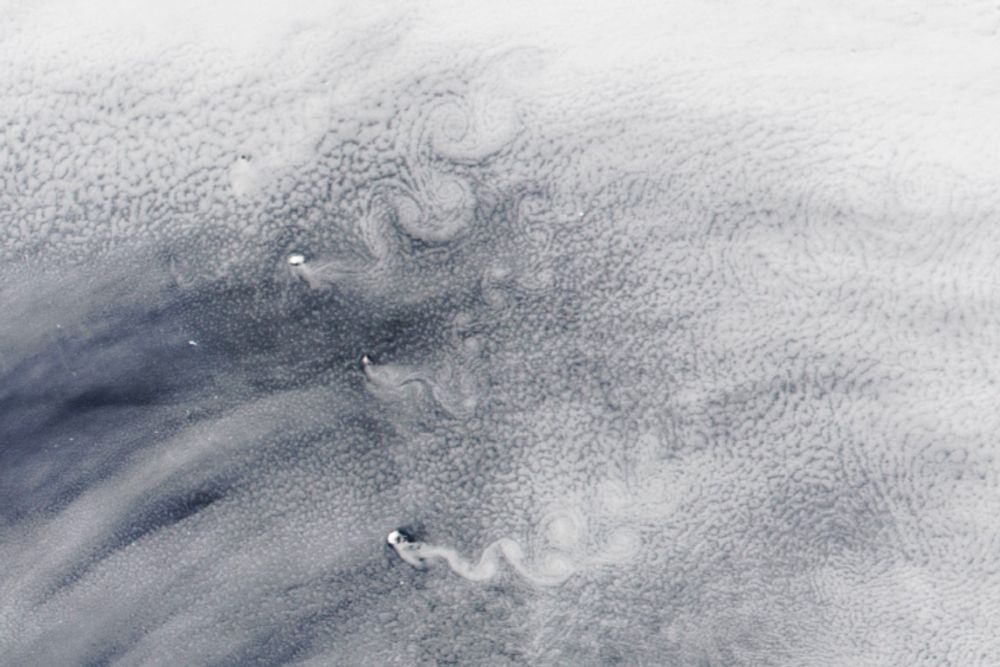
Swirling Skies and Melting Icebergs
The remote South Sandwich Islands can disrupt passing clouds in ways that shed alternating rows of cloud spirals.
earthobservatory.nasa.gov
March 17, 2025 at 4:05 PM
🧪🛰️
My colleague @simoncarn.bsky.social and I were consulted for this note by @avoiland.bsky.social to comment on volcanoes and clouds in the South Atlantic.
A nice place to study aerosol-cloud interactions! (and other things of course)
earthobservatory.nasa.gov/images/15404...
My colleague @simoncarn.bsky.social and I were consulted for this note by @avoiland.bsky.social to comment on volcanoes and clouds in the South Atlantic.
A nice place to study aerosol-cloud interactions! (and other things of course)
earthobservatory.nasa.gov/images/15404...
When Spurr last erupted in 1992, volcanic ash & gas clouds (a potential aviation hazard) drifted south over the Pacific NW & Upper Midwest. A fully functional USGS & NOAA is needed to monitor such events & mitigate their impacts. NASA/NOAA satellite data also critical for tracking volcanic clouds.
March 12, 2025 at 10:48 PM
When Spurr last erupted in 1992, volcanic ash & gas clouds (a potential aviation hazard) drifted south over the Pacific NW & Upper Midwest. A fully functional USGS & NOAA is needed to monitor such events & mitigate their impacts. NASA/NOAA satellite data also critical for tracking volcanic clouds.
Reposted by Prof. Simon Carn
Some folks have asked, given recent news, “how do I show my friends/family the impact of NSF?” We have some easy Fact Sheets for you! Here’s a brief thread about this website: new.nsf.gov/about/fact-s... which hosts a ton of useful one-pagers.
February 8, 2025 at 3:31 PM
Some folks have asked, given recent news, “how do I show my friends/family the impact of NSF?” We have some easy Fact Sheets for you! Here’s a brief thread about this website: new.nsf.gov/about/fact-s... which hosts a ton of useful one-pagers.
Reposted by Prof. Simon Carn

A reminder: If you need to know about volcanic activity in the United States and are concerned that you might not be able to reach USGS websites at some point, PLEASE make sure you sign up for our volcano notification Service: volcanoes.usgs.gov/vns3/ It is a straight-to-email messaging system. 🌋🧪⚒️
Volcano Notification Service (VNS)
volcanoes.usgs.gov
February 1, 2025 at 3:41 AM
A reminder: If you need to know about volcanic activity in the United States and are concerned that you might not be able to reach USGS websites at some point, PLEASE make sure you sign up for our volcano notification Service: volcanoes.usgs.gov/vns3/ It is a straight-to-email messaging system. 🌋🧪⚒️
Satellite imagery from @planet.com shows increased steaming in the summit caldera of Fentale volcano (Ethiopia) in the last week. Emissions appear confined to topographic lows - perhaps a meteorological effect (temperature inversion?). @davidmpyle.bsky.social @volckaren.bsky.social 🧪
January 20, 2025 at 12:38 AM
Satellite imagery from @planet.com shows increased steaming in the summit caldera of Fentale volcano (Ethiopia) in the last week. Emissions appear confined to topographic lows - perhaps a meteorological effect (temperature inversion?). @davidmpyle.bsky.social @volckaren.bsky.social 🧪
#Volcanic SO₂ plume from #Kanlaon #volcano captured and entrained by Super Typhoon #Man-yi (#Pepito) during its passage through the #Philippines. Data from the #geostationary GK-2B GEMS instrument.
November 19, 2024 at 5:51 AM
#Volcanic SO₂ plume from #Kanlaon #volcano captured and entrained by Super Typhoon #Man-yi (#Pepito) during its passage through the #Philippines. Data from the #geostationary GK-2B GEMS instrument.
Reposted by Prof. Simon Carn
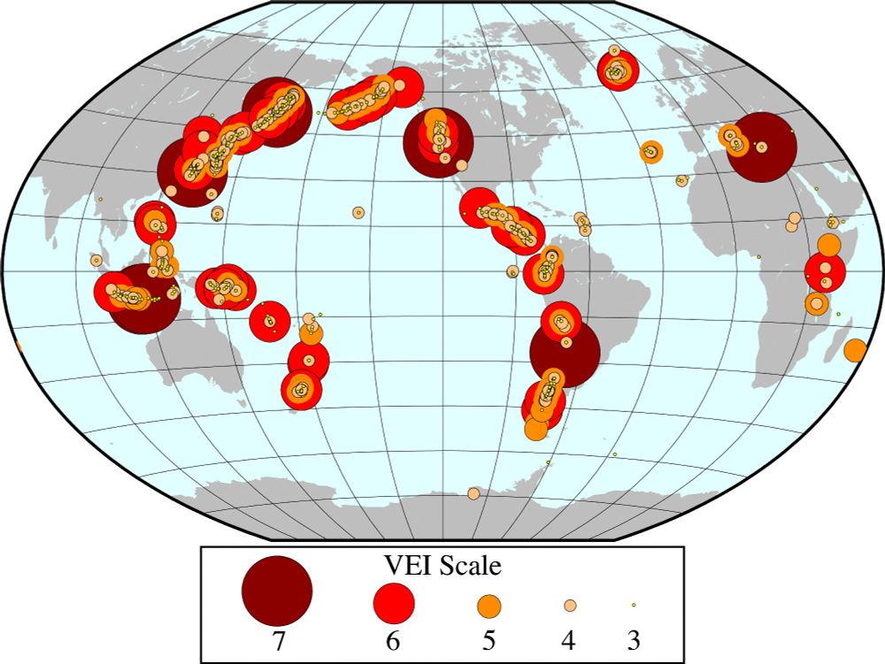
#30DayMapChallenge Day 14: World Map
Large explosive volcanic eruptions during the Holocene plotted by VEI (Volcano Explosivity Index). Volcano data from SI Global Volcanism Program.
Large explosive volcanic eruptions during the Holocene plotted by VEI (Volcano Explosivity Index). Volcano data from SI Global Volcanism Program.
November 15, 2024 at 4:58 AM
#30DayMapChallenge Day 14: World Map
Large explosive volcanic eruptions during the Holocene plotted by VEI (Volcano Explosivity Index). Volcano data from SI Global Volcanism Program.
Large explosive volcanic eruptions during the Holocene plotted by VEI (Volcano Explosivity Index). Volcano data from SI Global Volcanism Program.
Reposted by Prof. Simon Carn

No insurer will write a policy for global cooling triggered by a massive 🌋eruption. But we shouldn't ignore a risk just because it's uninsurable.
In this comment led by Markus Stoffel, we argue the risk industry ought to think more seriously about 'Tambora 2.0'.
www.nature.com/articles/d41...
In this comment led by Markus Stoffel, we argue the risk industry ought to think more seriously about 'Tambora 2.0'.
www.nature.com/articles/d41...

The next massive volcano eruption will cause climate chaos — and we are unprepared
Volcanic activity will be experienced differently in a warmer world. Researchers need to understand these risks and how they could spiral.
www.nature.com
November 12, 2024 at 3:27 PM
No insurer will write a policy for global cooling triggered by a massive 🌋eruption. But we shouldn't ignore a risk just because it's uninsurable.
In this comment led by Markus Stoffel, we argue the risk industry ought to think more seriously about 'Tambora 2.0'.
www.nature.com/articles/d41...
In this comment led by Markus Stoffel, we argue the risk industry ought to think more seriously about 'Tambora 2.0'.
www.nature.com/articles/d41...
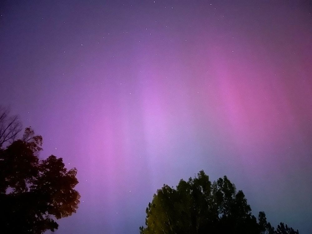
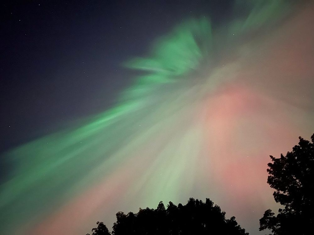
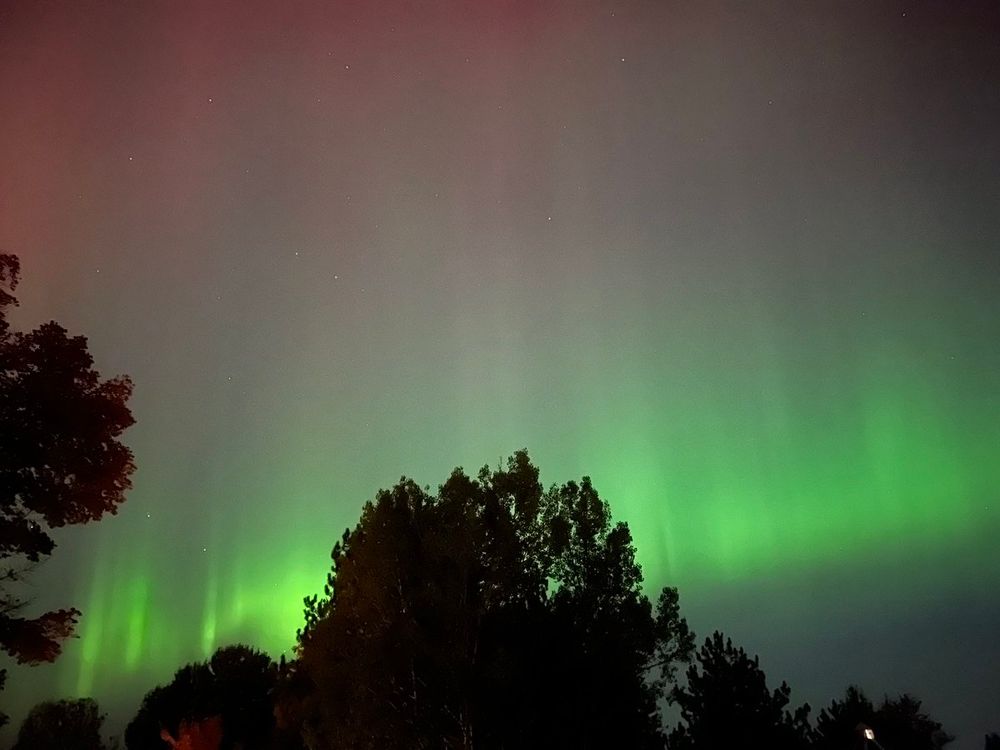
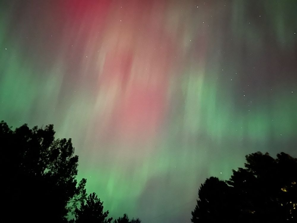
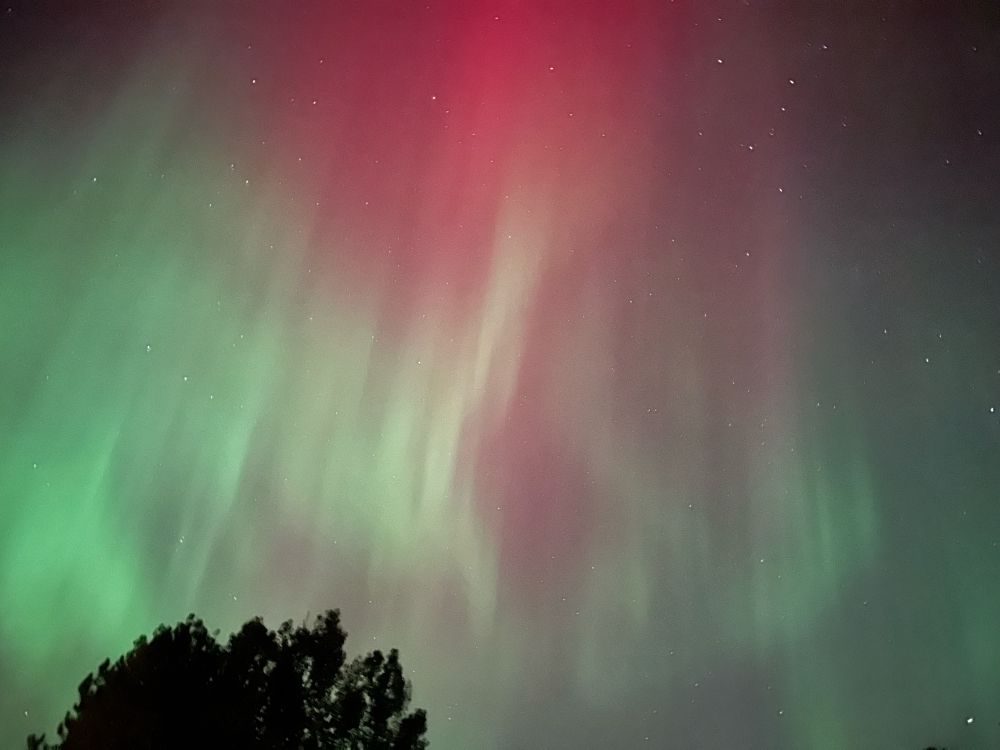
Evolution of colors in tonight’s #aurora over Hancock, #Michigan. @Upper Peninsula @NWSMarquette @TamithaSkov #northernlights #geomagneticstorm

November 16, 2024 at 10:20 PM
Evolution of colors in tonight’s #aurora over Hancock, #Michigan. @Upper Peninsula @NWSMarquette @TamithaSkov #northernlights #geomagneticstorm
October 8, 2024 at 4:19 AM
Another batch of #volcanic SO₂ en route to the #UK/#Ireland, courtesy of the latest #eruption on #Iceland's #Reykjanes peninsula. Might cause some local #AirQuality impacts in the coming days. @eddy_weather @ScottishEPA
SO₂ data: @NOAA/@NASA @JPSSProgram #NOAA20-#OMPS
SO₂ data: @NOAA/@NASA @JPSSProgram #NOAA20-#OMPS
November 16, 2024 at 10:20 PM
Another batch of #volcanic SO₂ en route to the #UK/#Ireland, courtesy of the latest #eruption on #Iceland's #Reykjanes peninsula. Might cause some local #AirQuality impacts in the coming days. @eddy_weather @ScottishEPA
SO₂ data: @NOAA/@NASA @JPSSProgram #NOAA20-#OMPS
SO₂ data: @NOAA/@NASA @JPSSProgram #NOAA20-#OMPS
The largest #eruption on record of #Kanlaon/#Canlaon #volcano (#Philippines) on June 3 produced an upper tropospheric SO₂ cloud (~0.05 Tg SO₂), seen here from #geostationary orbit by #SouthKorea's UV #GK2B #GEMS sensor.
@phivolcs_dost @News5PH @nababaha
@phivolcs_dost @News5PH @nababaha
November 16, 2024 at 10:20 PM
The largest #eruption on record of #Kanlaon/#Canlaon #volcano (#Philippines) on June 3 produced an upper tropospheric SO₂ cloud (~0.05 Tg SO₂), seen here from #geostationary orbit by #SouthKorea's UV #GK2B #GEMS sensor.
@phivolcs_dost @News5PH @nababaha
@phivolcs_dost @News5PH @nababaha
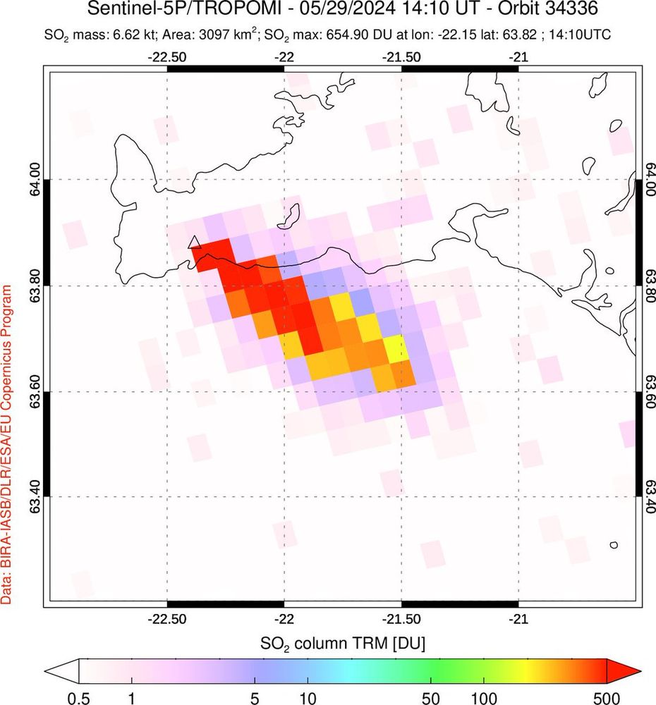
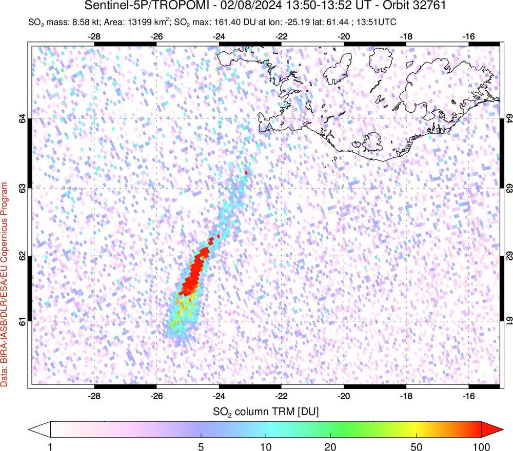
First #Sentinel5P #TROPOMI overpass ~1.3 hours after the onset of today's #eruption on #Iceland's #Reykjanes peninsula shows very high SO₂ column amounts in plume spreading SE. Est. SO₂ emission rate is ~1400 kg/s (~120,000 tons/day). @Vedurstofan @CopernicusEU @rockhardIES
November 16, 2024 at 10:20 PM
First #Sentinel5P #TROPOMI overpass ~1.3 hours after the onset of today's #eruption on #Iceland's #Reykjanes peninsula shows very high SO₂ column amounts in plume spreading SE. Est. SO₂ emission rate is ~1400 kg/s (~120,000 tons/day). @Vedurstofan @CopernicusEU @rockhardIES
SO₂ emissions from the April 16 #eruption of #Ruang #volcano (#Indonesia) measured with hourly cadence by #SouthKorea's #geostationary UV GK-2B #GEMS sensor. Relatively low SO₂ amounts detected so far. @PVMBG_ @id_magma @andrewcraigtupp
November 16, 2024 at 10:21 PM
SO₂ emissions from the April 16 #eruption of #Ruang #volcano (#Indonesia) measured with hourly cadence by #SouthKorea's #geostationary UV GK-2B #GEMS sensor. Relatively low SO₂ amounts detected so far. @PVMBG_ @id_magma @andrewcraigtupp
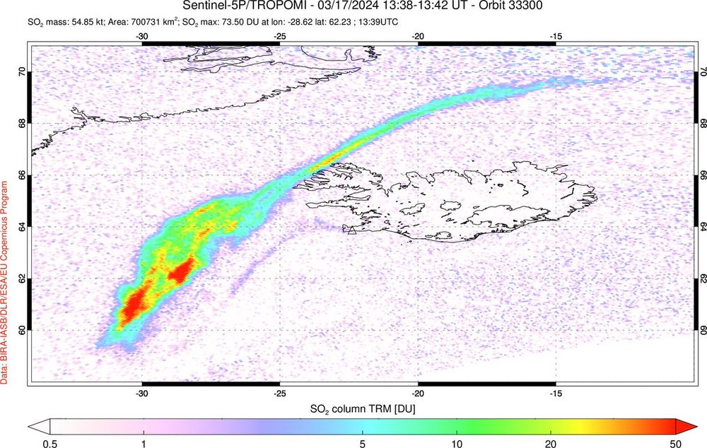
The latest #eruption in #Iceland has produced the largest #volcanic SO₂ cloud measured to date in the 2023-24 #Reykjanes Fires, consistent with reports that it is the most intense episode so far.
Data: @CopernicusEU #Sentinel5P #TROPOMI.
@Vedurstofan @rockhardIES @Alberto_Carac
Data: @CopernicusEU #Sentinel5P #TROPOMI.
@Vedurstofan @rockhardIES @Alberto_Carac
November 16, 2024 at 10:21 PM
The latest #eruption in #Iceland has produced the largest #volcanic SO₂ cloud measured to date in the 2023-24 #Reykjanes Fires, consistent with reports that it is the most intense episode so far.
Data: @CopernicusEU #Sentinel5P #TROPOMI.
@Vedurstofan @rockhardIES @Alberto_Carac
Data: @CopernicusEU #Sentinel5P #TROPOMI.
@Vedurstofan @rockhardIES @Alberto_Carac
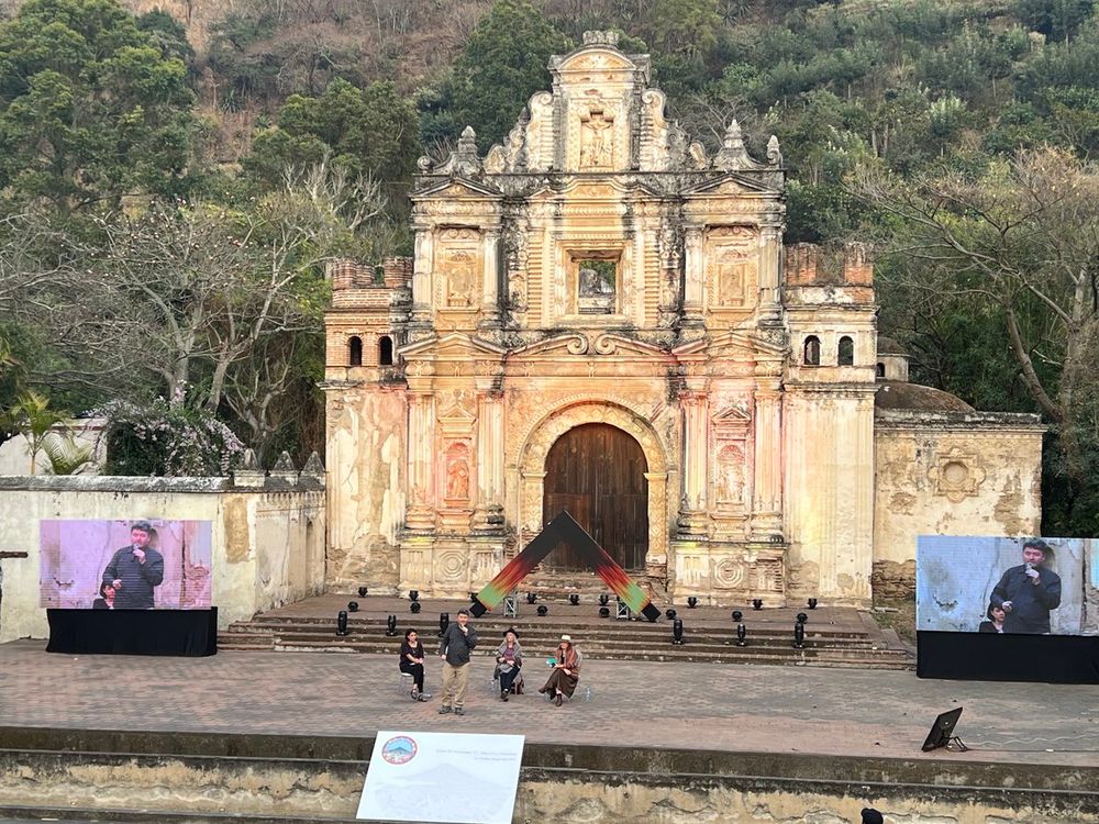
.@mtugeomining’s Rudiger Escobar-Wolf discussing #volcanic risk reduction in #Guatemala at the closing ceremony of the @COVolcanoes12 meeting in #Antigua. Many thanks to the organizers for a fantastic conference. @michigantech @mturesearch #CoV12
November 16, 2024 at 10:21 PM
.@mtugeomining’s Rudiger Escobar-Wolf discussing #volcanic risk reduction in #Guatemala at the closing ceremony of the @COVolcanoes12 meeting in #Antigua. Many thanks to the organizers for a fantastic conference. @michigantech @mturesearch #CoV12
As sunlight gradually returns to high northern latitudes, so does UV satellite monitoring of #volcanic SO₂ emissions from #Iceland. #Sentinel5P #TROPOMI detected SO₂ from today's #eruption on the #Reykjanes peninsula drifting over the N. Atlantic.
February 8, 2024 at 4:39 PM
As sunlight gradually returns to high northern latitudes, so does UV satellite monitoring of #volcanic SO₂ emissions from #Iceland. #Sentinel5P #TROPOMI detected SO₂ from today's #eruption on the #Reykjanes peninsula drifting over the N. Atlantic.
As sunlight gradually returns to high northern latitudes, so does UV satellite monitoring of #volcanic SO₂ emissions from #Iceland. #Sentinel5P #TROPOMI detected SO₂ from today's #eruption on the #Reykjanes peninsula drifting over the N. Atlantic. @BIRA_IASB @Vedurstofan

November 16, 2024 at 10:21 PM
As sunlight gradually returns to high northern latitudes, so does UV satellite monitoring of #volcanic SO₂ emissions from #Iceland. #Sentinel5P #TROPOMI detected SO₂ from today's #eruption on the #Reykjanes peninsula drifting over the N. Atlantic. @BIRA_IASB @Vedurstofan
Graphics artist Charley Harper's striking poster for @Volcanoes_NPS, depicting #lava flowing around a kīpuka in his distinctive 'minimal realism' style. #Hawaii #volcano
https://www.charleyharperartstudio.com/artwork/posters/national-park-posters/hawaii-volcanoes-national-park.html
https://www.charleyharperartstudio.com/artwork/posters/national-park-posters/hawaii-volcanoes-national-park.html

November 16, 2024 at 10:31 PM
Graphics artist Charley Harper's striking poster for @Volcanoes_NPS, depicting #lava flowing around a kīpuka in his distinctive 'minimal realism' style. #Hawaii #volcano
https://www.charleyharperartstudio.com/artwork/posters/national-park-posters/hawaii-volcanoes-national-park.html
https://www.charleyharperartstudio.com/artwork/posters/national-park-posters/hawaii-volcanoes-national-park.html
An #eruption has started on #Iceland's #Reykjanes peninsula (north of #Grindavik) with some impressive lava fountains. Follow @Vedurstofan for official updates.
Webcams:
https://www.youtube.com/watch?v=VIs83vmfZCk
https://www.youtube.com/watch?v=804nPrAUAxg
Webcams:
https://www.youtube.com/watch?v=VIs83vmfZCk
https://www.youtube.com/watch?v=804nPrAUAxg
November 16, 2024 at 10:32 PM
An #eruption has started on #Iceland's #Reykjanes peninsula (north of #Grindavik) with some impressive lava fountains. Follow @Vedurstofan for official updates.
Webcams:
https://www.youtube.com/watch?v=VIs83vmfZCk
https://www.youtube.com/watch?v=804nPrAUAxg
Webcams:
https://www.youtube.com/watch?v=VIs83vmfZCk
https://www.youtube.com/watch?v=804nPrAUAxg