


Markus Neteler
@neteler.mastodon.social.ap.brid.gy
geographer. remote sensing. open source GIS. oboe. co-founder of mundialis.de
[bridged from https://mastodon.social/@neteler on the fediverse by https://fed.brid.gy/ ]
[bridged from https://mastodon.social/@neteler on the fediverse by https://fed.brid.gy/ ]
Reposted by Markus Neteler

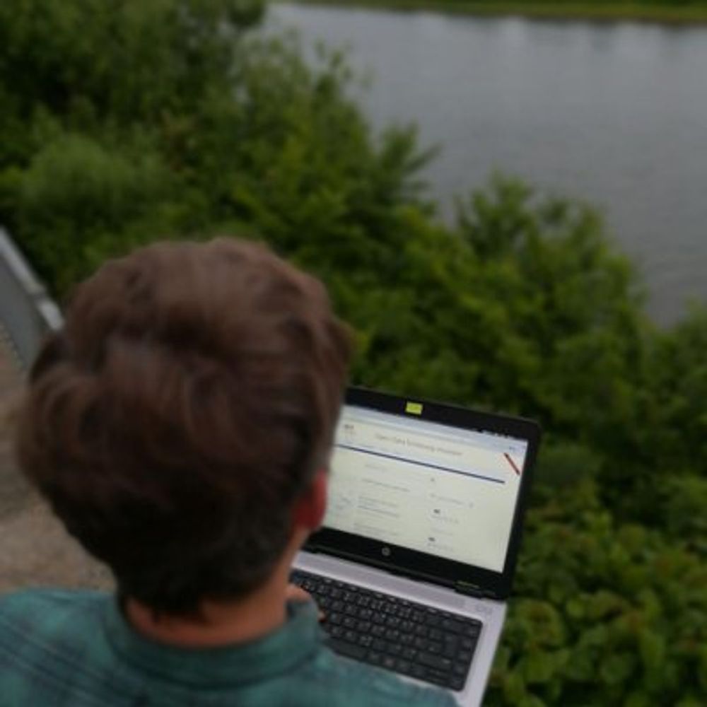
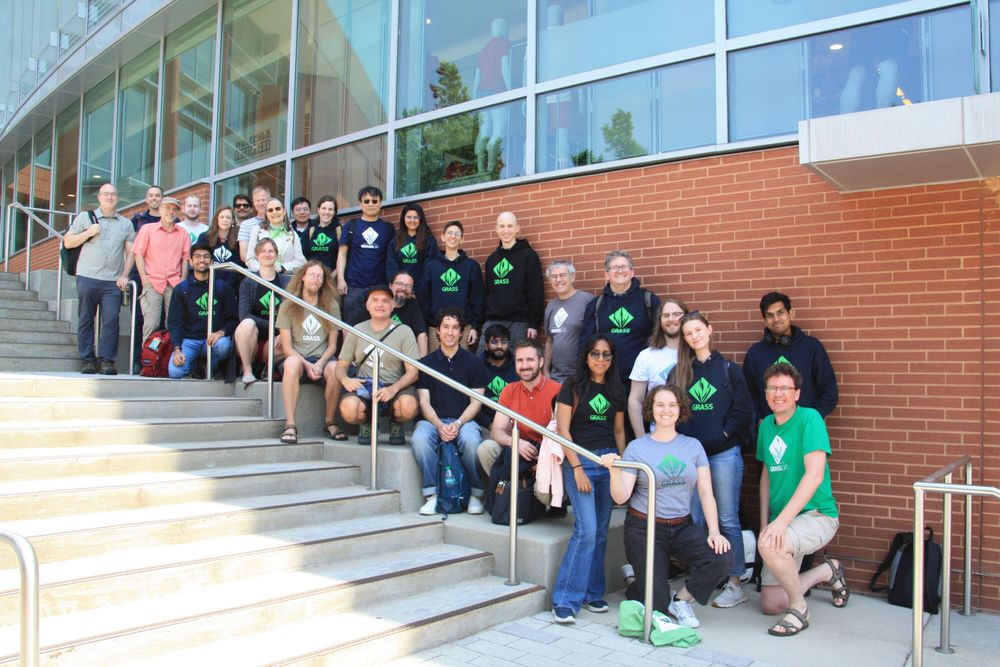
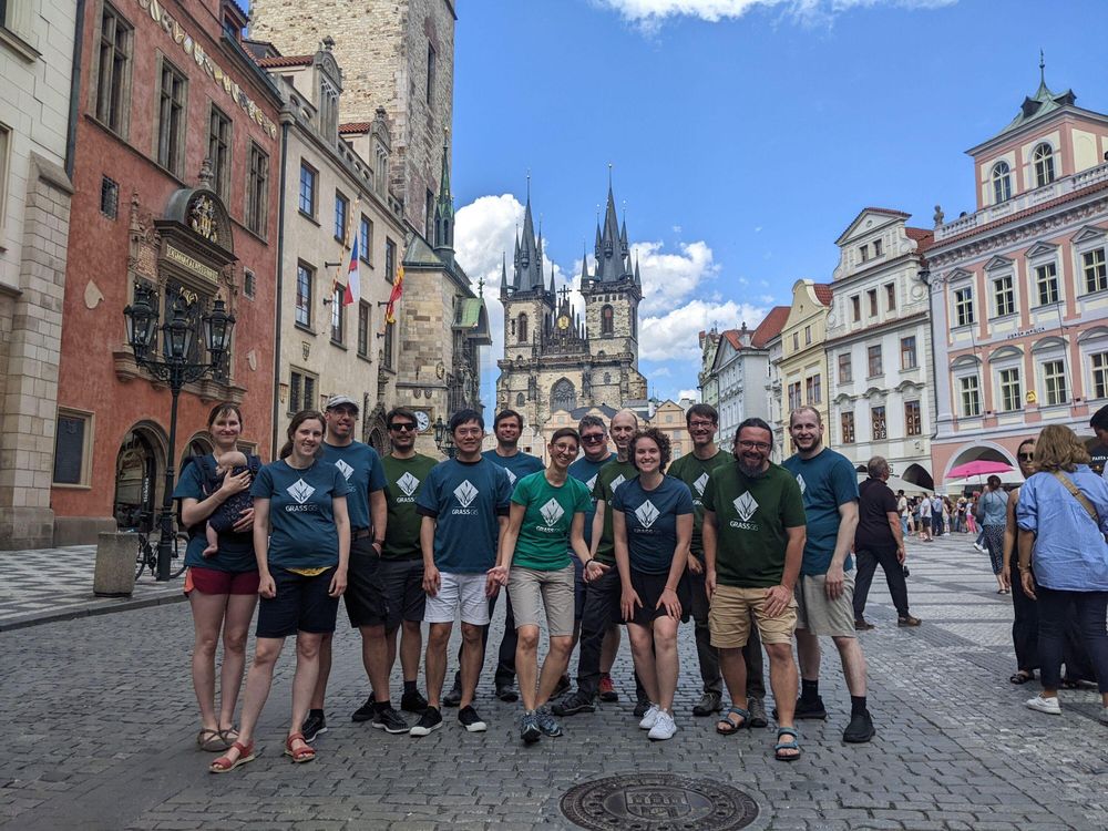
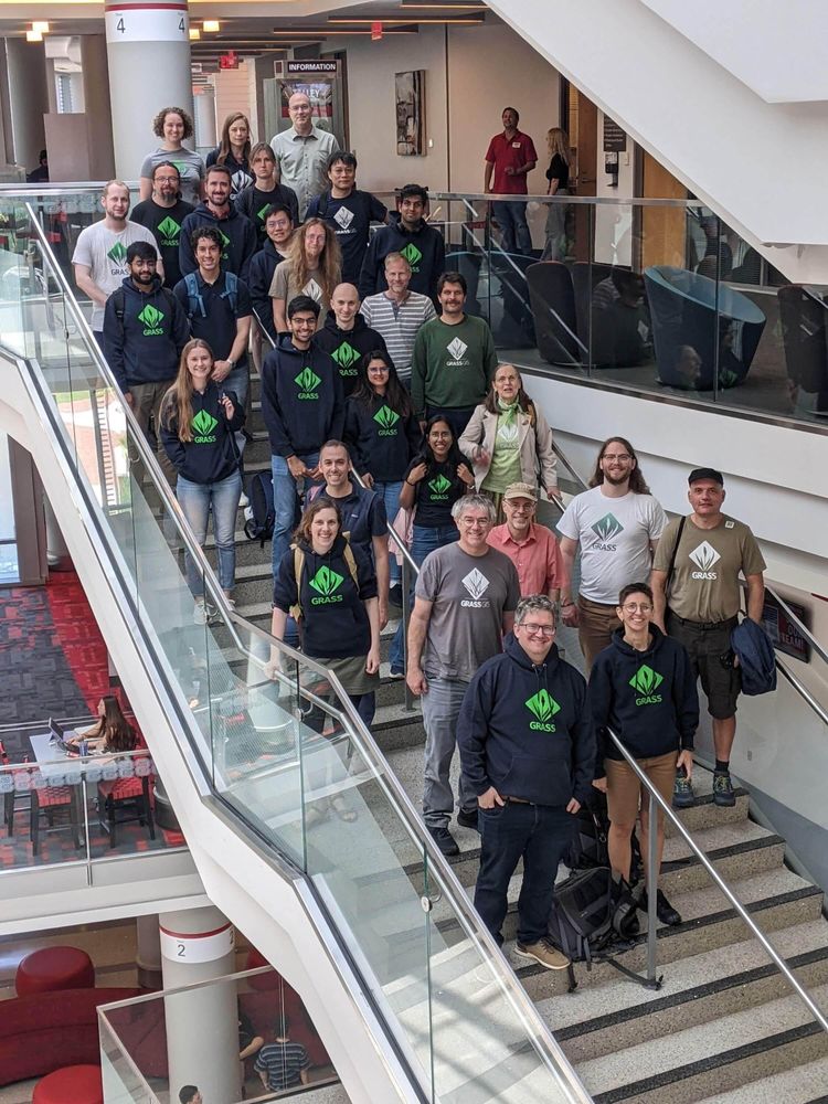
2025 was a big year for GRASS: modernized documentation, faster parallel raster algebra, a new Python API with NumPy integration, JSON outputs for data-science workflows, new addons, and a major developer summit in North Carolina—plus tutorials, workshops, and community support.
Read the full […]
Read the full […]
Original post on fosstodon.org
fosstodon.org
January 6, 2026 at 2:23 AM
2025 was a big year for GRASS: modernized documentation, faster parallel raster algebra, a new Python API with NumPy integration, JSON outputs for data-science workflows, new addons, and a major developer summit in North Carolina—plus tutorials, workshops, and community support.
Read the full […]
Read the full […]
Reposted by Markus Neteler

Here's the document release you were waiting for today!
The UNIX V4 tape!
https://archive.org/details/utah_unix_v4_raw
#retrocomputing
The UNIX V4 tape!
https://archive.org/details/utah_unix_v4_raw
#retrocomputing

UNIX V4 tape from University of Utah (raw) : Computer History Museum : Free Download, Borrow, and Streaming : Internet Archive
UNIX V4 tape from the University of Utah, received by Martin Newell circa June 1974 around when he modeled the Utah Teapot.This is the raw analog waveform and...
archive.org
December 19, 2025 at 10:29 PM
Here's the document release you were waiting for today!
The UNIX V4 tape!
https://archive.org/details/utah_unix_v4_raw
#retrocomputing
The UNIX V4 tape!
https://archive.org/details/utah_unix_v4_raw
#retrocomputing
Reposted by Markus Neteler

How can satellite data help assess heat risks?
Join our webinar “From EO Data to Heat Stress Maps.”
🗓 15 January 2026 | ⏰ 10:00–10:45 CET
🔗 More info: https://www.mundialis.de/en/heat-stress-maps-webinar-invitation/
#eo #heatstress #opendata
Join our webinar “From EO Data to Heat Stress Maps.”
🗓 15 January 2026 | ⏰ 10:00–10:45 CET
🔗 More info: https://www.mundialis.de/en/heat-stress-maps-webinar-invitation/
#eo #heatstress #opendata

December 18, 2025 at 8:39 AM
How can satellite data help assess heat risks?
Join our webinar “From EO Data to Heat Stress Maps.”
🗓 15 January 2026 | ⏰ 10:00–10:45 CET
🔗 More info: https://www.mundialis.de/en/heat-stress-maps-webinar-invitation/
#eo #heatstress #opendata
Join our webinar “From EO Data to Heat Stress Maps.”
🗓 15 January 2026 | ⏰ 10:00–10:45 CET
🔗 More info: https://www.mundialis.de/en/heat-stress-maps-webinar-invitation/
#eo #heatstress #opendata
Reposted by Markus Neteler
December’s Satellite Image of the Month features a stunning view of the Berry Islands (Bahamas). Learn more: https://www.mundialis.de/en/satellite-image-of-the-month-december-berry-islands-bahamas/
#osgeo #opendata #sentinel2
#osgeo #opendata #sentinel2

December 11, 2025 at 9:54 AM
December’s Satellite Image of the Month features a stunning view of the Berry Islands (Bahamas). Learn more: https://www.mundialis.de/en/satellite-image-of-the-month-december-berry-islands-bahamas/
#osgeo #opendata #sentinel2
#osgeo #opendata #sentinel2
Reposted by Markus Neteler
#webinar on the new #grass #python API in upcoming v8.5! Supported by Natrx, this update allows GRASS tools to be used as Python functions, integrates NumPy, and introduces efficient context managers. Discover how JSON outputs enhance Python integration […]
[Original post on fosstodon.org]
[Original post on fosstodon.org]


December 9, 2025 at 5:20 PM
#webinar on the new #grass #python API in upcoming v8.5! Supported by Natrx, this update allows GRASS tools to be used as Python functions, integrates NumPy, and introduces efficient context managers. Discover how JSON outputs enhance Python integration […]
[Original post on fosstodon.org]
[Original post on fosstodon.org]
Reposted by Markus Neteler
🌾 GRASS 8.4.2 is out! 🎉
This update brings enhanced stability and performance improvements to our powerful open-source software 🙌
The changes span core tools, GUI, Python support, packaging, and build infrastructure — making GRASS more stable, reliable, and polished for day-to-day use 🚀
👉 […]
This update brings enhanced stability and performance improvements to our powerful open-source software 🙌
The changes span core tools, GUI, Python support, packaging, and build infrastructure — making GRASS more stable, reliable, and polished for day-to-day use 🚀
👉 […]
Original post on fosstodon.org
fosstodon.org
December 2, 2025 at 2:16 PM
🌾 GRASS 8.4.2 is out! 🎉
This update brings enhanced stability and performance improvements to our powerful open-source software 🙌
The changes span core tools, GUI, Python support, packaging, and build infrastructure — making GRASS more stable, reliable, and polished for day-to-day use 🚀
👉 […]
This update brings enhanced stability and performance improvements to our powerful open-source software 🙌
The changes span core tools, GUI, Python support, packaging, and build infrastructure — making GRASS more stable, reliable, and polished for day-to-day use 🚀
👉 […]
Reposted by Markus Neteler
In line with our environmental management system and our ISO 14001 certification we are committed to reducing the environmental impact of our business travel.
A look at our CO₂e emissions for 2024: https://www.mundialis.de/en/our-co2e-compensation-for-2024/
A look at our CO₂e emissions for 2024: https://www.mundialis.de/en/our-co2e-compensation-for-2024/

November 27, 2025 at 8:59 AM
In line with our environmental management system and our ISO 14001 certification we are committed to reducing the environmental impact of our business travel.
A look at our CO₂e emissions for 2024: https://www.mundialis.de/en/our-co2e-compensation-for-2024/
A look at our CO₂e emissions for 2024: https://www.mundialis.de/en/our-co2e-compensation-for-2024/
Reposted by Markus Neteler

APELL and 100+ partners declare: digital sovereignty is possible with Open Source. One day before the European Summit on Digital Sovereignty they are publishing their "Declaration of Digital Independence", underlining control over digital technology is needed for resilience. The signatories call […]
Original post on eupolicy.social
eupolicy.social
November 17, 2025 at 7:11 AM
APELL and 100+ partners declare: digital sovereignty is possible with Open Source. One day before the European Summit on Digital Sovereignty they are publishing their "Declaration of Digital Independence", underlining control over digital technology is needed for resilience. The signatories call […]
Reposted by Markus Neteler
Wir laden Sie und Euch herzlich zum Webseminar „KI-gestützte Versiegelungsanalyse – Flächenversiegelung für die Abwasserwirtschaft“ am 20.11.2025 von 10-10:45 Uhr ein!
Weitere Informationen:
https://www.mundialis.de/einladung-webinar-ki-versieglungsanalyse/
Weitere Informationen:
https://www.mundialis.de/einladung-webinar-ki-versieglungsanalyse/

November 4, 2025 at 8:31 AM
Wir laden Sie und Euch herzlich zum Webseminar „KI-gestützte Versiegelungsanalyse – Flächenversiegelung für die Abwasserwirtschaft“ am 20.11.2025 von 10-10:45 Uhr ein!
Weitere Informationen:
https://www.mundialis.de/einladung-webinar-ki-versieglungsanalyse/
Weitere Informationen:
https://www.mundialis.de/einladung-webinar-ki-versieglungsanalyse/
Reposted by Markus Neteler

@FOSSGISeV ist Local Chapter der @osgeo .
Mit der Gründung der OSGeo Foundation im Jahr 2006 wurde auf internationaler Ebene das umgesetzt, was die GAV, heute FOSSGIS-Verein auf nationaler Ebene anstrebte: die offizielle und unabhängige Förderung Freier […]
[Original post on mastodon.online]
Mit der Gründung der OSGeo Foundation im Jahr 2006 wurde auf internationaler Ebene das umgesetzt, was die GAV, heute FOSSGIS-Verein auf nationaler Ebene anstrebte: die offizielle und unabhängige Förderung Freier […]
[Original post on mastodon.online]

October 7, 2025 at 12:02 PM
@FOSSGISeV ist Local Chapter der @osgeo .
Mit der Gründung der OSGeo Foundation im Jahr 2006 wurde auf internationaler Ebene das umgesetzt, was die GAV, heute FOSSGIS-Verein auf nationaler Ebene anstrebte: die offizielle und unabhängige Förderung Freier […]
[Original post on mastodon.online]
Mit der Gründung der OSGeo Foundation im Jahr 2006 wurde auf internationaler Ebene das umgesetzt, was die GAV, heute FOSSGIS-Verein auf nationaler Ebene anstrebte: die offizielle und unabhängige Förderung Freier […]
[Original post on mastodon.online]
Reposted by Markus Neteler
October's Satellite Image of the Month showcases the Aachen–Maastricht region, combining true color and false color composites for a unique perspective on this tri-border landscape. Learn more: https://www.mundialis.de/en/satellite-image-of-the-month-october-aachen-maastricht/
#osgeo #eo #opendata
#osgeo #eo #opendata

October 9, 2025 at 7:32 AM
October's Satellite Image of the Month showcases the Aachen–Maastricht region, combining true color and false color composites for a unique perspective on this tri-border landscape. Learn more: https://www.mundialis.de/en/satellite-image-of-the-month-october-aachen-maastricht/
#osgeo #eo #opendata
#osgeo #eo #opendata
Reposted by Markus Neteler

Ich stelle heute die Mastowall 2 vor, dazu etwas Hintergrund:
https://rstockm.github.io/mastowall/
Vor zwei Jahren wollte ich mit der #mastowall ein konkretes Problem lösen: es gab kein Pendant für die klassischen Twitter-Walls auf Mastodon. Ziel war es […]
[Original post on chaos.social]
https://rstockm.github.io/mastowall/
Vor zwei Jahren wollte ich mit der #mastowall ein konkretes Problem lösen: es gab kein Pendant für die klassischen Twitter-Walls auf Mastodon. Ziel war es […]
[Original post on chaos.social]

October 6, 2025 at 8:24 PM
Ich stelle heute die Mastowall 2 vor, dazu etwas Hintergrund:
https://rstockm.github.io/mastowall/
Vor zwei Jahren wollte ich mit der #mastowall ein konkretes Problem lösen: es gab kein Pendant für die klassischen Twitter-Walls auf Mastodon. Ziel war es […]
[Original post on chaos.social]
https://rstockm.github.io/mastowall/
Vor zwei Jahren wollte ich mit der #mastowall ein konkretes Problem lösen: es gab kein Pendant für die klassischen Twitter-Walls auf Mastodon. Ziel war es […]
[Original post on chaos.social]
Reposted by Markus Neteler
Auch wenn die GAV in ihrer ursprünglichen Form nicht mehr existiert, hat sie entscheidend zur Verbreitung Freier GIS-Software in Deutschland beigetragen. Ihre Initiativen und ihr Engagement haben den Grundstein für den heutigen FOSSGIS e.V. sowie die starke […]
[Original post on mastodon.online]
[Original post on mastodon.online]

October 3, 2025 at 6:40 AM
Auch wenn die GAV in ihrer ursprünglichen Form nicht mehr existiert, hat sie entscheidend zur Verbreitung Freier GIS-Software in Deutschland beigetragen. Ihre Initiativen und ihr Engagement haben den Grundstein für den heutigen FOSSGIS e.V. sowie die starke […]
[Original post on mastodon.online]
[Original post on mastodon.online]
Reposted by Markus Neteler
Der @FOSSGISeV war ursprünglich die
GRASS-Anwendervereinigung e.V. (GAV) @grassgis .
Die Gründungsversammlung zur GAV fand am 15.04.2000 statt, die Eintragung als gemeinnütziger Verein erfolgte am 18.01.2001.
Im Jahr 2008 nannte sich der Verein in FOSSGIS e.V […]
[Original post on mastodon.online]
GRASS-Anwendervereinigung e.V. (GAV) @grassgis .
Die Gründungsversammlung zur GAV fand am 15.04.2000 statt, die Eintragung als gemeinnütziger Verein erfolgte am 18.01.2001.
Im Jahr 2008 nannte sich der Verein in FOSSGIS e.V […]
[Original post on mastodon.online]

October 3, 2025 at 6:37 AM
Der @FOSSGISeV war ursprünglich die
GRASS-Anwendervereinigung e.V. (GAV) @grassgis .
Die Gründungsversammlung zur GAV fand am 15.04.2000 statt, die Eintragung als gemeinnütziger Verein erfolgte am 18.01.2001.
Im Jahr 2008 nannte sich der Verein in FOSSGIS e.V […]
[Original post on mastodon.online]
GRASS-Anwendervereinigung e.V. (GAV) @grassgis .
Die Gründungsversammlung zur GAV fand am 15.04.2000 statt, die Eintragung als gemeinnütziger Verein erfolgte am 18.01.2001.
Im Jahr 2008 nannte sich der Verein in FOSSGIS e.V […]
[Original post on mastodon.online]
Reposted by Markus Neteler
Herzliche Einladung zu unserem kostenlosen Webseminar „Waldmonitoring mit Sentinel-2“ am 14.10.2025 von 10-10:45 Uhr!
Weitere Infos: https://www.mundialis.de/einladung-webinar-waldmonitoring-mit-sentinel-2/
Weitere Infos: https://www.mundialis.de/einladung-webinar-waldmonitoring-mit-sentinel-2/

September 25, 2025 at 7:15 AM
Herzliche Einladung zu unserem kostenlosen Webseminar „Waldmonitoring mit Sentinel-2“ am 14.10.2025 von 10-10:45 Uhr!
Weitere Infos: https://www.mundialis.de/einladung-webinar-waldmonitoring-mit-sentinel-2/
Weitere Infos: https://www.mundialis.de/einladung-webinar-waldmonitoring-mit-sentinel-2/
Reposted by Markus Neteler
Satellite Image of the Month – #september – #lofoten 🇳🇴
This #sentinel2 false-color image (bands 11-8A-4) shows Norway’s Lofoten Islands: snowy peaks in cyan, sparse coastal vegetation in orange, and farmland in green. A red-tinted cloud drifts at the edge […]
[Original post on mastodon.social]
This #sentinel2 false-color image (bands 11-8A-4) shows Norway’s Lofoten Islands: snowy peaks in cyan, sparse coastal vegetation in orange, and farmland in green. A red-tinted cloud drifts at the edge […]
[Original post on mastodon.social]

September 11, 2025 at 8:34 AM
Satellite Image of the Month – #september – #lofoten 🇳🇴
This #sentinel2 false-color image (bands 11-8A-4) shows Norway’s Lofoten Islands: snowy peaks in cyan, sparse coastal vegetation in orange, and farmland in green. A red-tinted cloud drifts at the edge […]
[Original post on mastodon.social]
This #sentinel2 false-color image (bands 11-8A-4) shows Norway’s Lofoten Islands: snowy peaks in cyan, sparse coastal vegetation in orange, and farmland in green. A red-tinted cloud drifts at the edge […]
[Original post on mastodon.social]
Reposted by Markus Neteler

🗺️ Curious about where contributors of the open source geospatial tools coming from?
The FOSS4G Observatory (@OSS4gEO) maps the global distribution of contributors to open geospatial projects like @qgis, @geoserver, @grassgis, and many more.
Explore the map […]
[Original post on mastodon.social]
The FOSS4G Observatory (@OSS4gEO) maps the global distribution of contributors to open geospatial projects like @qgis, @geoserver, @grassgis, and many more.
Explore the map […]
[Original post on mastodon.social]

September 8, 2025 at 10:36 AM
🗺️ Curious about where contributors of the open source geospatial tools coming from?
The FOSS4G Observatory (@OSS4gEO) maps the global distribution of contributors to open geospatial projects like @qgis, @geoserver, @grassgis, and many more.
Explore the map […]
[Original post on mastodon.social]
The FOSS4G Observatory (@OSS4gEO) maps the global distribution of contributors to open geospatial projects like @qgis, @geoserver, @grassgis, and many more.
Explore the map […]
[Original post on mastodon.social]
Reposted by Markus Neteler
Wahnsinn: 158.867 öffentliche Organisationen veröffentlichen #opendata auf @opendata!
Leider nicht und wir haben in D ein großes Problem mit der Beschreibung von Organisationen in den Metadaten.
Hier ist die SPARQL-Abfrage mit der Zählung […]
Leider nicht und wir haben in D ein großes Problem mit der Beschreibung von Organisationen in den Metadaten.
Hier ist die SPARQL-Abfrage mit der Zählung […]
Original post on norden.social
norden.social
August 16, 2025 at 11:08 AM
Reposted by Markus Neteler
Our Satellite Image of the Month for August offers a striking false-color view of Karachi, Pakistan. Learn more about the city and the region: https://www.mundialis.de/en/satellite-image-of-the-month-august-karachi-pakistan/
#osgeo #opensource #eo
#osgeo #opensource #eo

August 7, 2025 at 7:01 AM
Our Satellite Image of the Month for August offers a striking false-color view of Karachi, Pakistan. Learn more about the city and the region: https://www.mundialis.de/en/satellite-image-of-the-month-august-karachi-pakistan/
#osgeo #opensource #eo
#osgeo #opensource #eo
Reposted by Markus Neteler
We’re pleased to share that mundialis has officially endorsed the United Nations Open Source Principles. Learn more: https://www.mundialis.de/en/mundialis-un-open-source-endorsement/
#opensource #foss #opendata
#opensource #foss #opendata

www.mundialis.de
July 31, 2025 at 9:46 AM
We’re pleased to share that mundialis has officially endorsed the United Nations Open Source Principles. Learn more: https://www.mundialis.de/en/mundialis-un-open-source-endorsement/
#opensource #foss #opendata
#opensource #foss #opendata
Reposted by Markus Neteler
🎂 Happy Birthday, #grass! 🎉
A toast 🥂 to the incredible science-based, open-source geospatial processing engine and to all the contributors and developers who make it possible! 🙌 🚀
A toast 🥂 to the incredible science-based, open-source geospatial processing engine and to all the contributors and developers who make it possible! 🙌 🚀

July 29, 2025 at 12:32 PM
🎂 Happy Birthday, #grass! 🎉
A toast 🥂 to the incredible science-based, open-source geospatial processing engine and to all the contributors and developers who make it possible! 🙌 🚀
A toast 🥂 to the incredible science-based, open-source geospatial processing engine and to all the contributors and developers who make it possible! 🙌 🚀
Reposted by Markus Neteler
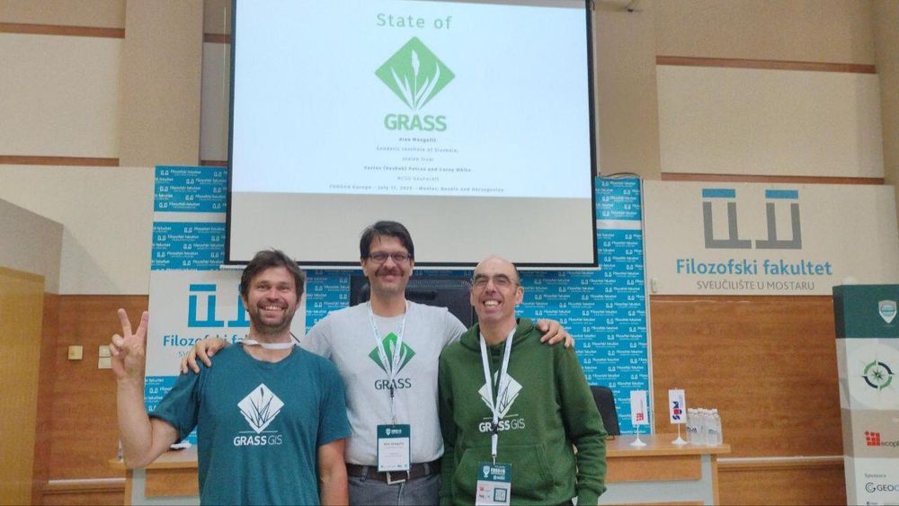
🌾 GRASS at FOSS4G Europe in Mostar! 🚀
This morning Alen Mangafić presented the latest news about the GRASS project! 🙌
Join us to connect with members of the community, explore open-source geospatial innovations, and share ideas. Let's make the most of this […]
[Original post on fosstodon.org]
This morning Alen Mangafić presented the latest news about the GRASS project! 🙌
Join us to connect with members of the community, explore open-source geospatial innovations, and share ideas. Let's make the most of this […]
[Original post on fosstodon.org]
July 17, 2025 at 1:49 PM
🌾 GRASS at FOSS4G Europe in Mostar! 🚀
This morning Alen Mangafić presented the latest news about the GRASS project! 🙌
Join us to connect with members of the community, explore open-source geospatial innovations, and share ideas. Let's make the most of this […]
[Original post on fosstodon.org]
This morning Alen Mangafić presented the latest news about the GRASS project! 🙌
Join us to connect with members of the community, explore open-source geospatial innovations, and share ideas. Let's make the most of this […]
[Original post on fosstodon.org]
Reposted by Markus Neteler
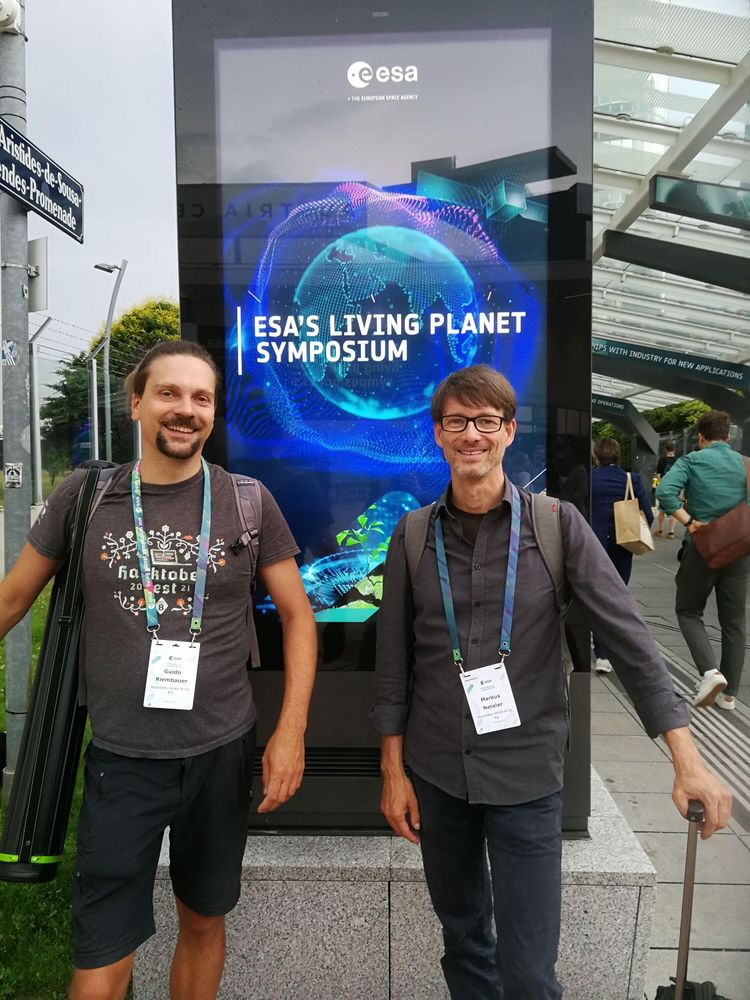
Back from the 2025 ESA Living Planet Symposium in Vienna! Excited to share our top takeaways and how mundialis is contributing: https://www.mundialis.de/en/back-from-the-2025-esa-living-planet-symposium/
#lps25 #earthobservation
#lps25 #earthobservation
July 4, 2025 at 7:31 AM
Back from the 2025 ESA Living Planet Symposium in Vienna! Excited to share our top takeaways and how mundialis is contributing: https://www.mundialis.de/en/back-from-the-2025-esa-living-planet-symposium/
#lps25 #earthobservation
#lps25 #earthobservation
Reposted by Markus Neteler
Check out the GRASS Developer Summit lightning talks now available on YouTube! Perfect for catching up on the latest developments. 🌿📺 #grassdevsummit #lightningtalks #opensource
https://www.youtube.com/watch?v=jwMir7Rd73k&list=PLycBDiXWmuxm6UCZSWJWrBpLWJYQITIma
https://www.youtube.com/watch?v=jwMir7Rd73k&list=PLycBDiXWmuxm6UCZSWJWrBpLWJYQITIma
July 3, 2025 at 2:00 PM
Check out the GRASS Developer Summit lightning talks now available on YouTube! Perfect for catching up on the latest developments. 🌿📺 #grassdevsummit #lightningtalks #opensource
https://www.youtube.com/watch?v=jwMir7Rd73k&list=PLycBDiXWmuxm6UCZSWJWrBpLWJYQITIma
https://www.youtube.com/watch?v=jwMir7Rd73k&list=PLycBDiXWmuxm6UCZSWJWrBpLWJYQITIma
Reposted by Markus Neteler
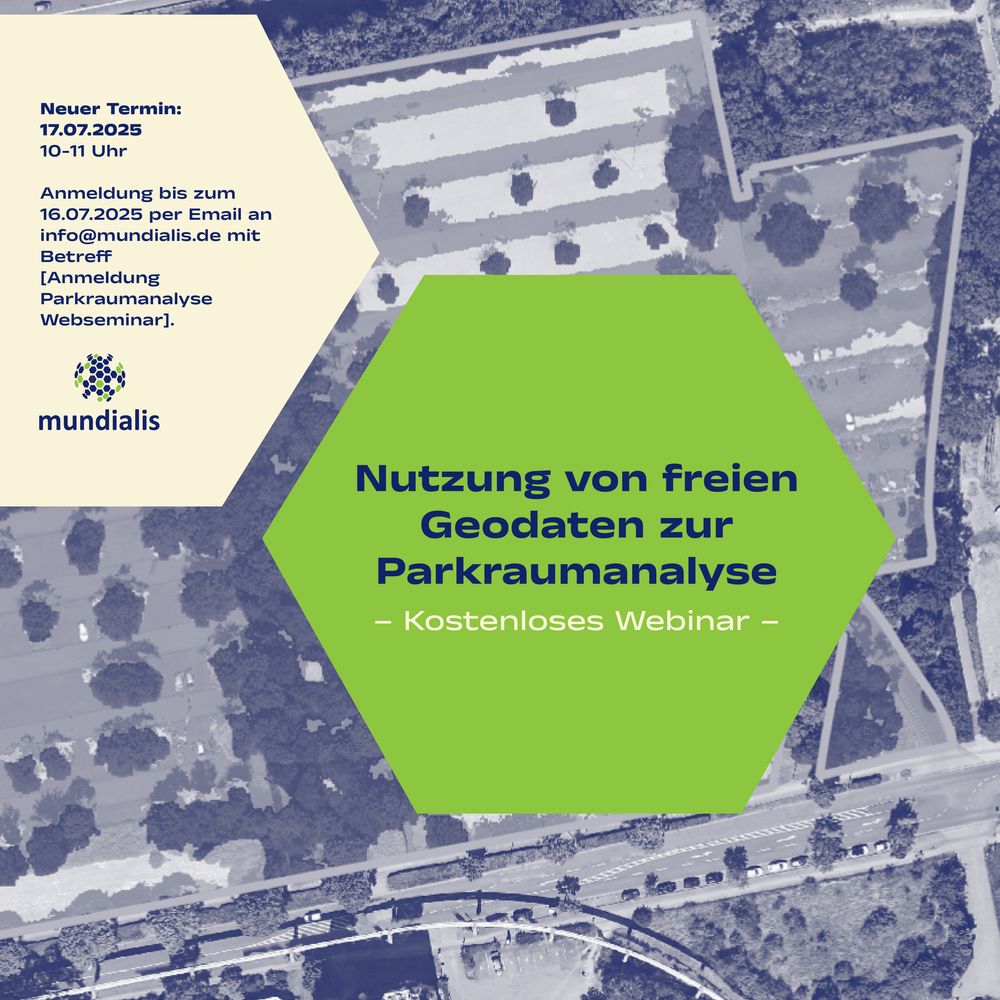
⚠️Terminänderung: Das kostenlose Webseminar „Nutzung von freien Geodaten zur Parkraumanalyse“ verschiebt sich um eine Woche auf den 17.07.2025 um 10 Uhr! Alle bisherigen Anmeldungen bleiben selbstverständlich bestehen.
Weitere Infos […]
[Original post on mastodon.social]
Weitere Infos […]
[Original post on mastodon.social]
July 3, 2025 at 8:07 AM
⚠️Terminänderung: Das kostenlose Webseminar „Nutzung von freien Geodaten zur Parkraumanalyse“ verschiebt sich um eine Woche auf den 17.07.2025 um 10 Uhr! Alle bisherigen Anmeldungen bleiben selbstverständlich bestehen.
Weitere Infos […]
[Original post on mastodon.social]
Weitere Infos […]
[Original post on mastodon.social]