


MN Chaser
@mnchaser.bsky.social
Storm Chaser 🌪️ Landscape photography. NWS/Skywarn trained spotter. WI 🐄 raised. MN based. Primarily severe #mnwx and other climate topics. https://mnchaser.com
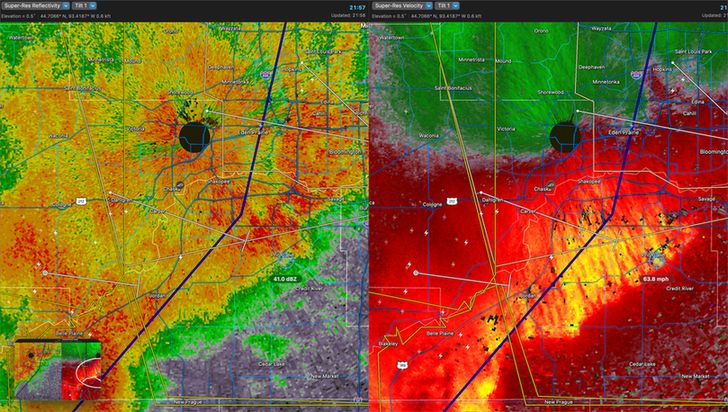
Wowza. That was fun. Radar measured 60mph+ here (20 miles from NWS). We got all of it. My weather station had debris up on it so I lost good reading. Power out in Prior Lake area. Neighbors sailboat flipped over. #mnwx
July 29, 2025 at 3:21 AM
Wowza. That was fun. Radar measured 60mph+ here (20 miles from NWS). We got all of it. My weather station had debris up on it so I lost good reading. Power out in Prior Lake area. Neighbors sailboat flipped over. #mnwx
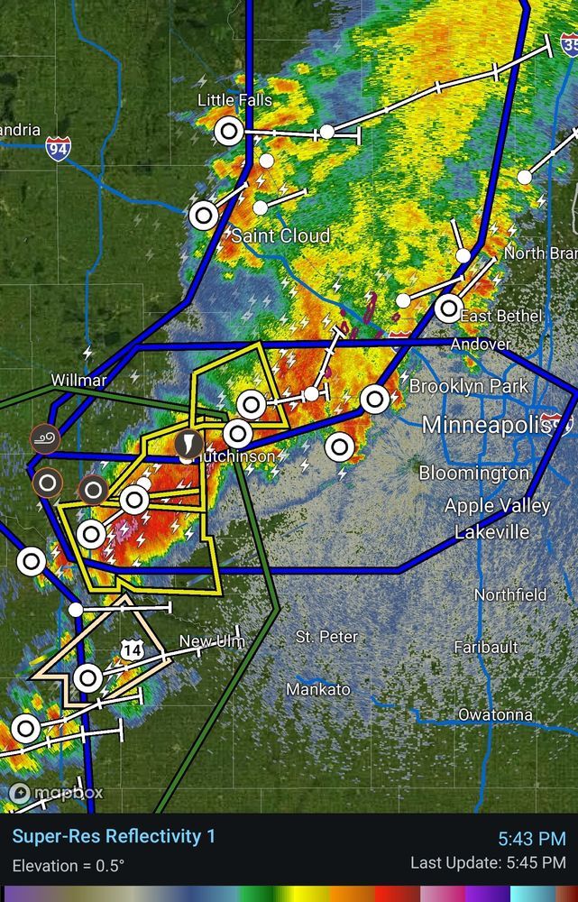
Line of strong storms moving east across the state. Looks like the muggy weather near the center of the state has helped maintain strength. #mnwx
June 2, 2025 at 10:56 PM
Line of strong storms moving east across the state. Looks like the muggy weather near the center of the state has helped maintain strength. #mnwx


May 15, 2025 at 11:09 AM
A bit cooler today with this "Omega Block" like setup over CONUS. After today, we should finally see a period of consistent sunshine and mid-to-upper 70's! #mnwx

May 3, 2025 at 3:34 PM
A bit cooler today with this "Omega Block" like setup over CONUS. After today, we should finally see a period of consistent sunshine and mid-to-upper 70's! #mnwx
For those chasing MN tomorrow - a kind reminder that it's construction season 🚧 with a handful of reduced lanes/closures (and people working)! Stay safe! #mnwx

April 27, 2025 at 6:04 PM
For those chasing MN tomorrow - a kind reminder that it's construction season 🚧 with a handful of reduced lanes/closures (and people working)! Stay safe! #mnwx
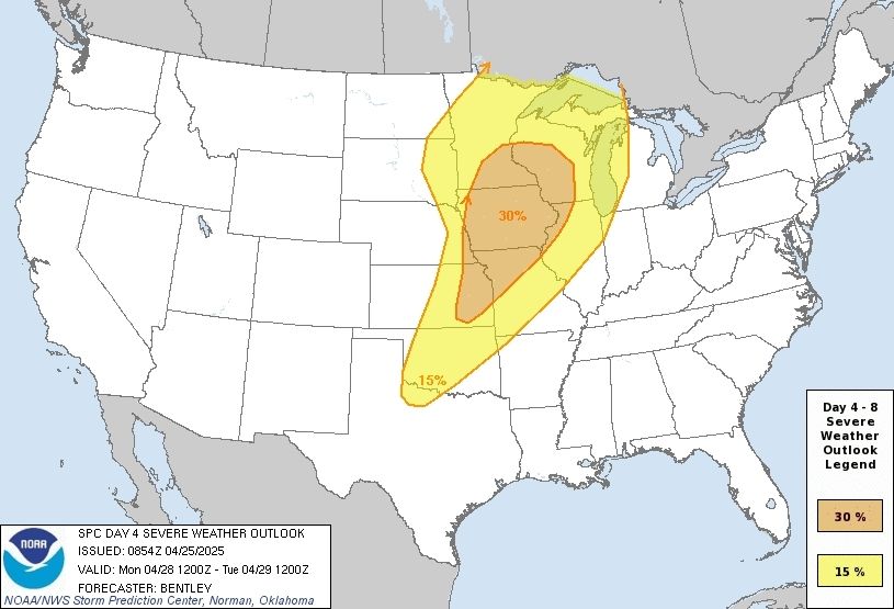
SPC Day 4 Outlook (Monday) ECMWF model 4pm timing of surface low and potential for another round of afternoon/evening severe storms. #mnwx

April 25, 2025 at 11:23 AM
SPC Day 4 Outlook (Monday) ECMWF model 4pm timing of surface low and potential for another round of afternoon/evening severe storms. #mnwx
Should come with a warning: won't shut up about weather.

April 25, 2025 at 5:00 AM
Should come with a warning: won't shut up about weather.