


BC
@mildthing99.bsky.social
Great to be here! 🌎🌍🌏
Thinking geographically 🌐 GIS, trivia and other important things... #GeographyTeacher and author; RGS C Geog, BBC Weather Watcher; landscape art and photography; #EruditePedagogy; #EduSky; Music, poetry esp with links to place
Thinking geographically 🌐 GIS, trivia and other important things... #GeographyTeacher and author; RGS C Geog, BBC Weather Watcher; landscape art and photography; #EruditePedagogy; #EduSky; Music, poetry esp with links to place
An #Asperitas fest over Downside, Surrey as #StormClaudia approached on Thu 13th November
@cloudappsoc.bsky.social
@stormhour.com
@metoffice.gov.uk
@thephotohour.bsky.social
@petergibbs.bsky.social #StormHour #loveukweather
@cloudappsoc.bsky.social
@stormhour.com
@metoffice.gov.uk
@thephotohour.bsky.social
@petergibbs.bsky.social #StormHour #loveukweather


November 15, 2025 at 1:55 PM
An #Asperitas fest over Downside, Surrey as #StormClaudia approached on Thu 13th November
@cloudappsoc.bsky.social
@stormhour.com
@metoffice.gov.uk
@thephotohour.bsky.social
@petergibbs.bsky.social #StormHour #loveukweather
@cloudappsoc.bsky.social
@stormhour.com
@metoffice.gov.uk
@thephotohour.bsky.social
@petergibbs.bsky.social #StormHour #loveukweather
🔊'London Under Fire' 🔊
'12 Postcards Passed By The Censor'
Story Map inspired by the excellent blog by @alondoninheritance.bsky.social alondoninheritance.com/thebombedcit...
Georef then #GIS mapped in @ArcGISStoryMaps
🎵 @psbhq.bsky.social 'London Can Take it' ❤️Ukraine
#30DayMapChallenge Day 15: Fire
'12 Postcards Passed By The Censor'
Story Map inspired by the excellent blog by @alondoninheritance.bsky.social alondoninheritance.com/thebombedcit...
Georef then #GIS mapped in @ArcGISStoryMaps
🎵 @psbhq.bsky.social 'London Can Take it' ❤️Ukraine
#30DayMapChallenge Day 15: Fire
November 14, 2025 at 11:51 PM
🔊'London Under Fire' 🔊
'12 Postcards Passed By The Censor'
Story Map inspired by the excellent blog by @alondoninheritance.bsky.social alondoninheritance.com/thebombedcit...
Georef then #GIS mapped in @ArcGISStoryMaps
🎵 @psbhq.bsky.social 'London Can Take it' ❤️Ukraine
#30DayMapChallenge Day 15: Fire
'12 Postcards Passed By The Censor'
Story Map inspired by the excellent blog by @alondoninheritance.bsky.social alondoninheritance.com/thebombedcit...
Georef then #GIS mapped in @ArcGISStoryMaps
🎵 @psbhq.bsky.social 'London Can Take it' ❤️Ukraine
#30DayMapChallenge Day 15: Fire
🔊'From Bank to Bet Fred'🔊
@openstreetmap.bsky.social v map of Dundee shops in Murraygate 1991 using #MediaLayers in
@esriuk.bsky.social ArcGIS Online
#3DScene > urban retail land use change.
🙏 UoD Archives
#ThinkForAMinute #Housemartins #NEA
arcg.is/1f8zuf0
Day 14: Data challenge: OpenStreetMap
@openstreetmap.bsky.social v map of Dundee shops in Murraygate 1991 using #MediaLayers in
@esriuk.bsky.social ArcGIS Online
#3DScene > urban retail land use change.
🙏 UoD Archives
#ThinkForAMinute #Housemartins #NEA
arcg.is/1f8zuf0
Day 14: Data challenge: OpenStreetMap
November 13, 2025 at 10:06 PM
🔊'From Bank to Bet Fred'🔊
@openstreetmap.bsky.social v map of Dundee shops in Murraygate 1991 using #MediaLayers in
@esriuk.bsky.social ArcGIS Online
#3DScene > urban retail land use change.
🙏 UoD Archives
#ThinkForAMinute #Housemartins #NEA
arcg.is/1f8zuf0
Day 14: Data challenge: OpenStreetMap
@openstreetmap.bsky.social v map of Dundee shops in Murraygate 1991 using #MediaLayers in
@esriuk.bsky.social ArcGIS Online
#3DScene > urban retail land use change.
🙏 UoD Archives
#ThinkForAMinute #Housemartins #NEA
arcg.is/1f8zuf0
Day 14: Data challenge: OpenStreetMap
🔊Using #GIS to visualise data in a webmap
Stepped explanation > #CreateBuffers analysis tool in @esriuk.bsky.social ArcGIS OnLine > visualise exclusion zones around #Merapi volcano
@oaknational.bsky.social #GIS integration KS4 GCSE Geog
tinyurl.com/yh56fjw3
#30DayMapChallenge Day 13: 10 minute map
Stepped explanation > #CreateBuffers analysis tool in @esriuk.bsky.social ArcGIS OnLine > visualise exclusion zones around #Merapi volcano
@oaknational.bsky.social #GIS integration KS4 GCSE Geog
tinyurl.com/yh56fjw3
#30DayMapChallenge Day 13: 10 minute map
November 12, 2025 at 11:03 PM
🔊Using #GIS to visualise data in a webmap
Stepped explanation > #CreateBuffers analysis tool in @esriuk.bsky.social ArcGIS OnLine > visualise exclusion zones around #Merapi volcano
@oaknational.bsky.social #GIS integration KS4 GCSE Geog
tinyurl.com/yh56fjw3
#30DayMapChallenge Day 13: 10 minute map
Stepped explanation > #CreateBuffers analysis tool in @esriuk.bsky.social ArcGIS OnLine > visualise exclusion zones around #Merapi volcano
@oaknational.bsky.social #GIS integration KS4 GCSE Geog
tinyurl.com/yh56fjw3
#30DayMapChallenge Day 13: 10 minute map
*Venetian blinds* #CirrocumulusUndulatus at #sunset #SurreyHills
@cloudappsoc.bsky.social @stormhour.com
@thephotohour.bsky.social @metoffice.gov.uk #StormHour #loveukweather #getoutside
@cloudappsoc.bsky.social @stormhour.com
@thephotohour.bsky.social @metoffice.gov.uk #StormHour #loveukweather #getoutside

November 12, 2025 at 8:39 PM
🔊*Tomorrow Never Knows*🔊
By 2125, will remoteness mean that these places can remain much the same as now?
Created in @esriuk.bsky.social ArcGIS Online using @johnnelsonmaps.bsky.social's #Firefly symbols 🙏#Beatles
#30DayMapChallenge Day 12: Map from 2125
Map: arcg.is/TWuOO1
By 2125, will remoteness mean that these places can remain much the same as now?
Created in @esriuk.bsky.social ArcGIS Online using @johnnelsonmaps.bsky.social's #Firefly symbols 🙏#Beatles
#30DayMapChallenge Day 12: Map from 2125
Map: arcg.is/TWuOO1
November 11, 2025 at 11:01 PM
🔊*Tomorrow Never Knows*🔊
By 2125, will remoteness mean that these places can remain much the same as now?
Created in @esriuk.bsky.social ArcGIS Online using @johnnelsonmaps.bsky.social's #Firefly symbols 🙏#Beatles
#30DayMapChallenge Day 12: Map from 2125
Map: arcg.is/TWuOO1
By 2125, will remoteness mean that these places can remain much the same as now?
Created in @esriuk.bsky.social ArcGIS Online using @johnnelsonmaps.bsky.social's #Firefly symbols 🙏#Beatles
#30DayMapChallenge Day 12: Map from 2125
Map: arcg.is/TWuOO1
🔊*The shape you're in*🔊
Do you recognise all of these topological countries?
Rectangle, Triangle, Crescent, Teardrop, Hexagon, Circle...
(the last one is the world's 'most circular country' with a roundness index of 0.934)
🎵🙏
@edsheeranbr.bsky.social
#30DayMapChallenge Day 11: Minimal map
Do you recognise all of these topological countries?
Rectangle, Triangle, Crescent, Teardrop, Hexagon, Circle...
(the last one is the world's 'most circular country' with a roundness index of 0.934)
🎵🙏
@edsheeranbr.bsky.social
#30DayMapChallenge Day 11: Minimal map
November 10, 2025 at 11:30 PM
🔊*The shape you're in*🔊
Do you recognise all of these topological countries?
Rectangle, Triangle, Crescent, Teardrop, Hexagon, Circle...
(the last one is the world's 'most circular country' with a roundness index of 0.934)
🎵🙏
@edsheeranbr.bsky.social
#30DayMapChallenge Day 11: Minimal map
Do you recognise all of these topological countries?
Rectangle, Triangle, Crescent, Teardrop, Hexagon, Circle...
(the last one is the world's 'most circular country' with a roundness index of 0.934)
🎵🙏
@edsheeranbr.bsky.social
#30DayMapChallenge Day 11: Minimal map
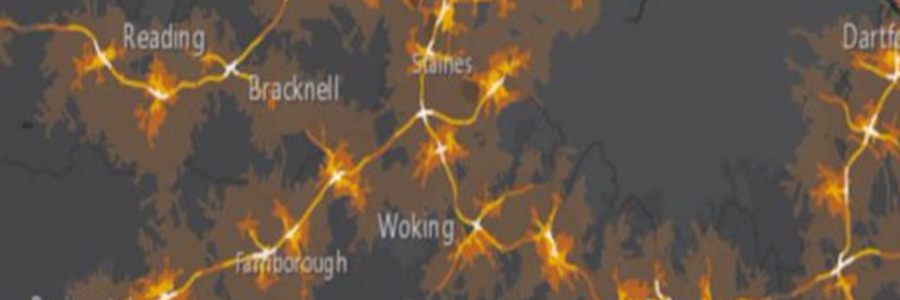
Using #GIS to map the track of a #TropicalStorm:
Stepped explanation: how to use georef data to visualise #TyphoonRai (Odette) 2022 in @esriuk.bsky.social ArcGISOnline
@oaknational.bsky.social lesson demo for #GIS integration at KS4 GCSE Geography
tinyurl.com/352hdcka
#30DayMapChallenge Day 10: Air
Stepped explanation: how to use georef data to visualise #TyphoonRai (Odette) 2022 in @esriuk.bsky.social ArcGISOnline
@oaknational.bsky.social lesson demo for #GIS integration at KS4 GCSE Geography
tinyurl.com/352hdcka
#30DayMapChallenge Day 10: Air
November 9, 2025 at 11:23 PM
Using #GIS to map the track of a #TropicalStorm:
Stepped explanation: how to use georef data to visualise #TyphoonRai (Odette) 2022 in @esriuk.bsky.social ArcGISOnline
@oaknational.bsky.social lesson demo for #GIS integration at KS4 GCSE Geography
tinyurl.com/352hdcka
#30DayMapChallenge Day 10: Air
Stepped explanation: how to use georef data to visualise #TyphoonRai (Odette) 2022 in @esriuk.bsky.social ArcGISOnline
@oaknational.bsky.social lesson demo for #GIS integration at KS4 GCSE Geography
tinyurl.com/352hdcka
#30DayMapChallenge Day 10: Air
🗺️ 113 year old maps reborn 🗺️
1912 sketch maps by teacher George Nebel for a field trip from Wood Street School #Woolwich to Isle of Thanet, Kent (they travelled by ship!)
#MediaLayers @esriuk.bsky.social ArcGIS Online
#30DayMapChallenge Day 9: Analog
Map🙏 Kent Archives
arcg.is/1nr55b1
1912 sketch maps by teacher George Nebel for a field trip from Wood Street School #Woolwich to Isle of Thanet, Kent (they travelled by ship!)
#MediaLayers @esriuk.bsky.social ArcGIS Online
#30DayMapChallenge Day 9: Analog
Map🙏 Kent Archives
arcg.is/1nr55b1
November 9, 2025 at 10:07 AM
🗺️ 113 year old maps reborn 🗺️
1912 sketch maps by teacher George Nebel for a field trip from Wood Street School #Woolwich to Isle of Thanet, Kent (they travelled by ship!)
#MediaLayers @esriuk.bsky.social ArcGIS Online
#30DayMapChallenge Day 9: Analog
Map🙏 Kent Archives
arcg.is/1nr55b1
1912 sketch maps by teacher George Nebel for a field trip from Wood Street School #Woolwich to Isle of Thanet, Kent (they travelled by ship!)
#MediaLayers @esriuk.bsky.social ArcGIS Online
#30DayMapChallenge Day 9: Analog
Map🙏 Kent Archives
arcg.is/1nr55b1
🔊#JourneySticks are an ancient geographical information system #GIS used for millennia.
Glimpses of a brilliant KS1 Y1 lesson 'Making a map of our route' by @oaknational.bsky.social stepping 'old' #GIS and 'new' #GIS + @aphextwin.bsky.social
#30DayMapChallenge Day 9: Analog
tinyurl.com/35y5wf5r
Glimpses of a brilliant KS1 Y1 lesson 'Making a map of our route' by @oaknational.bsky.social stepping 'old' #GIS and 'new' #GIS + @aphextwin.bsky.social
#30DayMapChallenge Day 9: Analog
tinyurl.com/35y5wf5r
November 8, 2025 at 10:26 PM
🔊#JourneySticks are an ancient geographical information system #GIS used for millennia.
Glimpses of a brilliant KS1 Y1 lesson 'Making a map of our route' by @oaknational.bsky.social stepping 'old' #GIS and 'new' #GIS + @aphextwin.bsky.social
#30DayMapChallenge Day 9: Analog
tinyurl.com/35y5wf5r
Glimpses of a brilliant KS1 Y1 lesson 'Making a map of our route' by @oaknational.bsky.social stepping 'old' #GIS and 'new' #GIS + @aphextwin.bsky.social
#30DayMapChallenge Day 9: Analog
tinyurl.com/35y5wf5r
🔊Do you know the way to Kathmandu?
3D map: 2025 Imagery v 1967 Corona satellite via Nepali Times #MediaLayer @esriuk.bsky.social ArcGISOnline #Scene + GEBCO bathymetry 3.5 x exagg
c 200%⬆️ #UrbanSprawl शहरी विस्तार
+ @johnmaus.bsky.social 'Do Your Best'
#30DayMapChallenge Day 8: Urban
arcg.is/1iPyW10
3D map: 2025 Imagery v 1967 Corona satellite via Nepali Times #MediaLayer @esriuk.bsky.social ArcGISOnline #Scene + GEBCO bathymetry 3.5 x exagg
c 200%⬆️ #UrbanSprawl शहरी विस्तार
+ @johnmaus.bsky.social 'Do Your Best'
#30DayMapChallenge Day 8: Urban
arcg.is/1iPyW10
November 8, 2025 at 1:04 AM
🔊Do you know the way to Kathmandu?
3D map: 2025 Imagery v 1967 Corona satellite via Nepali Times #MediaLayer @esriuk.bsky.social ArcGISOnline #Scene + GEBCO bathymetry 3.5 x exagg
c 200%⬆️ #UrbanSprawl शहरी विस्तार
+ @johnmaus.bsky.social 'Do Your Best'
#30DayMapChallenge Day 8: Urban
arcg.is/1iPyW10
3D map: 2025 Imagery v 1967 Corona satellite via Nepali Times #MediaLayer @esriuk.bsky.social ArcGISOnline #Scene + GEBCO bathymetry 3.5 x exagg
c 200%⬆️ #UrbanSprawl शहरी विस्तार
+ @johnmaus.bsky.social 'Do Your Best'
#30DayMapChallenge Day 8: Urban
arcg.is/1iPyW10
🍃🌉On this day 1940🌉🍃
'Galloping Gertie' Tacoma Narrows Bridge collapsed in 40mph/64kmh winds. Where were the viewpoints?
Tacoma-Kitsap pen link gone until 1950.
Created in @Esri ArcGIS Online using #MediaLayers
Webmap: arcg.is/0j9ibq
#30DayMapChallenge Day 7: Accessibility
'Galloping Gertie' Tacoma Narrows Bridge collapsed in 40mph/64kmh winds. Where were the viewpoints?
Tacoma-Kitsap pen link gone until 1950.
Created in @Esri ArcGIS Online using #MediaLayers
Webmap: arcg.is/0j9ibq
#30DayMapChallenge Day 7: Accessibility
November 6, 2025 at 10:46 PM
🍃🌉On this day 1940🌉🍃
'Galloping Gertie' Tacoma Narrows Bridge collapsed in 40mph/64kmh winds. Where were the viewpoints?
Tacoma-Kitsap pen link gone until 1950.
Created in @Esri ArcGIS Online using #MediaLayers
Webmap: arcg.is/0j9ibq
#30DayMapChallenge Day 7: Accessibility
'Galloping Gertie' Tacoma Narrows Bridge collapsed in 40mph/64kmh winds. Where were the viewpoints?
Tacoma-Kitsap pen link gone until 1950.
Created in @Esri ArcGIS Online using #MediaLayers
Webmap: arcg.is/0j9ibq
#30DayMapChallenge Day 7: Accessibility
🔊How has phys geog/tectonics influenced biogeographic realms (faunal boundaries)?
3D: #WallaceLine #LydekkerLine #WeberLine
@esriuk.bsky.social ArcGISOnline #Scene GEBCO 10x exagg
#Evolution #Marsupial v #Mammal @TEEDinosaurs
#30DayMapChallenge Day 6: Dimensions
arcg.is/GOHq90
3D: #WallaceLine #LydekkerLine #WeberLine
@esriuk.bsky.social ArcGISOnline #Scene GEBCO 10x exagg
#Evolution #Marsupial v #Mammal @TEEDinosaurs
#30DayMapChallenge Day 6: Dimensions
arcg.is/GOHq90
November 5, 2025 at 10:46 PM
🔊How has phys geog/tectonics influenced biogeographic realms (faunal boundaries)?
3D: #WallaceLine #LydekkerLine #WeberLine
@esriuk.bsky.social ArcGISOnline #Scene GEBCO 10x exagg
#Evolution #Marsupial v #Mammal @TEEDinosaurs
#30DayMapChallenge Day 6: Dimensions
arcg.is/GOHq90
3D: #WallaceLine #LydekkerLine #WeberLine
@esriuk.bsky.social ArcGISOnline #Scene GEBCO 10x exagg
#Evolution #Marsupial v #Mammal @TEEDinosaurs
#30DayMapChallenge Day 6: Dimensions
arcg.is/GOHq90
🔊How to use #GIS to visualise physical processes at different types of plate margin e.g. convergent plate boundary: a stepped explanation
@oaknational.bsky.social lesson demonstrating #GIS integration at KS4 GCSE Geography #TectonicHazards
tinyurl.com/3zecmytx
#30DayMapChallenge Day 5: Earth
@oaknational.bsky.social lesson demonstrating #GIS integration at KS4 GCSE Geography #TectonicHazards
tinyurl.com/3zecmytx
#30DayMapChallenge Day 5: Earth
November 4, 2025 at 10:51 PM
🔊How to use #GIS to visualise physical processes at different types of plate margin e.g. convergent plate boundary: a stepped explanation
@oaknational.bsky.social lesson demonstrating #GIS integration at KS4 GCSE Geography #TectonicHazards
tinyurl.com/3zecmytx
#30DayMapChallenge Day 5: Earth
@oaknational.bsky.social lesson demonstrating #GIS integration at KS4 GCSE Geography #TectonicHazards
tinyurl.com/3zecmytx
#30DayMapChallenge Day 5: Earth
🔊🎶Let's go back 🎶🔊
GPS track of a cloudless recent ascent (+ descent!) for a long-awaited return to the magnificent Cader (Cadair) Idris, Eryri Nat Pk, N Wales @natreswales.bsky.social
#FlyoverVideo outdooractive_uk + @jungle4eva.bsky.social #30DayMapChallenge
Day 4: Data challenge: My Data
GPS track of a cloudless recent ascent (+ descent!) for a long-awaited return to the magnificent Cader (Cadair) Idris, Eryri Nat Pk, N Wales @natreswales.bsky.social
#FlyoverVideo outdooractive_uk + @jungle4eva.bsky.social #30DayMapChallenge
Day 4: Data challenge: My Data
November 3, 2025 at 11:22 PM
🔊🎶Let's go back 🎶🔊
GPS track of a cloudless recent ascent (+ descent!) for a long-awaited return to the magnificent Cader (Cadair) Idris, Eryri Nat Pk, N Wales @natreswales.bsky.social
#FlyoverVideo outdooractive_uk + @jungle4eva.bsky.social #30DayMapChallenge
Day 4: Data challenge: My Data
GPS track of a cloudless recent ascent (+ descent!) for a long-awaited return to the magnificent Cader (Cadair) Idris, Eryri Nat Pk, N Wales @natreswales.bsky.social
#FlyoverVideo outdooractive_uk + @jungle4eva.bsky.social #30DayMapChallenge
Day 4: Data challenge: My Data
🔊Using #GIS to visualise global trends in urbanisation
A stepped explanation demonstrating how to create a #GIS choropleth webmap using shapefiles
@oaknational.bsky.social lesson demonstrating #GIS integration at KS4 GCSE Geography
tinyurl.com/3ksbwwmy
#30DayMapChallenge Day 3: Polygons
A stepped explanation demonstrating how to create a #GIS choropleth webmap using shapefiles
@oaknational.bsky.social lesson demonstrating #GIS integration at KS4 GCSE Geography
tinyurl.com/3ksbwwmy
#30DayMapChallenge Day 3: Polygons
November 2, 2025 at 10:46 PM
🔊Using #GIS to visualise global trends in urbanisation
A stepped explanation demonstrating how to create a #GIS choropleth webmap using shapefiles
@oaknational.bsky.social lesson demonstrating #GIS integration at KS4 GCSE Geography
tinyurl.com/3ksbwwmy
#30DayMapChallenge Day 3: Polygons
A stepped explanation demonstrating how to create a #GIS choropleth webmap using shapefiles
@oaknational.bsky.social lesson demonstrating #GIS integration at KS4 GCSE Geography
tinyurl.com/3ksbwwmy
#30DayMapChallenge Day 3: Polygons
A #sundog (#parhelion) 22° on north side of the sun over #SwaleEstuary seen from #TankertonSlopes @whitstablelive.bsky.social
@cloudappsoc.bsky.social @metoffice.gov.uk
@stormhour.com
@thephotohour.bsky.social #StormHour #getoutside
@cloudappsoc.bsky.social @metoffice.gov.uk
@stormhour.com
@thephotohour.bsky.social #StormHour #getoutside

November 2, 2025 at 9:40 PM
A #sundog (#parhelion) 22° on north side of the sun over #SwaleEstuary seen from #TankertonSlopes @whitstablelive.bsky.social
@cloudappsoc.bsky.social @metoffice.gov.uk
@stormhour.com
@thephotohour.bsky.social #StormHour #getoutside
@cloudappsoc.bsky.social @metoffice.gov.uk
@stormhour.com
@thephotohour.bsky.social #StormHour #getoutside
🔊Using #GIS to visualise + analyse #deforestation
Stepped explanation #FishboneDeforestation + #EcosystemFragmentation
#RemoteSensing @esriuk.bsky.social #Wayback
@oaknational.bsky.social lesson demonstrating #GIS integration at KS4 GCSE Geography
tinyurl.com/33wkc6sr
#30DayMapChallenge Day 2: Lines
Stepped explanation #FishboneDeforestation + #EcosystemFragmentation
#RemoteSensing @esriuk.bsky.social #Wayback
@oaknational.bsky.social lesson demonstrating #GIS integration at KS4 GCSE Geography
tinyurl.com/33wkc6sr
#30DayMapChallenge Day 2: Lines
November 2, 2025 at 12:14 AM
🔊Using #GIS to visualise + analyse #deforestation
Stepped explanation #FishboneDeforestation + #EcosystemFragmentation
#RemoteSensing @esriuk.bsky.social #Wayback
@oaknational.bsky.social lesson demonstrating #GIS integration at KS4 GCSE Geography
tinyurl.com/33wkc6sr
#30DayMapChallenge Day 2: Lines
Stepped explanation #FishboneDeforestation + #EcosystemFragmentation
#RemoteSensing @esriuk.bsky.social #Wayback
@oaknational.bsky.social lesson demonstrating #GIS integration at KS4 GCSE Geography
tinyurl.com/33wkc6sr
#30DayMapChallenge Day 2: Lines
🔊💡Set the night on fire💡🔊
UK+RoI Lighthouses & Shipping Forecast areas
Data AI generated in ChatGPT + cleaning needed!
Mapped with ArcGIS Online
Animated icons made in ezgif plus John Nelson's Firefly icons
arcg.is/1ir9Oq3
#30DayMapChallenge Day 1: Points
UK+RoI Lighthouses & Shipping Forecast areas
Data AI generated in ChatGPT + cleaning needed!
Mapped with ArcGIS Online
Animated icons made in ezgif plus John Nelson's Firefly icons
arcg.is/1ir9Oq3
#30DayMapChallenge Day 1: Points
October 31, 2025 at 11:46 PM
🔊💡Set the night on fire💡🔊
UK+RoI Lighthouses & Shipping Forecast areas
Data AI generated in ChatGPT + cleaning needed!
Mapped with ArcGIS Online
Animated icons made in ezgif plus John Nelson's Firefly icons
arcg.is/1ir9Oq3
#30DayMapChallenge Day 1: Points
UK+RoI Lighthouses & Shipping Forecast areas
Data AI generated in ChatGPT + cleaning needed!
Mapped with ArcGIS Online
Animated icons made in ezgif plus John Nelson's Firefly icons
arcg.is/1ir9Oq3
#30DayMapChallenge Day 1: Points
Extremely vivid #Sundogs (#parhelion) 22° on eastern side of the morning sun in #Cirrostratus over the #SurreyHills
@cloudappsoc.bsky.social @stormhour.com
@thephotohour.bsky.social
@metoffice.gov.uk
#StormHour #loveukweather
@cloudappsoc.bsky.social @stormhour.com
@thephotohour.bsky.social
@metoffice.gov.uk
#StormHour #loveukweather


October 28, 2025 at 2:26 PM
Extremely vivid #Sundogs (#parhelion) 22° on eastern side of the morning sun in #Cirrostratus over the #SurreyHills
@cloudappsoc.bsky.social @stormhour.com
@thephotohour.bsky.social
@metoffice.gov.uk
#StormHour #loveukweather
@cloudappsoc.bsky.social @stormhour.com
@thephotohour.bsky.social
@metoffice.gov.uk
#StormHour #loveukweather
'Smiling down'
A rare #CircumzenithalArc in #CirrusFibratus over the #SurreyHills this morning.
@cloudappsoc.bsky.social @stormhour.com
@thephotohour.bsky.social @metoffice.gov.uk
#StormHour #loveukweather
A rare #CircumzenithalArc in #CirrusFibratus over the #SurreyHills this morning.
@cloudappsoc.bsky.social @stormhour.com
@thephotohour.bsky.social @metoffice.gov.uk
#StormHour #loveukweather

October 28, 2025 at 1:54 PM
'Smiling down'
A rare #CircumzenithalArc in #CirrusFibratus over the #SurreyHills this morning.
@cloudappsoc.bsky.social @stormhour.com
@thephotohour.bsky.social @metoffice.gov.uk
#StormHour #loveukweather
A rare #CircumzenithalArc in #CirrusFibratus over the #SurreyHills this morning.
@cloudappsoc.bsky.social @stormhour.com
@thephotohour.bsky.social @metoffice.gov.uk
#StormHour #loveukweather
Spectacular #WaxingCrescent 🌒 23.3% and #BeltOfVenus seen from Marco Polo Beach #Ventimiglia, Liguria, Italy
@davidbflower.bsky.social @stormhour.com
@thephotohour.bsky.social #StormHour
@davidbflower.bsky.social @stormhour.com
@thephotohour.bsky.social #StormHour

October 26, 2025 at 8:40 PM
Spectacular #WaxingCrescent 🌒 23.3% and #BeltOfVenus seen from Marco Polo Beach #Ventimiglia, Liguria, Italy
@davidbflower.bsky.social @stormhour.com
@thephotohour.bsky.social #StormHour
@davidbflower.bsky.social @stormhour.com
@thephotohour.bsky.social #StormHour
Dreamy #WaxingCrescent 🌒 9.2% seen from Monterosso al Mare, #Cinqueterre, Italy
@davidbflower.bsky.social @stormhour.com
@thephotohour.bsky.social #StormHour
@davidbflower.bsky.social @stormhour.com
@thephotohour.bsky.social #StormHour


October 24, 2025 at 6:19 PM
Dreamy #WaxingCrescent 🌒 9.2% seen from Monterosso al Mare, #Cinqueterre, Italy
@davidbflower.bsky.social @stormhour.com
@thephotohour.bsky.social #StormHour
@davidbflower.bsky.social @stormhour.com
@thephotohour.bsky.social #StormHour
An #OvershootingTop above #Cumulonimbus at sunset over the Ligurian Sea seen from Monterosso al Mare, #Cinqueterre, Italy
@cloudappsoc.bsky.social @stormhour.com
@thephotohour.bsky.social
@cloudappsoc.bsky.social @stormhour.com
@thephotohour.bsky.social

October 23, 2025 at 12:47 PM
An #OvershootingTop above #Cumulonimbus at sunset over the Ligurian Sea seen from Monterosso al Mare, #Cinqueterre, Italy
@cloudappsoc.bsky.social @stormhour.com
@thephotohour.bsky.social
@cloudappsoc.bsky.social @stormhour.com
@thephotohour.bsky.social
Marina Baie des Anges, Alpes-Maritimes, France
4 pyramid-shaped apartment blocks at Villeneuve-Loubet designed by André Minangoy (and Jean Marchand?); built 1969-1993
Seen on approach to Nice Côte d'Azur Airport (NCE)
Controversial #ModernistArchitecture #Gigantism
4 pyramid-shaped apartment blocks at Villeneuve-Loubet designed by André Minangoy (and Jean Marchand?); built 1969-1993
Seen on approach to Nice Côte d'Azur Airport (NCE)
Controversial #ModernistArchitecture #Gigantism

October 23, 2025 at 11:11 AM
Marina Baie des Anges, Alpes-Maritimes, France
4 pyramid-shaped apartment blocks at Villeneuve-Loubet designed by André Minangoy (and Jean Marchand?); built 1969-1993
Seen on approach to Nice Côte d'Azur Airport (NCE)
Controversial #ModernistArchitecture #Gigantism
4 pyramid-shaped apartment blocks at Villeneuve-Loubet designed by André Minangoy (and Jean Marchand?); built 1969-1993
Seen on approach to Nice Côte d'Azur Airport (NCE)
Controversial #ModernistArchitecture #Gigantism