


Mandi Thran
@mandithran.bsky.social
Flood forecaster for the Australian Bureau of Meteorology, Honourary Lecturer in Natural Hazards at the University of Sydney. PhD in marine geology w/ numerical modelling, postdoc in coastal hazards. Opinions my own.
Pinned
Mandi Thran
@mandithran.bsky.social
· Feb 21
I've created some feeds for all things flooding in Australia. Please like so that others can find them!
Australia Floods: bsky.app/profile/did:...
Victoria Floods: bsky.app/profile/did:...
ACT Floods: bsky.app/profile/did:...
Western Australia Floods: bsky.app/profile/did:...
Australia Floods: bsky.app/profile/did:...
Victoria Floods: bsky.app/profile/did:...
ACT Floods: bsky.app/profile/did:...
Western Australia Floods: bsky.app/profile/did:...
Heed the warnings ahead of this flood watch - this region is completely sodden. It is not going to take very much rain for river levels to rise.
NSW Flood Watch: www.bom.gov.au/nsw/warnings...
SES warnings: www.ses.nsw.gov.au
Hazards Near Me app: www.nsw.gov.au/emergency/ha...
NSW Flood Watch: www.bom.gov.au/nsw/warnings...
SES warnings: www.ses.nsw.gov.au
Hazards Near Me app: www.nsw.gov.au/emergency/ha...
www.bom.gov.au
August 19, 2025 at 10:10 PM
Heed the warnings ahead of this flood watch - this region is completely sodden. It is not going to take very much rain for river levels to rise.
NSW Flood Watch: www.bom.gov.au/nsw/warnings...
SES warnings: www.ses.nsw.gov.au
Hazards Near Me app: www.nsw.gov.au/emergency/ha...
NSW Flood Watch: www.bom.gov.au/nsw/warnings...
SES warnings: www.ses.nsw.gov.au
Hazards Near Me app: www.nsw.gov.au/emergency/ha...
Flood watch for minor to moderate flooding current. We just sent out a minor warning for Sussex Inlet and a minor-moderate for the Hawkesbury Nepean. This is a dangerous storm. Stay up to date with the latest warnings:
www.bom.gov.au/australia/wa...
www.hazardwatch.gov.au
www.bom.gov.au/australia/wa...
www.hazardwatch.gov.au
www.bom.gov.au
July 1, 2025 at 10:35 AM
Flood watch for minor to moderate flooding current. We just sent out a minor warning for Sussex Inlet and a minor-moderate for the Hawkesbury Nepean. This is a dangerous storm. Stay up to date with the latest warnings:
www.bom.gov.au/australia/wa...
www.hazardwatch.gov.au
www.bom.gov.au/australia/wa...
www.hazardwatch.gov.au
Happening NOW! I will be tuning in on night shift 🌖

Our 💯 hours to #SaveAmericasForecasts starts tomorrow!
Tune in to hear over 200+ US meteorologists and climate scientists share the importance of federally funded weather and climate research!
wclivestream.com
Tune in to hear over 200+ US meteorologists and climate scientists share the importance of federally funded weather and climate research!
wclivestream.com

May 30, 2025 at 7:48 AM
Happening NOW! I will be tuning in on night shift 🌖
Record flooding in the Manning, with records going back to 1929. Stay up to date with the latest warnings - and never underestimate these small coastal NSW troughs
hazardwatch.gov.au
hazardwatch.gov.au

HazardWatch - Hazard Warnings
View warnings issued by Australian Emergency Services.
hazardwatch.gov.au
May 21, 2025 at 10:20 AM
Record flooding in the Manning, with records going back to 1929. Stay up to date with the latest warnings - and never underestimate these small coastal NSW troughs
hazardwatch.gov.au
hazardwatch.gov.au
Another busy week for flooding in Australia. Normally, the kinds of rainfall totals we’re seeing in the international models wouldn’t be *too* concerning, but these catchments are already sodden, so rivers will rise quickly to any new rain.

🚨 Flood Watch for parts of the Northern Rivers, Mid North Coast, and North West Slopes in New South Wales has been issued.
More info:
http://www.bom.gov.au/nsw/warnings/flood/floodwatch1.shtml
More info:
http://www.bom.gov.au/nsw/warnings/flood/floodwatch1.shtml
April 1, 2025 at 5:44 AM
Another busy week for flooding in Australia. Normally, the kinds of rainfall totals we’re seeing in the international models wouldn’t be *too* concerning, but these catchments are already sodden, so rivers will rise quickly to any new rain.
This likely to be the largest flood in living memory for many across the Thomson, Barcoo, and Cooper catchments in Queensland. Rivers have already passed or are expected to surpass 2000, 1990, and 1974 flood levels. River levels are still rising; we have yet to see any peaks along the main channels.
🚨 Major Flood Warning for the Thomson and Barcoo Rivers and Cooper Creek has been issued.
More info:
http://www.bom.gov.au/qld/warnings/flood/thomson-barcoo-cooper.shtml
More info:
http://www.bom.gov.au/qld/warnings/flood/thomson-barcoo-cooper.shtml
March 27, 2025 at 8:56 AM
This likely to be the largest flood in living memory for many across the Thomson, Barcoo, and Cooper catchments in Queensland. Rivers have already passed or are expected to surpass 2000, 1990, and 1974 flood levels. River levels are still rising; we have yet to see any peaks along the main channels.
The Thomson and Barcoo Rivers and Cooper Creeks are experiencing an incredibly significant flood right now. Possibly one of the largest in living memory for this area. Please stay up to date with the latest warnings. There’s another update coming tonight
🚨 Major Flood Warning for the Thomson and Barcoo Rivers and Cooper Creek has been issued.
More info:
http://www.bom.gov.au/qld/warnings/flood/thomson-barcoo-cooper.shtml
More info:
http://www.bom.gov.au/qld/warnings/flood/thomson-barcoo-cooper.shtml
March 26, 2025 at 10:17 AM
The Thomson and Barcoo Rivers and Cooper Creeks are experiencing an incredibly significant flood right now. Possibly one of the largest in living memory for this area. Please stay up to date with the latest warnings. There’s another update coming tonight
Great piece. Three key takeaways that resonate: 1. Getting good code from an LLM is *always* an iterative process; 2. Using LLMs means I code *more* and therefore I learn at an accelerated pace about what works and what doesn’t; and 3. ALWAYS TEST what it produces because it is usually overconfident

Thoughts on using LLMs for coding, which can often be difficult and unintuitive, and why "vibe coding" is a fantastic way to explore the capabilities of LLMs (Simon Willison/Simon Willison's Weblog)
Main Link | Techmeme Permalink
Main Link | Techmeme Permalink
March 12, 2025 at 5:34 PM
Great piece. Three key takeaways that resonate: 1. Getting good code from an LLM is *always* an iterative process; 2. Using LLMs means I code *more* and therefore I learn at an accelerated pace about what works and what doesn’t; and 3. ALWAYS TEST what it produces because it is usually overconfident
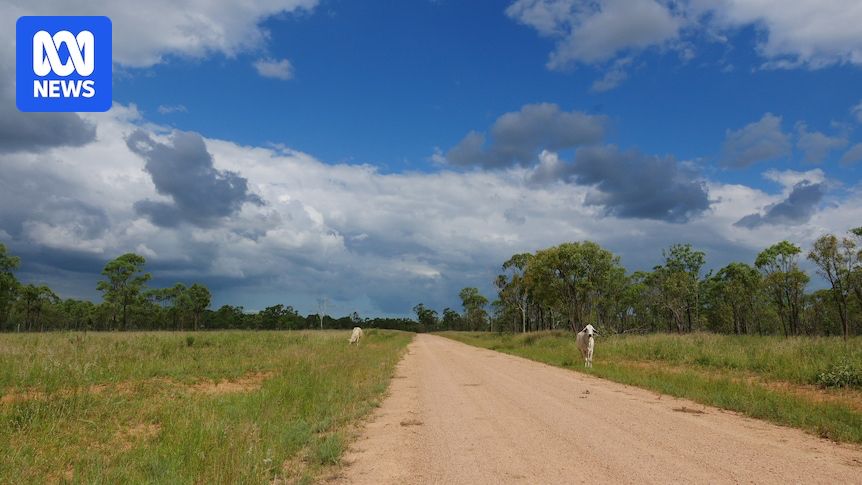
Again, a reminder that some of the worst flood impacts from a cyclone can occur long after it makes landfall and is downgraded. The flood threat is far from over for SEQ and NE NSW.
www.abc.net.au/news/2025-03...
www.abc.net.au/news/2025-03...

Live: More than 250,000 without power as Alfred downgraded but flood threat continues
Ex-Tropical Cyclone Alfred has been downgraded to a tropical low and is currently sitting off Bribie Island, moving slowly north.
www.abc.net.au
March 7, 2025 at 11:22 PM
Again, a reminder that some of the worst flood impacts from a cyclone can occur long after it makes landfall and is downgraded. The flood threat is far from over for SEQ and NE NSW.
www.abc.net.au/news/2025-03...
www.abc.net.au/news/2025-03...
Looking at Cyclone Alfred as a flood forecaster, I want to highlight how flood risk fits into the broader conversation about tropical cyclones. Some key points 🧵
March 6, 2025 at 8:23 AM
Looking at Cyclone Alfred as a flood forecaster, I want to highlight how flood risk fits into the broader conversation about tropical cyclones. Some key points 🧵
First flood warning of TC Alfred has been sent - Minor to Major for the Bellinger in NSW.
The modelling has been startlingly consistent over several days indicating moderate to major flooding possible or even likely for many rivers across NE NSW and SE QLD.
www.bom.gov.au/nsw/warnings...
The modelling has been startlingly consistent over several days indicating moderate to major flooding possible or even likely for many rivers across NE NSW and SE QLD.
www.bom.gov.au/nsw/warnings...
www.bom.gov.au
March 5, 2025 at 6:55 AM
First flood warning of TC Alfred has been sent - Minor to Major for the Bellinger in NSW.
The modelling has been startlingly consistent over several days indicating moderate to major flooding possible or even likely for many rivers across NE NSW and SE QLD.
www.bom.gov.au/nsw/warnings...
The modelling has been startlingly consistent over several days indicating moderate to major flooding possible or even likely for many rivers across NE NSW and SE QLD.
www.bom.gov.au/nsw/warnings...
The story of this cyclone has been full of (literal) twists and turns.
This is a very dangerous storm that has already caused damage to the coast. Stay up to date with the latest warnings and follow the advice of emergency services.
www.bom.gov.au/aviation/?re...
This is a very dangerous storm that has already caused damage to the coast. Stay up to date with the latest warnings and follow the advice of emergency services.
www.bom.gov.au/aviation/?re...
March 4, 2025 at 7:34 PM
The story of this cyclone has been full of (literal) twists and turns.
This is a very dangerous storm that has already caused damage to the coast. Stay up to date with the latest warnings and follow the advice of emergency services.
www.bom.gov.au/aviation/?re...
This is a very dangerous storm that has already caused damage to the coast. Stay up to date with the latest warnings and follow the advice of emergency services.
www.bom.gov.au/aviation/?re...
We’ve got eyes on the Qld North Tropical Coast tonight. The amount of rainfall forecast tonight is nowhere near the totals we’ve seen in recent weeks. However, catchments in the NTC are very wet from recent flooding, and rivers and creeks are very responsive to even small amounts of rainfall.
February 21, 2025 at 4:41 AM
We’ve got eyes on the Qld North Tropical Coast tonight. The amount of rainfall forecast tonight is nowhere near the totals we’ve seen in recent weeks. However, catchments in the NTC are very wet from recent flooding, and rivers and creeks are very responsive to even small amounts of rainfall.
I've created some feeds for all things flooding in Australia. Please like so that others can find them!
Australia Floods: bsky.app/profile/did:...
Victoria Floods: bsky.app/profile/did:...
ACT Floods: bsky.app/profile/did:...
Western Australia Floods: bsky.app/profile/did:...
Australia Floods: bsky.app/profile/did:...
Victoria Floods: bsky.app/profile/did:...
ACT Floods: bsky.app/profile/did:...
Western Australia Floods: bsky.app/profile/did:...
February 21, 2025 at 4:07 AM
I've created some feeds for all things flooding in Australia. Please like so that others can find them!
Australia Floods: bsky.app/profile/did:...
Victoria Floods: bsky.app/profile/did:...
ACT Floods: bsky.app/profile/did:...
Western Australia Floods: bsky.app/profile/did:...
Australia Floods: bsky.app/profile/did:...
Victoria Floods: bsky.app/profile/did:...
ACT Floods: bsky.app/profile/did:...
Western Australia Floods: bsky.app/profile/did:...
We will certainly be keeping an eye on this over the next several days… still too early to say how it might impact the east coast
www.abc.net.au/news/2025-02...
www.abc.net.au/news/2025-02...
Cyclone likely to form off Queensland coast, BOM says
Showers are forecast for much of the state's east coast today as the weather bureau monitors a tropical low in the Coral Sea.
www.abc.net.au
February 20, 2025 at 10:39 PM
We will certainly be keeping an eye on this over the next several days… still too early to say how it might impact the east coast
www.abc.net.au/news/2025-02...
www.abc.net.au/news/2025-02...