


Kevin Burkman
@kevinburkman.bsky.social
GIS & Cartography/Urban & Environmental Planning/Travel/Native Plant Restoration/History/Astronomy
I want this!

Oh check it out- a colleague sent me a CNC cut of New England in relief!

February 26, 2025 at 8:06 PM
I want this!
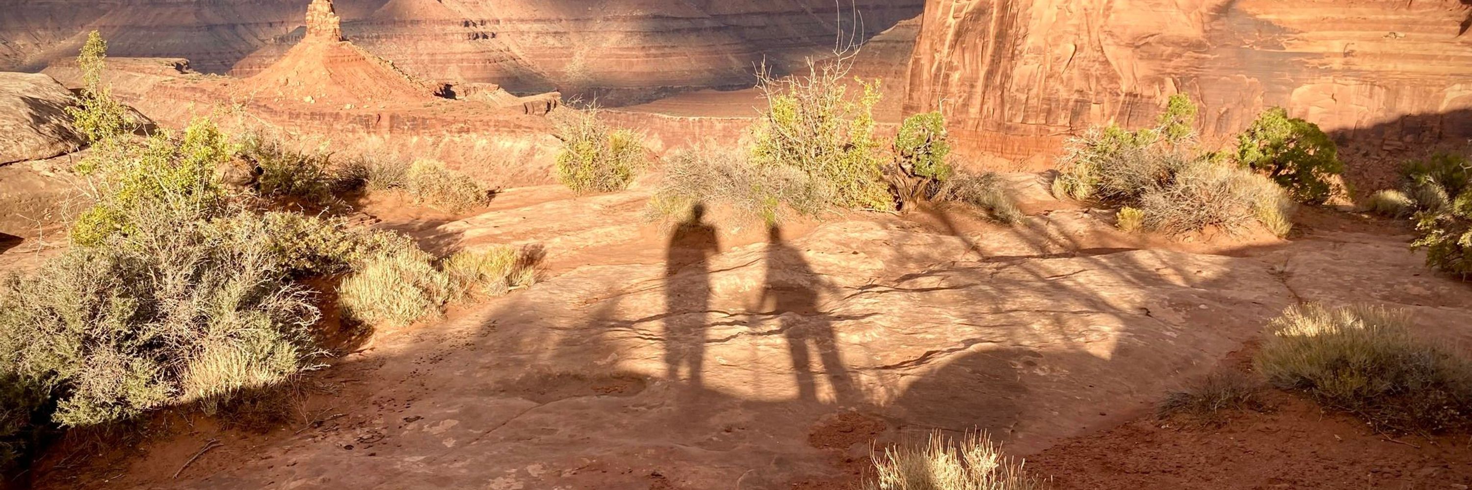
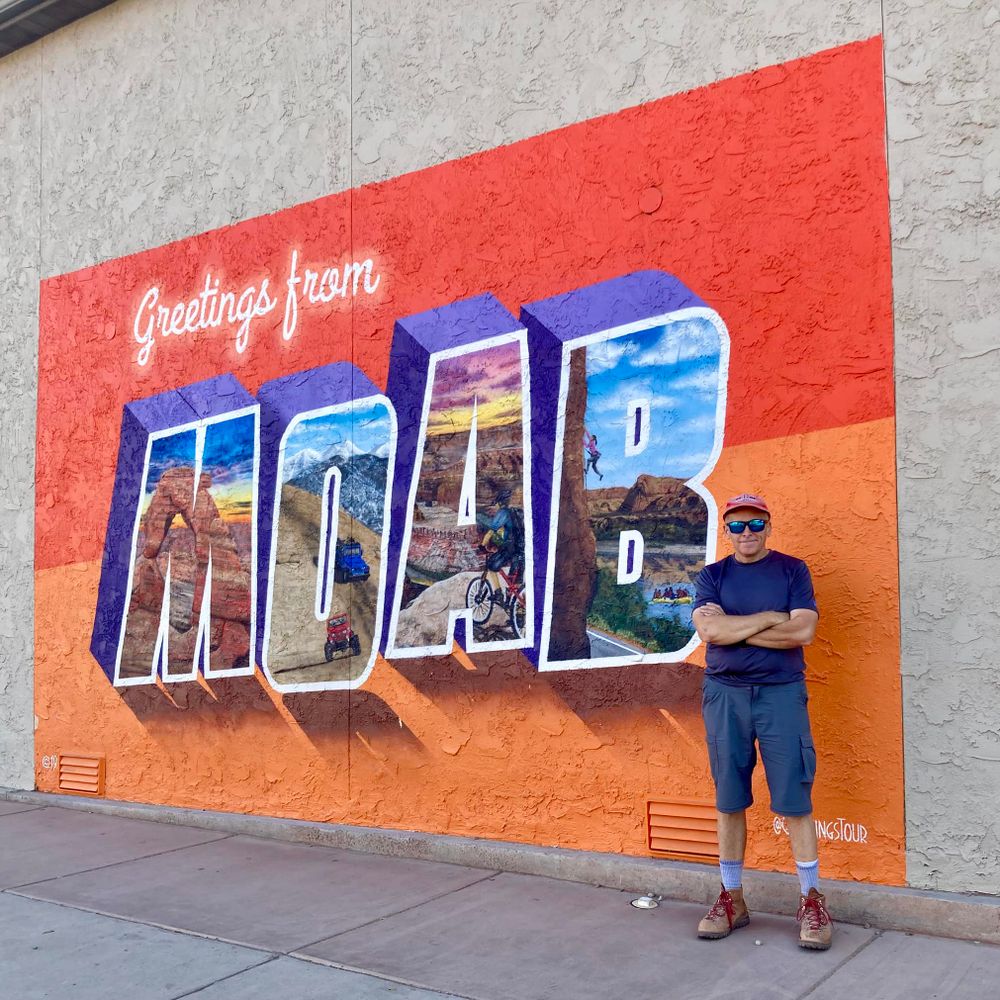
Here is my latest GIS creation, "Canyonlands of Moab Utah" Story Map, based largely on my travels there in October. If interested, please click on the link, and be sure to check it out on a tablet or full size monitor (phone screens won't do it justice). arcg.is/1i4SO12

The Canyonlands of Moab Utah
The Colorado Plateau is a massive, uplifted physiographic region, roughly centered in the Four Corners region of the southwestern United States. This plateau covers 130,000 square miles in Colorado, N...
arcg.is
February 1, 2025 at 7:38 PM
Here is my latest GIS creation, "Canyonlands of Moab Utah" Story Map, based largely on my travels there in October. If interested, please click on the link, and be sure to check it out on a tablet or full size monitor (phone screens won't do it justice). arcg.is/1i4SO12
Beautiful work!
#LiDAR #map of Solliès-Pont, France
See interactive version on: tinyurl.com/2uk9292n
#mapping #maps #cartography #gischat
See interactive version on: tinyurl.com/2uk9292n
#mapping #maps #cartography #gischat


December 31, 2024 at 5:53 PM
Beautiful work!
Reposted by Kevin Burkman

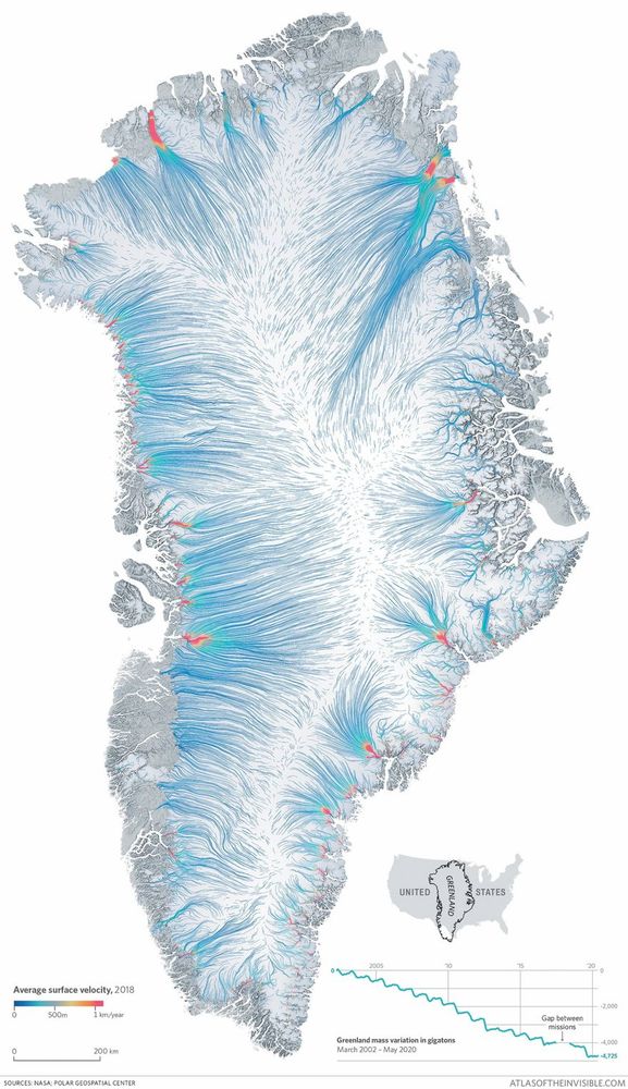
Very striking #map of #greenland flowing ice !
By James Cheshire and Oliver Uberti
See more on: tinyurl.com/bddd5yue
By James Cheshire and Oliver Uberti
See more on: tinyurl.com/bddd5yue
December 12, 2024 at 10:15 AM
Very striking #map of #greenland flowing ice !
By James Cheshire and Oliver Uberti
See more on: tinyurl.com/bddd5yue
By James Cheshire and Oliver Uberti
See more on: tinyurl.com/bddd5yue
I recently completed a private commission work, "North Central Pennsylvania Recreation Map", which highlights the landscape of Pine Creek and the surrounding trails, mountains and forests.

December 3, 2024 at 2:23 PM
I recently completed a private commission work, "North Central Pennsylvania Recreation Map", which highlights the landscape of Pine Creek and the surrounding trails, mountains and forests.
Very excited to announce my "Watersheds of Sourland Mountain" has been selected for publication in the 2025 ESRI Map Book!

November 28, 2024 at 2:15 PM
Very excited to announce my "Watersheds of Sourland Mountain" has been selected for publication in the 2025 ESRI Map Book!
To one and all, Happy GIS Day!
In celebration, here are a couple of pilot maps I have created for an upcoming Story Map, which focuses on the canyonlands of Moab, Utah, inspired by my + years of travel there.
And be sure to kiss your favorite GIS analyst today!
In celebration, here are a couple of pilot maps I have created for an upcoming Story Map, which focuses on the canyonlands of Moab, Utah, inspired by my + years of travel there.
And be sure to kiss your favorite GIS analyst today!


November 20, 2024 at 8:50 AM
To one and all, Happy GIS Day!
In celebration, here are a couple of pilot maps I have created for an upcoming Story Map, which focuses on the canyonlands of Moab, Utah, inspired by my + years of travel there.
And be sure to kiss your favorite GIS analyst today!
In celebration, here are a couple of pilot maps I have created for an upcoming Story Map, which focuses on the canyonlands of Moab, Utah, inspired by my + years of travel there.
And be sure to kiss your favorite GIS analyst today!