

Javier Escartín
@jescartin.bsky.social
CNRS Scientist @ Ecole Normale Supérieure de Paris (Dept. of Geosciences). Marine geologist.
Mapping the seafloor - including with robots (autonomous and remotely-operated). Interested in tectonics, volcanism, hydrothermal activity... mostly under water.
Mapping the seafloor - including with robots (autonomous and remotely-operated). Interested in tectonics, volcanism, hydrothermal activity... mostly under water.
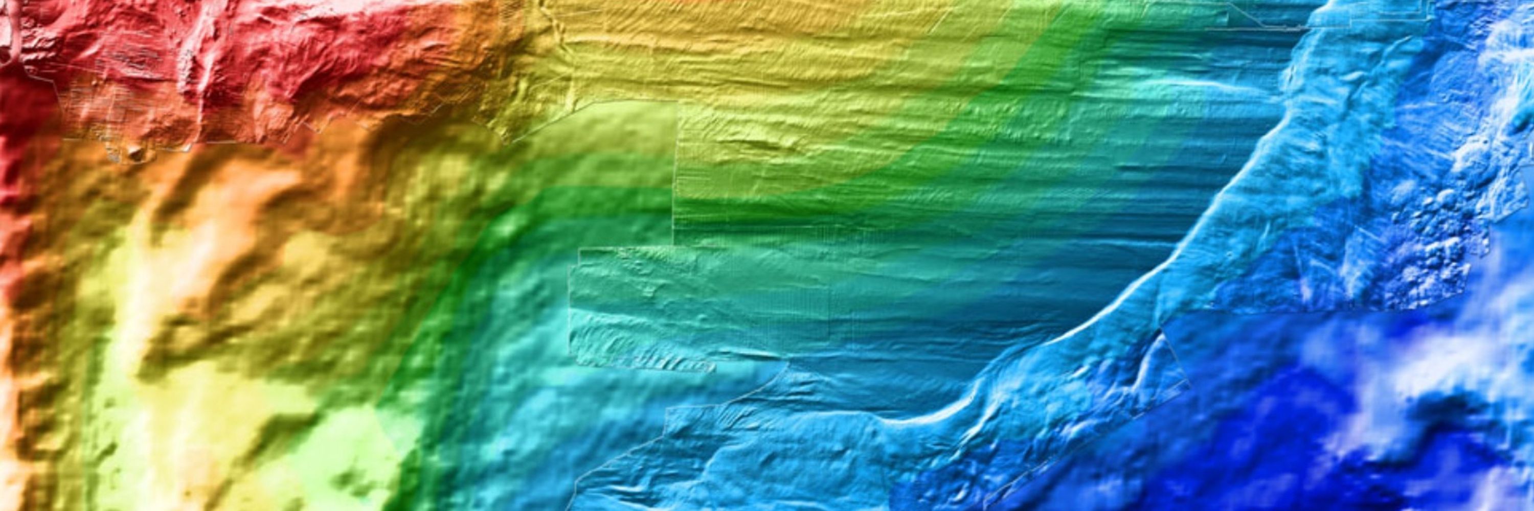
On the menu for this transit: how to set up a cruise project, the planning and management of the cruise before and during the cruise, and the follow up. From logistics to science and through administration. And supported by the French Oceanographic Fleet and the Reseau des Universités Marines.
October 12, 2025 at 2:24 PM
On the menu for this transit: how to set up a cruise project, the planning and management of the cruise before and during the cruise, and the follow up. From logistics to science and through administration. And supported by the French Oceanographic Fleet and the Reseau des Universités Marines.
4) Sonar coverage during a dive of AUV Ulyx (gray background) covering a zone of approximately 6x3 km, with sonar swaths of about 400 m (horizontal stripes). The identified barrels shown as black dots line up along tracks followed by ships during barge dumping.

July 11, 2025 at 5:25 PM
4) Sonar coverage during a dive of AUV Ulyx (gray background) covering a zone of approximately 6x3 km, with sonar swaths of about 400 m (horizontal stripes). The identified barrels shown as black dots line up along tracks followed by ships during barge dumping.
Copyright for all images: Flotte Océanographique Française - Campagne NODSSUM.
2) Barrel dumped at the seafloor at about 4700 m water depth and 3) a probable leak of unknown material - probably tar used to embed the waste in the barrels.
2) Barrel dumped at the seafloor at about 4700 m water depth and 3) a probable leak of unknown material - probably tar used to embed the waste in the barrels.


July 11, 2025 at 5:25 PM
Copyright for all images: Flotte Océanographique Française - Campagne NODSSUM.
2) Barrel dumped at the seafloor at about 4700 m water depth and 3) a probable leak of unknown material - probably tar used to embed the waste in the barrels.
2) Barrel dumped at the seafloor at about 4700 m water depth and 3) a probable leak of unknown material - probably tar used to embed the waste in the barrels.
Copyright for all images: Flotte Océanographique Française - Campagne NODSSUM.
1) Swath of Ulyx sonar data (left) and close-up of the barrels at the seafloor, showing as bright spots (from box on the left), with the bright illuminated side by the sonar and the shadow away from the AUV.
1) Swath of Ulyx sonar data (left) and close-up of the barrels at the seafloor, showing as bright spots (from box on the left), with the bright illuminated side by the sonar and the shadow away from the AUV.

July 11, 2025 at 5:25 PM
Copyright for all images: Flotte Océanographique Française - Campagne NODSSUM.
1) Swath of Ulyx sonar data (left) and close-up of the barrels at the seafloor, showing as bright spots (from box on the left), with the bright illuminated side by the sonar and the shadow away from the AUV.
1) Swath of Ulyx sonar data (left) and close-up of the barrels at the seafloor, showing as bright spots (from box on the left), with the bright illuminated side by the sonar and the shadow away from the AUV.
Eric can U send an email to me and patrick? To go over this? Cheers
escartin@geologie.ens.fr
patrick.chardon@clermont.in2p3.fr
escartin@geologie.ens.fr
patrick.chardon@clermont.in2p3.fr
June 30, 2025 at 3:47 PM
Eric can U send an email to me and patrick? To go over this? Cheers
escartin@geologie.ens.fr
patrick.chardon@clermont.in2p3.fr
escartin@geologie.ens.fr
patrick.chardon@clermont.in2p3.fr
And a current meter that will stay for a year or more...
June 30, 2025 at 1:45 PM
And a current meter that will stay for a year or more...
