


Scott
@isothermalwx.bsky.social
NWS Meteorologist Weather Prediction Center. In search of a snowstorm ❄️ Avid foodie 🍽️ Baltimore Sports Fan ⚾️🏈 Proud Marylander 🦀
**Thoughts are 100% my own and do not represent the thoughts of my employer!!**
**Thoughts are 100% my own and do not represent the thoughts of my employer!!**
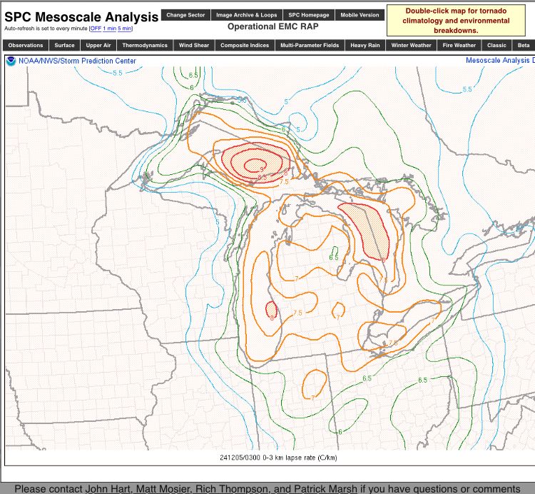
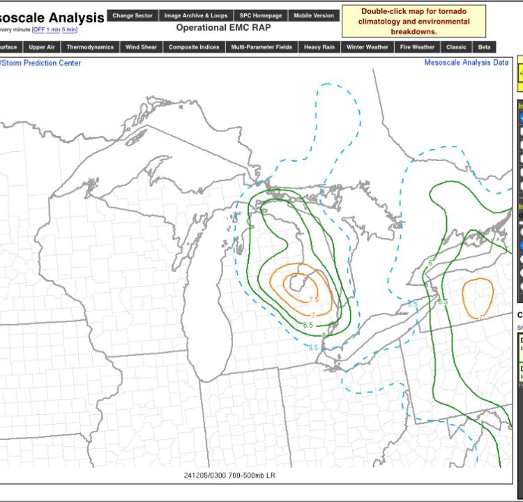
This is a truly classic snow squall event unfolding for the Great Lakes, Ohio Valley, into the Mid Atlantic. Those low to mid level lapse rates are pretty wicked. Michigan pretty much exhibiting one of the better environments for significant snow squall potential at any point in the season.
December 5, 2024 at 3:23 AM
This is a truly classic snow squall event unfolding for the Great Lakes, Ohio Valley, into the Mid Atlantic. Those low to mid level lapse rates are pretty wicked. Michigan pretty much exhibiting one of the better environments for significant snow squall potential at any point in the season.
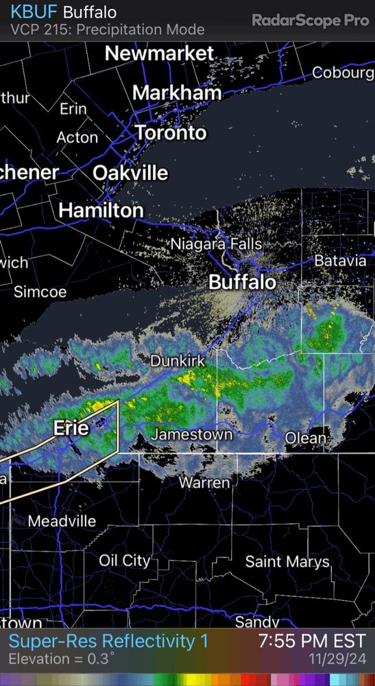
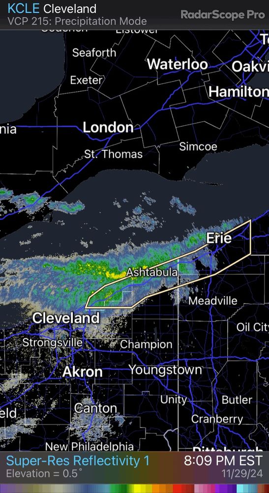
The event going on across the southern Lake Erie shores and just inland will be remembered by many living in the area. Totals over 4’ are looking increasingly likely from NE Ohio all the way to the Buffalo Southtowns near Hamburg and surrounds.
November 30, 2024 at 2:53 AM
The event going on across the southern Lake Erie shores and just inland will be remembered by many living in the area. Totals over 4’ are looking increasingly likely from NE Ohio all the way to the Buffalo Southtowns near Hamburg and surrounds.
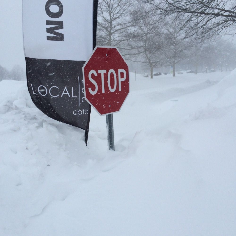
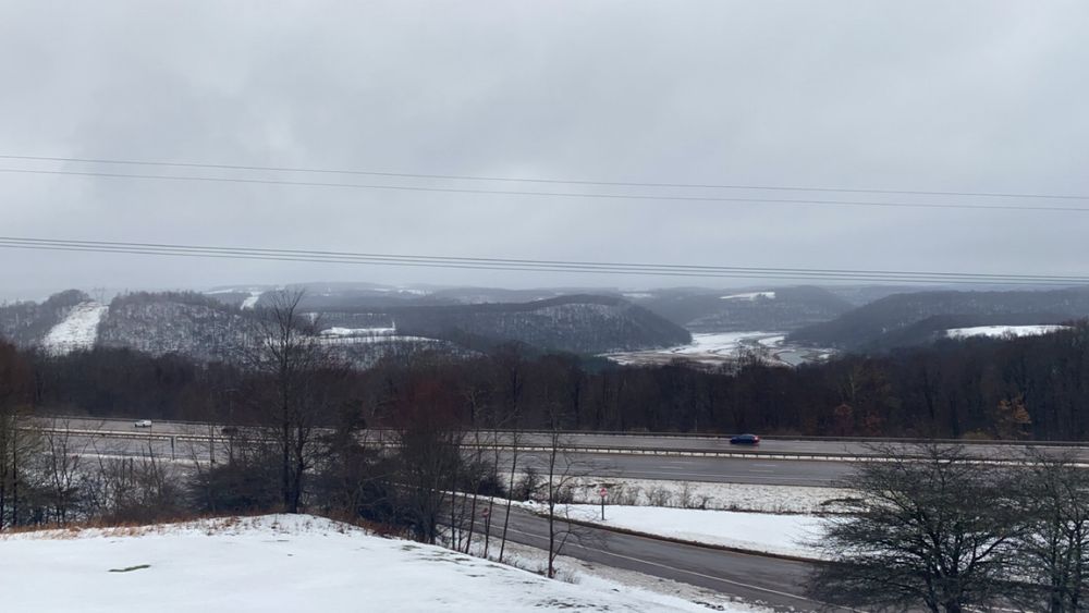
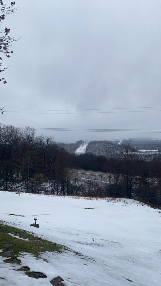
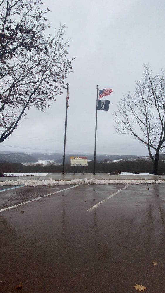
Was a beautiful sight towards the top near Keysers Ridge in Western MD earlier. The season has officially begun for the mountains!!
November 23, 2024 at 9:19 PM
Was a beautiful sight towards the top near Keysers Ridge in Western MD earlier. The season has officially begun for the mountains!!
Axis of convergence across Louisiana has persisted all day and continues this evening with some impressive totals being depicted via radar.
Some of these are probably inflated given the observed totals, but impressive nonetheless.
Lake Charles been busy with FFW’s today.
Some of these are probably inflated given the observed totals, but impressive nonetheless.
Lake Charles been busy with FFW’s today.

November 10, 2024 at 7:33 AM
Axis of convergence across Louisiana has persisted all day and continues this evening with some impressive totals being depicted via radar.
Some of these are probably inflated given the observed totals, but impressive nonetheless.
Lake Charles been busy with FFW’s today.
Some of these are probably inflated given the observed totals, but impressive nonetheless.
Lake Charles been busy with FFW’s today.
A quiet day across the CONUS yesterday will be a bit more active this afternoon and evening. Some much needed rain coming for parts of the Midwest.
Flash flooding isn’t expected to be widespread today, but instances of training/repeating over Northern MO and Southern IA could spark a few cases.
Flash flooding isn’t expected to be widespread today, but instances of training/repeating over Northern MO and Southern IA could spark a few cases.

October 24, 2024 at 8:36 AM
A quiet day across the CONUS yesterday will be a bit more active this afternoon and evening. Some much needed rain coming for parts of the Midwest.
Flash flooding isn’t expected to be widespread today, but instances of training/repeating over Northern MO and Southern IA could spark a few cases.
Flash flooding isn’t expected to be widespread today, but instances of training/repeating over Northern MO and Southern IA could spark a few cases.
We’re going to be in a very quiet pattern the next 7 days with the best precip chances residing over the PAC Northwest.
Persistent ridging from the weekend will carry over into the coming week with little variance in weather, precip wise.
Temps will be warm however, so summer has its last gasp
Persistent ridging from the weekend will carry over into the coming week with little variance in weather, precip wise.
Temps will be warm however, so summer has its last gasp

October 21, 2024 at 12:55 AM
We’re going to be in a very quiet pattern the next 7 days with the best precip chances residing over the PAC Northwest.
Persistent ridging from the weekend will carry over into the coming week with little variance in weather, precip wise.
Temps will be warm however, so summer has its last gasp
Persistent ridging from the weekend will carry over into the coming week with little variance in weather, precip wise.
Temps will be warm however, so summer has its last gasp


Finished up my set of nights last night on the ERO desk. Has been interesting to monitor this sneaky heavy rain setup across portions of the Southern High Plains.
Strong meridional push of warm moist air ahead of the upper circulation over the Four Corners will cause some flooding in spots.
Strong meridional push of warm moist air ahead of the upper circulation over the Four Corners will cause some flooding in spots.


October 17, 2024 at 2:56 PM
Finished up my set of nights last night on the ERO desk. Has been interesting to monitor this sneaky heavy rain setup across portions of the Southern High Plains.
Strong meridional push of warm moist air ahead of the upper circulation over the Four Corners will cause some flooding in spots.
Strong meridional push of warm moist air ahead of the upper circulation over the Four Corners will cause some flooding in spots.